

What is there today
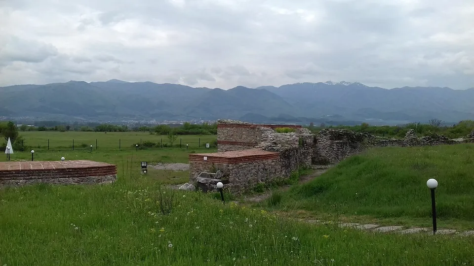
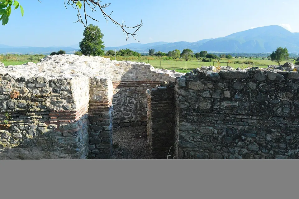
Excavation since 1980 has uncovered 280 m of the town walls and the foundations of public and religious buildings (bg.wikipedia; en.wikipedia). The walls, 2.40 to 2.60 m thick, stand in places 5 to 6 m high, built of stone set in mortar with bands of four courses of brick; the south wall has been fully explored, with four round towers and a gate opening into a semicircular exedra 40 m across, guarded by square towers (bg.wikipedia; de.wikipedia).
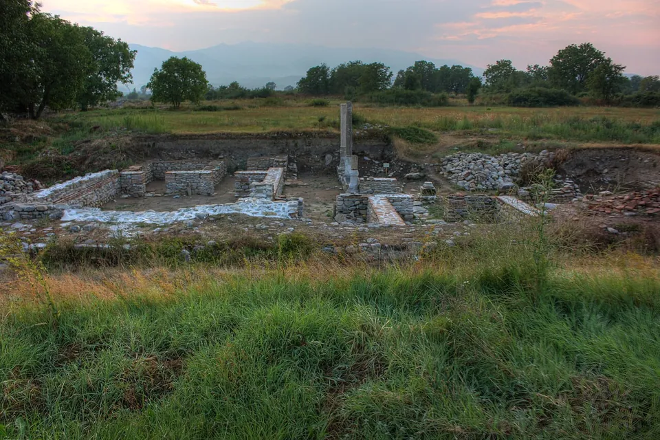
In the south-east corner, by the corner tower, a wealthy house was built round a courtyard with a marble colonnade; a pool in the middle of the courtyard was later paved over (bg.wikipedia). The public baths, of about the 320s, had underfloor heating, and their changing room, hot and cold rooms can still be made out (bg.wikipedia; de.wikipedia). Some of the finds, which include a votive relief of the Thracian Horseman and a statuette of Hermes, are shown in the historical museum in Gotse Delchev (en.wikipedia; de.wikipedia).
Is it worth the trip?
If you are in the Mesta valley, yes: it is the only Roman town in the Rhodopes, the walls stand high enough to read, and the setting between two mountain ranges adds to the visit (bg.wikipedia). It is far from the main Roman sites of Bulgaria and not worth a long detour on its own.
Getting there
The ruins are at the edge of the village of Garmen, 7 km east of Gotse Delchev (bg.wikipedia). A free car park for about 10 cars is mapped about 130 m away beside an information centre, and no bus stop is mapped nearby (OpenStreetMap). We could find no opening hours or fee published by an operator.
Visiting details
- Tickets
- Unknown
- Parking
- A free car park for about 10 cars is mapped about 130 m away, beside an information centre (OSM way/281165177, way/281165176).
- On foot
- About 2 min from the parking
Before you go
- We could find no operator page with opening hours or a fee (searched 2 October 2026). OpenStreetMap maps an information centre and a museum building at the site, with no hours.
- No bus stop is mapped near the site.
History
Trajan founded the town in 106 to mark his victory over the Dacians, on the site of a Thracian settlement, and named it “the city of victory on the Nestos”, the river Mesta (bg.wikipedia; de.wikipedia). It lay on the road from the Aegean coast and the Via Egnatia across the Rhodopes to Philippopolis, which helped it grow into an economic and cultural centre (bg.wikipedia; de.wikipedia). In 2020 a fragmented Greek inscription found here in 1923 was read as a letter from Septimius Severus and Caracalla thanking the townspeople for a gift of 700,000 denarii (en.wikipedia).
The baths were burned at the end of the 4th or the start of the 5th century, probably in the Gothic raids, rebuilt at the end of the 5th, and finally brought down by an earthquake in the later 6th century (bg.wikipedia). The town was a bishop’s seat, and was destroyed by Slavs and Avars at the end of the 6th century (bg.wikipedia). It revived in the 9th–10th centuries as Nikopol, and in Ottoman times the settlement moved a few kilometres west, keeping the name as Nevrokop, today’s Gotse Delchev (bg.wikipedia; de.wikipedia).
Sources
Every fact on this page comes from the records below, each used under the licence noted.
| Source | Licence |
|---|---|
| Pleiades 501525 | CC BY |
| Wikidata Q951149 | CC0 |
| OpenStreetMap way/281164974 | ODbL |
| Wikipedia (bg) — Никополис ад Нестум | CC BY-SA 4.0 |
| Wikipedia (en) — Nicopolis ad Nestum | CC BY-SA 4.0 |
| Wikipedia (de) — Nicopolis ad Nestum | CC BY-SA 4.0 |