Skip to content
Menu

Country · 31 sites · 2 hubs

Roman Bulgaria

At first, two Roman provinces divided what is now Bulgaria. Moesia, created under Augustus south of the Danube, took in the north of the country as Moesia Inferior. The river was the frontier: legionary camps and forts lined it, linked by a road along the bank, and Novae, 4 km east of Svishtov, is one of the few fortresses on that line to have been excavated and opened to the public.

The south was Thrace, a client kingdom of Rome until the emperor Claudius annexed it as a province in AD 46. Its capital was Philippopolis, today’s Plovdiv, where several roads crossed the Via Militaris, the highway from Singidunum (Belgrade) through Serdica (Sofia) to Constantinople. Plovdiv still has its Roman theatre, odeon, stadium and aqueduct.

After Rome gave up Dacia beyond the Danube in 271, Aurelian set up a new Dacia south of the river. Dacia Aureliana covered most of north-western Bulgaria, with its capital at Serdica, and was later split into two provinces governed from Serdica and from Ratiaria.

Inland, Nicopolis ad Istrum, 20 km north of Veliko Tarnovo, reached its peak under Hadrian, the Antonines and the Severans, and excavation there continues. In the south-east, Villa Armira near Ivaylovgrad is one of the largest and most richly decorated Roman villas excavated in Bulgaria.

Each page below says what is visible at the site today, whether it is worth the trip, and how to get there.
Sources: Wikipedia (en) — Moesia; Wikipedia (en) — Thracia; Wikipedia (en) — Dacia Aureliana; Wikipedia (en) — Via Militaris; Wikipedia (en) — Danubian Limes; Wikipedia (en) — Novae (fortress); Wikipedia (en) — Plovdiv; Wikipedia (en) — Nicopolis ad Istrum; Wikipedia (en) — Villa Armira

Philippopolis – Plovdiv
Serdica – Sofia
Mesembria
Kaliakra
Nicopolis ad Istrum
Perperikon
Abritus
Diocletianopolis
Odessos
Villa Armira
Castra Martis
Red Church, Perushtitsa
Aquae Calidae
Augusta Traiana
Deultum
Kabile
Marcianopolis
Novae
Oescus
Aqueducts of Plovdiv
Nicopolis ad Nestum
Roman baths of Pautalia
Sexaginta Prista
Sostra
Storgosia
Open Bulgaria on the interactive map

Select Show on map beside a site or town to see where it is.Scroll the list: each site or town is marked on the map as you reach it. The interactive map shows them all.

Roman towns

Several sites in or around one town, all seen from one base.

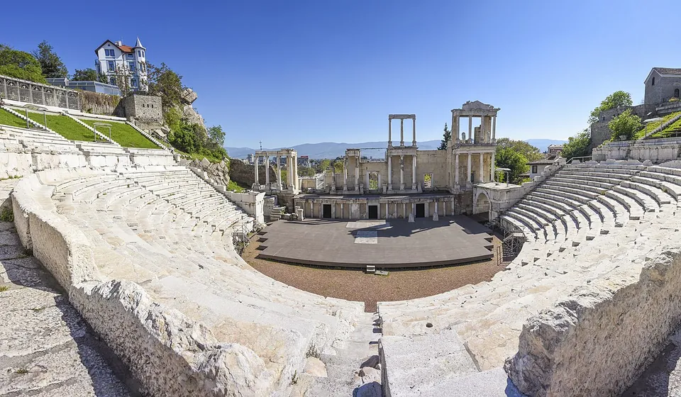
A wide panorama of the whole Roman theatre from the top of the seating, the marble rows curving round a semicircular stage floor towards a two-storey columned stage building, with a white house on the hill to the left and distant mountains under a clear sky.

Photo: Община Пловдив · CC BY-SA 4.0 · Commons

Hub · 5 stops

Plovdiv Province · Bulgaria

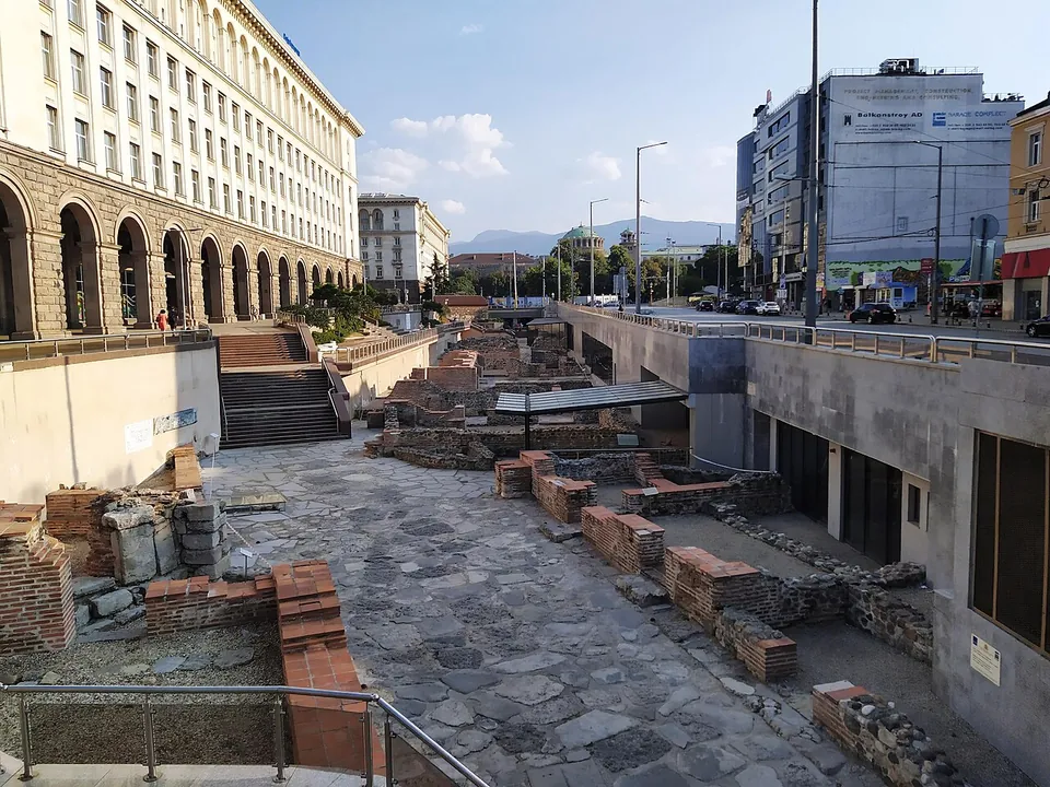
Philippopolis – Plovdiv

The stops each have their own page: the Roman theatre, set into the hillside of the Old Town and one of the best-preserved Roman theatres anywhere; the stadium, whose northern curved end has been partly restored on Roman Stadium Square; the odeon, the council house of the Roman city, which also served as a theatre; the Small Basilica, an early Christian church found during building work in 1988; and the Eirene Residence, a 3rd-century house with 160 m² of mosaic floors in the underpass beneath Tsar Boris III Boulevard (en.wikipedia).

  1. Roman theatre of Philippopolis · theatreTicketed
  2. Odeon of Philippopolis · theatreTicketed
  3. Small Basilica of Philippopolis · churchTicketed
  4. Stadium of Philippopolis · siteFree
  5. Eirene Residence · siteTicketed

Landmarks

Landmark

Worth planning a trip around.

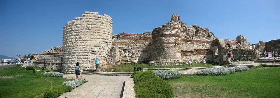
  1. A panorama of ruined fortress walls of stone with bands of brick, a tall round tower on the left and a broken gate tower in the middle, with a paved path, lawns and visitors in front.

    Photo: B0rder at en.wikipedia · Public domain · Commons

    city · Burgas Province

    Mesembria

    Be clear about what is Roman: most of what Nesebar is famous for, its churches of the 11th to 14th centuries, is medieval, and the town's earliest remains are Thracian and Greek (en.wikipedia; the museum).

    Show on map: Mesembria
    1st c. BC – 7th c. ADFree
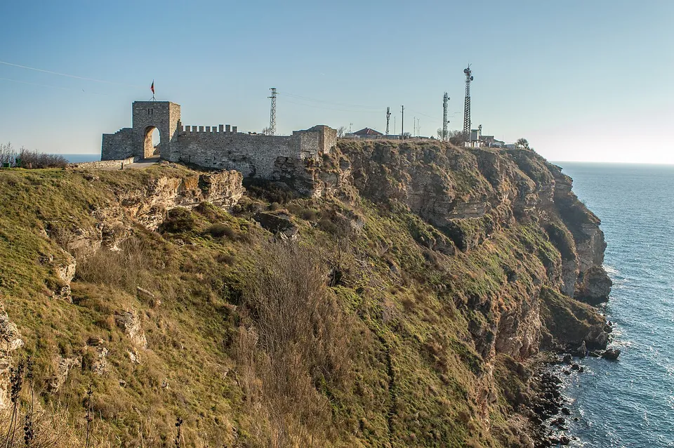
  2. A fortress gate tower with an arched opening and a stretch of crenellated wall stand on the edge of a grassy headland of reddish cliffs dropping into the sea, with radio masts behind.

    Photo: www.bdmundo.com · CC BY-SA 2.0 · Commons

    fort · Dobrich Province

    Kaliakra

    A gate and stretches of fortress wall run across the headland, and inside them lie the remains of a water supply, baths, churches and the residence of the 14th-century rulers (bg.wikipedia; OpenStreetMap).

    Show on map: Kaliakra
    1st c. BC – 7th c. ADUnknown
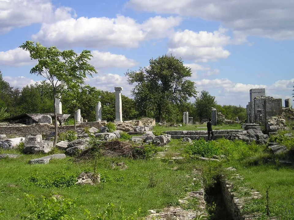
  3. A broad excavated area of low stone walls and fallen blocks in long green grass, with several standing white columns and a tall fragment of wall on the right, trees behind, under a blue sky with white clouds and a visitor walking among the ruins.

    Photo: Nk · Public domain · Commons

    city · Veliko Tarnovo Province

    Nicopolis ad Istrum

    You walk the city's streets, paved with huge stone blocks, with their pavements and the central drain and its inspection shafts still in place.

    Show on map: Nicopolis ad Istrum
    2nd – 7th c. ADTicketed
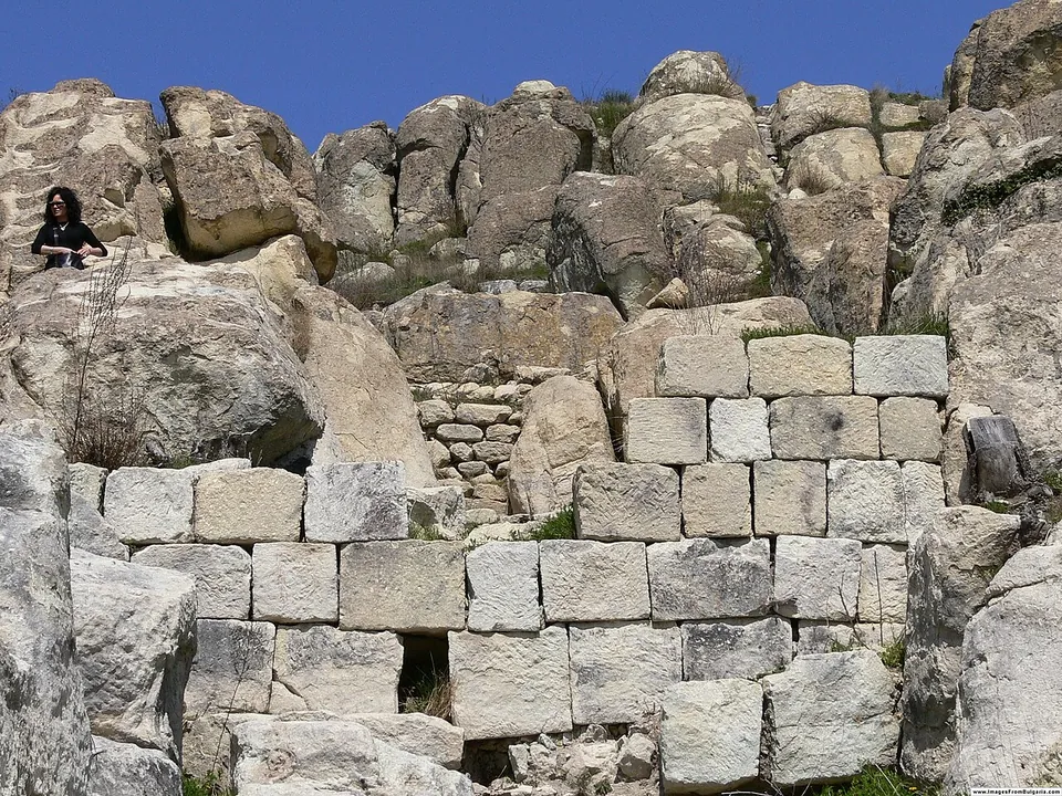
  4. A wall of large squared stone blocks built up against weathered boulders of pale bedrock on a hilltop, with a visitor sitting on the rocks at the top left and a deep blue sky above.

    Photo: Nenko Lazarov · CC BY 2.5 · Commons

    city · Kardzhali Province

    Perperikon

    Almost every surface of the summit has been worked by hand.

    Show on map: Perperikon
    1st c. BC – 7th c. ADUnknown

Hidden gems

Hidden gem

Remains that most visitors to the region never see.

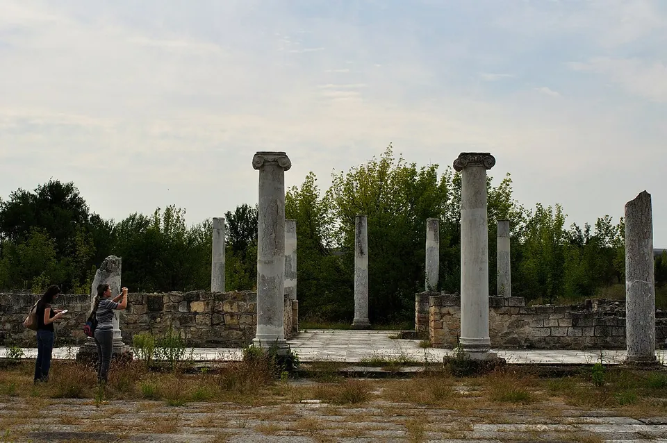
  1. Marble columns with Ionic capitals and broken column shafts stand around a paved open space, enclosed by low restored stone walls, with two visitors taking photographs and trees behind.

    Photo: Vladimir Petkov · CC BY-SA 2.0 · Commons

    city · Razgrad Province

    Abritus

    Under Constantine the Great, early in the 4th century, the town was enclosed by walls 1,400 m long and 2.10 to 3 m thick, with four gates and 35 towers, around 15 ha; with their battlements they rose to 12 m (the museum).

    Show on map: Abritus
    1st – 6th c. ADTicketed
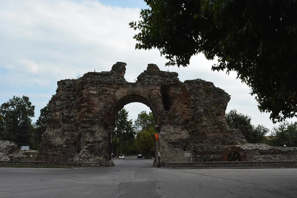
  2. A massive ruined gateway of stone and brick, its central arch still standing between two broken masses of masonry that rise above it, with a road running through the arch and trees on either side.

    Photo: BlackfishFoto · CC BY-SA 4.0 · Commons

    city · Plovdiv Province

    Diocletianopolis

    The walls run for 2,327 m round about 20 ha, 2.60–4 m thick and up to 12.5 m high, and once had 44 towers, four main gates and six smaller ones; the south and west gates survive best, the south gate rising to 13 m (bg.wikipedia).

    Show on map: Diocletianopolis
    1st – 7th c. ADFree
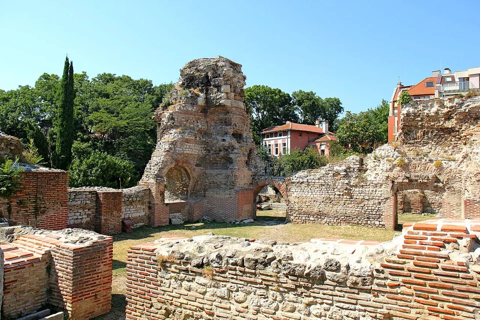
  3. A tall, ragged mass of Roman masonry with a brick arch at its foot rising above low walls of brick and stone, with a grassy floor between them, trees and a red-roofed house behind.

    Photo: Dina Rogatnykh · CC BY-SA 4.0 · Commons

    bath · Varna Province

    Odessos

    The large Roman baths lie in the south-east of the modern city, near the port.

    Show on map: Odessos
    1st c. BC – 7th c. ADTicketed
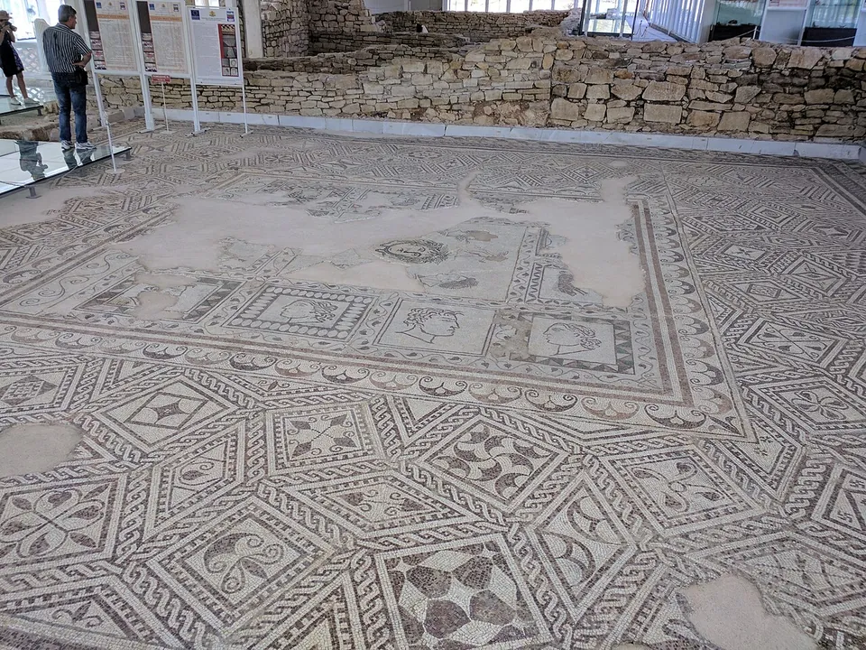
  4. A large floor mosaic of interlocking geometric panels in black, white and ochre filling a room under a modern shelter, with low stone walls on two sides, information boards along the back and two visitors at the edge.

    Photo: Камен Ханджиев · CC BY-SA 4.0 · Commons

    villa · Haskovo Province

    Villa Armira

    The villa is shown where it was found, with many of its floor mosaics still in place (en.wikipedia), under a modern roof (bg.wikipedia).

    Show on map: Villa Armira
    1st – 4th c. ADUnknown
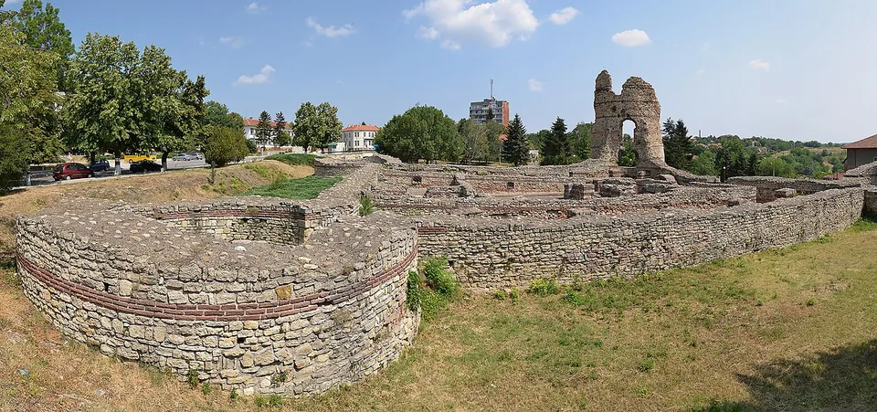
  5. A panorama of a square Roman fort of stone with bands of brick, a round corner tower in the foreground and a tall ruined tower with an arched opening rising at the far corner, on a grassy slope among trees and town buildings.

    Photo: Pudelek (Marcin Szala) · CC BY-SA 3.0 · Commons

    fort · Vidin Province

    Castra Martis

    The fort has two parts.

    Show on map: Castra Martis
    3rd – 6th c. ADUnknown
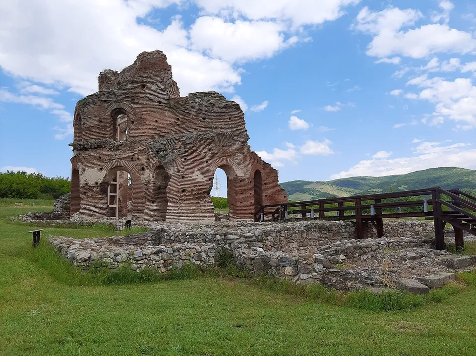
  6. The tall ruined shell of a red-brick church with arched openings and the stump of a dome, standing on a lawn behind low stone foundations, with a wooden walkway on the right and green hills under a cloudy sky.

    Photo: Spasimir Pilev · CC BY-SA 4.0 · Commons

    church · Plovdiv Province

    Red Church, Perushtitsa

    The church measured 32.70 m by 25.90 m.

    Show on map: Red Church, Perushtitsa
    5th – 7th c. ADUnknown
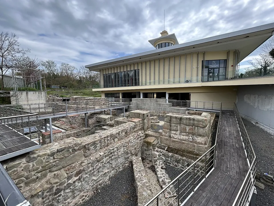
  7. Excavated walls of rough stone laid out below raised metal walkways, with a modern two-storey museum building with a small lantern tower behind them under a cloudy sky.

    Photo: Galileo01 · CC BY 4.0 · Commons

    bath · Burgas Province

    Aquae Calidae

    The ruins of the town walls, the Roman baths with their warm and cold pools, and medieval rooms are shown from raised walkways, and a museum displays the finds: gold coins and jewellery, lead seals, bathing tools, pottery, carved marble and inscriptions (the museum).

    Show on map: Aquae Calidae
    1st c. BC – 7th c. ADTicketed
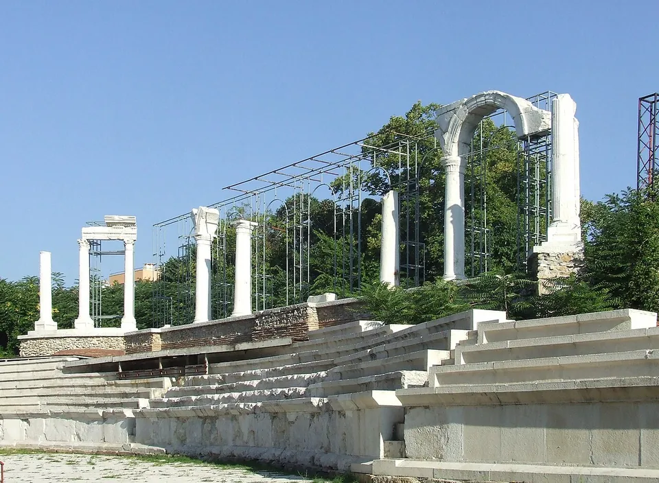
  8. Rows of pale stone seats rising in a shallow curve, with a line of re-erected white columns and a single tall arch along the top, partly held by modern metal scaffolding, under a clear blue sky.

    Photo: DALIBRI · CC BY-SA 3.0 de · Commons

    city · Stara Zagora Province

    Augusta Traiana

    The forum complex covers about 0.7 ha.

    Show on map: Augusta Traiana
    2nd – 7th c. ADRestricted access
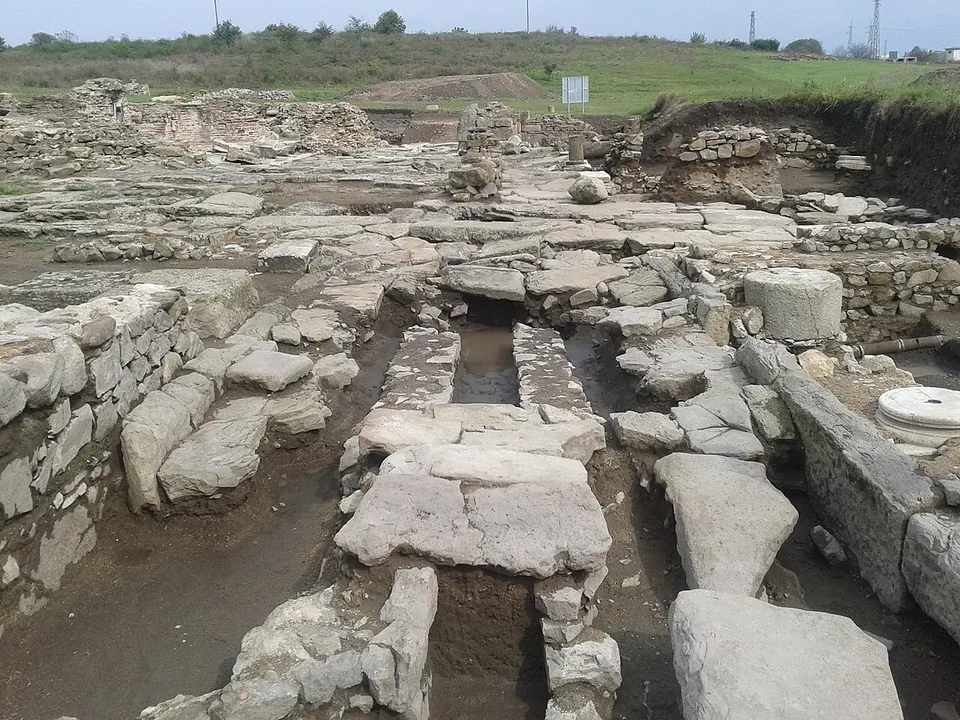
  9. An excavation of stone foundations, paving slabs and stone-lined channels, with column bases and drums scattered among the walls and grassy ground behind.

    Photo: Камен Ханджиев · CC BY-SA 4.0 · Commons

    city · Burgas Province

    Deultum

    Excavations since the 1980s have fully uncovered the town's east gate and part of its main street, with niches on the inner side of the gate for statues of the town's guardian gods (bg.wikipedia).

    Show on map: Deultum
    1st – 6th c. ADTicketed
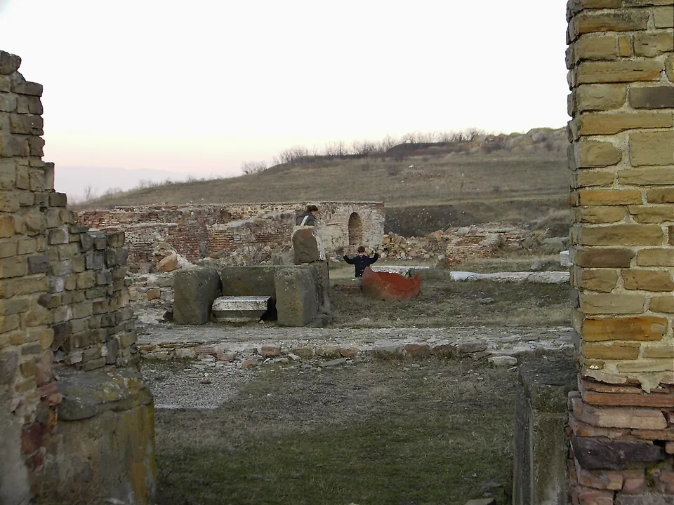
  10. Excavated Roman walls of pale squared stone with brick courses framing a view of foundations, a round-arched doorway and a grassy hill beyond, with a child standing among the ruins.

    Photo: Pamporoff · Public domain · Commons

    city · Yambol Province

    Kabile

    In the 2nd and 3rd centuries AD Kabile was the most important Roman military camp in the province of Thrace, garrisoned by the cohort of the Lucenses, and baths, public buildings, barracks, shrines and walls were built (bg.wikipedia).

    Show on map: Kabile
    1st c. BC – 6th c. ADUnknown
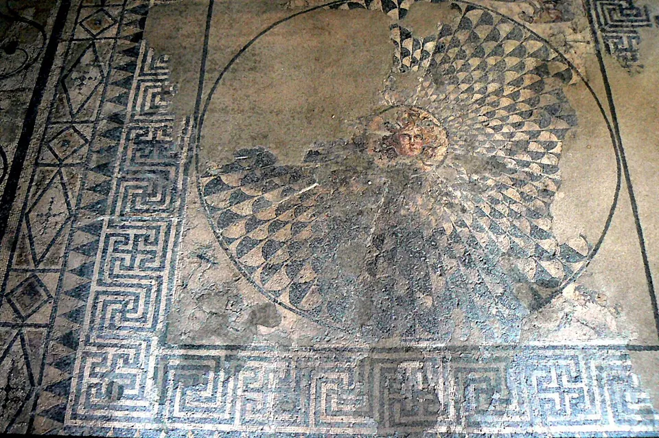
  11. A Roman floor mosaic with a small head of Medusa at the centre of a large circular shield of black and white scales, framed by a broad key-pattern border.

    Photo: Vassia Atanassova - Spiritia · CC BY-SA 3.0 · Commons

    city · Varna Province

    Marcianopolis

    The museum stands over the House of Antiope, a house of the late 3rd or early 4th century that filled a whole city block, with 21 rooms around a paved courtyard with a well (en.wikipedia; the municipality).

    Show on map: Marcianopolis
    2nd – 7th c. ADTicketed
  12. Restored low walls of pale squared stone with brick courses, forming rooms and a large rectangular hall across an open site, with a modern glass panel over one part and a line of trees behind.

    Photo: Alexander.D.Hristov · CC BY-SA 4.0 · Commons

    fort · Veliko Tarnovo Province

    Novae

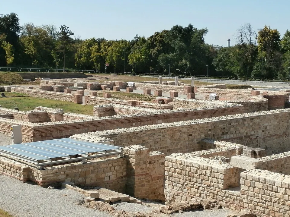
    The most complete remains are those of the bishop's complex, 6,500 m² with two churches, houses and service buildings, built from the first quarter of the 5th century on the site of the soldiers' baths, which were destroyed in the Gothic wars of 376–382.

    Show on map: Novae
    1st – 7th c. ADUnknown
  13. A wide view of a grassy excavation with low walls of rough stone, fallen column drums and squared blocks lying in heaps, poppies in the grass and a line of trees behind.

    Photo: Anton Lefterov · CC BY-SA 3.0 · Commons

    city · Pleven Province

    Oescus

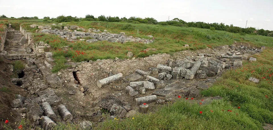
    Excavation, begun in 1904, has uncovered the centre of the colony: the forum and the temples, public and private buildings, public baths and shops around it, with parts of the streets and the town walls (the Regional Historical Museum Pleven; en.wikipedia).

    Show on map: Oescus
    1st – 6th c. ADUnknown
  14. A row of tall piers of red brick banded with pale stone, three of them still joined by round arches, standing on a low stone wall along a grassy verge beside a road, under a blue sky with clouds.

    Photo: Gitanes232 · CC BY-SA 4.0 · Commons

    aqueduct · Plovdiv Province

    Aqueducts of Plovdiv

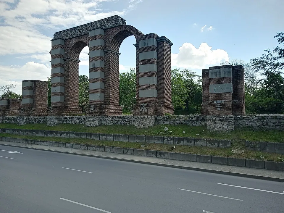
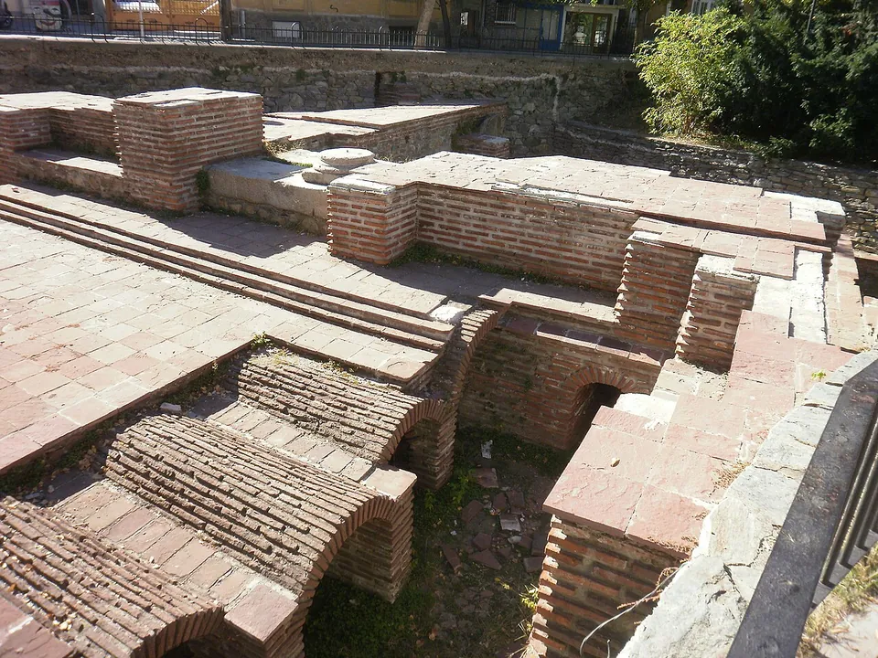
    What you see is a row of tall piers in opus mixtum, courses of squared stone alternating with courses of brick, with a few arches restored between them, in the central strip of Komatevsko Shose Boulevard at the Komatevo junction.

    Show on map: Aqueducts of Plovdiv
    3rd – 4th c. ADFree
  15. Excavated foundations of a building with low walls, white stone paving and a single standing column, in a grassy field at dusk, with trees and mountains behind.

    Photo: Klearchos Kapoutsis · CC BY 2.0 · Commons

    city · Blagoevgrad Province

    Nicopolis ad Nestum

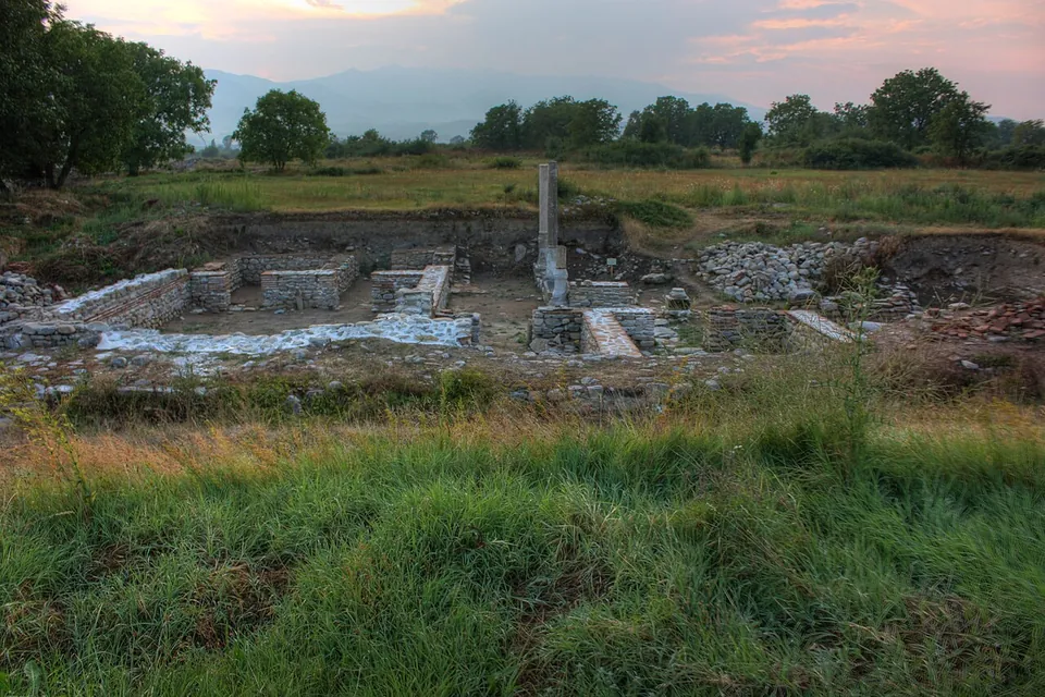
    Excavation since 1980 has uncovered 280 m of the town walls and the foundations of public and religious buildings (bg.wikipedia; en.wikipedia).

    Show on map: Nicopolis ad Nestum
    2nd – 6th c. ADUnknown
  16. Excavated rooms of brick, with rows of small brick vaults and arched openings below floor level and paved brick surfaces above, enclosed by a railing in a town street.

    Photo: Спасимир · CC BY-SA 3.0 · Commons

    bath · Kyustendil Province

    Roman baths of Pautalia

    Parts of six rooms have been uncovered over about 1,000 m², of a building thought to have covered some 3,000 m².

    Show on map: Roman baths of Pautalia
    2nd – 3rd c. ADUnknown
  17. Low walls of rough grey stone outlining rectangular rooms on a grassy terrace, with a longer, higher stretch of wall behind and trees all around.

    Photo: Rossen Radev · Public domain · Commons

    fort · Ruse Province

    Sexaginta Prista

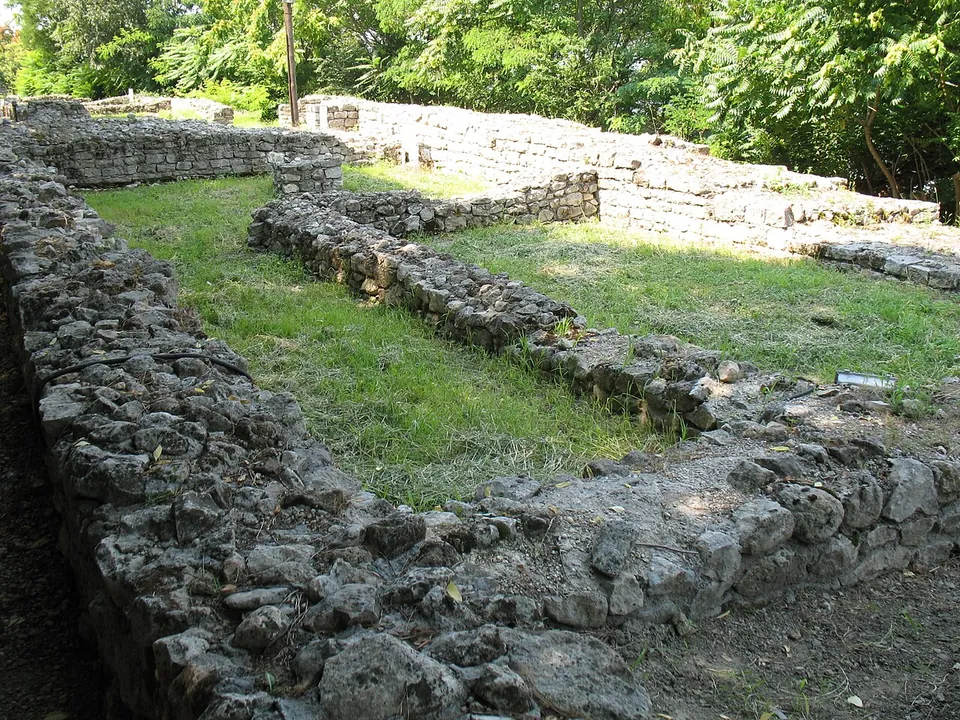
    Excavations in 1976–1978 and 2005–2006 uncovered about 50 m of the fort's north-western wall with a tower, six buildings, a temple of Apollo and the principia, the headquarters of the garrison.

    Show on map: Sexaginta Prista
    1st – 6th c. ADTicketed
  18. A re-erected round arch of white stone blocks set in a restored wall of rough stone banded with red brick, with a squat tower of the same masonry behind it and green wooded hills under a blue sky.

    Photo: Elena Chochkova · CC BY-SA 3.0 · Commons

    fort · Lovech Province

    Sostra

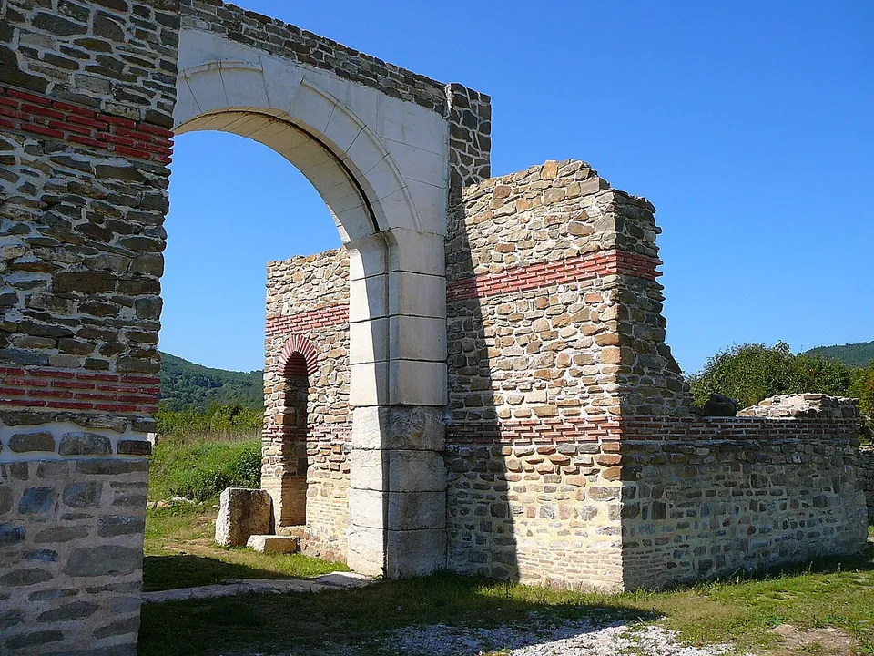
    The fort was rebuilt more than once, and both versions show: the first fort of about 147 had walls rounded at the corners and no towers, while the fort rebuilt from 254 stood inside the old walls and had many towers, as later Roman forts did (en.wikipedia).

    Show on map: Sostra
    1st – 5th c. ADUnknown
  19. Restored walls of grey rubble stone enclose a paved rectangular space reached by a short flight of steps, with an information board in front, column shafts standing to the right and woods behind.

    Photo: Todor Bozhinov / Тодор Божинов · CC BY-SA 3.0 · Commons

    fort · Pleven Province

    Storgosia

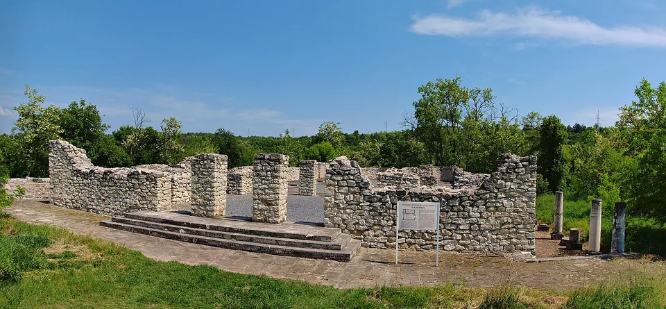
    Excavation has uncovered the fortress wall with its gates and towers, houses, a public granary and an early Christian basilica (the museum; bg.wikipedia).

    Show on map: Storgosia
    1st – 6th c. ADFree