Skip to content
Menu

Country · 14 sites

Roman Austria

Most of Austria’s Roman sites lie in the provinces of Noricum and Pannonia. Rome took over the kingdom of Noricum, and for more than four hundred years the Danube was the empire’s northern frontier. Forts lined the river from the Bavarian border eastwards, the Noric limes as far as Lower Austria and the Pannonian limes from Klosterneuburg on. Most of the garrisons lay in forts, fortlets and watchtowers, and many of today’s towns and villages grew from these posts and the settlements beside them. Since 2021 this stretch of the Danube frontier has been part of the Frontiers of the Roman Empire World Heritage Site.

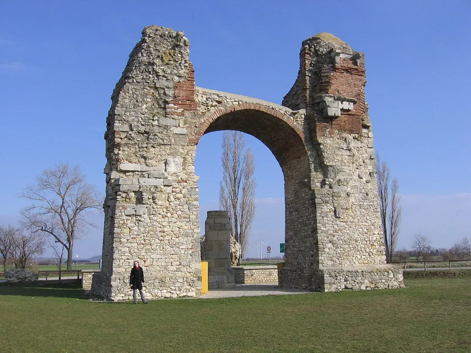
The largest site is Carnuntum, halfway between Vienna and Bratislava: a legionary fortress and a city that became the capital of Upper Pannonia (Pannonia Superior) and grew to about 50,000 inhabitants. Its remains lie in an archaeological park of about 1,000 hectares near Petronell-Carnuntum and Bad Deutsch-Altenburg, and its best-known monument, the Heidentor, is the partly reconstructed ruin of a four-way triumphal arch of which one arch still stands. Vindobona, a legionary fortress with a military settlement and a civil town, lies beneath Vienna, where dense modern building has made it hard to study. Upriver, Lauriacum at Enns became the largest military base in Noricum after the Legio II Italica built its fortress there around AD 200, and in the 5th century it was a bishop’s seat.

South of the Danube lie the towns of Noricum. On the Magdalensberg in Carinthia stood a Noric settlement that traded in the region’s iron before and during the first years of Roman rule; it was abandoned once the Roman town of Virunum had been built on the nearby Zollfeld. Further west, Teurnia near Spittal an der Drau was a late Roman provincial capital and bishop’s seat, and its episcopal church and memorial church are presented on site, with finds in a museum. Aguntum, near Lienz in East Tyrol, became a self-governing town under Claudius, and its excavated area covers about 3 hectares. In Styria, Flavia Solva near Leibnitz is the only Roman town in the state, and in the far west Bregenz, Roman Brigantium, is the site of the oldest Roman fort yet identified in Austria.

Sources: Wikipedia (de) — Limes Noricus; Wikipedia (de) — Limes Pannonicus; Wikipedia (en) — Danubian Limes; Wikipedia (en) — Carnuntum; Wikipedia (en) — Heidentor; Wikipedia (de) — Vindobona; Wikipedia (en) — Vindobona; Wikipedia (de) — Lauriacum; Wikipedia (de) — Stadt auf dem Magdalensberg; Wikipedia (de) — Virunum; Wikipedia (de) — Teurnia; Wikipedia (de) — Aguntum; Wikipedia (en) — Flavia Solva; Wikipedia (de) — Brigantium

Carnuntum
Vindobona
Roman bridge at St. Dionysen
Aguntum
Magdalensberg
Teurnia
Virunum
Burgus Oberranna
Castra Cannabiaca
Castra of Schlögen
Castrum Favianis
Comagena – Tulln an der Donau
Flavia Solva
Lauriacum
Open Austria on the interactive map

Select Show on map beside a site or town to see where it is.Scroll the list: each site or town is marked on the map as you reach it. The interactive map shows them all.

Landmarks

Landmark

Worth planning a trip around.

  1. A tall ruined arch of rough grey stone with bands of red brick, standing alone in a flat grassy field under a blue sky, a person at its foot for scale.

    Photo: Michael Dufek at de.wikipedia · CC BY-SA 3.0 · Commons

    city · Bruck an der Leitha District

    Carnuntum

    The heart of a visit is the Roman city quarter in the park beside Schloss Petronell.

    Show on map: Carnuntum
    1st – 5th c. ADTicketed
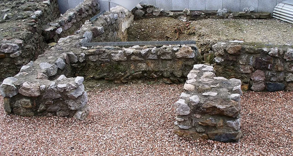
  2. Low walls of rough grey and brown stones, a few courses high, enclosing small rooms floored with reddish gravel, with a metal label strip along one wall and a modern pale wall behind.

    Photo: High Contrast · CC BY 3.0 de · Commons

    fort · Vienna

    Vindobona

    The Römermuseum, run by Wien Museum, is the place to start.

    Show on map: Vindobona
    1st – 5th c. ADTicketed

Hidden gems

Hidden gem

Remains that most visitors to the region never see.

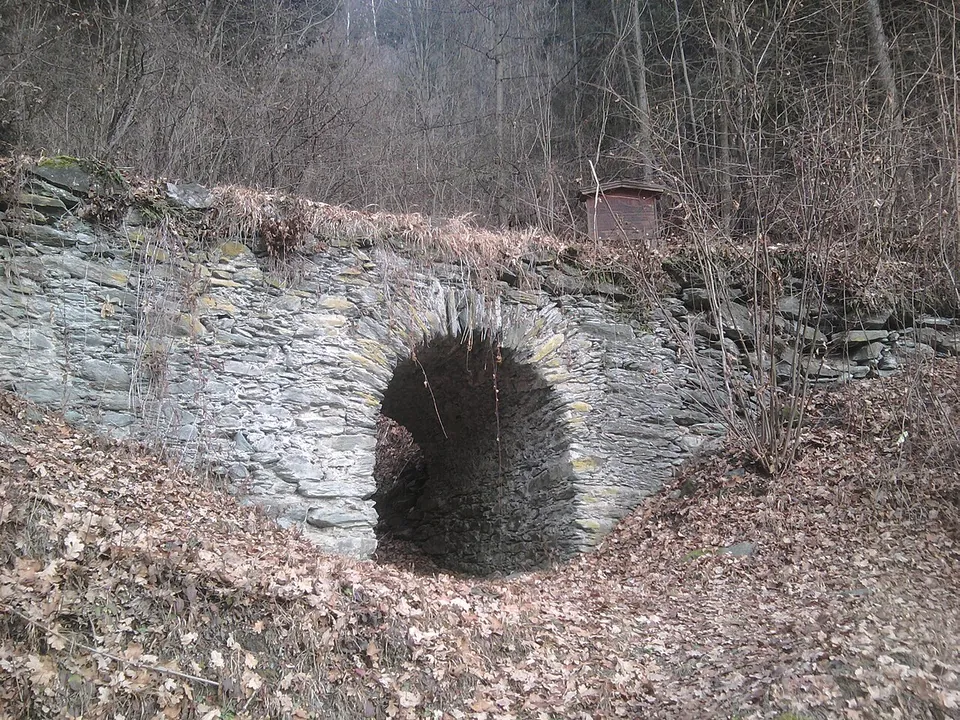
  1. A small single-arched bridge of grey slate-like stone slabs crossing a dry, leaf-filled gully in a bare winter wood, with a small sign on top.

    Photo: Daniel Kraft · CC BY-SA 3.0 · Commons

    bridge · Bruck-Mürzzuschlag District

    Roman bridge at St. Dionysen

    A single arch of rubble stone, under heritage protection (de.wikipedia), carries the old way across a gully.

    Show on map: Roman bridge at St. Dionysen
    1st – 3rd c. ADFree
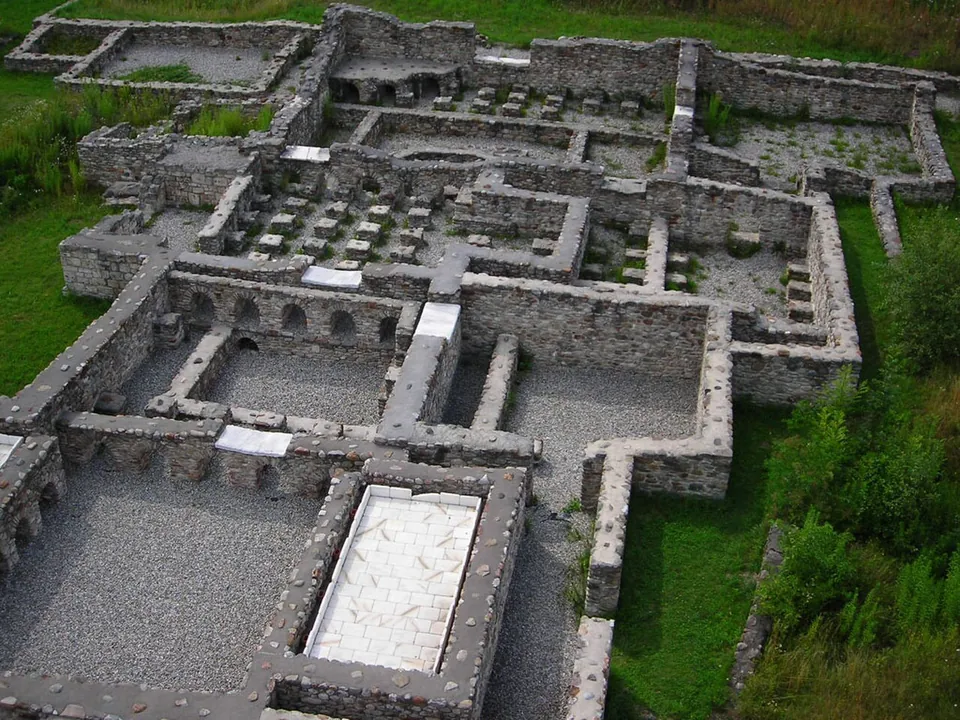
  2. The excavated walls of a bath building seen from above, rooms of grey stone with rows of small square pillars that held up heated floors, and a pale stone slab in one room.

    Photo: Simfunkel · CC BY-SA 3.0 · Commons

    city · Lienz District

    Aguntum

    Alongside the museum, visitors can see the town wall, the atrium house, the baths, the craftsmen's quarter and the macellum (de.wikipedia).

    Show on map: Aguntum
    1st – 7th c. ADTicketed
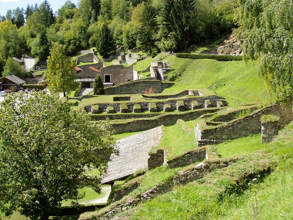
  3. A green hillside terraced with the low stone walls of excavated buildings, some under modern roofs, rising to a small group of rebuilt houses and woodland at the top.

    Photo: de:Benutzer:Griensteidl · CC BY-SA 3.0 · Commons

    city · Klagenfurt-Land District

    Magdalensberg

    Since 1948 annual excavations have uncovered the buildings around the forum, and most of them are now open as an open-air museum in which they have been conserved and in part rebuilt; the park is a branch of the Carinthian state museum (de.wikipedia).

    Show on map: Magdalensberg
    1st c. BC – 1st c. ADTicketed
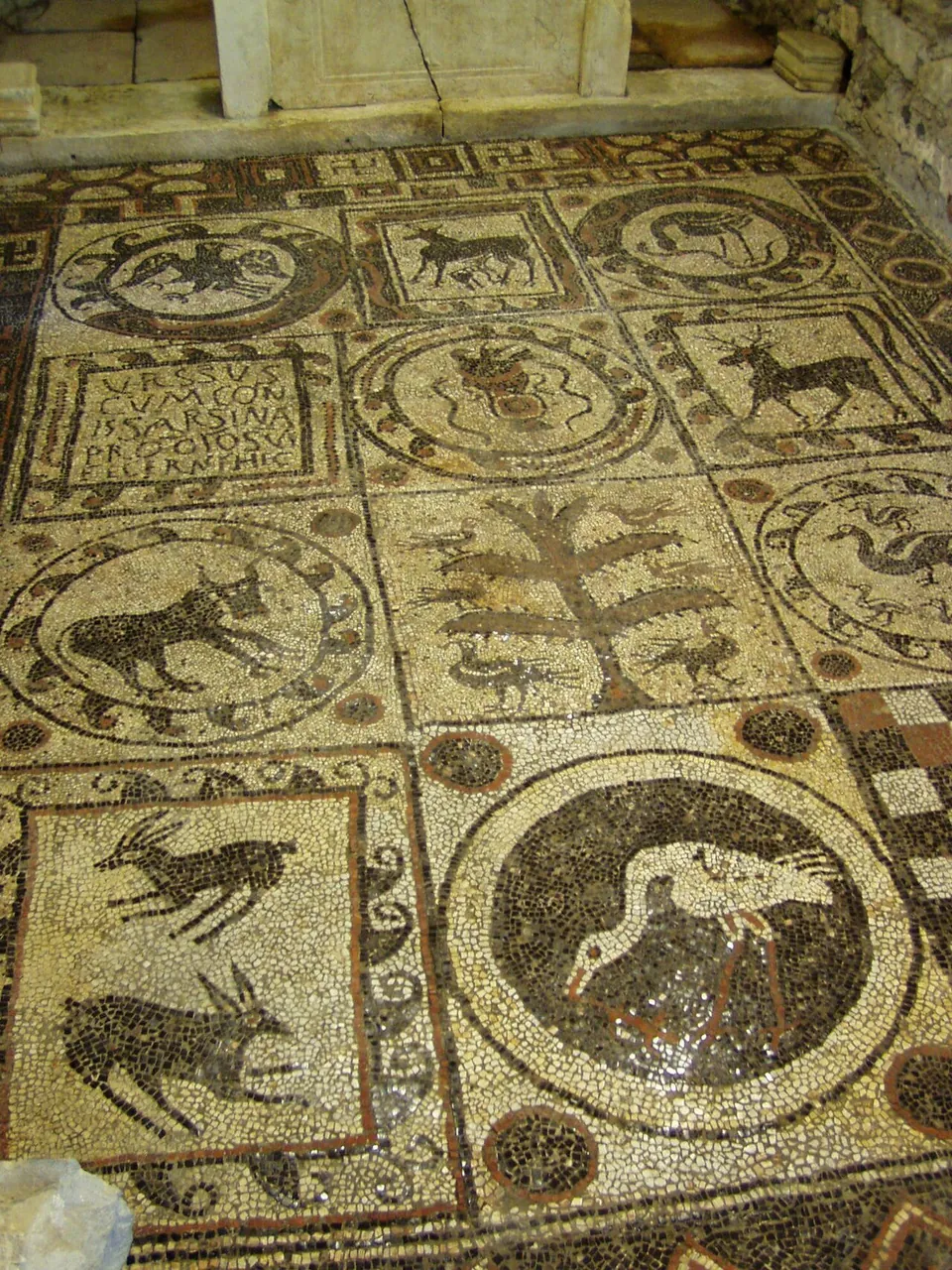
  4. A pebble-and-stone floor mosaic seen from above, divided into round and square panels with animals and a tree, laid in dark and reddish stones on a pale ground.

    Photo: Griensteidl · CC BY-SA 3.0 · Commons

    city · Spittal an der Drau District

    Teurnia

    The town was built on the Holzer Berg, a hill rising about 70 m above the valley, and the village of St. Peter in Holz now occupies the site (de.wikipedia).

    Show on map: Teurnia
    1st – 6th c. ADTicketed
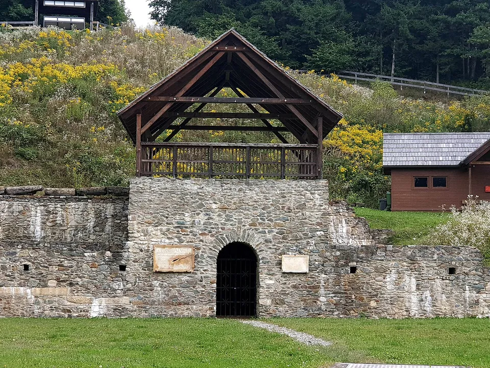
  5. A stretch of stone wall with an arched doorway at its centre, topped by an open timber-roofed platform, standing at the edge of a grassy arena.

    Photo: Alfred Platschka · CC BY-SA 4.0 · Commons

    city · Klagenfurt-Land District

    Virunum

    The town covered about 100 hectares.

    Show on map: Virunum
    1st – 5th c. ADRestricted access
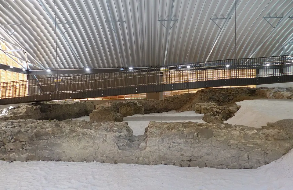
  6. Low walls of rough stone laid out on pale gravel inside a large modern hall with a curved corrugated metal roof, crossed by a raised steel walkway with railings.

    Photo: Wolfgang Sauber · CC BY-SA 4.0 · Commons

    fort · Schärding District

    Burgus Oberranna

    The fort's central court measured about 15 by 17 m and the whole fort about 28 by 29 m, with a round tower about 8–10 m across at each corner, probably three storeys and up to 10 m high when complete.

    Show on map: Burgus Oberranna
    3rd – 5th c. ADFree
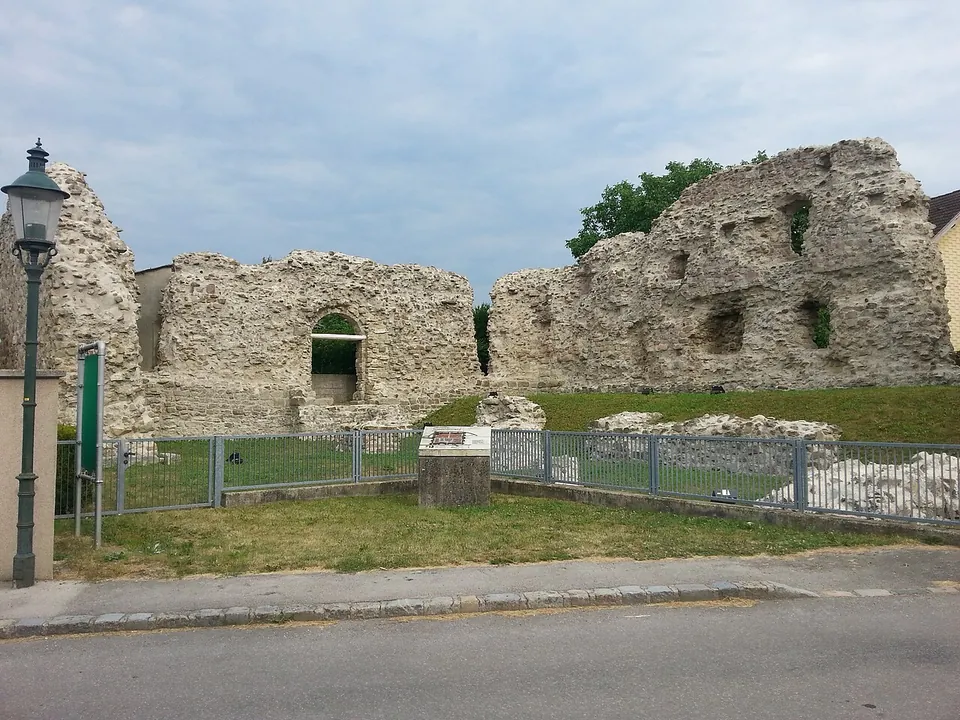
  7. Tall broken walls of rough rubble masonry with an arched opening, standing in a fenced grassy plot behind a low railing and an information panel, beside a village street with a lamp post.

    Photo: Veleius · CC0 · Commons

    fort · Tulln District

    Castra Cannabiaca

    The burgus, a small fort built inside the north-west corner of the larger one, is the centrepiece.

    Show on map: Castra Cannabiaca
    1st – 5th c. ADFree
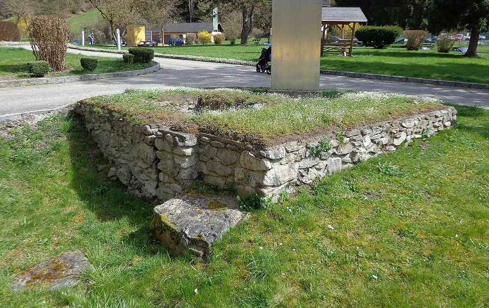
  8. A low square block of rough grey stone masonry, its top grown with grass, beside a lane, with lawns, a parked car and a small timber shelter behind.

    Photo: ViennaUK · CC BY-SA 4.0 · Commons

    fort · Eferding District

    Castra of Schlögen

    The bath house, excavated in 2014 and 2015, measures 14 by 6 m and its masonry was found in unusually good condition.

    Show on map: Castra of Schlögen
    2nd – 5th c. ADFree
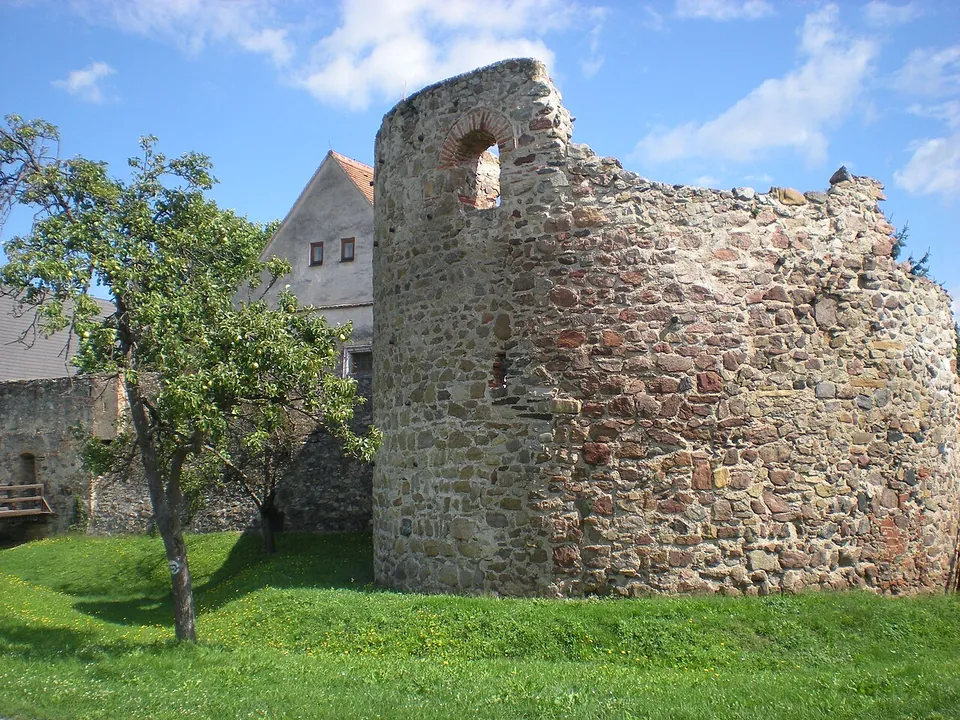
  9. A tall, round-fronted tower of rough rubble stone with a small brick-arched opening near the top, standing on a lawn beside a fruit tree, with a stretch of wall and an old house behind.

    Photo: Wolfgang Glock · CC BY-SA 3.0 · Commons

    fort · Krems District

    Castrum Favianis

    The best piece is the western horseshoe tower, about 11 by 14 m and 10 m high, probably of the 4th or 5th century and perhaps even from Severin's time.

    Show on map: Castrum Favianis
    1st – 5th c. ADFree
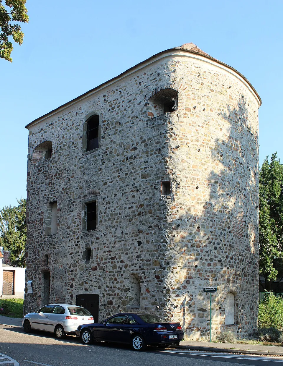
  10. A tall, roughly square stone tower with a rounded corner and small irregular windows, its walls of rubble masonry, standing beside a street with parked cars.

    Photo: Dguendel · CC BY 3.0 · Commons

    fort · Tulln District

    Comagena – Tulln an der Donau

    The Römerturm, also called the Salzturm because it was used to store salt in the 18th and 19th centuries, is the reason to come.

    Show on map: Comagena – Tulln an der Donau
    1st – 5th c. ADFree
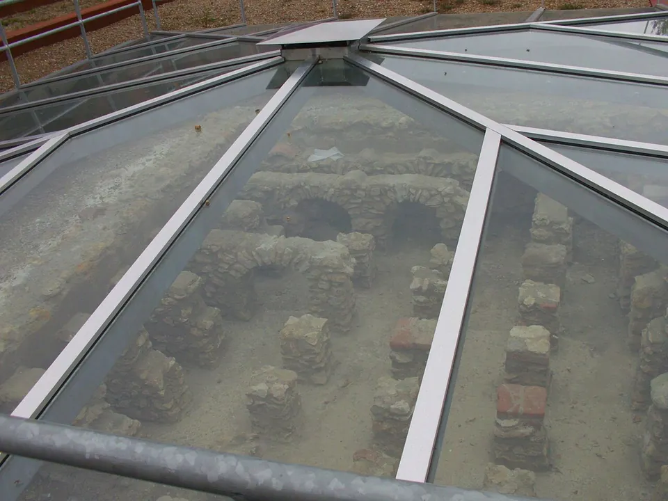
  11. Looking down through a glass roof onto excavated walls of rubble stone and rows of small square brick pillars that once held up a heated floor.

    Photo: Norbert Radtke (Dramburg) · CC BY-SA 3.0 · Commons

    city · Leibnitz District

    Flavia Solva

    Only a few foundations are visible, on the edge of Wagna.

    Show on map: Flavia Solva
    1st c. BC – 5th c. ADFree
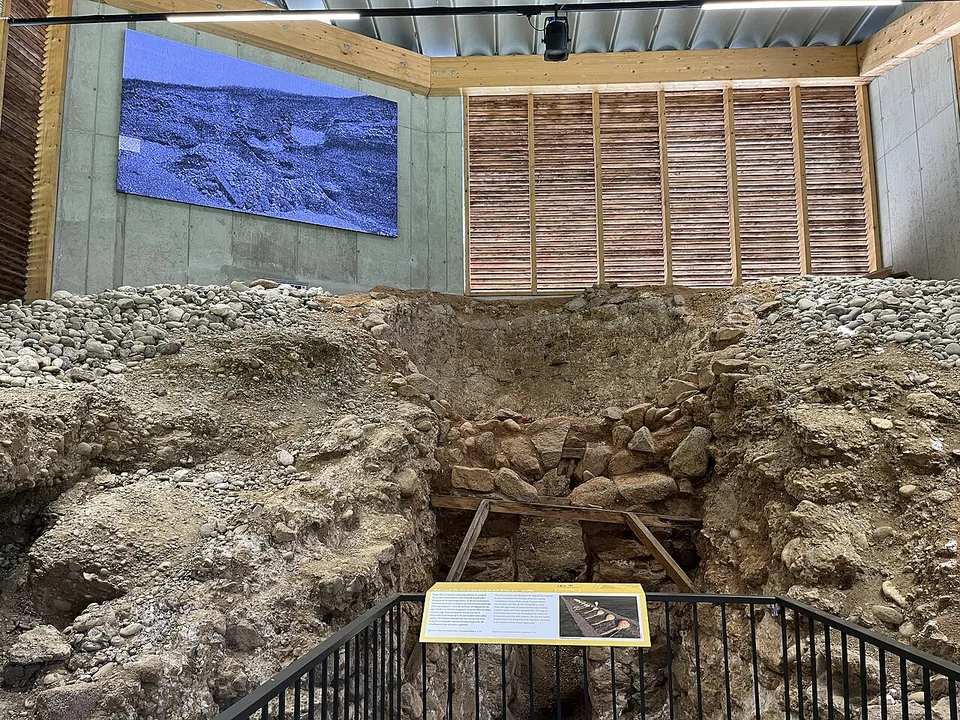
  12. A deep, roughly round pit lined with rounded stones and gravel under a modern timber shelter, seen from a railed walkway, with an information panel at the front and a projected image on the far wall.

    Photo: Dieringer63 · CC BY-SA 4.0 · Commons

    fort · Linz-Land District

    Lauriacum

    The most striking survivor is the lime kiln.

    Show on map: Lauriacum
    1st – 5th c. ADFree