Skip to content
Menu

See what Rome left behind.Roman ruins you can actually visit.

From frontier forts on the Danube to theatres on the Aegean: what is still standing, how to get there, and whether it is worth the detour.

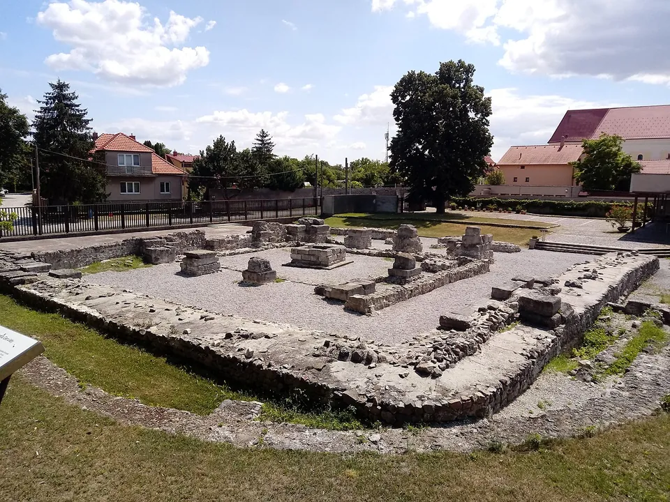
A square enclosure of low, grassy-topped stone walls around a gravel courtyard, with a row of stone piers and blocks set out inside it; houses with red roofs, a fence and tall trees surround the site.

Photo: Kawon Kez Sel · CC0 · Commons

Castra Gerulata

Country · 4 sites

Slovakia

In what is now Slovakia the Danube was the frontier of Roman Pannonia: Gerulata in Bratislava guarded its bank and the fort at Iža a bridgehead on the far side. Beyond the river, an inscription carved at Trenčín in 179 records a Roman winter camp.

Browse Slovakia →Show Slovakia on the interactive map
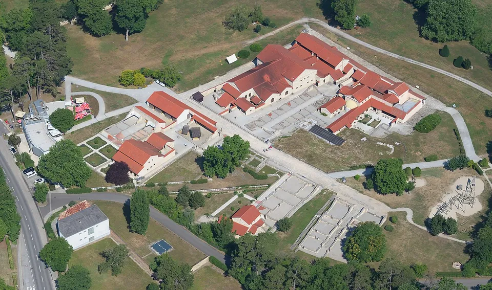
An aerial view of a cluster of rebuilt Roman houses with red tiled roofs around courtyards, next to excavated wall foundations in grass, with paths and trees around them.

Photo: Carsten Steger · CC BY-SA 4.0 · Commons

Carnuntum

Country · 14 sites

Austria

In what is now Austria, Rome took over the kingdom of Noricum and held the east as part of Pannonia, with the Danube as its frontier. Carnuntum, east of Vienna, became the capital of Upper Pannonia; Lauriacum at Enns was the largest military base in Noricum.

Browse Austria →Show Austria on the interactive map
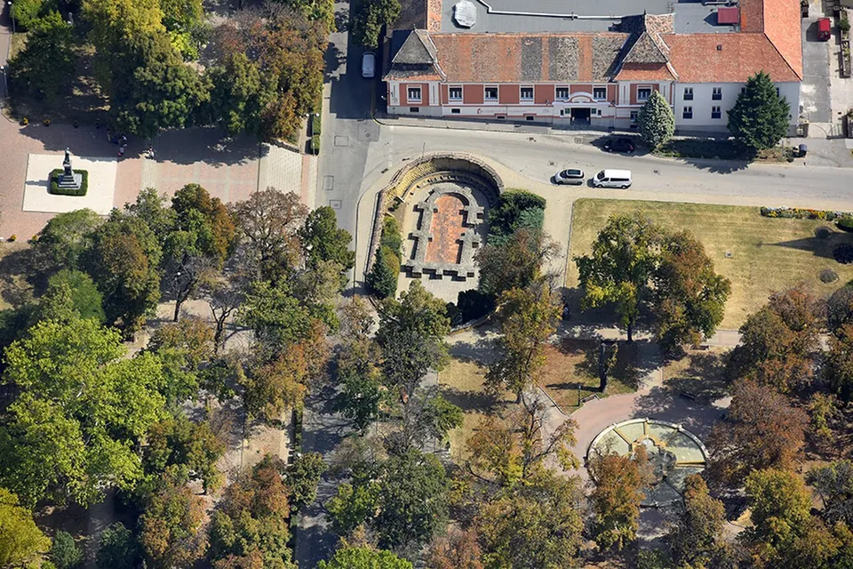
An aerial view of a park among trees and paths, with a sunken walled area of excavated foundations by a street and a long building with a tiled roof behind.

Photo: Civertan · CC BY-SA 4.0 · Commons

Early Christian Necropolis of Pécs

Country · 14 sites

Hungary

In what is now Hungary, Rome held the land west of the Danube as part of Pannonia, and the river was the empire's frontier. Aquincum in Budapest was the seat of Lower Pannonia's governor; Savaria, now Szombathely, is probably the country's oldest Roman town.

Browse Hungary →Show Hungary on the interactive map
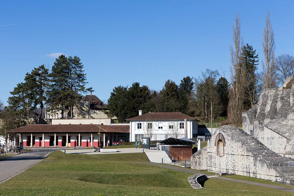
A lawn and paths in front of a long low building with a red-columned arcade and a white house with a hipped roof, with the tall rough stone wall of the theatre rising on the right.

Photo: Roland Zumbuehl · CC BY 3.0 · Commons

Augusta Raurica

Country · 23 sites

Switzerland

In the land of the Helvetii, Rome made Aventicum their capital, set a legionary camp at Vindonissa and founded Augusta Raurica, the oldest known Roman colony on the Rhine. Around 300 the frontier returned to the Rhine, and forts and watchtowers lined it.

Browse Switzerland →Show Switzerland on the interactive map
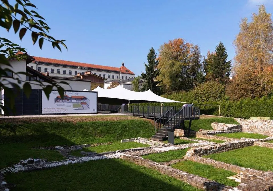
A sunken lawn crossed by low excavated stone walls, with a black metal viewing platform and steps, a white fabric canopy behind it, an illustrated information panel on the left and a large red-roofed building beyond the trees.

Photo: Matevž Paternoster, dokumentacija Muzeja in galerij mesta Ljubljane · CC BY-SA 3.0 · Commons

Emona – Ljubljana

Country · 10 sites · 2 hubs

Slovenia

The main road from the Pannonian plain into Italy crossed today's Slovenia, then divided between Roman Italy, Pannonia and Noricum. Its main towns were Emona (Ljubljana), Poetovio (Ptuj) and Celeia (Celje); late Roman walls and forts closed its passes.

Browse Slovenia →Show Slovenia on the interactive map
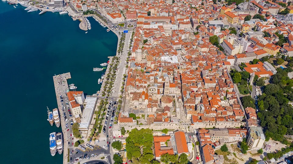
An aerial view of a dense old town of pale stone buildings with red-tiled roofs beside a harbour of blue water, a palm-lined promenade along the waterfront and moored boats at a pier.

Photo: dronepicr · CC BY 2.0 · Commons

Diocletian's Palace

Country · 19 sites · 4 hubs

Croatia

Most of Croatia's coast lay in Roman Dalmatia, whose capital Salona stood beside today's Split, where Diocletian built his retirement palace. Istria, in the north-west, was part of Roman Italy itself; Pula's amphitheatre keeps its complete outer wall.

Browse Croatia →Show Croatia on the interactive map
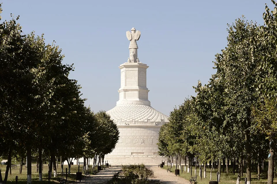
A tall white cylindrical monument with a stepped conical roof and a hexagonal tower topped by a sculpted trophy, seen at the end of a paved avenue lined with young trees.

Photo: geomcrae · CC BY-SA 4.0 · Commons

Tropaeum Traiani

Country · 21 sites · 1 hub

Romania

Trajan conquered Dacia in 106, and until 271-275 Oltenia, Transylvania and Banat were a Roman province of forts and cities such as Ulpia Traiana Sarmizegetusa and Apulum. Dobruja, between the Danube and the Black Sea, stayed Roman until about 680.

Browse Romania →Show Romania on the interactive map
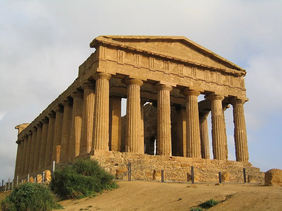
A Doric temple seen from one corner, its columns, entablature and front pediment all standing on a stepped base, built of warm golden stone, with dry ground and shrubs in front.

Photo: Evan Erickson · Public domain · Commons

Akragas/Agrigentum

Country · 247 sites · 29 hubs

Italy

Italy was the Roman homeland, keeping political, religious and financial privileges while Rome made provinces around the Mediterranean. Under Augustus it was organised in eleven regions from the Alps to the Ionian Sea.

Browse Italy →Show Italy on the interactive map
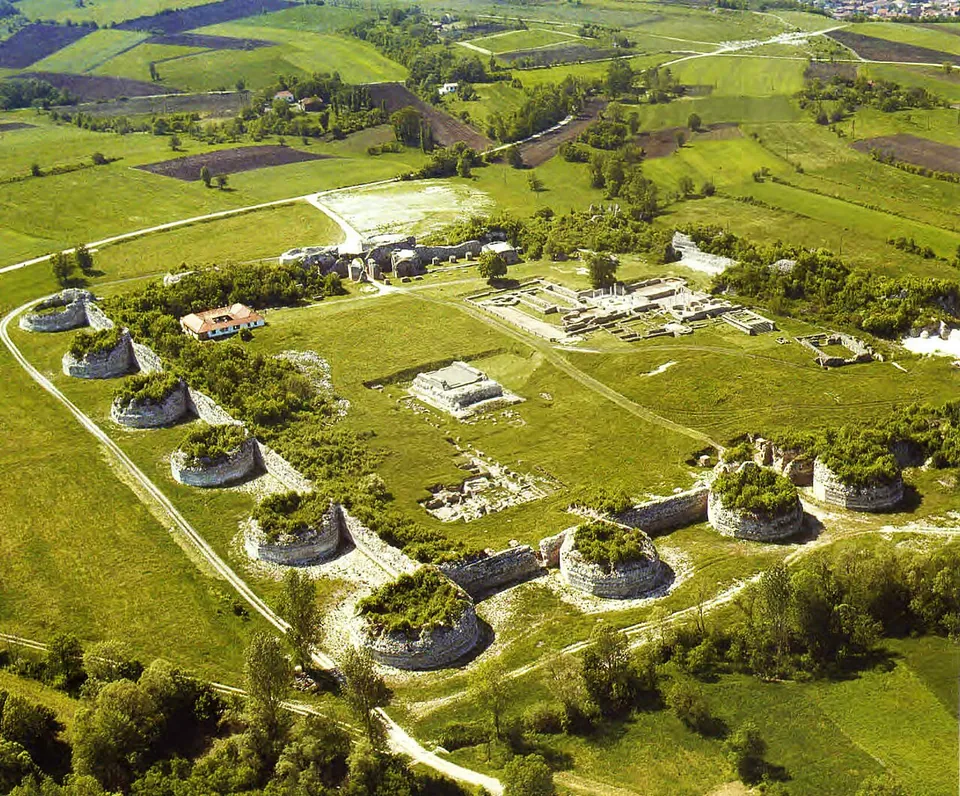
An aerial view of the whole site, an irregular ring of massive round towers and connecting wall enclosing mown grass, with the excavated foundations of the palace and its buildings laid out inside and farmland beyond.

Photo: Institute for the Protection of Cultural Monuments of Serbia · CC BY-SA 3.0 · Commons

Felix Romuliana

Country · 4 sites

Serbia

In what is now Serbia the Danube was Rome's northern frontier, lined with forts, and the Via Militaris ran south of it towards Constantinople. Constantine the Great was born at Naissus, today's Niš, and Galerius built a palace at Romuliana near Zaječar.

Browse Serbia →Show Serbia on the interactive map
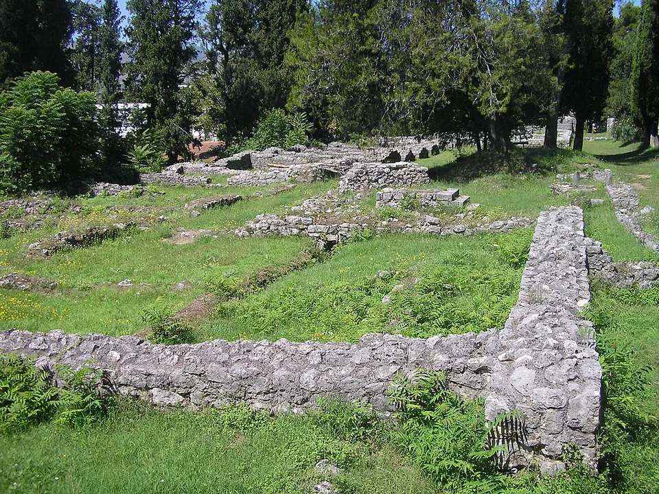
Long low walls of grey rubble stone crossing a lawn in a grove of dark cypress trees, outlining rooms of a large building.

Photo: Ma Ga · CC BY 3.0 · Commons

Mogorjelo

Country · 3 sites

Bosnia & Herzegovina

Most of Bosnia and Herzegovina lay in Roman Dalmatia, the farmed and garrisoned hinterland behind coastal towns such as Salona and Narona. Its remains include a walled late Roman estate at Mogorjelo and a Mithras relief carved into the rock at Jajce.

Browse Bosnia & Herzegovina →Show Bosnia & Herzegovina on the interactive map
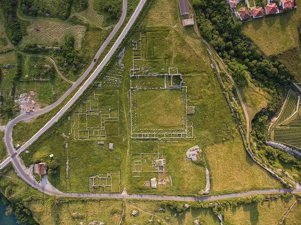
An aerial view of a long green plateau between roads and a river, marked with the rectangular outlines of excavated Roman buildings, a large square courtyard among them, with houses and fields around.

Photo: Mcipovic · CC BY-SA 4.0 · Commons

Doclea

Country · 1 site

Montenegro

Montenegro came under Rome through the Illyrian wars and lay in the province of Dalmatia. Under Diocletian, Dalmatia's south-eastern corner became the province of Praevalitana, whose first capital was Doclea, just outside today's Podgorica.

Browse Montenegro →Show Montenegro on the interactive map
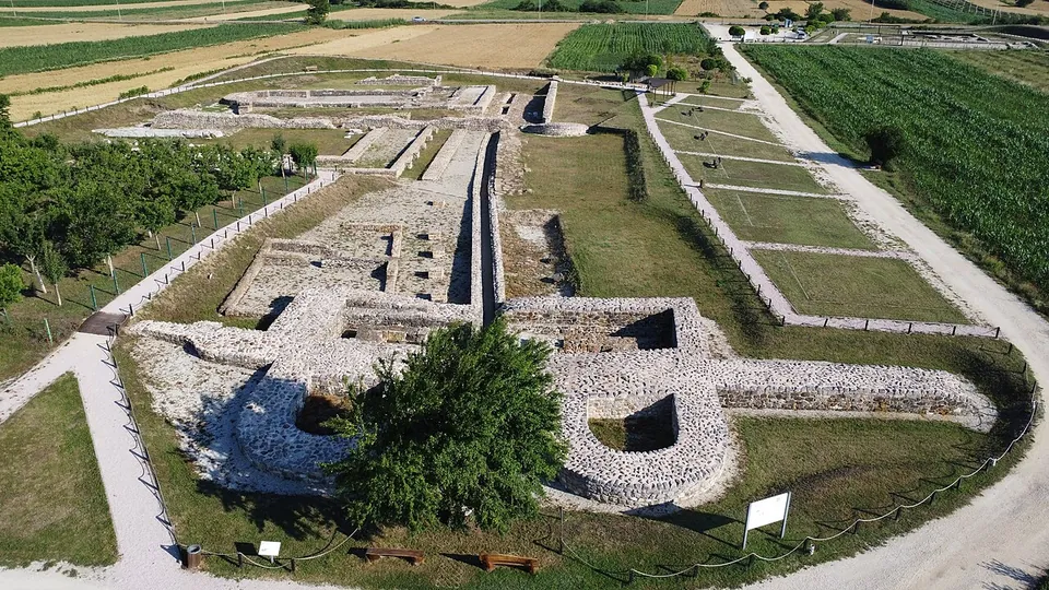
An aerial view over excavated stone walls and foundations laid out in mown grass, with a gateway between two rounded towers in the foreground, a gravel path around the site and farmland beyond.

Photo: Arianit · CC BY-SA 4.0 · Commons

Ulpiana

Country · 2 sites

Kosovo

The land that is now Kosovo was the heart of Dardania, first a district of Roman Moesia and from the end of the 3rd century a province of its own. Ulpiana, near Pristina, gained town rights under Trajan and was rebuilt by Justinian after an earthquake in 518.

Browse Kosovo →Show Kosovo on the interactive map
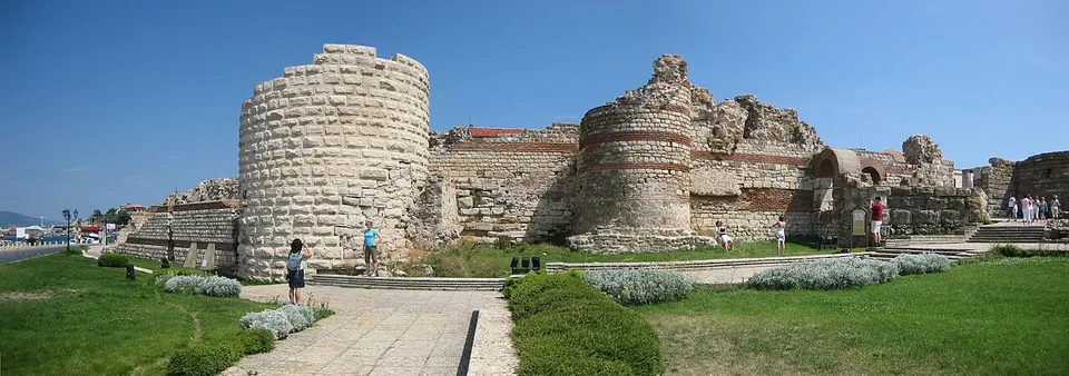
A panorama of ruined fortress walls of stone with bands of brick, a tall round tower on the left and a broken gate tower in the middle, with a paved path, lawns and visitors in front.

Photo: B0rder at en.wikipedia · Public domain · Commons

Mesembria

Country · 31 sites · 2 hubs

Bulgaria

Northern Bulgaria was Moesia, whose Danube frontier was lined with forts such as Novae; the south was Thrace, annexed by Claudius in AD 46. The Via Militaris ran through Serdica (Sofia) and Philippopolis (Plovdiv) on its way to Constantinople.

Browse Bulgaria →Show Bulgaria on the interactive map
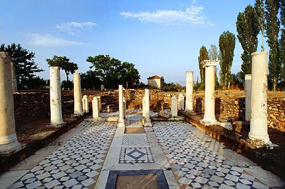
A colonnaded court with white marble columns, some broken off, standing along a floor of black and white geometric mosaic, with low stone walls, poplars and trees behind.

Photo: Revizionist at Macedonian Wikipedia · CC BY-SA 3.0 · Commons

Heraclea Lyncestis

Country · 9 sites

North Macedonia

Two Roman provinces met in what is now North Macedonia: Macedonia in the south, crossed by the Via Egnatia, and Moesia, later Dardania, in the north around Skopje. Stobi, where the Crna meets the Vardar, ended as a provincial capital.

Browse North Macedonia →Show North Macedonia on the interactive map
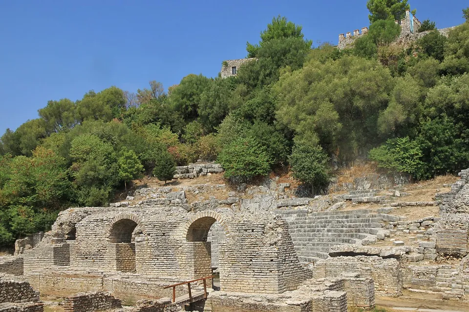
The stone tiers and arched stage building of an ancient theatre set into a wooded hillside, with the walls of a castle just visible at the top of the hill.

Photo: Marcin Konsek · CC BY-SA 4.0 · Commons

Butrint

Country · 5 sites

Albania

Rome reached Albania's coast of Greek colonies and Illyrian towns in 229 BC, taking Dyrrachium, today's Durrës, where the Via Egnatia later began its way to Byzantium. The young Augustus studied at Apollonia, near Fier.
Browse Albania →Show Albania on the interactive map
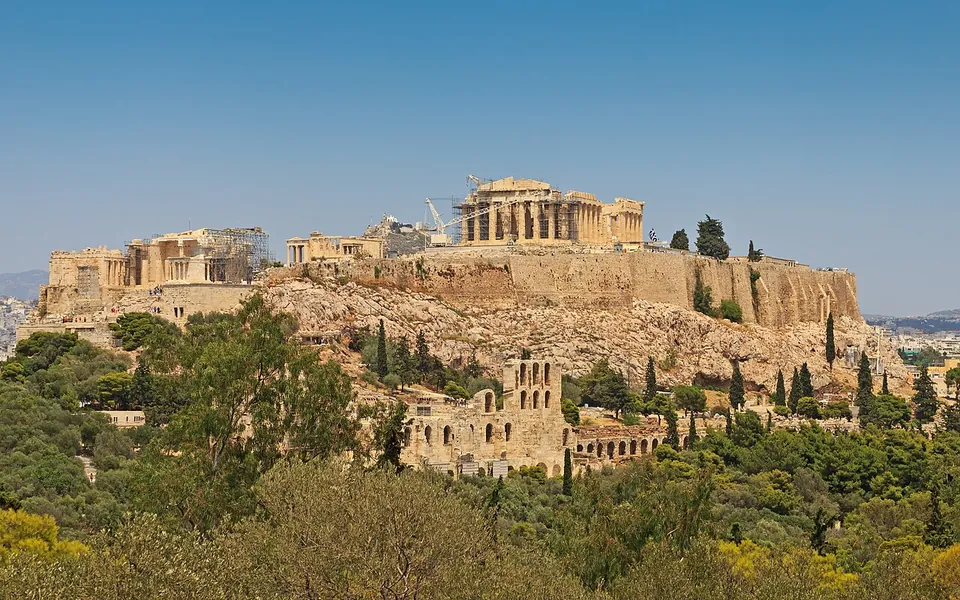
The rock of the Acropolis seen from a wooded hill to the south-west, its long fortification wall and ruined temples along the top under a clear sky, and below the rock a ruined stone facade with tiers of round-headed arches set among pines.

Photo: A.Savin · CC BY-SA 3.0 · Commons

Acropolis of Athens

Country · 57 sites · 6 hubs

Greece

Rome conquered mainland Greece in 146 BC and in time split it into Macedonia in the north, crossed by the Via Egnatia, Achaia in the south and Epirus in the west, while Crete was joined to Cyrenaica. Refounded Corinth governed Achaia, Thessalonica Macedonia.

Browse Greece →Show Greece on the interactive map
Explore every site on the interactive map
A country and its number of sitesSelect a bubble or a country for a summary.

Countries

The stone tiers and arched stage building of an ancient theatre set into a wooded hillside, with the walls of a castle just visible at the top of the hill.

Photo: Marcin Konsek · CC BY-SA 4.0 · Commons

Butrint

5 sites

Albania

Rome reached Albania's coast of Greek colonies and Illyrian towns in 229 BC, taking Dyrrachium, today's Durrës, where the Via Egnatia later began its way to Byzantium. The young Augustus studied at Apollonia, near Fier.
An aerial view of a cluster of rebuilt Roman houses with red tiled roofs around courtyards, next to excavated wall foundations in grass, with paths and trees around them.

Photo: Carsten Steger · CC BY-SA 4.0 · Commons

Carnuntum

14 sites

Austria

In what is now Austria, Rome took over the kingdom of Noricum and held the east as part of Pannonia, with the Danube as its frontier. Carnuntum, east of Vienna, became the capital of Upper Pannonia; Lauriacum at Enns was the largest military base in Noricum.

Long low walls of grey rubble stone crossing a lawn in a grove of dark cypress trees, outlining rooms of a large building.

Photo: Ma Ga · CC BY 3.0 · Commons

Mogorjelo

3 sites

Bosnia & Herzegovina

Most of Bosnia and Herzegovina lay in Roman Dalmatia, the farmed and garrisoned hinterland behind coastal towns such as Salona and Narona. Its remains include a walled late Roman estate at Mogorjelo and a Mithras relief carved into the rock at Jajce.

A panorama of ruined fortress walls of stone with bands of brick, a tall round tower on the left and a broken gate tower in the middle, with a paved path, lawns and visitors in front.

Photo: B0rder at en.wikipedia · Public domain · Commons

Mesembria

31 sites

Bulgaria

Northern Bulgaria was Moesia, whose Danube frontier was lined with forts such as Novae; the south was Thrace, annexed by Claudius in AD 46. The Via Militaris ran through Serdica (Sofia) and Philippopolis (Plovdiv) on its way to Constantinople.

An aerial view of a dense old town of pale stone buildings with red-tiled roofs beside a harbour of blue water, a palm-lined promenade along the waterfront and moored boats at a pier.

Photo: dronepicr · CC BY 2.0 · Commons

Diocletian's Palace

19 sites

Croatia

Most of Croatia's coast lay in Roman Dalmatia, whose capital Salona stood beside today's Split, where Diocletian built his retirement palace. Istria, in the north-west, was part of Roman Italy itself; Pula's amphitheatre keeps its complete outer wall.

The rock of the Acropolis seen from a wooded hill to the south-west, its long fortification wall and ruined temples along the top under a clear sky, and below the rock a ruined stone facade with tiers of round-headed arches set among pines.

Photo: A.Savin · CC BY-SA 3.0 · Commons

Acropolis of Athens

57 sites

Greece

Rome conquered mainland Greece in 146 BC and in time split it into Macedonia in the north, crossed by the Via Egnatia, Achaia in the south and Epirus in the west, while Crete was joined to Cyrenaica. Refounded Corinth governed Achaia, Thessalonica Macedonia.

An aerial view of a park among trees and paths, with a sunken walled area of excavated foundations by a street and a long building with a tiled roof behind.

Photo: Civertan · CC BY-SA 4.0 · Commons

Early Christian Necropolis of Pécs

14 sites

Hungary

In what is now Hungary, Rome held the land west of the Danube as part of Pannonia, and the river was the empire's frontier. Aquincum in Budapest was the seat of Lower Pannonia's governor; Savaria, now Szombathely, is probably the country's oldest Roman town.

A Doric temple seen from one corner, its columns, entablature and front pediment all standing on a stepped base, built of warm golden stone, with dry ground and shrubs in front.

Photo: Evan Erickson · Public domain · Commons

Akragas/Agrigentum

247 sites

Italy

Italy was the Roman homeland, keeping political, religious and financial privileges while Rome made provinces around the Mediterranean. Under Augustus it was organised in eleven regions from the Alps to the Ionian Sea.

An aerial view over excavated stone walls and foundations laid out in mown grass, with a gateway between two rounded towers in the foreground, a gravel path around the site and farmland beyond.

Photo: Arianit · CC BY-SA 4.0 · Commons

Ulpiana

2 sites

Kosovo

The land that is now Kosovo was the heart of Dardania, first a district of Roman Moesia and from the end of the 3rd century a province of its own. Ulpiana, near Pristina, gained town rights under Trajan and was rebuilt by Justinian after an earthquake in 518.

An aerial view of a long green plateau between roads and a river, marked with the rectangular outlines of excavated Roman buildings, a large square courtyard among them, with houses and fields around.

Photo: Mcipovic · CC BY-SA 4.0 · Commons

Doclea

1 site

Montenegro

Montenegro came under Rome through the Illyrian wars and lay in the province of Dalmatia. Under Diocletian, Dalmatia's south-eastern corner became the province of Praevalitana, whose first capital was Doclea, just outside today's Podgorica.

A colonnaded court with white marble columns, some broken off, standing along a floor of black and white geometric mosaic, with low stone walls, poplars and trees behind.

Photo: Revizionist at Macedonian Wikipedia · CC BY-SA 3.0 · Commons

Heraclea Lyncestis

9 sites

North Macedonia

Two Roman provinces met in what is now North Macedonia: Macedonia in the south, crossed by the Via Egnatia, and Moesia, later Dardania, in the north around Skopje. Stobi, where the Crna meets the Vardar, ended as a provincial capital.

A tall white cylindrical monument with a stepped conical roof and a hexagonal tower topped by a sculpted trophy, seen at the end of a paved avenue lined with young trees.

Photo: geomcrae · CC BY-SA 4.0 · Commons

Tropaeum Traiani

21 sites

Romania

Trajan conquered Dacia in 106, and until 271-275 Oltenia, Transylvania and Banat were a Roman province of forts and cities such as Ulpia Traiana Sarmizegetusa and Apulum. Dobruja, between the Danube and the Black Sea, stayed Roman until about 680.

An aerial view of the whole site, an irregular ring of massive round towers and connecting wall enclosing mown grass, with the excavated foundations of the palace and its buildings laid out inside and farmland beyond.

Photo: Institute for the Protection of Cultural Monuments of Serbia · CC BY-SA 3.0 · Commons

Felix Romuliana

4 sites

Serbia

In what is now Serbia the Danube was Rome's northern frontier, lined with forts, and the Via Militaris ran south of it towards Constantinople. Constantine the Great was born at Naissus, today's Niš, and Galerius built a palace at Romuliana near Zaječar.

A square enclosure of low, grassy-topped stone walls around a gravel courtyard, with a row of stone piers and blocks set out inside it; houses with red roofs, a fence and tall trees surround the site.

Photo: Kawon Kez Sel · CC0 · Commons

Castra Gerulata

4 sites

Slovakia

In what is now Slovakia the Danube was the frontier of Roman Pannonia: Gerulata in Bratislava guarded its bank and the fort at Iža a bridgehead on the far side. Beyond the river, an inscription carved at Trenčín in 179 records a Roman winter camp.

A sunken lawn crossed by low excavated stone walls, with a black metal viewing platform and steps, a white fabric canopy behind it, an illustrated information panel on the left and a large red-roofed building beyond the trees.

Photo: Matevž Paternoster, dokumentacija Muzeja in galerij mesta Ljubljane · CC BY-SA 3.0 · Commons

Emona – Ljubljana

10 sites

Slovenia

The main road from the Pannonian plain into Italy crossed today's Slovenia, then divided between Roman Italy, Pannonia and Noricum. Its main towns were Emona (Ljubljana), Poetovio (Ptuj) and Celeia (Celje); late Roman walls and forts closed its passes.

A lawn and paths in front of a long low building with a red-columned arcade and a white house with a hipped roof, with the tall rough stone wall of the theatre rising on the right.

Photo: Roland Zumbuehl · CC BY 3.0 · Commons

Augusta Raurica

23 sites

Switzerland

In the land of the Helvetii, Rome made Aventicum their capital, set a legionary camp at Vindonissa and founded Augusta Raurica, the oldest known Roman colony on the Rhine. Around 300 the frontier returned to the Rhine, and forts and watchtowers lined it.

Start with the landmarks

The rock of the Acropolis seen from a wooded hill to the south-west, its long fortification wall and ruined temples along the top under a clear sky, and below the rock a ruined stone facade with tiers of round-headed arches set among pines.

Photo: A.Savin · CC BY-SA 3.0 · Commons

site · Central Athens

Acropolis of Athens

The summit belongs to the 5th century BC.

A Doric temple seen from one corner, its columns, entablature and front pediment all standing on a stepped base, built of warm golden stone, with dry ground and shrubs in front.

Photo: Evan Erickson · Public domain · Commons

city · Sicily

Akragas/Agrigentum

The temple ridge.

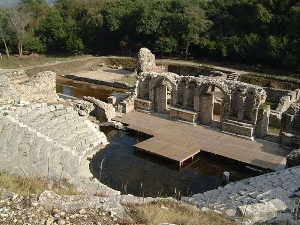
A theatre's curved stone seating dropping to a flooded orchestra, with a wooden walkway laid over the water in front of the ruined stage building and its row of arches, among trees.

Photo: Marc Morell · CC BY-SA 3.0 · Commons

city · Vlorë County

Butrint

The city spreads across the peninsula below the acropolis hill; the site museum is housed in the Venetian castle on the acropolis (en.wikipedia, Archaeological Museum).

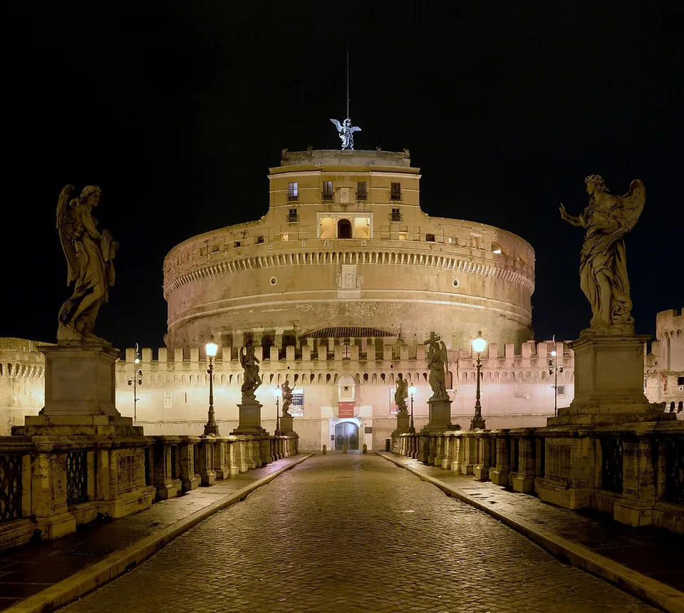
The castle at night, seen straight down the paved bridge, a broad floodlit cylinder with a squarer block and a winged statue on top and crenellated walls at its foot, with statues of angels on tall pedestals along both parapets of the bridge.

Photo: Livioandronico2013 · CC BY-SA 4.0 · Commons

tomb · Lazio

Castel Sant'Angelo

From outside, the Roman part is the massive cylinder: Hadrian's drum, built of peperino stone and Roman concrete faced with travertine and set on a square base (de.wikipedia).

Hidden gems

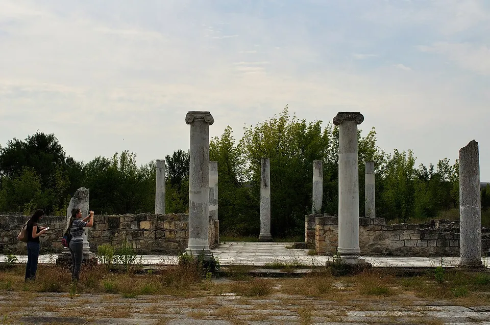
Marble columns with Ionic capitals and broken column shafts stand around a paved open space, enclosed by low restored stone walls, with two visitors taking photographs and trees behind.

Photo: Vladimir Petkov · CC BY-SA 2.0 · Commons

city · Razgrad Province

Abritus

Under Constantine the Great, early in the 4th century, the town was enclosed by walls 1,400 m long and 2.10 to 3 m thick, with four gates and 35 towers, around 15 ha; with their battlements they rose to 12 m (the museum).

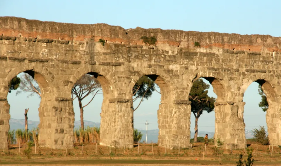
A row of tall round arches built of large weathered stone blocks, a band of reddish masonry along the top, with umbrella pines and distant hills seen through the openings.

Photo: Agricmarketing · Public domain · Commons

aqueduct · Lazio

Aqua Claudia

The aqueduct ran about 69 km from springs in the upper Aniene valley, and most of that was underground (en and it.wikipedia).

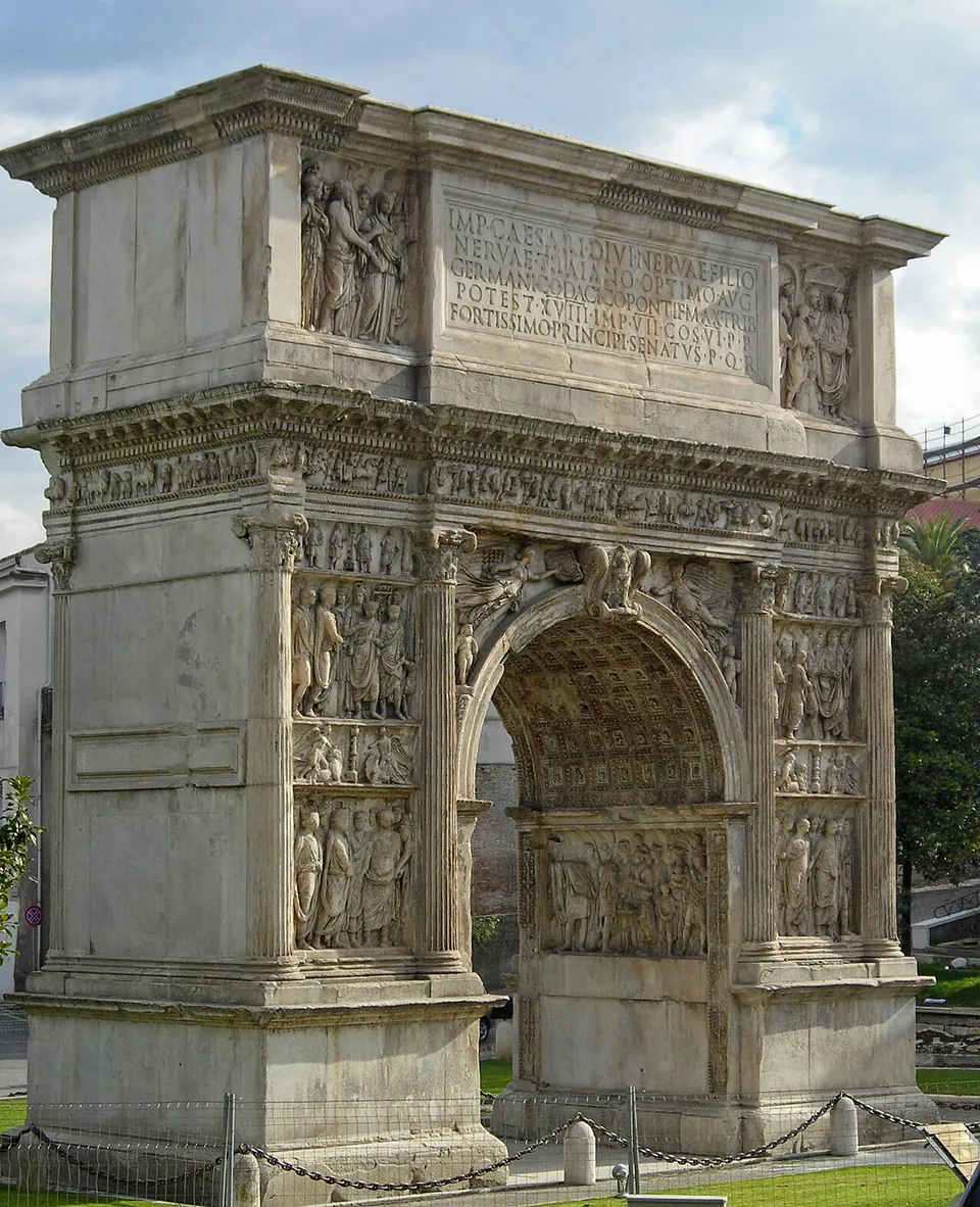
A single-arched marble gateway seen at an angle, every surface of its two piers carved with stacked relief panels of standing figures between engaged columns, a carved frieze running beneath an attic with a long Latin inscription flanked by two more relief panels, and a coffered vault visible inside the arch; a low chain barrier runs along its foot.

Photo: Decan · CC BY-SA 4.0 · Commons

arch · Campania

Arch of Trajan

One arch, 15.6 m high and 8.6 m wide, built of limestone blocks faced with Parian marble, and richly carved on both main faces and inside the archway (it.wikipedia).

By type of site