Skip to content
Menu

Country · 19 sites · 4 hubs

Roman Croatia

Roman Croatia belonged to two different worlds. Istria, in the north-west, was part of Italy itself: Augustus made it, with the Veneto, the tenth region of Roman Italy, Venetia et Histria, with its capital at Aquileia. Beyond the Arsia river, the region’s eastern boundary, began the province named after the Dalmatae, an Illyrian people of the central Adriatic coast. The Romans fought three Illyrian wars in the 3rd and 2nd centuries BC; Octavian campaigned inland in 35–33 BC, and after the great revolt of AD 6–9 the old province of Illyricum was divided, leaving Dalmatia as a province stretching from the Adriatic deep into the Balkans.

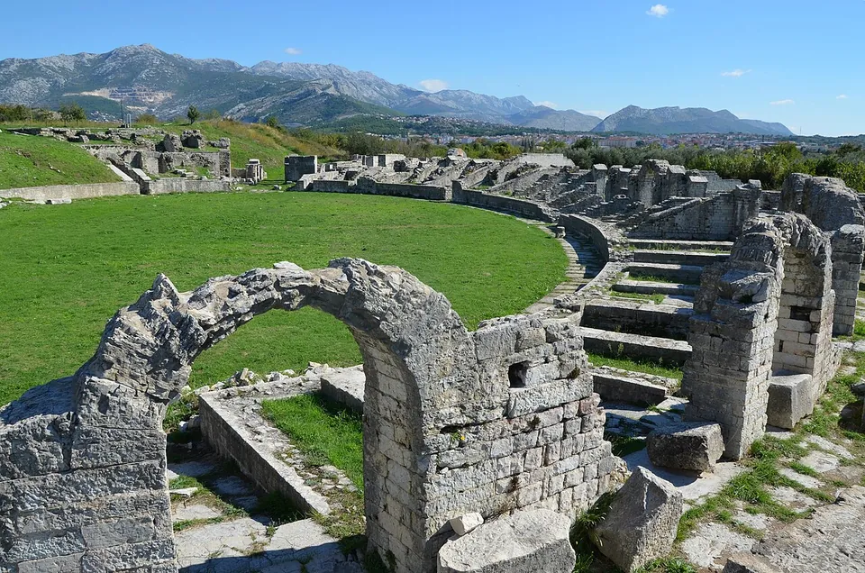
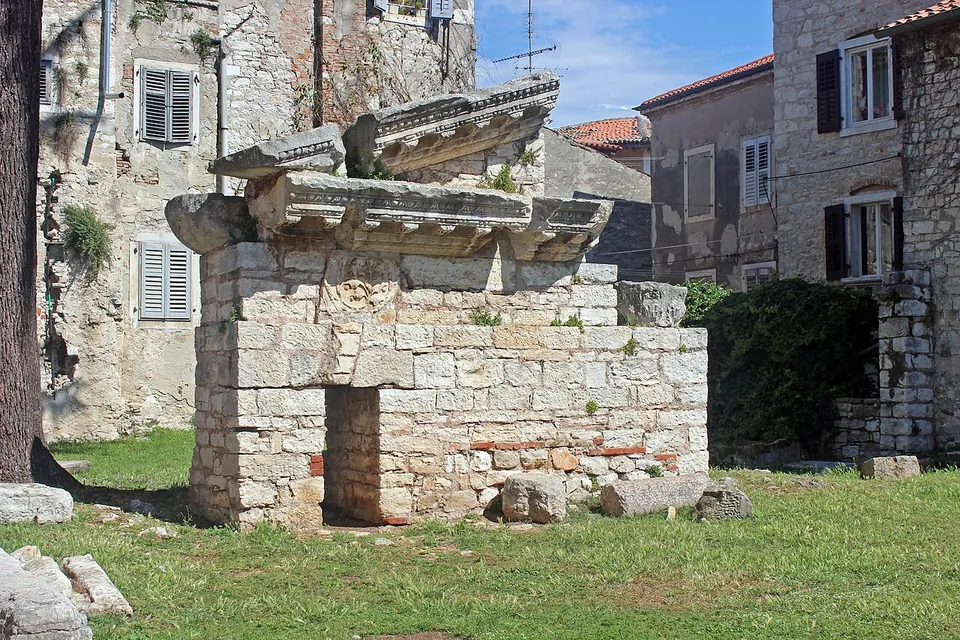
Its capital was Salona, near Split, one of the largest cities of the late Empire, and the emperor Diocletian, who was born there, built his retirement palace six kilometres away. That palace became the town of Split when refugees from Salona moved inside its walls in the 7th century, which is why it still stands. In Istria, the colony of Pola, today’s Pula, kept an amphitheatre whose outer wall survives complete, a temple of Augustus and an honorary arch; Poreč keeps its Roman street plan and an early Byzantine basilica famous for its mosaics. Inland, the legions guarded the river crossings from fortresses such as Burnum on the Krka and Tilurium on the Cetina.

This page lists the sites we have documented so far, from the great monuments of Split and Pula to smaller towns and forts in the Dalmatian hinterland.
Sources: Wikipedia (en) — Dalmatia (Roman province); Wikipedia (en) — Venetia et Histria; Wikipedia (en) — Pula; Wikipedia (en) — Diocletian's Palace; Wikipedia (en) — Salona; Wikipedia (en) — Pula Arena

Pola – Pula
Salona – Solin
Parentium – Poreč
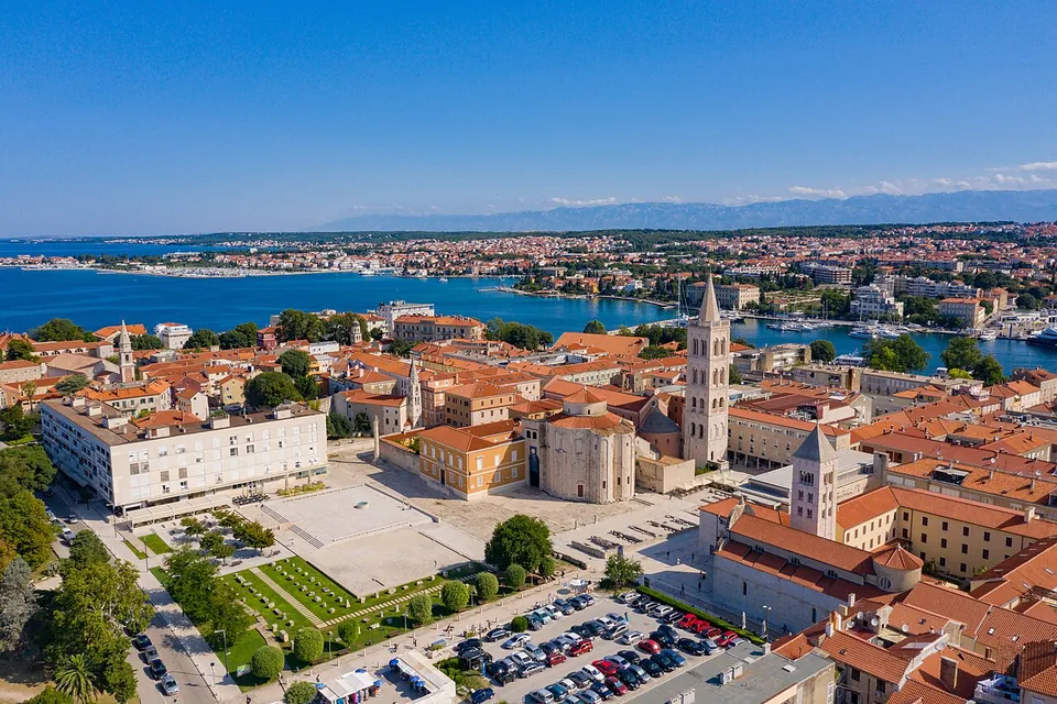
Iader – Zadar
Diocletian's Palace
Burnum
Narona
Nesactium
Aquae Iasae
Asseria
Roman villa at Brijuni National Park
Tilurium
Open Croatia on the interactive map

Select Show on map beside a site or town to see where it is.Scroll the list: each site or town is marked on the map as you reach it. The interactive map shows them all.

Roman towns

Several sites in or around one town, all seen from one base.

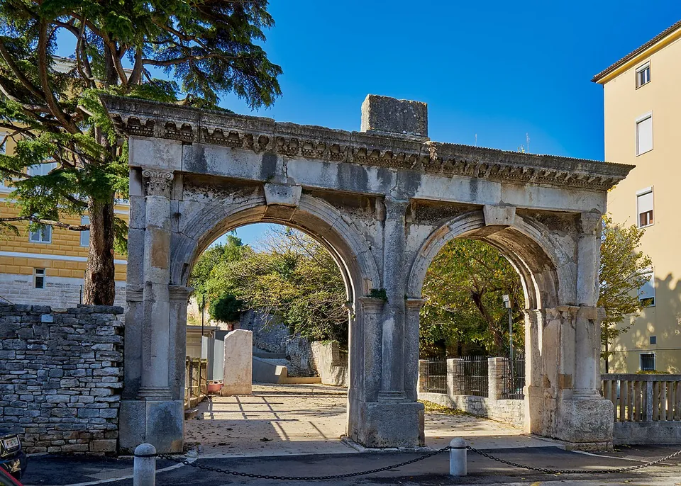
A Roman gateway with two equal round arches under one carved cornice, standing at the edge of a street with a stone wall on its left, trees behind and a paved path leading through.

Photo: Georg Karl Ell · CC BY-SA 4.0 · Commons

Hub · 4 stops

Istria County · Croatia

Pola – Pula

The stops each have their own page: the Pula Arena, the amphitheatre; the Temple of Augustus on the forum; the Arch of the Sergii at the end of the main street; and the Small Roman Theatre on the slope of the central hill.

  1. Pula Arena · amphitheatreTicketed
  2. Arch of the Sergii · archFree
  3. Temple of Augustus · templeTicketed
  4. Small Roman Theatre, Pula · theatreFree

Landmarks

Landmark

Worth planning a trip around.

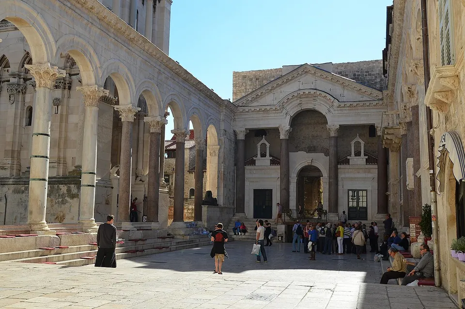
  1. A paved Roman court lined on the left by an arcade of granite columns carrying round arches, closed at the far end by a pedimented front on four columns with an arched opening, with visitors standing in the sun.

    Photo: Following Hadrian · CC BY-SA 2.0 · Commons

    palace · Split-Dalmatia County

    Diocletian's Palace

    The palace is an irregular rectangle of roughly 215 by 175–180 m, laid out like a legionary fort, with towers on its three landward walls and a gate in the middle of each side.

    Show on map: Diocletian's Palace
    3rd – 7th c. ADFree

Hidden gems

Hidden gem

Remains that most visitors to the region never see.

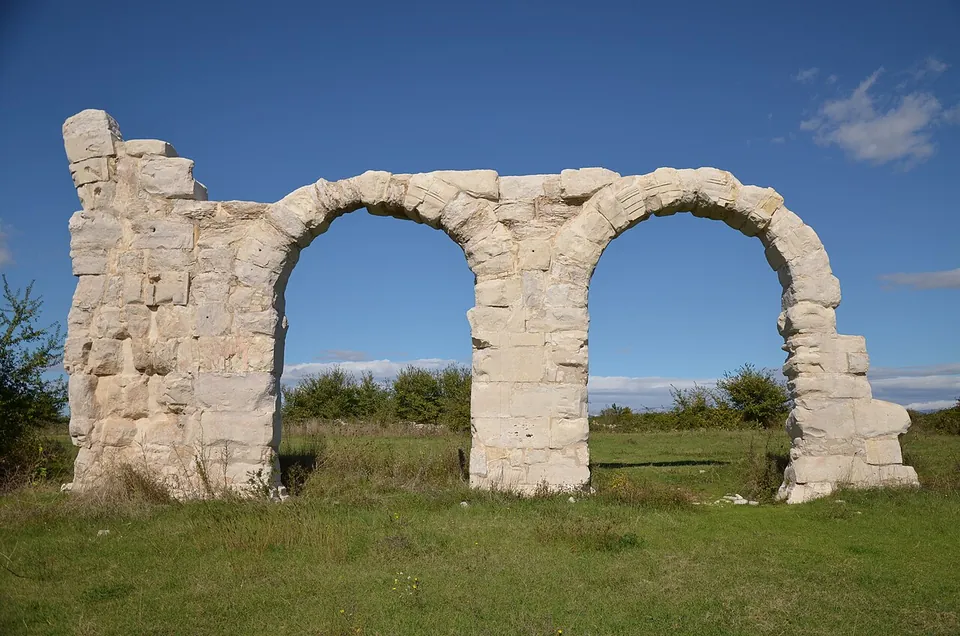
  1. Two round arches of large pale stone blocks on three piers, the end piers broken off at different heights, standing on grass against a blue sky.

    Photo: Carole Raddato · CC BY-SA 2.0 · Commons

    fort · Šibenik-Knin County

    Burnum

    The site is in two parts, both inside Krka National Park.

    Show on map: Burnum
    1st c. BC – 6th c. ADTicketed
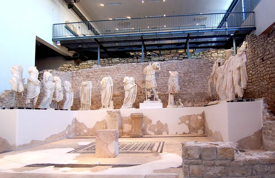
  2. A row of headless and damaged white marble statues of men and women in togas and robes standing on a plinth along the back of an excavated temple room with a mosaic floor, under a modern metal gallery.

    Photo: Rolf Kawel · CC BY-SA 3.0 de · Commons

    city · Dubrovnik-Neretva County

    Narona

    The Narona Archaeological Museum was the first museum in Croatia built in situ, over the remains of the Augusteum, the temple of the emperor Augustus (hr.wikipedia).

    Show on map: Narona
    1st c. BC – 6th c. ADTicketed
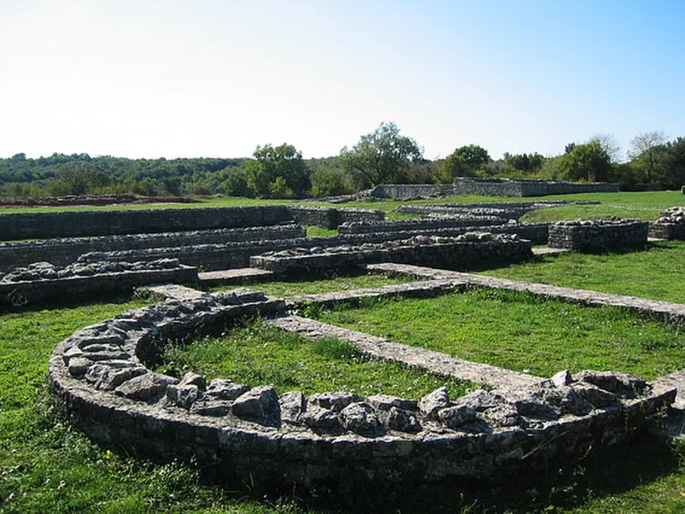
  3. The curved low stone wall of a church apse in the grass in the foreground, with the long parallel wall lines of the nave running away behind it and trees on the horizon.

    Photo: Hieronymushistriae · CC BY-SA 3.0 · Commons

    city · Istria County

    Nesactium

    An open archaeological park of conserved walls.

    Show on map: Nesactium
    2nd c. BC – 7th c. ADFree
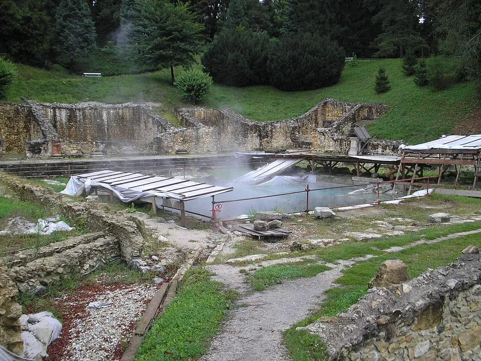
  4. Roman stone walls several metres high along the foot of a green slope, with steam rising from a pool of water behind a railing and gravel paths among the ruins in the foreground.

    Photo: Fraxinus · CC BY-SA 3.0 · Commons

    bath · Varaždin County

    Aquae Iasae

    A compact archaeological park covering about 6,000 m² of Roman public buildings of the 1st to 4th centuries.

    Show on map: Aquae Iasae
    1st – 4th c. ADTicketed
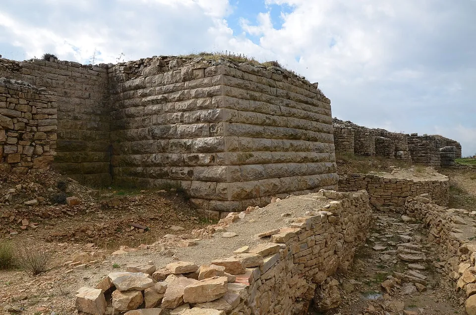
  5. A corner of massive city wall built of long courses of squared limestone blocks, standing several metres high, with lower stone foundations and a rubble path in front of it.

    Photo: Carole Raddato · CC BY-SA 2.0 · Commons

    city · Zadar County

    Asseria

    Long stretches of the city wall survive, in courses of massive squared blocks, with corner towers; English Wikipedia says the ashlar walls predate the Roman occupation, while German Wikipedia says the monumental late antique walls largely replaced the earlier Roman and Liburnian defences.

    Show on map: Asseria
    1st – 6th c. ADFree
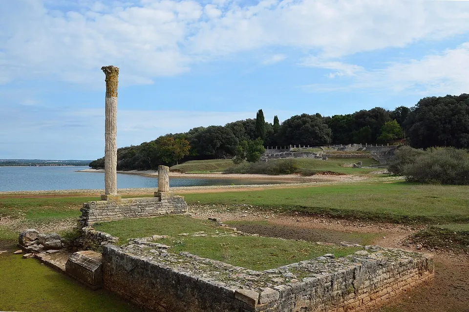
  6. A tall stone column with a worn capital stands at the corner of a low rectangular stone platform on grass, a shorter column stump behind it, with the bay and a wooded shore beyond.

    Photo: Following Hadrian (Carole Raddato) · CC BY-SA 2.0 · Commons

    villa · Istria County

    Roman villa at Brijuni National Park

    The villa was never one building but several, placed around the bay (the operator), and that is how it reads on the ground: walls standing several courses high on stepped terraces, rows of column shafts around open courts, a temple platform with one tall column standing at the end of the bay, and baths with a round basin sunk into the floor of one room (Commons photographs, 2013–2014).

    Show on map: Roman villa at Brijuni National Park
    1st c. BC – 6th c. ADTicketed
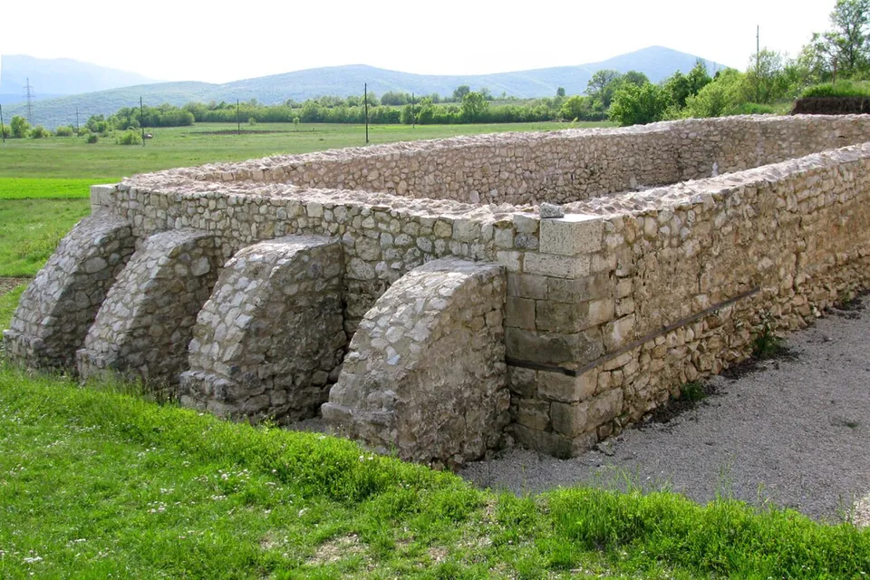
  7. A rectangular block of conserved Roman walls of rough limestone, about head high, with a row of sloping buttresses along one side, standing in grass with fields and low hills behind.

    Photo: Ante Perković · CC BY-SA 3.0 · Commons

    fort · Split-Dalmatia County

    Tilurium

    The camp covered about 12 hectares, and the village of Gardun sits over it (en.wikipedia).

    Show on map: Tilurium
    1st – 4th c. ADUnknown