Skip to content
Menu

Country · 9 sites

Roman North Macedonia

Two Roman provinces met in what is now North Macedonia. The south belonged to Macedonia, which Rome conquered in 168 BC and made a province in 146 BC. The north, around Skopje, lay in Moesia and later in the province of Dardania. Across the south ran the Via Egnatia, the road the Romans built in the 2nd century BC from Dyrrachium on the Adriatic, through the highlands around Lake Ohrid, to Thessalonica and on to Byzantium.

Heraclea Lyncestis, 2 km south of Bitola, was a waypoint on that road and, in the early Christian period, an important bishop’s seat; it was abandoned gradually in the 6th century after an earthquake and Slavic invasions. Stobi, near Gradsko, stands where the Crna joins the Vardar, on the main road from the Danube to the Aegean, and ended as the capital of the late Roman province of Macedonia Salutaris.

In the north, Scupi began as a Roman military camp on the site of a Dardanian settlement, became a colony of veteran legionaries and was abandoned in AD 518 after an earthquake; its ruins lie a few kilometres from the centre of Skopje. To the east, Bargala was a city of Macedonia Secunda whose gate, by its own inscription, was built in 371/372. In the 4th and 5th centuries it was a bishop’s seat, and excavations since 1966 have uncovered its walls, seven towers and two gates.

Each page below says what is visible at the site today, whether it is worth the trip, and how to get there.

Sources: Wikipedia (en) — Macedonia (Roman province); Wikipedia (en) — Moesia; Wikipedia (en) — Dardania (Roman province); Wikipedia (en) — Via Egnatia; Wikipedia (en) — Heraclea Lyncestis; Wikipedia (en) — Stobi; Wikipedia (en) — Scupi; Wikipedia (en) — Bargala

Heraclea Lyncestis
Stobi
Lychnidos – Ohrid
Skopje Aqueduct
Scupi
Bargala
Isar-Marvinci
Vinica Fortress
Davina Kula
Open North Macedonia on the interactive map

Select Show on map beside a site or town to see where it is.Scroll the list: each site or town is marked on the map as you reach it. The interactive map shows them all.

Landmarks

Landmark

Worth planning a trip around.

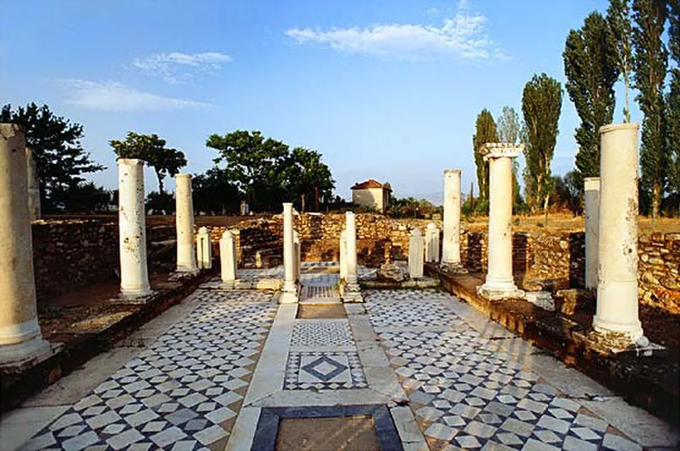
  1. A colonnaded court with white marble columns, some broken off, standing along a floor of black and white geometric mosaic, with low stone walls, poplars and trees behind.

    Photo: Revizionist at Macedonian Wikipedia · CC BY-SA 3.0 · Commons

    city · Municipality of Bitola

    Heraclea Lyncestis

    The site covers 4 hectares, of which 1,300 m² are covered with mosaics.

    Show on map: Heraclea Lyncestis
    6th c. BC – 7th c. ADUnknown
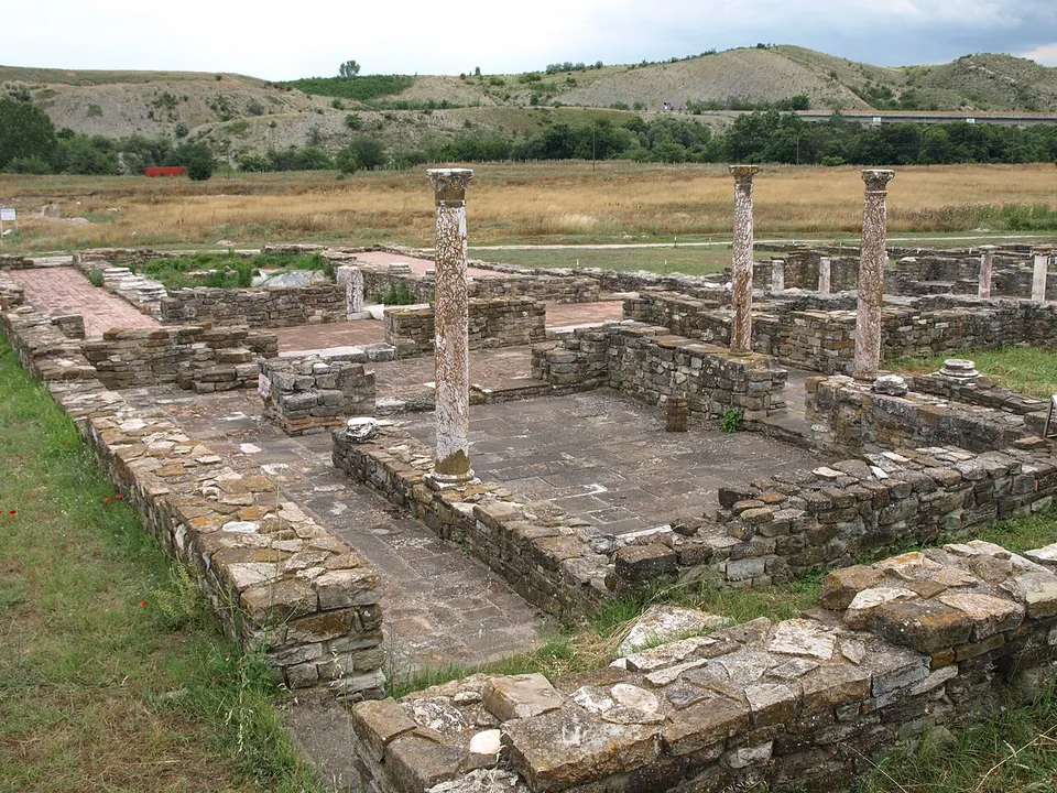
  2. Low walls of stone courses around a paved court, with three tall columns still standing, dry grassland beyond and bare hills on the horizon.

    Photo: Vaurien · CC BY-SA 3.0 de · Commons

    city · Municipality of Gradsko

    Stobi

    The archaeological site covers 16 hectares; the town stood on three walled terraces that step down to the Crna (mk.wikipedia), and its excavated and restored buildings form an open-air museum (de.wikipedia).

    Show on map: Stobi
    4th c. BC – 7th c. ADTicketed
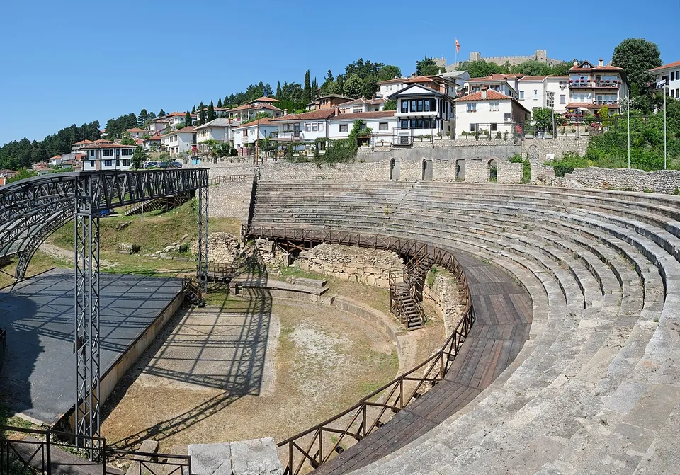
  3. A semicircle of stone seating rows descending to a flat orchestra, with a metal stage structure on the left, whitewashed houses above and a fortress wall on the hilltop behind.

    Photo: kallerna · CC BY-SA 4.0 · Commons

    city · Municipality of Ohrid

    Lychnidos – Ohrid

    The theatre was built at the end of the 3rd or the beginning of the 2nd century BC.

    Show on map: Lychnidos – Ohrid
    6th c. BC – 7th c. ADUnknown

Hidden gems

Hidden gem

Remains that most visitors to the region never see.

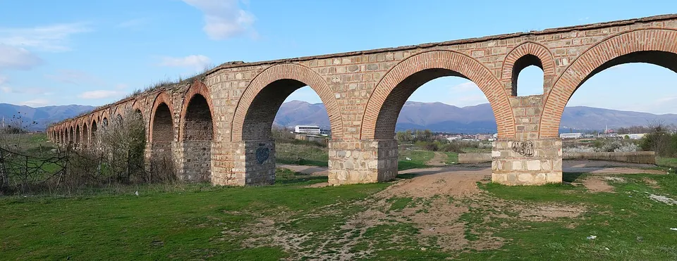
  1. A long arcade of round brick arches on massive stone piers crossing a grassy field, with a dirt track passing under one arch and mountains on the horizon.

    Photo: kallerna · CC BY-SA 4.0 · Commons

    aqueduct · City of Skopje

    Skopje Aqueduct

    The arcade itself.

    Show on map: Skopje Aqueduct
    1st c. BC – 7th c. ADFree
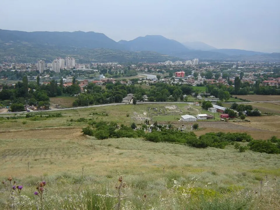
  2. A grassy hillside in the foreground looking down on a fenced excavation area with low walls and a few sheds, the tower blocks and houses of Skopje beyond and mountains on the horizon.

    Photo: Dimitar Georgievski · CC BY-SA 2.0 · Commons

    city · City of Skopje

    Scupi

    The city covered about 43 hectares — twice the size of Stobi, in the archaeologist Ivan Mikulčić's comparison (quoted by MARH).

    Show on map: Scupi
    1st c. BC – 7th c. ADUnknown
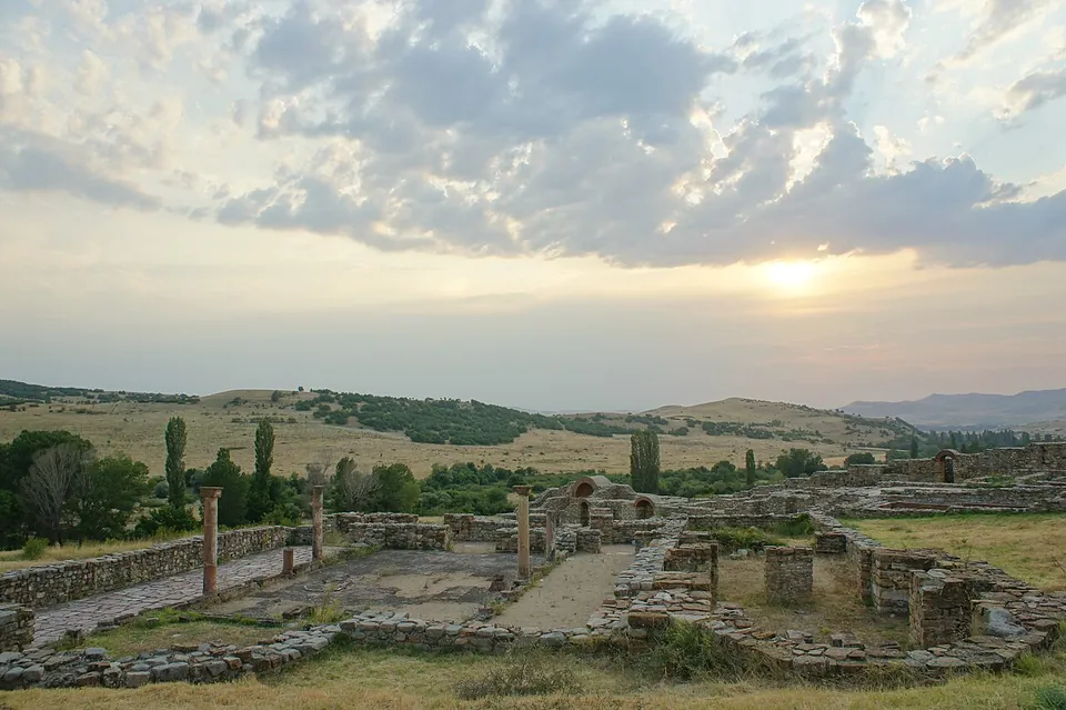
  3. Excavated stone walls and a few standing columns of a large church complex in dry grassland at sunset, with hills and scattered trees behind.

    Photo: Stotosenik · CC BY-SA 3.0 · Commons

    city · Municipality of Karbinci

    Bargala

    Excavation, begun in 1966, has uncovered the trapezoidal circuit of the town with its seven towers and two gates (en.wikipedia); the photographs show stone walls banded with brick, standing in places to more than head height, with brick arches.

    Show on map: Bargala
    1st c. BC – 7th c. ADUnknown
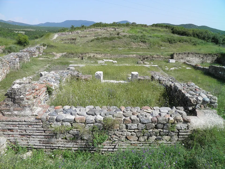
  4. Rooms of an excavated building with walls of stone bonded with courses of red brick, two small marble pillars standing inside, and grassy hills and mountains behind.

    Photo: Carole Raddato from FRANKFURT, Germany · CC BY-SA 2.0 · Commons

    city · Municipality of Valandovo

    Isar-Marvinci

    The town reached its greatest extent in the Roman period, when it spread over almost all the available ground, but most of the remains that survive belong to its last phase, when it shrank to a small fortification with a wall, a castrum (North Macedonia Timeless).

    Show on map: Isar-Marvinci
    6th c. BC – 7th c. ADUnknown
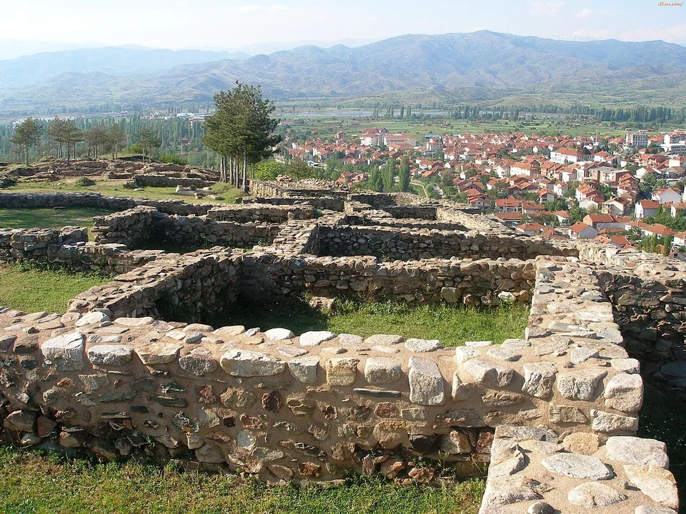
  5. Conserved low walls of rough stone forming a row of rectangular rooms on a grassy hilltop, with the red roofs of a town below and a line of mountains beyond.

    Photo: Makedonij at Macedonian Wikipedia · CC BY 3.0 · Commons

    fort · Municipality of Vinica

    Vinica Fortress

    The site stands on a promontory of the Plačkovica range, about 70 m above the town (it. and mk.wikipedia).

    Show on map: Vinica Fortress
    1st c. BC – 7th c. ADFree
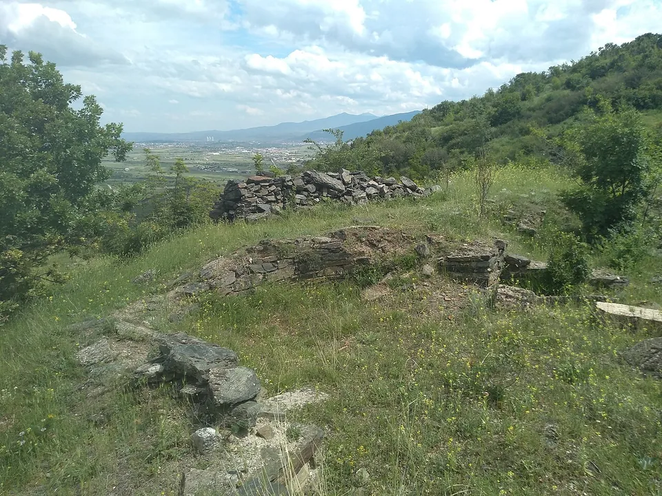
  6. Low courses of flat stones outlining walls in the grass of a hilltop, with bushes around and a wide plain with a city and mountains in the distance.

    Photo: Македонец · CC BY-SA 4.0 · Commons

    city · Municipality of Čučer-Sandevo

    Davina Kula

    At the southern, highest end of the hill stands the acropolis: an oval castle of about 185 × 110 m whose towered walls of stone and lime date from the late Roman 4th century and were rebuilt in the 6th, after the earthquake of 518.

    Show on map: Davina Kula
    3rd – 6th c. ADUnknown