Skip to content
Menu

Country · 247 sites · 29 hubs

Roman Italy

Italy was the homeland of the Romans. While Rome made provinces of the lands around the Mediterranean, Italy kept a special status, with political, religious and financial privileges, and under Augustus it was organised in eleven regions from the Alps to the Ionian Sea. It later lost its place as the heart of the empire but kept its symbolic value as the Roman homeland.

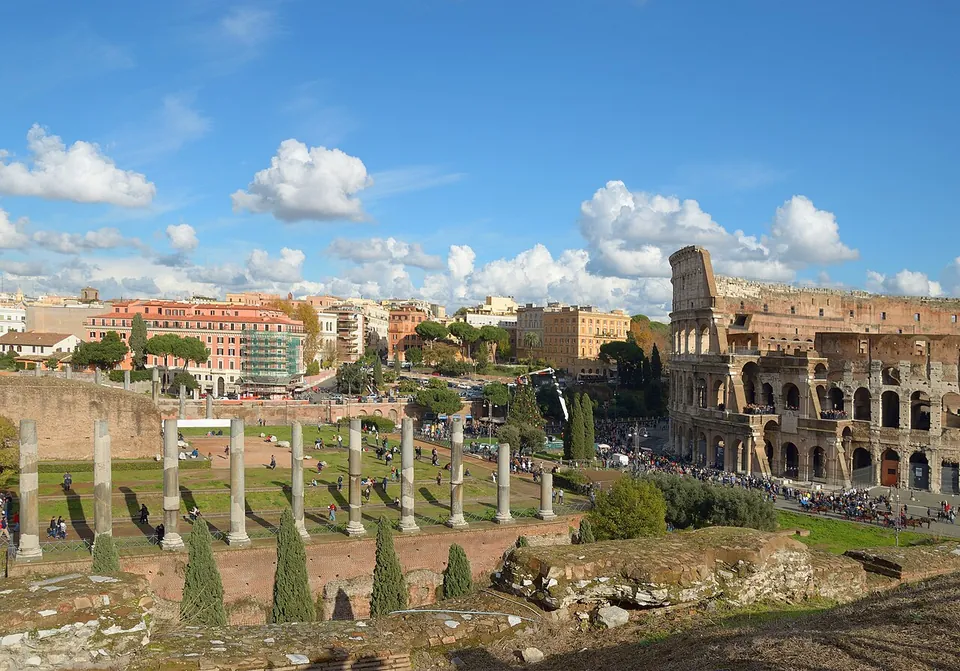
In Rome itself, the Forum was for centuries the centre of the city’s daily life, and is today a sprawling ruin in the small valley between the Palatine and Capitoline Hills. Beside it stands the Colosseum, begun under Vespasian in 72 and completed under Titus in 80, the largest ancient amphitheatre ever built. The Pantheon, rebuilt under Hadrian, still has the largest unreinforced concrete dome in the world. The Appian Way, begun in 312 BC, ran south from Rome to Brindisi, and some 20 km from the city lies the villa Hadrian built around AD 120 near Tivoli.

Around the Bay of Naples, the eruption of Vesuvius in 79 AD buried Pompeii and Herculaneum. Pompeii offers a snapshot of Roman life at the moment it was buried, and at Herculaneum the volcanic material preserved wooden roofs, beds and doors. Ostia, Rome’s port at the mouth of the Tiber, now lies 3 km from the sea, and its preservation is surpassed only by the two Vesuvian towns.

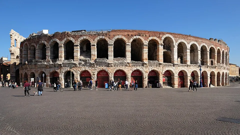
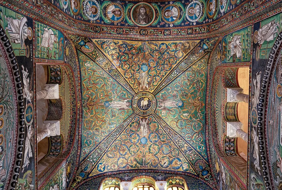
Further north, the Arena in Verona is one of the best-preserved ancient amphitheatres, and Aquileia, founded as a Roman colony in 181 BC near the head of the Adriatic, had an estimated population close to 100,000 in the 2nd century AD. In Sicily, the Villa Romana del Casale near Piazza Armerina keeps some 3,500 m² of mosaic and opus sectile floors from the early 4th century, and in Ravenna the 6th-century church of San Vitale holds mosaics that are among the most-studied works of Byzantine art.
Sources: Wikipedia (en) — Italy (Roman Empire); Wikipedia (en) — Roman Forum; Wikipedia (en) — Colosseum; Wikipedia (en) — Pantheon, Rome; Wikipedia (en) — Appian Way; Wikipedia (en) — Hadrian's Villa; Wikipedia (en) — Pompeii; Wikipedia (en) — Herculaneum; Wikipedia (en) — Ostia Antica; Wikipedia (en) — Verona Arena; Wikipedia (en) — Roman Aquileia; Wikipedia (en) — Villa Romana del Casale; Wikipedia (en) — Basilica of San Vitale

Roma – Rome
Verona
Ariminum – Rimini
Baiae – Bacoli
Ravenna
Augusta Praetoria – Aosta
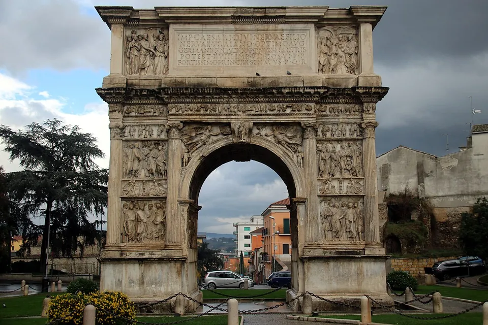
Beneventum – Benevento
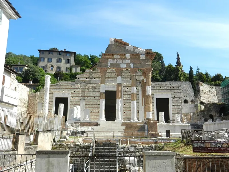
Brixia – Brescia
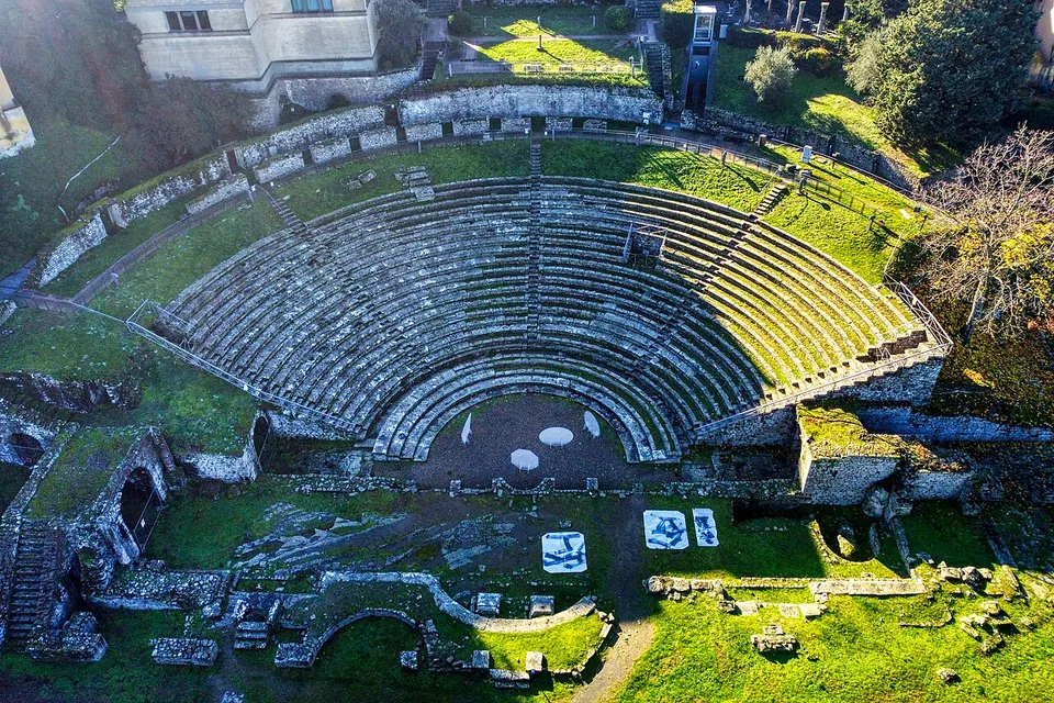
Faesulae – Fiesole
Praeneste – Palestrina
Puteoli – Pozzuoli
Spoletium – Spoleto
Tarracina – Terracina
Volaterrae – Volterra
Segusio – Susa
Turris Libisonis – Porto Torres
Mediolanum – Milan
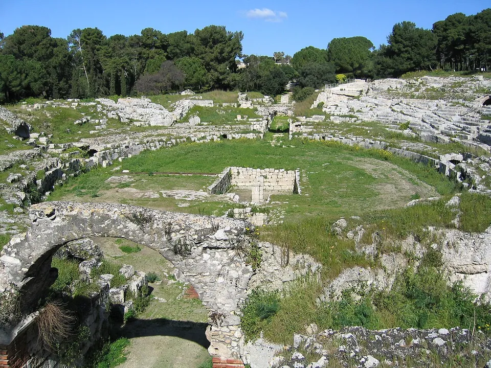
Syracusae – Syracuse
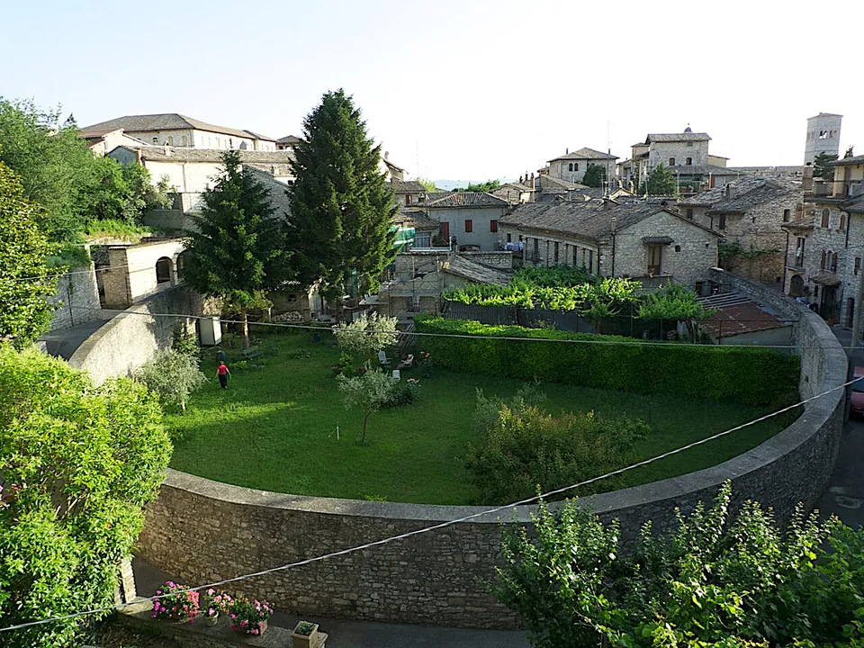
Asisium – Assisi
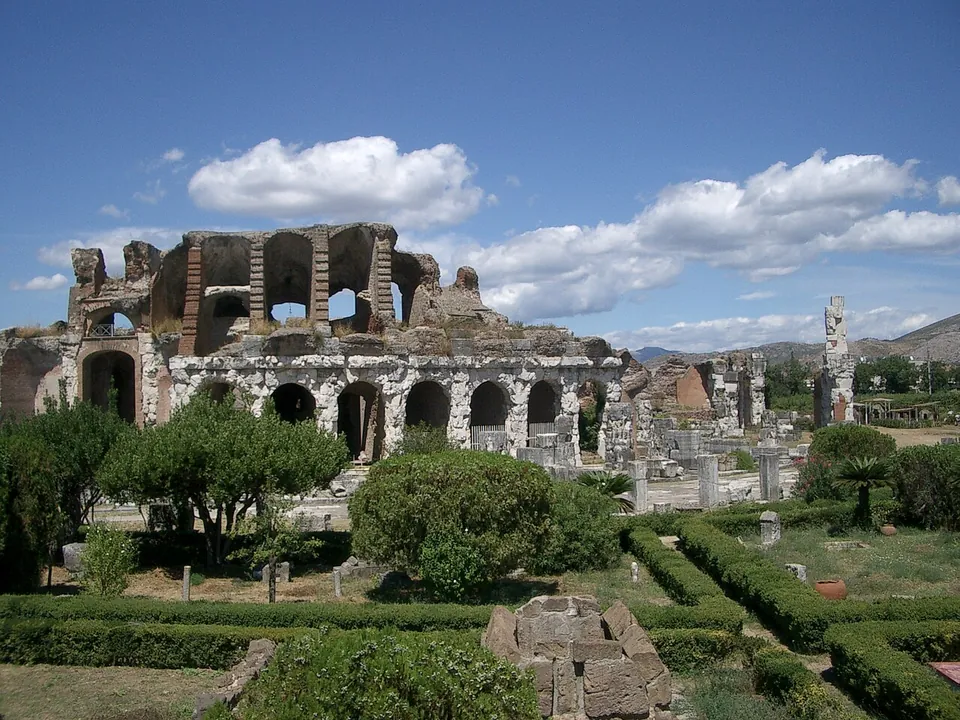
Capua – Santa Maria Capua Vetere
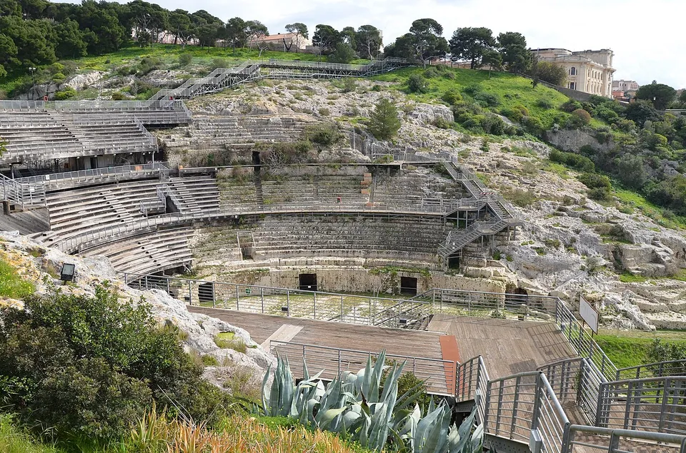
Caralis – Cagliari
Catane – Catania
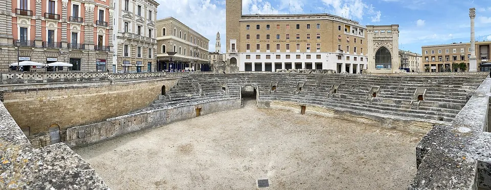
Lupiae – Lecce
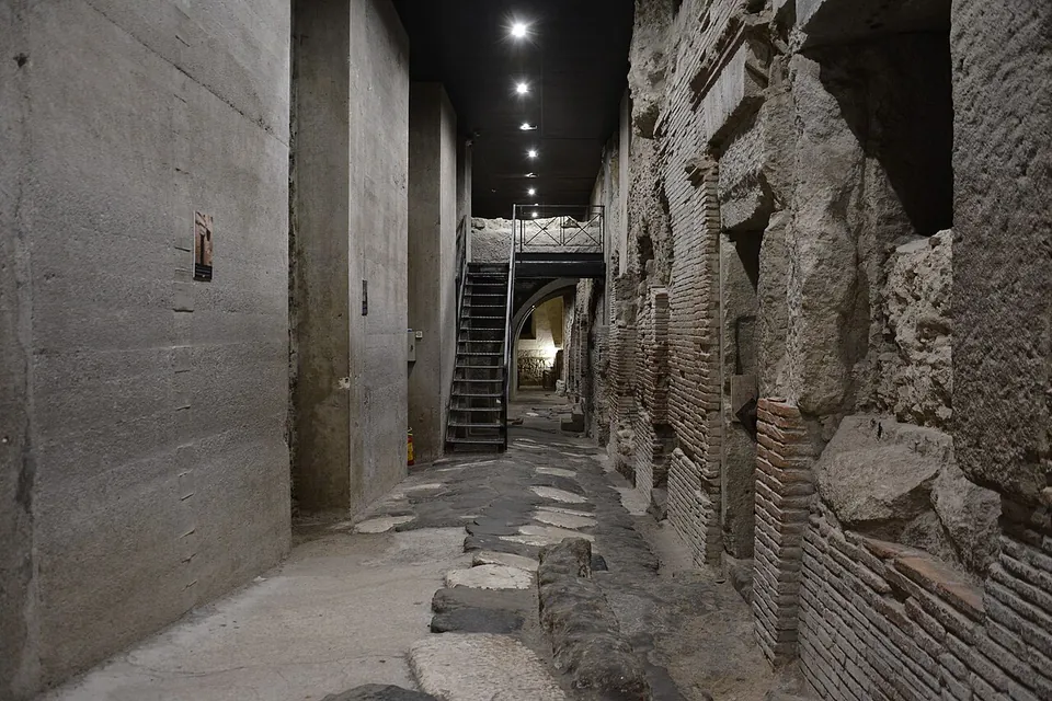
Neapolis – Naples
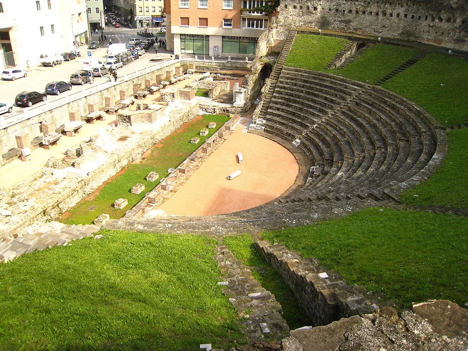
Tergeste – Trieste
Asculum Picenum – Ascoli Piceno
Eporedia – Ivrea
Interamnia Praetuttiorum – Teramo
Patavium – Padua
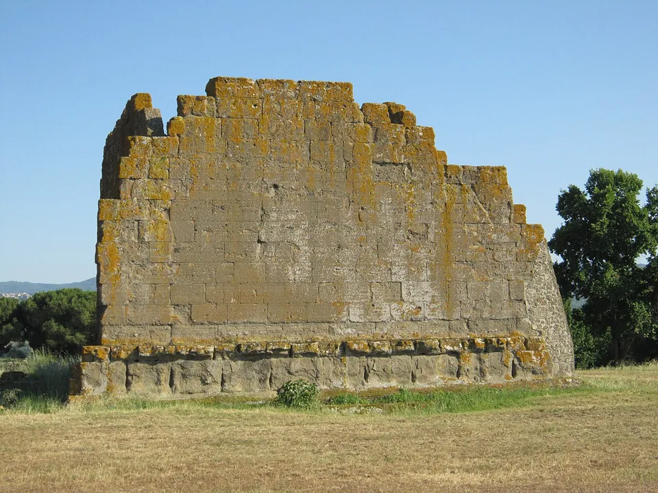
Akragas/Agrigentum
Hadrian's Villa
Herculaneum
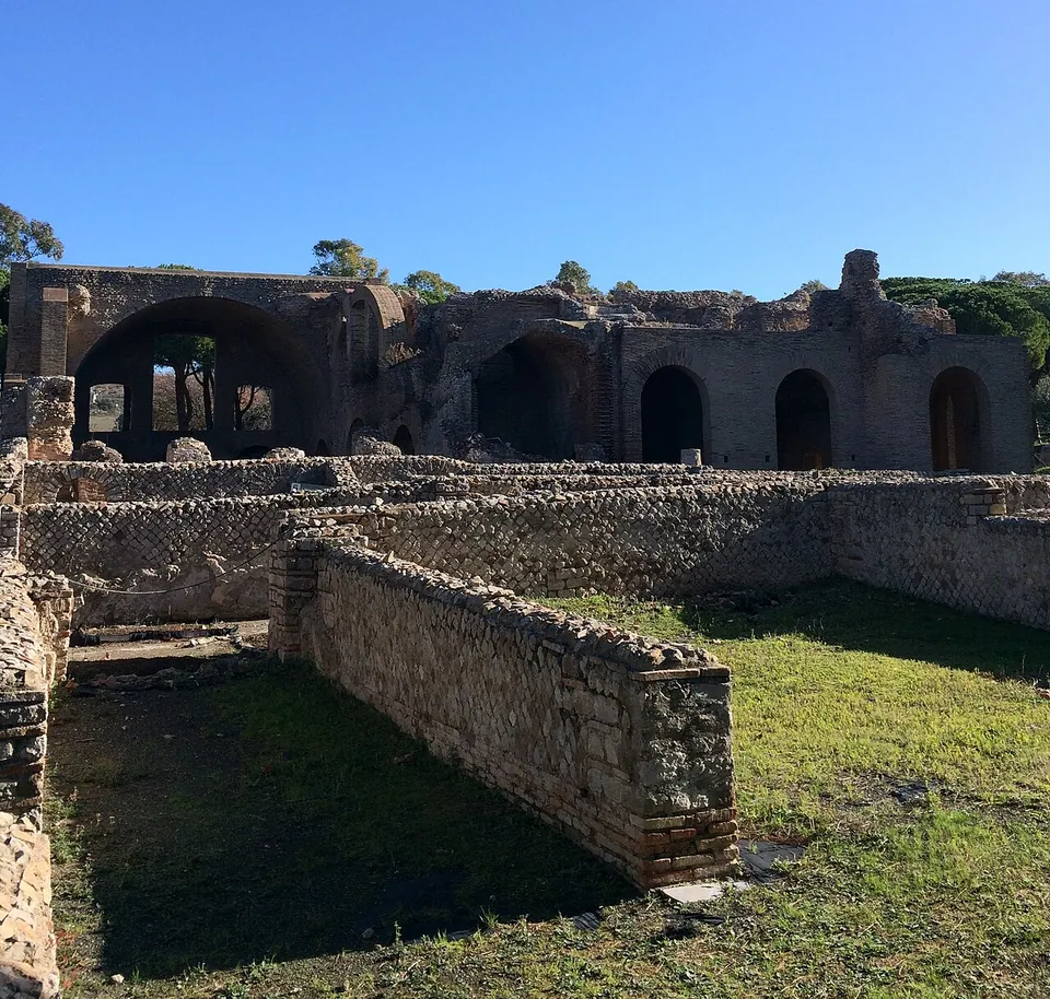
Ostia
Paestum
Pompeii
Villa Romana del Casale
Ancient theatre of Taormina
Cumae
Grottoes of Catullus
Oplontis
Stabiae
Villa Jovis
Aquileia
Copia – Sibari
Nora
Portus
Tharros
Alba Fucens
Archaeological park of Posillipo
Cosa
Etruscan Arch
Norba
Saepinum
Soluntum
Tibur – Tivoli
Tyndaris
Urbs Salvia
Arch of Malborghetto
Baths of Fordongianus
Castra Albana
Ferentium
Grumentum
Minturnae
Pont d'Aël
Pont Saint-Martin
Ponte dell'Abbadia
Roman amphitheatre of Lucera
Roman Theatre of Gubbio
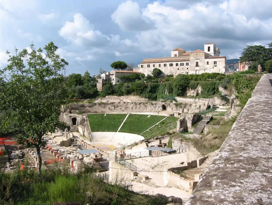
Roman Theatre of Sessa Aurunca
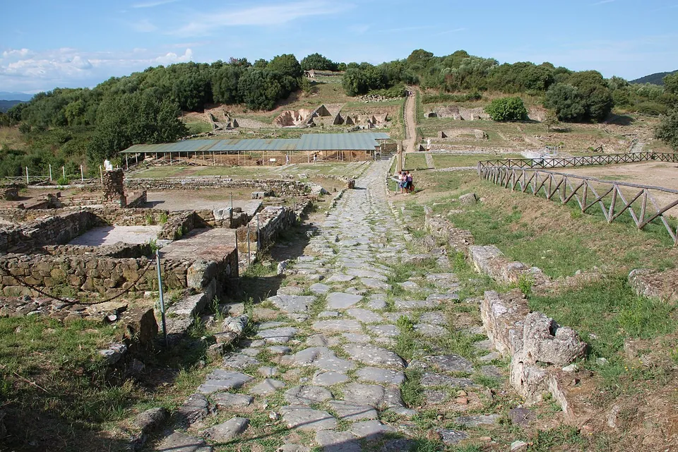
Rusellae
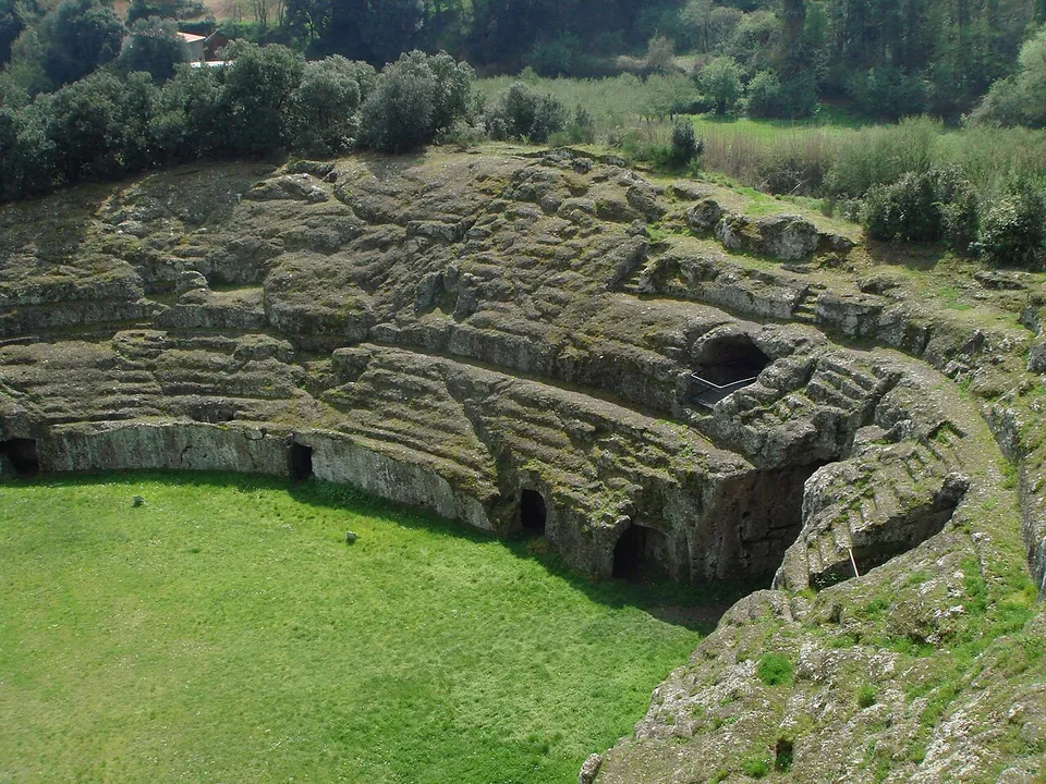
Sutri amphitheatre
Terme Taurine
Villa Regina and Antiquarium
Villa Romana of Minori
Ipogeo di Santa Maria in Stelle
Pont'ezzu
Temple of Antas
Albingaunum – Albenga
Amiternum
Ancona
Augusta Taurinorum
Carsulae
Fanum Fortunae – Fano
Firmum Picenum – Fermo
Gabii
Scylletium
Tusculum
Villa of Livia
Abellinum
Albintimilium
Allifae
Anfiteatro Fausto
Archaeological area of the Vicenza cathedral
Archaeological site of San Vincenzino
Baths of Bagnoli
Baths of Nero
Cales
Canusium
Cava d’Ispica
Cora – Cori
Helvia Recina
Industria
Larinum
Lucus Feroniae
Luna
Nuceria Alfaterna
Ocriticum
Parco Archeologico di Suasa
Ponte d'Augusto (Narni)
Roman Amphitheatre of Arezzo
Roman villa of Desenzano del Garda
Roman villa of San Biagio
Sarsina
Sentinum
Teate
Temple and Theatre of San Nicola
Temple of Diana at Nemi
Temple of Minerva (Marano di Valpolicella)
Trident(i)um – Trento
Varignano Roman Villa
Vetulonia
Villa dei Mosaici
Villa of Domitian
Villa of Tiberius (Sperlonga)
Villa Romana di Patti
Area archeologica la Fenice
Shrine of Hercules Curinus
Florentia – Florence
Open Italy on the interactive map

Select Show on map beside a site or town to see where it is.Scroll the list: each site or town is marked on the map as you reach it. The interactive map shows them all.

Roman towns

Several sites in or around one town, all seen from one base.

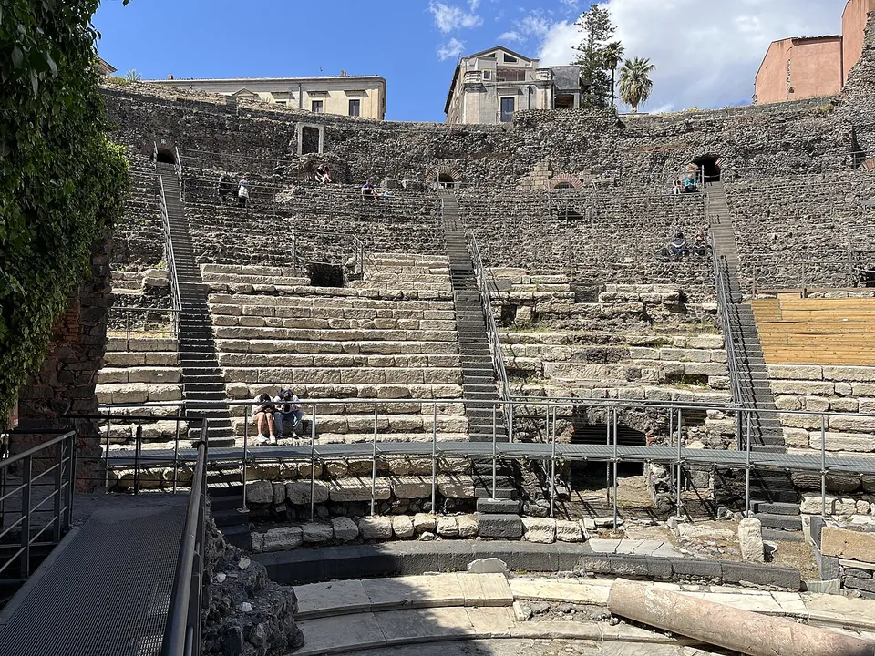
Tiers of grey stone seats rising in a semicircle, crossed by metal stairways and a raised walkway, with a few visitors sitting on the steps and buildings along the top.

Photo: Antony-22 · CC BY-SA 4.0 · Commons

Hub · 5 stops

Sicily · Italy

Catane – Catania

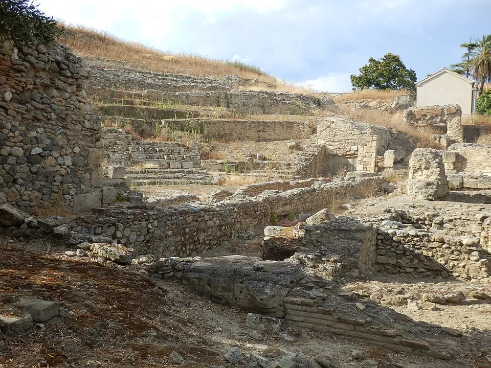
The theatre and the Odeon, side by side off Via Vittorio Emanuele II, are the main sight: a large Roman theatre whose tiers you walk among and a small one beside it, run together by the regional archaeological park (it.wikipedia; the park).

  1. Theatre and Odeon of Catania · theatreTicketed
  2. Terme dell'Indirizzo · bathTicketed
  3. Roman amphitheatre of Catania · amphitheatreTicketed
  4. Terme Achilliane · bathTicketed
  5. Terme della Rotonda · bathTicketed
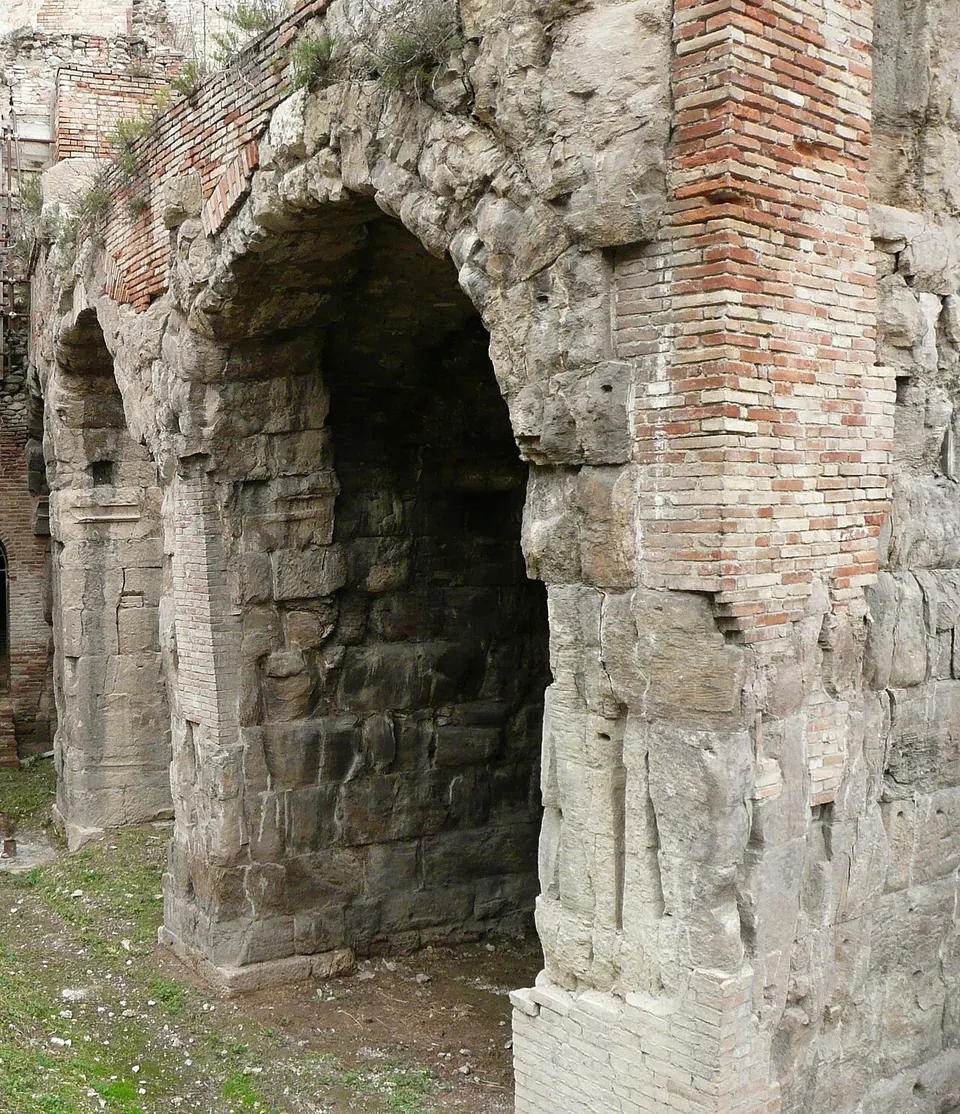
Two tall round-headed arches built of large grey squared stone blocks, patched and topped with red brick, standing in a sunken excavation with grass and earth at their feet.

Photo: Franco TamTam · Public domain · Commons

Hub · 2 stops

Abruzzo · Italy

Interamnia Praetuttiorum – Teramo

The theatre and the amphitheatre stand side by side next to the cathedral, in what was the western quarter of the Roman town; a theatre and an amphitheatre a few metres apart is described as almost unique (it.wikipedia).

  1. Roman Amphitheatre of Teramo · amphitheatreFree
  2. Roman Theatre of Teramo · theatreRestricted access

Landmarks

Landmark

Worth planning a trip around.

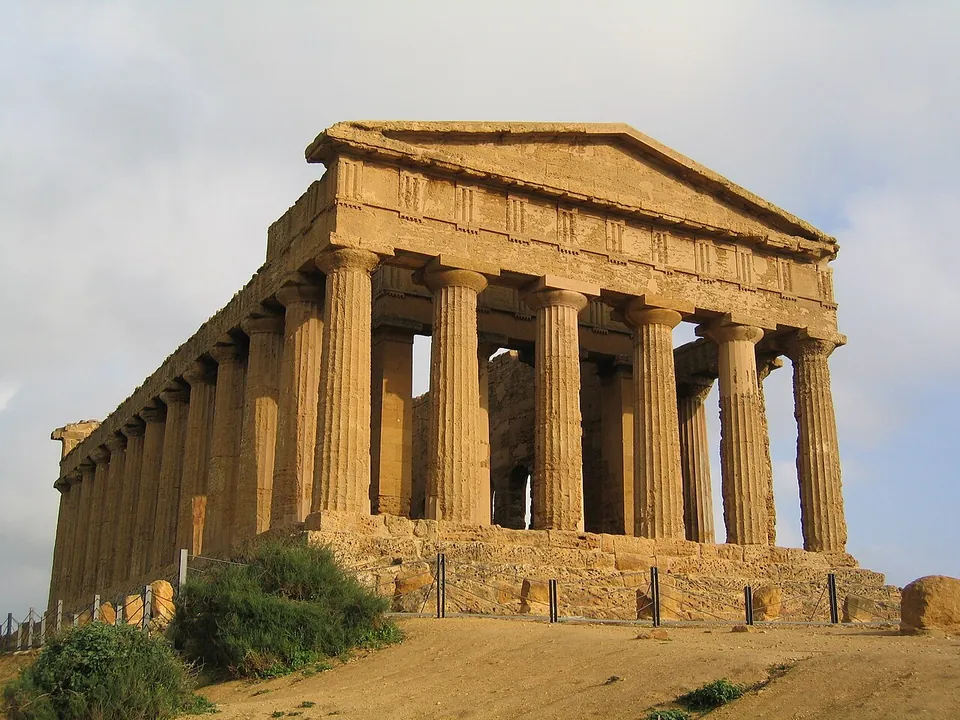
  1. A Doric temple seen from one corner, its columns, entablature and front pediment all standing on a stepped base, built of warm golden stone, with dry ground and shrubs in front.

    Photo: Evan Erickson · Public domain · Commons

    city · Sicily

    Akragas/Agrigentum

    The temple ridge.

    Show on map: Akragas/Agrigentum
    6th c. BC – 7th c. ADTicketed
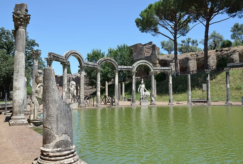
  2. A long rectangular pool of still green water edged with paving, ending in a curved row of columns joined alternately by arches and flat lintels, with statues standing between them and umbrella pines above.

    Photo: Carole Raddato from FRANKFURT, Germany · CC BY-SA 2.0 · Commons

    villa · Lazio

    Hadrian's Villa

    A landscape of ruins among olive trees and cypresses rather than one building.

    Show on map: Hadrian's Villa
    1st c. BC – 6th c. ADTicketed
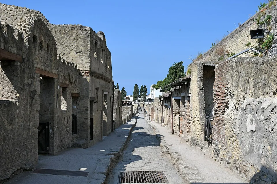
  3. A narrow paved street running straight between the walls of houses, with raised kerbs on both sides, doorways and window openings in the house fronts, and walls rising well above the height of a single storey.

    Photo: Phyrexian · CC BY-SA 4.0 · Commons

    city · Campania

    Herculaneum

    Excavation has uncovered about 4 to 4.5 hectares of a town of roughly 20, so this is a compact site: four fully excavated blocks of houses and shops (insulae III to VI) and parts of others, between excavated streets, with the rest of ancient Herculaneum, including most of its forum and its temples, still under modern Ercolano (it.wikipedia, fr.wikipedia).

    Show on map: Herculaneum
    4th c. BC – 1st c. ADTicketed
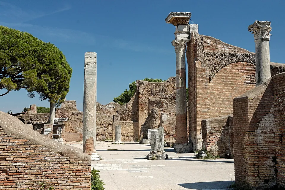
  4. A paved hall between high walls of red brick, with a broad brick arch behind and tall marble columns standing on the floor, two of them still carrying their carved capitals, against a blue sky.

    Photo: Marie-Lan Nguyen ( User:Jastrow ) · CC BY 2.5 · Commons

    city · Lazio

    Ostia

    A whole town of brick to walk through: houses, shops, warehouses and apartment blocks, sometimes several storeys high (fr.wikipedia), with floor mosaics still in place in many buildings (de.wikipedia).

    Show on map: Ostia
    4th c. BC – 7th c. ADTicketed
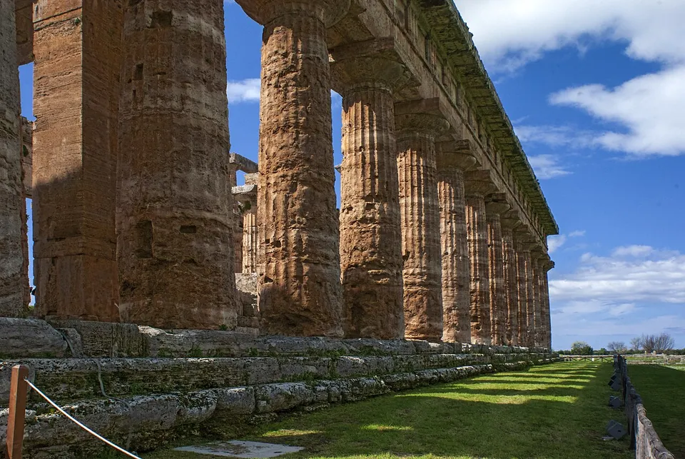
  5. Looking along the side of a Greek Doric temple, a row of massive fluted columns of weathered honey-coloured stone carrying stone beams, standing on a stepped base beside a mown lawn under a blue sky.

    Photo: Acquario51 · CC BY-SA 4.0 · Commons

    city · Campania

    Paestum

    The temples come first, and there is no point pretending otherwise: two temples of Hera stand side by side in the southern sanctuary, and a third, smaller one, to Athena, on the high ground to the north.

    Show on map: Paestum
    3rd c. BC – 7th c. ADTicketed
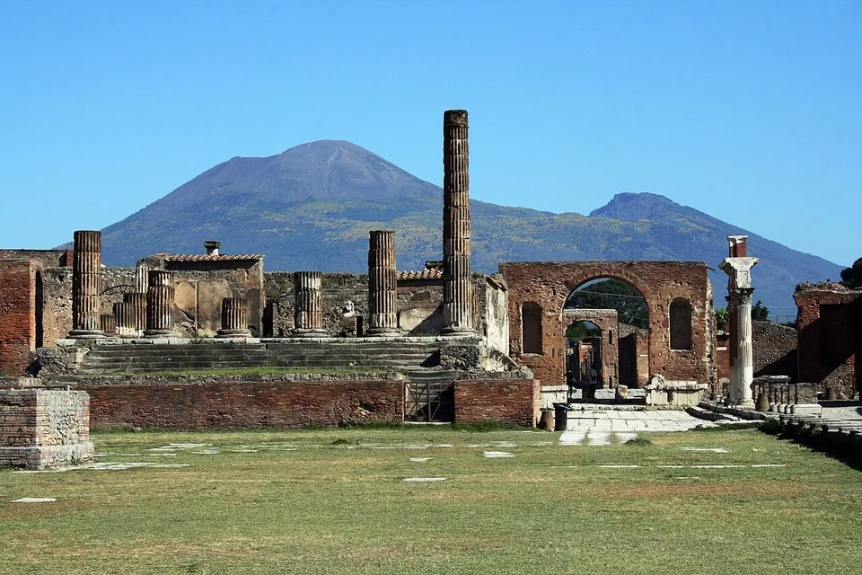
  6. A grassy open square ending in a raised platform of brick and stone with broad steps and a few broken columns, a tall brick arch to the right, and the double summit of Vesuvius against a clear blue sky.

    Photo: Glen Scarborough from The Central Coast, Australia · CC BY 2.0 · Commons

    city · Campania

    Pompeii

    The walled town covered 64 to 67 hectares, and about two-thirds of it has been excavated (en.wikipedia), so this is a day out rather than a single monument: you walk the old streets from one block to the next.

    Show on map: Pompeii
    3rd c. BC – 1st c. ADTicketed
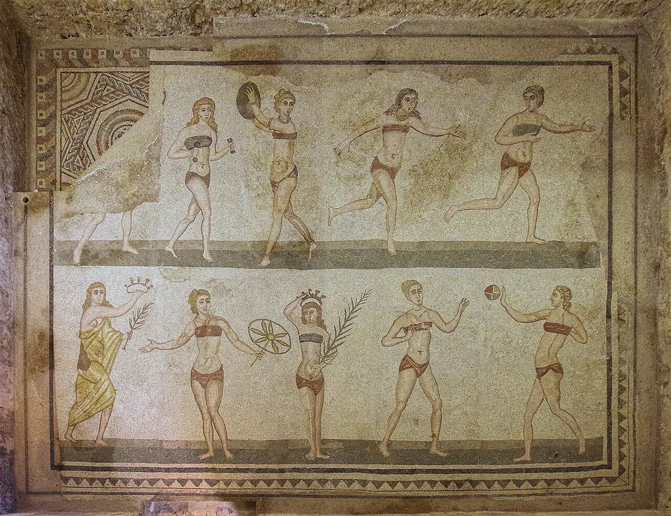
  7. A floor mosaic in two rows of young women in two-piece athletic dress, one lifting small weights, others running, throwing a discus and passing a ball, with a robed figure in the lower row holding out a crown and a palm branch.

    Photo: Berthold Werner · CC BY-SA 4.0 · Commons

    villa · Sicily

    Villa Romana del Casale

    The floors are the site.

    Show on map: Villa Romana del Casale
    3rd – 7th c. ADTicketed
  8. A panorama of the whole theatre from high on one side of the seating bowl, with the rows of the seating bowl sweeping round to a ruined red-brick stage building on the left, and the houses of the town and steep rocky mountains behind.

    Photo: Berthold Werner · CC BY-SA 3.0 · Commons

    theatre · Sicily

    Ancient theatre of Taormina

    Despite the name Teatro Greco, what stands is Roman: the operator states that everything visible belongs to the Roman rebuilding, above all the work of the first half of the 2nd century AD.

    Show on map: Ancient theatre of Taormina
    3rd c. BC – 5th c. ADTicketed
  9. Excavated walls and a straight paved street running across the lower city, with orange safety fencing round open trenches and a wooded hill rising behind, with structures on its crest.

    Photo: AlexanderVanLoon · CC BY-SA 3.0 · Commons

    city · Campania

    Cumae

    The visit centres on the acropolis, a hill above the coast with remains on two terraces (the operator).

    Show on map: Cumae
    8th c. BC – 7th c. ADTicketed
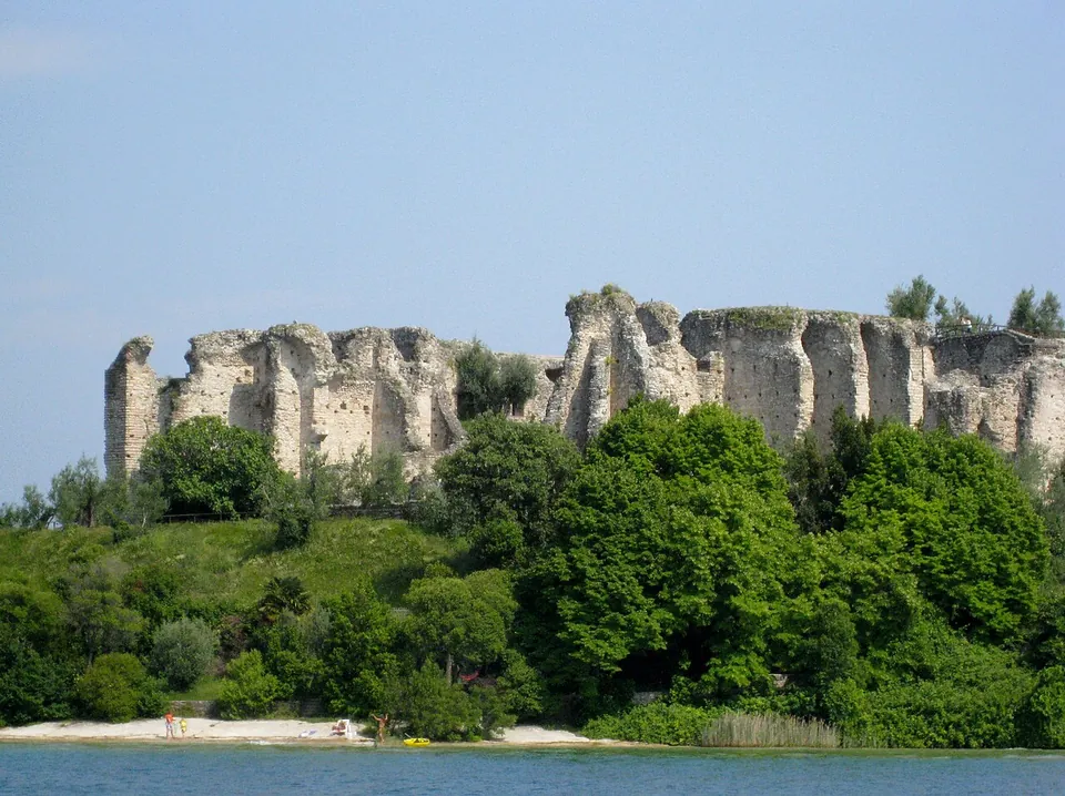
  10. Seen from the water, a long ragged line of pale stone walls and piers stands on top of a wooded bank above a narrow beach on the lake shore.

    Photo: Agsftw · CC BY-SA 3.0 · Commons

    villa · Lombardy

    Grottoes of Catullus

    The villa was a rectangle of 167 by 105 m, with a projecting wing at each short end, built on a sloping rock shelf that the builders cut back and propped up with massive substructures on the north side (it.wikipedia).

    Show on map: Grottoes of Catullus
    1st c. BC – 5th c. ADTicketed
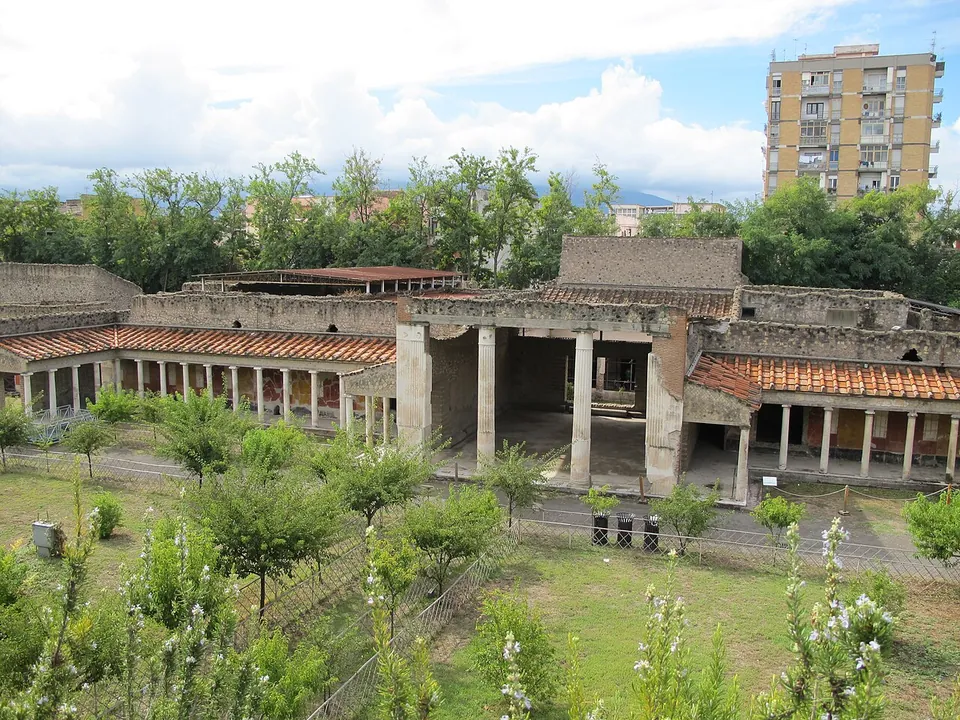
  11. A long front of rough stone walls with porticoes of slender columns under red-tiled roofs and a tall square opening between heavy piers in the middle, seen across a lawn with young trees and flowering shrubs, with a modern apartment block rising behind.

    Photo: ho visto nina volare from Italy · CC BY-SA 2.0 · Commons

    villa · Campania

    Oplontis

    Villa A, the "Villa of Poppaea".

    Show on map: Oplontis
    1st c. BC – 1st c. ADTicketed
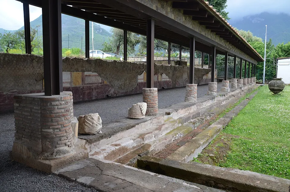
  12. A long covered portico on brick-built column stumps, with fragments of carved stone lying beside a stone-edged channel and a strip of lawn, and wooded mountains rising behind under cloud.

    Photo: Carole Raddato · CC BY-SA 2.0 · Commons

    villa · Campania

    Stabiae

    Two villas and the neighbouring Second Complex are open (the operator).

    Show on map: Stabiae
    2nd c. BC – 1st c. ADFree
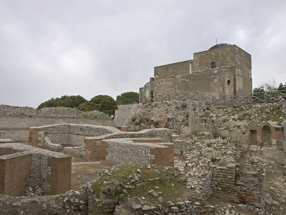
  13. Roofless rooms of brick and rubble walls, a few metres high, fill the foreground on a hilltop under a grey sky; behind them, on higher ground, stands a plain square church with a small dome.

    Photo: Ymblanter · CC BY-SA 4.0 · Commons

    villa · Campania

    Villa Jovis

    The building rose in terraces over a height difference of about 40 m, and its footprint covers some 0.7 hectares (en.wikipedia, de.wikipedia).

    Show on map: Villa Jovis
    1st c. BC – 3rd c. ADTicketed
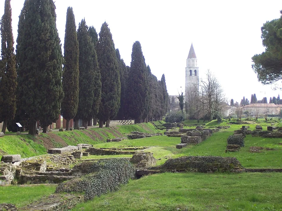
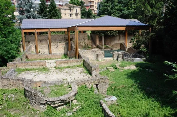
  14. Low excavated stone walls and terraces in mown grass, running beside a tall row of dark cypresses, with a white bell tower and the roofs of the town in the distance.

    Photo: Zavijavah · CC BY-SA 3.0 · Commons

    city · Friuli-Venezia Giulia

    Aquileia

    What you see of Roman Aquileia are the areas that have been excavated and left open: a forum with re-erected columns, the quays of a river port, quarters of houses reduced to their walls and floors, and large mosaic floors, several of them under modern covers.

    Show on map: Aquileia
    2nd c. BC – 7th c. ADTicketed
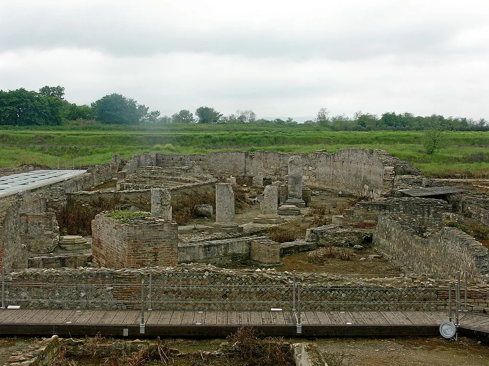
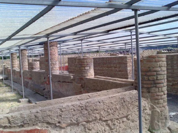
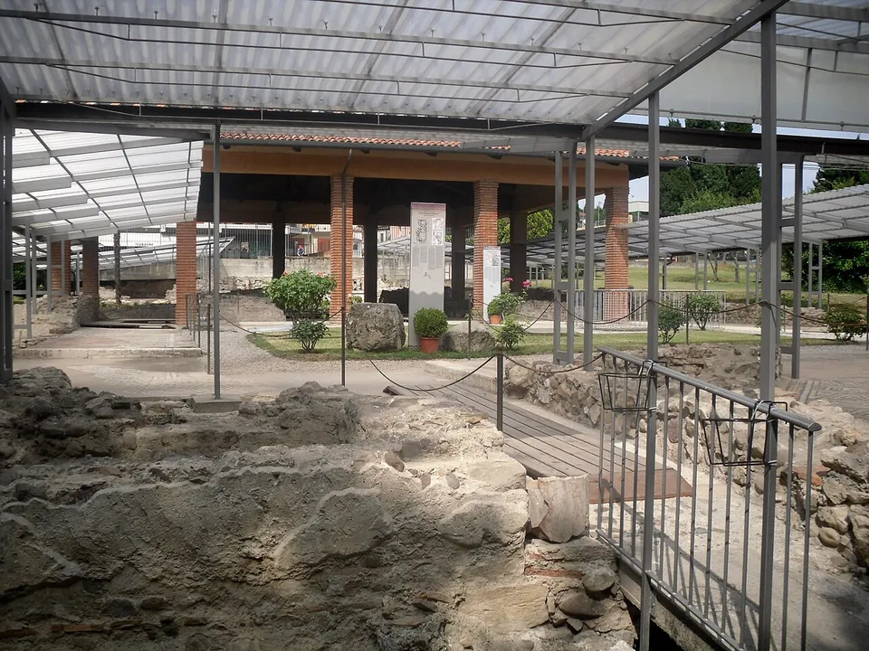
  15. Low ruined walls of rubble and brick and a few square stone piers spread across a sunken excavation, seen from a wooden boardwalk with a railing, with flat green farmland and trees beyond.

    Photo: Mboesch · CC BY-SA 4.0 · Commons

    city · Calabria

    Copia – Sibari

    The ruins lie in a broad excavation below the level of the surrounding farmland (Commons photographs).

    Show on map: Copia – Sibari
    2nd c. BC – 7th c. ADTicketed
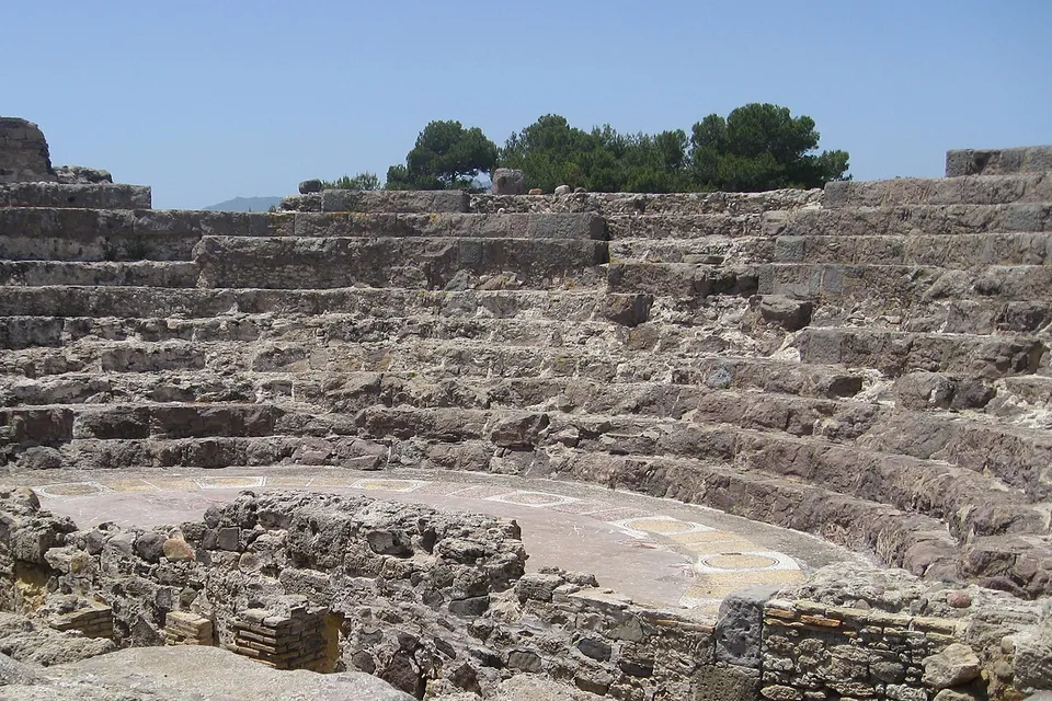
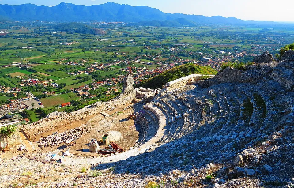
  16. The curved stone seating of a small theatre rising in tiers above a flat semicircular orchestra, with the low walls of the stage building in the foreground and pines along the top.

    Photo: Helga Steinreich · CC BY-SA 3.0 · Commons

    city · Sardinia

    Nora

    The theatre is the building to see.

    Show on map: Nora
    3rd c. BC – 7th c. ADTicketed
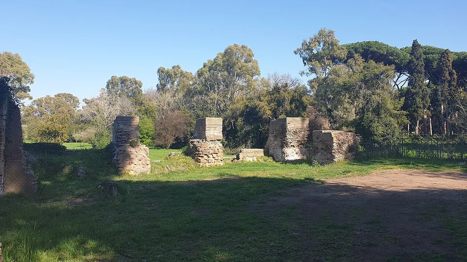
  17. Four squat piers of brick and rubble standing in rough grass in a sunny clearing, with a dirt track and a belt of trees behind them.

    Photo: MumblerJamie · CC BY-SA 2.0 · Commons

    harbour · Lazio

    Portus

    The visitable area is the Area archeologica dei Porti Imperiali di Claudio e Traiano, run by the Ostia Antica archaeological park.

    Show on map: Portus
    1st – 6th c. ADTicketed
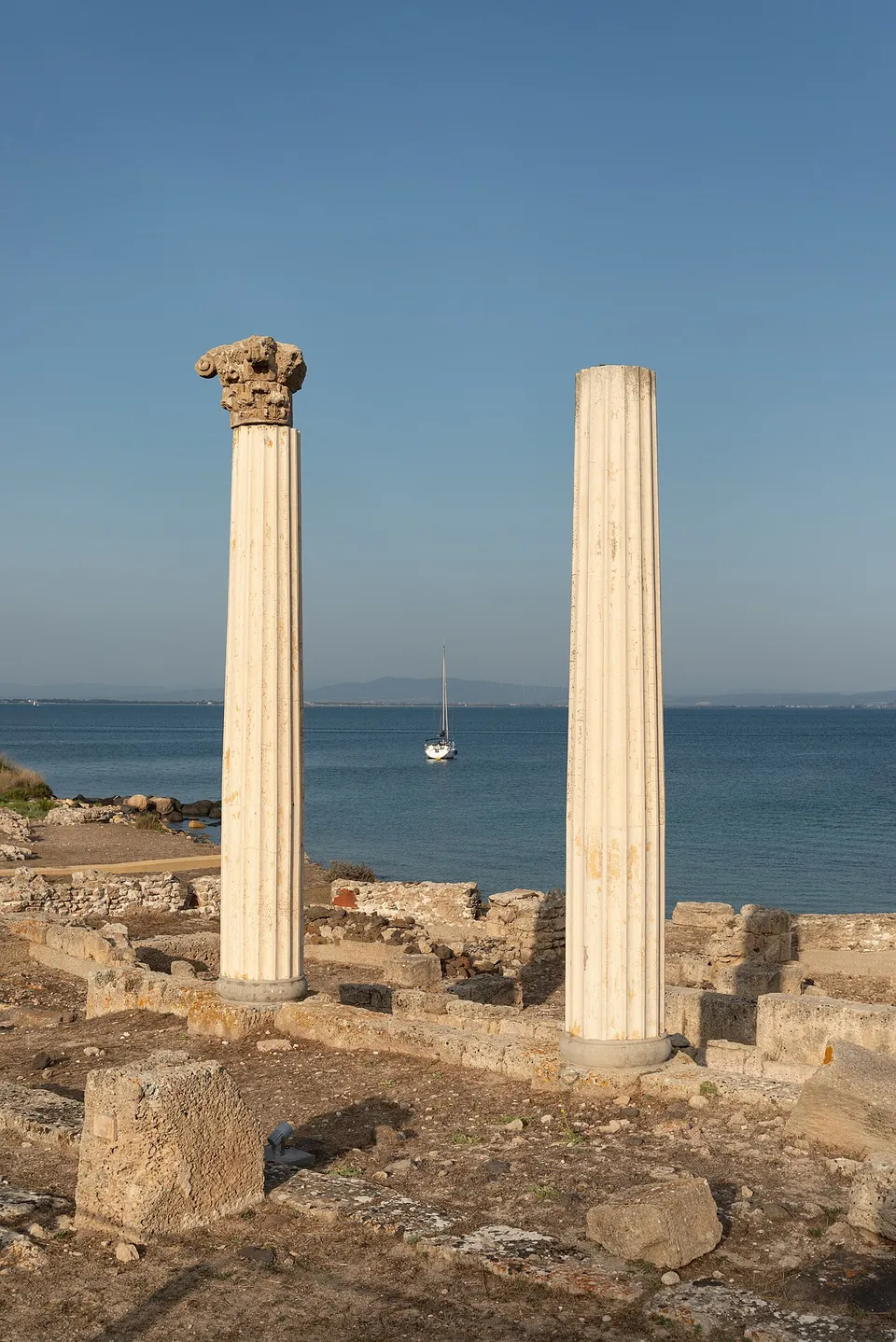
  18. Two fluted white columns stand among low stone walls, the left one topped by a Corinthian capital, with calm sea and a moored sailing boat behind them.

    Photo: GiorgioGaleotti · CC BY-SA 4.0 · Commons

    city · Sardinia

    Tharros

    The site is an open-air museum (it.wikipedia) on a narrow promontory, in places only 100 m wide, at the southern end of the Gulf of Oristano (de.wikipedia; SardegnaTurismo).

    Show on map: Tharros
    3rd c. BC – 7th c. ADTicketed

Hidden gems

Hidden gem

Remains that most visitors to the region never see.

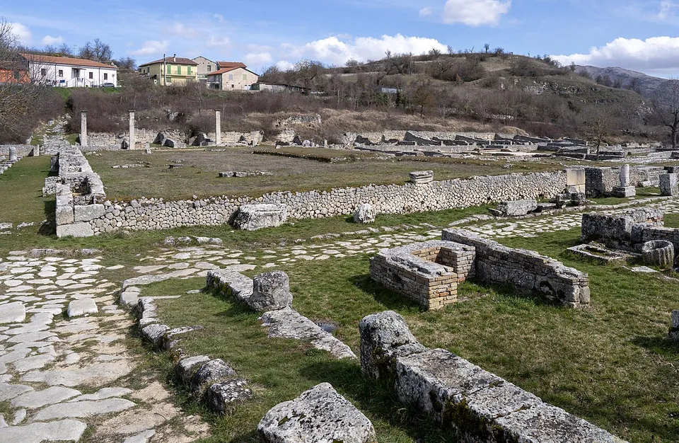
  1. A Roman street paved with large pale flagstones running between low walls of squared stone blocks, with long rows of excavated foundations and a few standing column shafts across the grass beyond, and houses on a hillside behind.

    Photo: PaestumPaestum · CC BY 4.0 · Commons

    city · Abruzzo

    Alba Fucens

    Excavation has exposed a large part of the town (the operator).

    Show on map: Alba Fucens
    4th c. BC – 6th c. ADFree
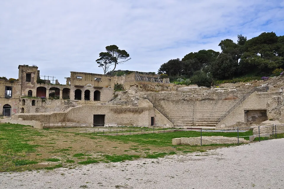
  2. Tiers of stone seating rising in a semicircle against the hillside, below a ruined two-storey building with a row of arched openings and pine trees on the crest, with a lawn and a gravel path in front.

    Photo: Armando Mancini · CC BY-SA 2.0 · Commons

    villa · Campania

    Archaeological park of Posillipo

    The way in is the visit's first monument.

    Show on map: Archaeological park of Posillipo
    1st c. BC – 3rd c. ADRestricted access
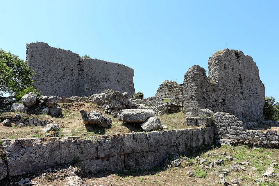
  3. Two tall ruined walls of grey rubble masonry rise above a terrace edged with a course of large squared blocks, with fallen stones scattered in the grass in front and a clear blue sky behind.

    Photo: Sailko · CC BY 3.0 · Commons

    city · Tuscany

    Cosa

    The walls are the set piece.

    Show on map: Cosa
    3rd c. BC – 6th c. ADFree
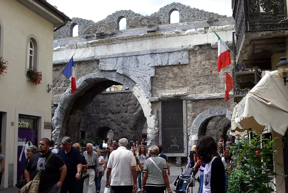
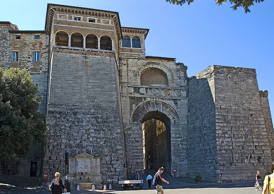
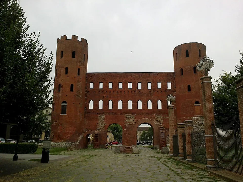
  4. A massive gate of large pale travertine blocks seen from the square in front of it. Two tall sloping-sided towers flank a central front with a single round-headed archway at street level, a band of round shields above it and a second, smaller arch higher up. On top of the left tower stands a later storey with an open arcaded loggia, and a stone fountain is set against the foot of that tower. People walk past on the paving.

    Photo: Francesco Gasparetti · CC BY 2.0 · Commons

    gate · Umbria

    Etruscan Arch

    The gate is still built into the Etruscan wall it belonged to, and it is still the main way into the upper town (the Ministry of Culture).

    Show on map: Etruscan Arch
    3rd c. BC – 3rd c. ADFree
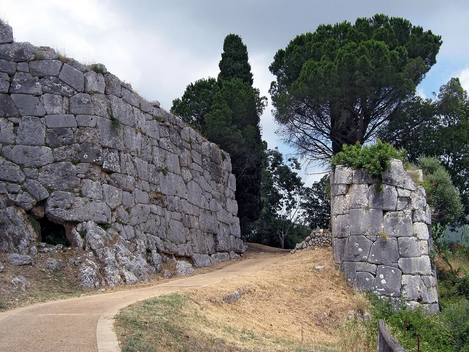
  5. A paved path curving between a towering wall of huge, irregular grey limestone blocks fitted without mortar on the left and a rounded tower of the same masonry on the right, with pines and cypresses beyond.

    Photo: Kroelleboelle · CC BY-SA 3.0 · Commons

    city · Lazio

    Norba

    The walls are the reason to come.

    Show on map: Norba
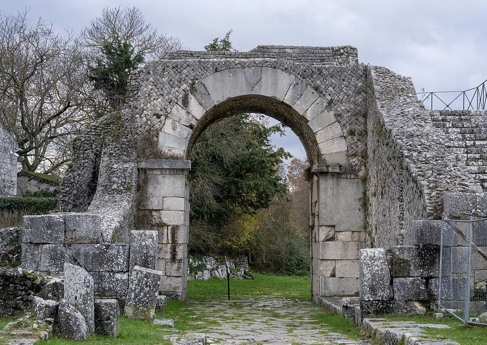
    5th – 1st c. BCFree
  6. A round arch of large dressed stone blocks on square stone piers, set in a high wall faced with small stones laid in a diagonal net pattern, with fallen blocks in the grass on either side and a paved track running through the opening towards trees.

    Photo: Stapinium · CC BY 4.0 · Commons

    city · Molise

    Saepinum

    The walls are the first thing you see: a circuit of about 1,270 m in small-stone net-pattern masonry, punctuated by round towers, enclosing about 12 hectares, with a monumental gate at each end of the two main streets (it.wikipedia).

    Show on map: Saepinum
    3rd c. BC – 7th c. ADFree
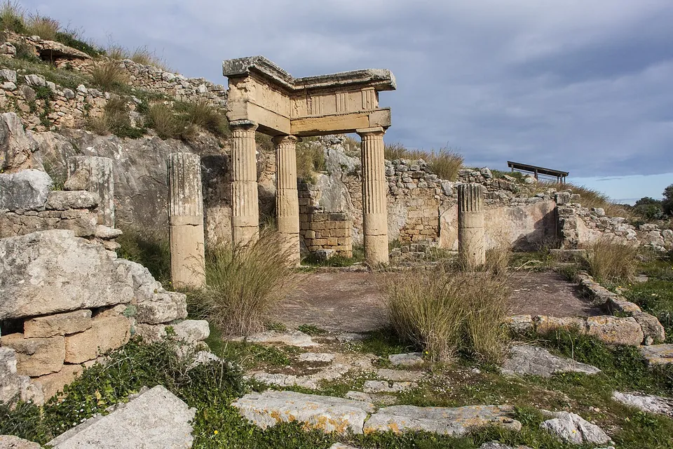
  7. Three fluted stone columns carrying a corner of entablature, with further column shafts standing on their own, round a paved courtyard among ruined walls on a hillside.

    Photo: Davide Mauro · CC BY-SA 4.0 · Commons

    city · Sicily

    Soluntum

    A town plan you can walk.

    Show on map: Soluntum
    3rd c. BC – 3rd c. ADTicketed
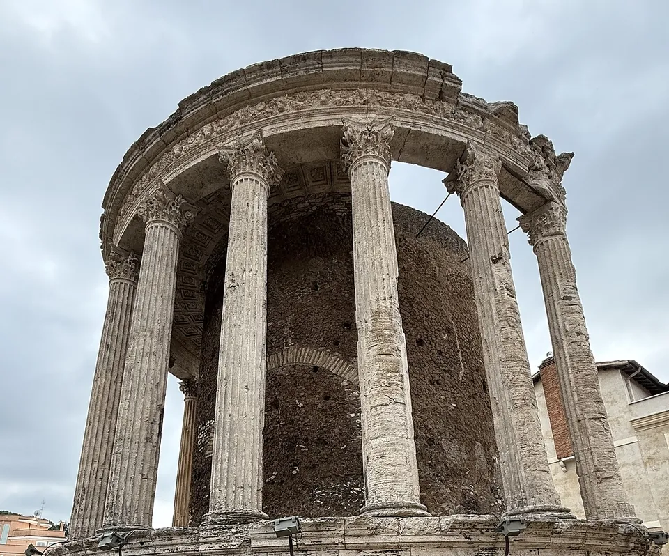
  8. A round temple seen from below, its curved row of fluted Corinthian columns carrying a carved frieze and cornice in front of a rough circular inner wall, against a cloudy sky.

    Photo: Alesca06 · CC0 · Commons

    city · Lazio

    Tibur – Tivoli

    The postcard view is the acropolis at the east end of the old town, where two small temples stand side by side overlooking the falls and the gorge (en.wikipedia).

    Show on map: Tibur – Tivoli
    8th c. BC – 7th c. ADTicketed
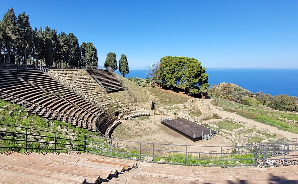
  9. A semicircle of stone seating rows cut into a hillside, seen from the upper rows, with a low stage platform on the levelled floor below, umbrella pines and cypresses along the top, and the open sea beyond.

    Photo: Bernard Gagnon · CC BY 4.0 · Commons

    city · Sicily

    Tyndaris

    The theatre is the set piece.

    Show on map: Tyndaris
    3rd c. BC – 7th c. ADTicketed
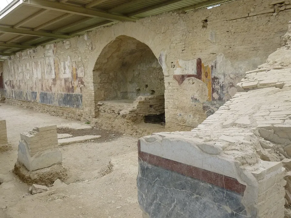
  10. A long sunken gallery under a modern roof of metal and translucent panels, its stone wall painted with faded red, yellow and white panels above a dark blue base, a metal walkway running along it and a few visitors at the far end.

    Photo: Diego Baglieri · CC BY-SA 4.0 · Commons

    city · Marche

    Urbs Salvia

    The park takes in the town inside its Augustan walls, which still stand to height for long stretches (Ministry of Culture), and the amphitheatre outside them.

    Show on map: Urbs Salvia
    2nd c. BC – 6th c. ADTicketed
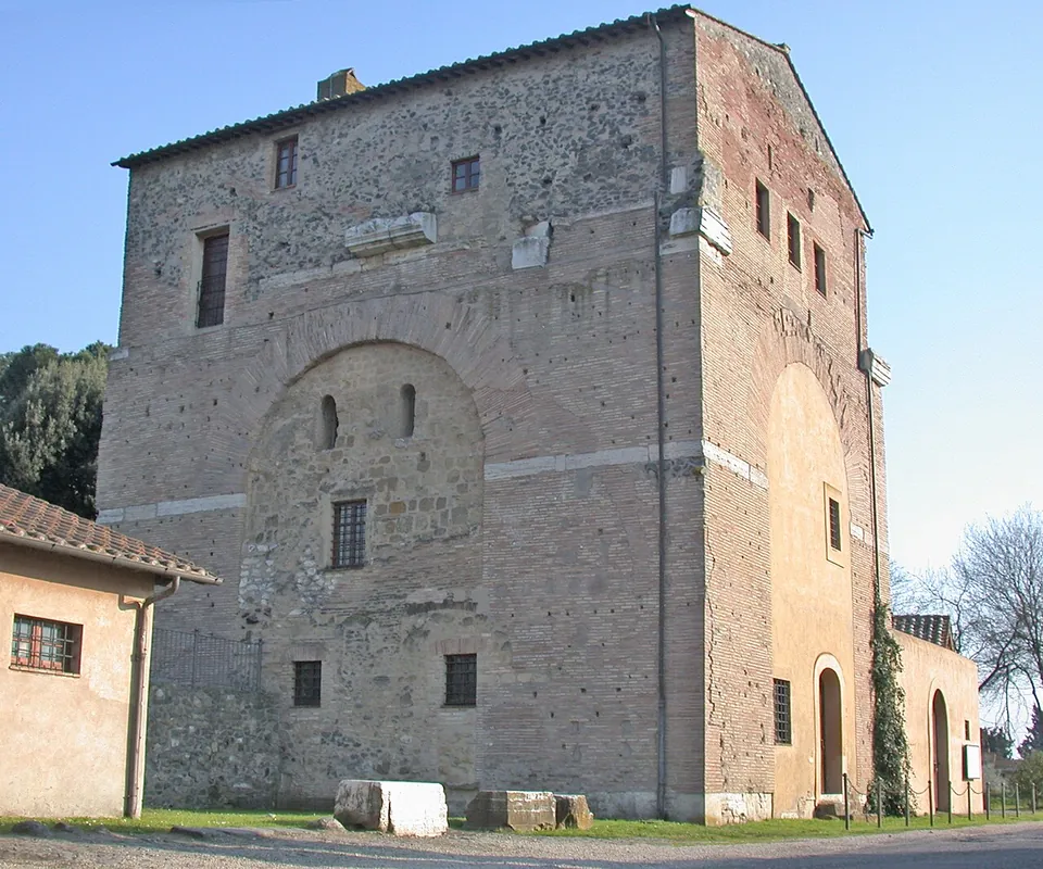
  11. A tall, square building of brick and rubble with small windows and a tiled roof; the outline of a great round-headed arch, filled in with masonry, shows in the middle of the wall, and blocks of pale stone lie on the grass in front.

    Photo: MM · Public domain · Commons

    arch · Lazio

    Arch of Malborghetto

    At first sight you see an austere farmhouse rather than an arch (it.wikipedia).

    Show on map: Arch of Malborghetto
    3rd – 7th c. ADFree
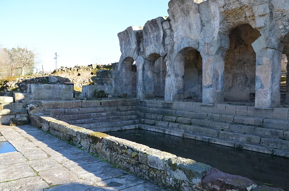
  12. A row of round arches on heavy pillars of grey volcanic stone, the top of the wall broken and uneven, rising above stone steps that run down into a rectangular pool of still water.

    Photo: Carole Raddato from FRANKFURT, Germany · CC BY-SA 2.0 · Commons

    bath · Sardinia

    Baths of Fordongianus

    The heart of the site is the 1st-century building at its northern end.

    Show on map: Baths of Fordongianus
    1st – 3rd c. ADTicketed
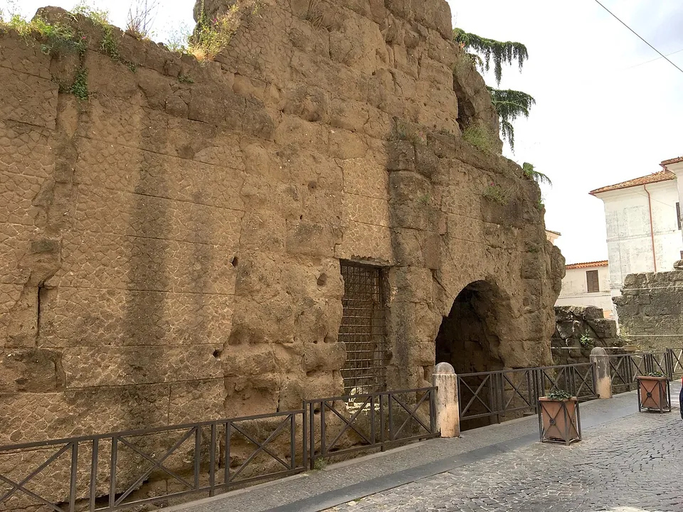
  13. A massive wall of large, weathered tufa blocks rising above a cobbled street behind an iron railing, with a tall round-headed passage opening through it at the far end and a modern house beyond.

    Photo: Rjdeadly · CC BY-SA 4.0 · Commons

    fort · Lazio

    Castra Albana

    The set piece is the Porta Praetoria, the main gate, which faced the Via Appia.

    Show on map: Castra Albana
    2nd – 4th c. ADFree
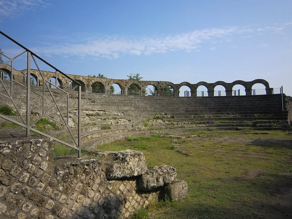
  14. Rows of grey stone seating rising in a semicircle from a grassy floor, with a line of round arches on square piers running along the top and a metal railing in the foreground.

    Photo: Carlomorino · CC BY-SA 3.0 · Commons

    city · Lazio

    Ferentium

    Only a small part of the town has been excavated and can be visited; other areas were investigated and covered over again, the forum among them, which lies under a farm (it.wikipedia).

    Show on map: Ferentium
    2nd c. BC – 7th c. ADUnknown
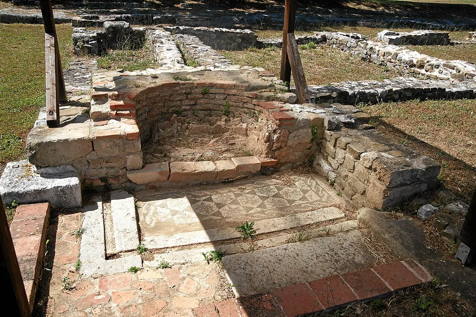
  15. A small apse-shaped niche of stone and brick, with a mosaic floor of small patterned squares in front of it and low excavated walls beyond, under a timber support.
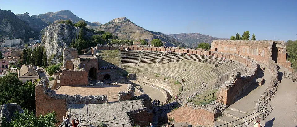
    Photo: Mboesch · CC BY-SA 4.0 · Commons

    city · Basilicata

    Grumentum

    The excavated buildings lie mostly along the town's main street, the plateia (the operator).

    Show on map: Grumentum
    3rd c. BC – 7th c. ADTicketed
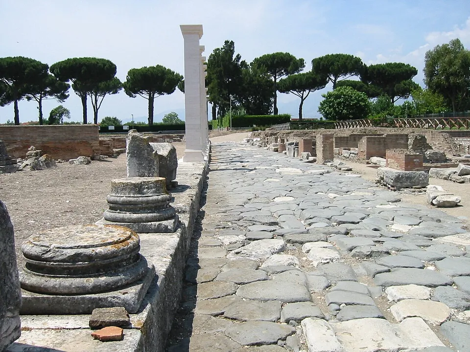
  16. A road paved with large, irregular grey stone blocks running straight between excavated walls, with round column bases on a raised kerb to the left, one tall white column, and umbrella pines in the distance.

    Photo: AlMare · Public domain · Commons

    city · Lazio

    Minturnae

    The Via Appia crosses the park as the ancient town's main street, an original stretch paved in basalt blocks (it.wikipedia).

    Show on map: Minturnae
    3rd c. BC – 6th c. ADTicketed
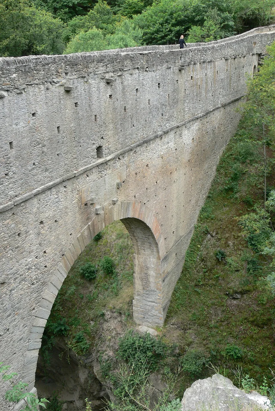
  17. A tall, narrow wall of grey dressed stone with a single round arch at its foot, rising straight out of a wooded gorge; rows of small square openings run along its face and a person stands on the top for scale.

    Photo: Wolfgang Sauber · CC BY-SA 3.0 · Commons

    aqueduct · Aosta Valley

    Pont d'Aël

    The bridge itself, complete to its deck: a single arch with a span of 14.24 m carrying a stone structure 60.46 m long and 2.26 m wide across a gorge only 12 m wide at this point (de.wikipedia).

    Show on map: Pont d'Aël
    1st c. BC – 3rd c. ADTicketed
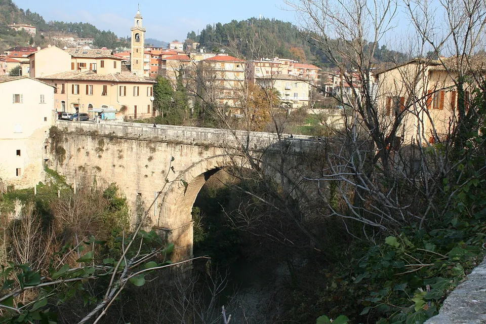
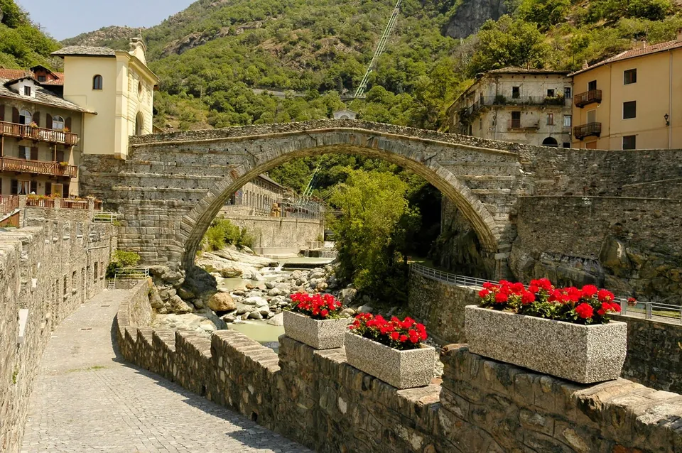
  18. A single wide arch of grey rubble stone over a rocky streambed, between the houses of the old town, seen from a cobbled lane with planters of red flowers on the parapet in front and wooded mountainside behind.

    Photo: dacolje · CC BY-SA 2.5 · Commons

    bridge · Aosta Valley

    Pont Saint-Martin

    The whole bridge.

    Show on map: Pont Saint-Martin
    1st c. BC – 7th c. ADFree
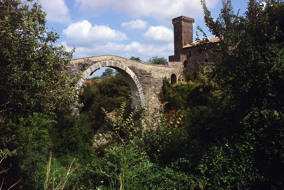
  19. A tall, round stone arch rising out of dense trees and shrubs, its humped deck running to a square crenellated tower and castle buildings on the right.
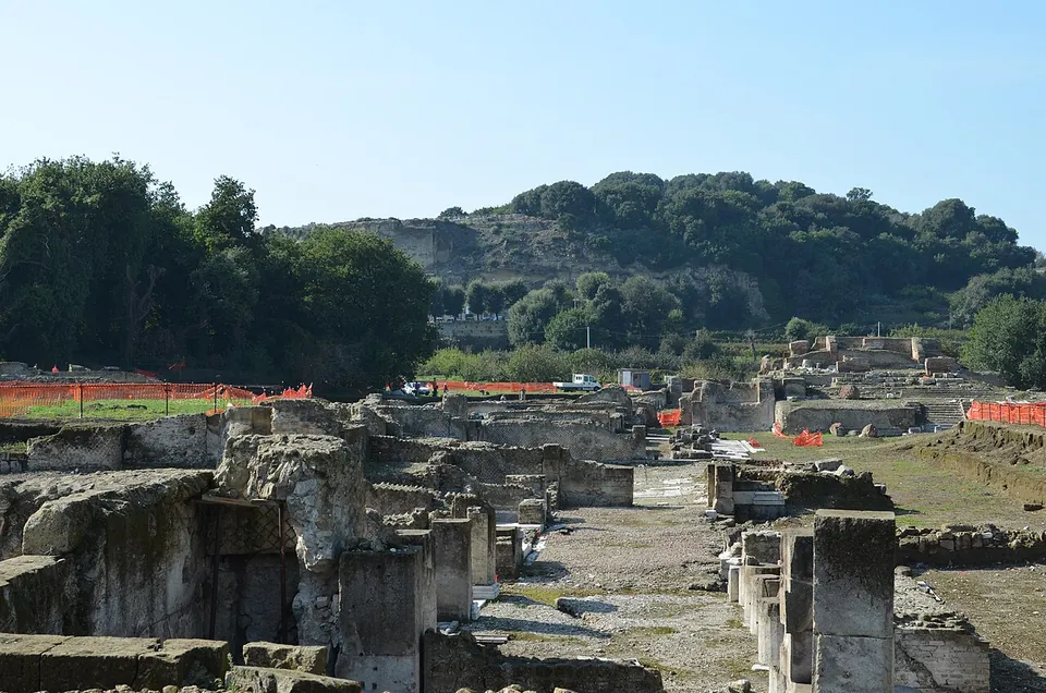
    Photo: Marco Ferrari · CC BY-SA 2.0 · Commons

    bridge · Lazio

    Ponte dell'Abbadia

    The bridge itself, standing and complete.
    Show on map: Ponte dell'Abbadia
    4th c. BC – 7th c. ADUnknown
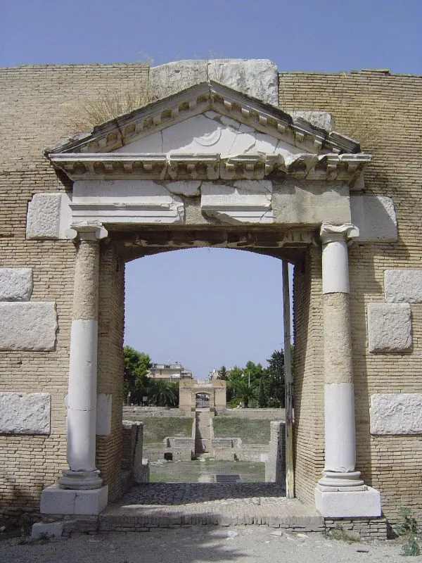
  20. A doorway of pale stone with a column on each side, the shafts patched with newer white stone, and a triangular pediment above, set in a wall of small yellow blocks, looking through across the arena to a second gateway on the far side.

    Photo: Maarten18 · CC BY 2.0 · Commons

    amphitheatre · Apulia

    Roman amphitheatre of Lucera

    The amphitheatre sits in a natural hollow, dug out into a rough oval, with part of the seating laid on the slope (fr.wikipedia).

    Show on map: Roman amphitheatre of Lucera
    1st c. BC – 3rd c. ADRestricted access
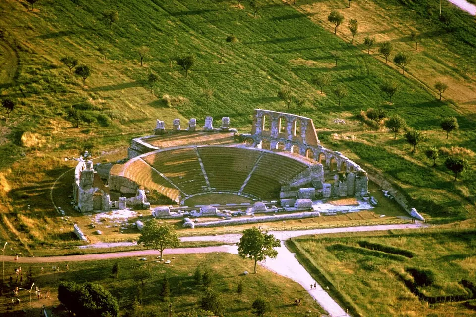
  21. An aerial view of the theatre in a mown meadow - the semicircle of stepped seating, the ring of arches behind it with a taller section of two-storey arcade standing at one end, the stage foundations across the front, and gravel paths leading in past scattered trees.

    Photo: Celsius1 at Italian Wikipedia · CC BY-SA 3.0 · Commons

    theatre · Umbria

    Roman Theatre of Gubbio

    The theatre is built of squared limestone blocks with a rusticated face.

    Show on map: Roman Theatre of Gubbio
    1st c. BC – 3rd c. ADTicketed
  22. The theatre seen from a stone parapet above, its curved seating banks grassed over and cut by stairways, with the excavated stage building and rows of stone fragments in the foreground and town buildings on the hill behind.

    Photo: Gianni Bencivenga · CC BY-SA 3.0 · Commons

    theatre · Campania

    Roman Theatre of Sessa Aurunca

    The theatre is one of the most imposing Roman public buildings found so far in Campania (the Ministry of Culture); it.wikipedia calls it the second-largest Roman theatre in the region after Naples.

    Show on map: Roman Theatre of Sessa Aurunca
    1st c. BC – 4th c. ADRestricted access
  23. A Roman street paved with large irregular stone slabs runs up through the excavated town centre, with low stone walls of buildings on both sides, a long canopy roof over an excavation in the middle distance and wooded hills behind.

    Photo: LepoRello · CC BY-SA 3.0 · Commons

    city · Tuscany

    Rusellae

    The town sits on two hills with a small valley between them, and the forum occupies the valley (it.wikipedia).

    Show on map: Rusellae
    3rd c. BC – 7th c. ADTicketed
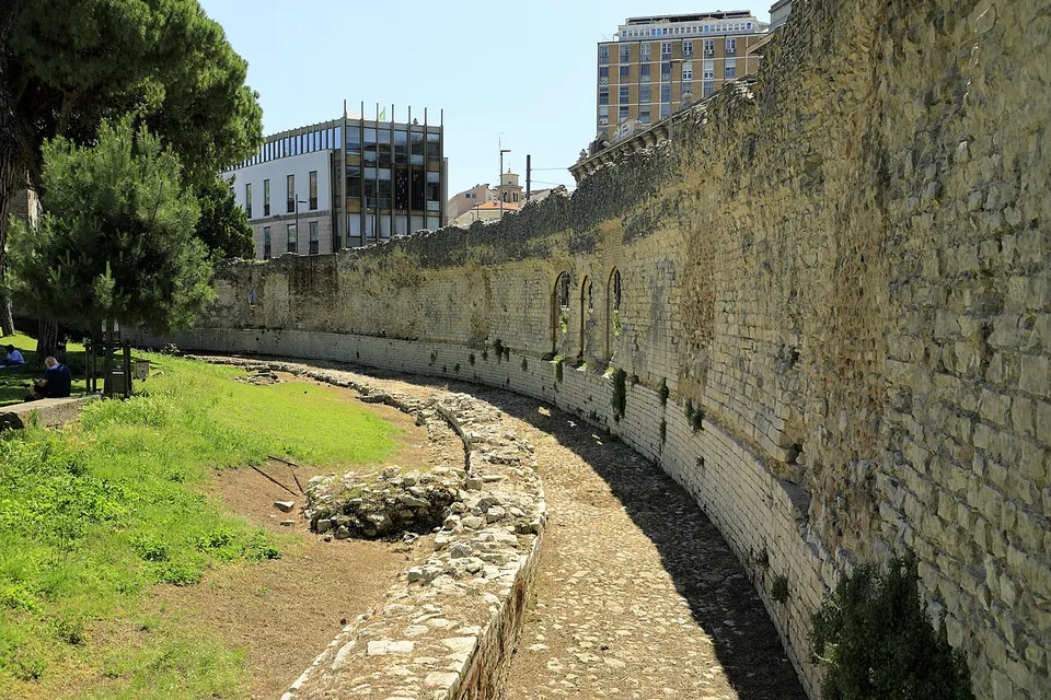
  24. Looking down on one curve of the amphitheatre, where tiers of seating carved out of the grey-green tuff rise above a mown grass arena, with dark openings cut into the rock wall at arena level and trees on the ridge behind.

    Photo: G.Hagedorn · CC BY-SA 3.0 · Commons

    amphitheatre · Lazio

    Sutri amphitheatre

    Everything you see is the rock itself.

    Show on map: Sutri amphitheatre
    1st c. BC – 3rd c. ADTicketed
  25. Low brick-faced walls of excavated rooms enclosing a patch of grass in the foreground, and behind them a long brick building with a row of tall round-arched openings, the largest opening onto a vaulted hall.

    Photo: SamHolt6 · CC BY-SA 4.0 · Commons

    bath · Lazio

    Terme Taurine

    The complex covers about two hectares (the operator) and has two parts side by side (it.wikipedia).

    Show on map: Terme Taurine
    1st c. BC – 7th c. ADRestricted access
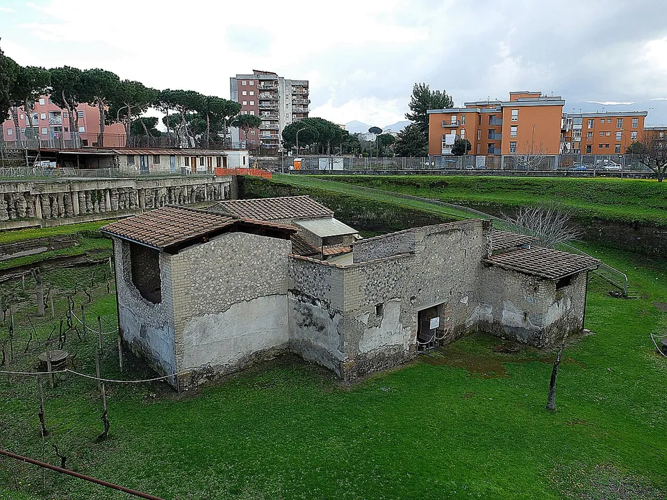
  26. A small farm building of rough stone and plastered walls under restored tiled roofs, standing in a grassy hollow planted with young vines on stakes, with modern apartment blocks and umbrella pines on the rim above.

    Photo: RealCarlo · CC BY 2.0 · Commons

    villa · Campania

    Villa Regina and Antiquarium

    Villa Regina is a working farm rather than a luxury house.

    Show on map: Villa Regina and Antiquarium
    1st c. BC – 1st c. ADTicketed
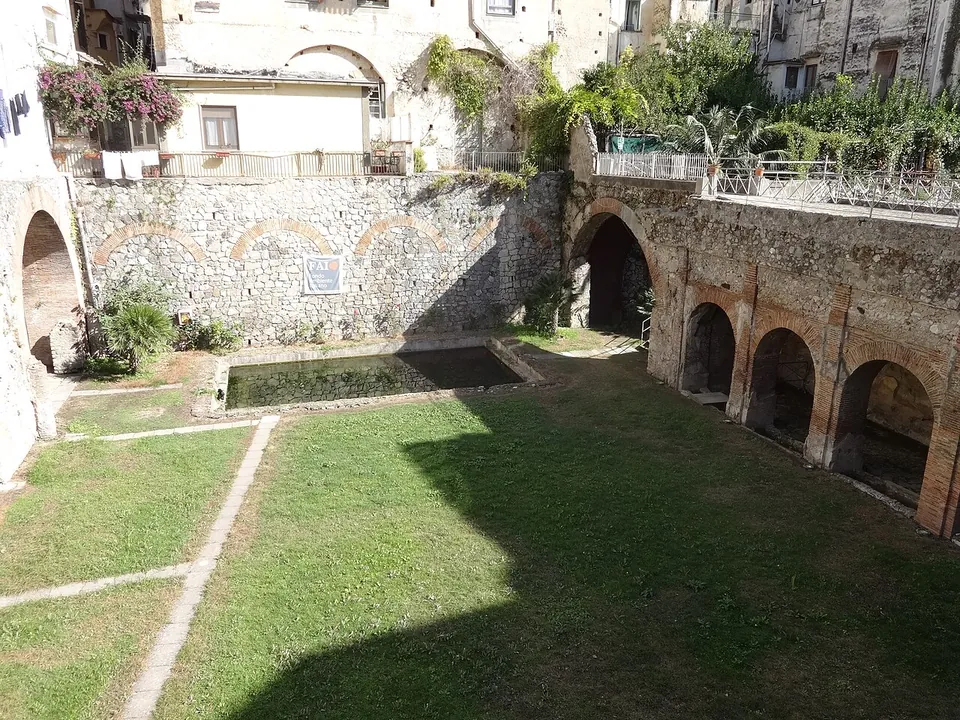
  27. A sunken lawn with a long rectangular pool along one side, bounded by a row of round-headed arches in stone and brick, with the plastered houses of the modern town rising above the far wall.

    Photo: Derbrauni · CC BY-SA 4.0 · Commons

    villa · Campania

    Villa Romana of Minori

    The villa was built around a garden, the viridarium, which had a pool at its centre and was enclosed on three sides by porticoes (it.wikipedia; the ministry).

    Show on map: Villa Romana of Minori
    1st – 6th c. ADTicketed
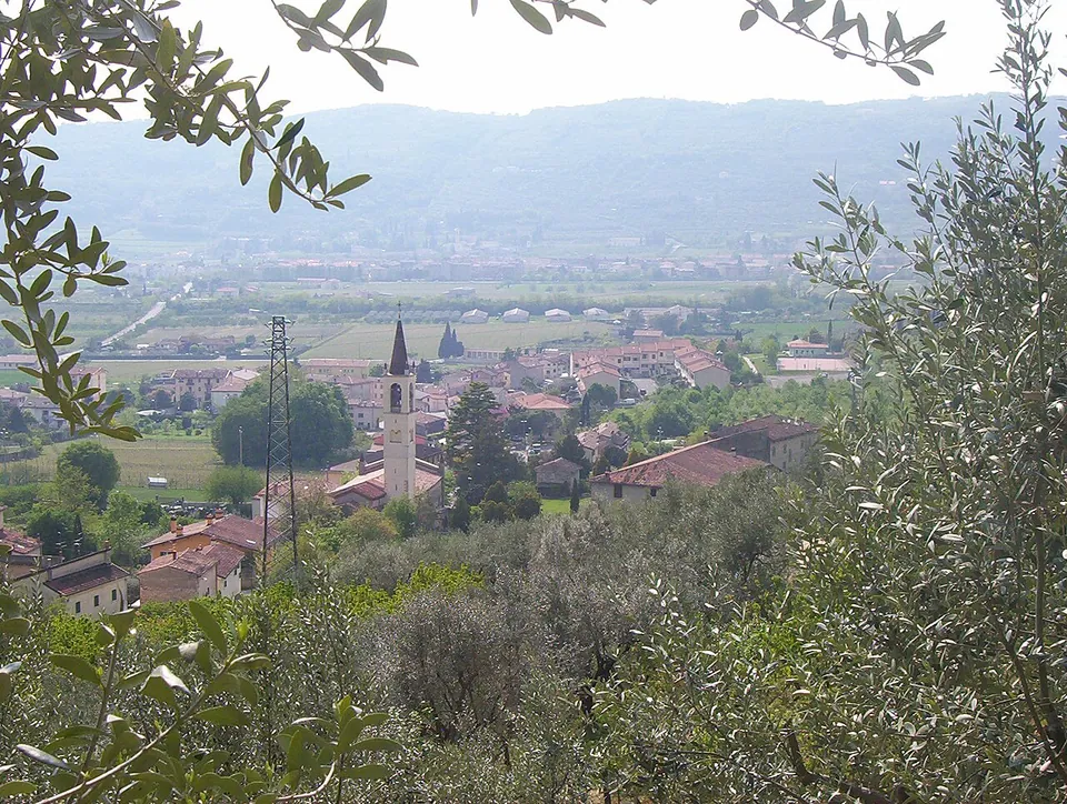
  28. A village of red-roofed houses and a slender bell tower with a pointed spire on the valley floor, seen from a hillside through olive branches, with flat farmland and a line of hills beyond.

    Photo: Adert · CC BY-SA 3.0 · Commons

    site · Veneto

    Ipogeo di Santa Maria in Stelle

    The water of an underground spring collects in a semicircular settling basin cut in the rock and runs on along a low, narrow, barrel-vaulted channel 100 m long, with four shafts along it.
    Show on map: Ipogeo di Santa Maria in Stelle
    3rd – 6th c. ADRestricted access
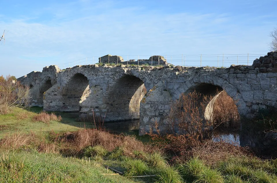
  29. Several round stone arches of the bridge seen close to, standing in still water among reeds and grass, a metal fence running along the top of the deck.

    Photo: Carole Raddato from FRANKFURT, Germany · CC BY-SA 2.0 · Commons

    bridge · Sardinia

    Pont'ezzu

    The bridge itself.

    Show on map: Pont'ezzu
    1st c. BC – 4th c. ADFree
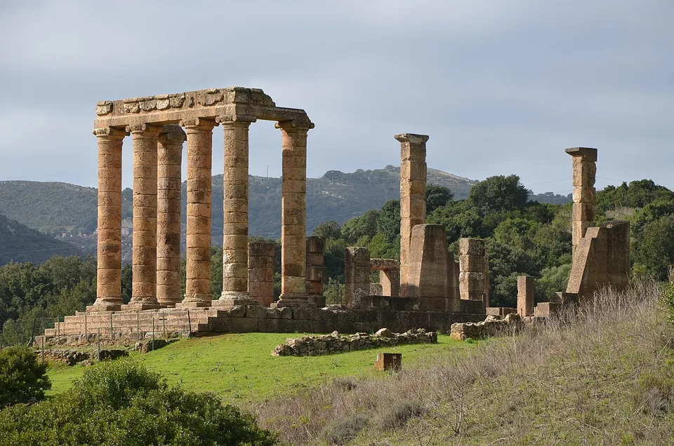
  30. Tall columns of honey-coloured stone carrying a short stretch of entablature at the front of the temple, with stumps of pillars and walls standing on the platform behind them, a grassy slope in front and wooded mountains beyond.

    Photo: Carole Raddato from FRANKFURT, Germany · CC BY-SA 2.0 · Commons

    temple · Sardinia

    Temple of Antas

    The temple stands on a podium of local limestone about 20 m long (it.wikipedia, de.wikipedia).

    Show on map: Temple of Antas
    1st c. BC – 3rd c. ADTicketed
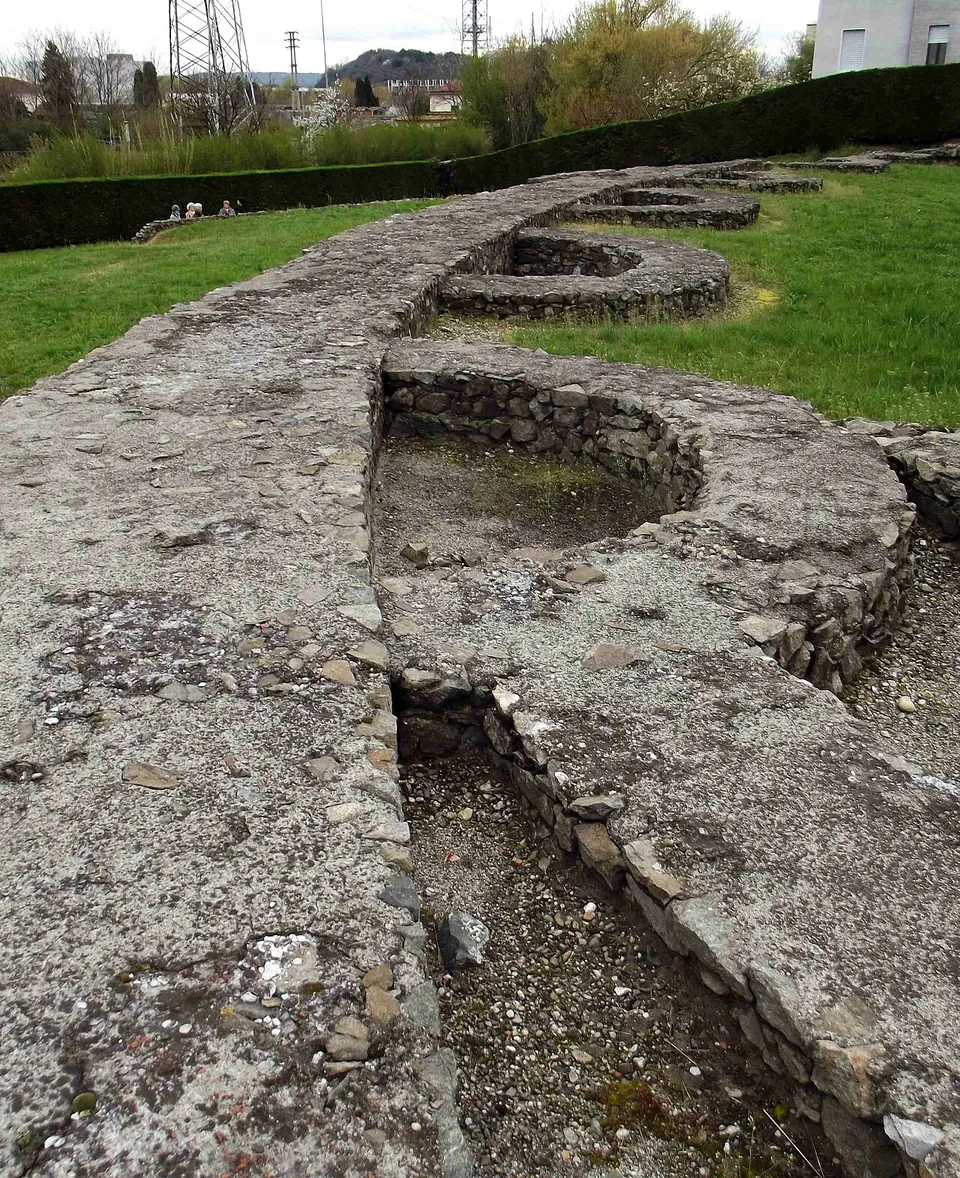
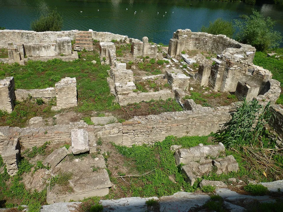
  31. Low walls of squared stone blocks laid out in rooms and a rounded apse among grass and weeds, with the water of a river directly behind them.

    Photo: Broenberr · CC BY-SA 4.0 · Commons

    city · Liguria

    Albingaunum – Albenga

    In the old town.

    Show on map: Albingaunum – Albenga
    2nd c. BC – 6th c. ADFree
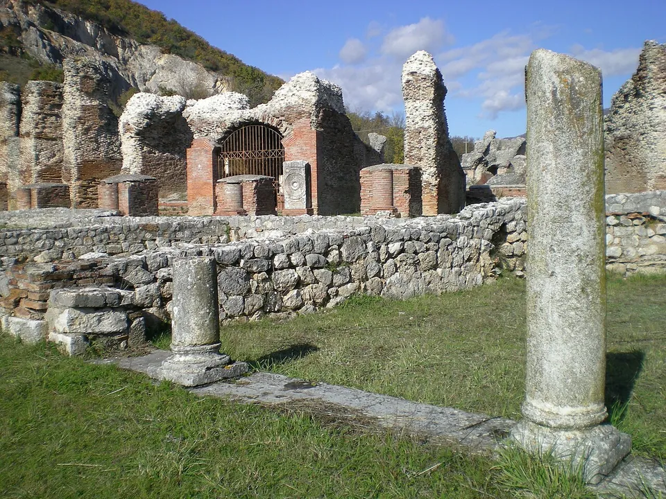
  32. Two weathered stone columns, one tall and one short, among low walls of rough stone in the grass, and behind them a row of ruined brick piers and arches, one closed with an iron grille, under a blue sky.

    Photo: Lasacrasillaba · Public domain · Commons

    city · Abruzzo

    Amiternum

    The archaeological park is two zones with separate entrances, on either side of the modern road and the river Aterno (the operator).

    Show on map: Amiternum
    3rd c. BC – 7th c. ADTicketed
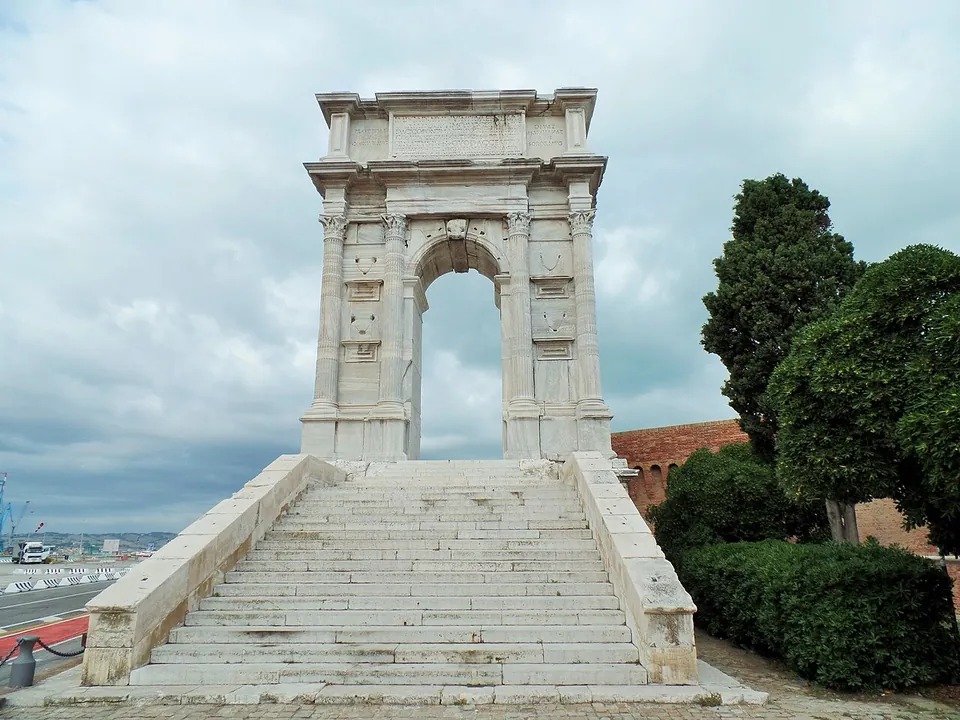
  33. A tall, narrow single arch of pale marble on a high podium, framed by pairs of fluted columns and topped by a plain attic, reached by a broad flight of stone steps, with trees to one side and the port behind.

    Photo: Claudio.stanco · CC BY-SA 4.0 · Commons

    city · Marche

    Ancona

    The Arch of Trajan is the set piece.

    Show on map: Ancona
    1st c. BC – 7th c. ADFree
  34. The brick gate front-on at the end of a stone-paved street, with arched openings at ground level, a row of arched windows and a row of square windows above, between two battlemented towers; a bronze statue stands on a tall brick pedestal to the right.

    Photo: rene boulay · CC BY-SA 3.0 · Commons

    city · Piedmont

    Augusta Taurinorum

    The Porta Palatina.

    Show on map: Augusta Taurinorum
    1st c. BC – 7th c. ADTicketed
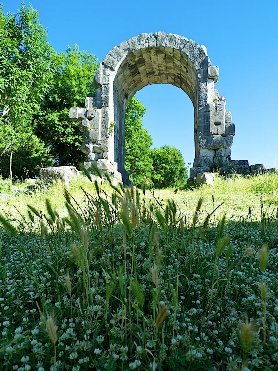
  35. A single tall round-headed arch of large grey stone blocks, standing alone in a meadow of long grass and white clover, with trees on either side and blue sky through the opening.

    Photo: Jan Hazevoet · CC BY 3.0 · Commons

    city · Umbria

    Carsulae

    The ticketed area is a fenced expanse of meadow and trees of 22 hectares (it.wikipedia).

    Show on map: Carsulae
    3rd c. BC – 7th c. ADTicketed
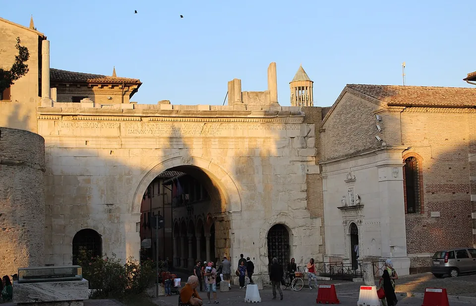
  36. A broad gate of pale squared stone with one large round-headed central arch and two small arched side openings, ruined stumps of masonry along its top and a bell tower rising behind, a church front with a carved doorway built against its right side, and people and bicycles in the square in front.

    Photo: Giompaola · CC BY-SA 4.0 · Commons

    city · Marche

    Fanum Fortunae – Fano

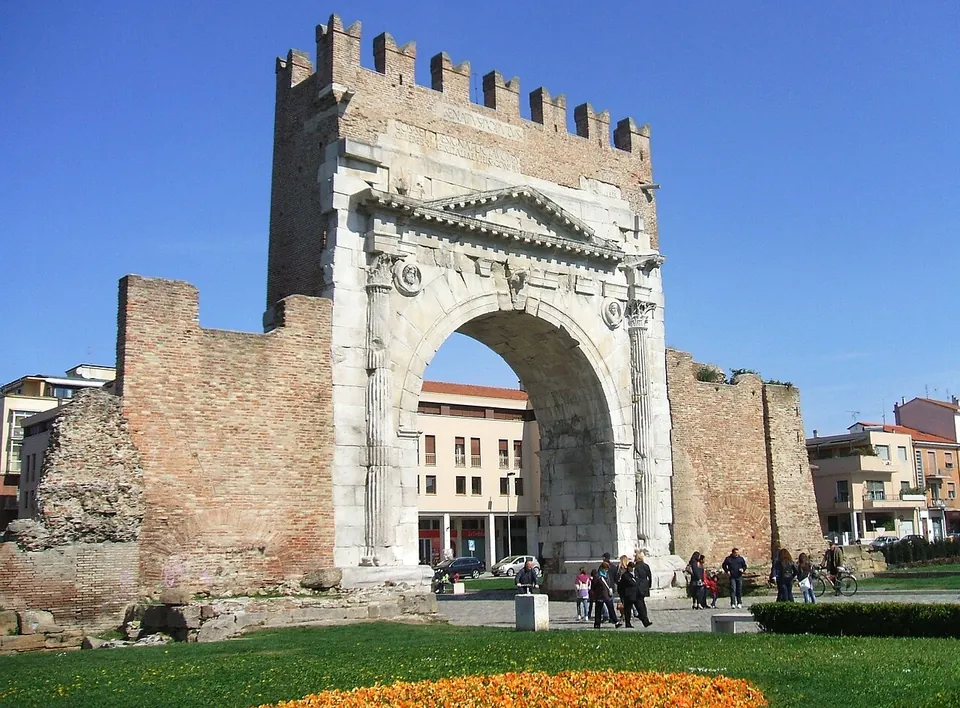
    The Arch of Augustus is the set piece.

    Show on map: Fanum Fortunae – Fano
    1st c. BC – 7th c. ADFree
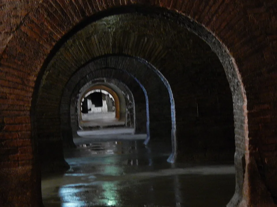
  37. A long underground view through a line of brick arches, one behind another, with a film of water on the floor reflecting the light.

    Photo: Giacomo Alessandroni · CC BY-SA 4.0 · Commons

    city · Marche

    Firmum Picenum – Fermo

    The Roman cisterns are the set piece.

    Show on map: Firmum Picenum – Fermo
    3rd c. BC – 7th c. ADTicketed
  38. A tall free-standing wall of squared, lichen-spotted stone blocks, ragged along its top edge, rising from a low stepped base in a mown field, with trees and distant hills behind.

    Photo: Carlomorino · CC BY-SA 3.0 · Commons

    city · Lazio

    Gabii

    The park the state holds covers about 70 hectares on the southern rim of a volcanic crater whose lake was drained in the 19th century (the operator; en.wikipedia).

    Show on map: Gabii
    5th c. BC – 7th c. ADRestricted access
  39. Rows of stone seating rising up a grassy slope above the excavated stage area, with walls of rough rubble stone in the foreground and a small white house on the hilltop behind.

    Photo: Michelvincenzo · CC BY-SA 4.0 · Commons

    city · Calabria

    Scylletium

    The remains lie in the olive groves of a former olive-oil estate (the Ministero della Cultura).

    Show on map: Scylletium
    2nd c. BC – 7th c. ADTicketed
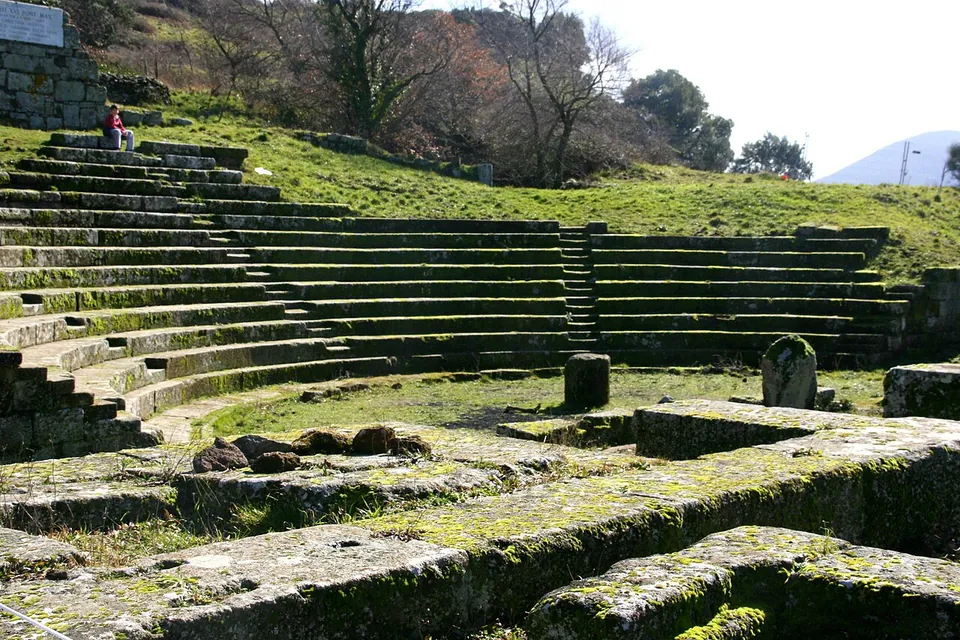
  40. The curved stone seating of a small Roman theatre set into a grassy hillside, with low walls and blocks of the stage area in the foreground and bare trees on the slope above.

    Photo: Luiza Serpa Lopes · Public domain · Commons

    city · Lazio

    Tusculum

    The visitor route runs mainly through the forum, with the theatre halfway round (the operator).

    Show on map: Tusculum
    4th c. BC – 7th c. ADTicketed
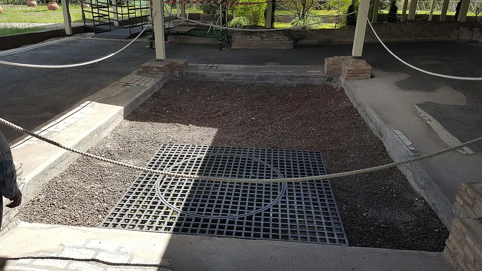
  41. A sunken rectangular bed of gravel with a metal grating at its centre, edged by low stone kerbs and a grey paved floor, under a modern shelter roof on slender posts, with rope barriers keeping visitors back.

    Photo: MumblerJamie · CC BY-SA 2.0 · Commons

    villa · Lazio

    Villa of Livia

    The operator describes the private wing with the bedrooms of Livia and the emperor, an atrium and a small inner garden, and the large reception rooms that open onto a peristyle; the rooms once had painted walls and floors of mosaic and cut marble (Soprintendenza Speciale di Roma).

    Show on map: Villa of Livia
    1st c. BC – 7th c. ADRestricted access
  42. A row of brick columns rising from low stone walls, under a modern roof of clear panels on thin metal posts.

    Photo: Razzairpina at Italian Wikipedia · Public domain · Commons

    city · Campania

    Abellinum

    At the entrance, on the north side of the plateau, part of the Roman town wall still stands, built in opus reticulatum, a facing of small stones set in a diagonal net (the operator).

    Show on map: Abellinum
    1st c. BC – 6th c. ADFree
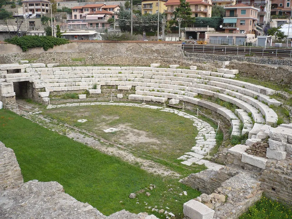
  43. A small Roman theatre seen from one side, its curved rows of pale stone seats rising around a grassy orchestra edged with a paved strip, with apartment blocks beyond the outer wall.

    Photo: Zanner · Public domain · Commons

    city · Liguria

    Albintimilium

    The ticketed area holds the theatre, the public baths and the Antiquarium, a museum room in the middle of the site (the operator).

    Show on map: Albintimilium
    2nd c. BC – 7th c. ADTicketed
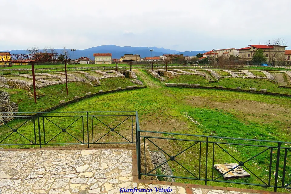
  44. An oval arena of grass inside a low ring of stone walls and grassy banks, seen over a green metal railing from a paved terrace, with houses and mountains behind.

    Photo: Gianfranco Vitolo from Sarno (Sa), Italia · CC BY-SA 2.0 · Commons

    city · Campania

    Allifae

    The walls are the main thing.

    Show on map: Allifae
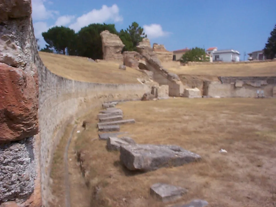
    4th c. BC – 7th c. ADFree
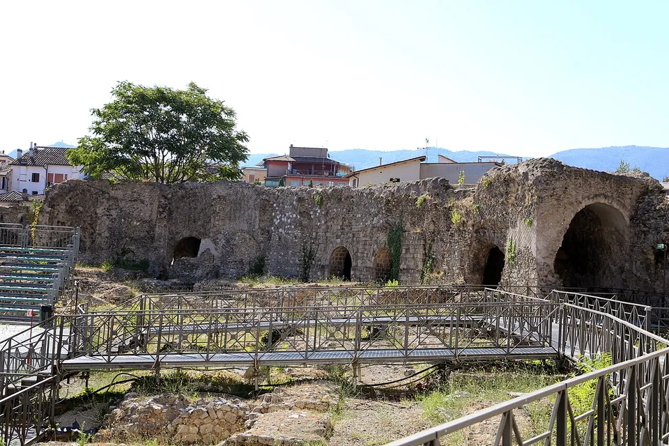
  45. The inside of the amphitheatre, with a raised metal walkway running over excavated ground and, behind it, a curving wall of rough stone pierced by arched openings, modern houses and hills above.

    Photo: Sailko · CC BY-SA 4.0 · Commons

    amphitheatre · Umbria

    Anfiteatro Fausto

    The oval is still easy to read on the ground, about 97.5 by 73 m overall (it.wikipedia).

    Show on map: Anfiteatro Fausto
    1st – 3rd c. ADTicketed
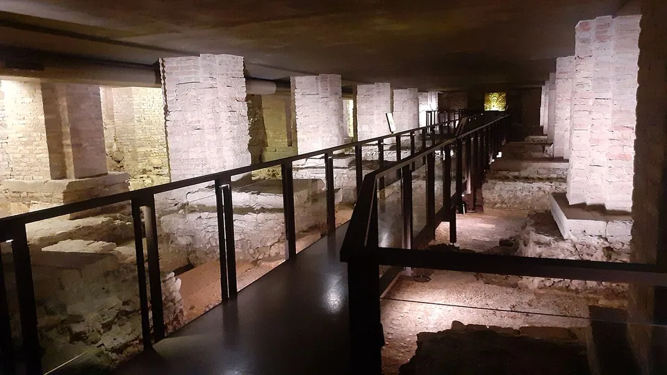
  46. A long, low underground hall beneath the cathedral, where a black-railed walkway runs between square brick piers rising to a concrete ceiling, with excavated stone wall footings and patches of floor lying below the walkway on both sides.

    Photo: Adert · CC BY-SA 4.0 · Commons

    town house · Veneto

    Archaeological area of the Vicenza cathedral

    About 750 m² of excavation run under the cathedral nave, the sacristy and the crypt.

    Show on map: Archaeological area of the Vicenza cathedral
    1st c. BC – 4th c. ADRestricted access
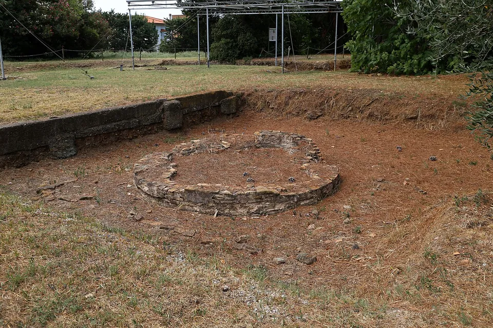
  47. A low ring of stone, the base of a round fountain, sits in a shallow sunken area of bare earth, with a low stone retaining wall behind it and, beyond, grass, trees and the metal frames of protective shelters.

    Photo: Sailko · CC BY 3.0 · Commons

    villa · Tuscany

    Archaeological site of San Vincenzino

    The villa survives as low walls and floor levels, partly in a shaded park among tall trees and partly under metal shelters over the excavations.

    Show on map: Archaeological site of San Vincenzino
    1st c. BC – 5th c. ADTicketed
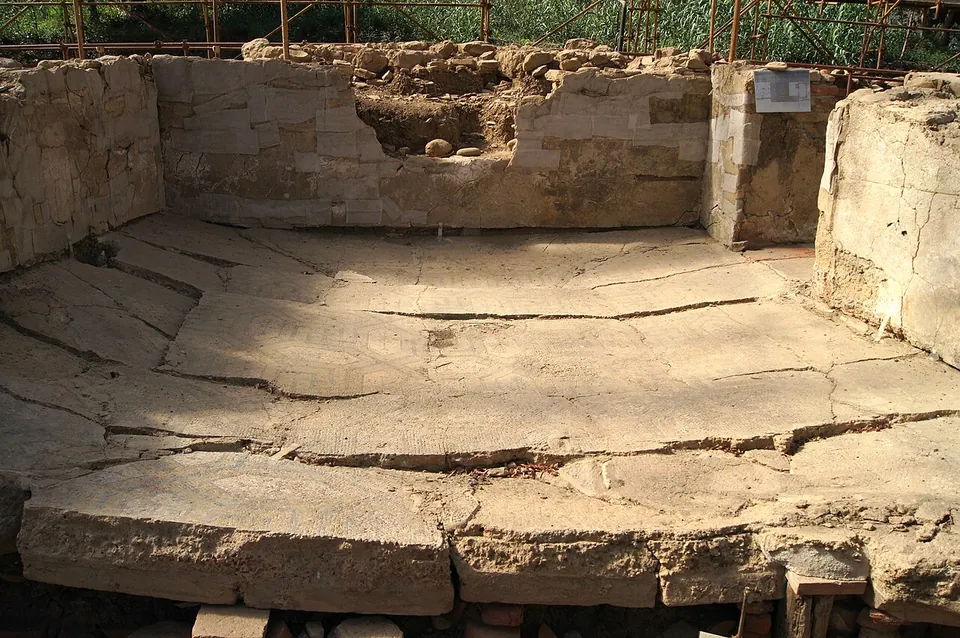
  48. A sunken room floor of pale tesserae, its faint geometric pattern crossed by long cracks where the floor has sagged and split, enclosed on three sides by low walls of squared sandstone blocks with traces of plaster, under a frame of scaffolding poles.

    Photo: Rjdeadly · CC BY-SA 4.0 · Commons

    bath · Sicily

    Baths of Bagnoli

    A fenced strip of excavation about 32 m long and 7 m wide (de.wikipedia), holding a row of six rooms (the operator): a cold-bath suite of three rooms, a warm room (tepidarium) and the two rooms of the hot bath (caldarium).

    Show on map: Baths of Bagnoli
    2nd – 7th c. ADUnknown
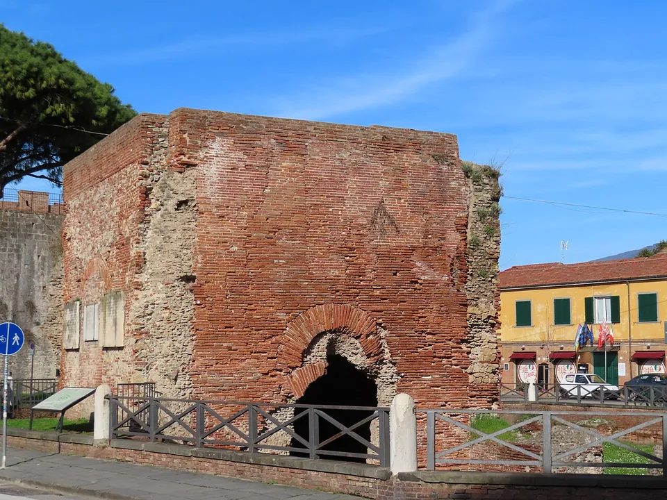
  49. A square block of red brick ruin with a dark arched opening at its base, standing inside a wooden-railed enclosure beside a paved street, an information board at the railing, an old brick wall behind it on the left and yellow-fronted houses on the right.

    Photo: Superchilum · CC BY-SA 4.0 · Commons

    bath · Tuscany

    Baths of Nero

    The piece that stands is the laconicum, the room for hot-air bathing: square on the outside and octagonal inside, it keeps its four brick outer walls (Comune di Pisa).

    Show on map: Baths of Nero
    1st – 3rd c. ADFree
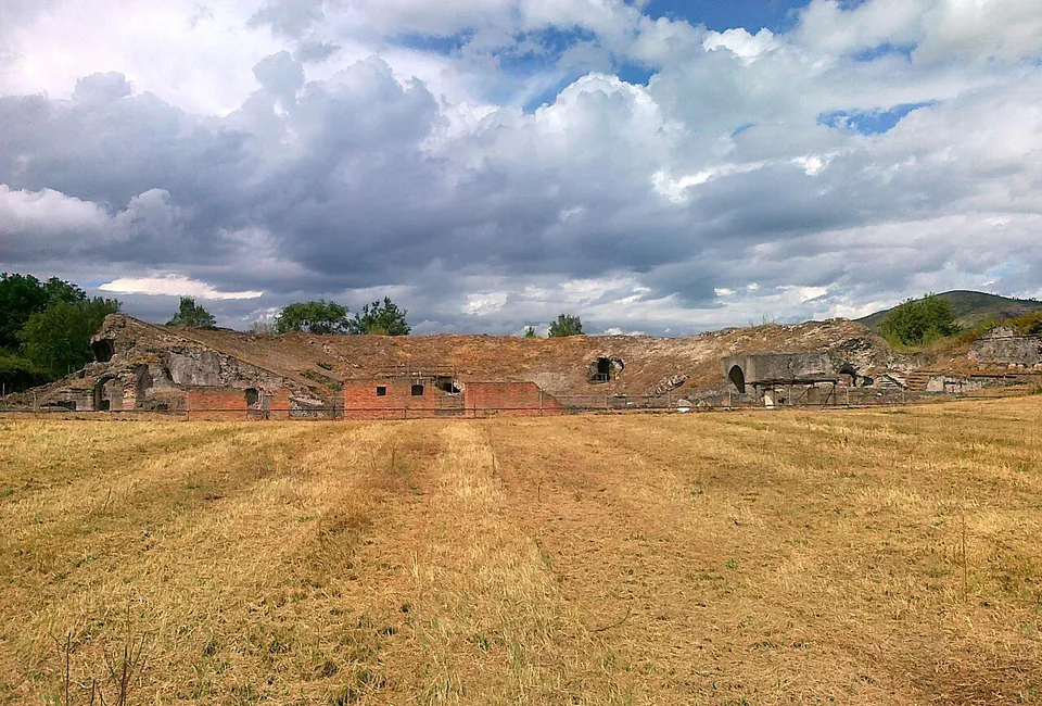
  50. A long, low ruin of rubble masonry with a row of dark arched openings and patches of red brick, seen across a wide field of mown, straw-coloured grass under a cloudy sky.

    Photo: PietroCifone · CC BY-SA 3.0 · Commons

    city · Campania

    Cales

    The ancient town survives across its whole extent, though the motorway runs through it, and the Ministry of Culture says plainly that its remains are not easy to read on the ground (cultura.gov.it).

    Show on map: Cales
    4th c. BC – 7th c. ADRestricted access
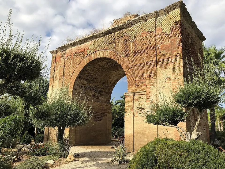
  51. A tall single arch built of small orange-brown bricks, its piers and upper edge worn and patched, standing in a planted garden with young olive trees and palms, a gravel path running through the opening.

    Photo: Davide Mauro · CC BY-SA 4.0 · Commons

    city · Apulia

    Canusium

    The temple of Jupiter "Toro" stands in the town centre, on Via Imbriani.

    Show on map: Canusium
    4th c. BC – 7th c. ADRestricted access
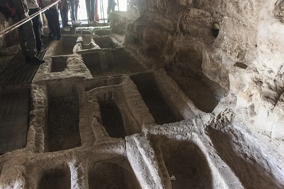
  52. Inside a rock-cut burial chamber, the floor is cut into rows of rectangular grave trenches separated by narrow ridges of stone, with a timber walkway and a rope barrier along one side and visitors' legs visible at the top.

    Photo: Davide Mauro · CC BY-SA 4.0 · Commons

    necropolis · Sicily

    Cava d’Ispica

    The ticketed archaeological area lies at the Modica end of the gorge.

    Show on map: Cava d’Ispica
    3rd – 7th c. ADTicketed
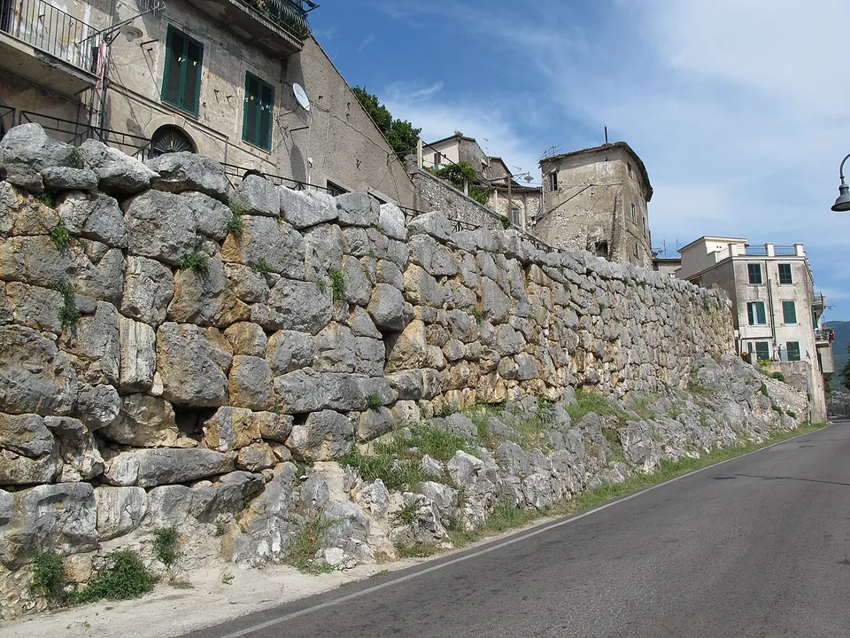
  53. A long wall of large, irregular grey limestone blocks fitted together runs beside an asphalt road, with houses and balconies built on top of it.

    Photo: pietro scerrato · CC BY 3.0 · Commons

    city · Lazio

    Cora – Cori

    The walls are what the whole town shares.

    Show on map: Cora – Cori
    8th c. BC – 7th c. ADFree
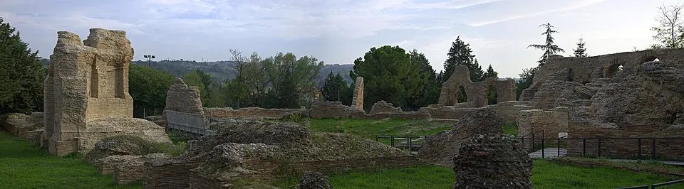
  54. A wide panorama across mown grass scattered with low brick and stone ruins, a tall pier of masonry standing on the left and a long ruined wall with arched openings on the right, with trees and hills behind.

    Photo: Maxmar69 · CC BY-SA 3.0 · Commons

    theatre · Marche

    Helvia Recina

    The theatre is the only well-preserved part of the town above ground (en.wikipedia).

    Show on map: Helvia Recina
    2nd c. BC – 7th c. ADFree
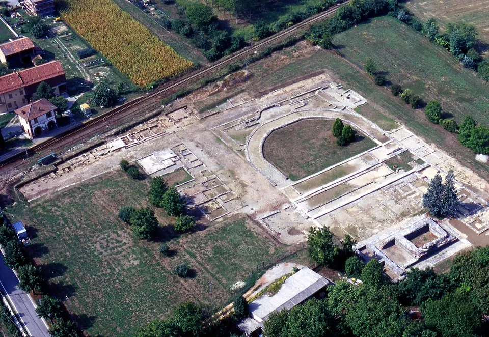
  55. An aerial view of a large excavated rectangle of pale ground among fields and trees, laid out with low wall lines; in the middle a horseshoe-shaped enclosure with a lawn inside and, beside it, a rectangular walled structure, with a railway line and houses at the upper left.

    Photo: Soprintendenza per i Beni Archeologici del Piemonte e del Museo Antichità Egizie · CC BY-SA 3.0 · Commons

    city · Piedmont

    Industria

    The archaeological area covers 2.65 hectares (the Soprintendenza), of which about 1.5 hectares has been excavated, roughly a tenth of the ancient town (it.wikipedia).

    Show on map: Industria
    2nd c. BC – 4th c. ADRestricted access
  56. The curving stone wall round the arena, with large fallen blocks lying on the dry grass of the arena floor and ruined masonry on the slope above.

    Photo: Vicoduomo at English Wikipedia · Public domain · Commons

    amphitheatre · Molise

    Larinum

    The amphitheatre is the main sight.

    Show on map: Larinum
    3rd c. BC – 7th c. ADFree
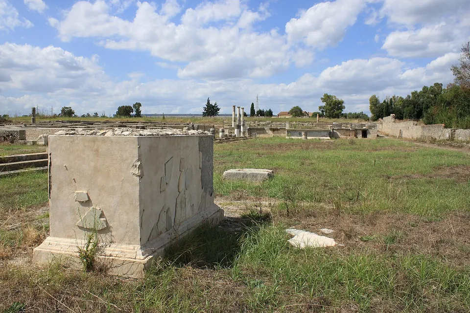
  57. A large rectangular stone pedestal on a moulded plinth, with a few fragments of its marble facing set back onto its sides, stands in rough grass; behind it low walls, a few standing columns and a long boundary wall stretch across a flat, open site under a cloudy sky.

    Photo: Rossignol Benoît · CC BY-SA 4.0 · Commons

    city · Lazio

    Lucus Feroniae

    The forum is the centre of the visit: a long rectangular square with a colonnaded portico down its western side, where the shops opened, some of them paved with mosaics and some marked at the door with a sign of the trade inside (en.wikipedia; it.wikipedia).

    Show on map: Lucus Feroniae
    6th c. BC – 5th c. ADFree
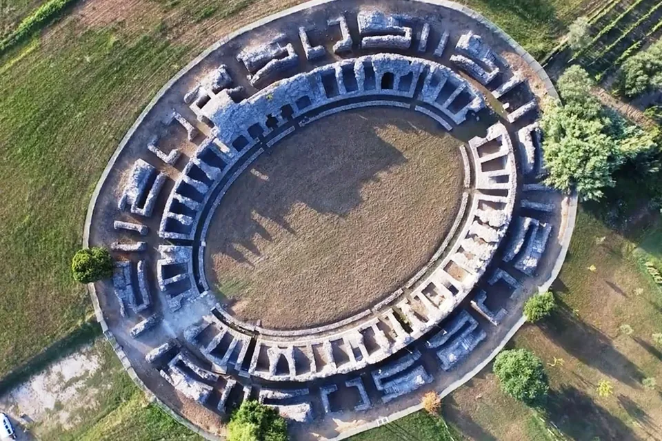
  58. An aerial view of an oval amphitheatre, its arena of bare earth ringed by the stubs of stone walls that divide the seating into rows of small chambers, set in mown grass with trees around it and a path running past one end.

    Photo: Roccella~frwiki · CC BY-SA 4.0 · Commons

    city · Liguria

    Luna

    The archaeological area covers almost the whole of the Roman town, and the operator suggests allowing about two hours (the operator).

    Show on map: Luna
    2nd c. BC – 7th c. ADTicketed
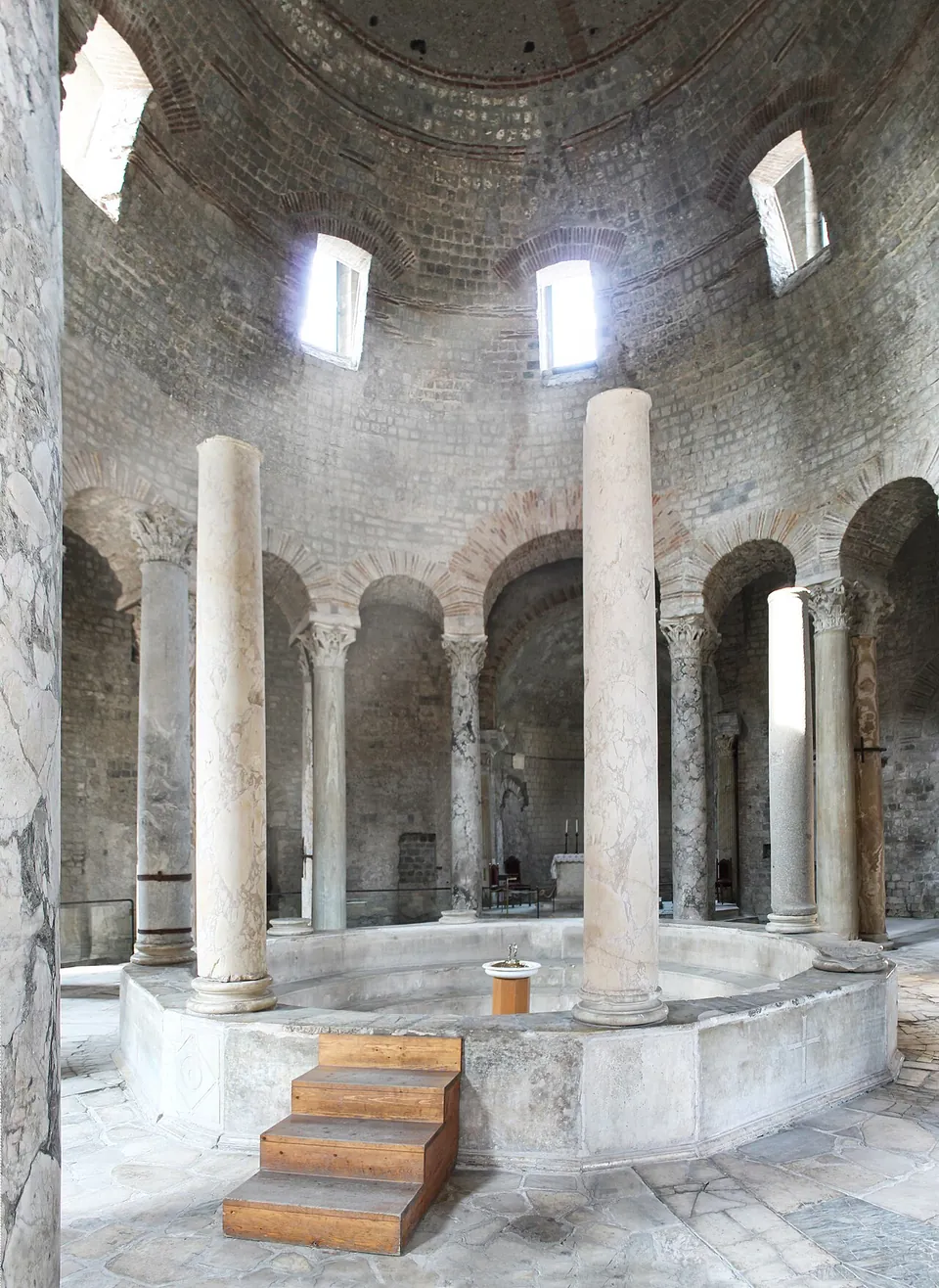
  59. Inside a domed round hall, a wide circular font with a low marble rim and wooden steps up to it, ringed by tall plain columns, with paired columns and arches opening onto an ambulatory behind and round-headed windows high in the dome.

    Photo: Nucerino · CC BY-SA 4.0 · Commons

    city · Campania

    Nuceria Alfaterna

    The baptistery of Santa Maria Maggiore ("La Rotonda") is the set piece.

    Show on map: Nuceria Alfaterna
    4th c. BC – 7th c. ADRestricted access
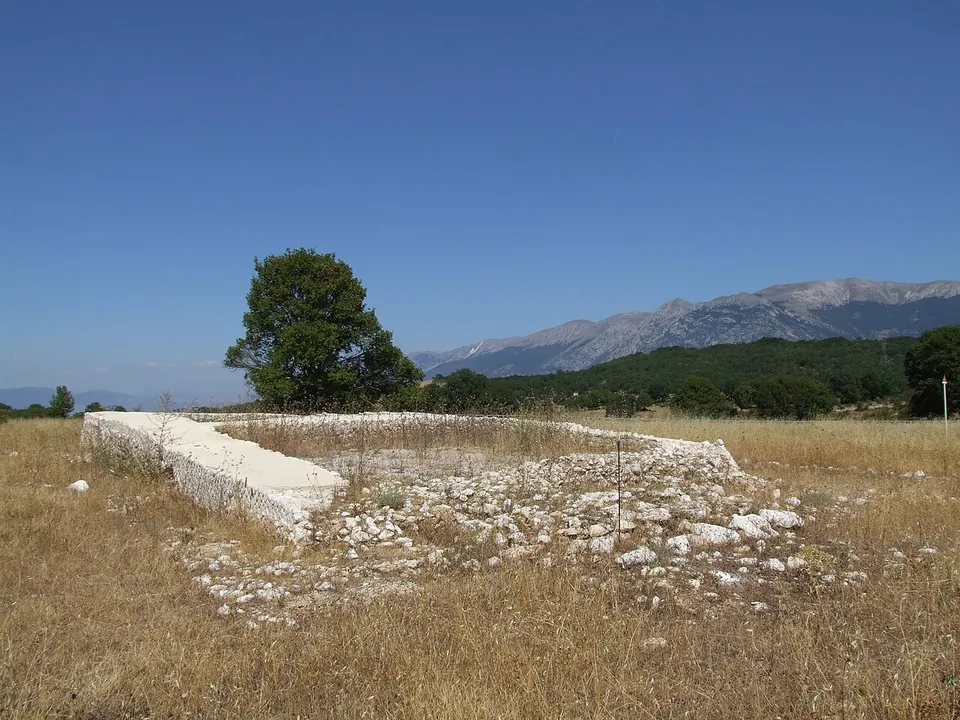
  60. A rectangle of low, pale stone walls in dry summer grass, one end raised slightly higher than the rest, with a tree behind and a long mountain ridge on the horizon.

    Photo: Pasquale Di Giannantonio · Public domain · Commons

    sanctuary · Abruzzo

    Ocriticum

    The excavated sanctuary is a walled sacred precinct on two terraces (Ministry of Culture).

    Show on map: Ocriticum
    4th c. BC – 6th c. ADUnknown
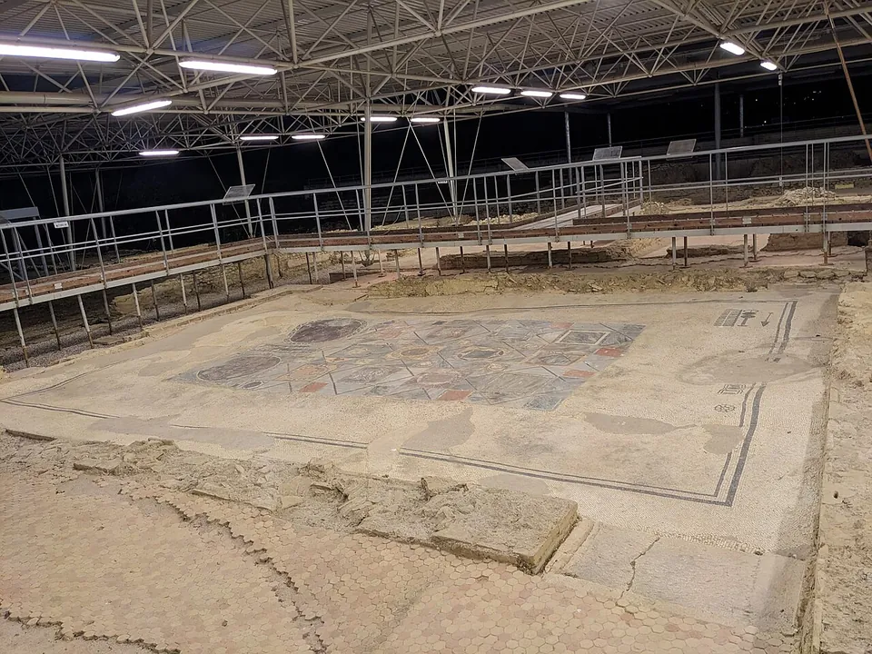
  61. A large room floor under a metal roof lit by strip lights, paved in pale mosaic with a dark border and a coloured inlaid panel in its centre, with low stone walls around it and metal-railed walkways running above.

    Photo: Accurimbono · CC BY-SA 4.0 · Commons

    town house · Marche

    Parco Archeologico di Suasa

    The house is big — about 105 by 34 m, some 3,500 m² (the operator; it.wikipedia) — and is presented in the open air, much of it under a modern roof, with raised walkways that let you look down into the rooms (it.wikipedia; en.wikipedia).

    Show on map: Parco Archeologico di Suasa
    1st c. BC – 6th c. ADTicketed
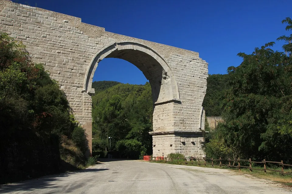
  62. A single tall round arch of pale squared stone blocks, ending in a broken edge on the right, spanning a gravel road with a wooden fence along one side and wooded hills behind.

    Photo: ImagoAnimae · CC BY-SA 3.0 · Commons

    bridge · Umbria

    Ponte d'Augusto (Narni)

    The first arch, at the southern end, stands complete.

    Show on map: Ponte d'Augusto (Narni)
    1st c. BC – 7th c. ADFree
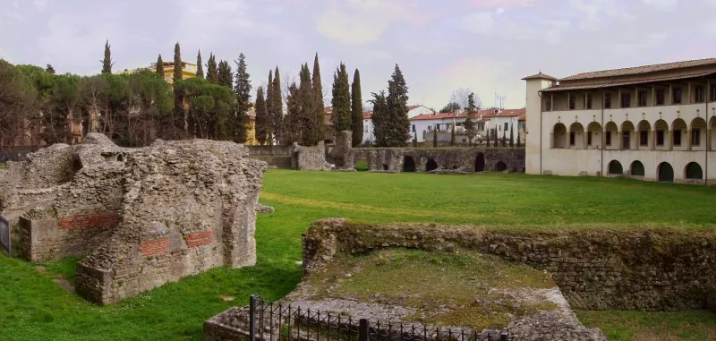
  63. Rough masses of Roman masonry with bands of red brick rising from the grass in the foreground, the open lawn of the arena beyond, and the arcaded museum building and a line of cypresses behind.

    Photo: Francesco Mulas (Fmulas at it.wikipedia) · CC BY 3.0 · Commons

    amphitheatre · Tuscany

    Roman Amphitheatre of Arezzo

    Do not expect a standing arena.

    Show on map: Roman Amphitheatre of Arezzo
    2nd – 3rd c. ADTicketed
  64. Low ruined walls and floor levels under a long metal-framed canopy, crossed by a wooden walkway with railings, with a row of square brick-red pillars and a lawn beyond.

    Photo: Imiimane · CC BY-SA 3.0 · Commons

    villa · Lombardy

    Roman villa of Desenzano del Garda

    The excavated villa covers about one hectare, with residential wings and working quarters side by side (the operator).

    Show on map: Roman villa of Desenzano del Garda
    1st c. BC – 4th c. ADTicketed
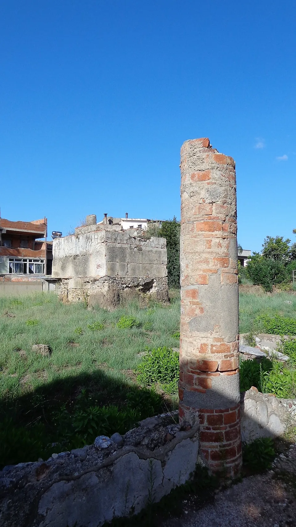
  65. A single column built of curved bricks rising from low stone walls, with grass around it, a squared block of masonry behind and modern houses at the edge of the site under a blue sky.

    Photo: Effems · CC BY-SA 4.0 · Commons

    villa · Sicily

    Roman villa of San Biagio

    The house was laid out on a square plan around a courtyard with a portico of eight columns a side, the peristyle (it.wikipedia, de.wikipedia).

    Show on map: Roman villa of San Biagio
    1st c. BC – 7th c. ADFree
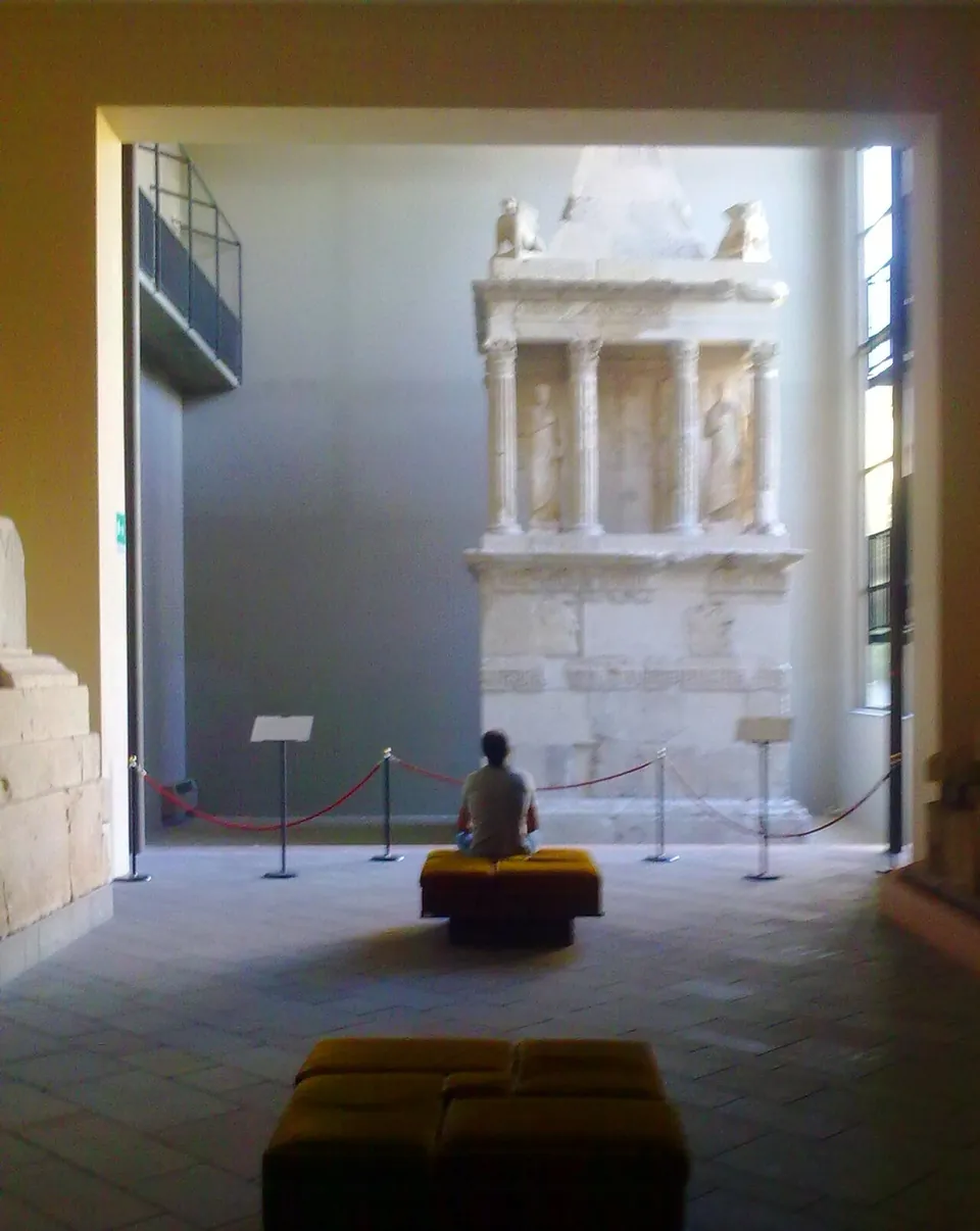
  66. A tall pale stone funerary monument against the end wall of a high museum hall, with a square base, an open storey of columns with statues between them and a pointed roof; a visitor sits on a bench in front of it behind a rope barrier.

    Photo: Uomodis08 · CC BY 3.0 · Commons

    city · Emilia-Romagna

    Sarsina

    In the town itself the Roman remains are modest.

    Show on map: Sarsina
    3rd c. BC – 7th c. ADTicketed
  67. Two plain stone columns standing in mown grass beside the low foundations of walls, with a red-roofed shelter over excavated remains behind them and wooded hills beyond.

    Photo: FAM1885 · CC BY-SA 4.0 · Commons

    city · Marche

    Sentinum

    The park has two areas, Civita and Santa Lucia, either side of the provincial road to Fabriano and joined by a walkway (the operator).

    Show on map: Sentinum
    3rd c. BC – 7th c. ADTicketed
  68. Low brick walls of excavated rooms in the grass, one curving in a semicircle, with a wooden canopy on posts sheltering more walls behind, and apartment blocks above the trees.

    Photo: Cats' photos · CC BY-SA 4.0 · Commons

    city · Abruzzo

    Teate

    Four groups of remains, all on the hill of the old town, none of them a self-contained ruin field: the Romans' town lies under the modern one, and you meet it street by street.

    Show on map: Teate
    2nd c. BC – 6th c. ADTicketed
  69. The semicircular seating of a small theatre in pale limestone rubble, rows of steps curving round a flat orchestra, with the plain, a town and a mountain range far below and beyond.

    Photo: Gianfranco Vitolo from Sarno (Sa), Italia · CC BY-SA 2.0 · Commons

    theatre · Campania

    Temple and Theatre of San Nicola

    The theatre is what you see.

    Show on map: Temple and Theatre of San Nicola
    2nd c. BC – 7th c. ADUnknown
  70. Low stepped courses of large squared stone blocks form a platform in an excavation area, with loose blocks and black protective sheeting on the ground in front and an overgrown ruined house and wooded hillside behind.

    Photo: Livioandronico2013 · CC BY-SA 4.0 · Commons

    temple · Lazio

    Temple of Diana at Nemi

    The sanctuary stood on a hillside terrace of 200 by 175 m below the modern village of Nemi, held up on the downhill side by triangular substructures and on the uphill side by a massive wall of semicircular niches that probably held statues (en.wikipedia).

    Show on map: Temple of Diana at Nemi
    3rd c. BC – 7th c. ADRestricted access
  71. Under a translucent roof on steel posts, a raised rectangular platform of rubble-stone walls with a gravelled top, a rusted metal plate set into its face, and exposed rock strata behind.

    Photo: Syrio · CC BY-SA 4.0 · Commons

    temple · Veneto

    Temple of Minerva (Marano di Valpolicella)

    What you see are the remains of the temple rebuilt in the Augustan age: the walls of its four-sided central chamber (the cella) and of the galleries that ran round it, under a modern shelter roof set against the rock face of the hill (the operator).

    Show on map: Temple of Minerva (Marano di Valpolicella)
    2nd c. BC – 4th c. ADFree
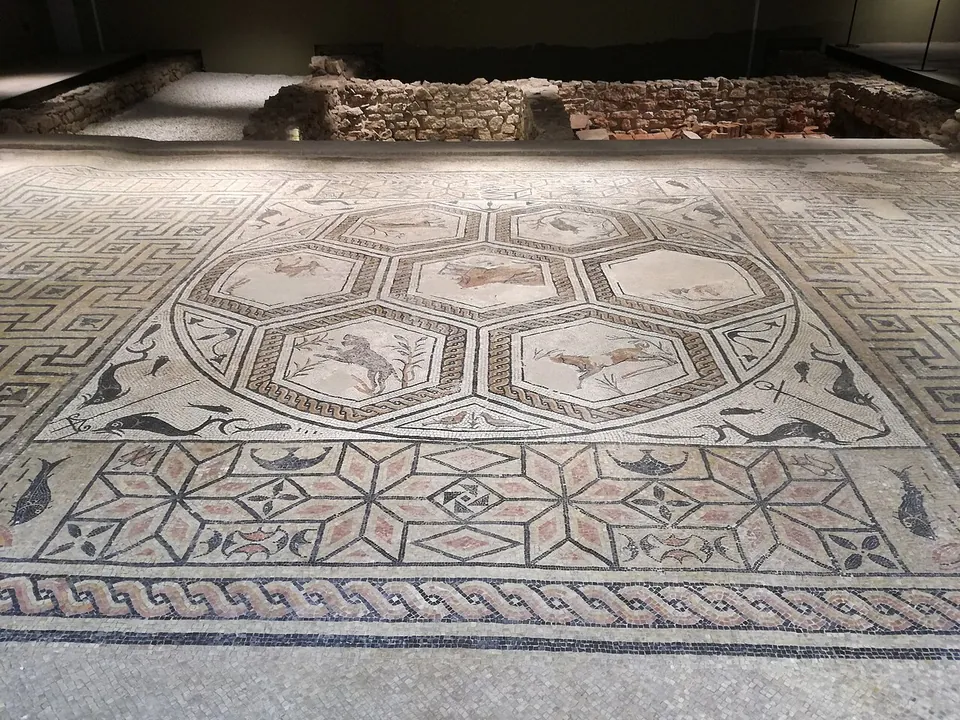
  72. A large mosaic floor under low lighting, its centre a ring of hexagonal panels showing running animals, with dolphins in the corners, a band of eight-pointed stars below and a twisted-rope border, and low stone walls behind it.

    Photo: Robertk9410 · CC0 · Commons

    city · Trentino-Alto Adige/Südtirol

    Trident(i)um – Trento

    The Spazio Archeologico Sotterraneo del Sas (S.A.S.S.) is the core of the visit: about 1,700 m² of the Roman town uncovered when the Teatro Sociale was restored and enlarged in 1990–2000.

    Show on map: Trident(i)um – Trento
    1st c. BC – 7th c. ADTicketed
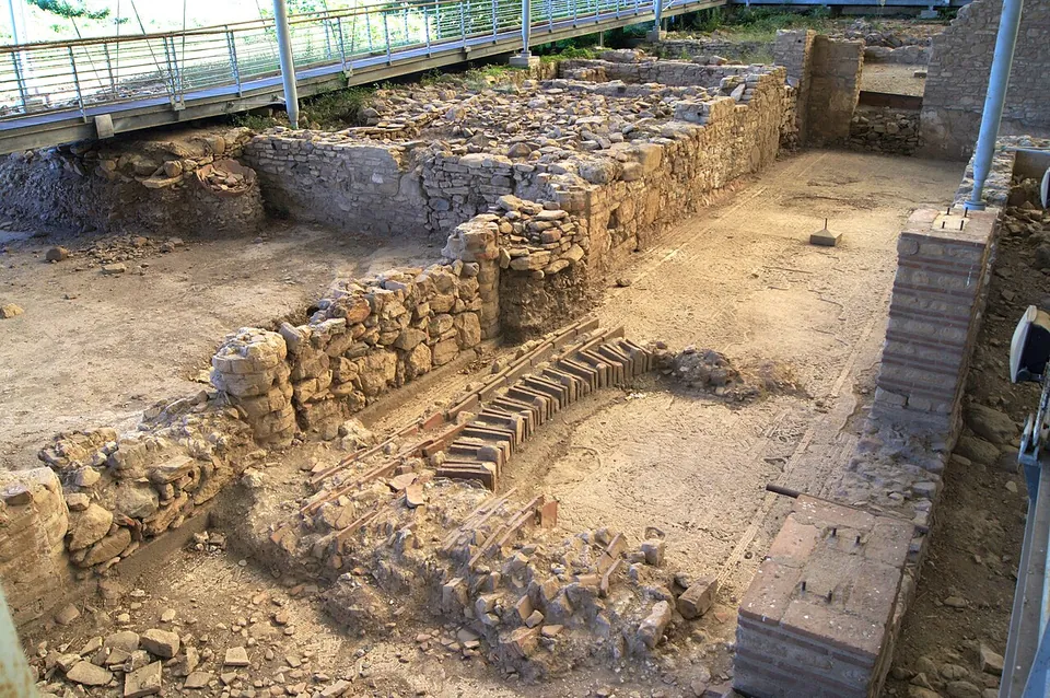
  73. Low walls of squared grey stone and red brick divide a sandy floor into small rooms beneath a metal shelter held up on steel posts.

    Photo: Donatella Chiapponi · CC BY-SA 4.0 · Commons

    villa · Liguria

    Varignano Roman Villa

    The excavations lie under long metal roofs in a small valley running down to the cove.

    Show on map: Varignano Roman Villa
    1st c. BC – 5th c. ADTicketed
  74. A street paved with large flat stones runs past rows of low walls of rough grey stone, one to three courses high, set into a grassy slope with bare trees and a fence above.

    Photo: Gabriele Delhey · CC BY-SA 3.0 · Commons

    city · Tuscany

    Vetulonia

    The archaeological park is free and split into several areas (the operator).

    Show on map: Vetulonia
    3rd – 1st c. BCFree
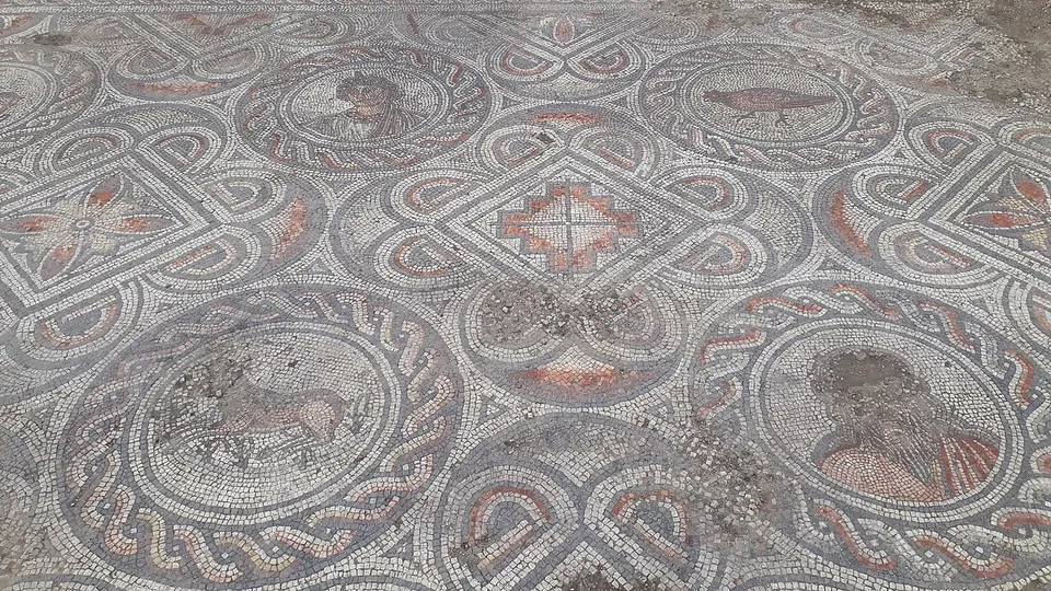
  75. A mosaic floor of interlaced grey, white and red bands forming circles and squares; the circles hold small pictures, among them a bird and a bearded head, and the squares hold red geometric stars.

    Photo: Piergiovanna Grossi · CC BY-SA 4.0 · Commons

    villa · Veneto

    Villa dei Mosaici

    The villa has been brought to light almost entirely (it.wikipedia).

    Show on map: Villa dei Mosaici
    4th – 8th c. ADRestricted access
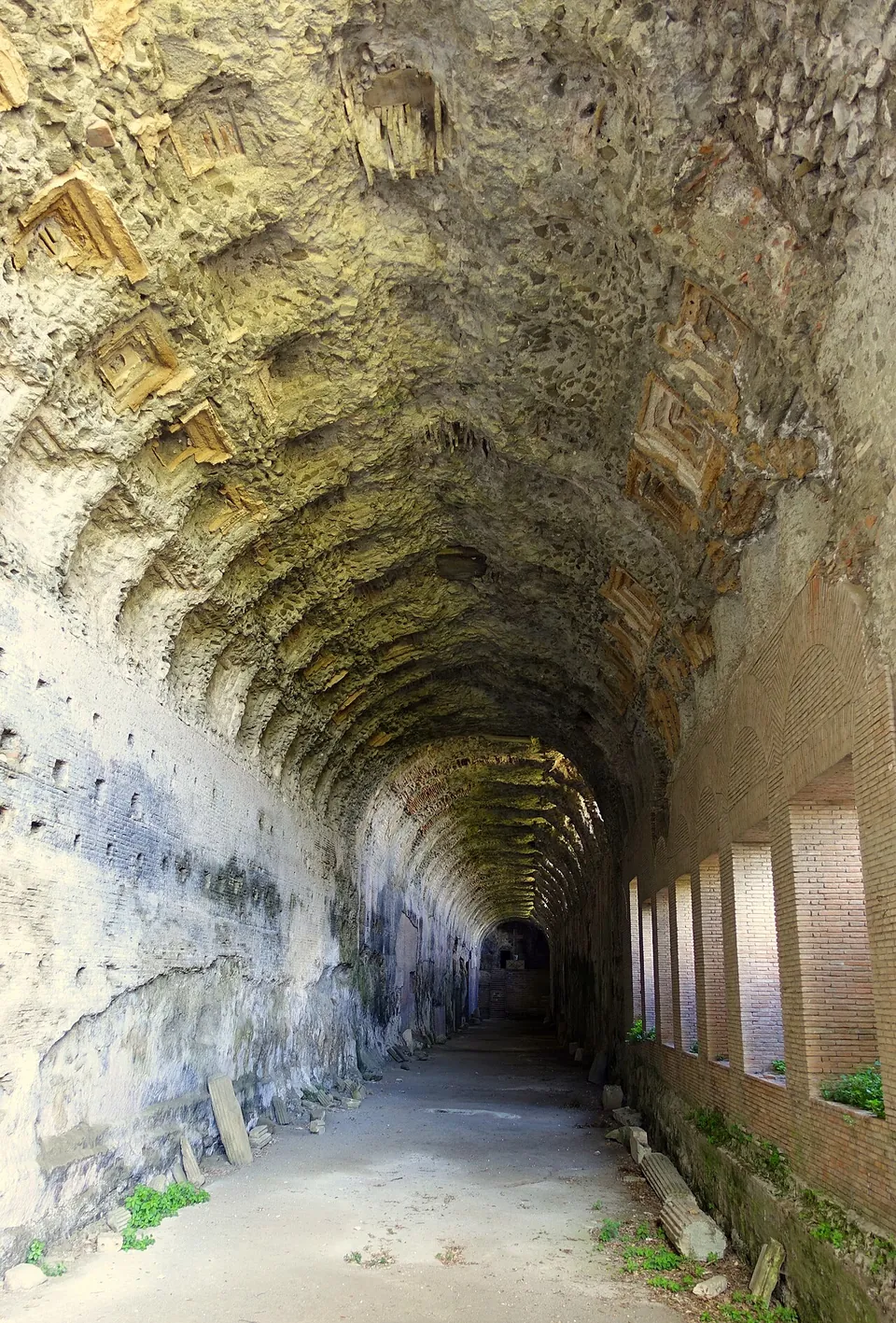
  76. A long barrel-vaulted corridor of pale stone running into the distance. The vault is patterned with weathered square coffers, and a row of tall rectangular windows lets light in along the right-hand wall.

    Photo: Daderot · Public domain · Commons

    villa · Lazio

    Villa of Domitian

    Most of the remains lie inside the Pontifical Villas, an extraterritorial property of the Holy See.

    Show on map: Villa of Domitian
    1st – 3rd c. ADRestricted access
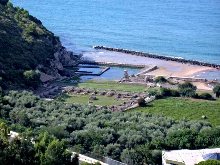
  77. Seen from the hillside above, the low walls of rows of rooms laid out across green terraces run down to the shore, where rectangular stone-edged pools of seawater sit beside a beach and a breakwater at the foot of a wooded cliff, with trees in the foreground.

    Photo: MM · Public domain · Commons

    villa · Lazio

    Villa of Tiberius (Sperlonga)

    Two things, on one ticket.

    Show on map: Villa of Tiberius (Sperlonga)
    1st c. BC – 3rd c. ADTicketed
  78. Excavated rooms of the villa seen from above, low walls of rough stone and brick around bare earth floors, a squared brick pier in the foreground and a raised metal walkway with railings running along the far side under the roof.

    Photo: Rjdeadly · CC BY-SA 4.0 · Commons

    villa · Sicily

    Villa Romana di Patti

    The explored part is the centre of the house: a courtyard surrounded by a portico (the peristyle), with the living rooms around it (it.wikipedia).

    Show on map: Villa Romana di Patti
    1st c. BC – 7th c. ADTicketed
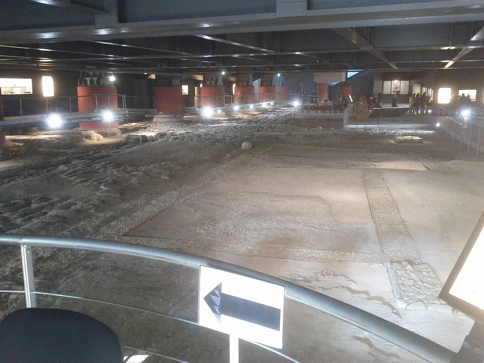
  79. A long, low underground hall under a steel ceiling, seen over a railing from the entrance walkway. Smooth pale floor surfaces divided by narrow borders fill the foreground, a band of rough stone paving runs along the left, and walkways lit by spotlights edge the hall past red-painted pillars and lit display cases.

    Photo: Accurimbono · CC BY-SA 3.0 · Commons

    city · Marche

    Area archeologica la Fenice

    You walk a few metres below today's street level, on walkways over the excavated ground.

    Show on map: Area archeologica la Fenice
    2nd c. BC – 3rd c. ADFree
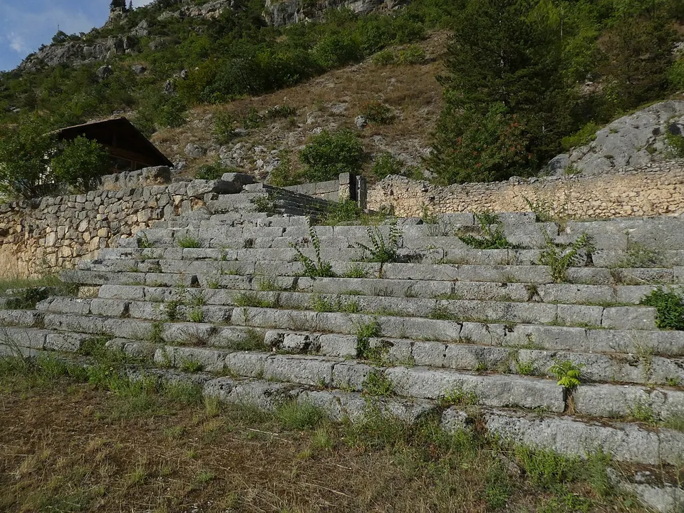
  80. A broad flight of grey stone steps, many treads wide, climbing a grassy slope to a wall of mortared stone, with a small tiled-roof hut and a wooded, rocky mountainside above.

    Photo: Syrio · CC BY-SA 4.0 · Commons

    sanctuary · Abruzzo

    Shrine of Hercules Curinus

    The sanctuary stood on artificial terraces that step down the mountainside (the Ministry).

    Show on map: Shrine of Hercules Curinus
    4th c. BC – 2nd c. ADUnknown
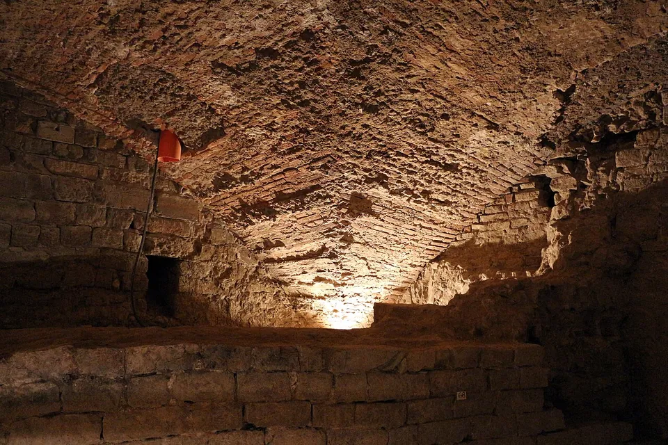
  81. A low underground chamber under a rough brick barrel vault, lit from below, with a ledge of squared stone blocks running along the floor in front of it.

    Photo: Sailko · CC BY 3.0 · Commons

    city · Tuscany

    Florentia – Florence

    The theatre is the one place where Roman structures can be seen where they were built.

    Show on map: Florentia – Florence
    1st c. BC – 7th c. ADTicketed