

What is there today
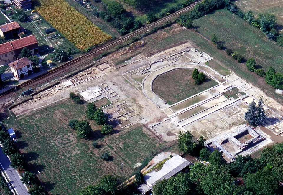
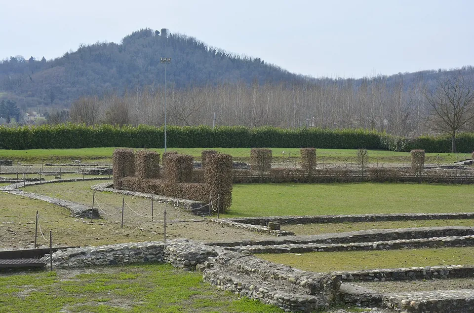
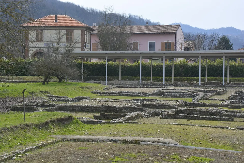
The archaeological area covers 2.65 hectares (the Soprintendenza), of which about 1.5 hectares has been excavated, roughly a tenth of the ancient town (it.wikipedia). Everything is at ground level: the houses, shops and temples survive as foundations, and of the temple that was probably the town’s Capitolium only the podium remains (it.wikipedia).
Two streets cross in the site and flank the main sacred area of the town. It comprises a large semicircular open space, once surrounded by porticoes, closed at one end by a monumental exedra flanked by two small temples and facing, at the other, the high podium of a temple with a monumental stair (the Soprintendenza). The forum square it must have been linked to is still buried under private land. Along the streets are parts of the blocks that fronted the crossing: houses, some of them with rich floors, and shops (the Soprintendenza). At the north edge of the ancient town stand the ruins of the medieval parish church of San Giovanni di Dustria (the Soprintendenza; OpenStreetMap maps them about 270 m from the excavations).
The finds are not here. The bronzes from the sanctuary, among them statuettes of Isis-Fortuna, a sistrum, small bulls offered to Serapis and a silenus attributed to a Hellenistic workshop of Pergamon, are displayed in the Museo di Antichità in Turin (it.wikipedia).
Is it worth the trip?
For most travellers, only if you are already in the area and have booked. What is on the ground is a plan in low stone walls rather than standing buildings, and the remains are fragile and weathered (it.wikipedia). The sanctuary is the reason to come: the Ministry of Culture singles it out as the feature that distinguishes Industria from the other Roman towns of Piedmont and northern Italy, and the horseshoe of its precinct stands out in the excavated plan. The bronzes in Turin are the other half of the story and worth pairing with a visit.
It is a quiet place: it.wikipedia records 2,989 visitors in 2016. It opens three days a week, and only by booking.
Getting there
The site is on Corso Industria at Monteu da Po, near where the Dora Baltea joins the Po, about 11 km in a straight line from Chivasso. The river has since moved well away from the ancient town (the Soprintendenza). The railway halt beside it is disused; the nearest public transport is the Monteu Da Po (Bivio) bus stop, about 200 m away (OpenStreetMap). No car park is mapped.
The Ministry of Culture lists the site as open on Thursday, Saturday and Sunday, 10.00–17.00, with booking required on 379 1592724; other openings can be arranged on request, and extra days are announced for some public holidays. No price is published for ordinary visits. The guided visits for Ferragosto 2025, led by volunteers of the Associazione Culturale Athena, were free on booking. These details come from the Ministry’s pages as archived in 2025; the live site could not be reached in October 2026, so confirm when you book.
Visiting details
- Opening hours
- Thursday, Saturday and Sunday 10.00–17.00, by booking only (tel. 379 1592724); further openings can be arranged on request. Closed Monday, Tuesday, Wednesday and Friday. Extra openings are announced for some public holidays.
- Tickets
- No tariff is published for the regular openings. For the Ferragosto 2025 opening the Ministry of Culture described the guided visits, led by volunteers of the Associazione Culturale Athena, as free on booking.
- Parking
- No car park is mapped at the site. The address is Corso Industria, Monteu da Po.
Before you go
- Booking is required for every visit (tel. 379 1592724).
- The railway halt next to the site, Monteu da Po on the Asti–Chivasso line, is disused; the nearest public transport is the Monteu Da Po (Bivio) bus stop, about 200 m away.
Hours and prices checked 15 December 2025 on the operator's own site. Confirm before travelling.
History
The Roman town grew up beside a Celto-Ligurian village mentioned by Pliny the Elder, Bodincomagus, a name it.wikipedia renders as “market place on the river Po”. It was probably founded in 124–123 BC, one of a series of colonies in the Monferrato promoted by the consul Marcus Fulvius Flaccus (it.wikipedia); the Soprintendenza puts the legal foundation at the end of the 2nd century BC and the regularly planned town in the Augustan age. It lay in the ninth Augustan region of Italy, Liguria.
Its wealth came from the river. Barges loaded with stone from the Alps called here, and the town traded the products of the Aosta Valley’s mines; families of merchants, the Avilii and the Lollii among them, are recorded in its inscriptions, and there were metal workshops (it.wikipedia; the Soprintendenza). The cult of Isis arrived with those merchants and their workforce of Greek origin (it.wikipedia). From the second half of the 1st century AD the centre was dominated by a temple that was probably the Capitolium, long taken for a temple of Isis; early in the 2nd century the sacred area was enlarged with the great semicircular temple, the Serapeion, dedicated to Serapis and perhaps also to Isis and Harpocrates (it.wikipedia).
The town was lived in without a break until the end of the 4th century AD. As a Christian community formed, the pagan sanctuary was abandoned, looted and partly destroyed. The town shrank between the 4th and the end of the 5th century, but traces of houses and burials, among them a Lombard tomb of the early 7th century, show people living here into the early Middle Ages (it.wikipedia). Its name survived in the parish church of Dustria, and in the later Middle Ages the settlement moved to the nearby hill and became Monteu da Po.
The site was identified in 1745 from a bronze plaque found near Monteu da Po, a dedication by the town’s college of priests of Isis, the pastophori. Count Bernardino Morra di Lauriano dug here in the early 19th century and made the first plan, taking the semicircular building for a theatre; it was looted through the 19th century, and excavations by the University of Turin in 1961–1963 recognised the building as a temple of the Egyptian cults (it.wikipedia; the Soprintendenza).
Nearby
Photo: rene boulay · CC BY-SA 3.0 · Commons
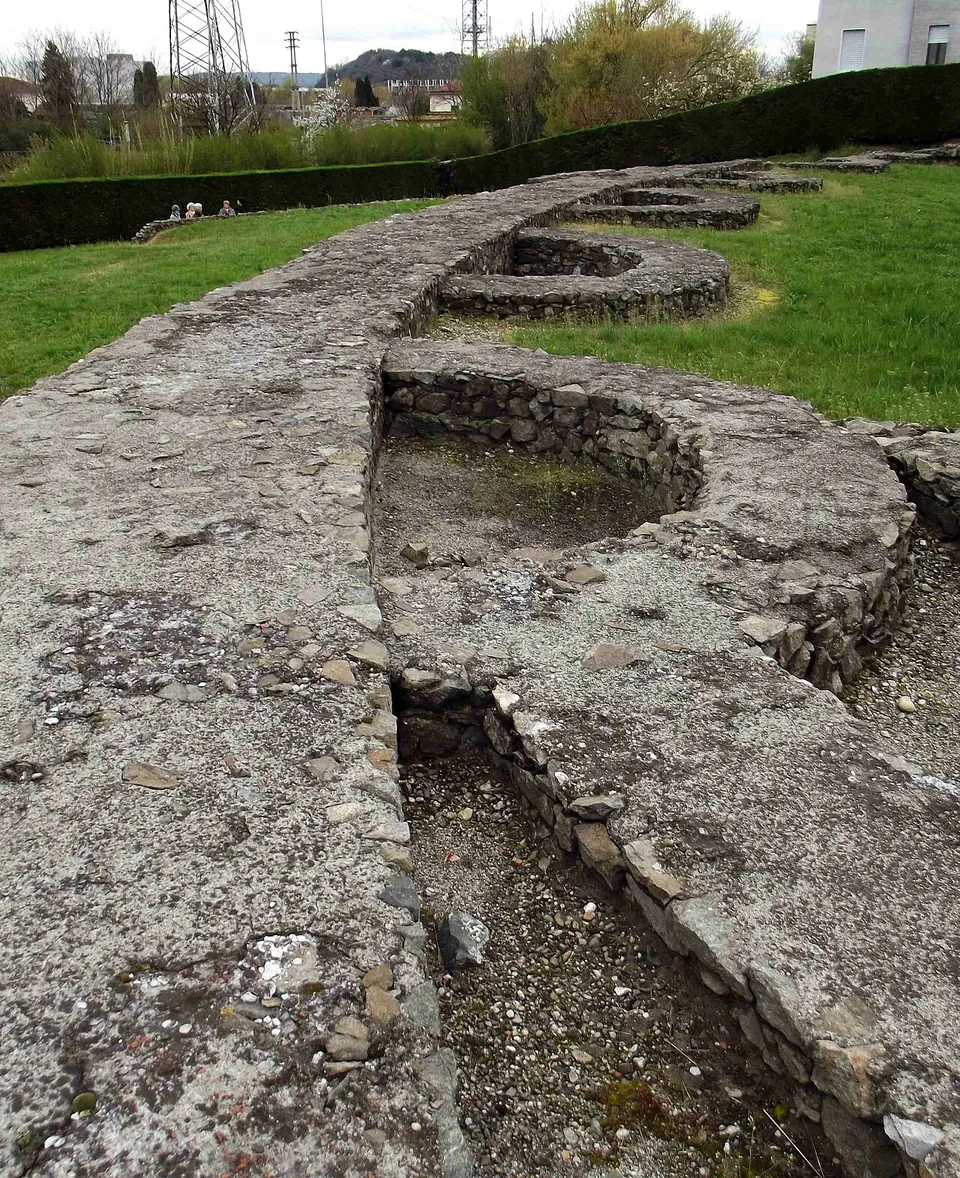
Photo: F Ceragioli · CC BY-SA 3.0 · Commons
36 km · amphitheatre · Piedmont
Roman Amphitheatre of Ivrea
What you see is the plan of the building rather than the building.
Photo: F Ceragioli · CC BY-SA 3.0 · Commons
36 km · city · Piedmont
Eporedia – Ivrea
The amphitheatre is the one Roman monument you can stand in front of.


Straight-line distances.
Sources
Every fact on this page comes from the records below, each used under the licence noted.