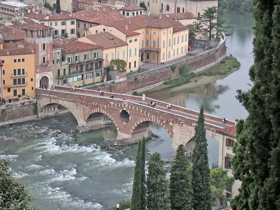
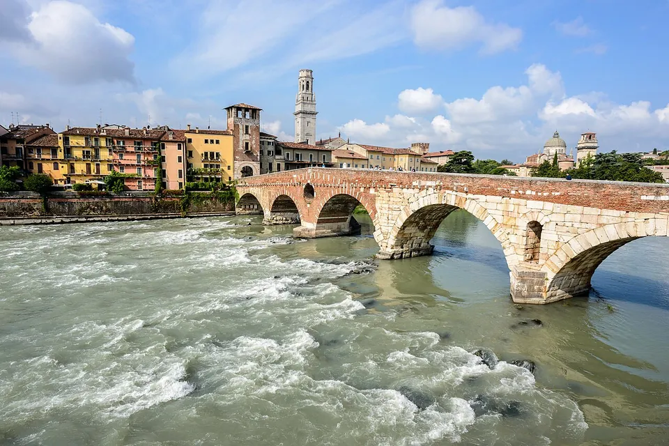


The Ponte Pietra is the one Roman bridge left in Verona: five arches over the Adige between the old town and the Roman Theatre, two of them Roman and the rest rebuilt in 1298 and 1520–1521 (it.wikipedia). German troops blew it up in 1945, and all but one arch was put back together in 1957–1959, largely from its own stones recovered from the river. It is free, open at all hours and 130 m from the Roman Theatre, so it belongs on any walk to the theatre; it is not a reason to travel on its own.
What is there today
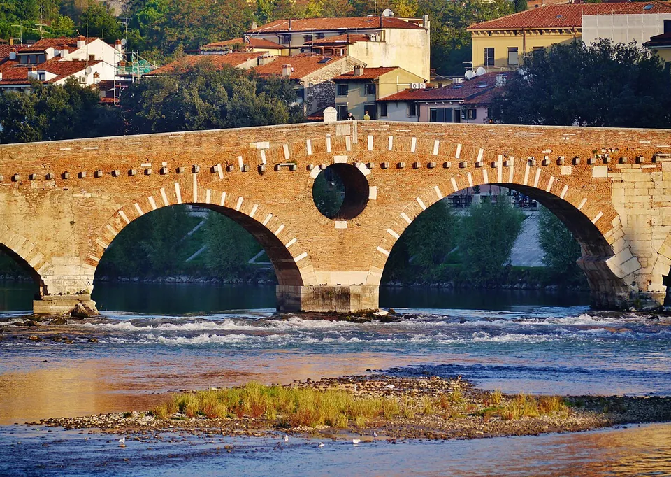
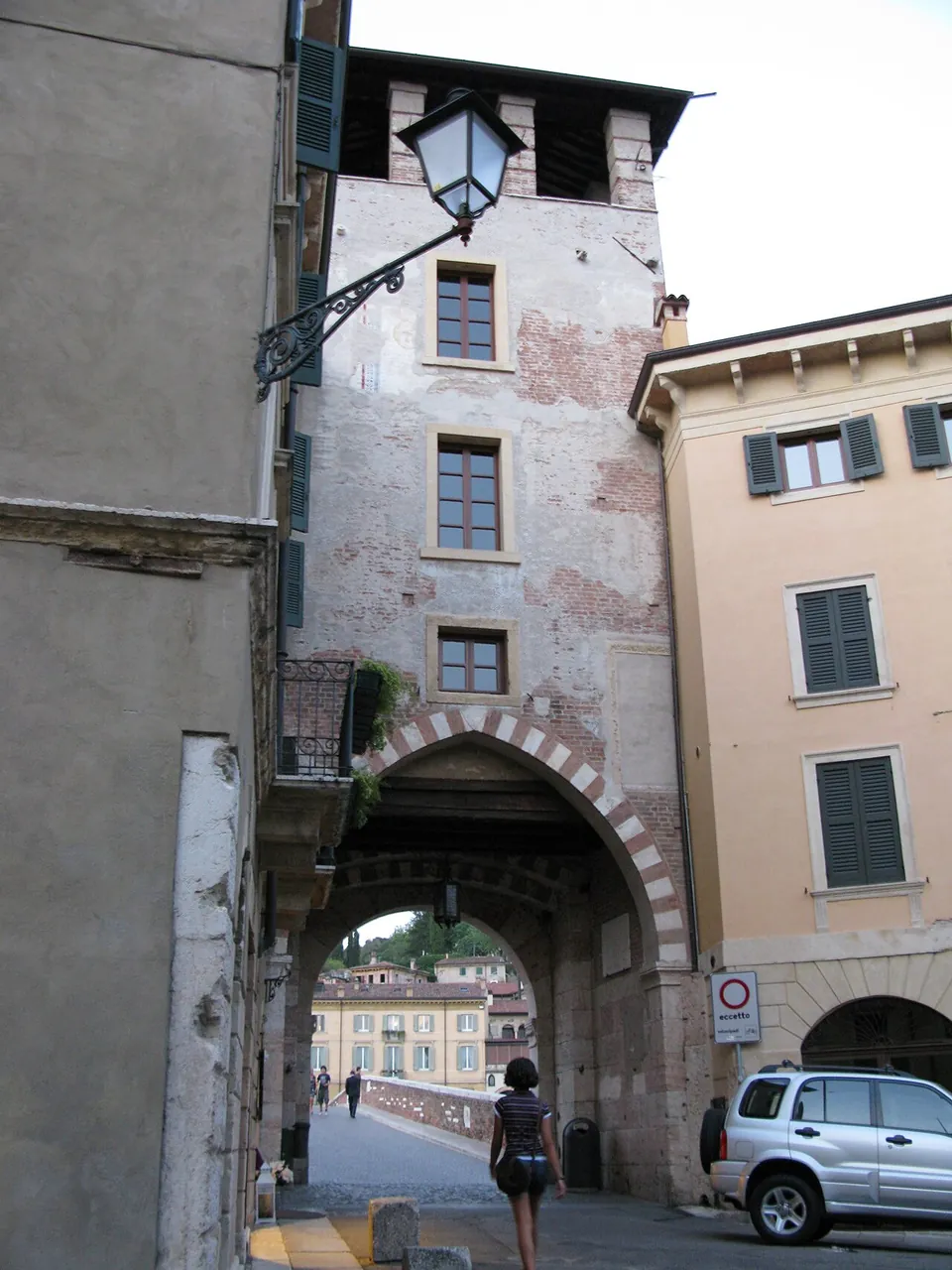
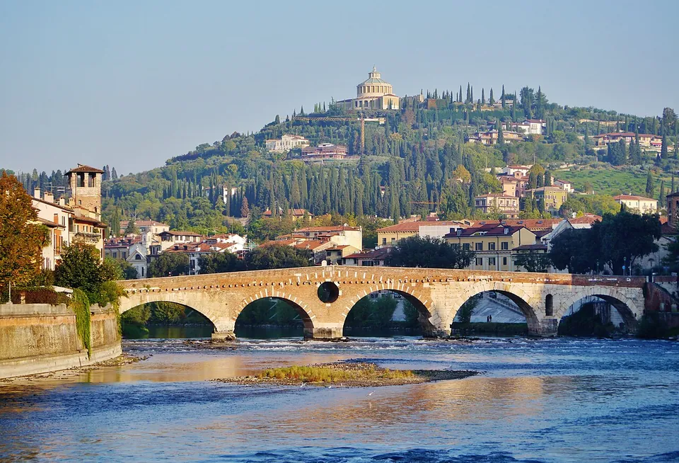
A footbridge about 93 to 95 m long on five arches (it.wikipedia; fr.wikipedia), and you read its history from the materials. The two arches on the theatre side, and the pier between them, are the Roman bridge: large blocks of pale stone laid without mortar, with an arched opening in the pier to let floodwater through (it.wikipedia; ArcheoVeneto). A keystone of these arches carries the relief of a naked male figure, perhaps a water god, dated to the 2nd or 3rd century AD and taken as a sign of a probable repair under the empire (ArcheoVeneto; it.wikipedia). The arch on the town side was rebuilt in 1298 by Alberto della Scala, lord of Verona, who also restored the tower above it; the two middle arches, with the large round opening between them, were rebuilt in 1520–1521, in brick with stone arch rings (it.wikipedia).
Know what you are looking at. The explosion of 24 April 1945 left only the town-side arch standing. The rebuilding reassembled 529 of the original stone blocks and added 379 new ones, 169 of them cut from reworked original stone; so many pieces had been lost that it could not be a rebuilding from the original pieces alone (it.wikipedia). The Roman arches you see are largely Roman stones reassembled, with replacements where they were missing.
The deck is closed to motor traffic and paved with setts (OpenStreetMap).
Is it worth the trip?
As part of a day in Verona, yes. It costs nothing, it lies on the way from the old town to the Roman Theatre, and like the city’s Roman gates and the Arco dei Gavi it stands in the street, with no ticket. The contrast between the pale Roman stone and the later brick is the thing to look for.
On its own it does not justify the journey. Of the five arches, only the two on the theatre side are Roman, and even those are a post-war reassembly. The Verona page covers the Arena, the theatre and the rest of the Roman town.
Getting there and what it costs
The bridge is about 580 m from Piazza delle Erbe, the site of the Roman forum, and about 1.1 km from the Arena. The Roman Theatre is about 130 m away, at the end of the bridge away from the old town, and the station of the funicular up to Castel San Pietro is about the same distance away. City buses stop at Santo Stefano / Ponte Pietra, about 90 m from the bridge. Verona Porta Nuova, the main railway station, is about 2.5 km away in a straight line. Drivers will find a small paid car park about 100 m from the bridge on the old-town side (all OpenStreetMap; distances measured from the bridge).
There is no ticket and the bridge is open at all hours (ArcheoVeneto, read 17 October 2026; OpenStreetMap).
Visiting details
- Opening hours
- Always open; it is a public footbridge, closed to motor traffic.
- Tickets
- Free; there is no ticket.
- Parking
- A small paid surface car park about 100 m from the bridge on the old-town side (OpenStreetMap way/299841347; its capacity is not mapped).
Hours and prices checked 17 October 2026 on the operator's own site. Confirm before travelling.
History
The bridge stands where a ford once crossed the Adige. A wooden bridge first carried the Via Postumia, the road from Genoa to Aquileia, over the river here, built with the road in 148 BC according to it.wikipedia, and was later replaced in stone (it.wikipedia). Published dates for the stone bridge differ: en.wikipedia and de.wikipedia give about 100 BC, while it.wikipedia says only that it is older than the new town laid out after Verona became a Latin colony in 89 BC, and fr.wikipedia has a wooden bridge still standing here under Augustus. Being older than the town plan is why it does not line up with the Roman street grid (it.wikipedia). When the grid was drawn, the Via Postumia was moved onto the town’s main street and a second Roman bridge, the Pons Postumius, was built about 150 m downstream (it.wikipedia). Floods ruined that bridge in the Middle Ages; a few fragments remain (it.wikipedia; en.wikipedia). The Ponte Pietra linked the town to the theatre district on the far bank (ArcheoVeneto). Its Latin name is uncertain: some accounts call it the pons marmoreus, the marble bridge, and others give that name to the Pons Postumius (de.wikipedia; fr.wikipedia; en.wikipedia; it.wikipedia).
Floods and men damaged it again and again, notably in 1007, 1153, 1232 and 1239. In 1298 Alberto della Scala restored the tower on the town side and rebuilt the arch next to it, and in 1368 Cansignorio della Scala laid an aqueduct across it that brought running water to houses in the centre and to the Madonna Verona fountain in Piazza delle Erbe. In that period the bridge was lined with the wooden houses of boatmen and millers, with shops and inns, and a second tower closed it on the country side. The two middle arches, left in timber after earlier collapses, were to be rebuilt in stone in 1503, but the part under construction partly collapsed and was patched up in wood again; in 1508 the city asked the friar and architect Fra Giocondo to take charge, and the two arches were built in about a year from 1520, matched to the Roman ones. The country-side tower was pulled down in 1801, and the houses on the bridge were cleared in the following years (it.wikipedia).
On 24 April 1945 retreating German troops blew it up (it.wikipedia; de.wikipedia). Piero Gazzola, superintendent of monuments in Verona, chose to rebuild it as it was and where it was, with the Veronese architect Libero Cecchini; the work ran from 4 February 1957 to 3 March 1959, using as much of the original material as could be recovered from the riverbed; much of the brick for the medieval part came from bombed buildings that were being demolished (it.wikipedia).
More photographs


Nearby
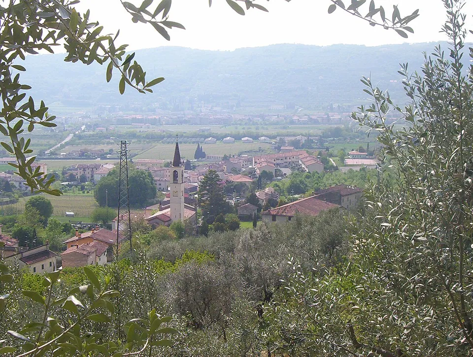
Photo: Adert · CC BY-SA 3.0 · Commons
6 km · site · Veneto
Ipogeo di Santa Maria in Stelle
The water of an underground spring collects in a semicircular settling basin cut in the rock and runs on along a low, narrow, barrel-vaulted channel 100 m long, with four shafts along it.
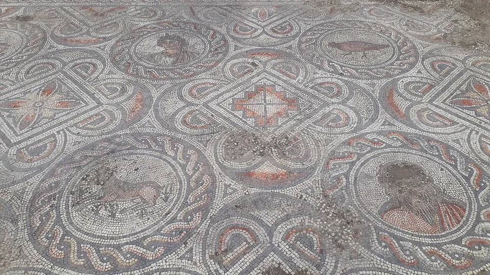
Photo: Piergiovanna Grossi · CC BY-SA 4.0 · Commons
11 km · villa · Veneto
Villa dei Mosaici
The villa has been brought to light almost entirely (it.wikipedia).
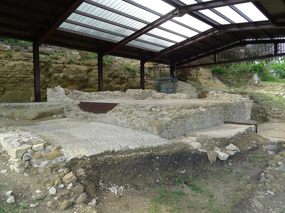
Photo: Syrio · CC BY-SA 4.0 · Commons
15 km · temple · Veneto
Temple of Minerva (Marano di Valpolicella)
What you see are the remains of the temple rebuilt in the Augustan age: the walls of its four-sided central chamber (the cella) and of the galleries that ran round it, under a modern shelter roof set against the rock face of the hill (the operator).


Straight-line distances.
Sources
Every fact on this page comes from the records below, each used under the licence noted.
| Source | Licence |
|---|---|
| Wikidata Q540546 | CC0 |
| OpenStreetMap way/1525501040 | ODbL |
| Wikipedia (it) — Ponte Pietra | CC BY-SA 4.0 |
| Wikipedia (en) — Ponte Pietra (Verona) | CC BY-SA 4.0 |
| Wikipedia (de) — Ponte Pietra | CC BY-SA 4.0 |
| Wikipedia (fr) — Pont de pierre (Vérone) | CC BY-SA 4.0 |
| Wikipedia (it) — Ponte Postumio | CC BY-SA 4.0 |
| Wikipedia (it) — Urbanistica di Verona | CC BY-SA 4.0 |
| Università di Padova, ArcheoVeneto — Bridge "Pietra", Verona (description and visiting information) | licence not recorded |