

What is there today
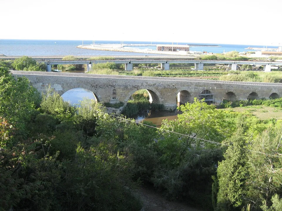
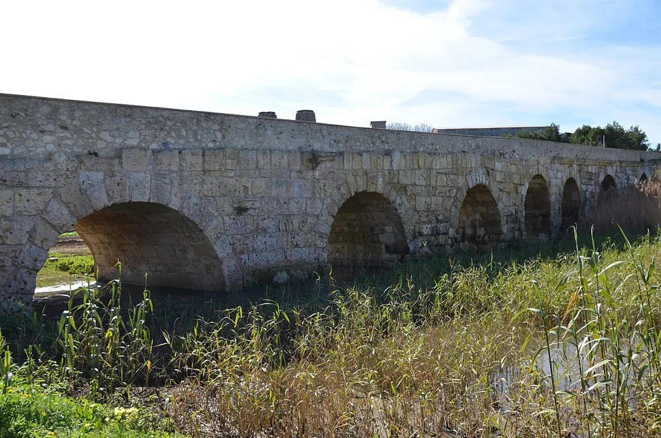
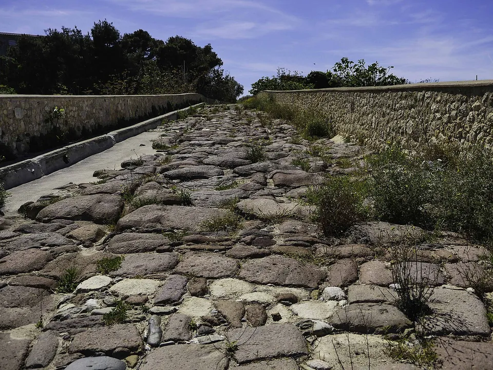
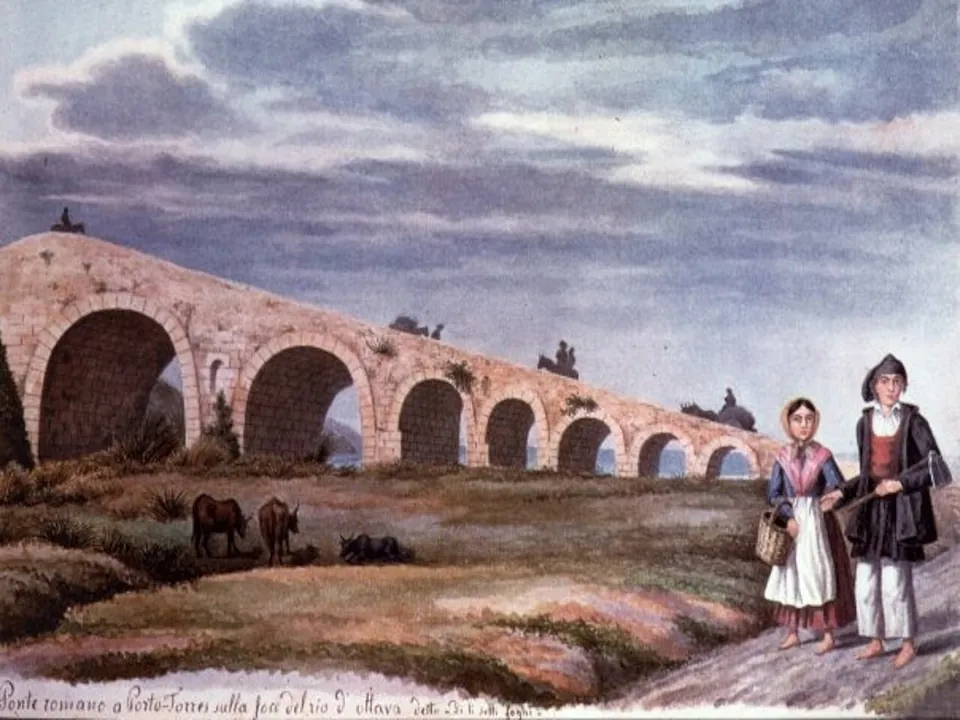
The whole bridge survives. Its seven arches shrink in span towards the east, and the carriageway on top, about 6 m wide, is paved with blocks of trachyte, while the structure is built of large blocks of the soft local limestone (the operator). it.wikipedia calls it the most important Roman bridge in Sardinia because it is so well preserved.
Look for the details. Between the two largest arches are two niches, now empty, perhaps meant for statues of river gods. The keystone of the first arch from the west, on the south face, carries a relief of a two-handled drinking cup, a kantharos, with two big-cat heads above it (the operator). The epigraphist Giuseppe Piras reads it as two panthers drinking from the cup, a scene from the imagery of Dionysus, and takes it to mean that the bridge was under the god’s protection. From a cup he found carved in the southern niche, he proposes that it held a statue of Dionysus (it.wikipedia). The first pier from the east has a larger cutwater than the others, perhaps to steer floodwater under the bridge (the operator).
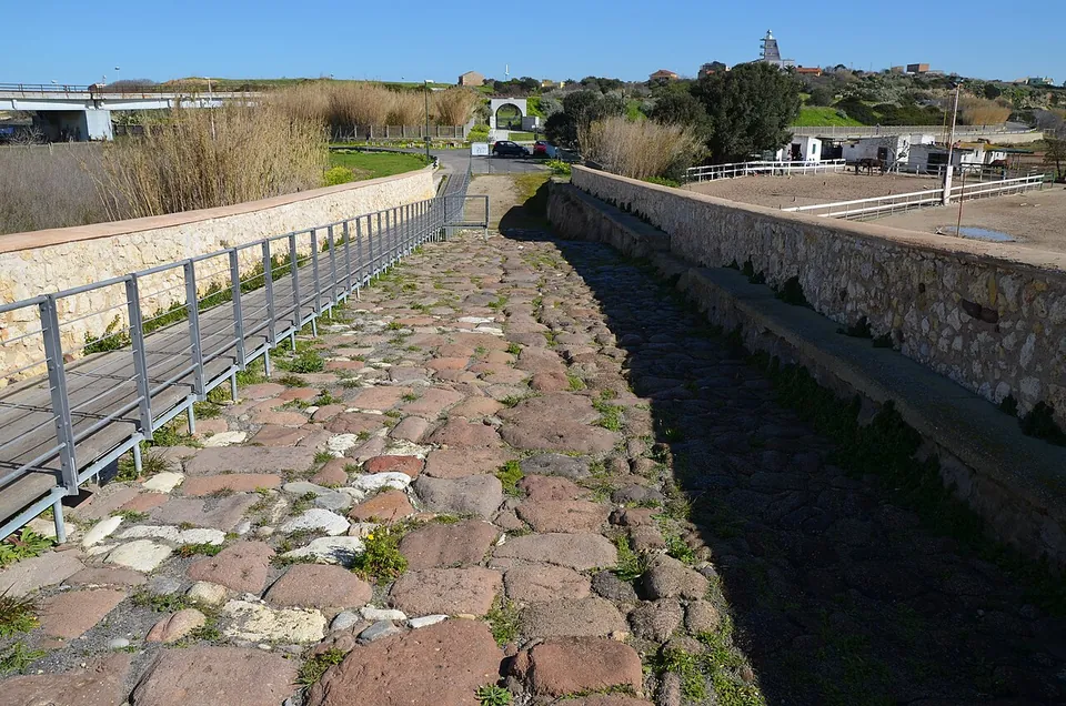
The carriageway was asphalted for motor traffic, which used the bridge until the 1980s. Since then it has been closed to traffic and restored, and the works have brought to light its building phases and the small channels that carried water away (the operator), as well as the Roman paving under the asphalt (it.wikipedia). A raised walkway runs along it so that people can cross without wearing the paving down (it.wikipedia).
Is it worth the trip?
Yes, if you are already in Porto Torres, but not just now for the walk across. The deck has been mapped as closed since November 2024, and was still mapped closed in August 2026 (OpenStreetMap), while the consolidation works go on. The press reported in 2023 and 2024 that these were due to finish in 2026 (L’Unione Sarda). No operator page says when the walkway will reopen. You can still see the arches from outside. That is a short stop, not a reason to travel, and the town’s other stop, the museum and its archaeological park, is closed too, since 2 May 2026.
Getting there
The bridge is at the edge of Porto Torres, about 500 m from the Antiquarium Turritano (see the Turris Libisonis – Porto Torres page for the station and buses). OpenStreetMap maps a free car park about 300 m away. No operator publishes hours or a ticket for the bridge. It stands in the open by the river, outside the archaeological park, whose mapped boundary is about 280 m away (OpenStreetMap).
Visiting details
- Tickets
- Restricted access
- Parking
- OSM maps a free surface car park about 300 m from the bridge (way/447853328).
Before you go
- The walk across the bridge is shut. OpenStreetMap has mapped the deck as closed to everyone since November 2024 ("Bridge out of order"), and a mapper confirmed it in August 2026. The consolidation works that began in 2024 were due to end in 2026 (L'Unione Sarda); no operator page says when the walkway will reopen. The arches can still be seen from outside.
- No operator publishes opening hours or a ticket for the bridge. It stands in the open by the river, outside the fenced archaeological park, which has itself been closed since 2 May 2026.
History
The bridge was built in the first years of the colony, which was founded between 46 and 41 BC (the operator; it.wikipedia). It let travellers and traders from the farmland of the Nurra reach the town (the operator). it.wikipedia adds that it linked the town with the mines of the Argentiera and with Karales, today’s Cagliari, in the south of the island.
It was still the road’s crossing in the 19th century, when Sassari and Porto Torres paid for repairs to its paving and parapets and argued over who should pay what. In 1858 Sassari’s town architect described the bridge as the only safe crossing in winter for the shepherds of the Nurra and for the carts bringing in its produce (it.wikipedia). Lorries bound for the petrochemical works crossed it until the 1980s.
The bridge once gave its name to the whole west bank of the river, where the Ferromin works were built in the early 20th century, and a modern anti-ship battery close by is still named after it (it.wikipedia; OpenStreetMap). Neither is Roman.
More photographs


Sources
Every fact on this page comes from the records below, each used under the licence noted.
| Source | Licence |
|---|---|
| Wikidata Q37283749 | CC0 |
| Vici.org 7842 | CC BY-SA (text), CC0 (metadata) |
| OpenStreetMap way/1547622483 | ODbL |
| Antiquarium Turritano — Turris Libisonis, il Ponte Romano (the operator) | licence not recorded |
| Wikipedia (it) — Ponte romano di Porto Torres | CC BY-SA 4.0 |
| Wikipedia (it) — Colonia Iulia Turris Libisonis | CC BY-SA 4.0 |
| L'Unione Sarda — Un percorso pedonale illuminato nel Ponte Romano di Turris (28 November 2023) | licence not recorded |
| L'Unione Sarda — Porto Torres, decoration returns to the Roman Bridge (21 February 2024) | licence not recorded |
| OpenStreetMap — Via Ponte Romano across the bridge (access=no) and its history | licence not recorded |