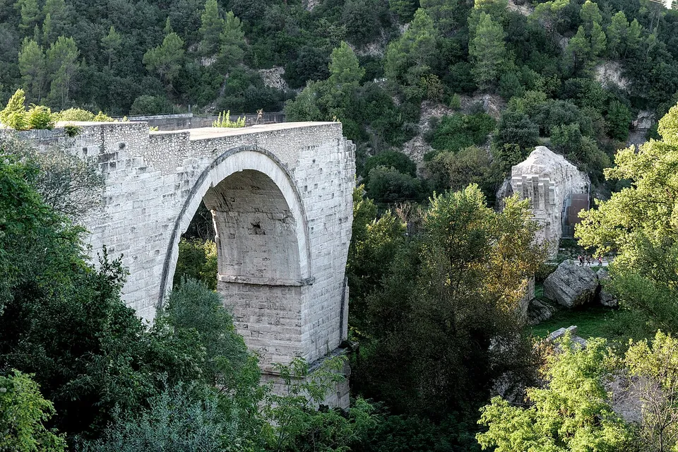
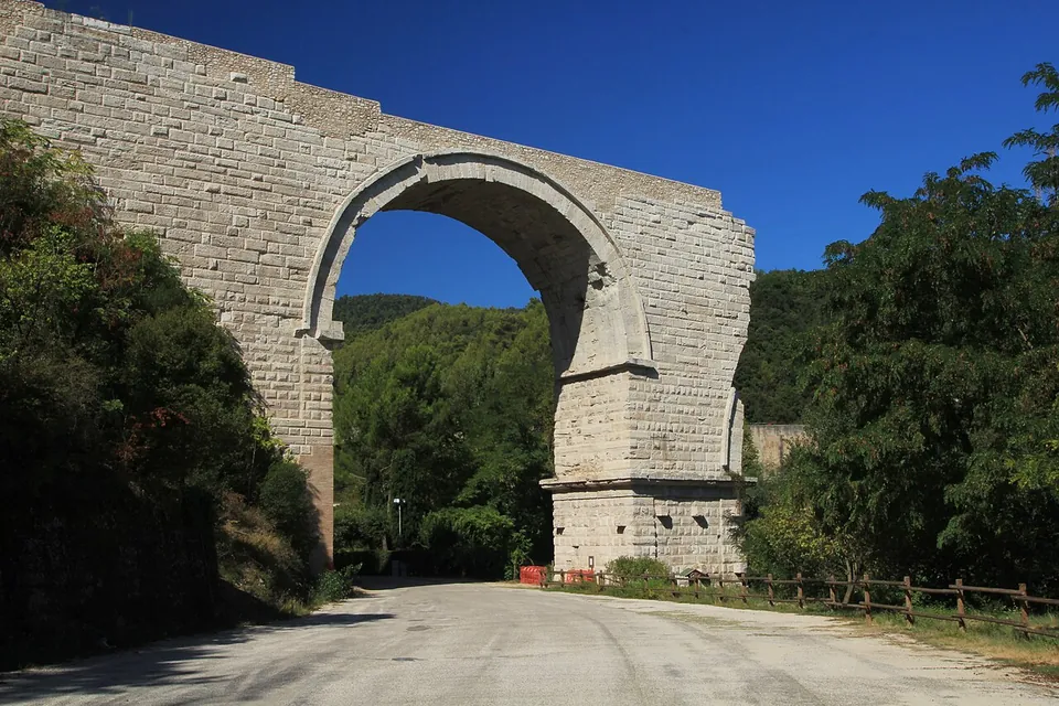
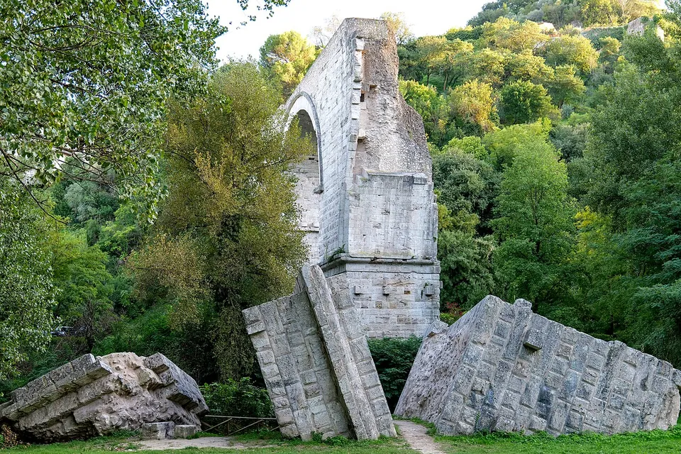
The Ponte d’Augusto is the broken Roman bridge that carried the Via Flaminia over the river Nera just below the hill town of Narni. One of its four arches still stands, about 30 m high (the town’s tourism office), and its remains are counted among the most evocative Roman monuments of southern Umbria (it.wikipedia).
What is there today
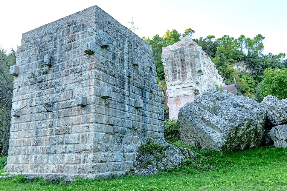
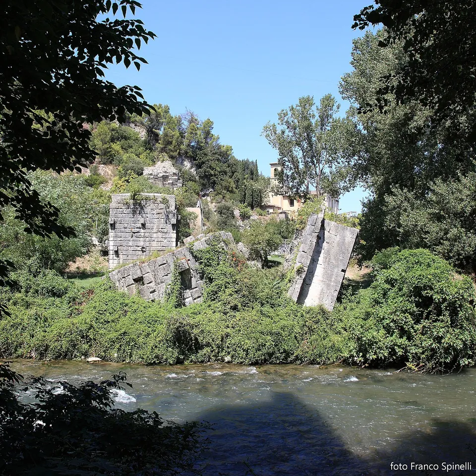
The first arch, at the southern end, stands complete. It is built of large squared blocks of travertine (de.wikipedia, the town’s tourism office; older travellers and en.wikipedia describe them as white marble), spans about 19 m, and a road runs underneath it. Beyond it are the ruins of two piers of the central arch, a matching section of masonry on the opposite bank, and blocks that fell into the riverbed in the bridge’s repeated collapses (it.wikipedia; the town’s tourism office). A cornice projects from the face of the piers at about two thirds of their height (it.wikipedia).
The bridge can be seen from below, from Via dei Tre Ponti, and from above, along a path that runs beside the Via Flaminia. The area by the bridge is also where the walking and cycling path through the Gole del Nera, the gorge of the river, sets off on an old railway line (the town’s tourism office).
Is it worth the trip?
Yes, if you are anywhere in southern Umbria. It is free, always open and has a car park beside it, so it costs little more than the stop itself. Expect one great arch and a field of broken masonry rather than a bridge you can cross: the attraction is the scale of what is left, which made it a fixture of the Grand Tour. If you have more time, combine it with the old town of Narni above, the gorge path, or Ponte Cardona in the woods nearby (below).
Getting there
The bridge stands on Via dei Tre Ponti below Narni, near Narni Scalo (it.wikipedia, Umbria Tourism). There is a free car park about 35 m from the arch, and a second about 170 m away (OpenStreetMap). The nearest mapped bus stop, Narni Scalo, is about 800 m away. Trains from Rome to Narni-Amelia station run roughly every hour and take between 50 minutes and an hour and a half, depending on the train (the town’s tourism office).
There is no gate, no ticket and no opening hours: it is an open-air ruin on a public road (the town’s tourism office, read 21 October 2026).
Visiting details
- Opening hours
- Open at all times. It is an open-air ruin with no gate, seen from Via dei Tre Ponti below or from a path above.
- Tickets
- Free; there is no ticket.
- Parking
- A free car park about 35 m from the arch (OSM way/977813778) and a second, also free, about 170 m away (way/977813779).
Hours and prices checked 21 October 2026 on the operator's own site. Confirm before travelling.
Ponte Cardona
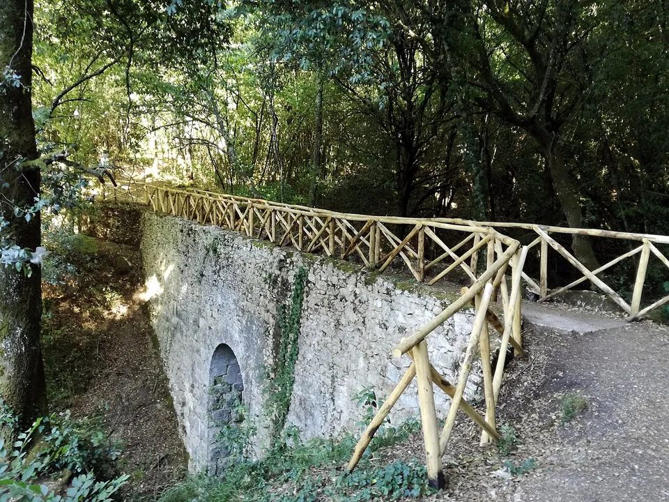
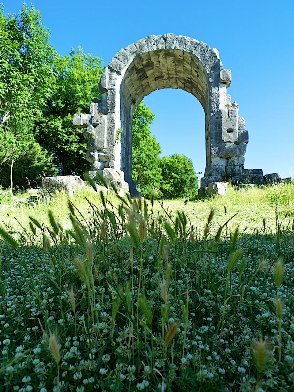
About 2.8 km away in the woods, Ponte Cardona is a much smaller Roman bridge, about 19 m long with a single round arch, built of squared travertine blocks in the 1st century AD to carry the aqueduct of Formina, which brought water to Narni (it.wikipedia). It is the last of the four bridges along the aqueduct; its vault, abutments and part of its sides are preserved, and it has been restored many times over the centuries (the town’s tourism office; it.wikipedia). The Geographic Centre of Italy was marked a short distance from it in 2006.
To reach it, leave the car at the “Geographic Center of Italy” car park and follow a woodland trail of about 900 m that runs along the line of the aqueduct (the town’s tourism office); the bridge can be visited on your own along these marked paths (it.wikipedia). Guided visits inside the aqueduct channel are a separate matter: they run only from May to October, on holidays and the days before them, for small groups booked at least ten days ahead, at €20 a person including guide, helmet and insurance (the town’s tourism office).
History
The bridge was built under Augustus around 27 BC, as part of his rebuilding of the Via Flaminia, the road from Rome to Rimini on the Adriatic coast (it.wikipedia, de.wikipedia, Umbria Tourism). It was one of the largest bridges the Romans built: published figures put its length at between 130 and 160 m, its roadway 30 to 40 m above the river and about 8 m wide (en, de, it.wikipedia; the town’s tourism office). Its four arches were all of different widths; the central one, now gone, spanned between 30.7 and 32.1 m by the published reconstructions (en, de, it.wikipedia).
According to the Umbrian archaeological superintendence, irregularities in the structure suggest that building it was a long affair, and old repairs show that it failed more than once under heavy use or natural disasters (as quoted on en.wikipedia). An earthquake damaged it in 847, and after a great flood it fell in 1053, when a chronicle records that “pons Narniae fuit dirutus”, the bridge of Narni was destroyed; from then on, sources call it a broken bridge (the town’s tourism office). The pier that stood in the middle of the river came down in a flood in the 19th century: it.wikipedia gives 17 July 1885, the superintendence 1855. The structure was reinforced in the 1970s and damaged again by an earthquake in 2000, after which restoration work began (en.wikipedia).
Even as a ruin it drew travellers. It was a regular stop on the Grand Tour; J. M. W. Turner sketched it in 1819, and Jean-Baptiste-Camille Corot’s painting of it, The Bridge at Narni, is in the Louvre (en, de.wikipedia).
More photographs
Nearby
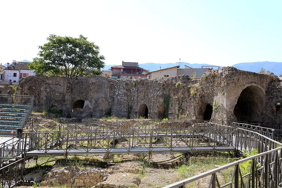
Photo: Sailko · CC BY-SA 4.0 · Commons
11 km · amphitheatre · Umbria
Anfiteatro Fausto
The oval is still easy to read on the ground, about 97.5 by 73 m overall (it.wikipedia).
13 km · city · Umbria
Carsulae
The ticketed area is a fenced expanse of meadow and trees of 22 hectares (it.wikipedia).
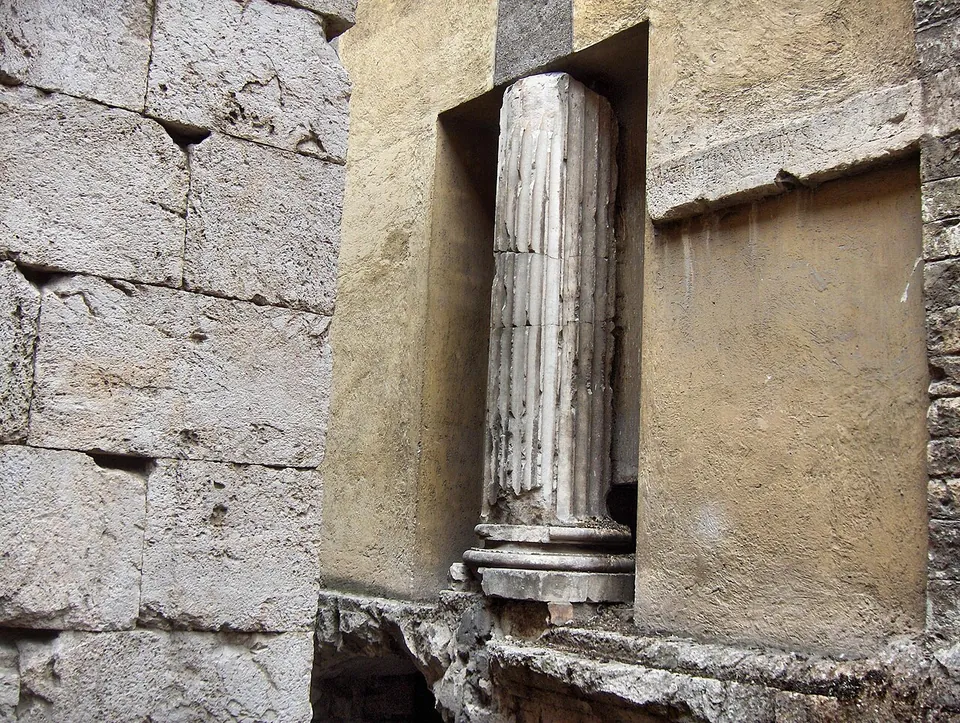
Photo: JoJan · CC BY 3.0 · Commons


Straight-line distances.
Sources
Every fact on this page comes from the records below, each used under the licence noted.
| Source | Licence |
|---|---|
| Pleiades 208942846 | CC BY |
| Wikidata Q2103779 | CC0 |
| OpenStreetMap way/101088334 | ODbL |
| Turismo Narni (Comune di Narni) — The Augustus Bridge | licence not recorded |
| Turismo Narni (Comune di Narni) — Roman bridges in Narni | licence not recorded |
| Turismo Narni (Comune di Narni) — Cardona Bridge | licence not recorded |
| Turismo Narni (Comune di Narni) — Visit to the Roman Aqueduct of Formina | licence not recorded |
| Turismo Narni (Comune di Narni) — How to arrive | licence not recorded |
| Umbria Tourism (Regione Umbria) — The bridge of Augustus in Narni | licence not recorded |
| Wikipedia (it) — Ponte di Augusto | CC BY-SA 4.0 |
| Wikipedia (en) — Bridge of Augustus (Narni) | CC BY-SA 4.0 |
| Wikipedia (de) — Ponte d’Augusto (Narni) | CC BY-SA 4.0 |
| Wikipedia (it) — Ponte Cardona | CC BY-SA 4.0 |
| Pleiades — Ponte Cardona | licence not recorded |
| Wikidata — Ponte Cardona (Q30897986) | licence not recorded |