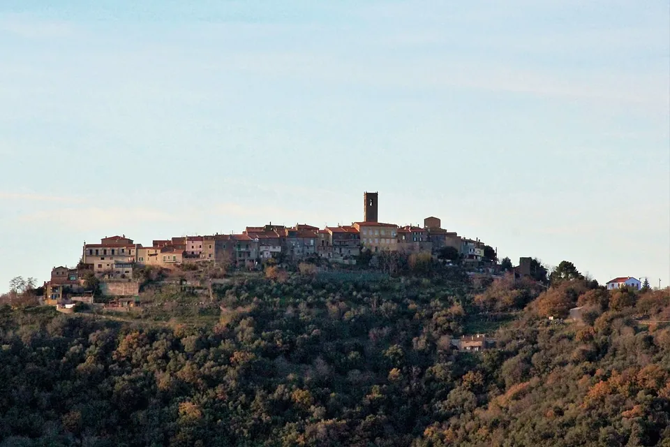


Vetulonia was one of the cities of the Etruscan league, on a hill above the Grosseto plain, and what you walk through below the village is a quarter of paved streets and atrium houses from the late 3rd to the mid-1st century BC, built after the city had allied itself with Rome. The other reason to come is Etruscan rather than Roman: monumental burial mounds of the 7th century BC along the road below the village.
What is there today
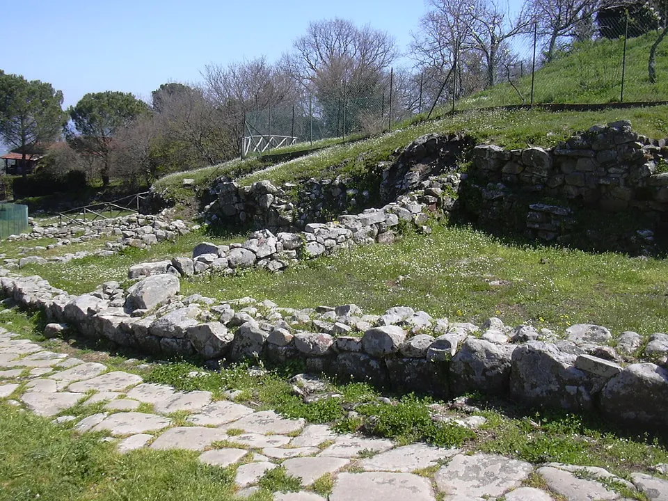
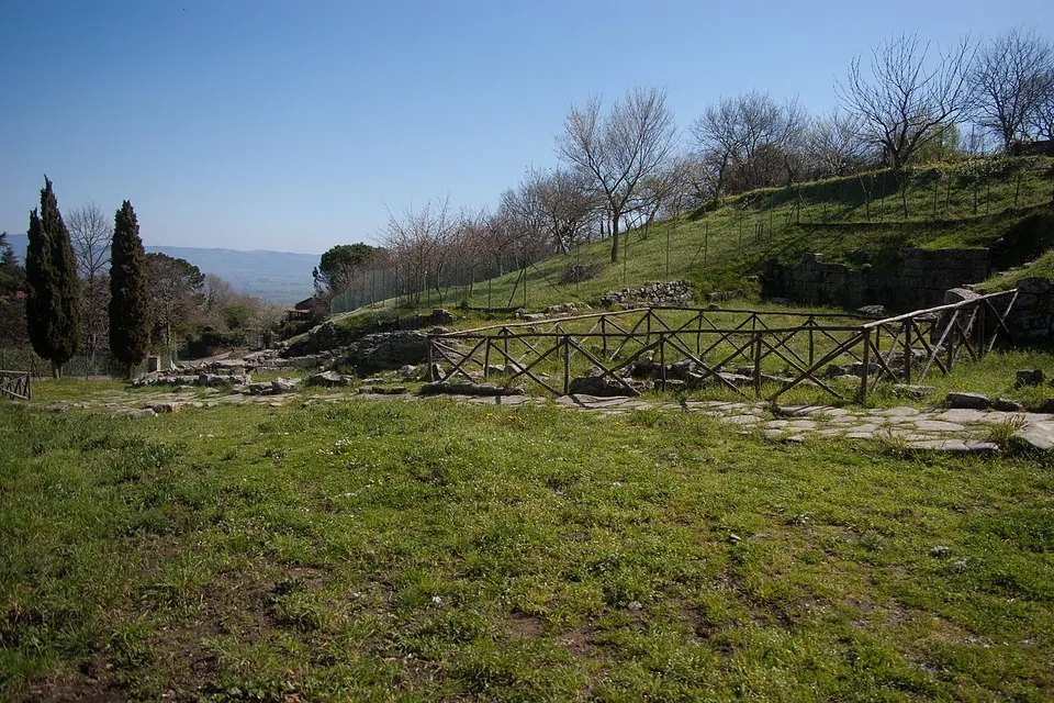
The archaeological park is free and split into several areas (the operator). The main one, Scavi Città – Poggiarello Renzetti, is the clearest evidence of the ancient town: streets, among them a wide paved street its excavator called the “via Decumana”, workshops and houses built round an atrium, dated to the late 3rd and 2nd century BC (it.wikipedia). What a visitor sees is the lower part of the walls and the paving, so the quarter reads as a street plan rather than as standing rooms. Among the houses are the “domus of Medea”, named after the rich terracotta decoration of its atrium, which scholars have pieced together from fragments as the story of Medea at Corinth; a large house with a cistern cut into the rock, in use from the early 3rd to the mid-1st century BC; and the “domus dei Dolia”, named for the large storage jars found still whole where they stood (it.wikipedia; the operator). Excavation of the domus dei Dolia has resumed (the operator).
Two smaller areas lie about 300 m from the main quarter:
- Costia dei Lippi, terrace walls of a residential quarter of the Hellenistic period (the operator). Pleiades describes walls in squared stone, terraces and a paved road, read as a domestic quarter of roughly the 3rd to the 1st century BC, excavated from the 1960s.
- Costa Murata, entered from Via Case di Siena, in use from the late 7th century BC to the late Republic. It was probably a sacred area at first: a votive deposit there held Greek pottery of the 6th and 5th centuries BC, now in the village museum. Today it shows houses of the Hellenistic-Roman period and a wide view (the operator); Pleiades records a later Roman house and a Roman road paved in basalt.
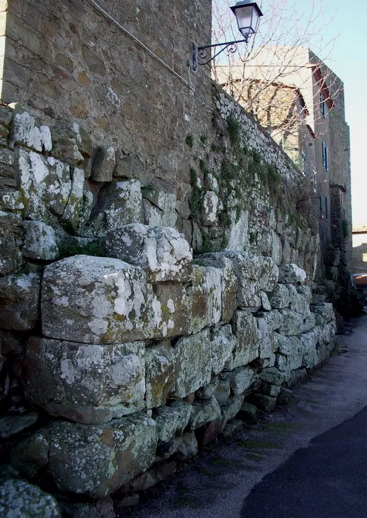
In the village itself, a stretch of huge polygonal blocks is traditionally called the walls of the Arce, the citadel, and dated to the 6th century BC; their date and purpose are now debated, and the stretch has been reinterpreted as part of a great podium built to mark out and monumentalise a sacred area (it.wikipedia).
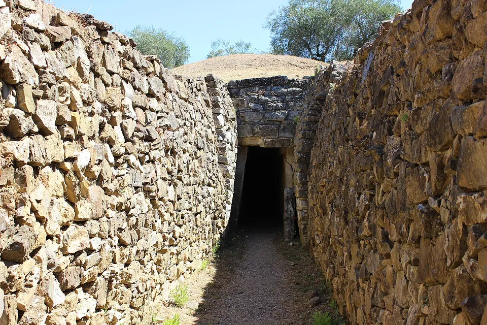
Down the Via dei Sepolcri, below the village, come the Etruscan tombs: the archaic chamber tomb of the Belvedere, then two great 7th-century BC tumuli, the Pietrera and the Diavolino II (the operator). The Pietrera is the largest funerary monument at Vetulonia, an earth mound of about 60 m across and some 15 m high with two burial chambers one above the other; the central pillar that carried the upper chamber’s domed roof is still in place (it.wikipedia). The Diavolino II is closed for works at the time of writing (the operator).
The finds are divided mainly between the national archaeological museum in Florence, the archaeological museum in Grosseto and the Isidoro Falchi civic museum (MuVet) in the village, about 300 m from the main quarter (it.wikipedia; OpenStreetMap).
Is it worth the trip?
For the Roman story alone, it is a modest stop. The houses and streets belong to the period after Vetulonia’s alliance with Rome, and the remains are ground-level walls and paving on a grassy slope, not standing buildings. What makes the visit worthwhile is the whole: a hill town with the Etrusco-Roman quarter below it, the citadel blocks in its streets, a museum of the city’s finds and the largest tombs of its necropolis a short drive down the hill, all free except the museum. If you are already in the Maremma, it pairs naturally with Rusellae, which faced the same ancient lagoon. As a destination in itself from far away, it is for people who are as curious about the Etruscans as about Rome.
Getting there
Vetulonia is a hamlet of Castiglione della Pescaia, about 16 km in a straight line from Grosseto. The main excavated quarter is below the village (fr.wikipedia), beside the Strada Comunale della Scala Santa, and there are car parks about 160 m and 250 m away, the second free (OpenStreetMap). No bus stop is mapped nearby, so plan on a car, which you will also need for the tombs further down the road (the Diavolino II is 2.3 km from the main quarter).
The park is free. It is open Tuesday to Sunday and closed on Mondays: 08.30 to 16.30 from 25 October 2026 to 27 March 2027, and 09.45 to 18.30 in the summer season (29 March to 24 October in 2026), with last entry 30 minutes before closing. The open-air areas shut during an orange or red weather alert, and maps are available at the entrance (parchiarcheomaremma.cultura.gov.it, read 23 October 2026).
The museum in the village, on Piazza Vetluna, charges €5 (€2.50 reduced; free under 6). It is open Tuesday to Sunday and on Mondays that are public holidays, 10.00 to 16.00 from November to March, 10.00 to 18.00 from April to mid-June and from mid-September to October, and 10.00 to 14.00 and 15.00 to 19.00 from mid-June to mid-September; closed 25 and 26 December and 1 January (museoisidorofalchi.it, read 23 October 2026).
Visiting details
- Opening hours
- Tuesday to Sunday, closed on Mondays. 08.30–16.30 from 25 October 2026 to 27 March 2027; 09.45–18.30 in the summer season (29 March to 24 October in 2026). Last entry 30 minutes before closing. The open-air areas close during an orange or red weather alert.
- Tickets
- Free for every area of the archaeological park. The Isidoro Falchi civic museum in the village charges separately, €5 (€2.50 reduced, free under 6).
- Parking
- Two car parks mapped about 160 m and 250 m from the excavated quarter, the second tagged free (OSM way/222272311 and way/222277791).
Before you go
- The Tomba del Diavolino II, one of the two great Etruscan tumuli, is temporarily closed for works (the operator, October 2026).
- No bus stop or railway station is mapped near the site; it needs a car.
Hours and prices checked 23 October 2026 on the operator's own site. Confirm before travelling.
History
The oldest evidence on the hill comes from graves of the end of the Bronze Age and above all the early Iron Age, the 9th and 8th centuries BC; in the course of the 7th century BC it became a fully organised city (it.wikipedia). Below it lay the Lacus Prelius, a lagoon that gave the city its outlet to the Tyrrhenian Sea; Rusellae also faced it (it.wikipedia; the operator). The rich 7th-century graves, with their gold jewellery worked in filigree and granulation, are what made Vetulonia famous (it.wikipedia).
Rome had its own story about the place. According to the poet Silius Italicus, the Romans took the insignia of their magistrates, the fasces and the curule chair, from Vetulonia; in 1898 a tomb in the necropolis produced a bundle of iron rods around a double-headed axe (en.wikipedia), and Pleiades says the city “may have been” the source of both. Pliny the Elder and Ptolemy mention the town (en.wikipedia), and a marble relief of the Julio-Claudian period found at Cerveteri in 1840 personifies the people of Vetulonia, the Vetulonenses, as a man with an oar, a nod to the city’s tie to the water (it.wikipedia). A plaster cast of it stands at the entrance of the village museum (it.wikipedia).
The excavated quarter records a revival of the city after its alliance with Rome, in the late 3rd and 2nd centuries BC. Traces of destruction in every quarter dug so far, no later than the middle of the 1st century BC, appear to mark the end of the Etrusco-Roman city, and have been linked with the upheavals of Sulla’s time (it.wikipedia). Under the Empire Vetulonia shrank to a secondary centre as malaria spread (en.wikipedia).
In the Middle Ages even the name was lost: the village on the hill was called Colonna. Isidoro Falchi, a municipal doctor and amateur archaeologist, argued from 1881 that this was Vetulonia, the old name was officially restored in 1887, and he led thirty-four seasons of excavation between 1884 and 1913. The Poggiarello Renzetti quarter was uncovered by him between 1893 and 1896 and dug again between 1985 and 1990 (it.wikipedia).
More photographs


Nearby
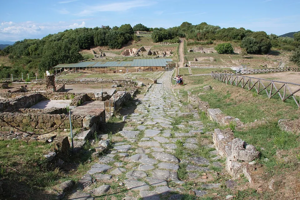
Photo: LepoRello · CC BY-SA 3.0 · Commons
16 km · city · Tuscany
Rusellae
The town sits on two hills with a small valley between them, and the forum occupies the valley (it.wikipedia).

Straight-line distances.
Sources
Every fact on this page comes from the records below, each used under the licence noted.
| Source | Licence |
|---|---|
| Pleiades 403291 | CC BY |
| Wikidata Q2860782 | CC0 |
| Vici.org 21527 | CC BY-SA (text), CC0 (metadata) |
| OpenStreetMap way/429082007 | ODbL |
| Pleiades — Costa Murata archaeological area | licence not recorded |
| Pleiades — Costia dei Lippi | licence not recorded |
| Wikidata — Costa Murata (Q131386156) | licence not recorded |
| Wikipedia (it) — Vetulonia (sito archeologico) | CC BY-SA 4.0 |
| Wikipedia (en) — Vetulonia | CC BY-SA 4.0 |
| Wikipedia (it) — Tomba della Pietrera | CC BY-SA 4.0 |
| Wikipedia (it) — Tomba del Diavolino II | CC BY-SA 4.0 |
| Wikipedia (it) — Museo civico archeologico Isidoro Falchi | CC BY-SA 4.0 |
| Parchi Archeologici della Maremma — Parco archeologico di Vetulonia (the operator) | licence not recorded |
| Parchi Archeologici della Maremma — winter opening hours 25 October 2026 to 27 March 2027 | licence not recorded |
| MuVet, Museo civico archeologico Isidoro Falchi — hours and prices | licence not recorded |