What is there today
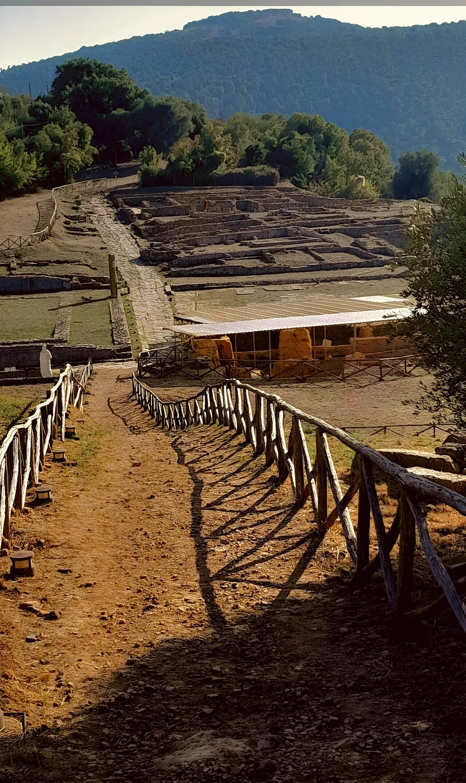
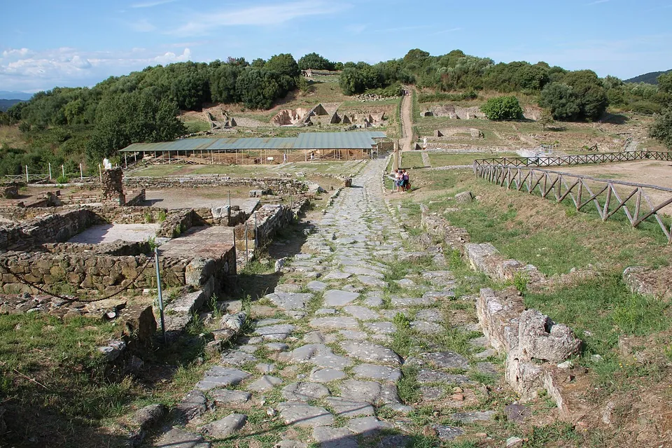
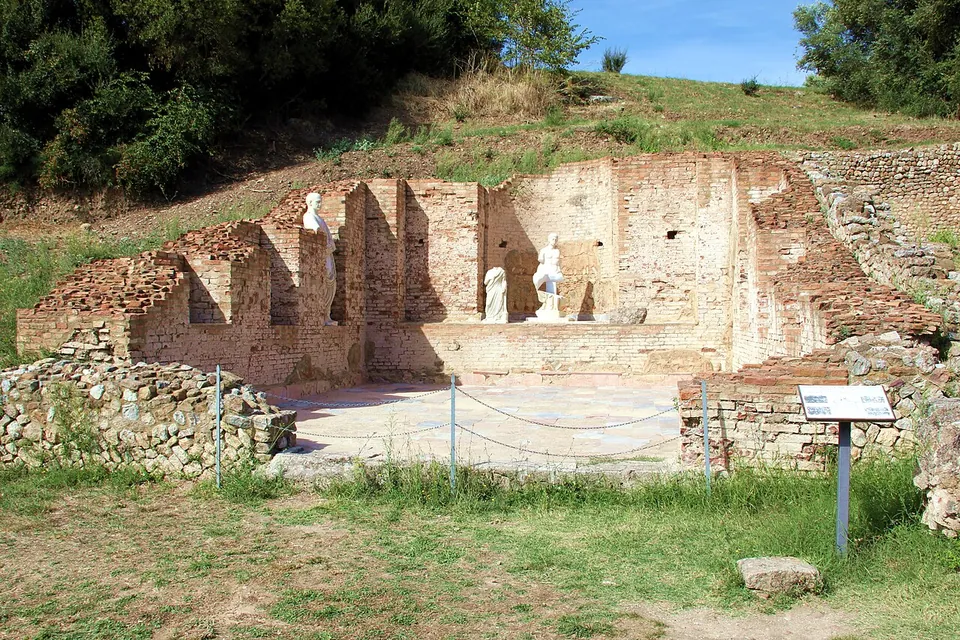
The town sits on two hills with a small valley between them, and the forum occupies the valley (it.wikipedia). A paved Roman street leads up through the centre past the House of the Mosaics, a town house of the 1st century BC that was later given baths and turned to public use, to the forum square. Under a canopy beside it, Etruscan buildings older than the forum have been left on view below the level of the Roman paving. On the north side stands the brick hall of the Bassi, added to the forum’s basilica in the first half of the 2nd century AD, once clad in marble and decorated with a cycle of portraits glorifying what was probably a family of local notables (it.wikipedia). OpenStreetMap also maps Roman shops of the 4th to 5th century AD near the forum.
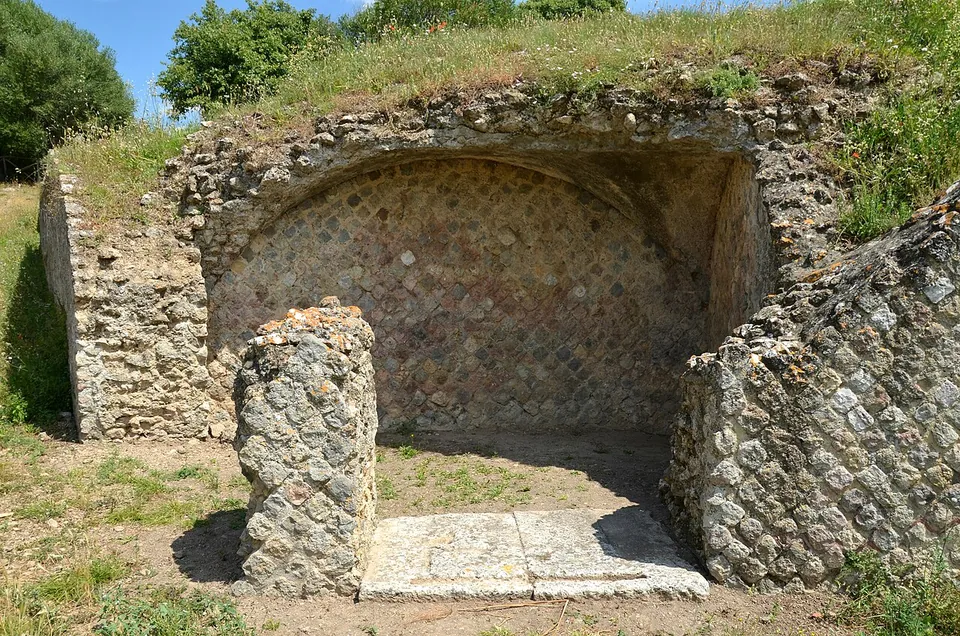
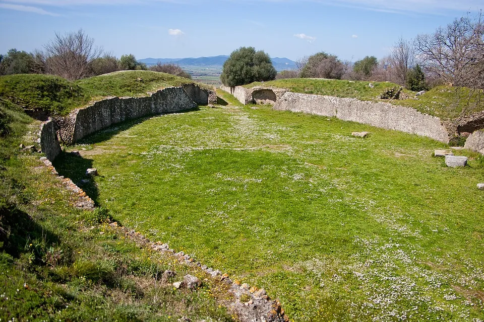
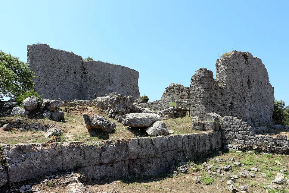
On the top of the northern hill is the amphitheatre, small at 38 by 27 m, with its walls of net-pattern masonry and four entrances, two of them vaulted, and it was built over the remains of an earlier Hellenistic house (it.wikipedia). On the lower slopes of the northern hill lie the baths of the early 2nd century, where a church was later set into the ruins, and on the far side of the amphitheatre the House of the Impluvium, one of the few houses of the Archaic period in Etruria known in full, with a basin in its courtyard to catch rainwater (it.wikipedia). Its date is given as the 6th century BC in it.wikipedia and the early 4th century BC in en.wikipedia.
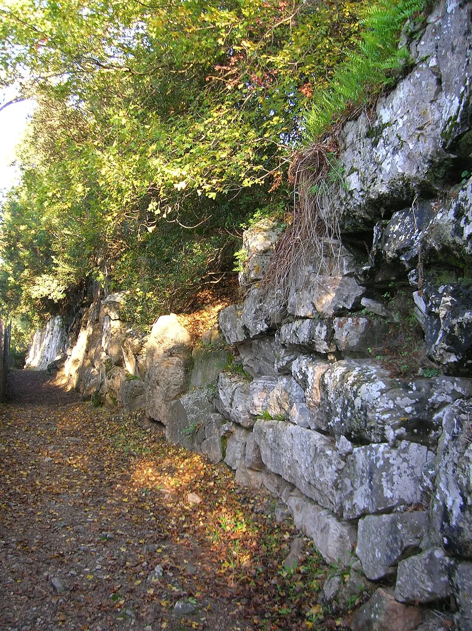
The walls are the other half of the visit. They run for about 3.2 km round both hills, built of large unmortared stone blocks in the 6th century BC (other accounts say the 7th to 6th), and since the restorations of 1980–1996 much of the circuit can be walked (it.wikipedia; the operator says it is visible and accessible for long stretches).
Is it worth the trip?
Yes, if you like ruins with room around them. This is a whole ancient town centre, abandoned since the Middle Ages, and it is little known. What you walk through is mostly a plan of low walls. The walls, the amphitheatre and the hall of the Bassi are the parts that stand up; much else is foundations, and the marine mosaics of the baths are lost (it.wikipedia).
It needs a car. No bus stop is mapped within 2 km, and the park is an open-air site that may close when a weather alert is in force, as it did on 10 September and 7 October 2026 (the operator).
Getting there
The park lies along the state road from Grosseto to Siena, about 10 km north of the city by the operator’s reckoning (8.4 km in a straight line from the centre); the address is Strada dei Ruderi, Grosseto. Two free car parks are mapped on the east side of the site (OpenStreetMap).
It is open every day: 09.45 to 18.45 from 29 March to 24 October, and 08.15 to 17.15 from 25 October to 28 March, with last entry 45 minutes before closing. A full ticket is €4, with reductions and free entry under the national rules for state museums, and tickets can be bought on site or online through the Musei Italiani portal the operator links to (Parchi Archeologici della Maremma, read 21 October 2026; check before travelling). In summer the amphitheatre is used for performances (it.wikipedia).
Visiting details
- Opening hours
- Open every day. From 29 March to 24 October 09.45–18.45; from 25 October to 28 March 08.15–17.15. Last entry and the ticket office close 45 minutes before closing time. The park may close when a yellow, orange or red weather alert is in force.
- Tickets
- €4 full price. Reduced and free admission as set by Italian law for state museums, and free for Disability Card holders. Tickets can also be bought online through the Musei Italiani portal, which the operator links to.
- Parking
- Two free car parks are mapped on the east side of the site, 330–390 m east of the forum area (OSM way/166830175 and way/166830189). The operator's address is Strada dei Ruderi, Grosseto.
Before you go
- No bus stop is mapped within 2 km; the site needs a car.
- Outdoor site that closes during weather alerts; it shut for orange alerts on 10 September and 7 October 2026 (the operator).
Hours and prices checked 21 October 2026 on the operator's own site. Confirm before travelling.
History
People settled the two hills from the second half of the 8th century BC, and in the 6th century BC the town was enclosed by its wall, taking in about 45 hectares (it.wikipedia). Rome took it in 294 BC, when the consul Lucius Postumius Megellus captured it (the operator, citing Livy), and in 205 BC it supplied grain and timber for Scipio’s fleet (en.wikipedia). It became a Roman colony between the triumviral period and the reign of Augustus.
Its best years were the 1st and 2nd centuries AD, when the forum was rebuilt in monumental form and the amphitheatre and the baths went up (it.wikipedia). A shrine of the imperial cult on the forum, the Augusteum, received so many dedications that they formed the richest group of statues of any building of its kind in the Italian peninsula, and two men of the town’s Vicirius family became consuls in AD 89 and 98 (it.wikipedia).
In late antiquity the town declined and its buildings were mostly reused for other purposes (the operator). The one new building known from the period is a small bath house near the east gate, paid for by Betitius Perpetuus Arzygius, governor of Tuscia et Umbria from 366 (it.wikipedia). Rusellae was a bishop’s seat by the end of the 5th century; at the end of the 6th or early in the 7th a church with a font was built into the ruined baths, and the Lombards took the region in the same years (it.wikipedia; the operator). In 1138 the pope moved the see to Grosseto, and the town was slowly abandoned (the operator).
The amphitheatre was first cleared in 1774, but systematic excavation of the town began only in 1959, directed for many years by Clelia Laviosa; restoration and the fencing of the site between 1980 and 1996 opened it to the public (it.wikipedia). A few marble pilaster capitals from the baths are now in the Museo archeologico e d’arte della Maremma in Grosseto (it.wikipedia).
More photographs
Nearby
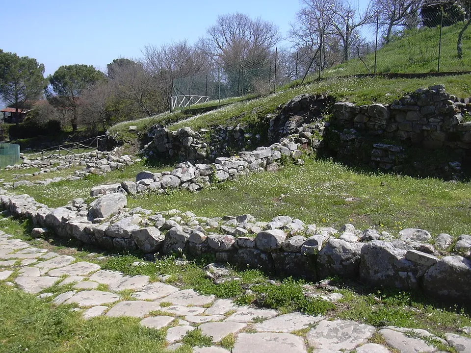
Photo: Gabriele Delhey · CC BY-SA 3.0 · Commons
16 km · city · Tuscany
Vetulonia
The archaeological park is free and split into several areas (the operator).


Straight-line distances.
Sources
Every fact on this page comes from the records below, each used under the licence noted.
| Source | Licence |
|---|---|
| Pleiades 413288 | CC BY |
| Wikidata Q2860778 | CC0 |
| OpenStreetMap relation/17573319 | ODbL |
| Wikipedia (it) — Roselle (sito archeologico) | CC BY-SA 4.0 |
| Wikipedia (en) — Rusellae | CC BY-SA 4.0 |
| Wikipedia (fr) — Site archéologique de Roselle | CC BY-SA 4.0 |
| Wikipedia (it) — Anfiteatro romano di Roselle | CC BY-SA 4.0 |
| Wikipedia (it) — Mura di Roselle | CC BY-SA 4.0 |
| Parchi Archeologici della Maremma — Parco archeologico di Roselle (the operator; hours and tickets) | licence not recorded |
| Parchi Archeologici della Maremma — winter opening hours 25 October 2026 – 27 March 2027 | licence not recorded |