

What is there today
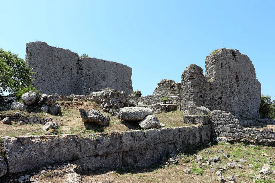
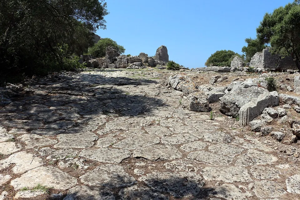
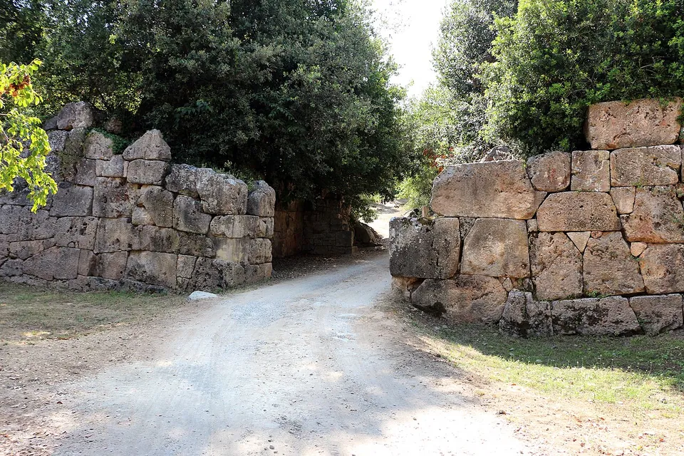
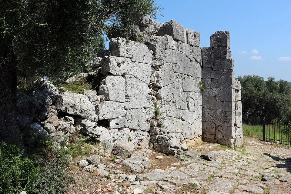
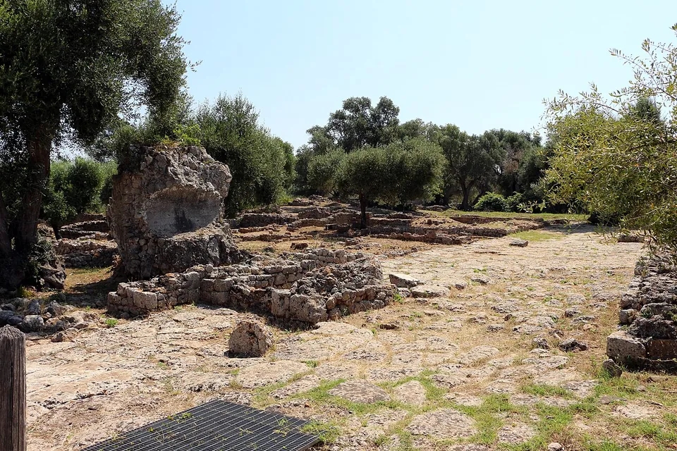
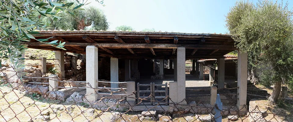
The walls are the set piece. They run for about 1.5 km round the hilltop, built of large stone blocks shaped on the outer face and fitted together without mortar, with eighteen towers along the way (it.wikipedia, Pleiades). Three gates led in, and you enter today by the north-west one, the Porta Fiorentina (it.wikipedia, en.wikipedia). Inside, much of the town is still buried, and what has been excavated lies in separate areas. On the arx, the citadel at the town’s highest point, the walls of the Capitolium still stand up to 9 m high, and the small Temple D beside it is still clearly visible (it.wikipedia). A paved processional street leads down to the forum, an open square of low walls among olive trees; along its north side are the stepped circle of the comitium, where citizens assembled, the council house and the traces of one of the earliest Roman basilicas (it.wikipedia, de.wikipedia). Nearby are excavated houses, one of them under a protective roof, and the baths, which are still being excavated. The National Archaeological Museum stands inside the park, built over a Roman house, but it is closed for refitting (the operator).
Is it worth the trip?
Yes, if you like your ruins quiet and in the open. Cosa has a prominent place in Roman archaeology because of how thoroughly it has been excavated (en.wikipedia), and it shows the plan of a Republican colony that later towns never built over: large parts of it were never resettled (de.wikipedia). What stands tall is the walls, the gates and the Capitolium; the rest is a plan at ground level, so this is a walk over a hilltop rather than a town of standing buildings. Entry to the park is free, which makes it an easy stop.
Two things to know before going. The museum, with the temples’ terracotta decoration, is closed for now, so the finds cannot be seen. And the park shuts whenever an orange or red weather alert is in force, as it did twice in September and October 2026 (the operator).
Getting there
The park is at Via delle Ginestre 35 in Ansedonia, part of the comune of Orbetello (the operator), about 7 km in a straight line from the centre of Orbetello (OpenStreetMap) and about 140 km north-west of Rome (en.wikipedia). There is free parking for visitors (the operator), with a car park mapped about 270 m from the Capitolium (OpenStreetMap). No bus stop or railway station is mapped near the site, so it is a place to reach by car. Maps are free at the ticket office, and visitors with reduced mobility can arrange access by contacting the staff (0564 881421).
The park is open Tuesday to Sunday and closed on Mondays: 09.45 to 18.30 from 29 March to 24 October, and 08.30 to 17.00 from 25 October 2026 to 27 March 2027, with last entry half an hour before closing. Entry to the archaeological park is free; the museum charges €2 when it is open (the operator, read 23 October 2026; check before travelling, since hours change twice a year).
Visiting details
- Opening hours
- Tuesday to Sunday, closed on Mondays. 09.45–18.30 from 29 March to 24 October; 08.30–17.00 from 25 October 2026 to 27 March 2027. Last entry 30 minutes before closing. The park stays closed whenever an orange or red weather alert is in force.
- Tickets
- The archaeological park is free. The National Archaeological Museum of Cosa, inside the park, charges €2, with the reductions and free entry that apply at all state museums; it was closed for refitting when this was checked.
- Parking
- Free parking for visitors (the operator); a car park is mapped about 270 m from the Capitolium (OSM way/1163298088).
Before you go
- The museum is closed for refitting (the operator's notice of the winter timetable, from 25 October 2026); the park itself is open.
- No bus stop or railway station is mapped near the site; plan on a car.
Hours and prices checked 23 October 2026 on the operator's own site. Confirm before travelling.
The walls and gates
The wall went up with the colony: Pleiades gives the traditional date as about 273 to 264 BC. Its towers stand at irregular intervals (it.wikipedia), and all three gates share one design, an outer and an inner gate with a courtyard between them; on the jambs of the Porta Romana, the north-east gate, the grooves of a portcullis can still be seen (it.wikipedia). The arx had its own inner wall (en.wikipedia). Part of what you see is modern work: Tuscany’s archaeological superintendency has repaired and partly reconstructed the circuit (en.wikipedia, it.wikipedia). Accounts differ on the shape of the towers: most were rectangular, with one or three round ones depending on the source.
The arx and the Capitolium
The arx held most of Cosa’s temples (en.wikipedia). The oldest, built around 240 to 220 BC and identified, though not with certainty, as a temple of Jupiter, is no longer visible; so much of its terracotta roof decoration survives that the reconstruction of it is among the most complete of any Etrusco-Italic temple (it.wikipedia, “Tempio di Giove”). The Capitolium stands on a terrace faced with polygonal masonry and measures about 21 by 26 m; its three cells are the reason it is thought to have served Jupiter, Juno and Minerva (it.wikipedia). Published dates for it range from the early to the middle 2nd century BC. Temple D, a single square cell of about 9 m a side, built around 170 to 160 BC, is thought to have been dedicated to Mater Matuta (it.wikipedia).
The forum, the comitium and the basilica
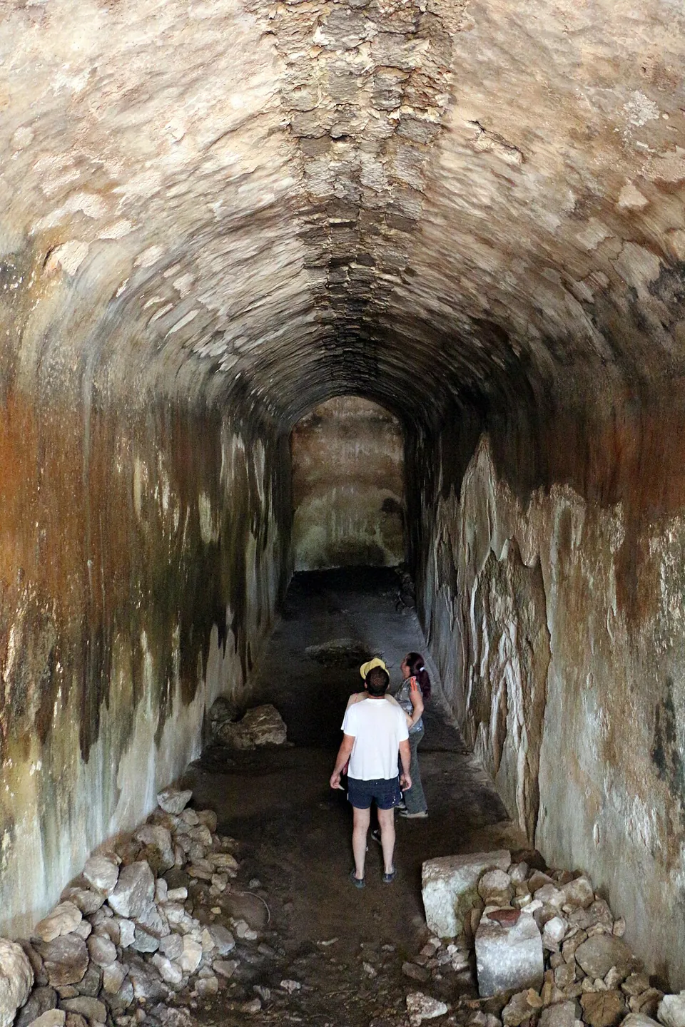
The forum measured 88 by 35 m and was entered through a triple arch whose collapsed masonry still lies at the north-west end (it.wikipedia). The comitium, a circle of stone steps 8.6 m across, may have held up to 596 people, and the curia rose behind it. In the basement of the curia a Mithraeum was later fitted out, and the earthen benches along its walls and the bases for statues can still be seen (it.wikipedia); it.wikipedia dates it to the 2nd century AD and en.wikipedia to the early 3rd. Of the basilica, built around 150 to 140 BC and the oldest yet known in a Roman colony, only a few traces remain; under Nero it was turned into a small theatre, an odeum, after an earthquake around AD 51 (it.wikipedia, de.wikipedia, en.wikipedia). Water was always Cosa’s problem: every building had its own cisterns, and the public cistern at the forum’s east corner held an estimated 750,000 litres (it.wikipedia).
Houses and baths
The House of the Skeleton is named after the skeleton of an adult man found in its cistern, perhaps thrown in when the town was destroyed around 70 BC. It was built after 89 BC around an atrium, and most of its rooms keep floors of opus signinum, a crushed-tile cement, laid in geometric patterns (it.wikipedia). The baths beside the forum are still being excavated, by Florida State University, Bryn Mawr College and the University of Tübingen since 2013; their most imposing part is a high wall carrying a raised tank (it.wikipedia).
History
Cosa was founded in 273 BC as a Latin colony on land taken from the Etruscans after Rome’s defeat of Vulci in 280 BC, to hold the newly conquered territory and give the Republic a protected port (en.wikipedia, it.wikipedia). The Via Aurelia linked it to Rome from about 241 BC. A second group of colonists arrived in 197 BC, and the town prospered until the first half of the 1st century BC, when it was sacked in circumstances still unknown (it.wikipedia); a hoard of coins hidden in a house dates that end to around 70 BC.
Augustus partly rebuilt it, but by the 2nd century AD it was largely abandoned again; a revival under the Severan emperors in the early 3rd century did not last, and Rutilius Namatianus describes the site in 417 as deserted ruins, abandoned, it was said, because of a plague of mice (it.wikipedia, en.wikipedia). en.wikipedia raises malaria, common on this coast, as a possible reason for the town’s on-and-off occupation. A church was built on the ruins of the basilica in the 6th century, and the arx became a small fortified Byzantine outpost, abandoned in the late 6th or early 7th century (en.wikipedia). A medieval castle on the Eastern Height, outside today’s visitor route, was destroyed by the army of Siena in 1329, and the site was left empty after that (en.wikipedia, it.wikipedia).
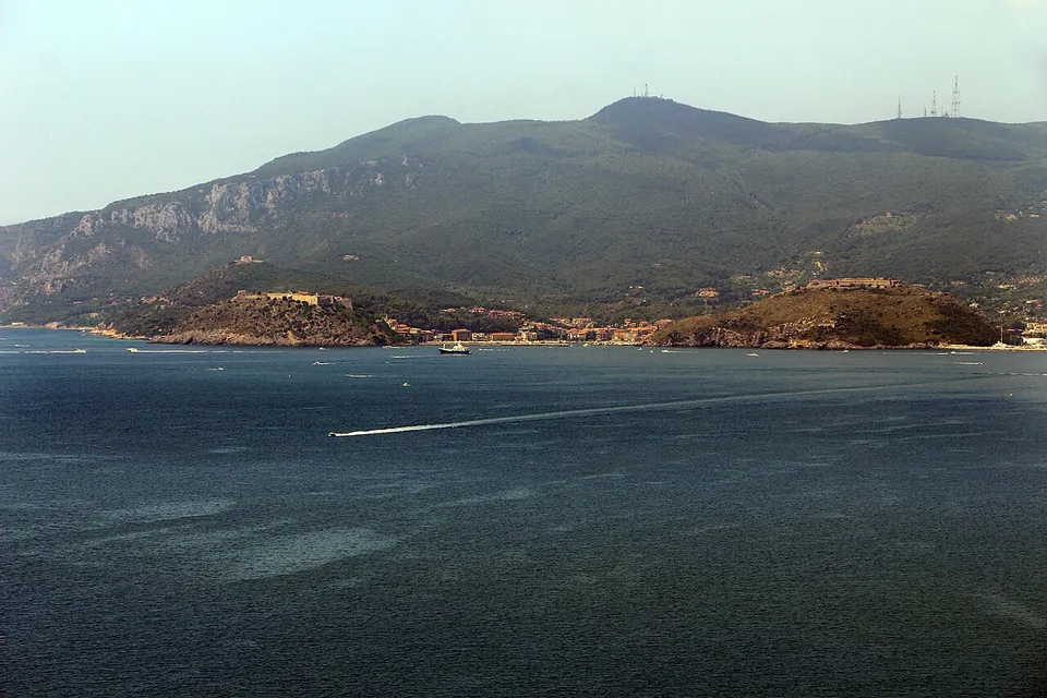
The American Academy in Rome began excavating in 1948 under Frank Brown, and the work has continued with other universities ever since (it.wikipedia). Below the hill lay the colony’s harbour, the Portus Cosanus, the earliest Roman harbour known so far; it is deserted today and its inner lagoon silted up (en.wikipedia).
More photographs





Nearby
Photo: Marco Ferrari · CC BY-SA 2.0 · Commons
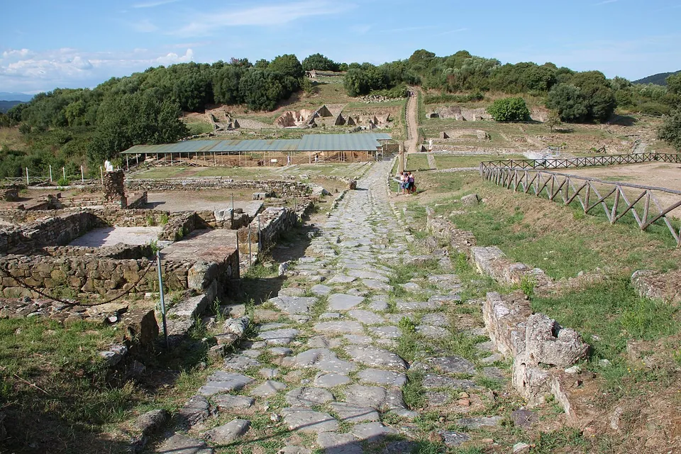
Photo: LepoRello · CC BY-SA 3.0 · Commons
47 km · city · Tuscany
Rusellae
The town sits on two hills with a small valley between them, and the forum occupies the valley (it.wikipedia).


Straight-line distances.
Sources
Every fact on this page comes from the records below, each used under the licence noted.