

What is there today
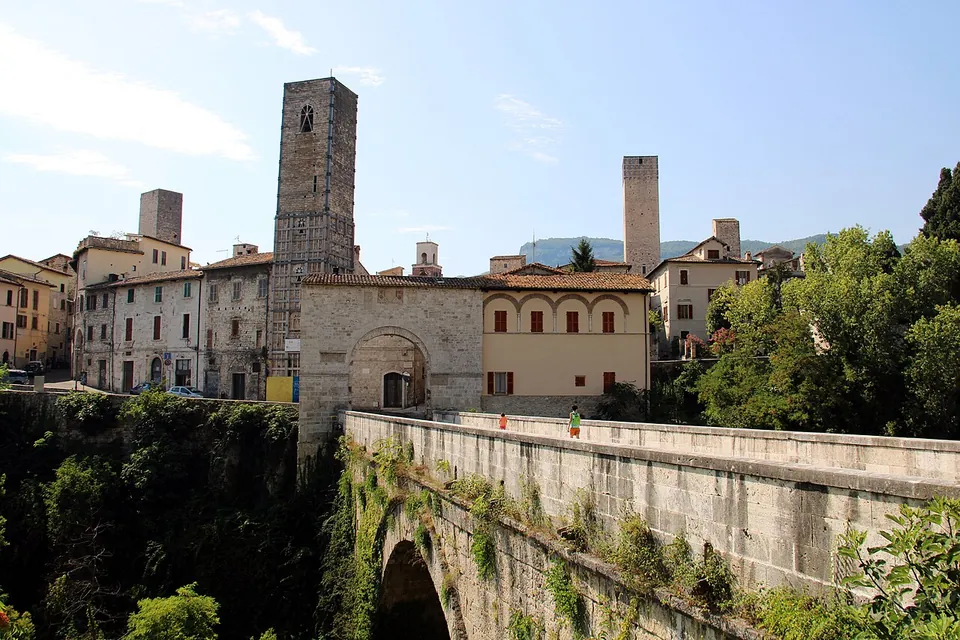
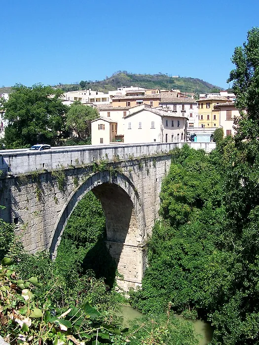
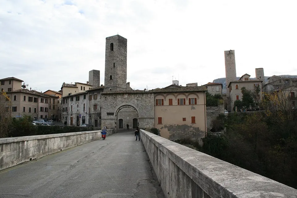
The bridge is one round arch of squared travertine blocks with a span of 22.20 m, standing 25 m high to the roadway, which is 62 m long and 6.50 m wide (it.wikipedia; de.wikipedia and the city’s tourism site give the same span and length). The blocks are laid without mortar and held together by the thrust of the arch. On both banks a plinth rising 5 m above the water carries pilasters with Doric capitals, set against the spurs of rock, and fragments of Doric frieze set in place of fallen stones show it was already being repaired in Roman times (it.wikipedia). It is regarded as one of the most representative Roman bridges, having kept its construction features intact, but the structure is no longer Roman all the way through: in the restorations of the 1930s the core was emptied and a reinforced-concrete bridge cast inside it, anchored to the Roman shell. It holds the shell up and takes the vibration of the traffic, and it is visible at no point (it.wikipedia).
Inside the piers are inspection chambers and a passage that runs from bank to bank. A stair in the left abutment leads in; another follows the curve of the arch up to the keystone, and from there a walkway hung between the two Roman walls goes down the other side (FAI). From these chambers the dry-laid masonry can be seen, along with the layers of road paving laid one over another down the centuries; excavation found the Roman surface, of travertine, still marked by wheel ruts (it.wikipedia).
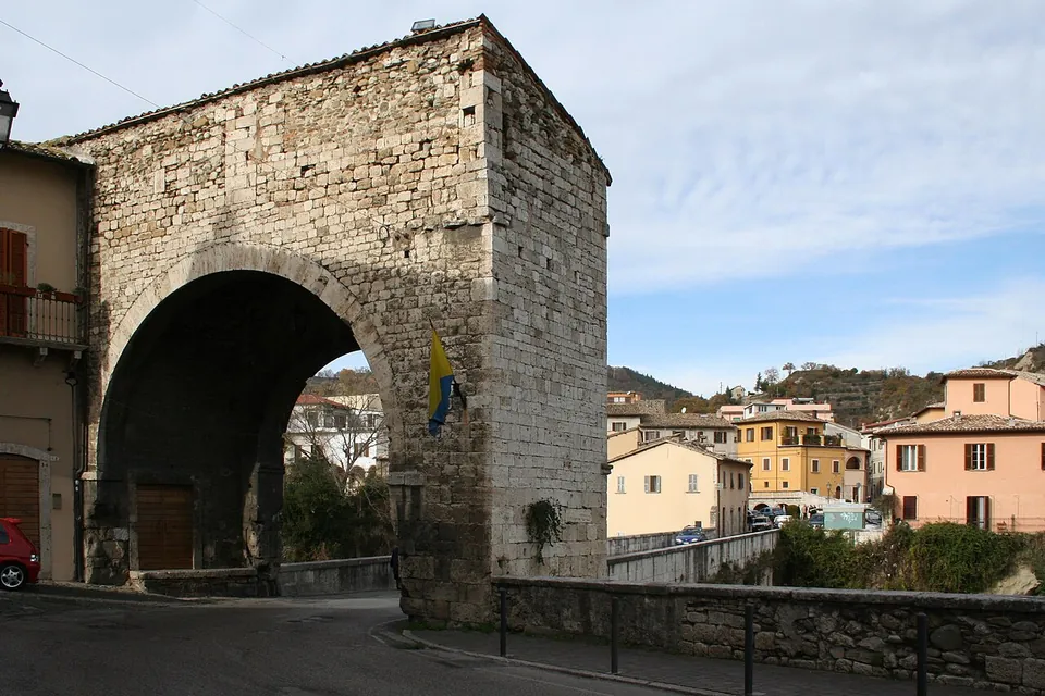
The gate at the town end is a single large arch of squared travertine blocks with a two-banded cornice. A Latin inscription in Gothic letters, on a stone set into the wall on the right, records that the podestà Fildesmilio da Mogliano had it built in 1230, probably from material of an earlier Roman gate (it.wikipedia, which gives the reuse as likely, not certain). Higher up, another inscription marks the peace and alliance with Fermo of 1450 (it.wikipedia).
The Roman amphitheatre, grouped with this stop, lay about 300 m to the south (Wikidata, OpenStreetMap). There is nothing to see of it: its remains lie under and around Piazza San Tomaso and are no longer visible, although the vaulted radial walls that carried its seating were still standing in the 18th century (amphi-theatrum.de).
Is it worth the trip?
As part of a walk round Ascoli, yes. This is a Roman bridge still in daily use after two thousand years, thrown in one arch across a deep green gorge, which the city’s tourism site counts among the best preserved the Romans built anywhere, and it costs nothing. On its own it is a short stop: you see the arch, cross the roadway and pass under the gate. The interior, where the Roman stonework is laid bare, is the part that would make it more, and no regular opening of it was found. Pair it with the other stops of Asculum Picenum – Ascoli Piceno rather than coming for the bridge alone.
Getting there
The bridge and its gate are about 0.5 km north-west of Piazza del Popolo in the historic centre (straight-line distance). Two free car parks are mapped about 250 m from the gate and the nearest bus stop, Porta Cappuccina - Via Rigantè, about 160 m away (OpenStreetMap).
The bridge and the gate are part of the street, free and open at all times. No published opening times were found for the passage inside the bridge. The bridge was one of FAI’s autumn open-day sites in 2016 and 2018 (FAI), so watch FAI’s and the city’s announcements rather than counting on getting in.
Visiting details
- Opening hours
- The bridge and the gate at its end carry a public street and can be seen at any time. No published opening times were found for the passage inside the bridge.
- Tickets
- Free.
- Parking
- Two free car parks are mapped about 250 m and 275 m from the gate (OSM way/297819476 and relation/7590278), and the Parcheggio San Pietro in Castello about 245 m away. The nearest bus stop, Porta Cappuccina - Via Rigantè, is about 160 m away.
Before you go
- No regular opening was found for the passage inside the bridge, where the Roman masonry can be seen; the bridge was one of FAI's autumn open-day sites in 2016 and 2018, so do not count on going in.
Hours and prices checked 24 October 2026 on the operator's own site. Confirm before travelling.
History
Asculum became a Roman municipium after Gnaeus Pompeius Strabo took and sacked it in 89 BC, and it prospered under Augustus, who made Picenum the fifth region of Italy, gaining temples, theatres, houses, bridges and fortifications (it.wikipedia). The bridge belongs to that Augustan building; de.wikipedia dates it to 25 BC, and its designer is unknown. A secondary branch of the Via Salaria set out from the bridge (it.wikipedia).
Earthquakes, erosion and the floods of the Tronto meant repeated consolidation over the centuries, and in the early 1930s a radical restoration (FAI). The works of 1929–30 and 1937–38 ended with the consolidation of 1938, directed by the Ascoli engineer G. Viccei for the bimillennium of Augustus, which did most for the bridge’s survival; a marker stone records the restoration, and on 25 July 1943 its date and the fascist fasces were erased from it and replaced with the city’s arms (it.wikipedia).
The gate was built in 1230 at the head of the bridge. Some derive its name from a temple of Sol supposed to have stood here, others from “Sullae statio”, after a column Sulla set up there; neither is more than a proposal. It became the Porta Cappuccina in the 16th century, after the Capuchin friars were allowed in 1544 to build a small church near it (it.wikipedia).
More photographs

Nearby
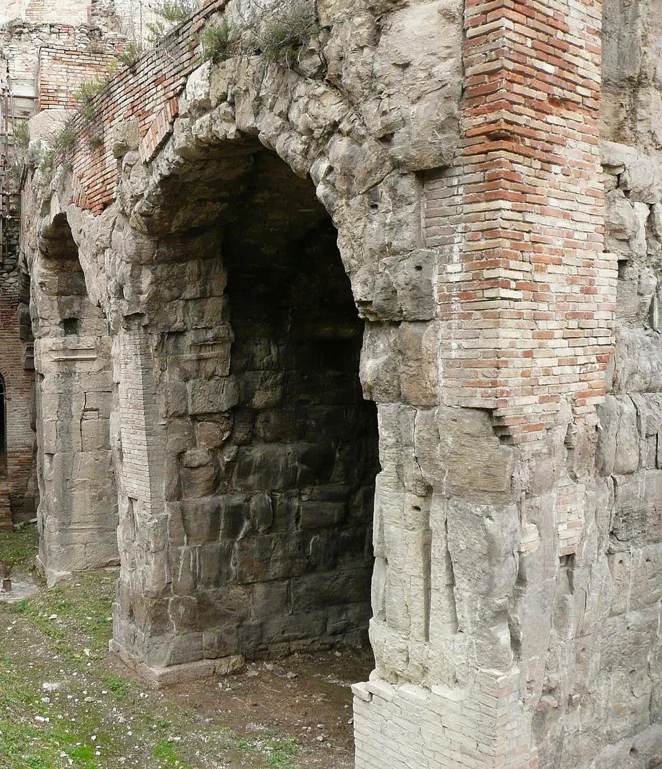
Photo: Franco TamTam · Public domain · Commons
24 km · city · Abruzzo
Interamnia Praetuttiorum – Teramo
The theatre and the amphitheatre stand side by side next to the cathedral, in what was the western quarter of the Roman town; a theatre and an amphitheatre a few metres apart is described as almost unique (it.wikipedia).
Photo: Franco TamTam · Public domain · Commons
Photo: Franco TamTam · Public domain · Commons


Straight-line distances.
Sources
Every fact on this page comes from the records below, each used under the licence noted.
| Source | Licence |
|---|---|
| Pleiades 413249073 | CC BY |
| Wikidata Q3908845 | CC0 |
| OpenStreetMap way/459347762 | ODbL |
| Pleiades — Solestà Roman bridge | licence not recorded |
| Wikidata — Ponte Romano di Solestà (Q2103727) | licence not recorded |
| Wikipedia (it) — Ponte romano di Solestà | CC BY-SA 4.0 |
| Wikipedia (de) — Ponte Romano di Solestà | CC BY-SA 4.0 |
| Wikipedia (it) — Porta Solestà | CC BY-SA 4.0 |
| Wikipedia (it) — Asculum | CC BY-SA 4.0 |
| Visit Ascoli (Comune di Ascoli Piceno) — the bridge in Porta Solestà | licence not recorded |
| FAI, I Luoghi del Cuore — Ponte romano di Porta Solestà | licence not recorded |
| Wikidata — Asculum amphitheatre (Q28977988) | licence not recorded |
| amphi-theatrum.de — Ascoli, Amphitheater | licence not recorded |