

What is there today
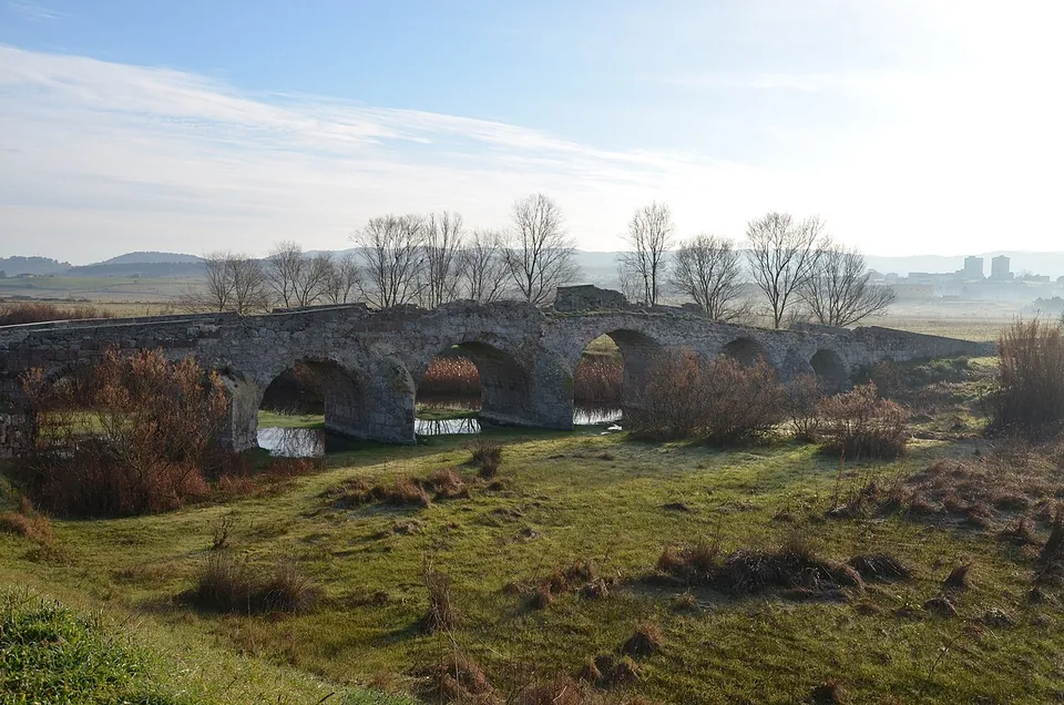
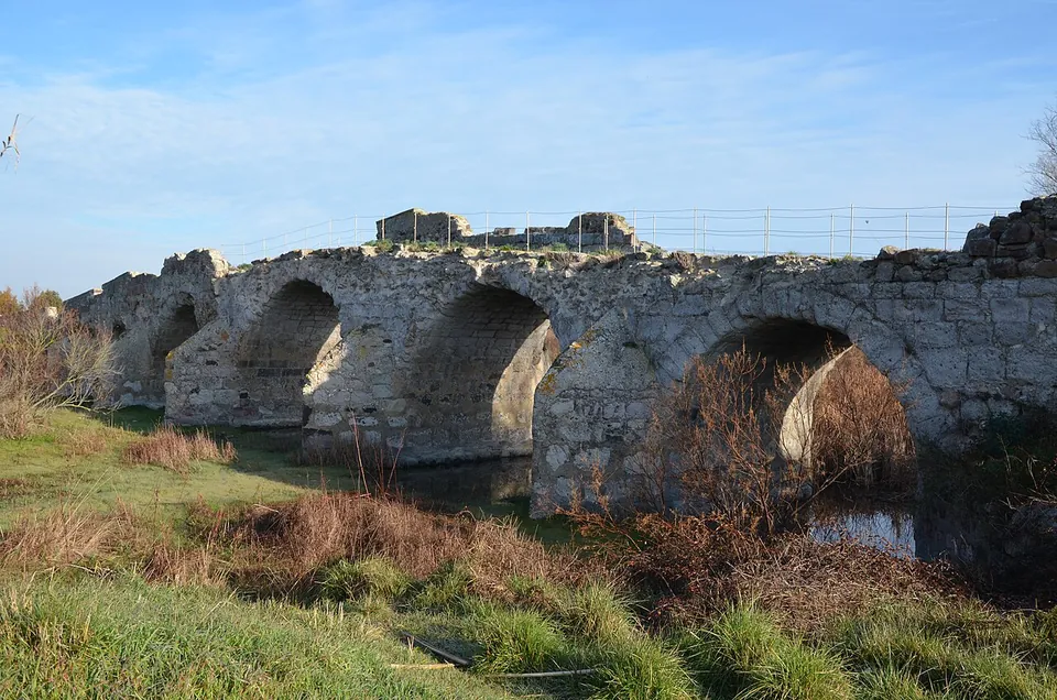
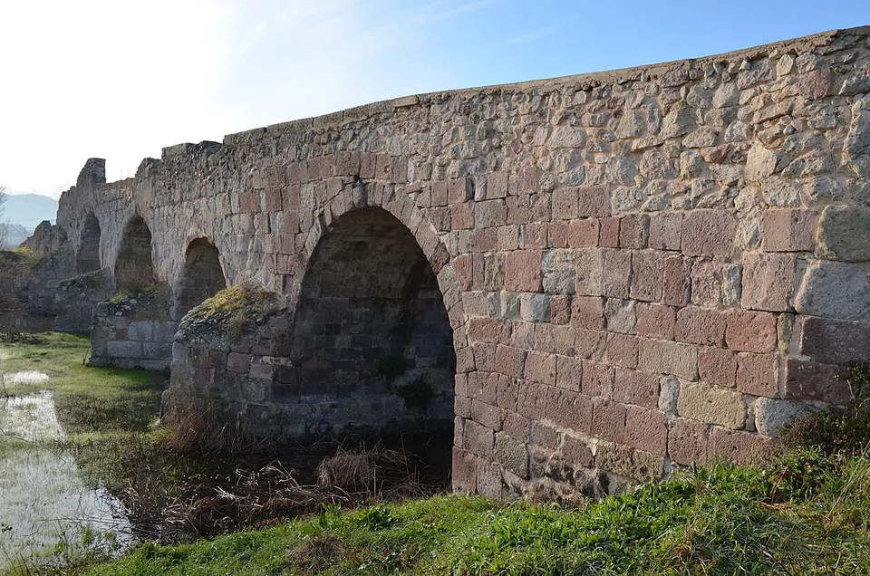
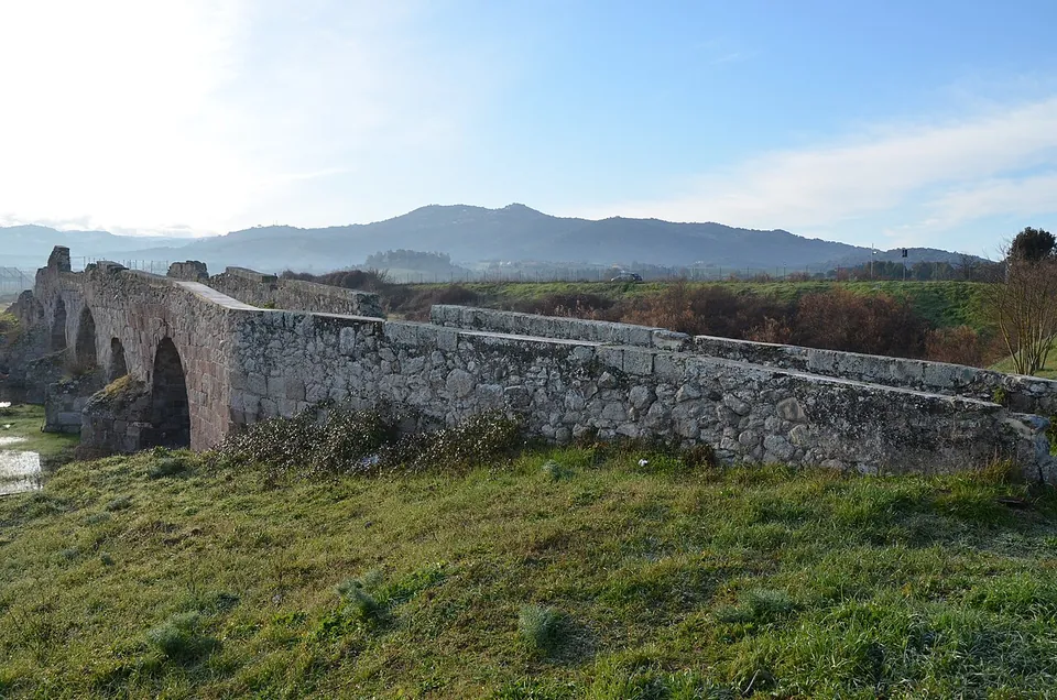
The bridge itself. It runs about 87.5 m on six round arches that grow smaller from the centre towards the banks, and rises to about 8 m at its highest (it.wikipedia; the regional culture portal SardegnaCultura gives over 90 m, so published lengths run from 87.5 to 90-odd metres). The core is concrete faced with squared blocks of local stone, some of them from medieval repairs, and the piers carry cutwaters upstream and downstream to break the current (it.wikipedia); SardegnaCultura notes that the cutwaters are well preserved. Pleiades calls it extremely well preserved compared with much of the other Roman building in the area. The river around it is a wetland, protected since 1992 as a nature oasis (Monumenti Aperti).
Is it worth the trip?
If you are in northern Sardinia with a car, yes, for a short stop: it is one of the largest Roman bridges on the island (Monumenti Aperti), it looks the part, and it costs nothing to see. There is nothing else here, though: no visitor centre or information point is mapped (OpenStreetMap). It pairs well with Ozieri, whose civic archaeological museum and, outside the town, the Romanesque basilica of Sant’Antioco di Bisarcio are on the regional tourist board’s list (SardegnaTurismo), and with the nuraghe and Roman house walls at Sa Mandra ’e Sa Giua, about 1 km away (it.wikipedia; OpenStreetMap).
Getting there
The bridge is 3.7 km in a straight line from the centre of Ozieri (OpenStreetMap). SardegnaCultura’s directions: from Ozieri take the SS 132 towards San Nicola as far as the junction, then carry on for about another kilometre, leaving San Nicola on your right. No car park, bus stop or station is mapped near the bridge; minor country roads pass about 60 m away and a footpath crosses the bridge (OpenStreetMap).
No operator publishes opening hours or an admission charge, and no fee or gate is recorded in OpenStreetMap: it is an open-air bridge in open country.
Visiting details
- Tickets
- Free
Before you go
- No operator publishes opening hours or a ticket for the bridge. It stands in open country with a footpath mapped across it, and no gate or fee is recorded.
- No bus stop, railway station or car park is mapped near the bridge; the nearest mapped roads are minor country roads about 60 m away. Plan on a car.
History
The bridge probably dates from the 1st century AD, had a major restoration in the late empire, in the 3rd or 4th century, and was reworked again in the Middle Ages (it.wikipedia). It carried the Roman road between Cagliari and Olbia across the Monteacuto valley, which had several more bridges along the same route; the archaeologist Paola Basoli has suggested that they were built by the Roman troops stationed at the nearby fort of Luguido, near Oschiri (SardegnaCultura for the road and bridges; it.wikipedia for Basoli). Pleiades links the bridge to the heavy military presence Rome kept on the island after Augustus reorganised the province, and reads it as a statement of Roman control over movement across the river as much as a crossing.
It never fell out of use. Medieval roads from the mountains to the south and from the west still converged on it (SardegnaCultura), and until a few decades ago it carried motor traffic across the river (it.wikipedia). SardegnaCultura’s entry describes it as never excavated, but a paper of 2011 reports restoration work and excavation at the bridge, and the restoration was published again in 2012 (titles listed by Pleiades and it.wikipedia).
More photographs

Sources
Every fact on this page comes from the records below, each used under the licence noted.
| Source | Licence |
|---|---|
| Pleiades 257120882 | CC BY |
| Wikidata Q3907939 | CC0 |
| Vici.org 16311 | CC BY-SA (text), CC0 (metadata) |
| OpenStreetMap way/285328655 | ODbL |
| Wikipedia (it) — Pont'ezzu | CC BY-SA 4.0 |
| SardegnaCultura (Regione Sardegna) — Ozieri, Roman bridge | licence not recorded |
| Monumenti Aperti — Pont'ezzu | licence not recorded |
| SardegnaTurismo (Regione Sardegna) — Ozieri | licence not recorded |