

Copia was the Roman colony on the plain of the Crati in northern Calabria, and its remains are the heart of the archaeological park of Sibari: paved streets, house walls, mosaic floors and a theatre. Two Greek cities, Sybaris and Thurii, stood on the same site before it.
What is there today
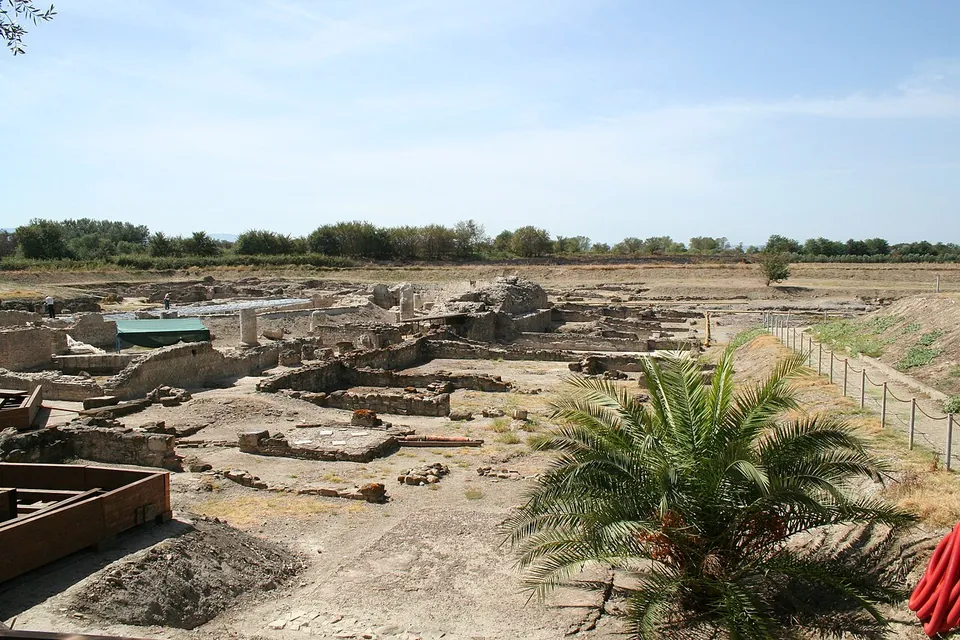
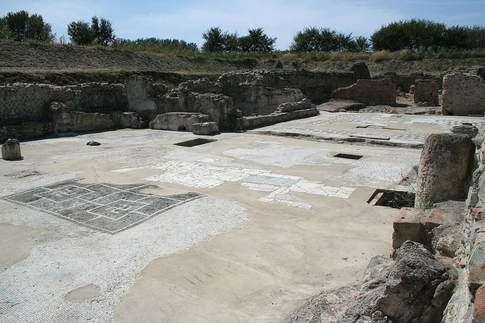
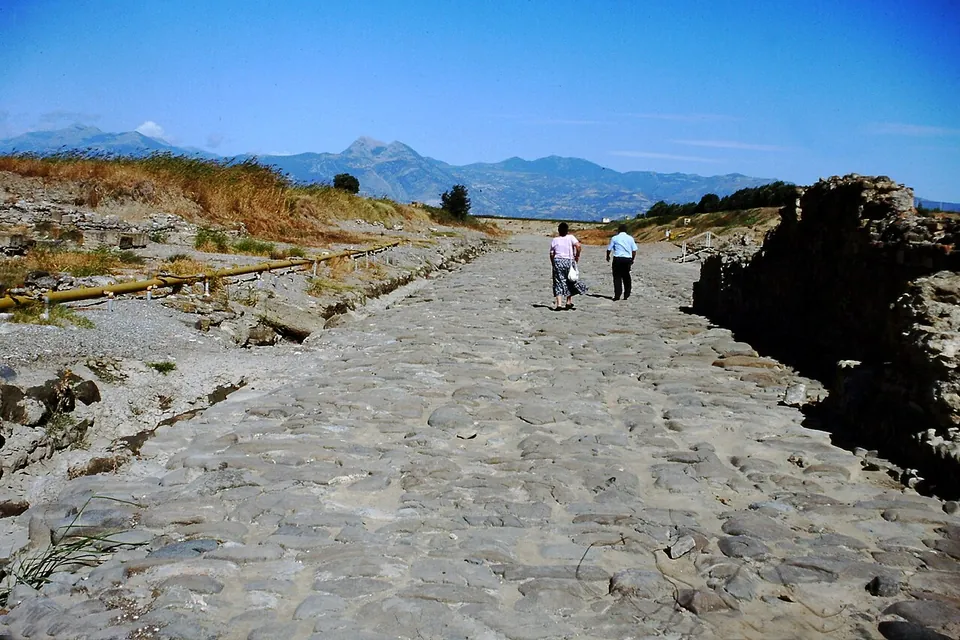
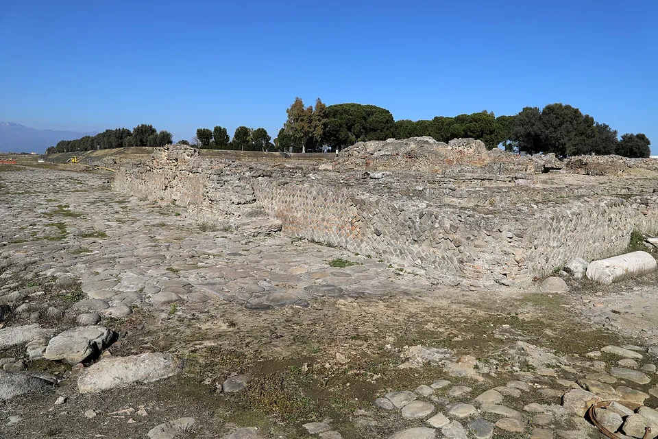
The ruins lie in a broad excavation below the level of the surrounding farmland (Commons photographs). The best-preserved remains, in the area called Parco del Cavallo, date from the Roman period: a quarter laid out along two large streets, with a theatre (it.wikipedia). The earliest explorations here uncovered mainly Roman structures belonging to the Latin colony of Copia (it.wikipedia). The streets cross at right angles, the planned grid of Greek Thurii that the Roman town kept (it.wikipedia; en.wikipedia). Behind the theatre lie the remains of a large town house, one of the most sumptuous private buildings in the Roman city, built in the 1st century BC and enlarged and remodelled while it stayed in use until the 5th century AD (en.wikipedia). Elsewhere in the park you see broad stone-paved streets, the walls of a bath building beside the north–south street, and black-and-white mosaic floors in the excavated buildings (the descriptions of photographs on Commons).
The famous city is the one you cannot see. Archaic Sybaris lies under 6 to 10 m of river silt, below the water table — published figures differ (en.wikipedia; fr.wikipedia) — and only small areas of it have been reached (en.wikipedia). The finds from all three cities, among them a bronze charging bull that the operator calls the most striking piece, are in the Museo archeologico nazionale della Sibaritide (the operator), which the same ticket covers.
Is it worth the trip?
Yes, if you are on the Ionian coast of Calabria or driving the SS106: it is a Roman town plan you can walk through, beside the main road, the ticket is cheap and it includes a national museum. Set expectations honestly, though. This is a plan at ground level — foundations, low walls, streets and floors — on a flat, open plain, not a town of standing buildings, and the name promises a Greek city that is almost entirely out of sight. See the museum as well: it holds what gives the ruins their meaning.
Getting there
The site is in the comune of Cassano all’Ionio, south-east of the village of Sibari, in the province of Cosenza (en.wikipedia), right beside the SS106 Jonica coast road. A car park is mapped about 300 m from the point on this page’s map, with free public toilets and history boards near the path (OpenStreetMap). No bus stop or station is mapped nearby, so it is a site for drivers.
A ticket is €5, reduced €2, and covers both the archaeological park and the Sibaritide museum (the operator’s listing on the Ministry of Culture site, as archived in April 2026). In summer the park has opened 09.30 to 20.00, with the ticket office closing at 19.00 (the operator, August 2025). The ministry listing leaves its weekly timetable blank, so the opening days and winter hours are not confirmed: phone the park (+39 337 1591152) before travelling. The excavations lie in waterlogged ground, and the Crati flooded the whole park in 2012–13 (it.wikipedia; the operator), which is one more reason to check that it is open.
Visiting details
- Opening hours
- Summer hours 09.30–20.00, ticket office until 19.00 (the operator's notice for August 2025). The ministry listing leaves its weekly timetable blank, so the opening days and winter hours are not confirmed; phone the park on +39 337 1591152 before going.
- Tickets
- €5; reduced €2. The ticket covers both the archaeological park and the Museo archeologico nazionale della Sibaritide.
- Parking
- A car park is mapped about 300 m from the point (OSM node/13157959401), just off the SS106 Jonica, which passes about 50 m away.
Before you go
- No bus stop or railway station is mapped near the site; plan on a car.
- The excavations lie in waterlogged ground on the Crati plain, and the river flooded the whole park in 2012–13; check that it is open before a long drive.
Hours and prices checked 20 April 2026 on the operator's own site. Confirm before travelling.
The theatre
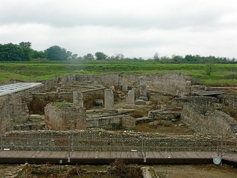
The Roman theatre stands in the Parco del Cavallo area (it.wikipedia), a few hundred metres west of the point on this page’s map (Wikidata; OpenStreetMap). Pleiades dates it between 30 BC and AD 300 and rates what survives as traces; the photographs show low walls of rubble and brick and square piers rather than a standing cavea, with a visitors’ boardwalk along one side in 2009 (Commons).
History
Achaean and Troezenian settlers founded Sybaris around 720 BC, and its wealth became so proverbial that “sybarite” still means a lover of luxury (en.wikipedia). Kroton destroyed it in about 510 BC. In 444/443 BC a new colony under Athenian leadership, Thurii, was built partly on top of the old city (en.wikipedia), on a grid attributed to the planner Hippodamus (it.wikipedia; Pleiades). Lucanians sacked Thurii around 390 BC, and the Roman Republic placed a garrison there in 282 BC (Pleiades).
Thurii went over to Hannibal after Cannae; in 204 BC, withdrawing to Bruttium, he took 3,500 of its leading citizens to Kroton and gave the town to his troops to plunder (en.wikipedia). In 194 BC Rome refounded it as a colony with Latin rights, with 3,000 foot soldiers and 300 horsemen as colonists, under the name Copia — the name on its coins — though the old name Thurii soon came back into use (en.wikipedia). It was a municipal town in the late Republic: Spartacus took it in 72 BC, Julius Caesar garrisoned it with Gaulish and Spanish cavalry, and in 40 BC Sextus Pompeius laid waste its territory but could not take the walls. Gaius Octavius, the father of Augustus, defeated a Spartacist force nearby, and the infant future emperor was given the surname Thurinus (en.wikipedia).
Pliny, Ptolemy and Strabo all knew the town, and Procopius still names it in the 6th century AD (en.wikipedia). The Crati, building its delta out into the sea at about a metre a year, left the town landlocked and cut off from trade; it was abandoned in the Middle Ages, in the 9th century according to Pleiades, and buried by the river’s silt (en.wikipedia; Pleiades). The ruins were excavated from 1932, but the waterlogged ground defeated deep digging until a core-drilling programme in the early 1960s located the Greek city and systematic campaigns followed from 1969 (en.wikipedia; it.wikipedia).
More photographs


Sources
Every fact on this page comes from the records below, each used under the licence noted.
| Source | Licence |
|---|---|
| Pleiades 452457 | CC BY |
| Wikidata Q220583 | CC0 |
| Vici.org 11394 | CC BY-SA (text), CC0 (metadata) |
| OpenStreetMap way/260663627 | ODbL |
| Wikipedia (it) — Parco archeologico di Sibari | CC BY-SA 4.0 |
| Wikipedia (en) — Sybaris | CC BY-SA 4.0 |
| Wikipedia (en) — Thurii | CC BY-SA 4.0 |
| Wikipedia (it) — Thurii | CC BY-SA 4.0 |
| Wikipedia (de) — Sybaris | CC BY-SA 4.0 |
| Wikipedia (fr) — Sybaris | CC BY-SA 4.0 |
| Pleiades — Roman theatre of Sybaris/Copia | licence not recorded |
| Wikidata — Roman Theatre of Sybaris (Q56476980) | licence not recorded |
| Ministero della Cultura — Museo archeologico nazionale della Sibaritide (prices; the operator's listing, archived copy of 20 April 2026) | licence not recorded |
| Ministero della Cultura — Ferragosto 2025 al Parco archeologico nazionale della Sibaritide (summer hours; archived copy of 4 August 2025) | licence not recorded |
| Parchi Archeologici di Crotone e Sibari (the operator) | licence not recorded |