Photo: Carlo grifone · CC BY-SA 4.0 · Commons
gate · Aosta Valley
Porta Praetoria
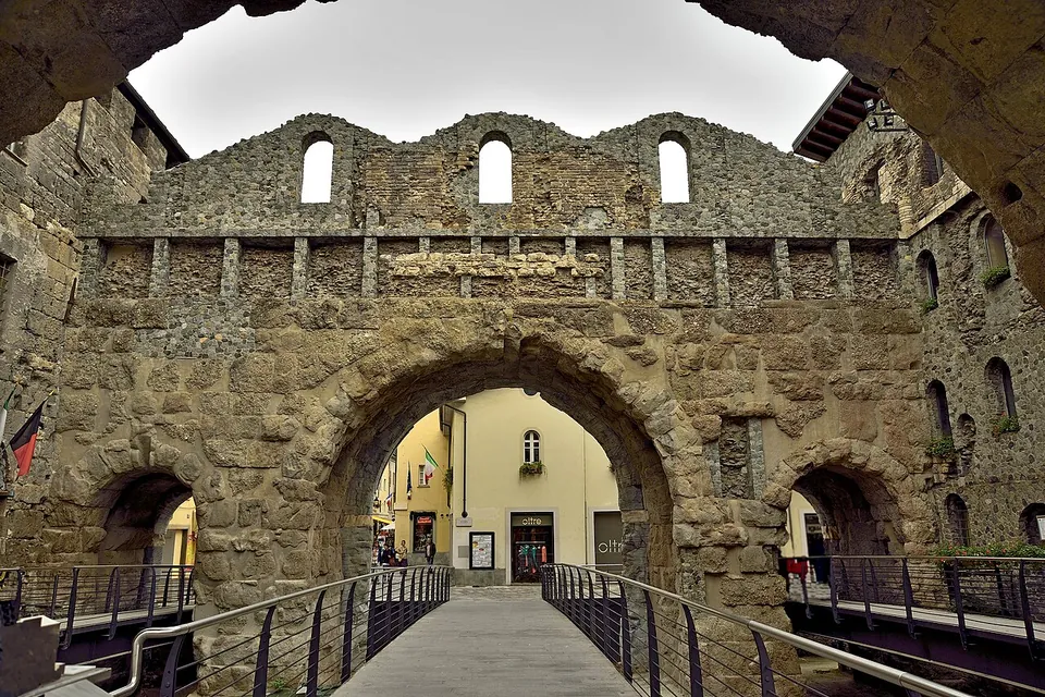
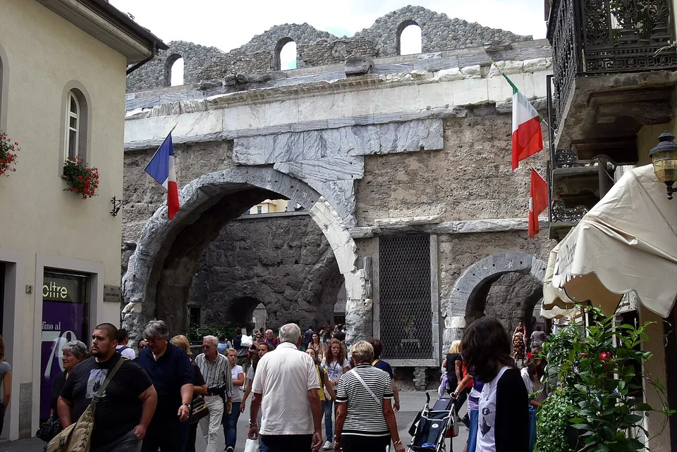
The gate is two parallel rows of arches with a small square between them, which served as a parade ground for troops (it.wikipedia; Lovevda).
Free
Augusta Praetoria Salassorum, Aoste
city · Aosta Valley, Italy
2 places to see, the best preserved and best known first.
Photo: Carlo grifone · CC BY-SA 4.0 · Commons
gate · Aosta Valley
The gate is two parallel rows of arches with a small square between them, which served as a parade ground for troops (it.wikipedia; Lovevda).
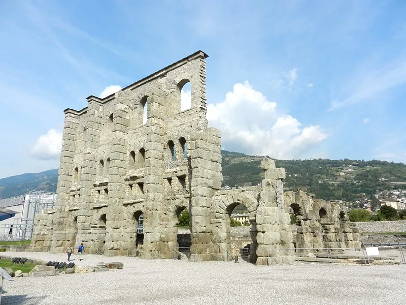
Photo: Geobia · CC BY-SA 3.0 · Commons
Augusta Praetoria was the Roman colony Augustus founded in the Aosta Valley, and modern Aosta still lives inside it: the town walls survive almost entire, its eastern gate stands intact, and within a short walk stand a triumphal arch, the 22 m façade of the theatre, the vaulted gallery under the forum, the arcades of an amphitheatre and a Roman bridge. For a Roman town in the Alps this is an unusually complete set, and one combined ticket covers the parts that charge.
The walls and the eastern gate. The walls enclose a rectangle of 724 by 572 m and are still preserved almost in their entirety, 6.4 m high, built of concrete faced with small stone blocks. Of the twenty towers, en.wikipedia lists six as well preserved, among them the Tour du Pailleron and the Tour du Lépreux, though two of the six, Tourneuve (13th century) and Bramafan (11th century, on a Roman bastion), are medieval in their present form. The street grid inside them still follows the Roman plan (fr.wikipedia; en.wikipedia).
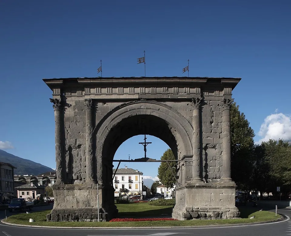
The Porta Praetoria and the Arch of Augustus. The way into the old centre still runs through the eastern gate, the Porta Praetoria, a double row of arches with a courtyard between them, and outside it, on the line of the town’s main street, stands the Arch of Augustus, raised for the Roman victory over the Salassi in 25 BC (it.wikipedia; en.wikipedia). Both are free, in the street, and described on the Porta Praetoria page.
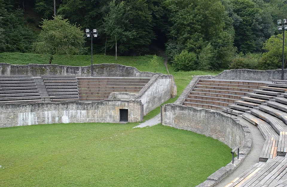
The theatre and the amphitheatre. Near the gate, inside the walls, the south façade of the theatre still stands 22 m high, and immediately north of it the arcades of the amphitheatre survive in the walls of a convent (it.wikipedia). Both are on the Roman Theatre of Aosta page, with the theatre’s hours and the combined ticket.
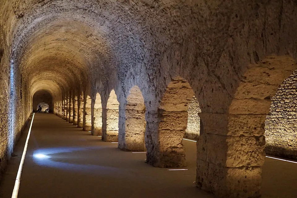
The forum cryptoporticus. Next to the cathedral, in a small garden, lies the entrance to the cryptoporticus: a two-aisled vaulted gallery running round three sides of a rectangle of 89 by 73 m, open to the south, under the terrace on which the forum’s two temples stood (it.wikipedia; the operator). it.wikipedia names them as the temples of the deified Augustus and of the Capitoline triad. What it was for is not clear: perhaps a covered walk used in ceremonies, from the 3rd century a store, and in any case a retaining wall for the terrace (it.wikipedia). It is one of the few forum cryptoporticoes open to the public, with those of Arles, Reims and Bavay (it.wikipedia; fr.wikipedia).
The Roman bridge. About 150 m east of the arch, the Pont de Pierre carried the road over the Buthier on a single flattish arch of 17 m; in the Middle Ages the torrent moved its bed to the west, the bridge was gradually buried, and only in modern times was it dug out again, so it now spans dry ground (it.wikipedia; de.wikipedia). It is dated to the second half of Augustus’s reign (de.wikipedia).
The Villa della Consolata. Some 400 m from the northern walls, a suburban house found during building work in 1971 dates from the second half of the 1st century BC, before the colony was founded; it was altered around AD 300 and finally abandoned in the late 5th or early 6th century (the operator). Under a modern shelter a raised walkway with information panels passes its kitchen, store rooms, bedrooms and dining room with patterned floors, and a bath suite with underfloor heating (it.wikipedia).
The museum. The MAR, the regional archaeological museum in the centre, stands on the Roman remains of one of the town’s gates, the Porta Principalis Sinistra, and shows almost only finds from Augusta Praetoria (the operator), including a model of the Roman town.
Yes. The operator calls Aosta the Rome of the Alps, and the town earns it: a double gate, an arch and walls you can follow in the open street, and a theatre façade standing 22 m high against the mountains. Everything is within a compact centre, so it is a half-day on foot, and the cryptoporticus is the surprise of the visit.
Know the limits. Much of Roman Aosta is fragments built into the later town, as the theatre’s and the gate’s pages explain, and the Villa della Consolata is open only by booking on three half-days a week.
Aosta has a railway station on the line to Ivrea and Chivasso, with direct trains only as far as Ivrea; buses from the bus station by the railway go to Turin, Milan, Chamonix and Martigny. By road the A5 motorway from Turin reaches the town, and the nearest airports with scheduled flights are Turin, 65 km away, and Geneva, 109 km (en.wikipedia). In town the stops are close together: the theatre and the gate lie 0.3–0.4 km from the forum, the arch about 0.8 km and the bridge about 1 km (the candidate records).
The cryptoporticus opens daily, 09.00–19.00 from April to September and 10.00–13.00 and 14.00–17.00 from October to March; the MAR museum keeps the same hours but closes at 18.00 in winter. Both are closed on 25 December and 1 January. They are sold only on the Aosta Archeologica combined ticket, which also covers the theatre, the MegaMuseo and the early Christian church of San Lorenzo; its price and concessions are on the Roman Theatre of Aosta page. With that ticket you can book the Villa della Consolata on 0165 275911 for Tuesday or Saturday mornings, 09.00–13.00, or Friday afternoons, 14.00–17.00 (Regione autonoma Valle d’Aosta, valledaostaheritage.com, read 20 October 2026 – check before travelling). The gate, the arch, the walls and the bridge are in the street.
Before you go
Hours and prices checked 20 October 2026 on the operator's own site. Confirm before travelling.
The valley belonged to the Salassi, a Celtic people who stood in the way of the road over the Alpine passes into Gaul; in 25 BC Augustus sent Aulus Terentius Varro Murena against them, and they were killed or sold into slavery (en.wikipedia; it.wikipedia), although it.wikipedia notes that inscriptions with Salassian and Roman names side by side point to the survivors being absorbed rather than wiped out. A colony of 3,000 veterans followed in 25 or 24 BC (published dates differ), on the site of Varro’s camp (fr.wikipedia; Pleiades). Pleiades describes it as the capital of the province of the Graian Alps from 11 BC.
The town was laid out like a military camp, at the point where the roads to the Great and Little St Bernard passes divided (it.wikipedia; en.wikipedia), with its main street, about 9 to 10 m wide by the two Wikipedia accounts, running from east to west between its gates. it.wikipedia puts the walled area at 41 hectares and counts it from the 1st century among the richest and most populous towns of northern Italy.
After the fall of the Western Empire the town passed in turn to the Burgundians, the Ostrogoths and the Byzantines, then to the Lombards, who were driven out by the Franks under Pepin the Short; under Charlemagne it became a stage on the Via Francigena from Aachen to Italy (en.wikipedia; Pleiades). The Roman buildings were reused rather than cleared: the arch was lived in, a chapel stood on top of the gate, the amphitheatre became a convent and houses were built against the theatre (it.wikipedia), stories told on those monuments’ pages.
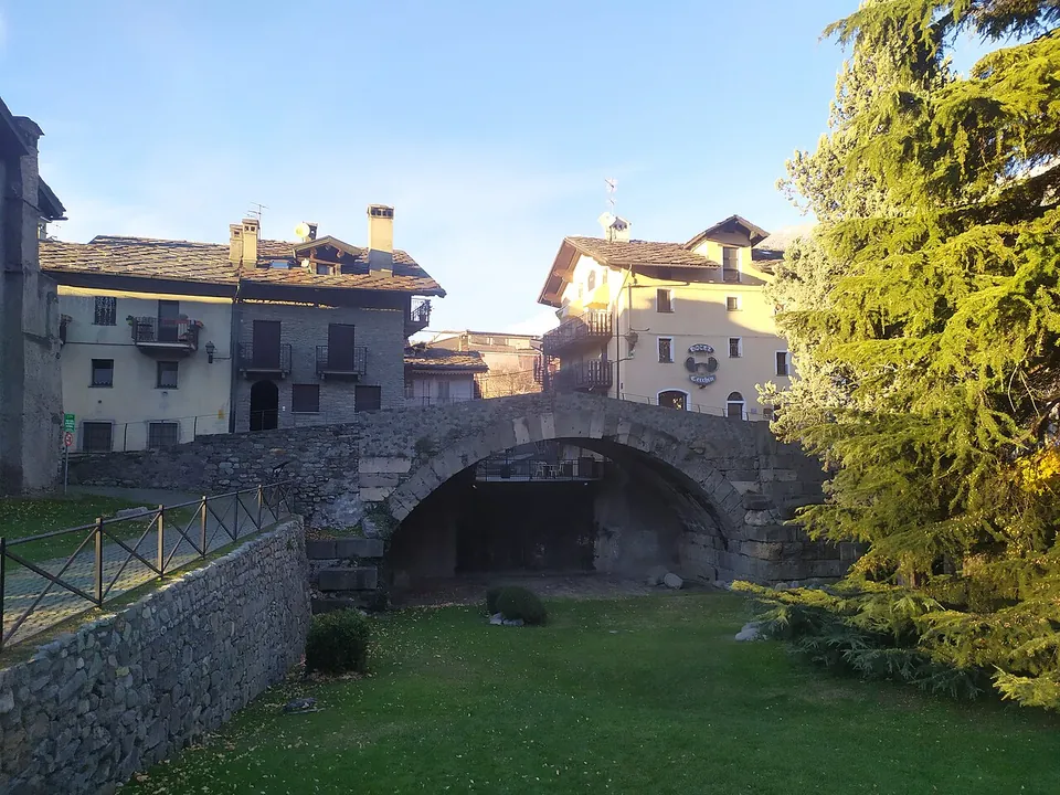
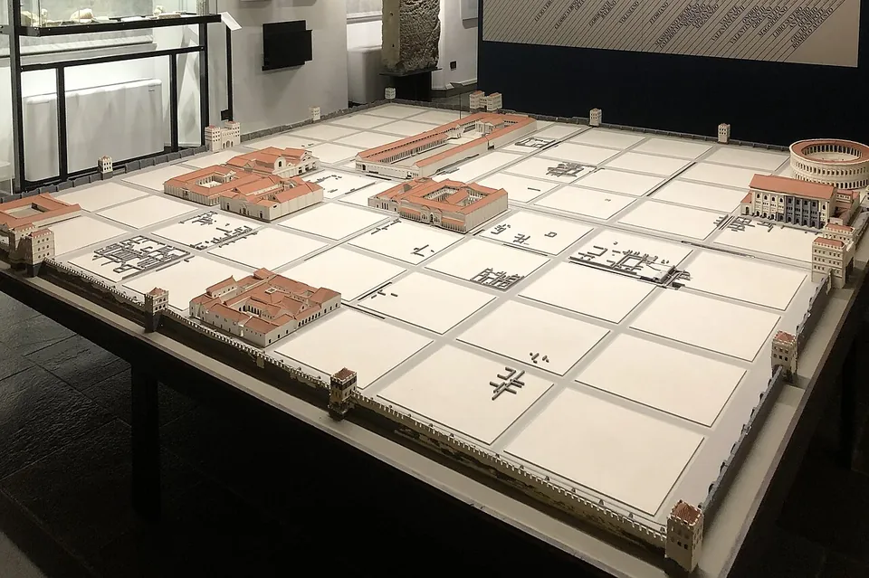
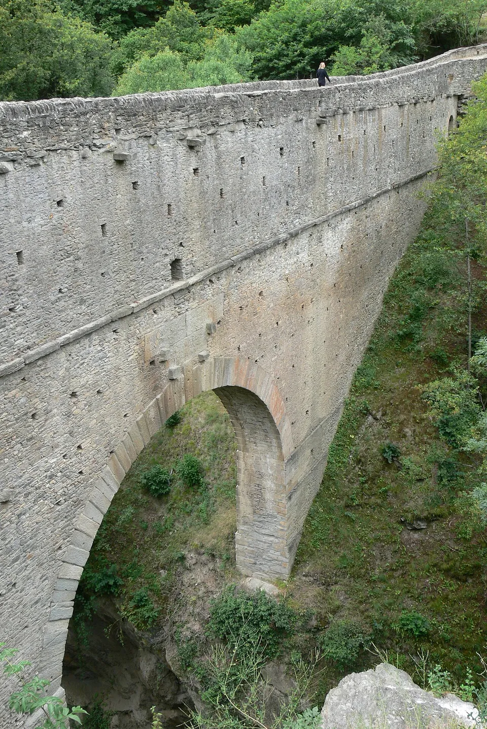
Photo: Wolfgang Sauber · CC BY-SA 3.0 · Commons
10 km · aqueduct · Aosta Valley
The bridge itself, complete to its deck: a single arch with a span of 14.24 m carrying a stone structure 60.46 m long and 2.26 m wide across a gorge only 12 m wide at this point (de.wikipedia).
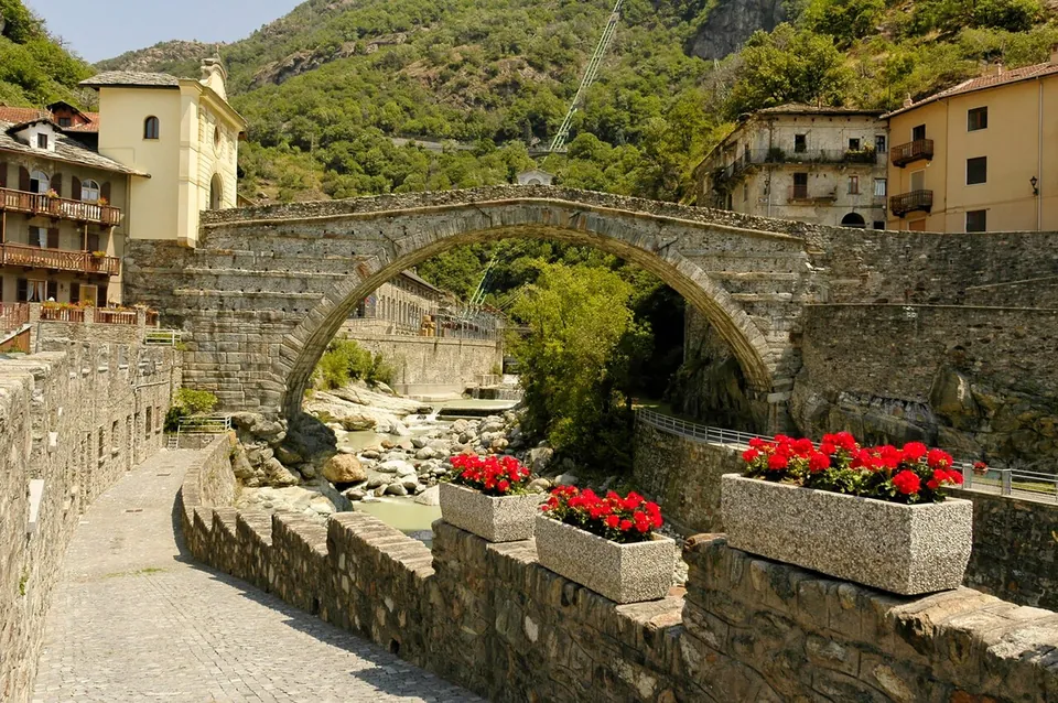
Photo: dacolje · CC BY-SA 2.5 · Commons
44 km · amphitheatre · Martigny District, Valais
The arena measures 75.5 by 63.7 m and held about 5,000 spectators (de.wikipedia).
Straight-line distances.
Every fact on this page comes from the records below, each used under the licence noted.