

What is there today
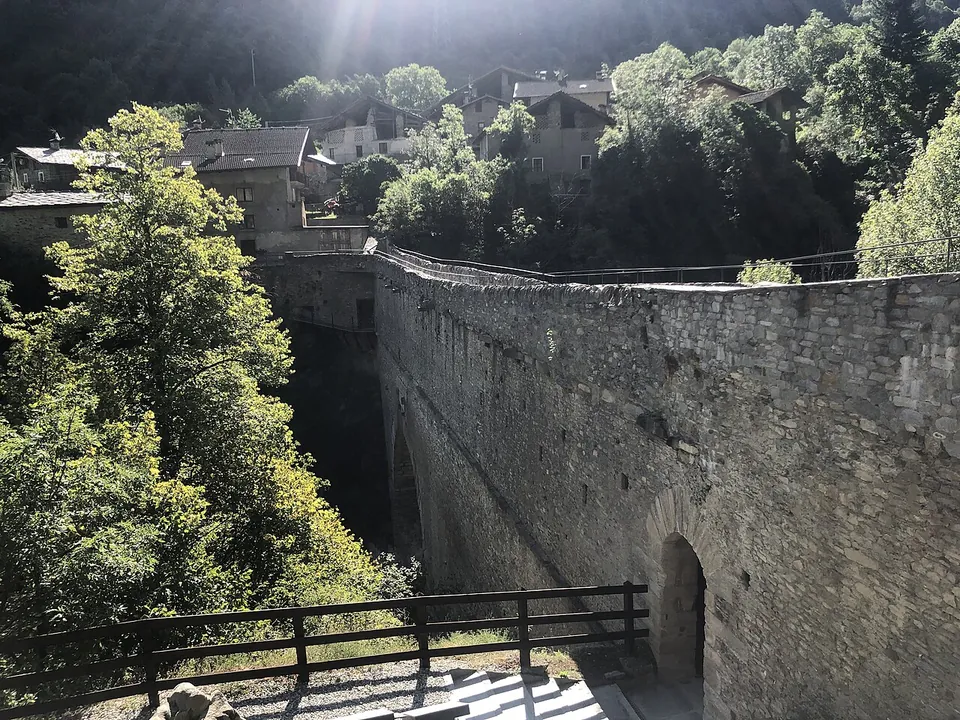
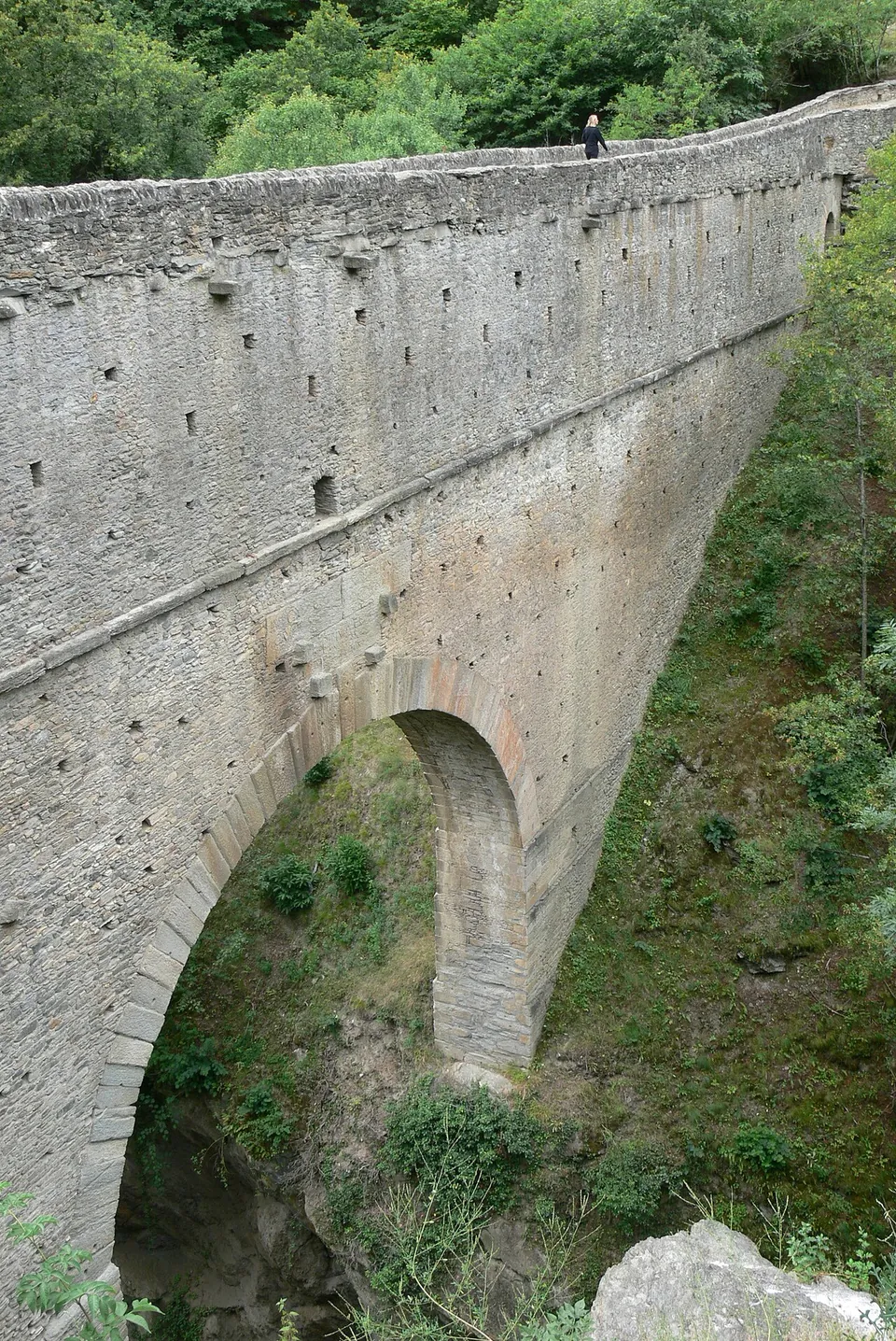
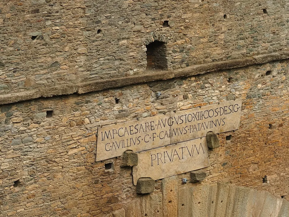
The bridge itself, complete to its deck: a single arch with a span of 14.24 m carrying a stone structure 60.46 m long and 2.26 m wide across a gorge only 12 m wide at this point (de.wikipedia). On the north face, a large inscription names the man who paid for it and, centred on its own line, the word PRIVATVM: a private work (de.wikipedia; the operator).
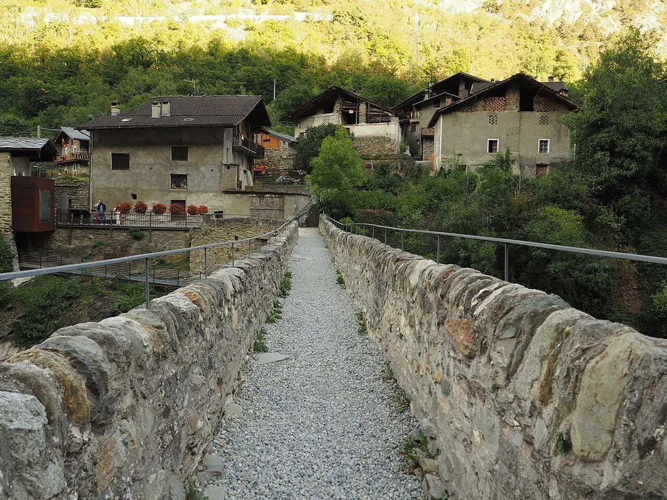
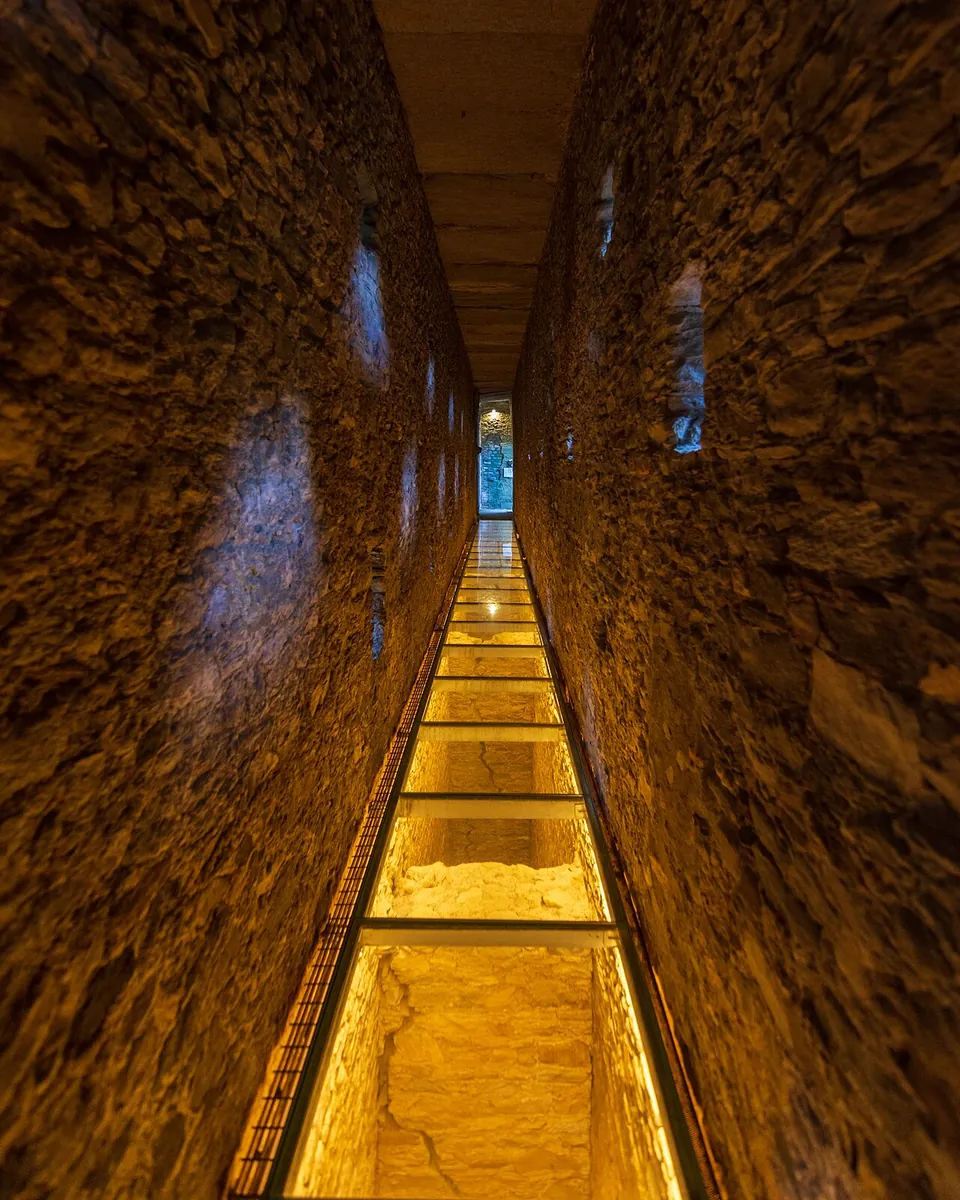
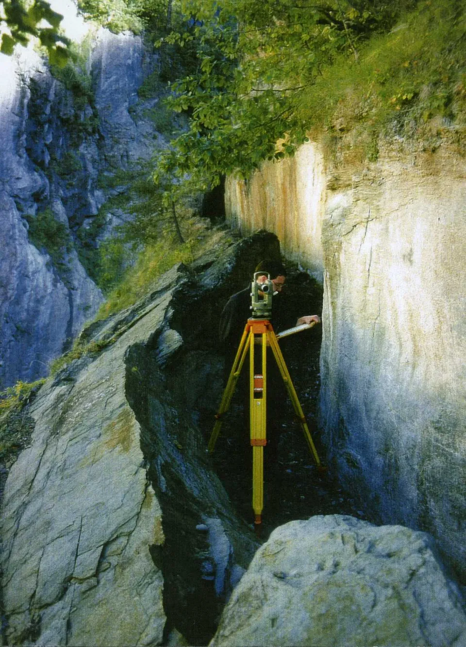
A visit has two levels. You first walk along the top, where the water channel ran, and then enter a covered passage inside the bridge from the left bank, coming out on the right bank, where a steel walkway reproduces the Roman service track once cut into the rock, which survives only in part because the local schist is crumbly (the operator). The passage keeps two rows of small windows in each side wall (de.wikipedia). Only the covered passage needs a ticket (the operator).
West of the bridge, a modern walking path runs at the level of the old channel (de.wikipedia). Upstream, the Roman channel was cut as a half-gallery into the cliff face, leaving a natural rock parapet up to 3 m high on the valley side (de.wikipedia). The gorge around the bridge, with a microclimate rare in the Aosta Valley, is protected as a Site of Community Importance covering 183 hectares (it.wikipedia).
Is it worth the trip?
Yes, if you are in the Aosta Valley between April and early November. This is a Roman aqueduct bridge you can walk both over and through, it stands above a 66 m drop, and its inscription states plainly who built it, when, and with whose money. It also pairs naturally with Augusta Praetoria – Aosta, the Roman colony a short drive away.
Keep expectations to scale: this is one bridge and its setting, not a ruin field, and the site is closed from 3 November to the end of March.
Getting there
The bridge is at the hamlet of Pont d’Aël in the comune of Aymavilles, on the right of the road from Aymavilles to Cogne, about 8 km south-west of Aosta (the operator; it.wikipedia for the distance). A free car park lies about 180 m from the bridge, and free public toilets are mapped nearby (OpenStreetMap). Without a car, take the Aosta–Cogne bus, which runs daily, to the stop “Aymavilles – Pont d’Aël” and walk about 1 km to the bridge (the operator).
From April to September it is open every day from 09.00 to 19.00; from 1 October to 2 November, every day from 10.00 to 13.00 and 14.00 to 17.00; it is closed from 3 November to 31 March. A ticket for the covered passage costs €5, or €3 for ages 19 to 25 and groups of at least 25 paying visitors; it is free up to 18, for disabled visitors and their companions, and for teachers with school groups, and for holders of the Abbonamento Musei Piemonte e Lombardia museum pass. The operator recommends buying online through MiDA ticket, warns that hours can change, and bars bulky backpacks and bags. The site is only partly accessible by wheelchair, though visitors with reduced mobility can look out from the bridge at its structure (lovevda.it, the Valle d’Aosta Region’s tourism office, read 19 October 2026 — check before travelling).
Visiting details
- Opening hours
- Daily 09.00–19.00 from April to September; daily 10.00–13.00 and 14.00–17.00 from 1 October to 2 November. Closed from 3 November to 31 March. The operator notes that hours can change and gives two phone numbers to check, (+39) 0165 902252 and (+39) 0165 274363.
- Tickets
- €5; €3 for ages 19–25 and groups of at least 25 paying visitors; free up to 18, for disabled visitors and their companions, for teachers with school groups and for holders of the Abbonamento Musei Piemonte e Lombardia. A ticket is needed only for the covered passage inside the bridge. Tickets can be bought online through MiDA ticket, which the operator recommends.
- Parking
- Free car park about 180 m from the bridge (OSM node/847296416); free public toilets are mapped nearby (OSM node/847296448).
Before you go
- From Aosta, the daily Aosta–Cogne bus stops at "Aymavilles – Pont d'Aël", about 1 km on foot from the bridge (the operator).
- Bulky backpacks and bags are not allowed in, and the site is only partly accessible by wheelchair, though visitors with reduced mobility can look out from the bridge at its structure (the operator).
Hours and prices checked 19 October 2026 on the operator's own site. Confirm before travelling.
History
The inscription on the north face reads IMP CAESARE AVGVSTO XIII COS DESIG / C AVILLIVS C F CAIMVS PATAVINVS / PRIVATVM: under the emperor Augustus, consul designate for the thirteenth time, Gaius Avillius Caimus, son of Gaius, of Patavium (Padua), built it at his own expense. That dates the bridge to 3 BC, when Augusta Praetoria (Aosta) was a newly founded colony (de.wikipedia; the operator). Caimus, from Patavium – Padua, belonged to the Avillii, a wealthy family of entrepreneurs by then well established in north-western Cisalpine Gaul (the operator); de.wikipedia calls him one of the lessees of the nearby mines.
What the water was for is read two ways. Mathias Döring, who made the first complete survey of the bridge in 1996, concluded that the 6 km aqueduct took water from the Grand Eyvia 2.9 km above the bridge to irrigate some 200 hectares of farmland west of Aosta, and supplied a washery for metal ore mined at Cogne on the way (de.wikipedia). The Region’s tourism page instead connects it to the quarrying and working of bardiglio, a grey-blue marble whose quarries have been identified further down the valley at Pesse, in Aymavilles, and which is used in many of Roman Aosta’s monuments (the operator). Either way, the operator notes that private aqueducts not tied to a villa or an estate are very rare. A water supply for Aosta itself is ruled out: the town drew its water from the nearby Buthier (de.wikipedia).
The lower passage is also read two ways. de.wikipedia describes a control corridor, 50.35 m long and 3.88 m high, whose windows lit floor and ceiling so that the bridge keeper could spot leaking water before frost damaged the masonry (de.wikipedia); the operator describes it as a walkway about a metre wide, ventilated and lit, for people and animals. The bridge probably once had a third storey, perhaps an open walkway, which would have brought its height to 22.15 m (de.wikipedia).
The earliest surviving description, with a sketch, is Pingone’s of 1550; views by Baron de Malzen (1826) and Aubert (1860) already show the bridge as it is today (de.wikipedia).
More photographs



Nearby
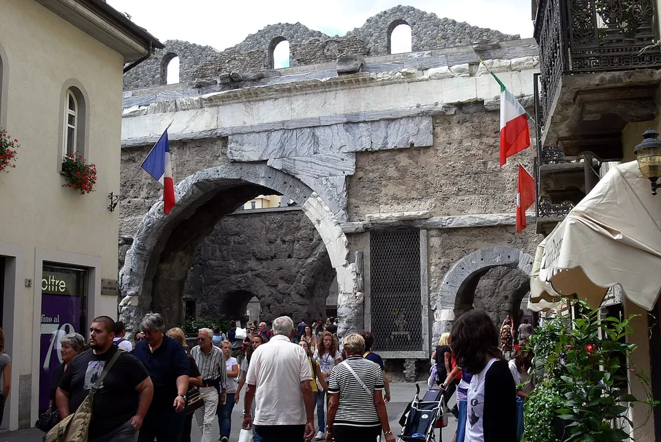
Photo: Wolfgang Sauber · CC BY-SA 3.0 · Commons
Photo: Geobia · CC BY-SA 3.0 · Commons
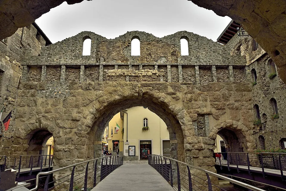
Photo: Carlo grifone · CC BY-SA 4.0 · Commons
10 km · gate · Aosta Valley
Porta Praetoria
The gate is two parallel rows of arches with a small square between them, which served as a parade ground for troops (it.wikipedia; Lovevda).


Straight-line distances.
Sources
Every fact on this page comes from the records below, each used under the licence noted.
| Source | Licence |
|---|---|
| Pleiades 167872 | CC BY |
| Wikidata Q844246 | CC0 |
| OpenStreetMap way/71170701 | ODbL |
| Wikipedia (de) — Pont d’Aël | CC BY-SA 4.0 |
| Wikipedia (it) — Ponte acquedotto di Pont d'Aël | CC BY-SA 4.0 |
| Wikipedia (fr) — Pont d'Aël | CC BY-SA 4.0 |
| Wikipedia (en) — Pont d'Aël | CC BY-SA 4.0 |
| Valle d'Aosta Region tourism office (lovevda.it) — the Roman aqueduct bridge of Pont-d'Ael, hours, prices and access | licence not recorded |