What is there today
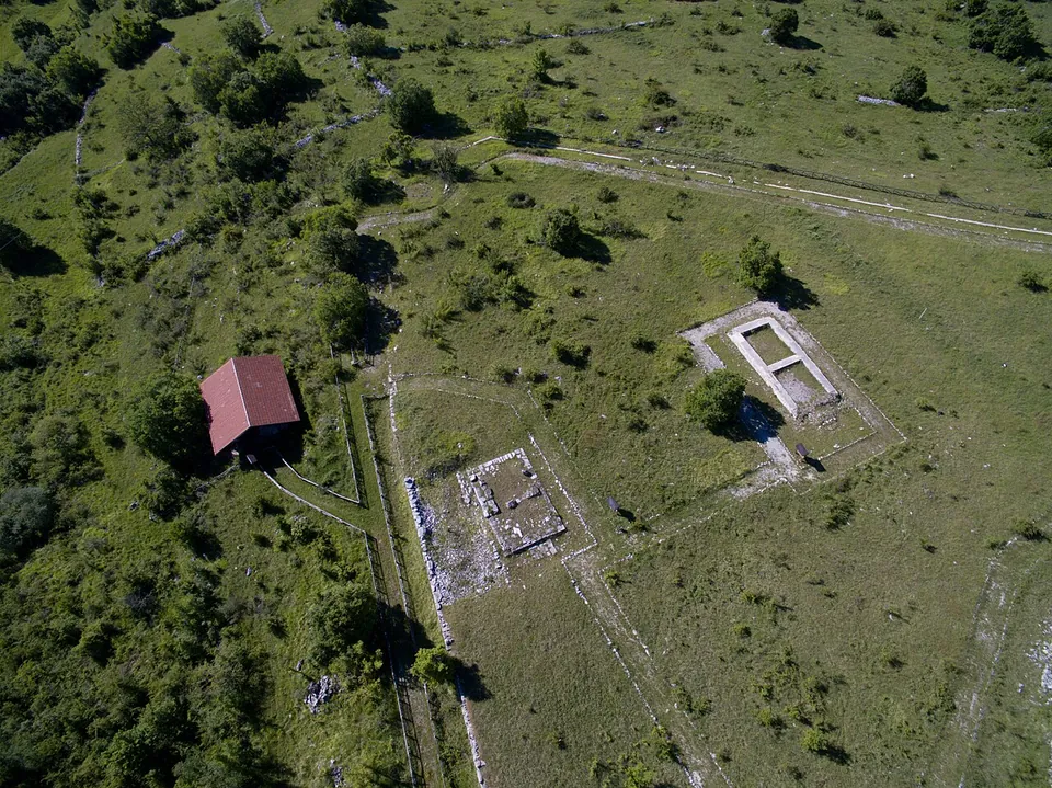
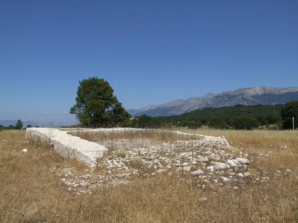
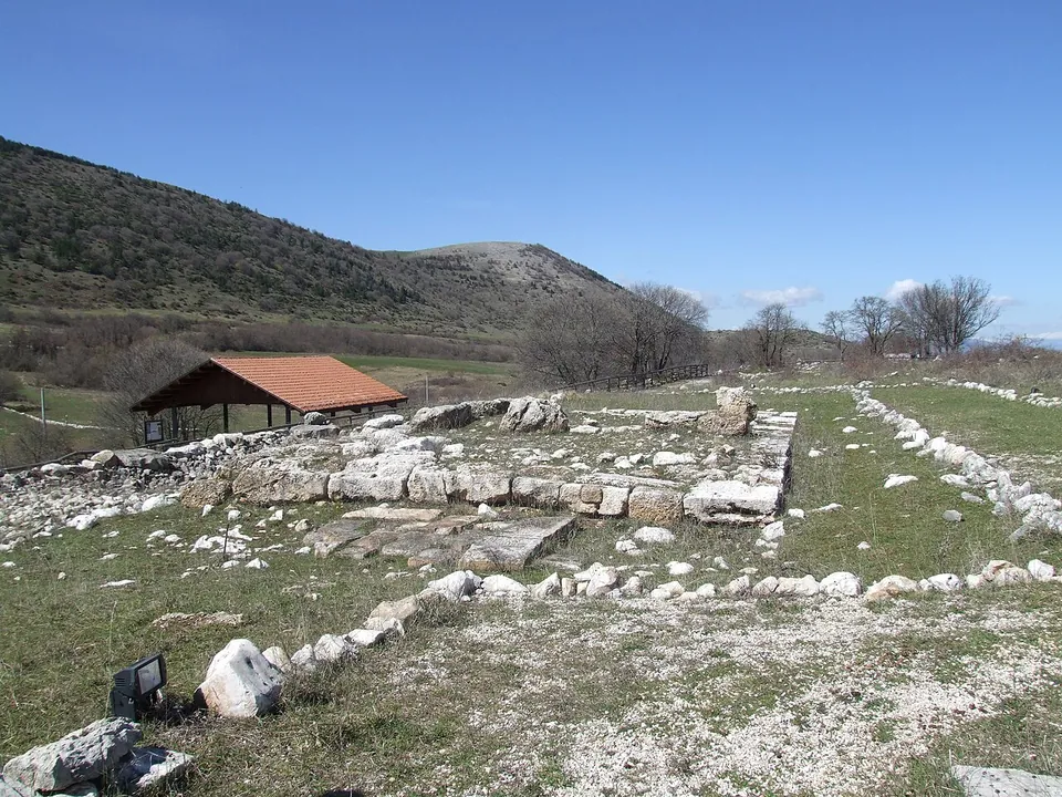
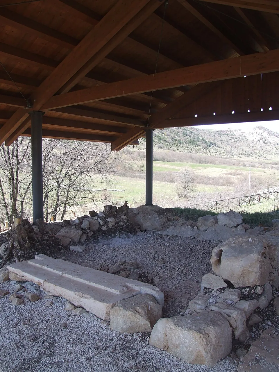
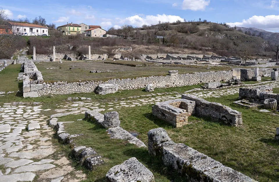
The excavated sanctuary is a walled sacred precinct on two terraces (Ministry of Culture). On the upper terrace are the remains of the oldest temple, probably dedicated to Hercules, and just above it the larger Roman temple of the early 1st century BC, probably Jupiter’s, of which only the podium, in opus reticulatum masonry, survives (it.wikipedia, en.wikipedia). On a lower terrace is a small shrine to female divinities, Ceres and Venus among them. The temples’ outlines have been rebuilt on the ground (italia.it), and the photographs show low walls and plans in open grassland, with a timber shelter over the small shrine. Remains of the settlement were excavated about 100 m south-east of the sanctuary (it.wikipedia).
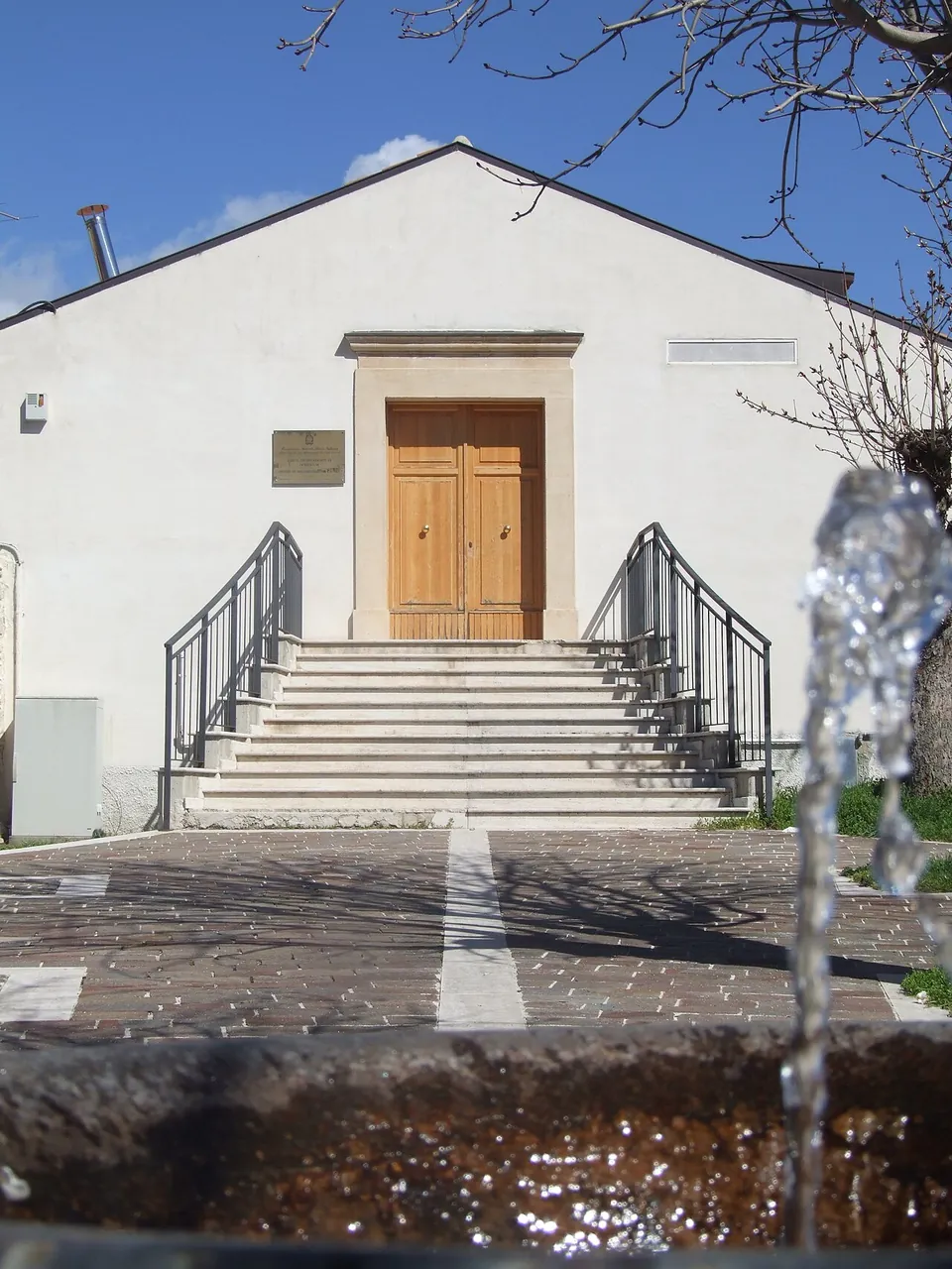
The finds are not on site. More than 700 votive objects came out of two deposits, and they are shown at the documentation centre in piazza XX Settembre in Cansano, at the archaeological museum in Sulmona and at the national archaeological museum in Chieti (Ministry of Culture).
Is it worth the trip?
Only for someone already in the Sulmona area who enjoys quiet sites. In the photographs the walls are only a few courses high: this is a set of foundations and outlines, and the reward is the setting, a plateau on the edge of the Maiella National Park (Ministry of Culture), as much as the stones. The finds belong with it: the documentation centre in Cansano shows them in six cases, each with an explanatory panel, by the part of the plateau they came from (it.wikipedia), though its opening hours are not published. As a destination in itself, it does not justify a long detour.
Getting there
The park lies about 7 km from Sulmona as the crow flies and 1.8 km from the village of Cansano; from the village it is about 5 km by a rural but paved road (italia.it). Plan on a car: a halt, Cansano Ocriticum, was built on the Sulmona–Isernia railway in 2023 about 375 m from the remains, but the line has no regular passenger service and is used by tourist trains (it.wikipedia; OpenStreetMap), and no bus stop or car park is mapped within 1.5 km (OpenStreetMap).
It is an open-air park. The Ministry of Culture’s most recent listing, written for the reopening in summer 2020, gives it as open until sunset with no booking needed, and it names no ticket; no operator publishes a current timetable or a price, or the hours of the documentation centre in Cansano (read 24 October 2026). it.wikipedia describes the lime-kiln area on the eastern hill as not open to visitors while it is still being studied.
Visiting details
- Opening hours
- An open-air park. The Ministry of Culture's listing, written for its reopening in summer 2020, gives it as open until sunset with no booking required; no current timetable is published, and none for the documentation centre in Cansano.
- Tickets
- No ticket or price is published by the operator; the ministry's listing names none.
Before you go
- A halt named Ocriticum is mapped about 375 m away on the Sulmona–Isernia railway, but the line has no regular passenger service and is used by tourist trains; plan on a car.
- The lime-kiln area on the eastern hill is not open to visitors while it is being studied (it.wikipedia).
Hours and prices checked 24 October 2026 on the operator's own site. Confirm before travelling.
History
The first temple was built at the end of the 4th century BC, a single room inside a dry-stone enclosure, and was enlarged later (en.wikipedia; it.wikipedia). The small shrine of the female divinities was probably built in the 3rd or 2nd century BC; inside it were glass flasks and balsam jars that still held traces of ointments, perfumes and cosmetics (en.wikipedia; it.wikipedia). Around the beginning of the 1st century BC, by then under Roman rule, the sanctuary was enlarged with the new temple on a higher terrace and an extended precinct, with service rooms along its inner north side for the sanctuary’s worshippers (en.wikipedia; it.wikipedia).
The place lay on the Via Nova, the road that crossed the Peligna basin into Samnium (Ministry of Culture), which it.wikipedia and Pleiades identify as the Via Claudia Nova. The Peutinger map, a surviving copy of a Roman road map, marks it as Iovis Lareni, seven miles from Sulmo (Pleiades; en.wikipedia). The name Ocriticum is known from an inscription found in the southern cemetery, dedicated by the cultores Jovis Ocriticani, a college devoted to Jupiter’s cult (Ministry of Culture), found in 2000 on a funerary marker. it.wikipedia suggests the name probably refers to the “ocre”, the fortified town on the summit of nearby Colle Mitra. The settlement’s buildings, along a gravelled road, were in use between the 1st and 3rd centuries AD, and one reading makes the place a road station (it.wikipedia). On the eastern hill a side road climbed to a large lime kiln and a building whose rooms are thought to have served to cool, store and sell the lime (en.wikipedia).
A violent earthquake in the 2nd century AD badly damaged the sanctuary, which was not rebuilt, and the area was slowly abandoned, the process ending around the 6th century AD. Two graves of that century were dug against the precinct wall and the foundations of the Italic temple, one of them holding a mother and her daughter (it.wikipedia).
The ruins were looted by clandestine diggers from the 19th century on. Systematic excavation began in 1992, when the Snam gas pipeline was laid through the area, and ended in 2005 (it.wikipedia). The park was laid out between 1999 and 2001 by the then archaeological superintendency of Abruzzo (Ministry of Culture); it.wikipedia dates its formal establishment, with the documentation centre, to 2004.
More photographs
Nearby
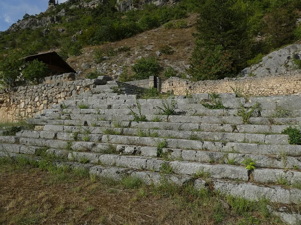
Photo: Syrio · CC BY-SA 4.0 · Commons
11 km · sanctuary · Abruzzo
Shrine of Hercules Curinus
The sanctuary stood on artificial terraces that step down the mountainside (the Ministry).
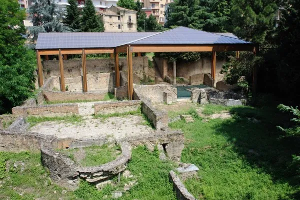
Photo: Cats' photos · CC BY-SA 4.0 · Commons
41 km · city · Abruzzo
Teate
Four groups of remains, all on the hill of the old town, none of them a self-contained ruin field: the Romans' town lies under the modern one, and you meet it street by street.


Straight-line distances.
Sources
Every fact on this page comes from the records below, each used under the licence noted.
| Source | Licence |
|---|---|
| Pleiades 432886 | CC BY |
| Wikidata Q3880770 | CC0 |
| Vici.org 1765 | CC BY-SA (text), CC0 (metadata) |
| OpenStreetMap way/342627499 | ODbL |
| Wikipedia (it) — Ocriticum | CC BY-SA 4.0 |
| Wikipedia (en) — Ocriticum | CC BY-SA 4.0 |
| Ministero della Cultura — Santuario di Ocriticum (reopening listing, hours) | licence not recorded |
| Italia.it (national tourism portal) — Cansano | licence not recorded |