

What is there today
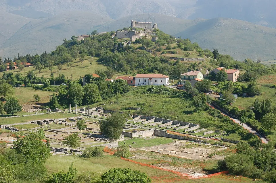
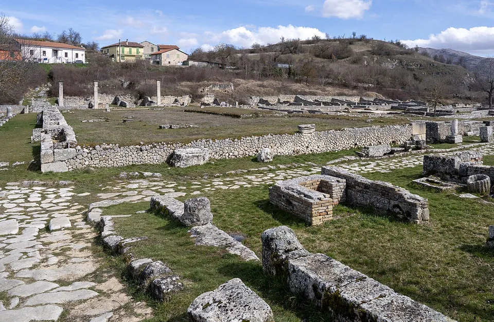
Excavation has exposed a large part of the town (the operator). The remains on view line three of its ancient streets, now called Via del Miliario, Via dei Pilastri and Via dell’Elefante. Along them are a colonnaded portico where the citizen assemblies voted, the basilica with its three aisles, the macellum (the food market) ringed by shops, and the baths, where the raised floors on little brick pillars that carried the hot air survive together with several mosaics. South of the baths is the sanctuary of Hercules, a small shrine behind a porticoed court (the operator). The forum at the centre measured 142 by 43.5 m (it.wikipedia).
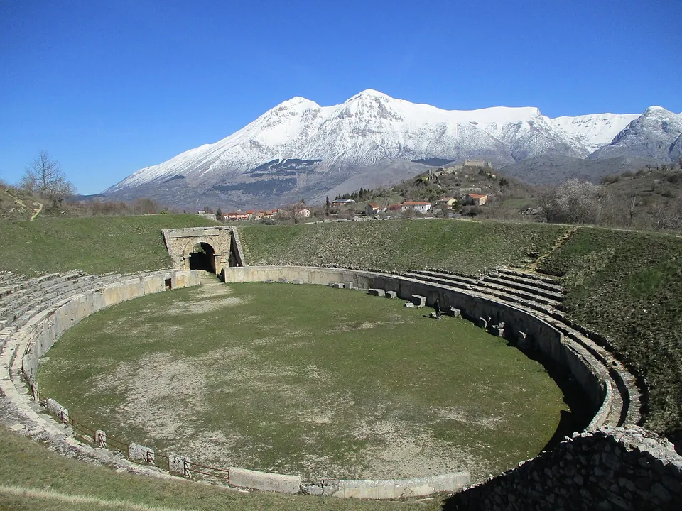
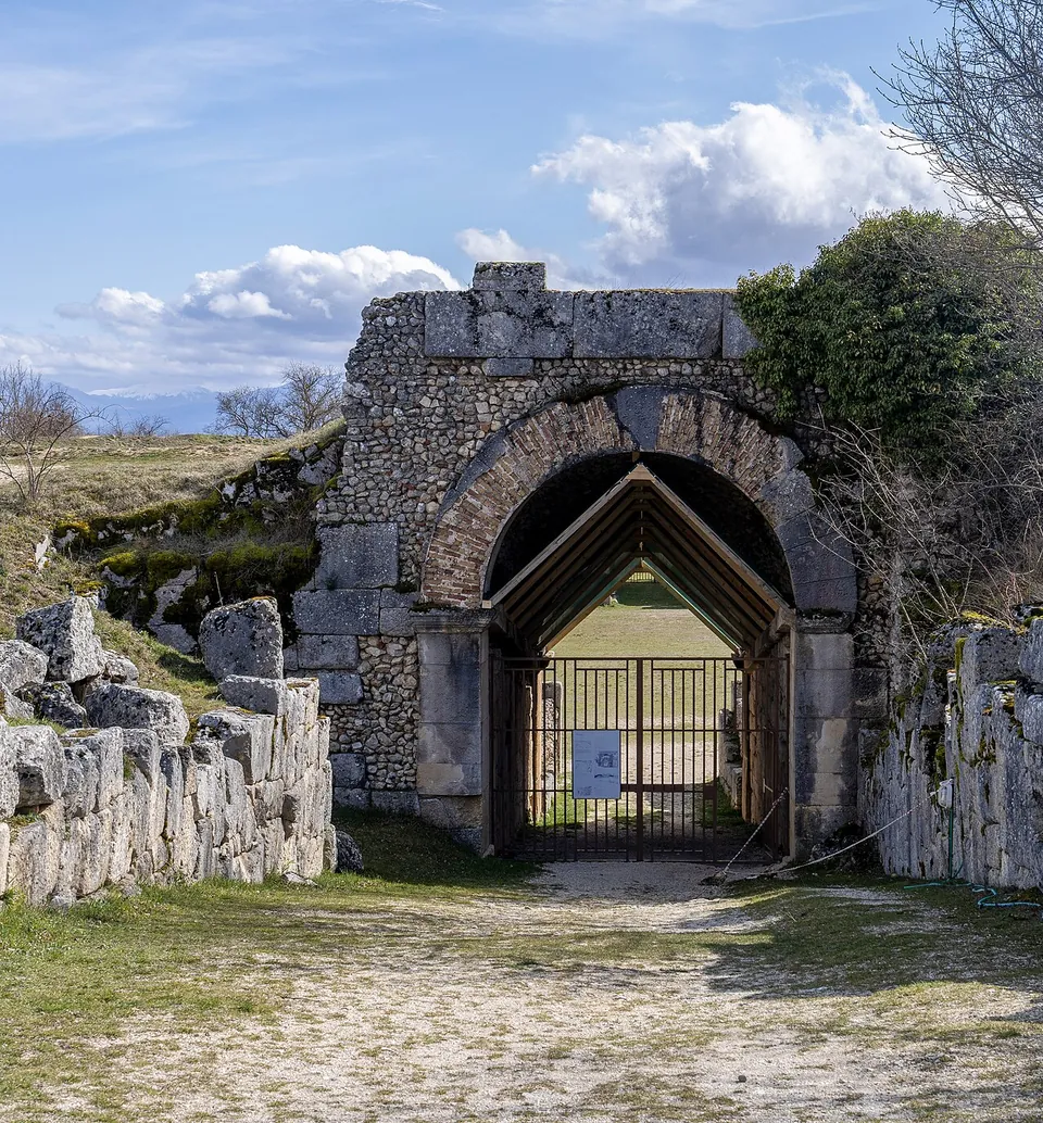
The amphitheatre is the set piece. It is an oval of 96 by 79 m, cut partly into the rock of the hill of San Pietro, with an arena of 64 by 37 m; over the monumental entrance on the town side, an inscription records the bequest of Naevius Sutorius Macro, a native of Alba and praetorian prefect under Tiberius, that paid for it (it.wikipedia). On the slope of the Pettorino hill, the traces of the theatre’s seating are visible, cut into the rock (it.wikipedia).
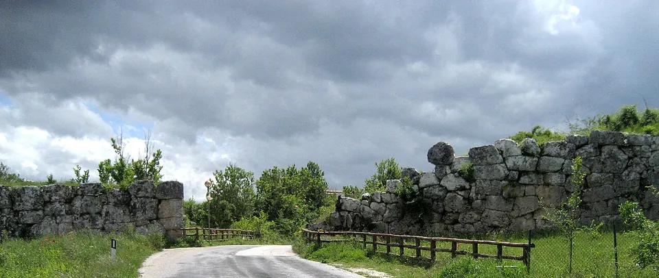
The walls run for about 3 km, in polygonal masonry of large blocks fitted closely together, and are well preserved for most of their length (it.wikipedia, fr.wikipedia); the four town gates are still partly preserved (the operator). On the hill of San Pietro, the church of San Pietro stands on a temple of Apollo, and reused Roman columns divide its three aisles; the operator dates the temple to the 3rd century BC, en.wikipedia to the 2nd. On the hill to the north-east are the ruins of the medieval village of Albe, destroyed by the earthquake of 1915, and of the 14th-century Orsini castle (the operator).
The finest finds are in Chieti: the colossal seated Hercules from the sanctuary is in the Museo archeologico nazionale at Villa Frigerj (the operator), and en.wikipedia places the statue of Venus in Chieti too.
Is it worth the trip?
Yes. en.wikipedia calls it probably the most important ancient site in Abruzzo, and what you walk through is a whole Roman town in its mountain setting, not a single monument: the streets, the forum buildings, the baths, an amphitheatre complete enough to read as one, and walls of huge fitted stones. It is free and always open.
Set your expectations for the town itself: most of it stands as foundations and low walls in the grass, so it is the plan, the walls and the amphitheatre that carry the visit. The church of San Pietro, with its Roman columns inside, opens only by appointment, so book ahead if you want to go in. And no public transport is mapped near the site, so plan on a car.
Getting there
The site is about 6.5 km north of Avezzano, at between about 950 and 1,000 m above sea level, next to the village of Albe in the comune of Massa d’Albe (en.wikipedia, de.wikipedia, it.wikipedia). A car park is mapped about 140 m from the centre of the excavated town, with two more nearby off Via degli Scavi; no bus stop or railway station is mapped near the site (OpenStreetMap).
The archaeological area is always open, every day, needs no booking and is free (Ministry of Culture listing, as updated by the operator in October 2025 - check before travelling). The church of San Pietro is visited by appointment, booked on +39 340 6255973 (the Ministry’s listing for the church).
Visiting details
- Opening hours
- Always open, every day; no booking needed. The church of San Pietro on the hill above the town is opened only by appointment.
- Tickets
- Free. The Ministry of Culture describes the archaeological area as open to the public and freely visitable.
- Parking
- A car park is mapped about 140 m from the centre of the excavated town (OSM way/979844292), with two more about 200 m away, off Via degli Scavi.
Before you go
- No bus stop or railway station is mapped near the site; it needs a car.
- The church of San Pietro is visited only by appointment, booked by telephone on +39 340 6255973 (the Ministry's listing).
Hours and prices checked 11 December 2025 on the operator's own site. Confirm before travelling.
History
Alba Fucens was a town of the Aequi, close to the territory of the Marsi, until Rome founded a Latin colony there in 304 BC, or 303 BC in other sources (it.wikipedia). Some 6,000 colonists built the first walls in the years after they arrived, and held them the next year against an Aequian attack (it.wikipedia). The town lay on a hill just north of the Via Valeria (en.wikipedia).
In the Second Punic War it sent 2,000 men to help Rome in 211 BC, but later refused further contingents and was punished (en.wikipedia). Rome then used it to hold important state prisoners, among them Syphax of Numidia, Perseus of Macedonia and Bituitus, king of the Arverni (Pleiades). It stayed loyal in the Social War, and in 44 BC the legio Martia, which had deserted Mark Antony for Octavian, quartered there; Cicero praised the town as well fortified, well placed for war and faithful (en.wikipedia). Inscriptions show its prosperity under the Empire (en.wikipedia).
It was abandoned gradually in late antiquity, especially after a serious earthquake in the first half of the 6th century. Procopius records it for the last time in 537, when the Byzantines occupied it during the Gothic war, and under the Lombards the village of Albe grew up on the hill above (en.wikipedia). The Roman remains were declared a national monument in 1902 (it.wikipedia). Systematic excavation began in 1949 under a Belgian team led by Fernand De Visscher of the University of Louvain, and went on under Joseph Mertens until 1979 (it.wikipedia, fr.wikipedia; the operator); the Soprintendenza for Abruzzo has excavated since 2006 (it.wikipedia) and the Université libre de Bruxelles since 2007 (fr.wikipedia).
About 1.5 km north-east, at Arci, are the remains of the siphon bridge that carried the town’s aqueduct across a valley (en.wikipedia).
More photographs


Nearby
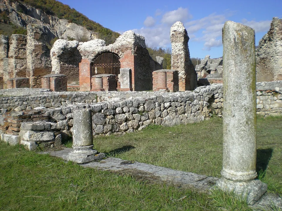
Photo: Lasacrasillaba · Public domain · Commons
37 km · city · Abruzzo
Amiternum
The archaeological park is two zones with separate entrances, on either side of the modern road and the river Aterno (the operator).
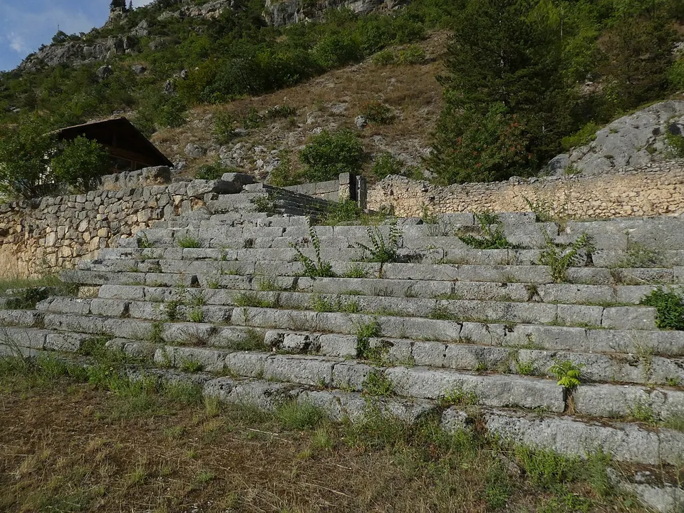
Photo: Syrio · CC BY-SA 4.0 · Commons
43 km · sanctuary · Abruzzo
Shrine of Hercules Curinus
The sanctuary stood on artificial terraces that step down the mountainside (the Ministry).
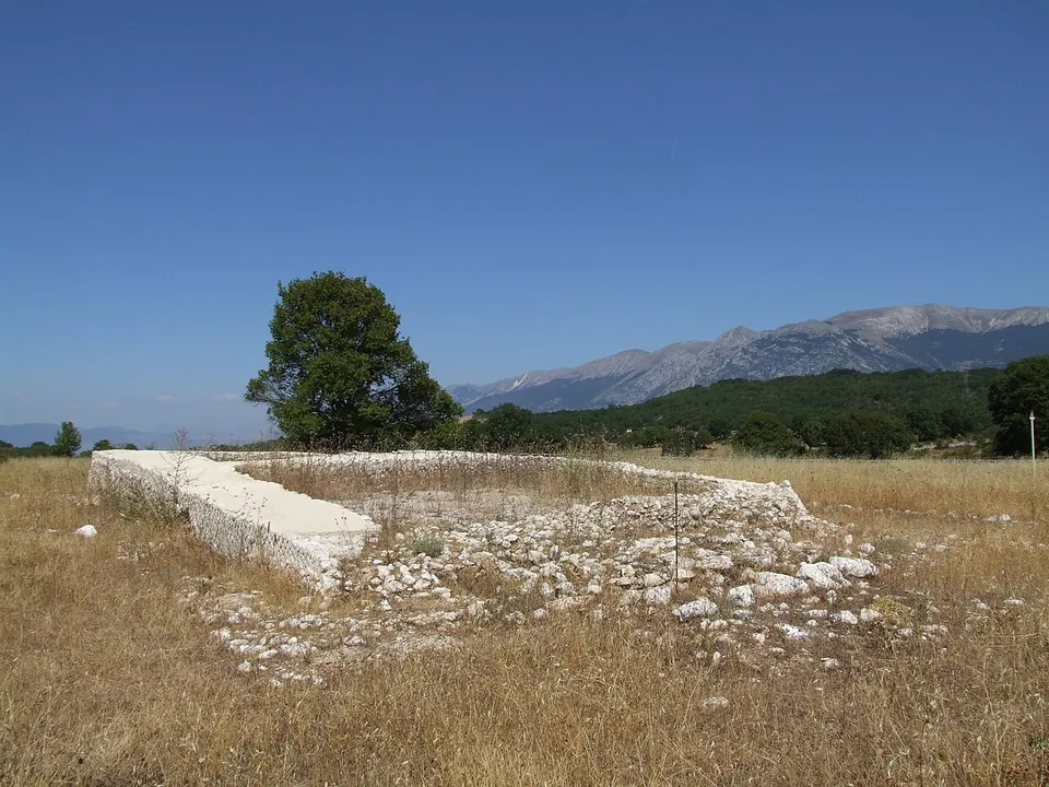
Photo: Pasquale Di Giannantonio · Public domain · Commons
49 km · sanctuary · Abruzzo
Ocriticum
The excavated sanctuary is a walled sacred precinct on two terraces (Ministry of Culture).


Straight-line distances.
Sources
Every fact on this page comes from the records below, each used under the licence noted.
| Source | Licence |
|---|---|
| Pleiades 413005 | CC BY |
| Wikidata Q944515 | CC0 |
| OpenStreetMap way/849311280 | ODbL |
| Wikipedia (it) — Alba Fucens | CC BY-SA 4.0 |
| Wikipedia (en) — Alba Fucens | CC BY-SA 4.0 |
| Wikipedia (fr) — Alba Fucens | CC BY-SA 4.0 |
| Wikipedia (de) — Alba Fucens | CC BY-SA 4.0 |
| Wikipedia (it) — Anfiteatro romano di Alba Fucens | CC BY-SA 4.0 |
| Wikipedia (it) — Teatro romano di Alba Fucens | CC BY-SA 4.0 |
| Ministero della cultura — Area archeologica di Alba Fucens (the operator's listing) | licence not recorded |
| Ministero della cultura — Chiesa di San Pietro ad Alba Fucens (the operator's listing) | licence not recorded |
| Wikidata — Amphitheatre of Alba Fucens (Q21011990) | licence not recorded |
| Wikidata — Roman theatre of Alba Fucens (Q90537702) | licence not recorded |