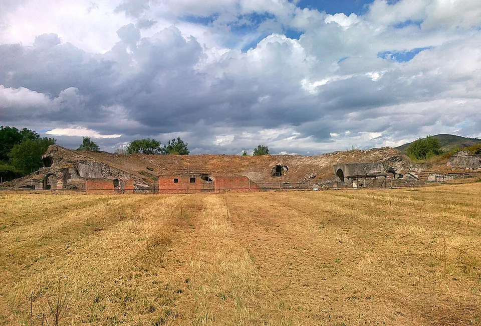


Cales was an ancient town on the Via Latina in northern Campania, taken by Rome in 335 BC and made a Latin colony the next year. Its ruins lie in open country in the comune of Calvi Risorta, cut through by the Autostrada del Sole, and the thing to see is the Roman theatre, whose seating has been entirely excavated.
What is there today
The ancient town survives across its whole extent, though the motorway runs through it, and the Ministry of Culture says plainly that its remains are not easy to read on the ground (cultura.gov.it). What stands out, all of it Roman:
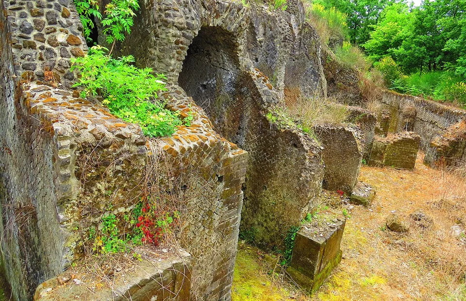
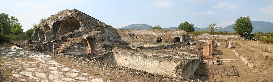
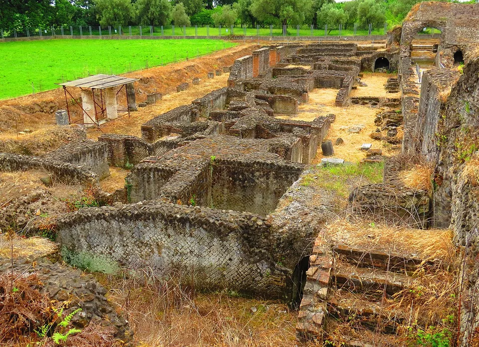
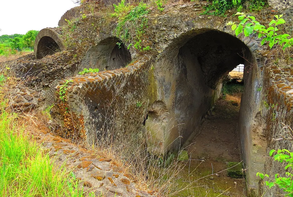
- The theatre. The Ministry dates its first building, probably, to the 2nd century BC, from walls found in the side entrances to the orchestra, with rebuilding in the age of Augustus that enlarged the stage front and added a monumental basin behind it; Pleiades dates the theatre to the 1st century BC. The seating rests on vaulted galleries with double arches in net-patterned stonework (opus reticulatum), and has been uncovered completely, though its tiers of seats are gone. Stairs with two flights, inside and out, climbed to it along an arcaded front (Ministry of Culture). A paved street runs past it.
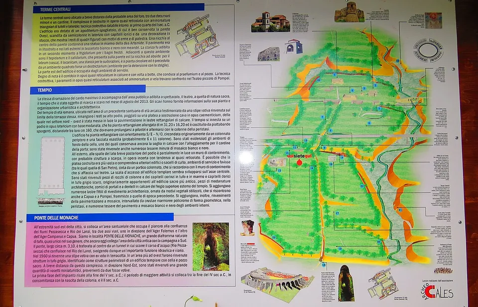
- Two bath complexes. The central baths date from the start of the 1st century BC, and some of their rooms survive almost entire, a few with stucco decoration still in place. The northern baths, of the 1st–2nd century AD, stand on three levels along the town’s main street, which followed the Via Latina from Teanum (Teano) to Capua (Ministry of Culture).
- A temple on a podium of the imperial period, probably the Capitolium of the forum, and the ruins of a castellum aquae, a water-distribution tank (Ministry of Culture).
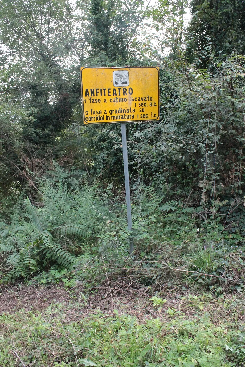
- The amphitheatre, about 500 m north-east of the theatre (OpenStreetMap), of the 1st century BC with later phases under the emperors (Ministry of Culture). Photographs from 2018 show its sign standing in thick undergrowth.
Older than the Roman town are stretches of the circuit wall, which had six gates and is built in places of squared blocks of the 5th century BC. The Ponte delle Monache is a passage cut through the tuff for the road to the Falernian country, and near it a building of a sanctuary with a votive deposit has been explored (Ministry of Culture). Many of the most important finds are in the Museo Campano in Capua (it.wikipedia). The Romanesque cathedral, of the 12th century, and a castle restored under the Angevins and Aragonese survive next to the site (en.wikipedia, it.wikipedia).
Is it worth the trip?
Only if you plan it. There are no opening hours: the site is opened on request, after a telephone booking with the archaeological office in Calvi Risorta, so a casual stop is not possible. For a visitor who does book, the theatre is a real Roman theatre with its seating structure standing, and the central baths keep some rooms with stucco decoration. The rest is scattered and some of it overgrown, and the motorway runs a little over 200 m from the theatre (OpenStreetMap). It suits someone already exploring the Roman towns of northern Campania rather than a first trip to Roman Italy.
Getting there
The ruins lie about 2 km south of the centre of Calvi Risorta and about 12 km north-west of Capua (OpenStreetMap), beside the A1 motorway. No car park, bus stop or railway station is mapped near the site; the nearest ordinary road passes about 220 m from the theatre, with tracks and footpaths running in.
Visits are by booking only: ring the Ufficio per i Beni Archeologici di Calvi Risorta on +39 0823 652533 (Ministry of Culture, read 24 October 2026). The Ministry’s page names no price; the site’s own former website gave entry as free (archived in May 2016), so ask when you book.
Visiting details
- Opening hours
- Open only on request, every day of the week, and booking is required. Ring the archaeological office in Calvi Risorta (Ufficio per i Beni Archeologici di Calvi Risorta) on +39 0823 652533 to arrange a visit.
- Tickets
- The Ministry of Culture's page gives no price. The site's own former website said entry was free (archived copy of May 2016).
- Parking
- No car park is mapped near the ruins (OpenStreetMap). The nearest ordinary road, an unclassified one, passes about 220 m from the theatre, and tracks and footpaths run closer.
Before you go
- Visits only by telephone booking with the archaeological office; there are no regular opening hours.
- No bus stop or railway station is mapped near the site; it needs a car.
- Photographs from 2018 show parts of the area, the amphitheatre among them, deep in undergrowth.
Hours and prices checked 24 October 2026 on the operator's own site. Confirm before travelling.
History
Cales was a town of the Ausones, also called the Aurunci (en.wikipedia, de.wikipedia). Rome took it in 335 BC under the consul Marcus Valerius Corvus, and in 334 BC settled a colony of Latin rights there with 2,500 citizens (de.wikipedia). It was the first Roman colony in the area and kept its own coinage (it.wikipedia); the Ministry describes its role as guarding the northern edge of ancient Campania and the roads into Latium and Samnium. It was an important Roman stronghold in the war against Hannibal, but by 209 BC it declared itself unable to provide more money or soldiers; more settlers were sent some time before 184 BC, and after the Social War it became a municipium (de.wikipedia).
The town grew prosperous on its wine, linked with the famous Falernian grown next door, and on its black-glazed pottery, which was exported as far as Etruria (it.wikipedia, de.wikipedia). Under Rome it gained the amphitheatre, baths and theatre, a rearranged street plan and, according to it.wikipedia, an important school of gladiators. From the 5th century AD it was the seat of a bishop (de.wikipedia).
In the early Middle Ages Cales was the seat of a Lombard gastald within the principality of Capua, then declined slowly until it was abandoned, leaving only the cathedral and the castle (it.wikipedia). Tombs of the Roman cemetery were found in 1883 (en.wikipedia). In the 1990s, works to extend the motorway’s parking areas uncovered traces of the protohistoric, archaic and pre-Roman settlement, and digs undertaken to stop looters in the surrounding cemeteries have recovered grave goods of the archaic period (Ministry of Culture).
More photographs




Nearby
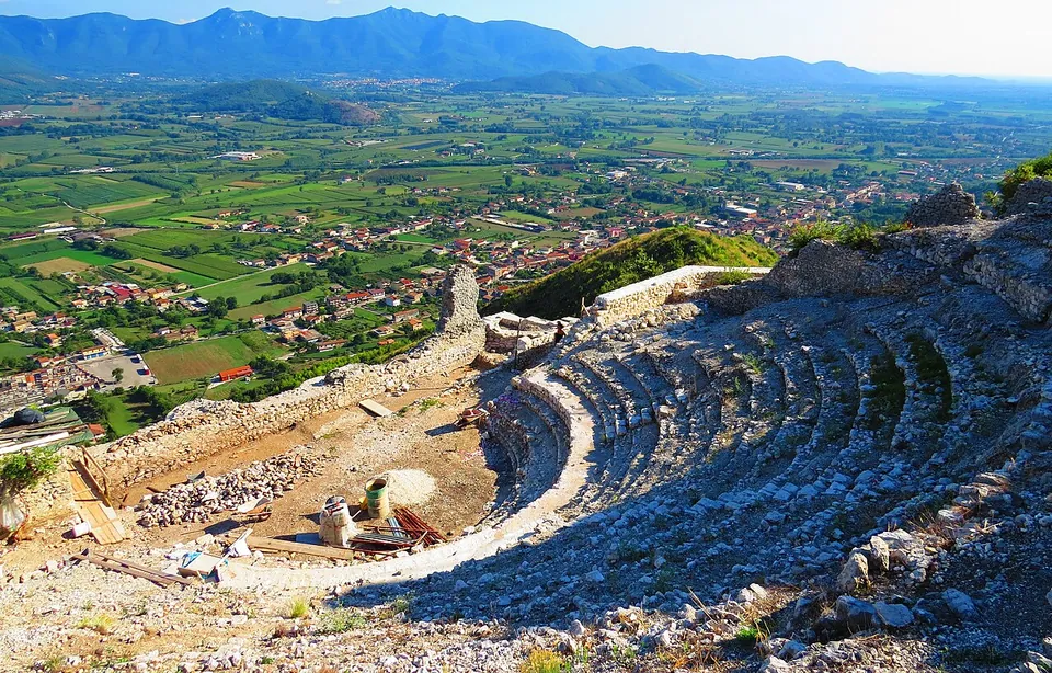
Photo: Gianfranco Vitolo from Sarno (Sa), Italia · CC BY-SA 2.0 · Commons
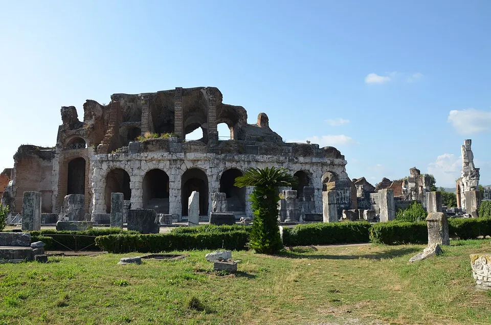
Photo: Carole Raddato from FRANKFURT, Germany · CC BY-SA 2.0 · Commons
16 km · amphitheatre · Campania
Roman amphitheatre of Santa Maria Capua Vetere
Much of the building is ruin.
Photo: Rico Heil · CC BY-SA 3.0 · Commons
16 km · city · Campania
Capua – Santa Maria Capua Vetere
The Roman city lies beneath the modern one, so Capua is visited as a set of separate stops, not as one field of ruins.


Straight-line distances.
Sources
Every fact on this page comes from the records below, each used under the licence noted.
| Source | Licence |
|---|---|
| Pleiades 432739 | CC BY |
| Wikidata Q1026628 | CC0 |
| OpenStreetMap way/132407602 | ODbL |
| Ministry of Culture — Teatro romano e Area archeologica dell'antica Cales (visiting and description) | licence not recorded |
| Sito Archeologico di Calvi Risorta — the site's former website (Wayback copy, 26 May 2016) | licence not recorded |
| Pleiades — Roman theater at Cales | licence not recorded |
| Wikidata — ancient Roman theater of Cales (Q70863776) | licence not recorded |
| Wikidata — Cales amphitheatre (Q28978006) | licence not recorded |
| vici.org — the theatre (11529) | licence not recorded |
| vici.org — the amphitheatre (4212) | licence not recorded |
| Wikipedia (de) — Cales | CC BY-SA 4.0 |
| Wikipedia (en) — Cales | CC BY-SA 4.0 |
| Wikipedia (it) — Cales | CC BY-SA 4.0 |