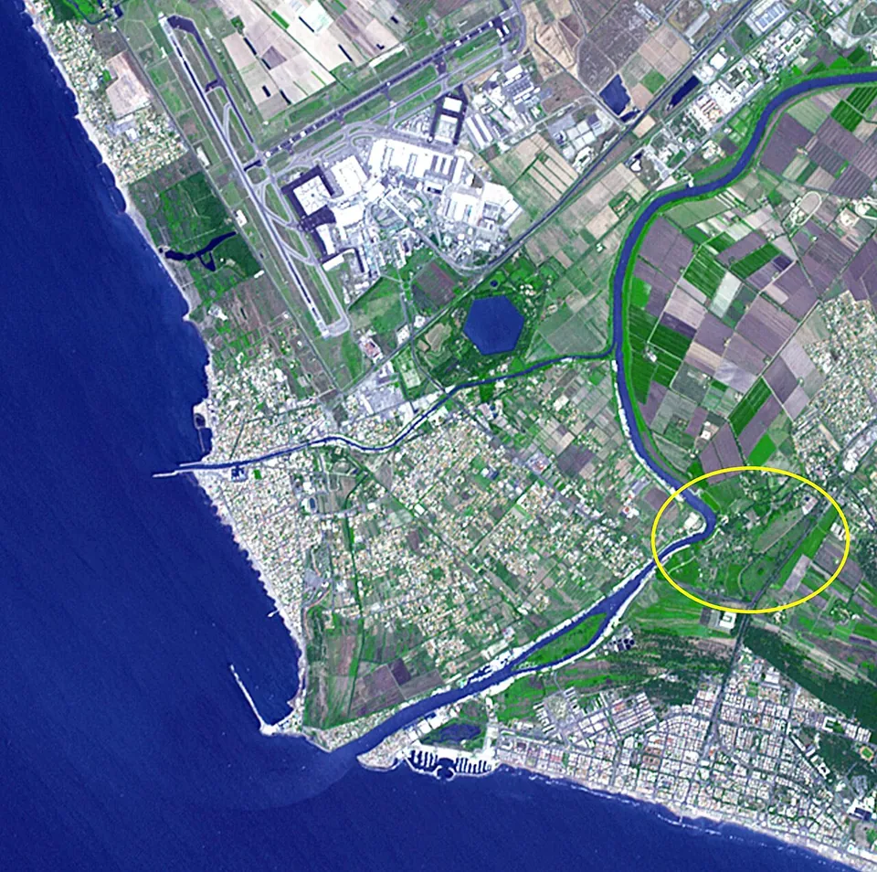
Portus was the artificial harbour of imperial Rome, begun by Claudius in AD 42 and enlarged by Trajan, and its remains lie on the coast at Fiumicino, about 25 km south-west of Rome, between the airport and the northern mouth of the Tiber (de.wikipedia). The draw is the scale of it: Trajan’s six-sided basin, still full of water, and around it the remains of the warehouses that stored grain for Rome.
What is there today
The visitable area is the Area archeologica dei Porti Imperiali di Claudio e Traiano, run by the Ostia Antica archaeological park. Not all of the harbour is in it: the park shares the ground with the Sforza-Cesarini family, who own Trajan’s basin (the operator).
- Trajan’s basin. The hexagon is preserved and still holds water as a lake (en.wikipedia), about 3 km from today’s shoreline because the coast has moved out (de.wikipedia; the operator). Pleiades gives its diameter as about 716 m.
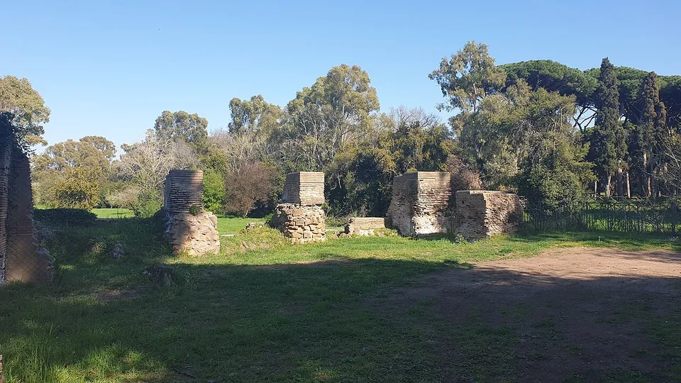
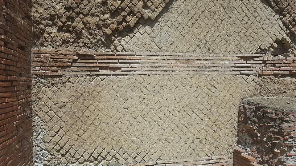
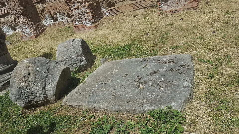
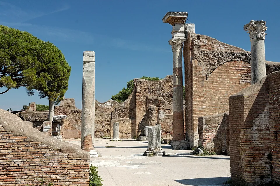
- Warehouses and the “Imperial Palace”. The most important buildings stood on the north-west side of the basin: the so-called Severan Warehouses and the so-called Imperial Palace, a grand building for high-ranking travellers, which gained a small amphitheatre early in the 3rd century; a second warehouse complex, the so-called Trajanic Warehouses, ran round the Darsena, the inner basin where goods were loaded onto river craft (the operator), which does not say which of them the visitor route reaches. en.wikipedia singles out the fineness of the warehouses’ brickwork; de.wikipedia adds remains of baths, temples and porticoes alongside the warehouses and docks.
- Claudius’s harbour. Of the imperial basins only Trajan’s survives as open water (fr.wikipedia), but the foundations of Claudius’s northern mole are visible for about a kilometre behind the Museo delle Navi, and on the old eastern quay the so-called Capitaneria (harbour office), a cistern and baths can be seen (the operator).
- Museo delle Navi. The ship museum was built where the wrecks were found, inside the ancient harbour basin. The remains of eight boats came to light there, three of them river-and-sea cargo boats built to carry goods up the Tiber to Rome, and the wrecks are the heart of the display (the operator).
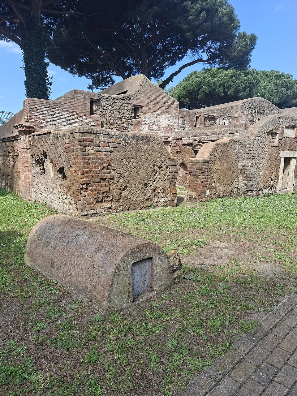
- Isola Sacra necropolis. On the island between the Fiumicino canal and the Tiber, more than 200 tombs line the road that ran from Portus to Ostia, built from the late 1st to the 4th century. Most are one- or two-storey brick tomb houses with pedimented façades; inscriptions in Latin or Greek often name the owners, and small reliefs beside them often show the dead at work, a midwife at a birth, a surgeon operating, a smith, a grain merchant (the operator). It has its own entrance and ticket (see below).
Is it worth the trip?
Yes, if you are curious about how Rome was fed, or if you have a few hours to spare near Fiumicino airport. The operator calls Portus the largest port infrastructure of the ancient world, and the hexagonal basin makes that easy to believe. What it is not is a second Ostia. The ruins are warehouse walls and harbour works spread through countryside hemmed in by the airport and the roads (the operator), not the streets of a town. If you have time for only one site, make it Ostia, which the park itself describes as one of the best-preserved Roman cities in the world (the operator).
One caveat for now: the operator lists the viewpoint over the Lago di Traiano as temporarily closed. The hexagon is the thing most people come to see, so check its status before you make the trip for it alone. The Isola Sacra necropolis nearby adds the life of the port’s people to its engineering, for a second €6 ticket.
Getting there and what it costs
The entrance is at Via Portuense 2360, under the viaduct of the Via dell’Aeroporto di Fiumicino (the operator), which gives no public-transport directions.
The area is open Tuesday to Sunday and on public holidays, from 10.00. From 1 April to 24 October the last entry is at 16.30, with the site closing at 17.30; in March the last entry is at 16.15 and it closes at 17.15; from 25 October to the end of February the last entry is at 15.30 and it closes at 16.30. It is closed on Mondays, 25 December and 1 January. A ticket is €6, or €2 for EU citizens aged 18 to 25; under-18s go free, as does everyone on the first Sunday of the month. An €18 ticket covers every site and museum of the Ostia Antica park for eight consecutive days. The ticket office takes cash and cards, and an audio guide in Italian or English costs €5 (the operator, and its ticket office Coopculture, read 22 October 2026; check before travelling, since prices and hours change).
The paths can be uneven, so wear comfortable shoes. Dogs are allowed on a lead, picnics are not, and because the airport is next door the whole area is a no-drone zone (the operator).
The Isola Sacra necropolis is reached along the Via dell’Aeroporto di Fiumicino, then Via Cima Cristallo and Via Pal Piccolo, to Via Monte Spinoncia 52. It opens Tuesday to Sunday, 10.30 to 16.30 with last entry at 16.00, closed on the same days as the harbour, and a ticket is €6 (€2 for EU citizens aged 18 to 25) (the operator). The Museo delle Navi is in Via Alessandro Guidoni, Fiumicino, open Tuesday to Sunday 10.00 to 16.00 (the operator).
Visiting details
- Opening hours
- Tuesday to Sunday and public holidays, from 10.00. 1 April to 24 October, last entry 16.30, exit by 17.30; March, last entry 16.15, exit by 17.15; 25 October to the end of February, last entry 15.30, exit by 16.30. Closed Mondays, 25 December and 1 January. The Isola Sacra necropolis keeps its own hours, Tuesday to Sunday 10.30–16.30, last entry 16.00.
- Tickets
- €6; €2 for EU citizens aged 18 to 25; free for under-18s and other listed categories, and for everyone on the first Sunday of the month. The Isola Sacra necropolis is a separate €6 ticket. An €18 ticket covers every site and museum of the Ostia Antica archaeological park for eight consecutive days. Audio guide (Italian or English) €5.
Before you go
- The operator lists the viewpoint over the Lago di Traiano, the water-filled hexagonal basin, as temporarily closed; check before going if the hexagon is what you came for.
- Because Fiumicino airport is next door, the whole area is a no-drone zone.
Hours and prices checked 22 October 2026 on the operator's own site. Confirm before travelling.
History
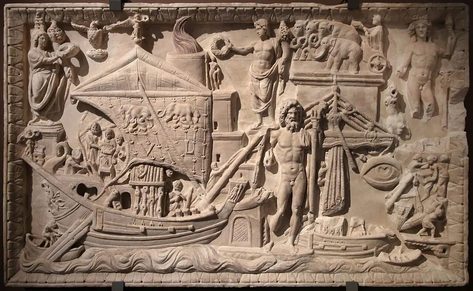
Until the 1st century AD Rome was served by the river port of Ostia, which could no longer handle the growing traffic (the operator). In AD 42 Claudius began a sea harbour about 4 km to the north, linked to the Tiber by an artificial canal, today’s Fiumicino canal (the operator; it.wikipedia). Cassius Dio describes him digging out a great tract of land, lining it with walls and letting the sea in, then building huge moles on either side of the entrance and an island between them carrying a lighthouse (en.wikipedia). The island was founded on the ship that had brought from Egypt the obelisk now in St Peter’s Square (the operator; it.wikipedia). Published figures for the area of Claudius’s basin range from about 70 to 250 hectares; whatever its size, it did not give full shelter, and Tacitus records grain ships sinking inside the harbour in a storm in 62 (en.wikipedia; de.wikipedia). Nero gave the harbour the name Portus Augusti (en.wikipedia).
Silting and exposure to storms led Trajan to build a new basin further inland between 100 and 112 (the operator; Pleiades; en.wikipedia gives 103): the hexagon, of 32 to 39 hectares in published figures, which became the heart of the whole system. it.wikipedia attributes its design to Apollodorus of Damascus. Canals linked it to Claudius’s harbour, to the Tiber and to the sea (en.wikipedia), and the harbour soon overtook Pozzuoli in importance (the operator). en.wikipedia describes Trajan’s Warehouses as the largest storage complex of the Roman Empire, covering more than 3.5 hectares. For more than 500 years Portus was Rome’s main port, the way in for glass, pottery, marble and slaves, and for the wild animals shipped from Africa for the shows in the Colosseum (en.wikipedia).
A permanent town grew up around the harbour in the 2nd and 3rd centuries, and in 314 Constantine raised it to the rank of a civitas, as Portus Romae (the operator). After the Vandal sack of 455 it was walled at the end of the 5th century, and an early Christian basilica became the centre of a residential quarter and the seat of the diocese of Porto (the operator). The Gothic invasion under Vitiges in 537 marked its end as a town, and it slowly emptied (it.wikipedia). In the 12th century the settlement moved to the bank of the Fiumicino canal, and as the coastline advanced the basins slowly silted up and turned to marsh (the operator).
The Isola Sacra necropolis was found by chance in 1925, during the draining of the island (it.wikipedia), and dug in the 1920s and 1930s (the operator). At the harbour, excavations between 2007 and 2012 by the Portus Project, in partnership with the University of Southampton, concentrated on the ground between the two basins and on the so-called Imperial Palace (en.wikipedia; fr.wikipedia).
More photographs
Nearby
4 km · city · Lazio
Ostia
A whole town of brick to walk through: houses, shops, warehouses and apartment blocks, sometimes several storeys high (fr.wikipedia), with floor mosaics still in place in many buildings (de.wikipedia).
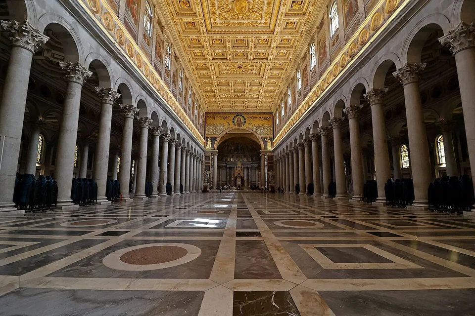
Photo: Monica_Rondoni · CC BY-SA 4.0 · Commons
20 km · church · Lazio
Basilica of Saint Paul outside the Walls
Very little of the late Roman church survived the fire.
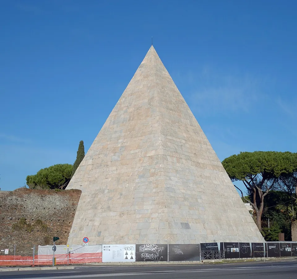
Photo: Livioandronico2013 · CC BY-SA 4.0 · Commons
22 km · tomb · Lazio
Pyramid of Cestius
The pyramid itself, complete: published heights are 36.4 to 37 m on a square base of about 29.5 m a side, of brick-faced concrete clad in white marble (en.wikipedia; it.wikipedia).


Straight-line distances.
Sources
Every fact on this page comes from the records below, each used under the licence noted.