

What is there today
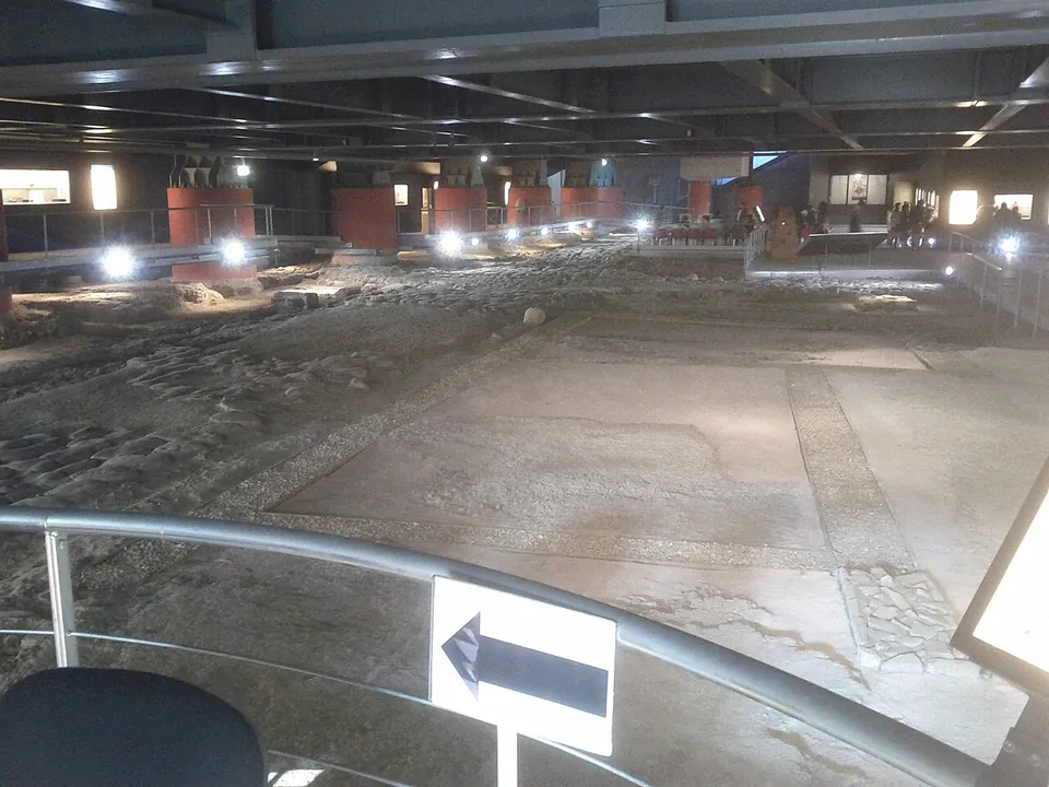
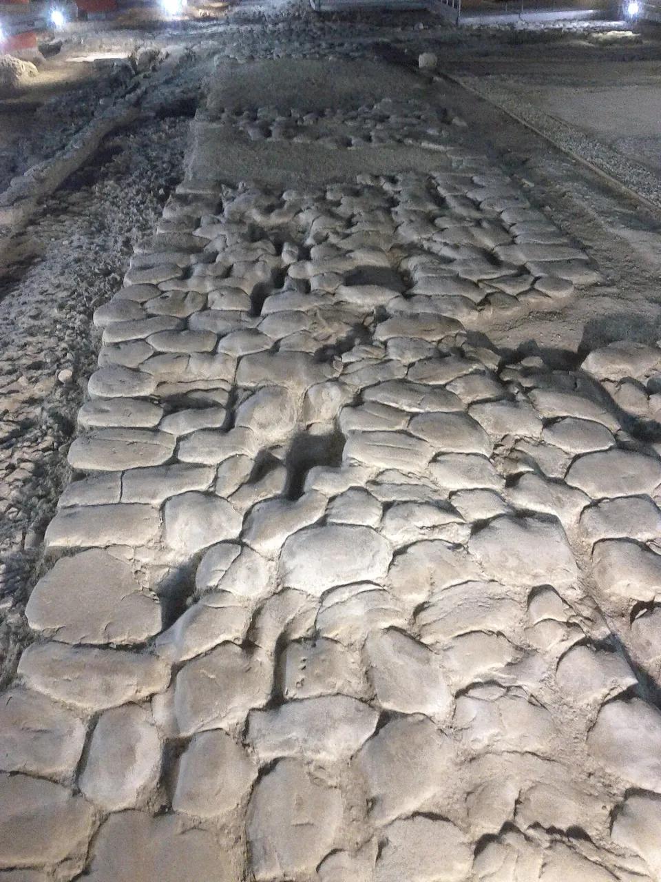
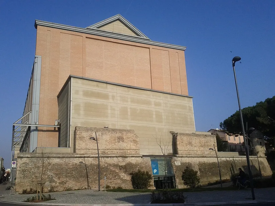
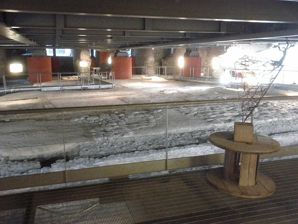
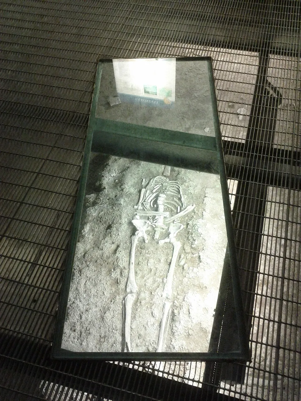
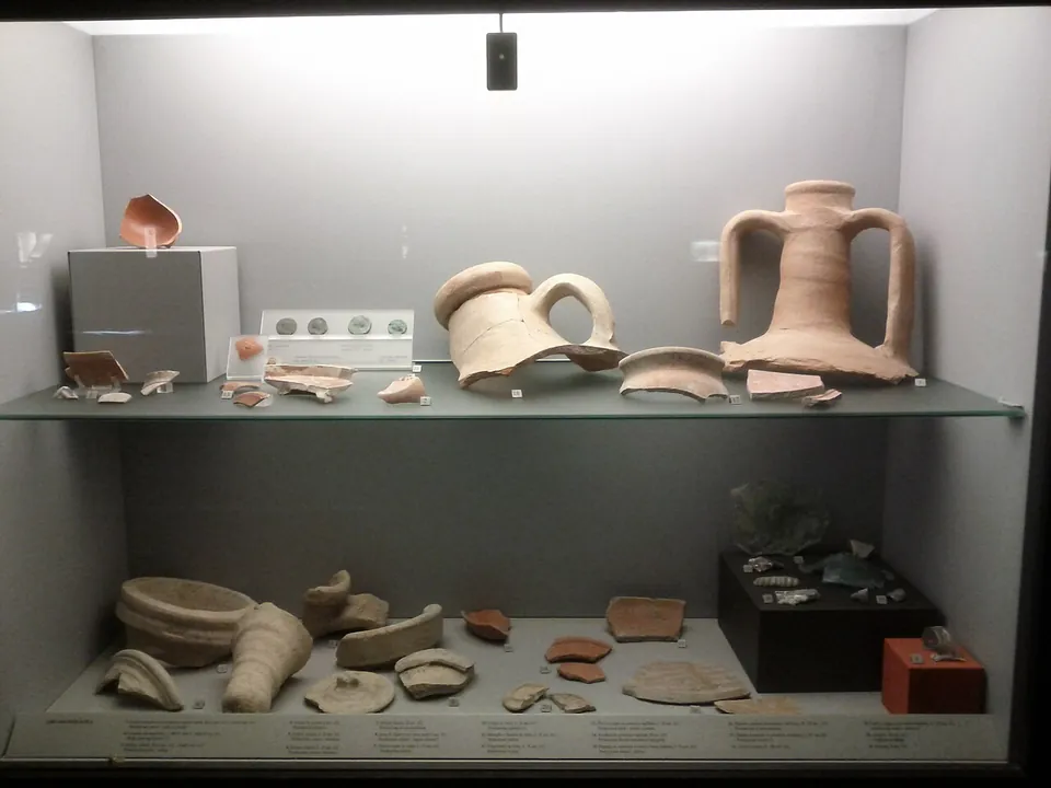
You walk a few metres below today’s street level, on walkways over the excavated ground. In the middle is the crossing of two Roman streets, a cardo and a decumanus, with the paving well enough preserved that the ruts worn by cart wheels can still be seen. On one side are the remains of shops (tabernae), the first of which the town describes as a thermopolium, a counter selling hot food and drink; on the other is a large town house (domus) that opened onto the cardo. Its cocciopesto floors, decorated with small white tesserae, survive, and so does the impluvium of its atrium, paved with bricks in a herringbone pattern (the Comune). The excavators also found 130 medieval graves; one has been left in place under glass (it.wikipedia). Display cases along the walkways hold finds from a century of excavations in and around Senigallia (it.wikipedia). The way in is through a passage in the town’s mid-16th-century ramparts, built by Duke Guidobaldo II Della Rovere (fr.wikipedia).
Is it worth the trip?
If you are in Senigallia, yes: it is free, in the centre of town, and it shows a street corner of the Roman town at its own level, with a house and shops around it and the things found there on display beside them, which the town calls a rare combination in Italy (the Comune). It is a short stop rather than a day out. What survives lies at floor level, street paving and house floors rather than standing buildings, so it rewards reading the labelled display cases more than looking for a view. On its own it does not justify a long detour.
The catch is the opening times: in autumn 2026 it opens only on Saturday and Sunday afternoons.
Getting there
The site lies under the La Fenice theatre in the centre of Senigallia, beside Via Carlo Pisacane and Viale Giacomo Leopardi (OpenStreetMap). From the motorway exit, head for the centre; the town gives Viale Giordano Bruno as the quickest way, about five minutes (the Comune). The Ex Pesa car park, about 70 m away, is free and has 88 spaces, and a bus stop is mapped about 120 m from the entrance (OpenStreetMap). The site is accessible to wheelchair users; animals are not allowed (the Comune).
Entry is free. From 17 September 2026 the town’s autumn notice gives the opening hours as Saturday and Sunday 15.00 to 20.00. The town’s own page for the site lists a different schedule, Thursday to Sunday 17.30 to 23.30, without saying when it applies, so check with the town’s culture office (071 6629203) before you plan around it. A free audio guide can be downloaded from izi.travel, and free guided tours are offered in summer (the Comune, read 23 October 2026).
Visiting details
- Opening hours
- Autumn 2026 (from the town's notice of 17 September 2026): Saturday and Sunday 15.00–20.00. The town's page for the site gives a different, undated schedule, Thursday to Sunday 17.30–23.30.
- Tickets
- Free. A free audio guide can be downloaded from izi.travel; free guided tours run in summer.
- Parking
- Ex Pesa car park, about 70 m away, free with 88 spaces (OpenStreetMap way/169565905).
Before you go
- Opening days change with the season and the town's two pages disagree; check with the Ufficio Cultura (071 6629203, [email protected]) before making a trip of it.
- No animals allowed.
Hours and prices checked 23 October 2026 on the operator's own site. Confirm before travelling.
History
Senigallia was the Roman colony of Sena Gallica, its name recalling the Gallic Senones, who occupied the northern Marche in the 4th century BC (fr.wikipedia). That the town had Roman origins was known long before 1989 from the foundations of the Rocca Roveresca; the theatre site was the surprise (it.wikipedia). It was excavated extensively between 1990 and 2000 and again in 2013 (FastiOnline).
Published dates for the remains differ. The town and it.wikipedia date the finds to the second and third centuries AD, and fr.wikipedia dates the remains to the first century BC and first century AD. The 2013 excavation, part of a research project on the town begun in 2010, dated the street crossing and at least three atrium houses to the end of the third century BC. It also found that in the second half of the second century BC the ground was raised, lifting the floors of all the houses and raising and shifting one of the streets (Lepore and Silani 2014). The quarter lay on the southern edge of the Roman town (the Comune). In the Middle Ages the ground was used for burials, which is where the 130 graves come from (the Comune).
More photographs



Nearby
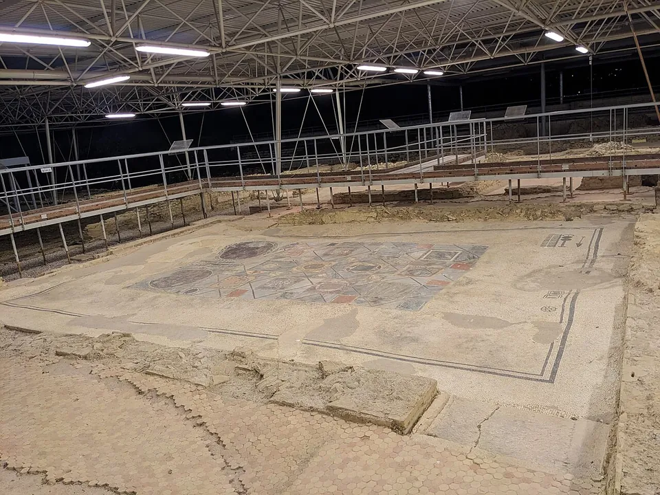
Photo: Accurimbono · CC BY-SA 4.0 · Commons
21 km · town house · Marche
Parco Archeologico di Suasa
The house is big — about 105 by 34 m, some 3,500 m² (the operator; it.wikipedia) — and is presented in the open air, much of it under a modern roof, with raised walkways that let you look down into the rooms (it.wikipedia; en.wikipedia).
Photo: Giompaola · CC BY-SA 4.0 · Commons
Photo: Claudio.stanco · CC BY-SA 4.0 · Commons


Straight-line distances.
Sources
Every fact on this page comes from the records below, each used under the licence noted.