The Santi Quaranta are the ruins of a long Roman cryptoporticus, a system of vaulted corridors built into the slope below the basilica of the Madonna delle Grazie, at the western edge of Benevento, facing the bridge where the Via Appia from Rome entered the city. With the foundations of the town’s amphitheatre and the Ponte Leproso a few minutes’ walk away, it is the centre of a cluster of Roman remains that lay inside the Roman city but outside its later walls.
What is there today
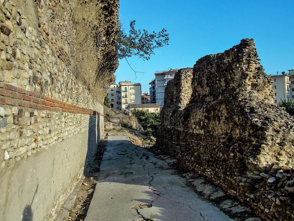
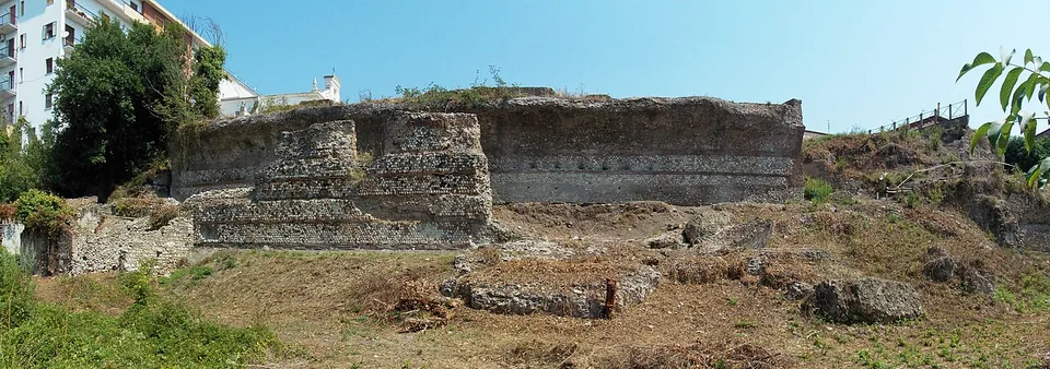
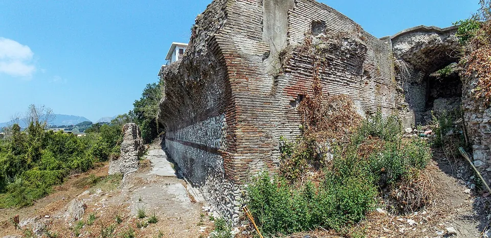
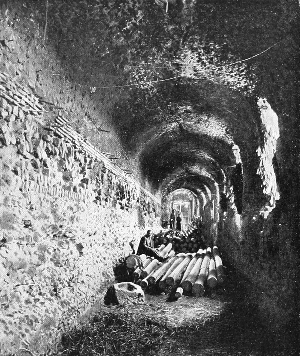
The cryptoporticus. What survives is a corridor 60 m long running roughly west to east, with two shorter corridors running back from its north side into the terrace on which the basilica stands (it.wikipedia). Its walls are built in bands of small, roughly squared stones set in a net pattern, alternating with courses of brick. The vaults collapsed almost everywhere when Allied bombing hit Benevento in August and September 1943, so the corridor now lies open to the sky. The north wall of its western arm still stands to full height, up to where the vault began; the south wall opposite leans a few degrees, keeps part of a window and is propped by a concrete buttress, and further east the outer wall stands to about half its height (it.wikipedia).
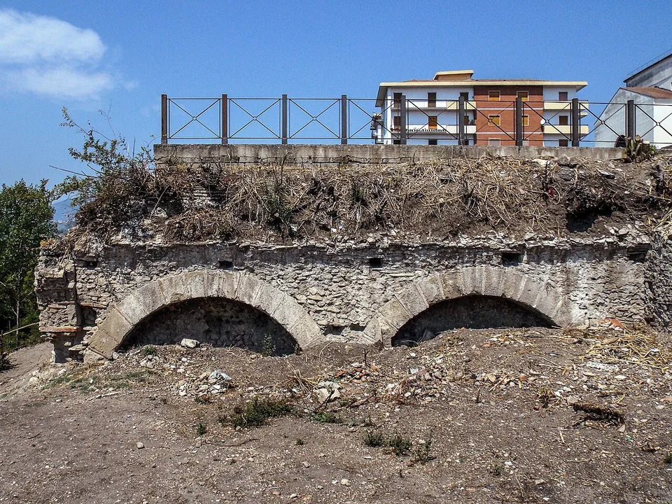
The intermediate side corridor is 3 to 3.3 m wide. Its far end keeps the only stretch of vault still intact in the building, but the last 4 m and more are now sealed off behind a dry-stone wall built on fallen rubble (it.wikipedia). The east corridor is almost filled with earth: only its west wall and part of its end wall show, with arches, probably Lombard, that once carried the vault on which the medieval church of the Forty Martyrs stood. Above the corridors, an upper level found in 1985 keeps patches of herringbone-pattern floor and a pair of column bases, probably from a colonnade, and three late antique or early medieval graves (it.wikipedia). The 60 m you see are only part of the building: substructures on the same line were traced for 546 m in all, and the gallery may once have run for more than 600 m (it.wikipedia).
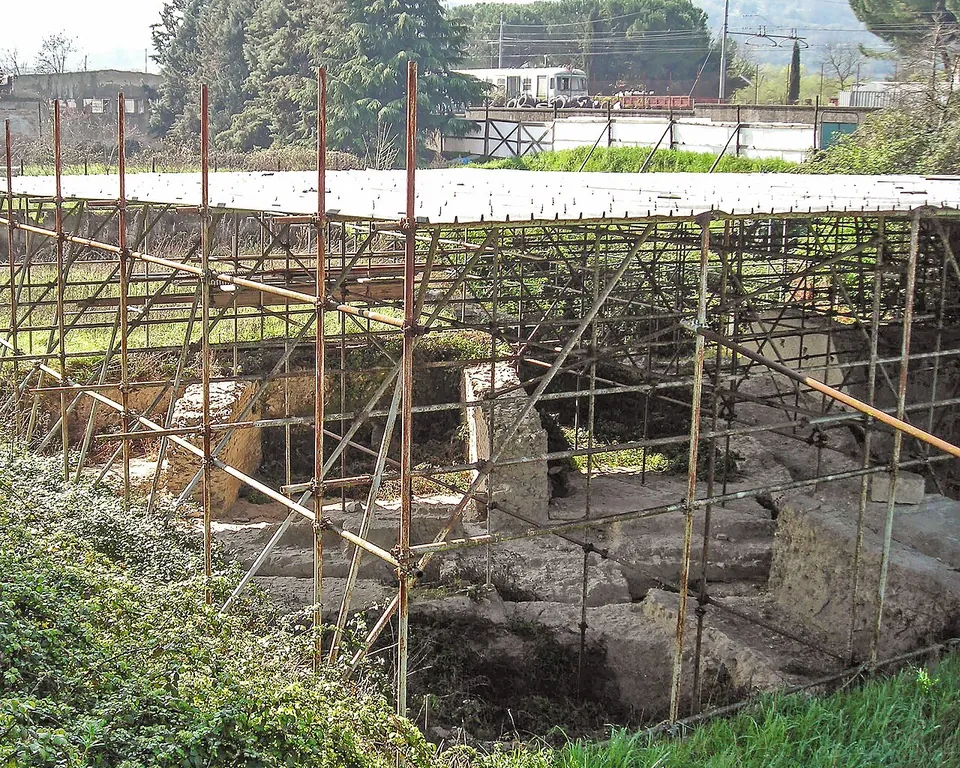
The amphitheatre, about 185 m to the south beside the Benevento Appia station (OpenStreetMap), came to light in 1985 when a Fascist-era building was demolished. What is exposed is its foundations and some upstanding parts of the lowest tier of the seating: the outer wall with two buttresses, stretches of the radial walls and a corridor floored in crushed-tile concrete. Part of it lies under the Benevento–Cancello railway (it.wikipedia). Reconstructions make it an oval about 160 by 130 m, three storeys and some 25 m high. A coin of Tiberius found at floor level and the building technique date it between the 1st century BC and the early 1st century AD, so it may be where Nero watched the gladiator show that Vatinius, a Beneventan former shoemaker risen high at his court, staged in his honour in 63 (it.wikipedia, after Tacitus). In February 2026 its walls stood behind old metal sheeting and fences (QN Itinerari).
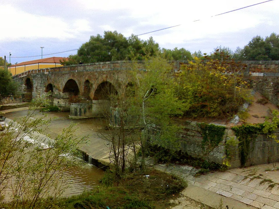
The Ponte Leproso, about 350 m to the south-west, carried the Via Appia from Capua across the Sabato into the city. Of its six arches, the four towards the far bank were rebuilt in 1712 by the Neapolitan architect Giovan Battista Nauclerio after the earthquake of 1702; the two nearest the city are older, much altered, but still show the Roman build of large, roughly dressed stone blocks, best seen on the intact second pier with its projecting cornice. Inscriptions reused in the first pier include two fragments naming the emperors Valentinian I, Valens and Gratian, probably from a restoration of 367–375. It has been closed to motor traffic since 2004 and is part of the UNESCO World Heritage site “Via Appia. Regina Viarum” (it.wikipedia).
Is it worth the trip?
As part of a day in Benevento, yes, for an hour at the end of it. The Arch of Trajan and the theatre are the reasons to come to Benevento; this corner adds a long Roman wall with its corridors still traceable, the foundations of an amphitheatre Nero may have sat in, and a bridge on the Via Appia whose two arches nearest the town keep Roman masonry, all within about 350 m of each other.
On its own it is not worth a special journey. The vaults that made the cryptoporticus a building are gone and the amphitheatre is seen through a fence. No official body runs the site, and no published times say when you can walk among the corridors: volunteers keep it.
Getting there
The cryptoporticus is about 500 m north-west of the Roman Theatre and about 1.2 km from the centre of the old town by Santa Sofia (OpenStreetMap distances). You reach it by Via Ursus, a steep lane from the river up to Viale San Lorenzo and the basilica (it.wikipedia; Meer). A bus stop, San Lorenzo, is mapped about 90 m away, and a car park about 35 m from the site (OpenStreetMap).
There is no ticket and no published timetable. The site has no operator: a group of volunteers, brought together by the journalist Felice Presta, took it in hand in 2015, cleared it and reopened Via Ursus, and holds public events there (it.wikipedia); a January 2026 article calls it easy to visit but accessible thanks to those volunteers (Meer). The Ponte Leproso is a public bridge, free to walk across. The amphitheatre is seen from outside its fence; a press report of February 2026 describes an approved €900,000 project to replace the fencing with a viewing balcony and a ramp down to the walls, with no dates given (QN Itinerari).
Visiting details
- Opening hours
- No opening hours are published. The site has no official operator; volunteers have looked after it since 2015 and hold public events there.
- Tickets
- No admission charge is published. The Ponte Leproso is a public bridge, closed to motor traffic, and the amphitheatre is seen from outside its fence.
- Parking
- A car park about 35 m from the site (OSM way/249399057), with two more within about 120 m.
Before you go
- No body publishes opening times for the cryptoporticus, so you cannot count on getting in among the corridors. The Ponte Leproso can be crossed whatever the day.
- The amphitheatre's walls stand behind old metal sheeting and fences. A press report of February 2026 describes an approved €900,000 project to replace them with a viewing balcony and a ramp; no start or end date is published.
Hours and prices checked 23 October 2026 on the operator's own site. Confirm before travelling.
History
No Roman source records when the cryptoporticus was built or what it was for. It went up in three or four phases, and published datings run from the triumviral or Augustan years of the 1st century BC, through the 1st century AD, to the late 2nd or 3rd century (it.wikipedia). Its size and its place facing the Appia’s bridge suggest an important building. In 1878 Saverio Sorda read it as a cryptoporticus, a covered and probably public walkway, the view most accept; the architect Almerico Meomartini, who studied it closely at the end of the 19th century, thought it a warehouse for goods coming into the city. Since the excavations of 1985 found the upper colonnade and the amphitheatre nearby, scholars have placed a forum in front of it, several see the building itself as commercial, perhaps a covered market, and Mario Torelli has proposed, by his own admission without archaeological proof, that it was the sanctuary of Minerva Berecyntia (it.wikipedia).
The name comes from a church of the Forty Martyrs of Sebaste built on the east corridor in the Middle Ages. Meomartini dated it to the Lombard duchy, but it is first recorded only in 1180; it was almost entirely lost by the 17th century. The corridors then served as a farm store and, in the 18th and 19th centuries, a rope-maker’s workshop, and the Collarile family owned the complex from the 16th to the 20th century. After the bombing of 1943 and decades of neglect, it was restored in 1985, when Lombard burials were also found, then abandoned again and partly used as an illegal dump until the volunteers took over in 2015 (it.wikipedia).
More photographs
Nearby
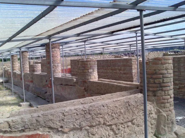
Photo: Razzairpina at Italian Wikipedia · Public domain · Commons
24 km · city · Campania
Abellinum
At the entrance, on the north side of the plateau, part of the Roman town wall still stands, built in opus reticulatum, a facing of small stones set in a diagonal net (the operator).
36 km · city · Molise
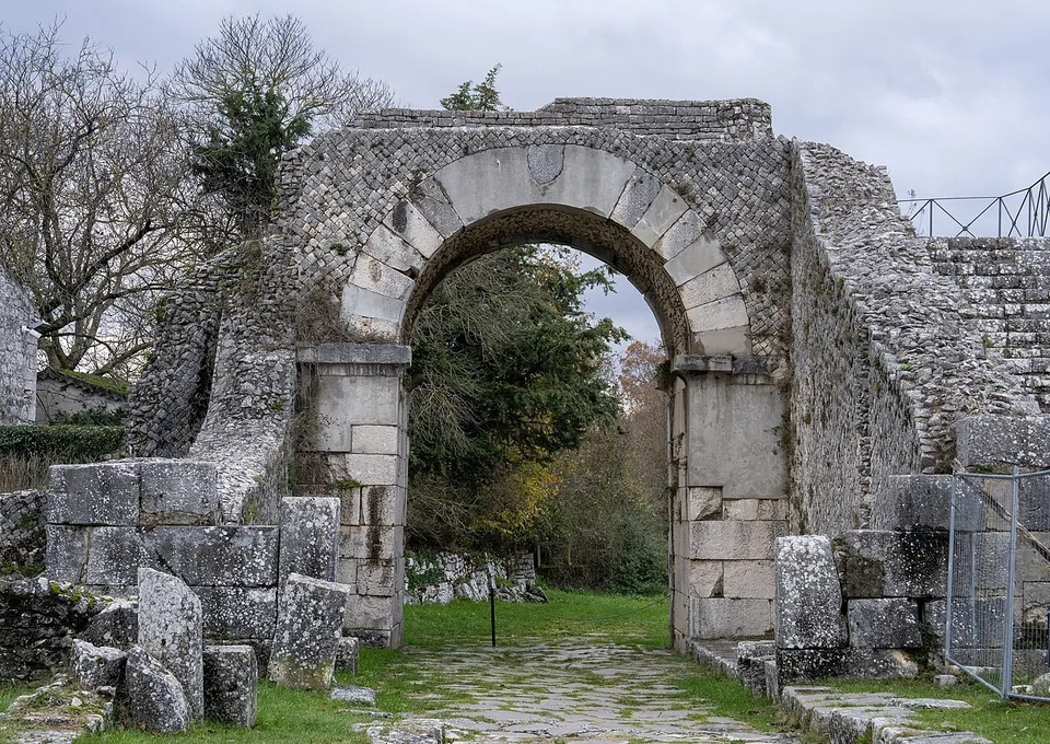
Saepinum
The walls are the first thing you see: a circuit of about 1,270 m in small-stone net-pattern masonry, punctuated by round towers, enclosing about 12 hectares, with a monumental gate at each end of the two main streets (it.wikipedia).
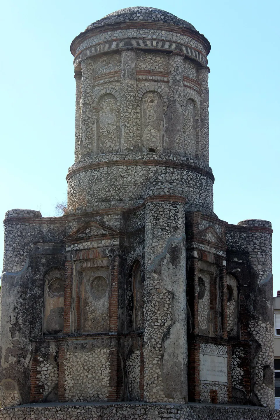
Photo: Miguel Hermoso Cuesta · CC BY-SA 4.0 · Commons
41 km · tomb · Campania
Mausoleum of the Conocchia
What you see is the outside of the tomb, standing on its own by a main road among modern buildings.


Straight-line distances.
Sources
Every fact on this page comes from the records below, each used under the licence noted.
| Source | Licence |
|---|---|
| Pleiades 427011796 | CC BY |
| Wikidata Q3949367 | CC0 |
| Vici.org 64525 | CC BY-SA (text), CC0 (metadata) |
| OpenStreetMap way/373734810 | ODbL |
| Wikipedia (it) — Santi Quaranta (Benevento) | CC BY-SA 4.0 |
| Wikipedia (fr) — Cryptoportique de Santi Quaranta | CC BY-SA 4.0 |
| Wikipedia (it) — Anfiteatro romano di Benevento | CC BY-SA 4.0 |
| Wikipedia (it) — Ponte Leproso | CC BY-SA 4.0 |
| Pleiades — Roman amphitheater at Beneventum | licence not recorded |
| Pleiades — Ponte Leproso | licence not recorded |
| Meer — Santi Quaranta a Benevento (16 January 2026) | licence not recorded |
| QN Itinerari — Progetto 'Regina Viarum', the amphitheatre project (13 February 2026) | licence not recorded |