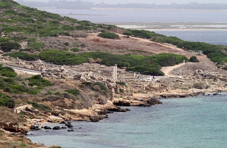
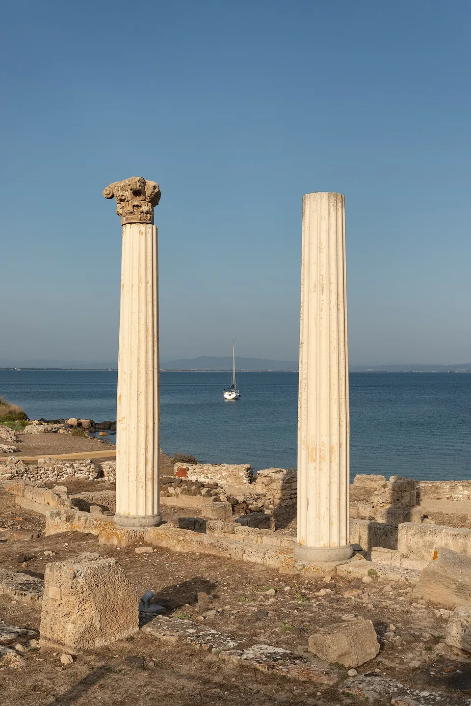
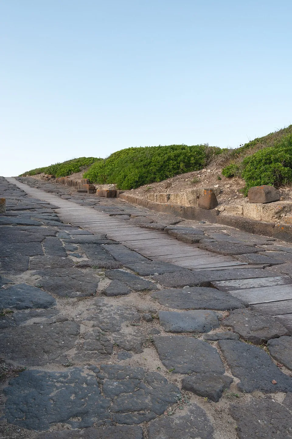


Tharros is the ruin of a port town on the southern tip of the Sinis peninsula in western Sardinia. The Phoenicians founded it and Rome renewed it, and what you see today is mostly the Roman and early Christian town: paved streets, three bath buildings by the sea, and two columns standing against the water (it.wikipedia; SardegnaTurismo).
What is there today
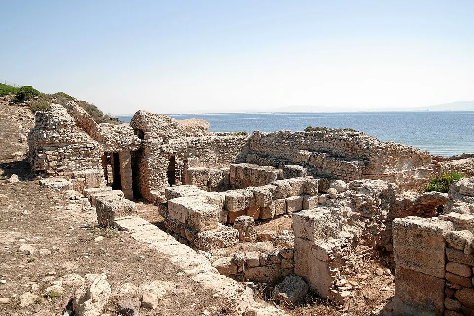
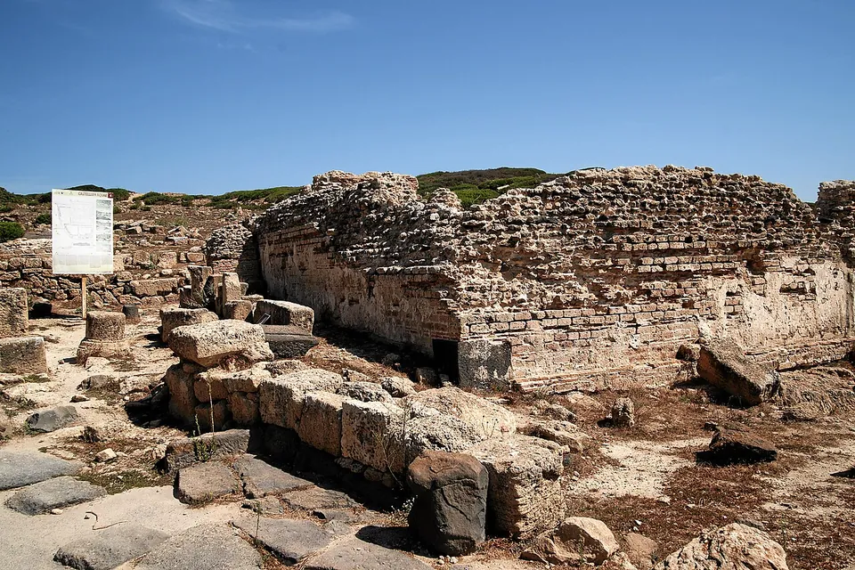
The site is an open-air museum (it.wikipedia) on a narrow promontory, in places only 100 m wide, at the southern end of the Gulf of Oristano (de.wikipedia; SardegnaTurismo). The Roman town gives it its shape. Its streets were laid out on a regular grid, paved and drained, and its two main streets, the cardo and decumanus maximus, can still be walked. The streets are paved in dark basalt slabs (de.wikipedia). In the 3rd century AD, when the town was at its height, three bath complexes went up close to the sea. From the same imperial period come parts of the aqueduct, above all the castellum aquae, the reservoir in the town centre that distributed its water, divided into three aisles by pillars (SardegnaTurismo). Pleiades dates one of the baths, the Baths of the Old Convent, to between 30 BC and AD 300.
The two columns standing by the water belong to the tetrastyle temple facing the sea. Both are reconstructions, and only the bases of the rest survive (SardegnaTurismo). In the early Christian period one of the baths was turned into a religious building and a baptistery was built (it.wikipedia), dated to the 5th or 6th century (SardegnaTurismo). Of the small amphitheatre only traces remain (the Ministry of Culture).
Older Tharros is there too. On the hill of Su Murru Mannu there are round huts of a Bronze Age Nuragic village, the Phoenician tophet (an open-air sanctuary) and Punic walls. The Punic “temple of the Doric half-columns” survives as a tall base cut into the rock, decorated with Doric half-columns along its sides (it.wikipedia; the Ministry of Culture). The town is only partly excavated, which often makes it hard to tell one period from another (it.wikipedia), and most of the finds are in museums in Cagliari, Oristano and Cabras and in the British Museum (it.wikipedia).
Is it worth the trip?
Yes, if you are in western Sardinia. The setting is much of the draw: the streets run downhill to the water on a narrow promontory. The visit takes an hour to an hour and a half (the site’s visitor service).
Know what you are getting. Apart from the baths and the reservoir, this is a town read in plan, as foundations and low walls, so it rewards a slow walk with the information panels. There is no shade anywhere on the site (the visitor service), which makes the early morning or the last hours of a summer day the time to go. A combined ticket adds the town museum in Cabras, where finds from Tharros are shown.
Getting there
The site lies beside the village of San Giovanni di Sinis in the municipality of Cabras (en.wikipedia; it.wikipedia), about 20 km west of Oristano (de.wikipedia). OpenStreetMap maps several paid car parks in the village, 450 m to 1 km from the centre of the site. From them it is a 500–800 m walk to the entrance (Coopculture). A shuttle runs from the piazza in San Giovanni to the entrance for €3.50, and a small panoramic road train runs to no fixed timetable outside August and some holidays, leaving according to bookings and visitor numbers (the visitor service). Without a car it is harder: the nearest railway station is Oristano, and buses from Oristano by way of Cabras run only in July and August (Coopculture). OpenStreetMap maps a stop named San Giovanni di Sinis about 1 km from the site.
From April to October the site opens daily: 09.00–20.00 from June to August, 09.00–19.00 in May and September, 09.00–18.00 in April and October. From November to March it opens 09.00–17.00, Tuesday to Sunday. Last entry is 45 minutes before closing. It is closed on 25 December and 1 January.
A ticket is €10. Over-65s, university students under 26 and groups of 20 or more pay €7, and ages 6 to 17 pay €5. Children under 6, residents of Cabras and Solanas, and disabled visitors with a companion get in free. Combined tickets cost €15 with the Museo Civico Giovanni Marongiu in Cabras, €11 with the Torre di San Giovanni (the Spanish watchtower on the hill above the site) and €17 for all three. Tickets are sold on site or online through the Fondazione Mont’e Prama, which manages the site. Guided tours in Italian run daily at set times and are included in the ticket, and tours in other languages can be requested. Some stretches of the route are awkward for wheelchairs, and there are toilets and a bookshop (penisoladelsinis.it, read 17 October 2026 — check before travelling). The Ministry of Culture’s listing, last updated in January 2024, still gives €11 and €9 and says booking is required.
Visiting details
- Opening hours
- Daily 09.00–20.00 from June to August; 09.00–19.00 in May and September; 09.00–18.00 in April and October; 09.00–17.00 from November to March, closed on Mondays. Last entry 45 minutes before closing. Closed 25 December and 1 January.
- Tickets
- €10; €7 for over-65s, university students under 26 and groups of 20 or more; €5 for ages 6–17; free under 6, for residents of Cabras and Solanas, and for disabled visitors and a companion. Combined tickets — with the Museo Civico Giovanni Marongiu in Cabras €15, with the Torre di San Giovanni €11, all three €17. Tickets on site or online through the Fondazione Mont'e Prama; the daily guided tours in Italian are included.
- Parking
- OpenStreetMap maps several paid car parks in San Giovanni di Sinis, 450–1,000 m from the centre of the site; the walk to the entrance is about 500–800 m. A paid shuttle (€3.50) runs from the village square to the entrance.
Before you go
- There is no shade on the site; take water and a hat in summer.
- From November to March the site is closed on Mondays.
- Some stretches of the route are awkward for wheelchairs.
Hours and prices checked 17 October 2026 on the operator's own site. Confirm before travelling.
History
People lived on the promontory long before the town. Round huts on Su Murru Mannu date from the Bronze Age, between about 1600 and 1300 BC. The Phoenicians founded the town in the 8th century BC next to that Nuragic village. Under Carthage it was fortified and enlarged, and it grew rich on trade with Africa, the Iberian peninsula and Massalia (it.wikipedia). Some accounts, the visitor service’s among them, credit the foundation to Carthage instead, in the 8th or 7th century BC (penisoladelsinis.it; Coopculture).
Rome conquered it in 238 BC, and in 215 BC it was one of the places where the revolt against Rome led by Ampsicora began. Under the empire the town was thoroughly renewed, with baths, an aqueduct and basalt-paved streets, and it gained the status of a community of Roman citizens (it.wikipedia). The Antonine Itinerary places it 12 miles from Othoca and 18 from Cornus. An inscription records repairs to the road from Tharros to Cornus as late as the reign of the emperor Philip (en.wikipedia; Pleiades).
A diocese was founded around 400 (en.wikipedia). After the fall of the Western Empire the town was ruled by the Vandals and then the Byzantines, and, harried by Muslim raids, it sank into a deepening crisis (it.wikipedia). It was the first capital of the Giudicato of Arborea until the seat moved to Oristano around 1070, and the town was abandoned (en.wikipedia; the Ministry of Culture). A Sardinian saying holds that Oristano was built from stone carted away from Tharros (it.wikipedia). Treasure hunters plundered the graves in its cemeteries from the 17th century onwards, and excavation, resumed in the mid-20th century, has not stopped since (SardegnaTurismo).
More photographs


Nearby
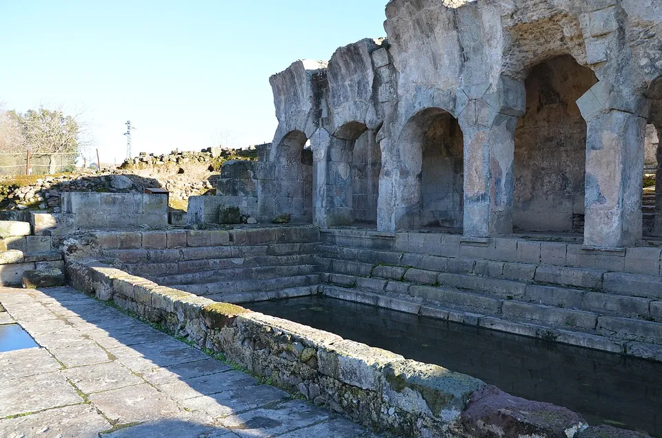
Photo: Carole Raddato from FRANKFURT, Germany · CC BY-SA 2.0 · Commons
34 km · bath · Sardinia
Baths of Fordongianus
The heart of the site is the 1st-century building at its northern end.

Straight-line distances.
Sources
Every fact on this page comes from the records below, each used under the licence noted.
| Source | Licence |
|---|---|
| Pleiades 472032 | CC BY |
| Wikidata Q736689 | CC0 |
| Vici.org 7846 | CC BY-SA (text), CC0 (metadata) |
| OpenStreetMap way/72444133 | ODbL |
| Pleiades — Baths of the Old Convent, Tharros | licence not recorded |
| Wikipedia (it) — Tharros | CC BY-SA 4.0 |
| Wikipedia (en) — Tharros | CC BY-SA 4.0 |
| Wikipedia (de) — Tharros | CC BY-SA 4.0 |
| SardegnaTurismo (Regione Sardegna) — Antica città di Tharros | licence not recorded |
| Ministero della Cultura — Area archeologica di "Tharros" | licence not recorded |
| Penisola del Sinis (the site's visitor service) — Area Archeologica di Tharros, hours and tickets | licence not recorded |
| Penisola del Sinis — Orari e biglietti (all sites, combined tickets) | licence not recorded |
| Penisola del Sinis — Il trenino (shuttle and panoramic train) | licence not recorded |
| Coopculture — Area Archeologica di Tharros (getting there) | licence not recorded |