What is there today
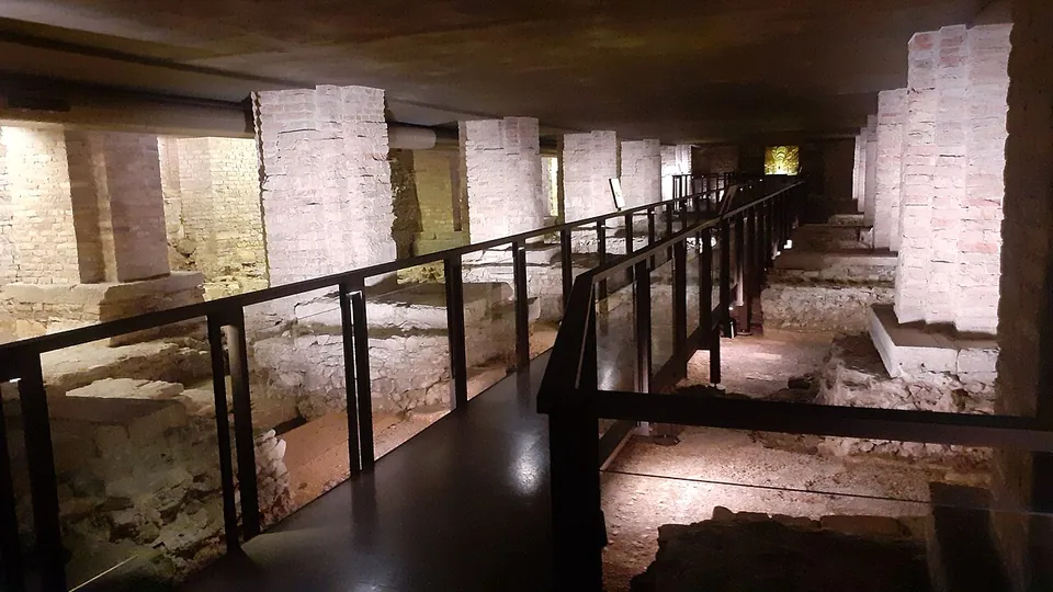
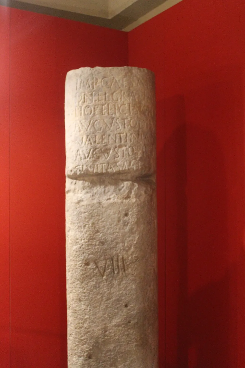
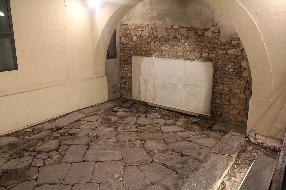
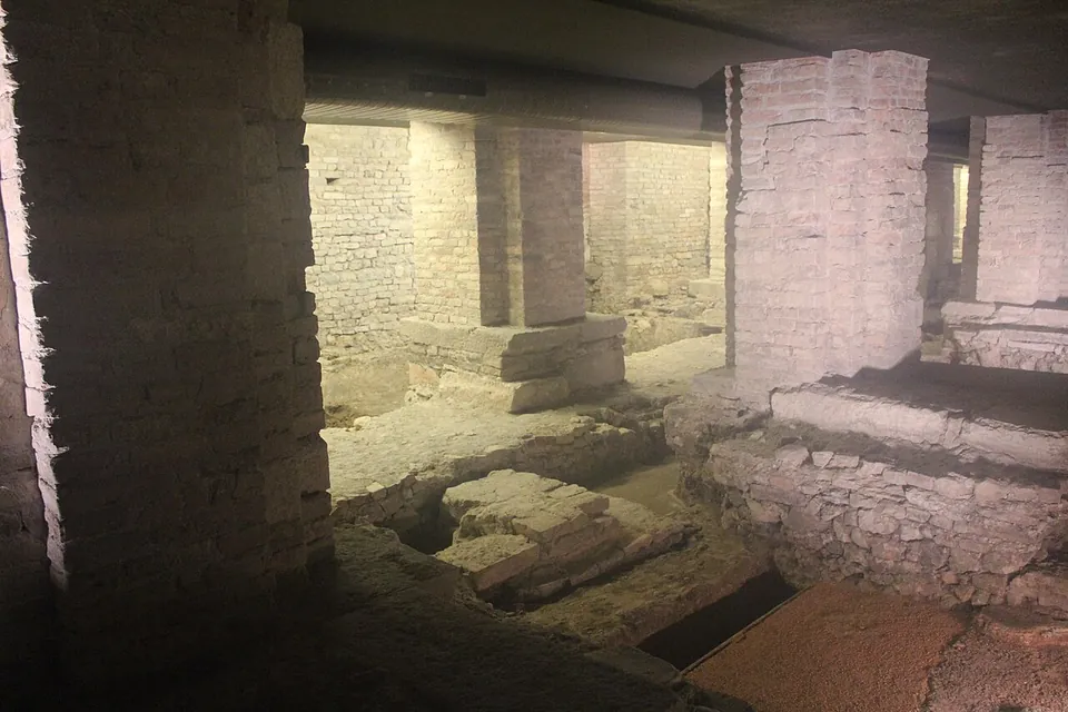
About 750 m² of excavation run under the cathedral nave, the sacristy and the crypt. You walk on walkways between modern brick piers, looking down on walls and floors, probably of Roman houses, in the south-western quarter of the town, whose blocks of about 80 m a side followed the line of the main street, today’s Corso Palladio. Under the sacristy (ArcheoVeneto) is a stretch of paved street, about 3 m below today’s ground level, 3.8 m wide with a pavement of about half a metre on each side, dated to between the end of the 1st century BC and the start of the 1st century AD. Beside it stands a milestone of the 4th century AD, dedicated by the city of Vicenza to the emperor Gratian. It has nothing to do with this street: it was found reused in the cathedral’s masonry, and the VIII cut under its inscription shows it stood eight miles from Vicenza (it.wikipedia). Over the Roman rooms under the nave lie the remains of the first Christian buildings before the present cathedral, among them a domus ecclesiae, a house used as a church (it.wikipedia). The museum’s archaeological section shows the most significant finds from the area (the operator).
On the same square is the better-preserved Roman piece: a cryptoporticus, the vaulted underground walk of a rich house, described below.
Is it worth the trip?
If you are in Vicenza, yes: the cathedral area and the cryptoporticus together make a short visit underground in Roman Vicetia, and the cryptoporticus is the best-preserved cryptoporticus of a private house north of the Po (it.wikipedia). They are not a reason to travel to Vicenza on their own. What you see under the cathedral is mostly foundations and floors rather than standing rooms, the area is shown on guided visits, and the cryptoporticus opens only at set times, so the visit needs planning around both.
Getting there
Both are on Piazza Duomo in the historic centre. The nearest mapped bus stops, Piazza Castello and Basilica, are a little over 200 m away, and so is a pay car park (OpenStreetMap).
The archaeological area is managed by the Museo Diocesano, Piazza Duomo 12 (tel. 0444 226400), under an agreement with the archaeological superintendency, and is seen on the museum’s guided visits (the operator; it.wikipedia). The museum’s own pages give its hours: from 1 April to 31 October, Monday to Friday 14.00–18.00 and weekends 10.30–13.00 and 14.00–18.00; from 1 November to 31 March, closing at 17.00. They do not say when the area itself is shown or what it costs, so call before going (the operator’s page as archived on 8 June 2026).
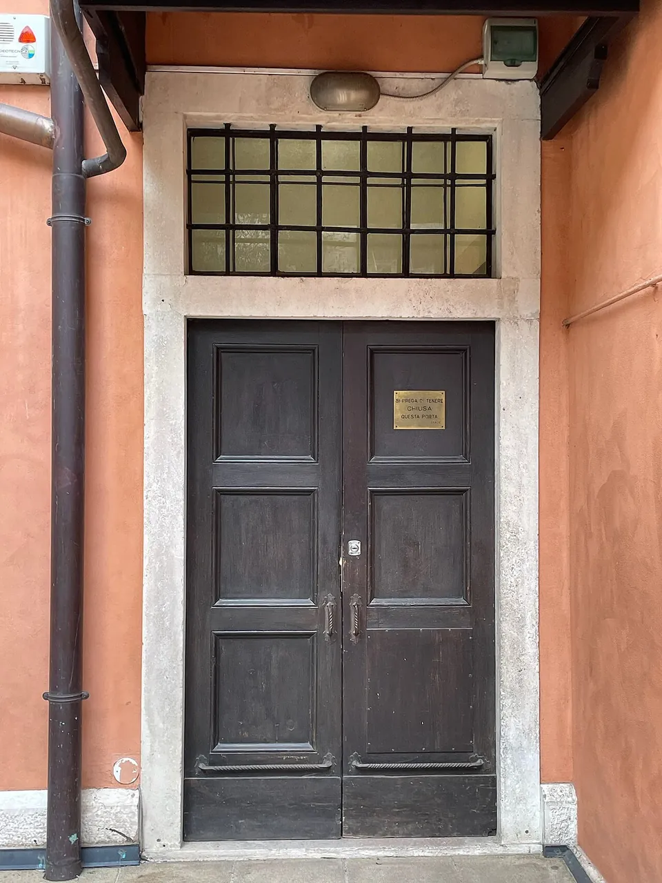
The cryptoporticus is entered from Piazza Duomo. The Ministry of Culture’s notice, last updated in May 2021, gives openings for the public on Saturdays 15.00–17.00 and Sundays 10.00–12.00 (Saturdays 15.00–18.00 and Sundays 9.00–12.00 in summer time), on the afternoon of the second Sunday of the month during the antiques market, and at other times by booking. A visit lasts about 30 minutes, with at most 15 people going down at a time. The same page’s timetable marks every day as closed, and the notice dates from 2021, so treat these times as a guide and confirm them first.
Visiting details
- Opening hours
- Shown on guided visits run by the Museo Diocesano, whose hours are 1 April to 31 October Monday to Friday 14.00–18.00, Saturday and Sunday 10.30–13.00 and 14.00–18.00; 1 November to 31 March Monday to Friday 14.00–17.00, Saturday and Sunday 10.30–13.00 and 14.00–17.00. The museum's pages do not give separate times for the area, so ask the museum (Piazza Duomo 12, tel. 0444 226400) before going. The Roman cryptoporticus across the square keeps its own hours, given on the page.
- Tickets
- The operator's page for the area gives no price; ask the Museo Diocesano (tel. 0444 226400).
- Parking
- Central Vicenza; the nearest car park mapped is a pay car park about 200 m from Piazza Duomo (OSM way/1309676074). Bicycle stands are mapped in and around the square.
Before you go
- The archaeological area is shown on the Museo Diocesano's guided visits, and the cryptoporticus opens only at set weekend times or by booking, so check both before going.
Hours and prices checked 8 June 2026 on the operator's own site. Confirm before travelling.
The cryptoporticus
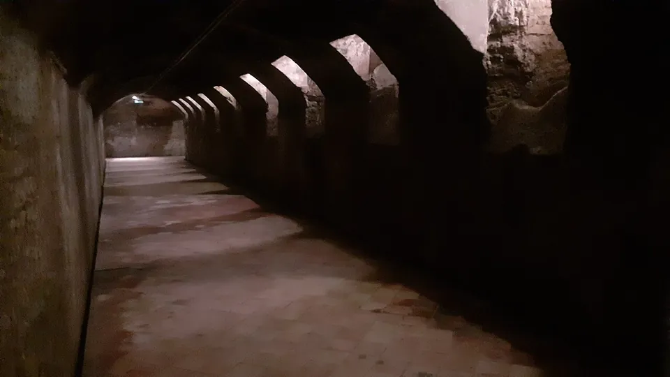
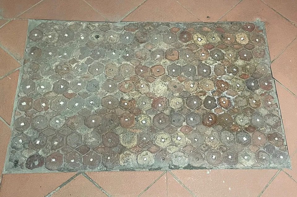
A cryptoporticus is a covered passage below ground. This one ran under the porticoes of a house’s garden courtyard, and the house itself has not survived. It is a U of three barrel-vaulted arms in Roman concrete: the central one 29.5 m long and the two side arms 27.35 m each, about 2.75 m high, with the floor 6.31 m below the present square (it.wikipedia; the Ministry of Culture gives about 29 and 27 m and “over 6 m”). Small slanting windows high in the inner walls let in light and air; it.wikipedia counts 31 of them, the Ministry 27. The walls keep a pale marmorino plaster edged with a band of red and a small stepped stucco cornice, a finish that it.wikipedia reads as a sign that the family spent time here and did not only store things. At the ends of the central arm are two rooms, one with holes for heavy shelving and a stone threshold about half a metre high, probably against floods. The original floor was of handmade brick hexagons, each with a white stone tessera in its centre, later covered with a white mosaic; two pieces of the floors found in the excavation are laid out in the side rooms, and the tiled floor you walk on is modern, laid just above the ancient one (it.wikipedia).
Built at the end of the 1st century BC (the Ministry allows up to the early 1st century AD), it was used at least until the 4th century AD, first as a cool retreat and then as a food store (it.wikipedia; the Ministry of Culture). It was found in 1954 by builders digging the cellars of the cathedral’s canonry, restored over three years and opened in 1957. Its finds, including terracotta antefixes, lamps and a bronze appliqué of a sea god, are in the Museo Naturalistico Archeologico at Santa Corona (it.wikipedia).
Teatro Berga and Ponte San Paolo
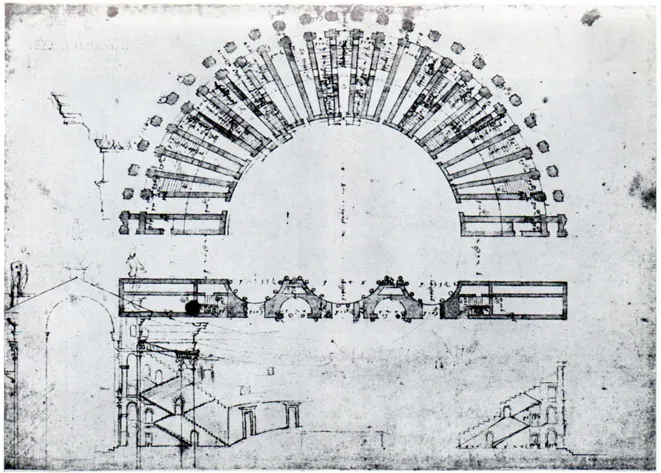
Vicetia’s theatre, the Teatro Berga, stood south-east of the town centre, across the river Retrone, and was built towards the end of the 1st century BC. Its cavea measured about 82 m across, for an estimated 5,000 or more spectators, and statues of the Julio-Claudian imperial family adorned its stage; some of them, found in 19th-century digs, are in the Museo Naturalistico Archeologico at Santa Corona. Little of the structure survives: houses were built over it, and some of the walls that carried the seating are inside them. What you can still see is its shape, because the street called Contrà Porton del Luzzo follows the outer curve of the seating. The ruins were still clearly visible in the 16th century, when Andrea Palladio measured them and drew the plan shown on this page (it.wikipedia).
The theatre was linked to the town centre by a bridge where Ponte San Paolo crosses the Retrone today. The Roman bridge, 34 m long on three arches, was demolished in 1875 and replaced by the present single-arch bridge on the same line (it.wikipedia), so crossing it puts you on the Roman route, not on Roman stone.
History
The Roman remains under the cathedral were found in 1946, when the cathedral, badly damaged by bombing in the Second World War, was being rebuilt and a new sacristy built. The first structures under the nave and the street were uncovered between 1946 and 1948 by the archaeological superintendency of the day; further digs under the crypt in 1975–1977 were filled in again afterwards. The area was first opened to the public in the 1950s, closed in the 1970s because of its prohibitive microclimate, cleaned up and restored from 2001 to 2003, and reopened on 20 December 2014 (it.wikipedia; the operator).
The street belonged to the minor streets running parallel to the town’s main axis (it.wikipedia), which followed the urban stretch of the Via Postumia (ArcheoVeneto). The milestone probably stood on the main road through Vicenza in the 4th century, the so-called Via Gallica (it.wikipedia). The houses beneath the nave were followed, in a long sequence of layers, by the first Christian places of worship, and the operator traces the religious buildings from the early Christian period to the Romanesque.
More photographs
Nearby
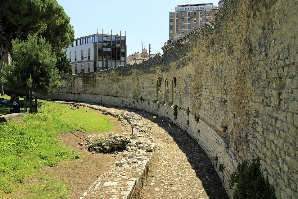
Photo: Falk2 · CC BY-SA 4.0 · Commons
30 km · bridge · Veneto
Ponte San Lorenzo
From the street, nothing: the river it crossed was filled in, and the bridge sits entirely below the modern road (OpenStreetMap; Turismo Padova, the city's tourism site).
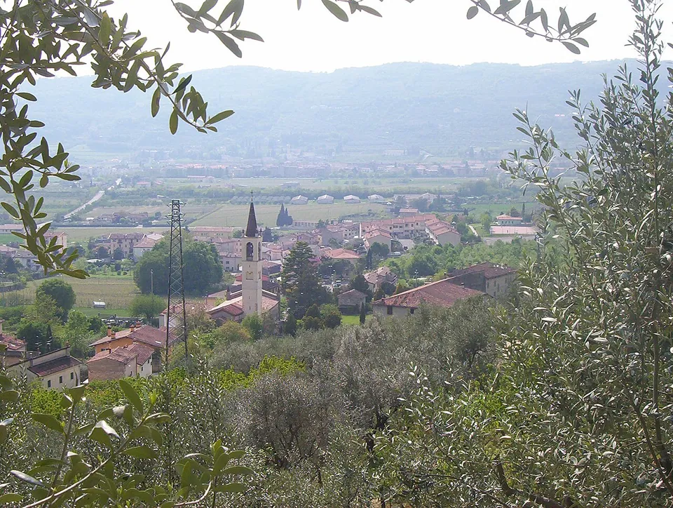
Photo: Adert · CC BY-SA 3.0 · Commons
40 km · site · Veneto
Ipogeo di Santa Maria in Stelle
The water of an underground spring collects in a semicircular settling basin cut in the rock and runs on along a low, narrow, barrel-vaulted channel 100 m long, with four shafts along it.


Straight-line distances.
Sources
Every fact on this page comes from the records below, each used under the licence noted.
| Source | Licence |
|---|---|
| Wikidata Q93225546 | CC0 |
| Museo Diocesano di Vicenza — Area archeologica della cattedrale (the operator; archived copy of 2026-06-08) | licence not recorded |
| Ministero della Cultura — Criptoportico romano di Vicenza (description and opening times) | licence not recorded |
| ArcheoVeneto — Roman houses and street in the Cathedral, Vicenza | licence not recorded |
| ArcheoVeneto — Roman cryptoporticus in Piazza Duomo, Vicenza | licence not recorded |
| Wikipedia (it) — Area archeologica della cattedrale di Vicenza | CC BY-SA 4.0 |
| Wikipedia (it) — Criptoportico romano (Vicenza) | CC BY-SA 4.0 |
| Wikipedia (en) — Roman cryptoporticus, Vicenza | CC BY-SA 4.0 |
| Wikipedia (it) — Teatro Berga | CC BY-SA 4.0 |
| Wikipedia (it) — Ponte San Paolo (Vicenza) | CC BY-SA 4.0 |
| Wikidata — Roman cryptoporticus, Vicenza (Q21208502) | licence not recorded |
| Wikidata — Teatro Berga (Q16912710) | licence not recorded |
| Wikidata — Ponte San Paolo (Q115676310) | licence not recorded |