What is there today
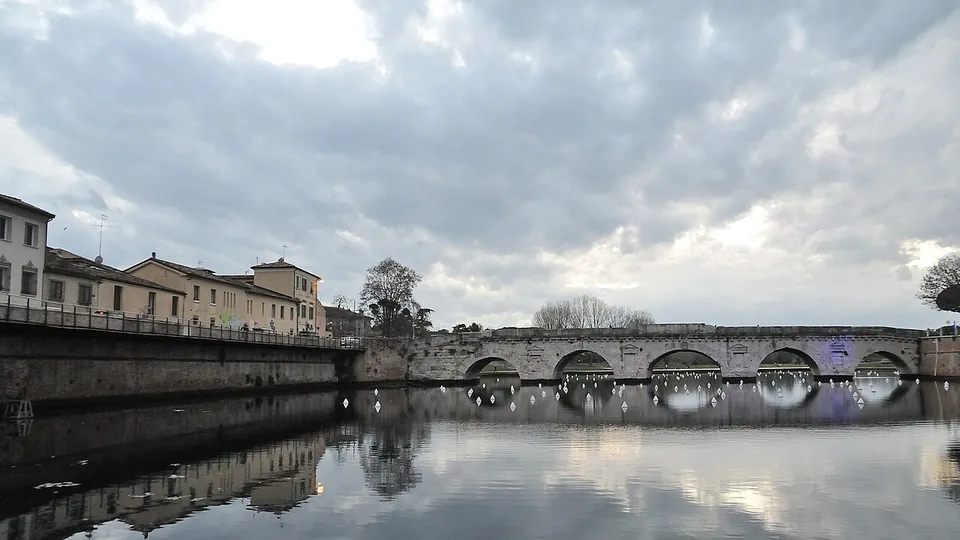
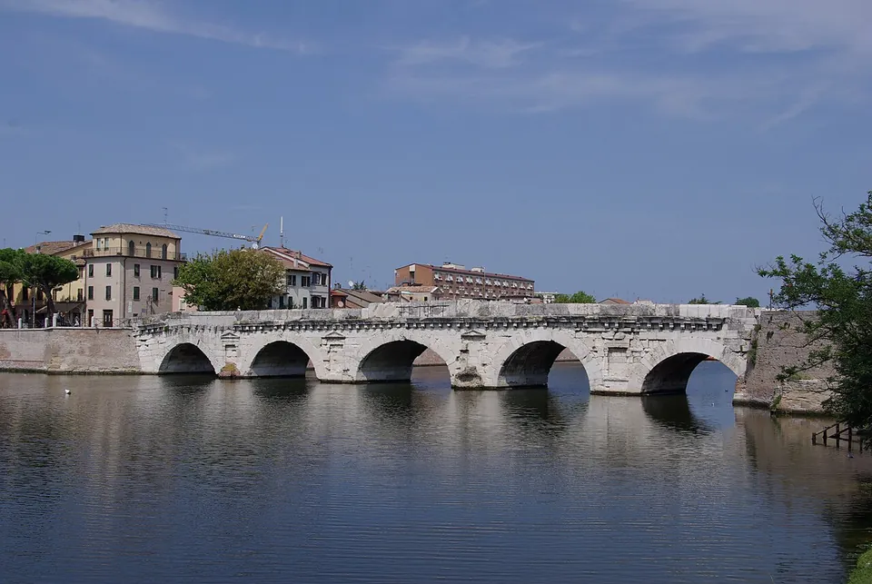
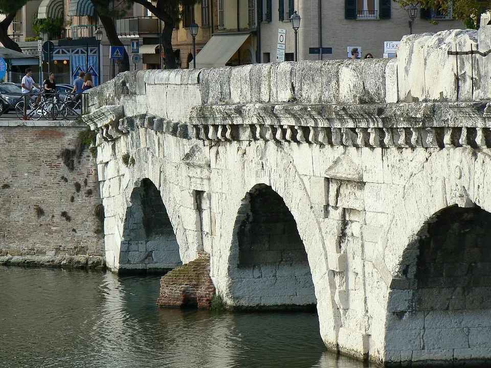
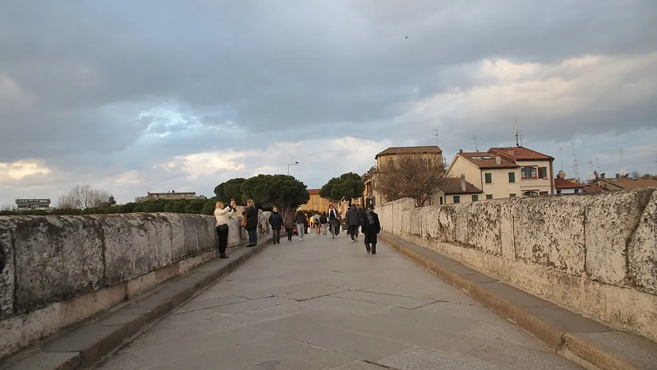
The whole bridge. Five arches of white limestone cross the old course of the Marecchia, now a basin of the port canal: the river itself was diverted further north between the late 1920s and 1931 (en.wikipedia; de.wikipedia). Published lengths run from 62 m between the abutments (de.wikipedia) to 74 m overall (it.wikipedia), and the arches widen towards the middle (it.wikipedia). The piers carry blind niches with small pediments, a cornice on brackets runs along both sides, and the keystones of the arches are carved with reliefs: an oak-leaf civic crown, a shield, a sacred dish, a libation vessel and an augur’s staff, symbols of Augustus and of the priestly colleges he presided over (it.wikipedia; en.wikipedia). The piers stand at a slant to the roadway, set to meet the river’s current (en.wikipedia; de.wikipedia).
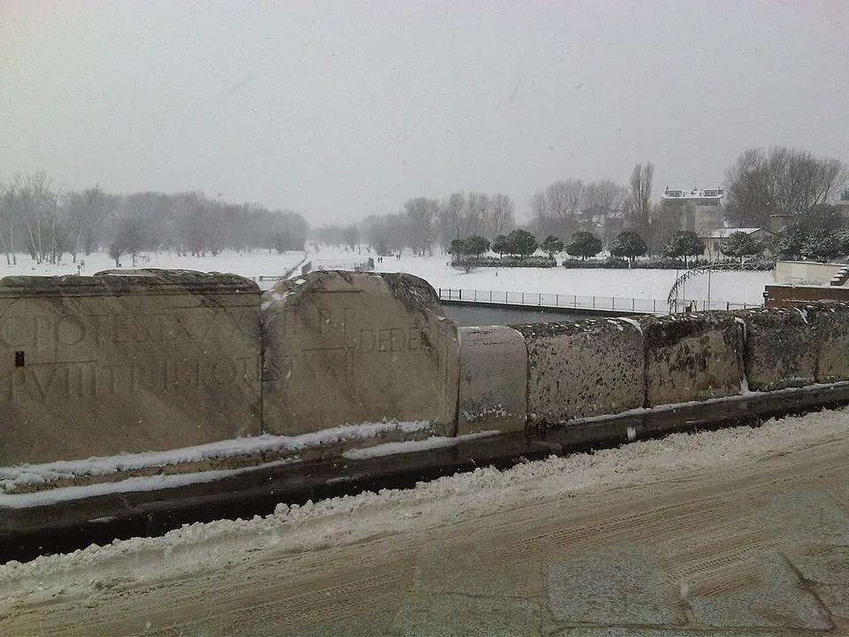
On the bridge itself, the parapet slabs over the middle arch carry, on both sides, the building inscription naming Augustus and Tiberius (riviera.rimini.it, the official tourism site; en.wikipedia). Two hollows in the upstream parapet gave the bridge its nickname, the Devil’s Bridge; they were most likely sockets for pulleys used to hoist material from boats (en.wikipedia). The bridge is less well preserved at its San Giuliano end, whose arch is the product of repeated rebuilding, the last in 1680 (en.wikipedia; de.wikipedia). By that end of the bridge, a fenced park opened in 2016 lays out 155 of its stones, recovered during works on the river in 1989–91 (en.wikipedia; OpenStreetMap). The tourism site recommends the square on the water nearby, reorganised in 2017–18 (en.wikipedia), for a view of the arches and a walk along the edge of the basin.
Is it worth the trip?
Yes, as part of a visit to Rimini: a Roman bridge still standing on its five arches and still walked across, with its building inscription on the parapet, costs nothing and is open at any hour. It is a short stop, not a destination in itself. Pair it with the Arch of Augustus at the other end of Corso d’Augusto, about a kilometre away, and with the Domus del Chirurgo, the town’s ticketed Roman house.
Getting there
The bridge is the end of Corso d’Augusto, the main street of the old town, and leads across into the Borgo San Giuliano and Viale Tiberio (de.wikipedia). From the Arch of Augustus it is a walk of about a kilometre down the Corso. A bus stop is mapped about 100 m from the bridge and a car park about 110 m away (OpenStreetMap).
There is no ticket and no opening time: since May 2020 the bridge has been a pedestrian street (en.wikipedia), crossed on foot from the old town (riviera.rimini.it, read 21 October 2026). No operator page gives the visiting arrangements of the park of loose stones.
Visiting details
- Opening hours
- Open at all times. The bridge is a pedestrian street between the old town and Borgo San Giuliano.
- Tickets
- Free.
- Parking
- A surface car park about 110 m from the bridge (OSM way/533620724); a bus stop is mapped about 100 m away (OSM node/12785289767).
Before you go
- No operator page gives visiting arrangements for the fenced park of the bridge's loose stones beside the water.
Hours and prices checked 21 October 2026 on the operator's own site. Confirm before travelling.
History
Rimini, Roman Ariminum, was a colony founded in 268 BC on the river Ariminus, the Marecchia (en.wikipedia). The bridge was begun under Augustus in AD 14 and finished under Tiberius in AD 21, as the inscription on its parapets records (it.wikipedia; riviera.rimini.it); it probably replaced an earlier bridge, most likely of wood (en.wikipedia; de.wikipedia). It stood at the southern end of two Roman roads, the Via Aemilia to Placentia (Piacenza) and the Via Popilia north along the coast, and was the last of Augustus’ works at Ariminum, after the arch, the repair of the Via Flaminia and the Via Aemilia and the renaming of the town as Colonia Augusta Ariminensis (en.wikipedia). The facing stone was not local: it is limestone from the Roman quarry at Aurisina, probably brought by sea (en.wikipedia; de.wikipedia).
In 552 the Gothic commander Usdrila damaged the bridge to stop the Byzantine army of Narses marching from Ravenna on Rome; Procopius wrote that afterwards a single unarmed man on foot could barely cross it. How much was broken is not known: readings range from both ends to only the last arch towards San Giuliano (en.wikipedia; de.wikipedia). Narses got across with the fleet that was following his army along the coast (en.wikipedia).
Damage and repairs followed over the centuries. By one account Pandolfo IV Malatesta set fire to the last arch in 1528, the arch towards San Giuliano was rebuilt in 1680 with stones from a collapsed Roman bridge on the Via Aemilia, and Spanish troops damaged the bridge in 1743 (en.wikipedia). It was declared a national monument in 1885 (en.wikipedia; it.wikipedia). In September 1944 retreating German troops had orders to blow it up, but the charges largely failed, and it was the only bridge over the Marecchia they left standing (en.wikipedia). Andrea Palladio called it the most beautiful of all the bridges he had seen, and his drawing of it, published in 1570, was the model for Green’s Bridge in Kilkenny, Ireland, completed in 1766 (en.wikipedia; de.wikipedia).
More photographs
Nearby
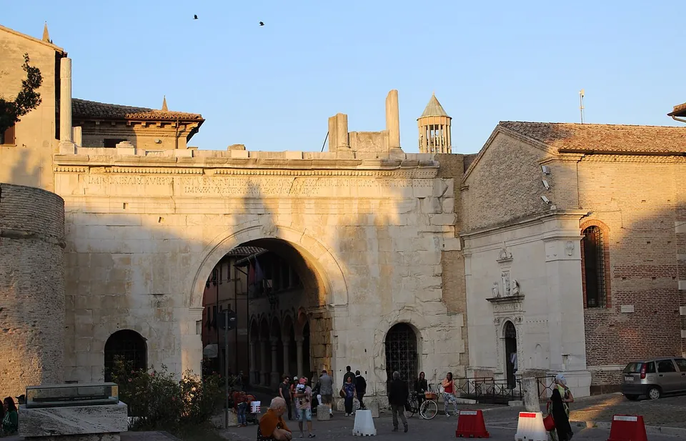
Photo: Giompaola · CC BY-SA 4.0 · Commons
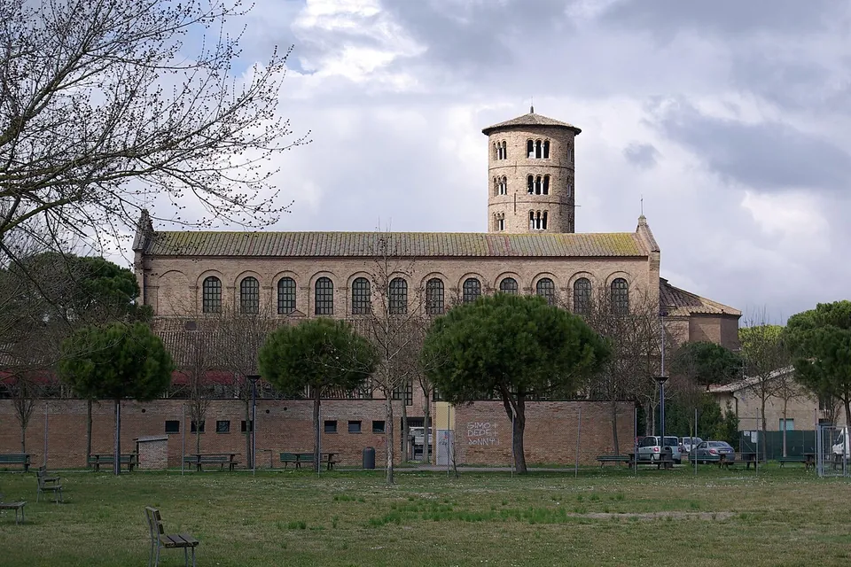
Photo: Berthold Werner · Public domain · Commons
44 km · church · Emilia-Romagna
Basilica of Sant'Apollinare in Classe
Outside, a plain brick church with a tall round bell tower (Musei Italiani); inside, what UNESCO called "an outstanding example of the early Christian basilica in its purity and simplicity of its design and use of space" (en.wikipedia).


Straight-line distances.
Sources
Every fact on this page comes from the records below, each used under the licence noted.
| Source | Licence |
|---|---|
| Pleiades 967100965 | CC BY |
| Wikidata Q2063557 | CC0 |
| Vici.org 11637 | CC BY-SA (text), CC0 (metadata) |
| OpenStreetMap way/490341668 | ODbL |
| Wikipedia (en) — Ponte di Tiberio (Rimini) | CC BY-SA 4.0 |
| Wikipedia (it) — Ponte di Tiberio | CC BY-SA 4.0 |
| Wikipedia (de) — Ponte di Tiberio | CC BY-SA 4.0 |
| Wikipedia (fr) — Pont de Tibère | CC BY-SA 4.0 |
| Riviera di Rimini (official tourism site) — Bridge of Tiberius | licence not recorded |