What is there today
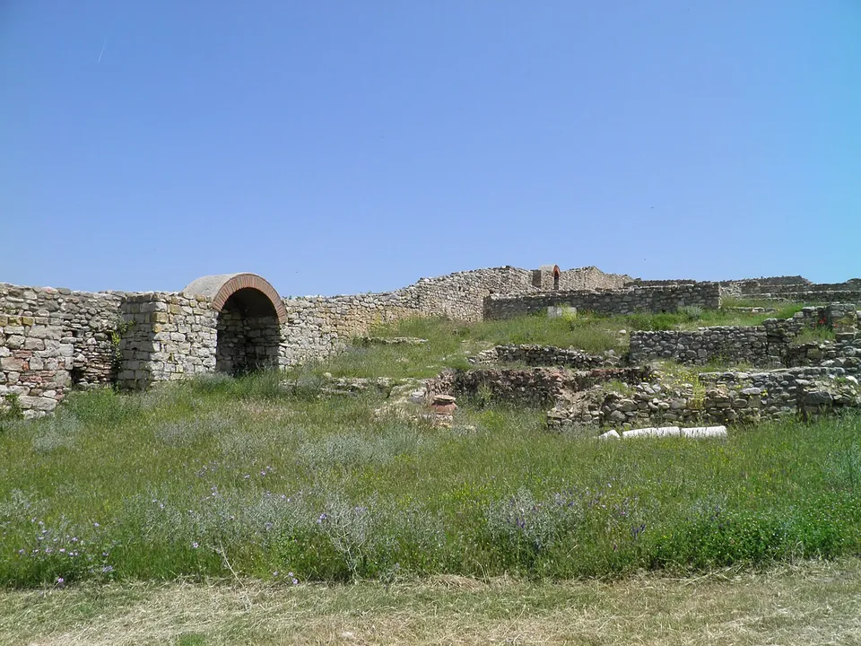
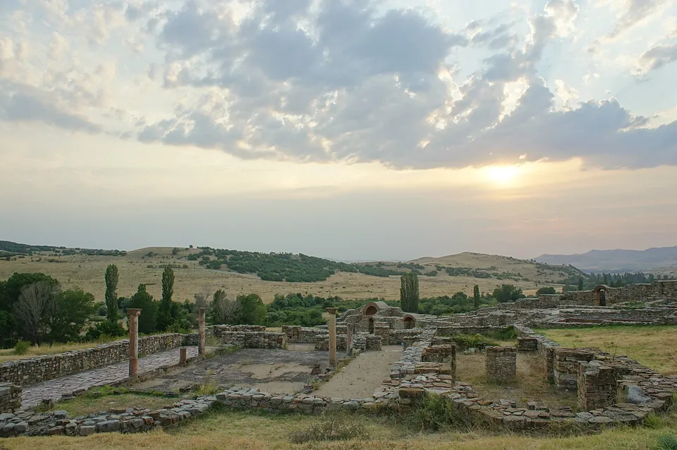
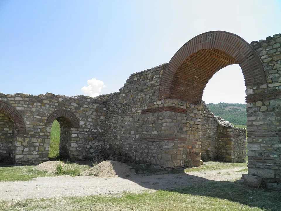
Excavation, begun in 1966, has uncovered the trapezoidal circuit of the town with its seven towers and two gates (en.wikipedia); the photographs show stone walls banded with brick, standing in places to more than head height, with brick arches. At the centre is the basilica complex of the town’s bishops, and four more basilicas stood outside the wall (en.wikipedia).
The episcopal basilica
The bishop’s church stood at the centre of the town, where Bargala was the seat of a bishopric in the 4th and 5th centuries (en.wikipedia); the main photograph on this page shows its excavated walls and a few standing columns.
The basilica outside the walls
One of the four churches outside the town wall (en.wikipedia), recorded as the basilica extra muros, lies about 200 m from the town’s point (from the two records’ coordinates).
Is it worth the trip?
Yes, if you are driving in eastern North Macedonia. The walls and towers of a late antique town stand in open country, dated by the inscription of its gate. It is not a museum site: no source records staff, hours or a visitor centre, and it needs a car.
Getting there
Bargala lies near the village of Gorni Kozjak, by the Kozjak river, about 12 km north-east of Štip (mk.wikipedia; en.wikipedia gives 15.5 km east of Štip). Two car parks are mapped about 155 m from the site, and no bus stop near it (OpenStreetMap).
No source records opening hours or a fee. In 2023 the municipality of Karbinci and the Institute and Museum in Štip began a project to light, fence and signpost the site, and its director said it would then be accessible to visitors 24 hours a day (Sakam da kažam, 2023); no later source says how access works now.
Visiting details
- Tickets
- Unknown
- Parking
- Two car parks are mapped about 155 m from the point (OpenStreetMap).
Before you go
- No bus stop is mapped near the site; it is about 12 km north-east of Štip and needs a car.
- In 2023 the municipality of Karbinci and the Institute and Museum in Štip began a project to light, fence and signpost the site, saying it would then be open to visitors 24 hours a day; no source confirms how access works now.
History
The name is Thracian (en.wikipedia). Bargala lay on the road from Oescus through Serdica to Stobi and is first mentioned only in late antiquity (de.wikipedia). An inscription records that the city gate was built in 371/372 (en.wikipedia), on the orders of Antonius Alypius, governor of the province of Dacia Mediterranea (de.wikipedia). The two articles thus place it in different provinces: en.wikipedia assigns it to Macedonia Secunda. At the end of the 4th century the town moved about 2 km higher up (de.wikipedia).
In the 4th and 5th centuries Bargala was a prosperous bishop’s seat (en.wikipedia), and a bishop of Bargala is named at the Council of Chalcedon in 451 (de.wikipedia). The bishopric lasted until the end of the 6th century. Gold coins of the emperor Phokas (602–610) and Slavic pottery of the 6th and 7th centuries were found on the site, and coins of the 580s give an approximate date for the town’s abandonment and the arrival of the Slavs (en.wikipedia).
More photographs
Nearby
20 km · fort · Municipality of Vinica
Vinica Fortress
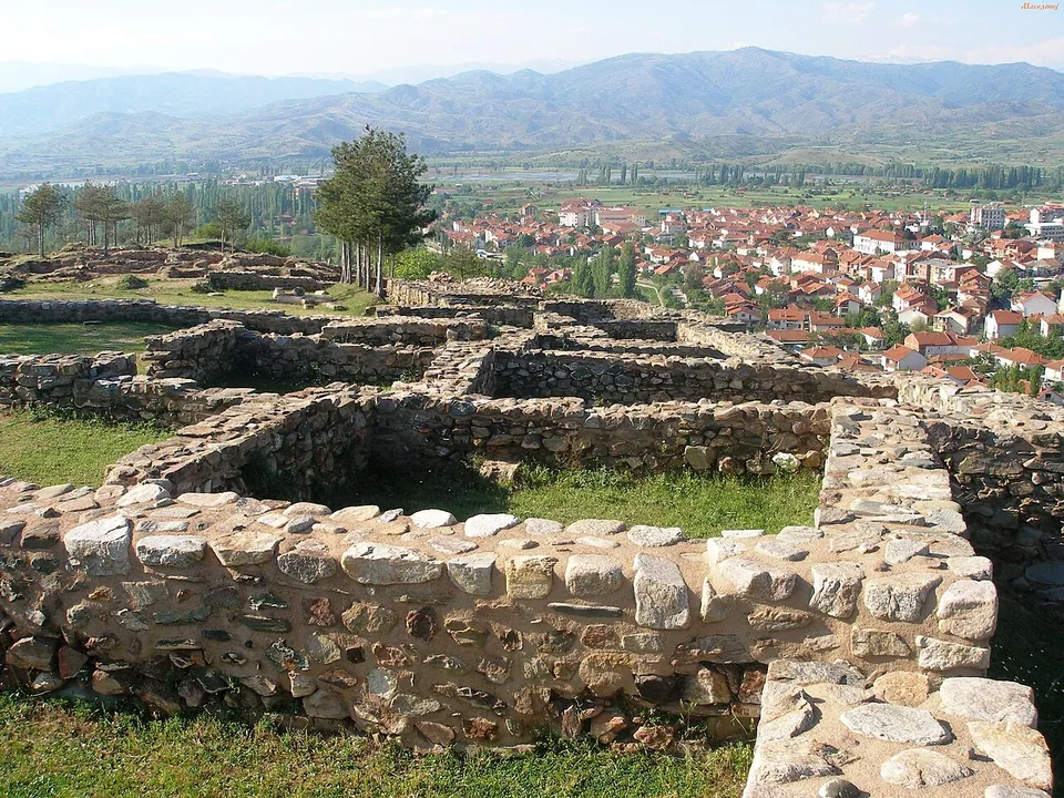
The site stands on a promontory of the Plačkovica range, about 70 m above the town (it. and mk.wikipedia).
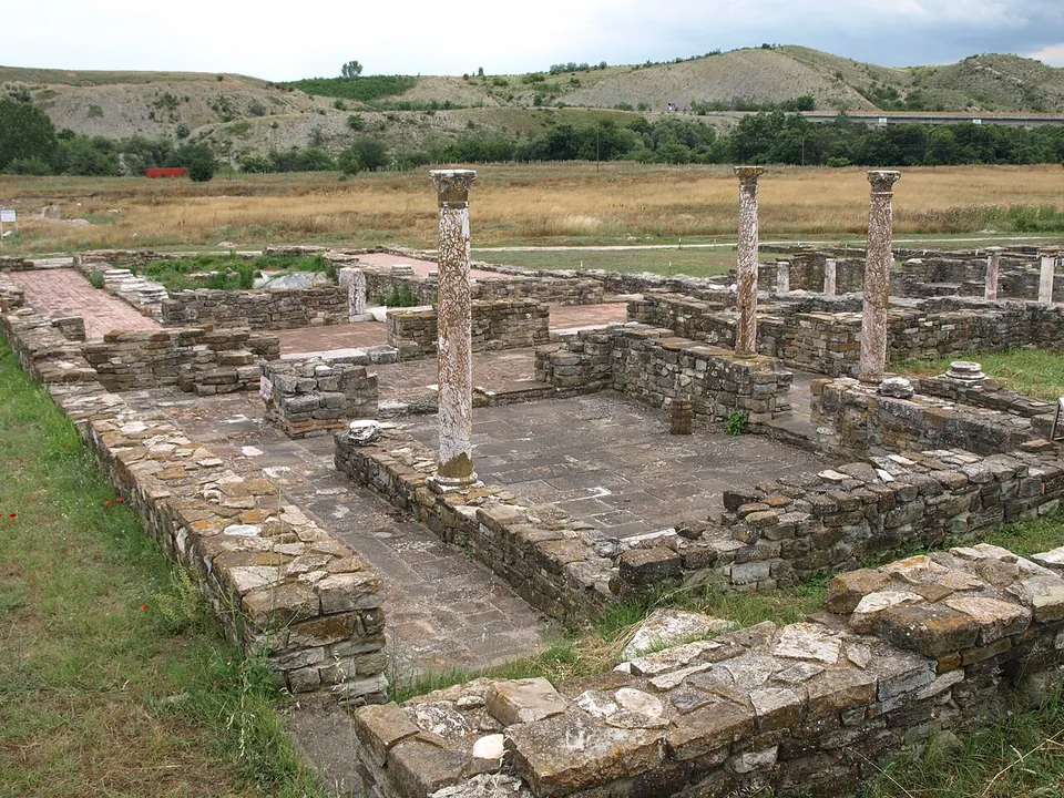
Photo: Vaurien · CC BY-SA 3.0 de · Commons
38 km · city · Municipality of Gradsko
Stobi
The archaeological site covers 16 hectares; the town stood on three walled terraces that step down to the Crna (mk.wikipedia), and its excavated and restored buildings form an open-air museum (de.wikipedia).


Straight-line distances.
Sources
Every fact on this page comes from the records below, each used under the licence noted.
| Source | Licence |
|---|---|
| Pleiades 491538 | CC BY |
| Wikidata Q2884464 | CC0 |
| OpenStreetMap way/189909367 | ODbL |
| Wikipedia (en) — Bargala | CC BY-SA 4.0 |
| Wikipedia (de) — Bargala | CC BY-SA 4.0 |
| Wikipedia (mk) — Баргала | CC BY-SA 4.0 |
| Sakam da kažam — Seureduva arheološkiot lokalitet Bargala (26 February 2023) | licence not recorded |