

What is there today
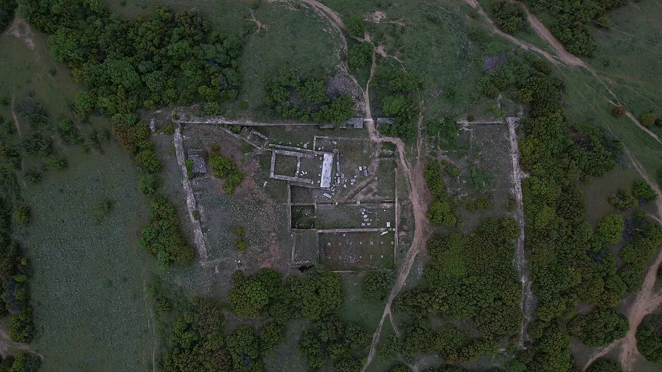
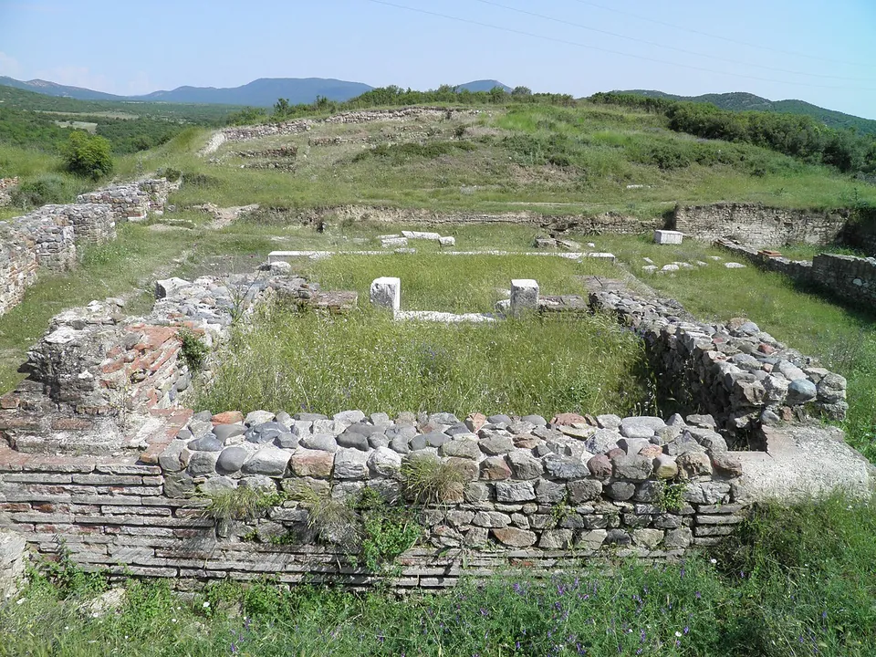
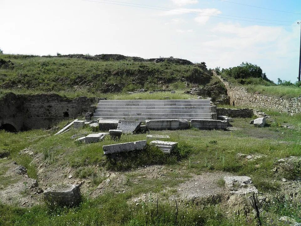
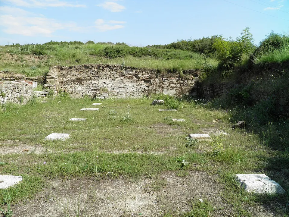
The town reached its greatest extent in the Roman period, when it spread over almost all the available ground, but most of the remains that survive belong to its last phase, when it shrank to a small fortification with a wall, a castrum (North Macedonia Timeless). From the air the walled enclosure and the outlines of its buildings are clear; on the ground the photographs show walls of stone bonded with brick courses, rows of marble bases and a flight of marble steps. The site has well over 200 graves (en.wikipedia).
The richest finds are not on the hill. They include the bronze cult jewellery of the so-called “Paeonian priestess” of the Iron Age, a helmet, early jewellery and pottery, and a Roman-period architrave from the city’s temple of Hercules, set up by a Macedoniarch (North Macedonia Timeless); the excavated finds went to the Museum of the Republic of North Macedonia (en.wikipedia).
Is it worth the trip?
Worth a stop if you are near Valandovo or Gevgelija, 18.6 km to the south (en.wikipedia): the hill looks out over the Valandovo basin and the Vardar valley (mk.wikipedia), and the walls and marble steps and bases on the hill are easy to read. It is not a presented site, though: no source records signs, staff or a path, and the best finds are in the museum in Skopje.
Getting there
The site is immediately above the village of Marvinci, on an easily reached rise to its south-west (mk.wikipedia; North Macedonia Timeless), a few kilometres from Valandovo (en.wikipedia). OpenStreetMap maps no path, road, car park or bus stop within 300 m of it, and no source records an operator, opening hours or a fee.
Visiting details
- Tickets
- Unknown
Before you go
- OpenStreetMap maps no path, road, car park or bus stop within 300 m of the site, and no source records an operator, opening hours or a fee.
- The best finds are in museums, not on the hill.
History
Settlements and cemeteries on the hill were in use without a break from the 7th century BC to the 6th century AD (mk.wikipedia; North Macedonia Timeless). The town sat directly on the important north–south trade route of the Balkans; it was already wealthy in its early period, reached the height of private wealth in the Hellenistic period, and its greatest urban extent under Rome (North Macedonia Timeless). Finds of the 4th century BC give the settlement’s name as Idomenae (en.wikipedia), and Pleiades lists Idomenae as a place of the Roman and late antique periods. Excavation took place between 1977 and 1986 (en.wikipedia).
More photographs

Sources
Every fact on this page comes from the records below, each used under the licence noted.
| Source | Licence |
|---|---|
| Pleiades 491586 | CC BY |
| Wikidata Q15622057 | CC0 |
| OpenStreetMap way/229632394 | ODbL |
| Wikipedia (en) — Isar, Marvinci | CC BY-SA 4.0 |
| Wikipedia (mk) — Исар (Марвинци) | CC BY-SA 4.0 |
| North Macedonia Timeless — Археолошки локалитет Исар, село Марвинци | licence not recorded |
| Wikidata — Idomenae (Q5989498) | licence not recorded |