

What is there today
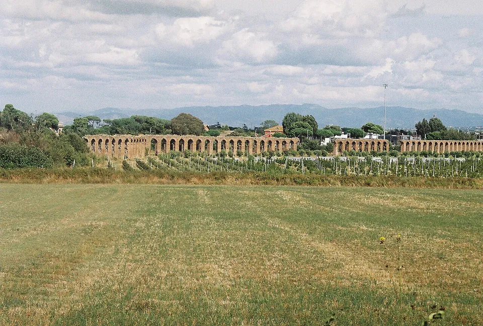
The aqueduct ran about 69 km from springs in the upper Aniene valley, and most of that was underground (en and it.wikipedia). The part a visitor comes for is the last stretch, where it rose onto arches near the seventh mile of the Via Latina and carried its water towards the city (en.wikipedia). From there to the city it ran largely on arches, shared with the Anio Novus, whose channel sits on top of the Claudia’s in the same structure (de, it and fr.wikipedia; Turismo Roma).
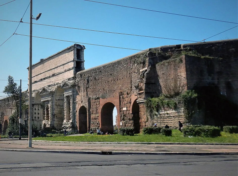
So the arcade is two aqueducts in one. The Anio Novus was begun and finished with the Claudia, and Claudius dedicated both on 1 August 52 (en.wikipedia, Aqua Anio Novus). It took its water straight from the Aniene near Subiaco, at the 42nd mile of the Via Sublacensis, and ran about 87 km. Half of its course above ground was shared with the Claudia: from the seventh mile of the Via Latina its channel was laid on top of the Claudia’s, on arches still largely visible in the Parco degli Acquedotti (it.wikipedia, Acquedotto Anio novus). The river’s crumbling banks often made its water muddy (en and it.wikipedia), but it ran at the highest level of all the aqueducts entering Rome (en.wikipedia). The two channels enter the city together over Porta Maggiore (it.wikipedia, Acquedotto Claudio).
From the countryside to the city:
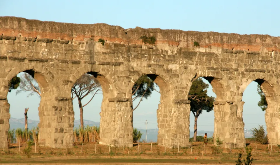
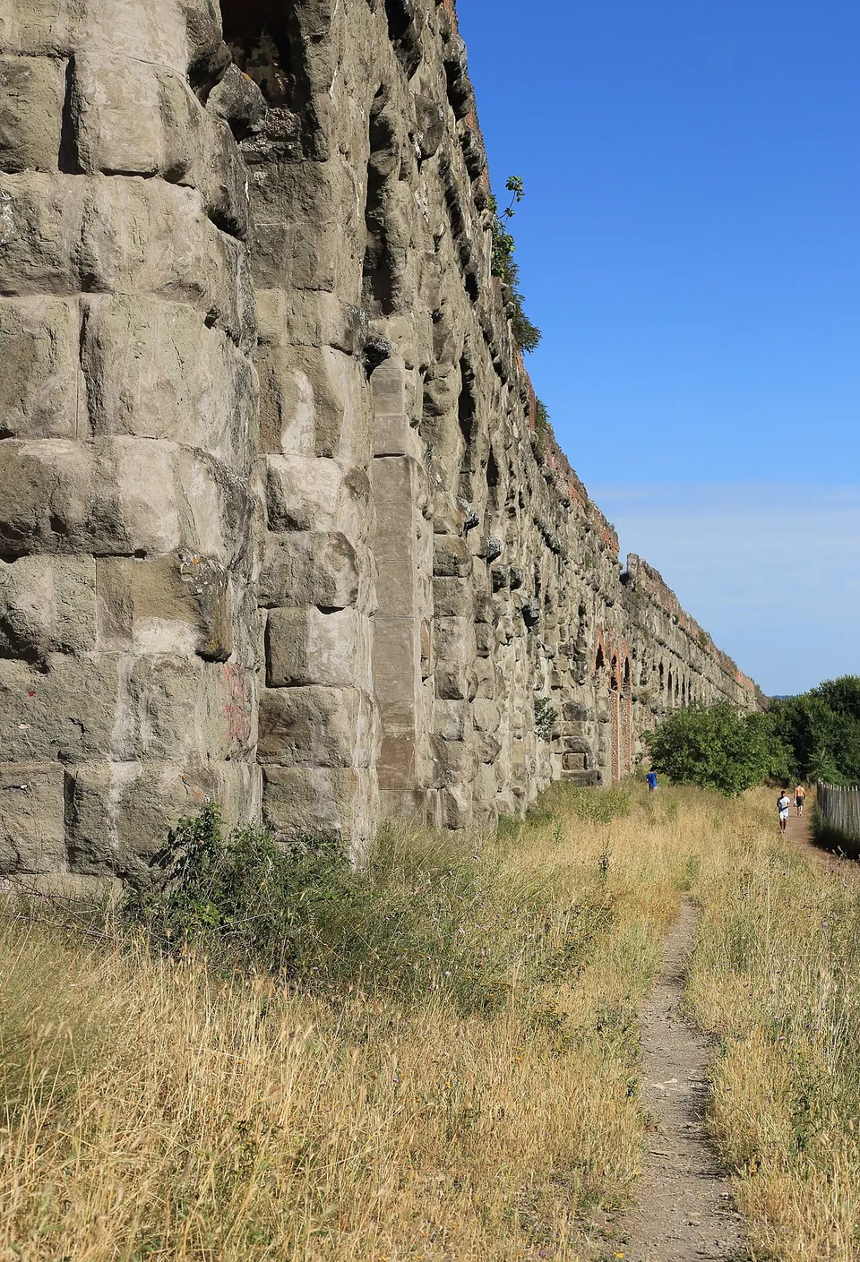
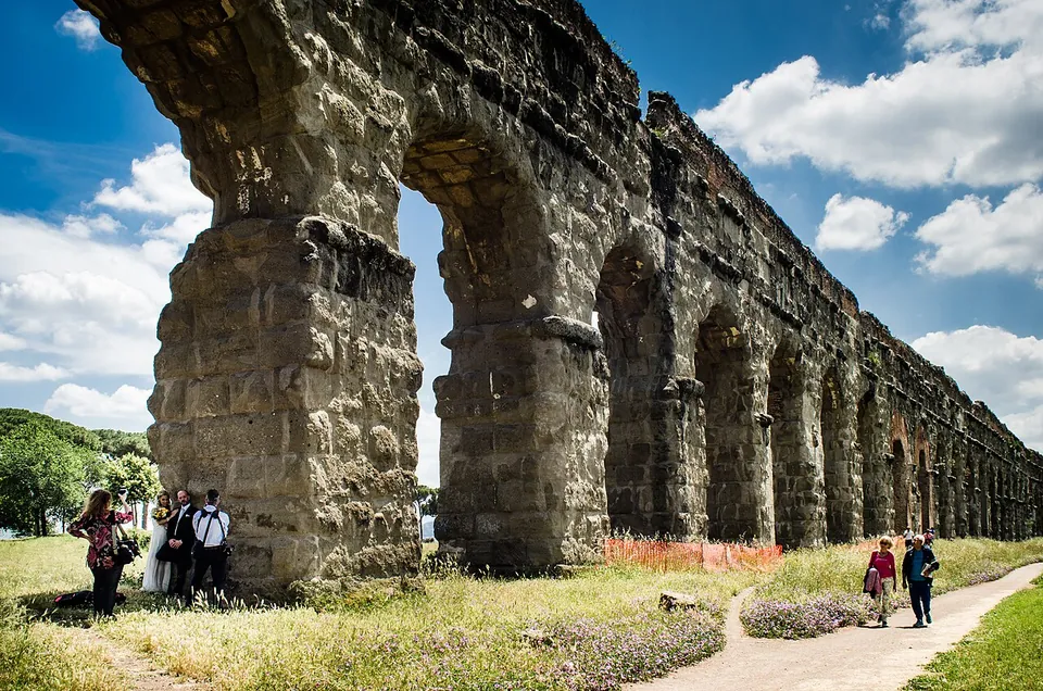
- Parco degli Acquedotti. This is the best-preserved part of the whole route, and its image of arches across the Roman Campagna has become a classic one (it.wikipedia). The piers measure about 3.35 by 3.10 m and stand some 5.5 m apart, and with the Anio Novus channel on top the structure is 17 to 27.40 m high (it.wikipedia); Turismo Roma counts 155 piers. Where arches have fallen you can see both channels in section, the Anio Novus above the Claudia (it.wikipedia). The park covers about 240 hectares and also holds the Acquedotto Felice, a papal aqueduct of 1585, and the Aqua Marcia (the regional park; Turismo Roma).
- Tor Fiscale. Here the Claudia crosses the Aqua Marcia twice, forming a trapezoidal enclosure about 300 m long, the “Campo Barbarico”, which the Goths used as a fort in 539 (it.wikipedia). The area is a separate entrance of the regional park (the regional park). Between Tor Fiscale and Porta Furba, where Via Tuscolana crosses the line, the piers were stripped of their squared blocks for reuse in later centuries (it.wikipedia).
- Porta Maggiore. The aqueduct entered the city here, and the channels of the Claudia and the Anio Novus can still be seen above the gate’s monumental arches (it.wikipedia). The inscriptions on its attic record Claudius’s work and the repairs of Vespasian and Titus (it and fr.wikipedia). The last forty or so arches before it were built into the Aurelian Walls (it.wikipedia).
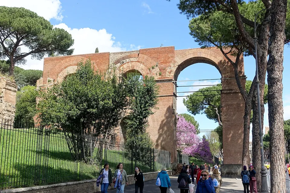
- The Neronian arches. Nero added a branch, the Arcus Neroniani, from near Porta Maggiore to the Caelian Hill, and several stretches of its brick arches are still visible and fairly well preserved (it.wikipedia). Domitian carried it on to the imperial palaces on the Palatine across the valley now crossed by Via di San Gregorio (it.wikipedia). The church of San Tommaso in Formis was later built into its side (en.wikipedia).
Is it worth the trip?
Yes, and the Parco degli Acquedotti is the place to see it. This is a long run of Roman arches, the best preserved on the route, in a free park that the regional park says is always open, with metro line A a kilometre away.
Know what kind of visit it is. The park is a stretch of meadow and paths in the south-eastern suburbs, about 8 km from the Colosseum, and the regional park lists no museum or ticket office for the aqueduct. Turismo Roma suggests the sunset light, when the arches stand against the sky. If you have only one afternoon, the Neronian arches on Via di San Gregorio, below the Palatine, are a glimpse of the same aqueduct in the centre.
Getting there
Take metro line A to Subaugusta or Giulio Agricola. From either station it is about 1 km on foot to the arches (OpenStreetMap). The regional park gives the entrances as Via Lemonia, which has several gates, Piazza Aruleno Celio Sabino, Viale Appio Claudio and Via Viviani (near Lucio Sestio station). Buses running along Via Tuscolana also serve it. By car, park on the street or at the ATAC car park at Cinecittà. Tor Fiscale has its own entrance at Via dell’Acquedotto Felice 120, near Porta Furba station on the same metro line (the regional park).
There is nothing to pay. The regional park says the area is always open and charges no entrance fee; Roma Capitale’s tourism office gives the hours as dawn to dusk. The park’s info point opens on Sundays and is closed in January, February, July and August (both read 20 October 2026).
Visiting details
- Opening hours
- Open air. The Parco degli Acquedotti, where the best-preserved arches stand, is always open according to the regional park that runs it; Roma Capitale's tourism office gives dawn to dusk. The park's info point opens on Sundays and is closed in January, February, July and August.
- Tickets
- Free. The regional park charges no entrance fee for its green areas.
- Parking
- Metro line A to Subaugusta or Giulio Agricola, then about 1 km on foot to the arches; the park is entered from Via Lemonia (several gates), Piazza Aruleno Celio Sabino, Viale Appio Claudio and Via Viviani. Parking is on the street, or at the ATAC car park at Cinecittà (the regional park).
Before you go
- The park lies in Rome's south-eastern suburbs, about 8 km from the Colosseum; it is a public park of meadow and paths, with no museum or ticket office for the aqueduct.
Hours and prices checked 20 October 2026 on the operator's own site. Confirm before travelling.
History
Caligula began the aqueduct in AD 38, together with the Anio Novus, and Claudius completed both in 52; they were inaugurated together on 1 August, and their cost has been put at 350 million sesterces (de and fr.wikipedia, the latter citing Pliny the Elder). Tacitus suggests that water was already flowing by 47 (en.wikipedia). It was the eighth aqueduct to supply Rome (en and it.wikipedia). Its springs, the Caeruleus and the Curtius, lay near the 38th milestone of the Via Sublacensis, between today’s Arsoli and Marano Equo, and their water is said to have been second in quality only to the Aqua Marcia’s (it.wikipedia). Published figures for its flow are close, at about 185,000 to 191,000 m³ a day (en and it.wikipedia).
It failed early. After about ten years in use it was out of service for nine; Vespasian restored it in 71 and Titus repaired it again in 81 (en and de.wikipedia). Nero’s branch to the Caelian, and Domitian’s extension to the Palatine, let it supply all fourteen districts of the city (en and de.wikipedia). Brick stamps of 123 show restorations under Hadrian, inscriptions record repairs under Arcadius and Honorius in the 5th century, and Alexander Severus reinforced the Neronian arches (en.wikipedia). From 271 a stretch south-east of Porta Maggiore was walled into the Aurelian Walls (de.wikipedia).
The Goths damaged it in 537, during their siege of Rome, and it was repaired under Belisarius (de and en.wikipedia). Pope Adrian I renovated part of it in the 8th century, and it probably went on supplying the Lateran Palace into the 11th (de.wikipedia). In 1585 Pope Sixtus V’s new aqueduct, the Acquedotto Felice, damaged it further: piers along the Vicolo del Mandrione were pierced to let the new channel through (it.wikipedia). Frontinus described the Claudia in some detail in his work on Rome’s aqueducts in the later 1st century (en.wikipedia).
More photographs



Nearby
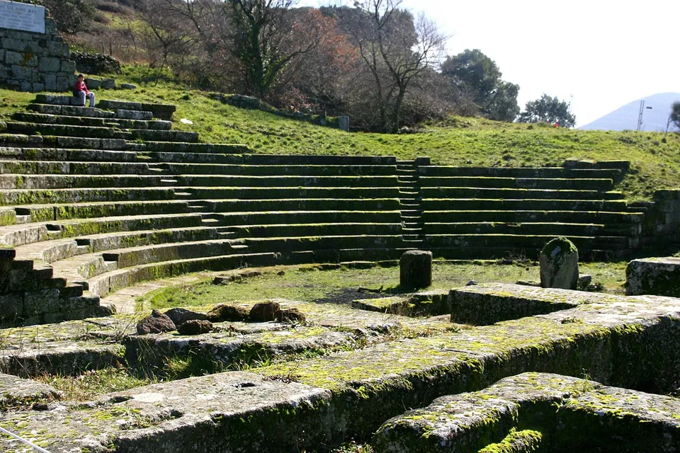
Photo: Luiza Serpa Lopes · Public domain · Commons
13 km · city · Lazio
Tusculum
The visitor route runs mainly through the forum, with the theatre halfway round (the operator).
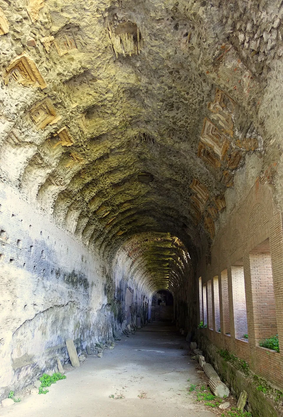
Photo: Daderot · Public domain · Commons
14 km · villa · Lazio
Villa of Domitian
Most of the remains lie inside the Pontifical Villas, an extraterritorial property of the Holy See.
Photo: Carlomorino · CC BY-SA 3.0 · Commons
14 km · city · Lazio
Gabii
The park the state holds covers about 70 hectares on the southern rim of a volcanic crater whose lake was drained in the 19th century (the operator; en.wikipedia).


Straight-line distances.
Sources
Every fact on this page comes from the records below, each used under the licence noted.
| Source | Licence |
|---|---|
| Pleiades 423563 | CC BY |
| Wikidata Q622930 | CC0 |
| Vici.org 58479 | CC BY-SA (text), CC0 (metadata) |
| OpenStreetMap way/781857867 | ODbL |
| Parco Regionale dell'Appia Antica — Come arrivare (the park's operator) | licence not recorded |
| Parco Regionale dell'Appia Antica — Aree e siti monumentali (the park's operator) | licence not recorded |
| Turismo Roma — Parco degli Acquedotti (Roma Capitale's tourism office) | licence not recorded |
| Wikipedia (en) — Aqua Claudia | CC BY-SA 4.0 |
| Wikipedia (it) — Acquedotto Claudio | CC BY-SA 4.0 |
| Wikipedia (de) — Aqua Claudia | CC BY-SA 4.0 |
| Wikipedia (fr) — Aqueduc de l'Aqua Claudia | CC BY-SA 4.0 |
| Pleiades — Aqua Anio Novus (merged into this site) | licence not recorded |
| Wikidata — Anio Novus (Q548608, merged into this site) | licence not recorded |
| Wikipedia (en) — Aqua Anio Novus | CC BY-SA 4.0 |
| Wikipedia (it) — Acquedotto Anio novus | CC BY-SA 4.0 |