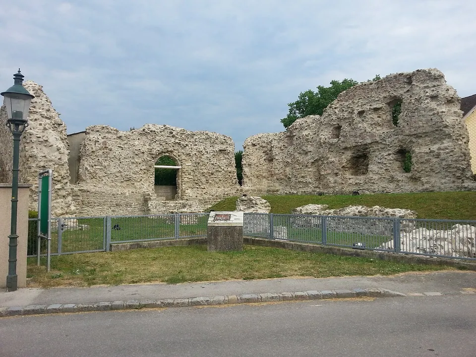
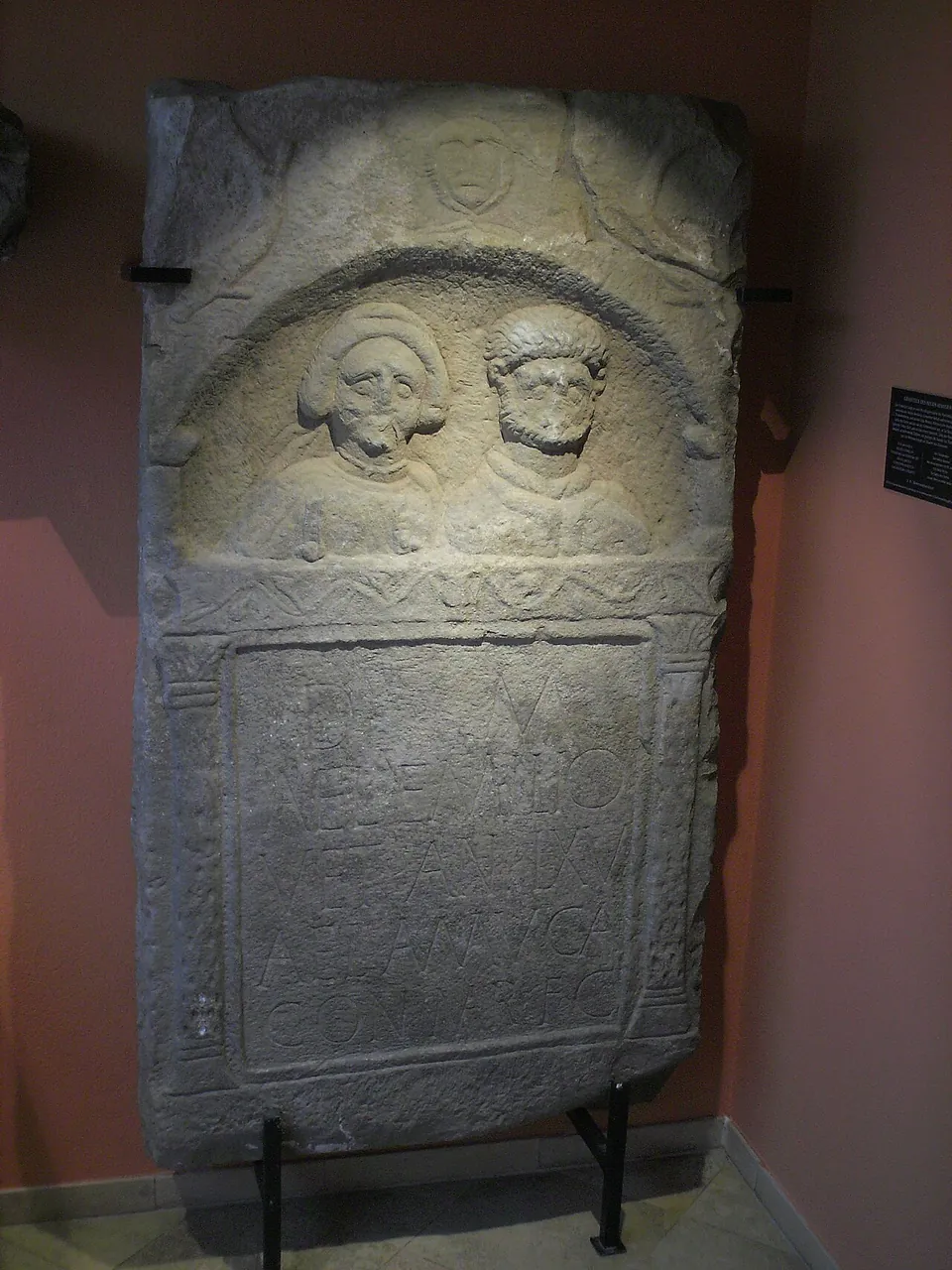
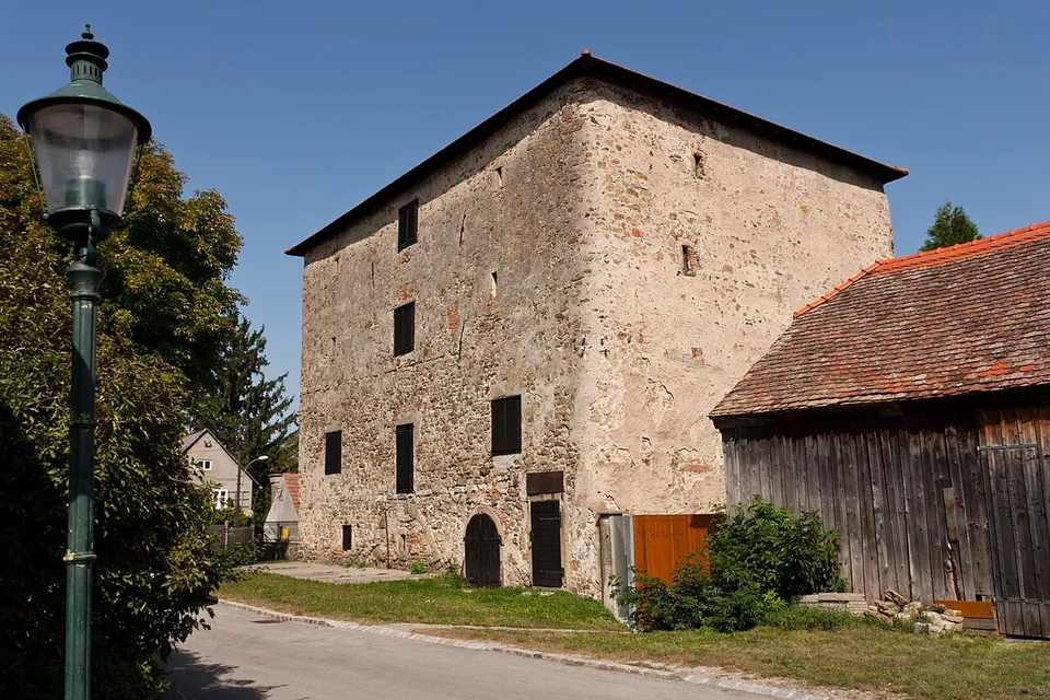
Zeiselmauer, a village on the Danube near Tulln, stands inside a Roman frontier fort, very probably the Cannabiaca named in the Notitia Dignitatum, and three of its late Roman buildings still stand: a small inner fort in a free archaeological park, a gate tower that became a granary, and a fan-shaped corner tower. After Carnuntum, no place in Austria has more late Roman building left (de.wikipedia).
What is there today
The burgus, a small fort built inside the north-west corner of the larger one, is the centrepiece. Until the 1970s it was hidden inside a farm; the municipality bought the property in 1970, stripped away the later additions, and conserved the Roman walls as a freely accessible archaeological park. It is about 20 by 21 m and was originally about 10 m high, with no windows on the ground floor and small slit or arched windows above, four of them in the south wall; its entrance arch, which opened into the fort, survives. Its builders reused older stones, tombstones and an altar among them, and its west wall later collapsed, in an earthquake or a flood; the fallen masonry can still be seen (de.wikipedia).
The Körnerkasten replaced the fort’s east gate, probably in the second half of the 4th century, with a rectangular, tower-like building with rounded corners, and its masonry is late Roman up to the eaves. The date 1581 over its door probably marks only a new gateway and cellar; it survived because the bishops of Passau used it as a tithe granary from the Middle Ages to the 19th century. It is privately owned and has not been studied in detail (de.wikipedia). North of it the fort wall runs on under the houses of Römergasse, which stand on its foundations, and at No. 6 is the ruin of the north-east fan-shaped tower, of the mid-4th century and the only tower of this type preserved above ground in Austria; it stood about 9 m high, and wooden pegs mark the holes of its builders’ scaffolding (de.wikipedia).
A 500 m Roman walk with information boards at five stops links the three buildings, starting from the church square. A small display room in the municipal office, opened in 2015 and free, shows finds of the 1st to 4th centuries from Zeiselmauer, some on loan from the Kunsthistorisches Museum, Carnuntum and the Federal Monuments Office; in its entrance stand an altar dedicated to Lucius Verus and the 2nd-century gravestone of the soldier Aelius Aemilius (de.wikipedia).
Is it worth the trip?
Yes, for anyone interested in what the late Roman frontier looked like. Nowhere else in Austria outside Carnuntum shows so much standing late Roman masonry in so small a space: the whole walk is half a kilometre, everything is free, and the burgus can be walked into. It is not a full day out; an hour or two covers it, and two of the three buildings can only be seen from outside.
Getting there
S40 trains run every half hour from Vienna’s Franz-Josefs-Bahnhof to Zeiselmauer-Königstetten (de.wikipedia), and the station is about 370 m from the burgus (OpenStreetMap). By car the village is on the B 14, and from the Danube cycle path it is two to three kilometres along side roads (de.wikipedia). The burgus park and the walk are open at all times. The display room is inside the municipal office at Bahnstraße 6, which is open Monday, Tuesday and Friday 08.00–12.00 and Thursday 08.00–12.00 and 16.00–19.00 (the municipality, read 5 October 2026). The crypt of the parish church can be seen only on a guided tour booked in advance (de.wikipedia).
Visiting details
- Opening hours
- The burgus archaeological park and the Roman walk are open at all times. The display room in the municipal office, Bahnstraße 6, opens with the office - Monday, Tuesday and Friday 08.00–12.00, Thursday 08.00–12.00 and 16.00–19.00, closed on Wednesdays and at weekends.
- Tickets
- Free - the burgus park, the walk and the display room.
Before you go
- The Körnerkasten and the fan-shaped tower are on private land and can only be seen from the street.
- The crypt of the parish church, over the fort's headquarters shrine, can be visited only on a guided tour booked in advance.
Hours and prices checked 5 October 2026 on the operator's own site. Confirm before travelling.
History
A timber-and-earth fort was built here in the late Flavian period, around AD 80, to guard the Tullnerfeld, the plain that opens into the Vienna basin, and to cover the flank of the fort at Tulln; it was later rebuilt in stone under Marcus Aurelius (161–180) and badly damaged again in the invasion of the Juthungi in 270. Its garrison, infantry and cavalry units in turn, was about 500 strong, and a civil settlement of up to 1,000 people grew beside it (de.wikipedia). The fort stood at the eastern border of Noricum, and its ancient name is very probably Cannabiaca, known only from the Notitia Dignitatum (de.wikipedia).
In the first half of the 4th century its corner towers were replaced by fan-shaped towers, and building went on until the reign of Valentinian I (364–375), when the north-west fan tower was pulled down and the burgus built in its place. After a last rebuilding, the fort was probably destroyed by the Rugii around 460, though estimates run from about 453 to a survival beyond the 5th century. Larger-scale settlement returned only around 791, and the village takes its name from Zeizo, a follower of the bishops of Passau who settled here around 971 (de.wikipedia). Legend makes it the birthplace of St Florian, executed at Lauriacum in 304 (de.wikipedia). Its remains have been part of the Danube Limes World Heritage Site since 2021 (de.wikipedia).
Nearby
9 km · fort · Tulln District
Comagena – Tulln an der Donau
The Römerturm, also called the Salzturm because it was used to store salt in the 18th and 19th centuries, is the reason to come.
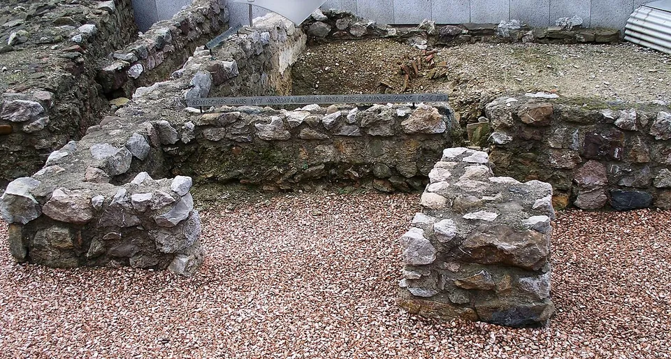
Photo: High Contrast · CC BY 3.0 de · Commons
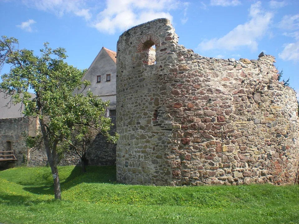
Photo: Wolfgang Glock · CC BY-SA 3.0 · Commons
45 km · fort · Krems District
Castrum Favianis
The best piece is the western horseshoe tower, about 11 by 14 m and 10 m high, probably of the 4th or 5th century and perhaps even from Severin's time.
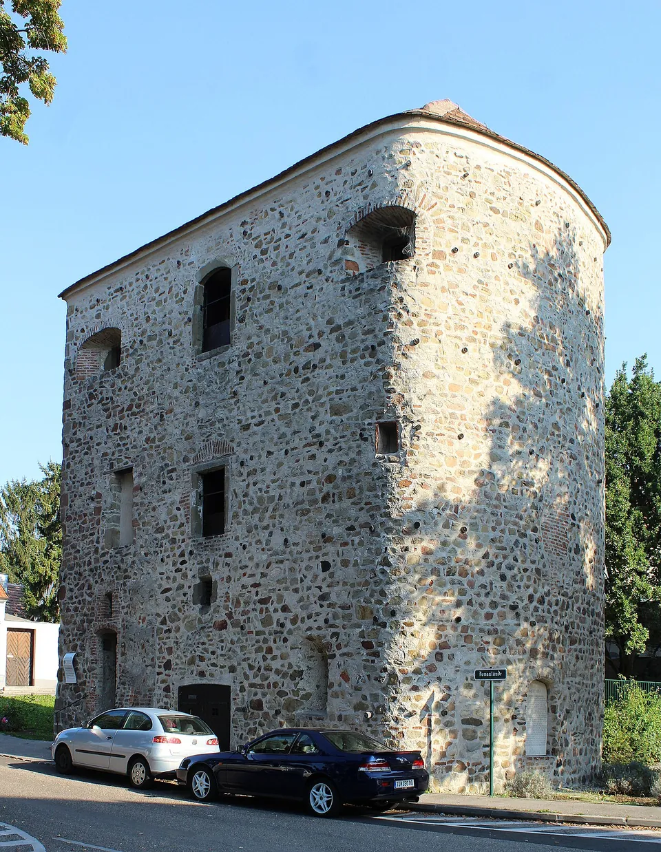


Straight-line distances.
Sources
Every fact on this page comes from the records below, each used under the licence noted.
| Source | Licence |
|---|---|
| Pleiades 128375 | CC BY |
| Wikidata Q1156633 | CC0 |
| Vici.org 7267 | CC BY-SA (text), CC0 (metadata) |
| OpenStreetMap way/476496838 | ODbL |
| Wikipedia (de) — Kastell Zeiselmauer | CC BY-SA 4.0 |
| Wikipedia (it) — Cannabiaca | CC BY-SA 4.0 |
| Marktgemeinde Zeiselmauer-Wolfpassing (office hours of the municipal office) | licence not recorded |