

What is there today
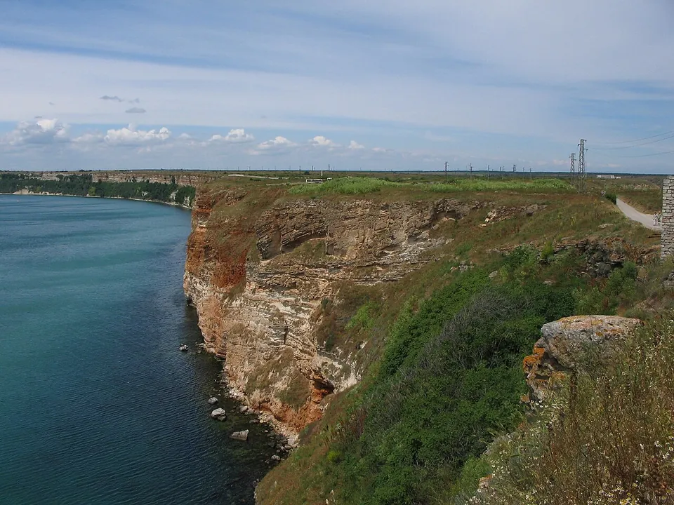
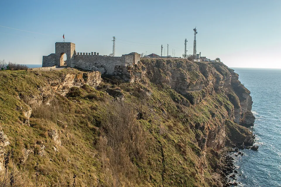
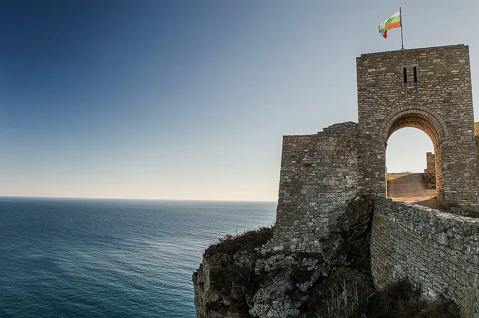
A gate and stretches of fortress wall run across the headland, and inside them lie the remains of a water supply, baths, churches and the residence of the 14th-century rulers (bg.wikipedia; OpenStreetMap). A small museum in a natural cave in the cliffs shows finds from the cape (OpenStreetMap). The headland is also a nature and archaeological reserve, where cormorants nest and dolphins can be seen (bg.wikipedia).
Be clear about what is Roman. The fortress was built over many centuries, and published descriptions present the standing remains chiefly as those of the 14th-century capital (bg.wikipedia). They do not say which stretches of wall belong to the Roman and late Roman fortifications; OpenStreetMap’s mappers mark one bath building as Roman, and a church built over a house of the 4th–6th century.
Is it worth the trip?
For the place, yes: the cliffs, the sea on three sides and the walk through the gate to the tip of the cape are why it is one of the 100 National Tourist Sites of Bulgaria (bg.wikipedia). For Roman remains you can recognise as Roman, no; come for the headland, and treat the Roman fortress as one layer of its story.
Getting there
Kaliakra is 12 km east of Kavarna (bg.wikipedia). An asphalt car park is mapped at the landward end of the fortress, about 370 m from the gate and a walk of about 6 minutes to its centre; no bus stop is mapped near the cape (OpenStreetMap). We could find no opening hours or fee published by an operator.
Visiting details
- Tickets
- Unknown
- Parking
- An asphalt car park is mapped at the landward end of the fortress, about 370 m from its gate (OSM way/109841254).
- On foot
- About 6 min from the parking
Before you go
- We could find no operator page with opening hours or a fee for the fortress (searched 2 October 2026). OpenStreetMap tags the cave museum as free.
- No bus stop is mapped near the cape; you will need a car.
History
The first settlement on the cape dates from the 4th century BC, when the Thracian Tirizi lived here and gave it its first name, Tirizis. In Hellenistic times a second wall was built further inland, and in Roman times the fortress was enlarged: round towers were completed in 341–342, by which time there was an outer and an inner town, and in the second half of the 4th century a third fortification, its walls 2.90 m thick, was built still further inland (bg.wikipedia).
In the 5th and 6th centuries the fortress, now called Akra, was a stronghold against the invading tribes and one of the 15 cities of the province of Scythia; in 513 the rebel general Vitalian fought the emperor Anastasius I near the cape (bg.wikipedia). Some researchers date a decline to the 7th century. The fortress had its greatest days in the second half of the 14th century, as the capital of the Bulgarian rulers Balik and Dobrotitsa, before the Ottomans took it in the 1390s (bg.wikipedia).
Nearby
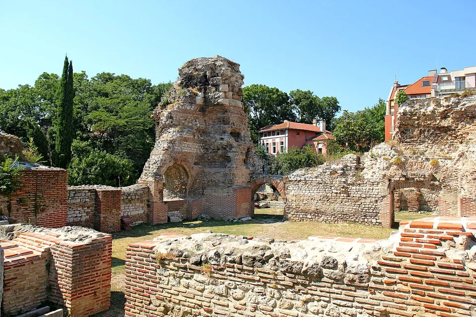
Photo: Dina Rogatnykh · CC BY-SA 4.0 · Commons
48 km · bath · Varna Province
Odessos
The large Roman baths lie in the south-east of the modern city, near the port.

Straight-line distances.
Sources
Every fact on this page comes from the records below, each used under the licence noted.
| Source | Licence |
|---|---|
| Pleiades 217013 | CC BY |
| Wikidata Q1648563 | CC0 |
| OpenStreetMap way/196669606 | ODbL |
| Wikipedia (bg) — Калиакра | CC BY-SA 4.0 |
| Wikipedia (en) — Kaliakra | CC BY-SA 4.0 |