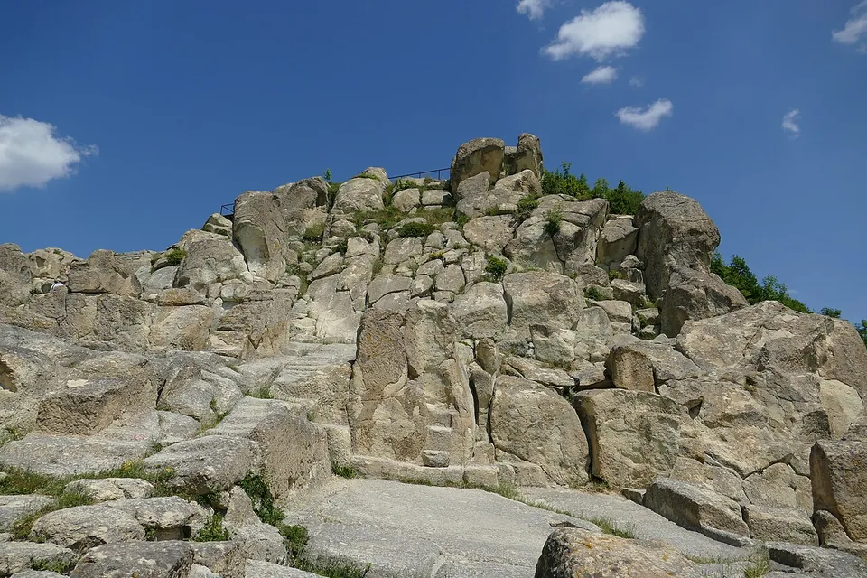
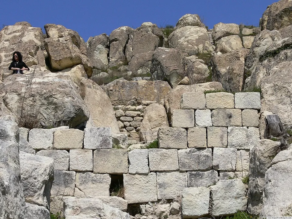
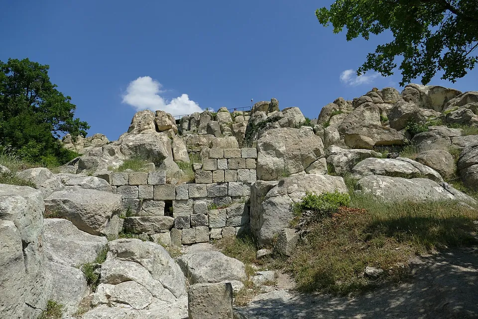


Perperikon is a rock city on a hilltop in the Eastern Rhodopes, 15 km north-east of Kardzhali, where a Thracian sanctuary, a palace and fortress of Roman times, a late antique church and a medieval stronghold were built one on top of another (en.wikipedia; bg.wikipedia). It is above all a Thracian and medieval site; the Roman period is one layer of many.
What is there today
Almost every surface of the summit has been worked by hand. There is a basin cut into the rock, 12 m by 8 m and 6 m deep, with rock-cut thrones, rooms and benches, and a “sacred way” leads to the so-called great temple, a hall of about 100 m by 10–12 m sunk 3–4.5 m into the rock on three levels, with a lion carved at its eastern end (bg.wikipedia).
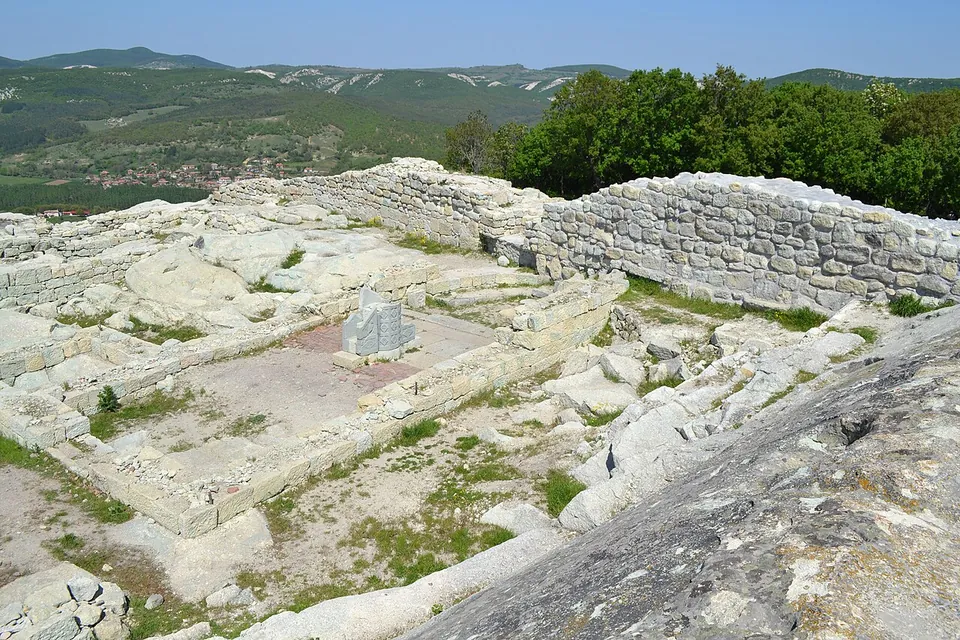
From Roman times, excavation has uncovered a large palace of several storeys and the fortress built around the hill, with walls up to 2.8 m thick; temples and houses were built inside the fortress too (en.wikipedia). In its middle the remains of a single-nave late antique church have been uncovered (bg.wikipedia), where a carved stone pulpit of the end of the 4th or the early 5th century was found in 2005 (en.wikipedia). The medieval fortress is the last layer.
How much of this is read correctly is disputed. bg.wikipedia notes that the excavations, begun in 2000, have been criticised for their methods and for overstating results, and leading Thracologists reject the claim that this was the famous oracle of Dionysus.
Is it worth the trip?
For the place itself, yes: a hilltop carved into a city, with long views over the Rhodopes. If you come only for Rome, know that the Roman palace and walls are one chapter in a site that is mostly about the Thracians and the Middle Ages, and that it is a steep climb over rock.
Getting there
Perperikon stands on a rocky hill 470 m high, 15 km north-east of Kardzhali (en.wikipedia) and 2 km south of the village of Gorna Krepost (bg.wikipedia). No bus stop is mapped nearby (OpenStreetMap), so you will need a car. The site charges a fee (OpenStreetMap), but we could find no operator page that publishes the price or the hours.
Visiting details
- Tickets
- A fee is charged (OpenStreetMap), but no operator page we could find publishes the price or the opening hours (searched 2 October 2026).
Before you go
- The site is a steep, rocky hilltop; wear proper shoes.
- No bus stop is mapped near the site; you will need a car.
History
People were active on the hill from about 5000 BC, and a round altar almost 2 m across, cut into the rock, dates from the early Iron Age. In 424 BC Medokos proclaimed himself king of Thrace at Perperikon. The palace and the fortress walls date from the time of the Roman Empire, and the church on the summit from the end of the 4th or the early 5th century (en.wikipedia). The archaeologist Nikolay Ovcharov holds that this was the bishop’s town where Nicetas of Remesiana converted the Bessi in the early 5th century (bg.wikipedia).
The medieval fortress of Hyperperakion is mentioned in the 13th century; the Ottomans destroyed the town in 1362 and carried off its people, and within a few decades the place was deserted (bg.wikipedia).
More photographs

Sources
Every fact on this page comes from the records below, each used under the licence noted.
| Source | Licence |
|---|---|
| Pleiades 501557 | CC BY |
| Wikidata Q1943549 | CC0 |
| OpenStreetMap way/28066013 | ODbL |
| Wikipedia (en) — Perperikon | CC BY-SA 4.0 |
| Wikipedia (bg) — Перперикон | CC BY-SA 4.0 |