

What is there today
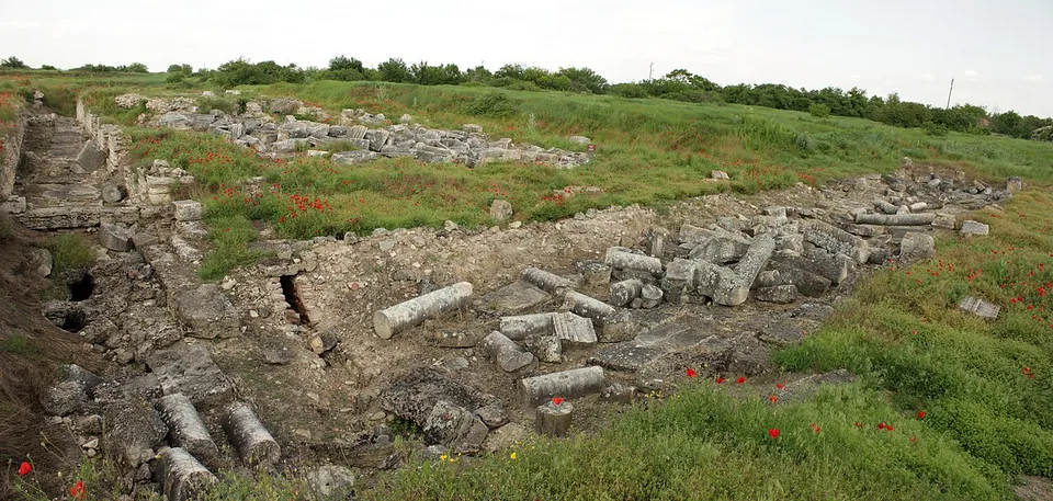
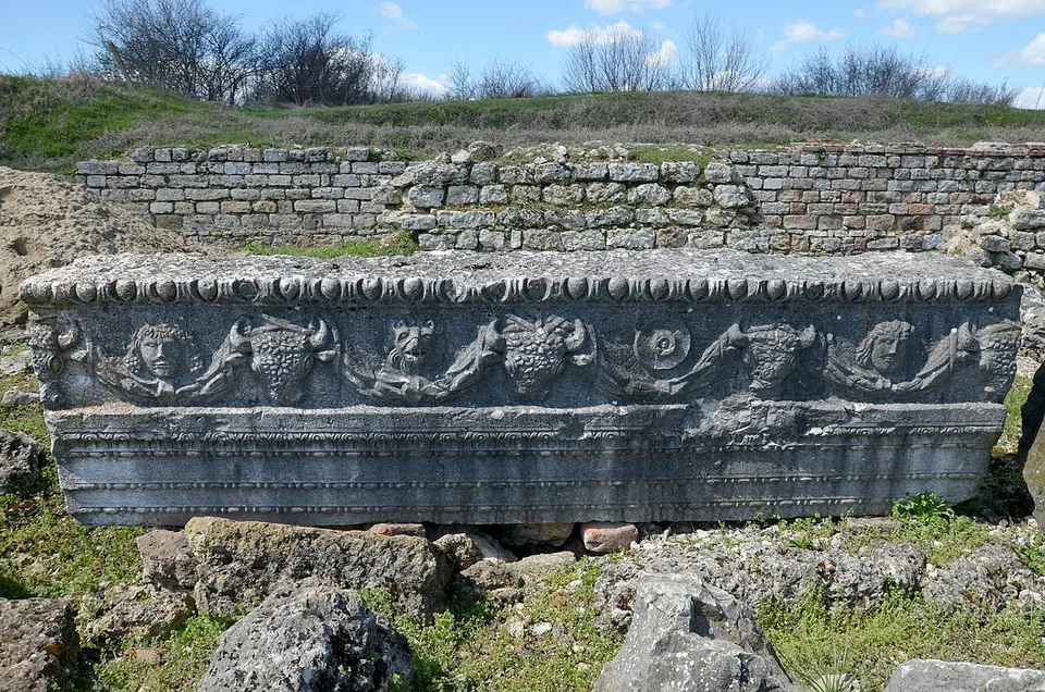
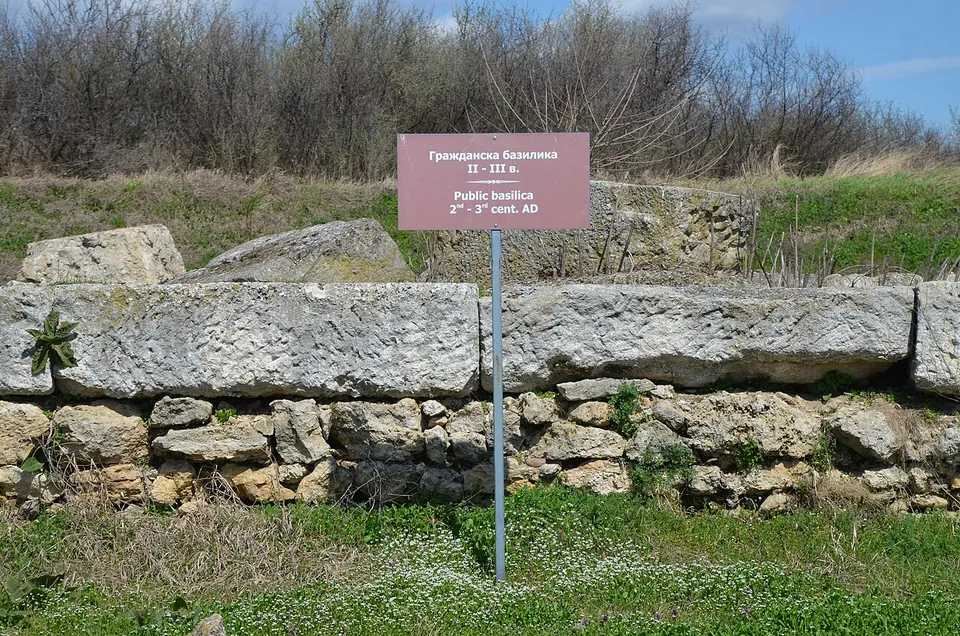
Excavation, begun in 1904, has uncovered the centre of the colony: the forum and the temples, public and private buildings, public baths and shops around it, with parts of the streets and the town walls (the Regional Historical Museum Pleven; en.wikipedia). The forum had four temples, which few Roman cities had: temples of Jupiter, Juno and Minerva on its south side, and on the north a temple of Fortuna, built by the city’s guild of craftsmen (bg.wikipedia). The ruins also include a main gate, a civil basilica, three public baths and a well-preserved stretch of paved road, and parts of the legionary fortress’s wall can still be seen (en.wikipedia). Work in 2020 showed that the great hall, of the 4th century, was faced with 14 kinds of rare coloured marble; its date and richness suggest it may have been built for Constantine’s visit in 328 (en.wikipedia).
What you walk among is foundations, low walls and fallen architecture in the grass: column drums, squared blocks and carved stones such as the architrave of the Temple of Fortuna, with small bilingual markers naming the buildings (the photographs). The best finds are not on site. The 3rd-century mosaic known as “The Achaeans”, found here in 1948, is in the Regional Historical Museum in Pleven, with many of the site’s other finds, and a statue of Fortuna is in the National Archaeological Museum in Sofia (en.wikipedia).
Is it worth the trip?
For readers who want the scale of a Roman frontier city, yes, especially combined with the museum in Pleven, which holds what was found here. It is a long drive into the countryside to a field of low ruins where nothing stands to any height, so a traveller after one impressive monument will find more elsewhere.
Getting there
Oescus lies on the edge of the village of Gigen, near where the Iskar meets the Danube, about 50 km north-west of Pleven (de.wikipedia; the Regional Historical Museum Pleven). No car park or bus stop is mapped within 1.2 km, so plan on a car (OpenStreetMap). We could find no opening hours or fee published by an operator.
Visiting details
- Tickets
- Unknown
Before you go
- We could find no operator page with opening hours or a fee for the site (searched 2 October 2026). The Regional Historical Museum in Pleven, which excavates it, publishes hours only for its museum in Pleven.
- No car park and no bus stop are mapped within 1.2 km; plan on driving to the village of Gigen.
History
Ptolemy describes Oescus as a town of the Triballi, and it took its name from the river Oescus, today the Iskar (en.wikipedia; bg.wikipedia). The legion V Macedonica had a fortress here from the early 1st century AD, and a settlement of veterans grew up beside it (en.wikipedia; de.wikipedia; bg.wikipedia). The legion left for the East in 62 and returned in 71, and a second legion, IV Scythica, was also based here until 101 (en.wikipedia).
The town became a colony, Colonia Ulpia Oescensium, named after Trajan, and was built over the legionary fortress. Published dates for the grant differ: soon after Trajan’s Dacian wars, between 106 and 112, or about 167 (en.wikipedia; bg.wikipedia; de.wikipedia). It stood where the Danube road met the roads south to Serdica and Philippopolis (en.wikipedia; bg.wikipedia). When Aurelian gave up Dacia in 271 the city was enlarged by 10 ha (de.wikipedia; en.wikipedia).
On 5 July 328 Constantine I came in person to open the bridge across the Danube that linked Oescus with Sucidava on the far bank; it was destroyed in 355, after about 27 years, and its ruins can be seen only from the northern, Romanian bank. A bishop of Oescus is recorded in 343 (en.wikipedia; de.wikipedia). The Huns took the city in the 5th century, Justinian I probably rebuilt its walls, and it came to an end with the Avar invasions of 585–586 (en.wikipedia; de.wikipedia). A Bulgarian village stood on the ruins from the 10th to the 14th century (en.wikipedia; de.wikipedia).
Nearby
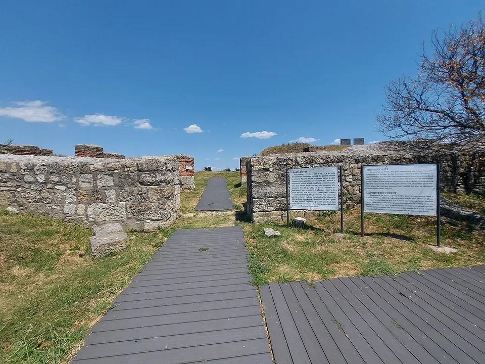
Photo: MSClaudiu · CC BY-SA 4.0 · Commons
6 km · fort · Olt County
Sucidava
On the upper terrace of the Danube stand the defensive walls of the late Roman town (4th–6th centuries) with eight fully exposed towers; the Roman baths, a palaeochristian basilica of the 5th–6th centuries and paved streets have also been found (ro.wikipedia).
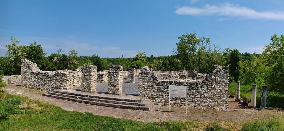
Photo: Todor Bozhinov / Тодор Божинов · CC BY-SA 3.0 · Commons
39 km · fort · Pleven Province
Storgosia
Excavation has uncovered the fortress wall with its gates and towers, houses, a public granary and an early Christian basilica (the museum; bg.wikipedia).


Straight-line distances.
Sources
Every fact on this page comes from the records below, each used under the licence noted.
| Source | Licence |
|---|---|
| Pleiades 216907 | CC BY |
| Wikidata Q1110806 | CC0 |
| OpenStreetMap way/27808205 | ODbL |
| Wikipedia (en) — Oescus | CC BY-SA 4.0 |
| Wikipedia (bg) — Ескус | CC BY-SA 4.0 |
| Wikipedia (de) — Colonia Ulpia Oescus | CC BY-SA 4.0 |
| Regional Historical Museum Pleven — archaeological sites | licence not recorded |
| Pleiades — Roman baths at Oescus | licence not recorded |