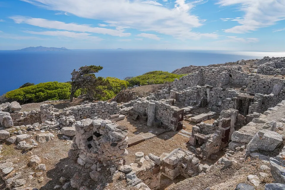
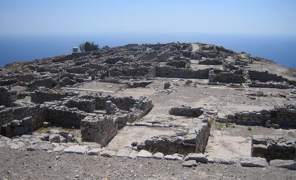


Ancient Thera is the city of ancient Santorini, strung along the crest of Mesa Vouno, a limestone mountain high above the sea (en.wikipedia; de.wikipedia). It was founded by settlers from Sparta, but what stands was shaped in the Hellenistic and Roman periods: a long main street, an agora with a great colonnade rebuilt under the emperors, a theatre and Roman baths (the operator; de.wikipedia).
What is there today
The city follows one street almost 800 m long and, at two to four metres, unusually wide for its time, running south-east along the ridge. About 200 m along it opens onto a plateau of roughly 100 by 100 m high above the rocky coast, where the houses are grouped round the agora, with the theatre built into the slope opposite. Everything is built of the mountain’s own limestone (de.wikipedia).
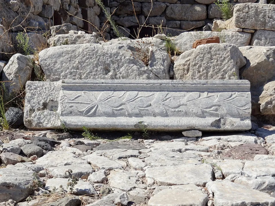
The agora follows the ridge for about 110 m and is 17 to 30 m wide, with the public buildings on the slope side and a free view east over the sea. Along it runs the Basilike Stoa, a hall 46 by 10 m whose roof rested on a row of ten Doric columns down the middle. It was the centre of public life, was completely rebuilt in the 1st century, and at its north end a separate room held statues of the imperial family (de.wikipedia).
The theatre, built in the 2nd century into the slope below the main street, seated about 1,500, more than the city needed, and drew audiences from all over the island (de.wikipedia).
The sacred area on the eastern spur of the ridge held a grotto of Hermes and Heracles, the temple of Apollo, a rock sanctuary of the Egyptian gods of the 3rd century BC, and a gymnasium of the 2nd century BC to which baths were added in the 1st century AD (de.wikipedia). The houses on the eastern slope, where the Ptolemaic officers lived round colonnaded courtyards, look down on the sea far below (de.wikipedia).
Is it worth the trip?
Yes, if you are on Santorini and can manage the climb. The ruins are low walls, but the setting on a bare ridge between two seas is the reason to come: the operator says the walk and the views are “reward enough”. The Roman city is the one you are walking through: the colonnade rebuilt for the emperors, the theatre and the baths. Plan around the opening hours: it closes at 15.30, is shut on Wednesdays, and from December to February opens only by appointment (the operator).
Getting there
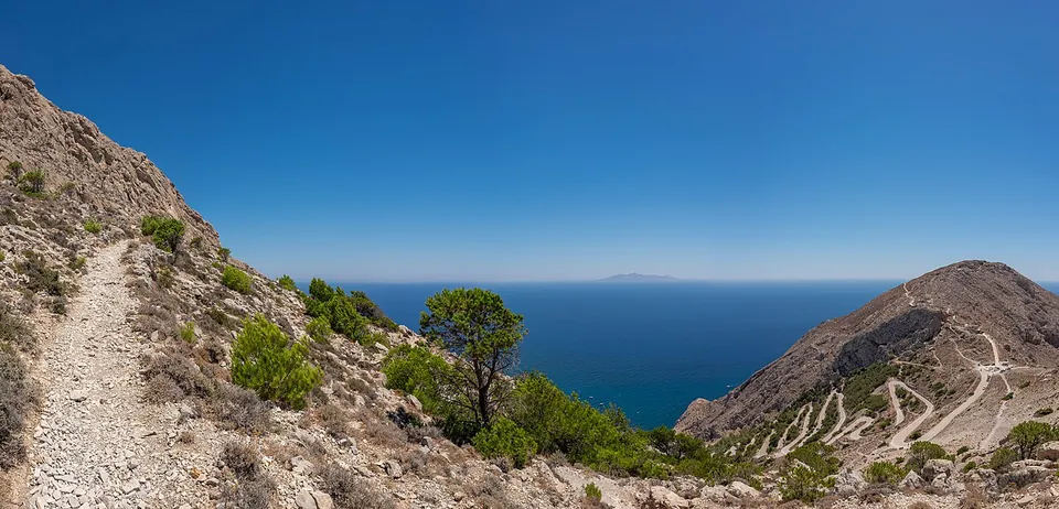
A winding road climbs to the site from Kamari, about 10 minutes by car; on foot it takes about 1 hour 10 minutes from Kamari, and footpaths also come up from the other side of the mountain (the operator; en.wikipedia). The operator lists parking at the top, and the last part is on foot, up steps and stone paths (OpenStreetMap).
From 1 March to 31 October it opens 08.30–15.30 every day except Wednesday; in November only from Friday to Sunday; from December to February by appointment (+30 210 3250148, +30 210 3310966). Last entry is 20 minutes before closing; it is shut on 1 January, 25 March, 1 May, Easter Sunday and 25–26 December. A ticket is €10, reduced €5, and entry is free on 6 March, 18 April, 18 May, the last weekend of September, 28 October, and on the first and third Sunday of each month from November to March (hh.gr, read 9 October 2026 — check before travelling). There are toilets (the operator). Finds from the excavations are in the archaeological museum in Fira (en.wikipedia).
Visiting details
- Opening hours
- 08.30–15.30, closed on Wednesdays, from 1 March to 31 October; in November only Friday to Sunday, 08.30–15.30; from 1 December to the end of February by appointment only (+30 210 3250148, +30 210 3310966). Last entry 20 minutes before closing. Closed 1 January, 25 March, 1 May, Easter Sunday and 25–26 December.
- Tickets
- €10; reduced €5. Free on 6 March, 18 April, 18 May, the last weekend of September and 28 October, and on the first and third Sunday of each month from November to March.
- Parking
- The operator lists parking at the site, reached by a winding road up from Kamari.
Before you go
- Closed on Wednesdays, and open only by appointment from December to February.
- The last stretch is a climb on foot up steps and stone paths on an exposed ridge; the operator warns that the walk "is no joke, especially during the famous northern winds of the Cyclades".
Hours and prices checked 9 October 2026 on the operator's own site. Confirm before travelling.
History
Dorian colonists from Sparta founded the city, by tradition under Theras, who gave it and the island his name; there is archaeological evidence of it from the 9th century BC, and around 630 BC Thera sent the colonists who founded Cyrene in Libya (de.wikipedia). In the second half of the 3rd century BC the Ptolemaic fleet for the whole Aegean was based here and the city was rebuilt on a regular grid; the fleet left around 145 BC (de.wikipedia).
From the middle of the 1st century BC the island and city belonged, by de.wikipedia’s account, to the Roman province of Asia. No high officials lived here, but Thera was prosperous enough for ambitious building projects, and its citizens twice held the office of provincial high priest (de.wikipedia). The city declined after the 3rd century AD but was still inhabited into the 9th, and sheltered the people of its harbours during the Arab raids (the operator). De.wikipedia has it given up after a small eruption of the Santorini volcano covered it with pumice in 726. The site was first excavated by Friedrich Hiller von Gaertringen at the turn of the 20th century: 1895–1904 by en.wikipedia’s dates, 1896–1902 by el.wikipedia’s.
More photographs

Sources
Every fact on this page comes from the records below, each used under the licence noted.
| Source | Licence |
|---|---|
| Pleiades 599971 | CC BY |
| Wikidata Q433004 | CC0 |
| Vici.org 11426 | CC BY-SA (text), CC0 (metadata) |
| OpenStreetMap way/25126722 | ODbL |
| Hellenic Heritage (H.O.C.R.E.D., for the Ministry of Culture) — Ancient Thera, hours and tickets | licence not recorded |
| Wikipedia (de) — Alt-Thera | CC BY-SA 4.0 |
| Wikipedia (en) — Ancient Thera | CC BY-SA 4.0 |
| Wikipedia (el) — Αρχαία Θήρα | CC BY-SA 4.0 |