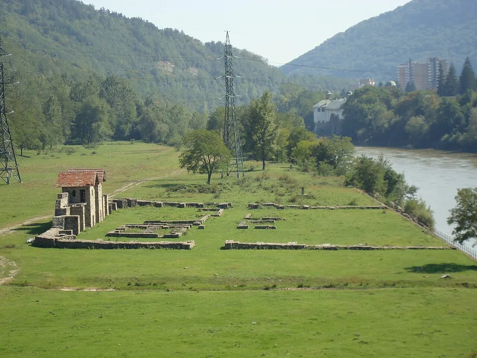
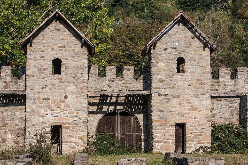
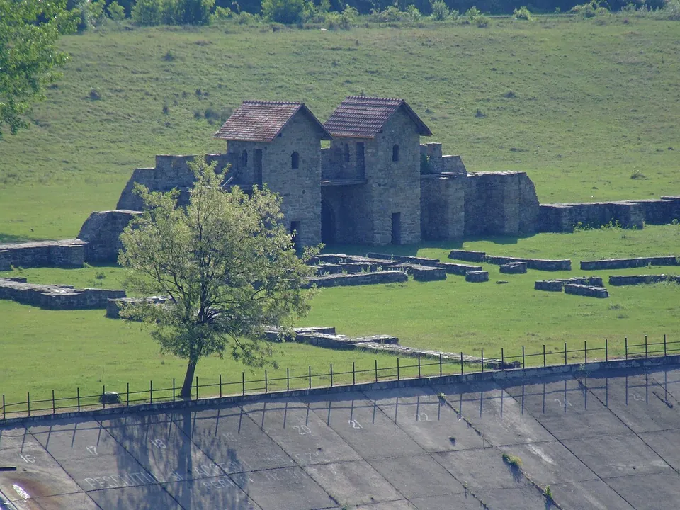


Arutela is a small Roman fort on the Olt, near Cozia Monastery, built about 138 by a unit of Syrian archers on the Olt frontier (Limes Alutanus). Its gate, reconstructed in the 1970s as the first attempt of its kind in Romania, and its walls make it easy to picture.
What is there today
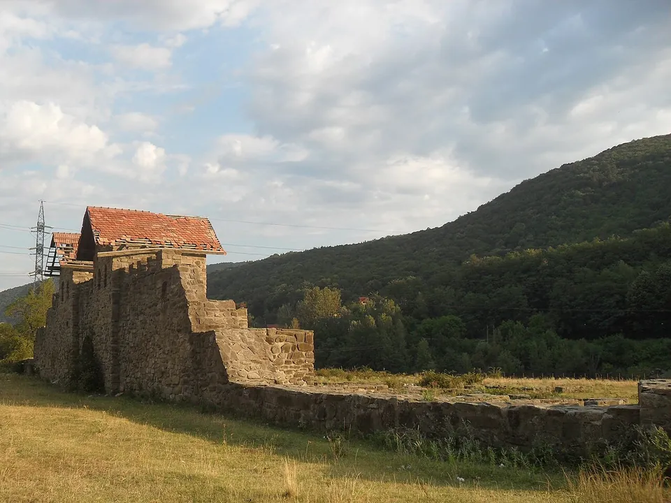
The fort is roughly 60 m square (published dimensions differ), on a terrace on the left bank of the Olt, near Cozia Monastery and the Turnu hydroelectric works (ro.wikipedia; MNIR). The National Museum of Romanian History describes the fortification as restored, with part of its buildings open to visit; the main gate (porta praetoria) was reconstructed on the hypotheses of the research team in the 1970s, “the first such attempt in Romania” (MNIR). Under a project of the Ministry of Culture funded by the national recovery plan (PNRR), the fort has been rehabilitated again; the result was criticised online in August 2026 (Euronews). The photographs here date from 2007–2012, before that work.
Is it worth the trip?
Yes, if you are on the Olt valley road: it is a quick stop, and the rebuilt gate and walls give a clear idea of a small frontier fort. Be aware that what stands is largely reconstruction, now twice over, and that the setting is shared with a river embankment and power lines.
Getting there
The fort lies at Poiana Bivolari, between Păușa and Căciulata, by the town of Călimănești (ro.wikipedia), about 5 km from the town centre (OpenStreetMap). A path is mapped next to it and a road about 150 m away.
No operator publishes opening hours or admission for the fort (searched 3 October 2026).
Visiting details
- Tickets
- Unknown
Before you go
- No operator page publishes opening hours or admission for the fort (searched 2026-10-03). The Ministry of Culture's recent rehabilitation was criticised online in August 2026 (Euronews), so what you find may differ from the photographs.
History
Two building inscriptions of 138 name the Syrian archers (Suri sagittarii) who built the fort, under Hadrian (MNIR; ro.wikipedia). It belonged to the Limes Alutanus, the frontier along the Olt, in the province of Dacia Inferior, later Dacia Malvensis (de.wikipedia). A small bronze fragment names a clerk of the first cohort of Spaniards, and a stamp of the Fifth Macedonian Legion was also found (ro.wikipedia). With the rest of the Dacian Limes, it became a UNESCO World Heritage Site in 2024 (de.wikipedia).
More photographs

Sources
Every fact on this page comes from the records below, each used under the licence noted.
| Source | Licence |
|---|---|
| Pleiades 216713 | CC BY |
| Wikidata Q3093473 | CC0 |
| OpenStreetMap way/282110921 | ODbL |
| Wikipedia (ro) — Castrul roman Arutela | CC BY-SA 4.0 |
| Wikipedia (de) — Arutela | CC BY-SA 4.0 |
| Wikipedia (en) — Arutela (castra) | CC BY-SA 4.0 |
| National Museum of Romanian History — The Roman frontier in Lower Dacia, 11, Arutela | licence not recorded |
| Euronews România — the Ministry of Culture criticised over the rehabilitation of Arutela (13 August 2026) | licence not recorded |