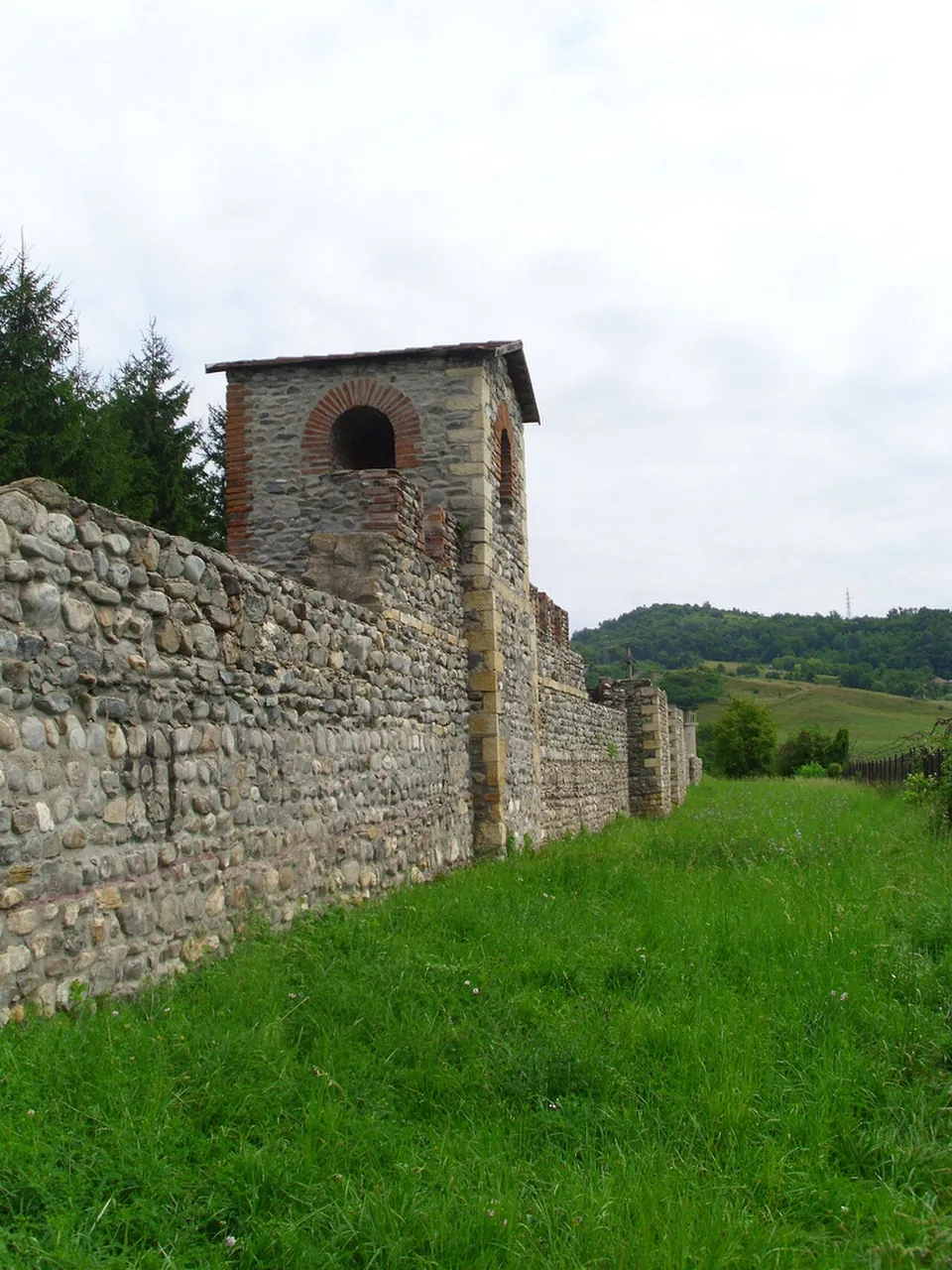
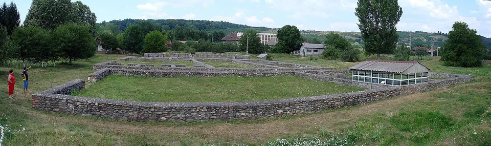
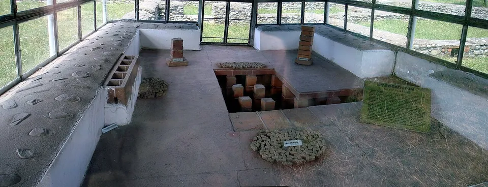


Jidava is a Roman auxiliary fort at the southern entrance to Câmpulung, the only stone fort on the Limes Transalutanus, the Roman frontier beyond the Olt. Its consolidated walls, partly rebuilt towers, the foundations of the headquarters, the commander’s house and the granary, and an underfloor heating system under a glass shelter make up an open-air museum, opened in 1970 and run by the Argeș County Museum.
What is there today
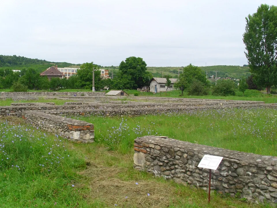
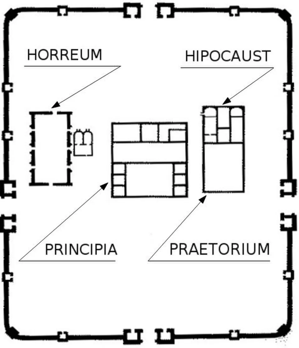
The fort is a rectangle with rounded corners, 132 by 99 m, with four gates and walls 1.80 m thick (de and ro.wikipedia). Inside, the operator shows the stone enclosure wall with its gates and towers, the officers’ building, the commander’s house (praetorium), the granary (horreum), and a hypocaust, the Roman underfloor heating. On the south side a curtain tower has been rebuilt, and in part the towers of the main gate, the semicircular tower at the south-west corner, and the towers of the other three gates (the operator). The hypocaust of the praetorium has been reconstructed (ro.wikipedia).
The headquarters building (principia) covered 30 by 35 m, the commander’s house 17 by 38 m, and the granary 13 by 34 m (de.wikipedia). A museum inside the fort (ro.wikipedia), opened in 1970, shows finds from the fort and the frontier: lamps, inscribed bricks and tiles, amphorae, pieces of floors and mosaic, parts of the hypocaust, arrowheads, spearheads, knives and military equipment (the operator).
Is it worth the trip?
Yes, if you are on the road from Pitești to Câmpulung and the Bran pass. The operator calls it the most important and best-preserved fort on the Limes Transalutanus, and it is set up for visitors, with a museum, signs and set hours. Expect foundations and some rebuilt towers rather than tall ruins. Rehabilitation works are planned until the end of 2029.
Getting there
The fort lies in the Pescăreasa district at the southern entrance to Câmpulung, just east of the Pitești–Câmpulung road, between the road and the Râul Târgului (the operator). That road is the DN73 (de.wikipedia), and the Bran pass lies about 20 km to the north (de and en.wikipedia). The museum stands inside the fort (ro.wikipedia).
The operator, the Argeș County Museum, opens the site Monday to Sunday, 09.00 to 17.00. A ticket is 20 RON, about €3.70, and 10 RON, about €1.90, for pupils, students and pensioners. Groups of 10 or more pay half (muzeul-judetean-arges.ro, 2026 tariffs, read 3 October 2026). Tickets can also be bought online through the museum’s site.
Argeș County began a project to restore and present the fort on 2 June 2026, to run until 31 December 2029. It covers conservation of the ruins, controlled demolition of modern buildings inside the fort, a new history and archaeology museum outside it, information panels, light metal and glass shelters over the praetorium, a rehabilitated access road and visitor routes (Argeș County Council, 8 June 2026). The announcement does not say whether the site closes during the works.
Visiting details
- Opening hours
- Monday to Sunday, 09.00–17.00.
- Tickets
- 20 RON (about €3.70); 10 RON (about €1.90) for pupils, students and pensioners. Groups of 10 or more pay half.
Before you go
- Argeș County is rehabilitating the site from 2 June 2026 to 31 December 2029, with demolition of modern buildings inside the fort, a new museum outside it, shelters over the praetorium and a rehabilitated access road (Argeș County Council, 8 June 2026). The announcement does not say whether the site closes during the works; the operator's page still gives daily hours.
Hours and prices checked 3 October 2026 on the operator's own site. Confirm before travelling.
History
The fort was built between 190 and 211, under Commodus and Septimius Severus, to control the road through the Bran pass (ro.wikipedia); some researchers date it earlier, to Hadrian (de.wikipedia). The operator names its garrison as the First Flavian Cohort of Commagenians, from Commagene in the province of Syria. de.wikipedia is more cautious: a graffito on a brick names the unit, an archer cohort, which was possibly stationed here in the 3rd century. About 400 arrowheads of an eastern type are said to have been found in the headquarters, and other military finds also point to archers (de.wikipedia).
Some of the first buildings inside were of timber. A fire that coins of Geta and Severus Alexander date to 222 or later destroyed them, and they were rebuilt in stone (en and de.wikipedia). The fort was destroyed by fire in the mid-240s. Romanian Wikipedia gives 244–245 and ties it to an invasion of the Carpi, while en.wikipedia dates the fire by a coin of 246. A smaller timber-and-earth fort, probably of the early 2nd century, lay about 300 m to the south (en and de.wikipedia).
The ancient name of the fort is not known. “Jidova” comes from local legend: people who passed the ruined walls in the Middle Ages credited them to the “jidovi”, the giants of folk tales (the operator). The fort was first recorded in 1876, and systematic excavation began in 1962 (ro.wikipedia).
More photographs


Sources
Every fact on this page comes from the records below, each used under the licence noted.
| Source | Licence |
|---|---|
| Pleiades 216856 | CC BY |
| Wikidata Q12723650 | CC0 |
| Vici.org 7486 | CC BY-SA (text), CC0 (metadata) |
| OpenStreetMap way/231502398 | ODbL |
| Muzeul Județean Argeș — Castrul roman Câmpulung-Jidova (the operator) | licence not recorded |
| Muzeul Județean Argeș — Tarife 2026 (the operator) | licence not recorded |
| Argeș County Council — launch of the Jidava rehabilitation project (8 June 2026) | licence not recorded |
| Wikipedia (de) — Kastell Câmpulung Muscel | CC BY-SA 4.0 |
| Wikipedia (ro) — Castrul roman Jidava | CC BY-SA 4.0 |
| Wikipedia (en) — Jidava (castra) | CC BY-SA 4.0 |