

What is there today
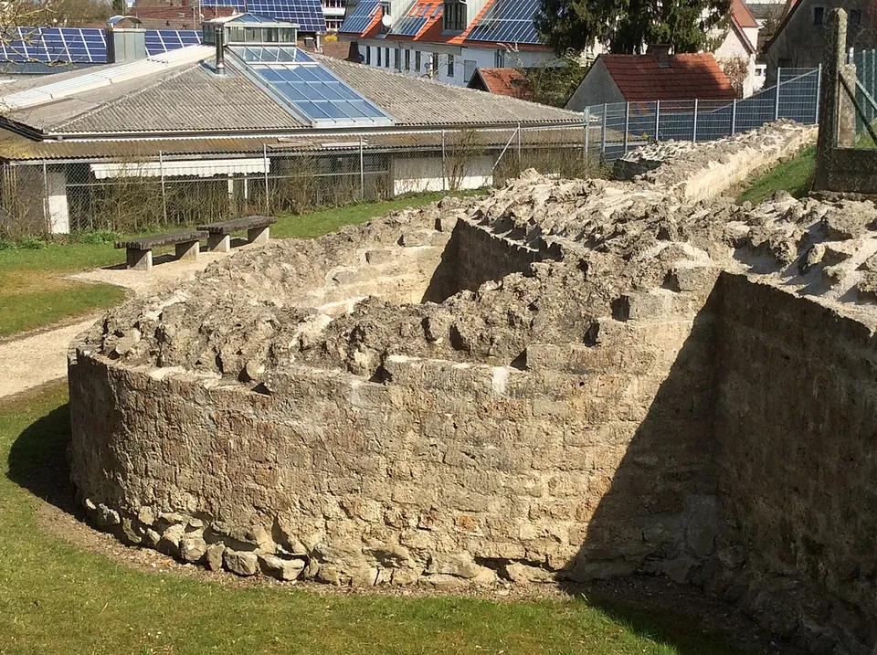
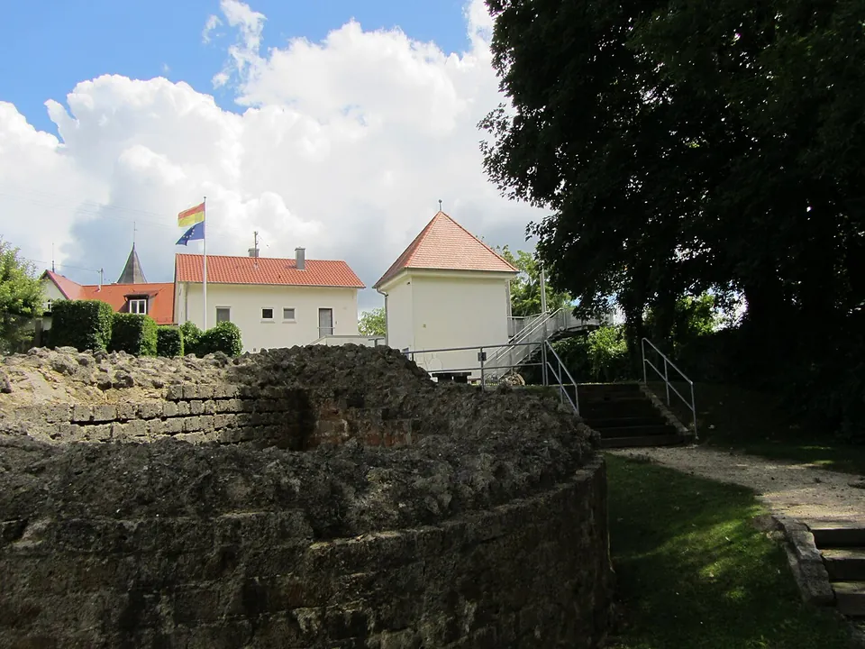
The fort itself is almost entirely built over by the village (de.wikipedia). What you see is in the park on the western edge of the plateau: two semicircular towers of the west wall and the stretch of wall between them, exposed in full and conserved. The lower masonry there is original Roman work; the upper courses were partly added in 1993–94 in small blocks of tuff, and a square tower on the same side, T7, was rebuilt and plastered (de.wikipedia). The operator describes the park as “reconstructed wall remains”, which is fair: these are low foundations, finished off in modern stone, not standing walls.
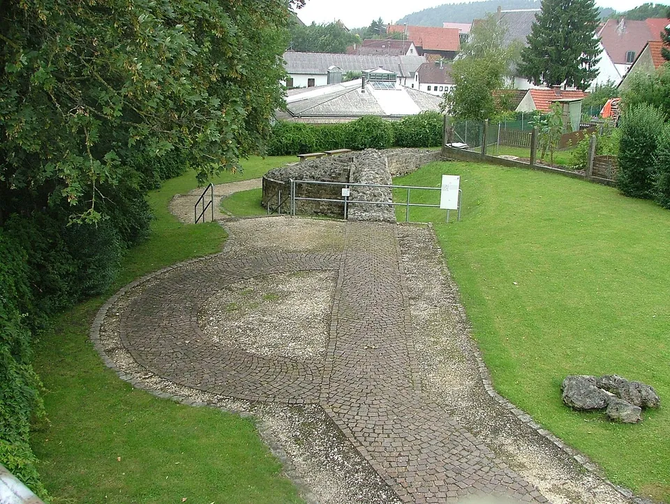
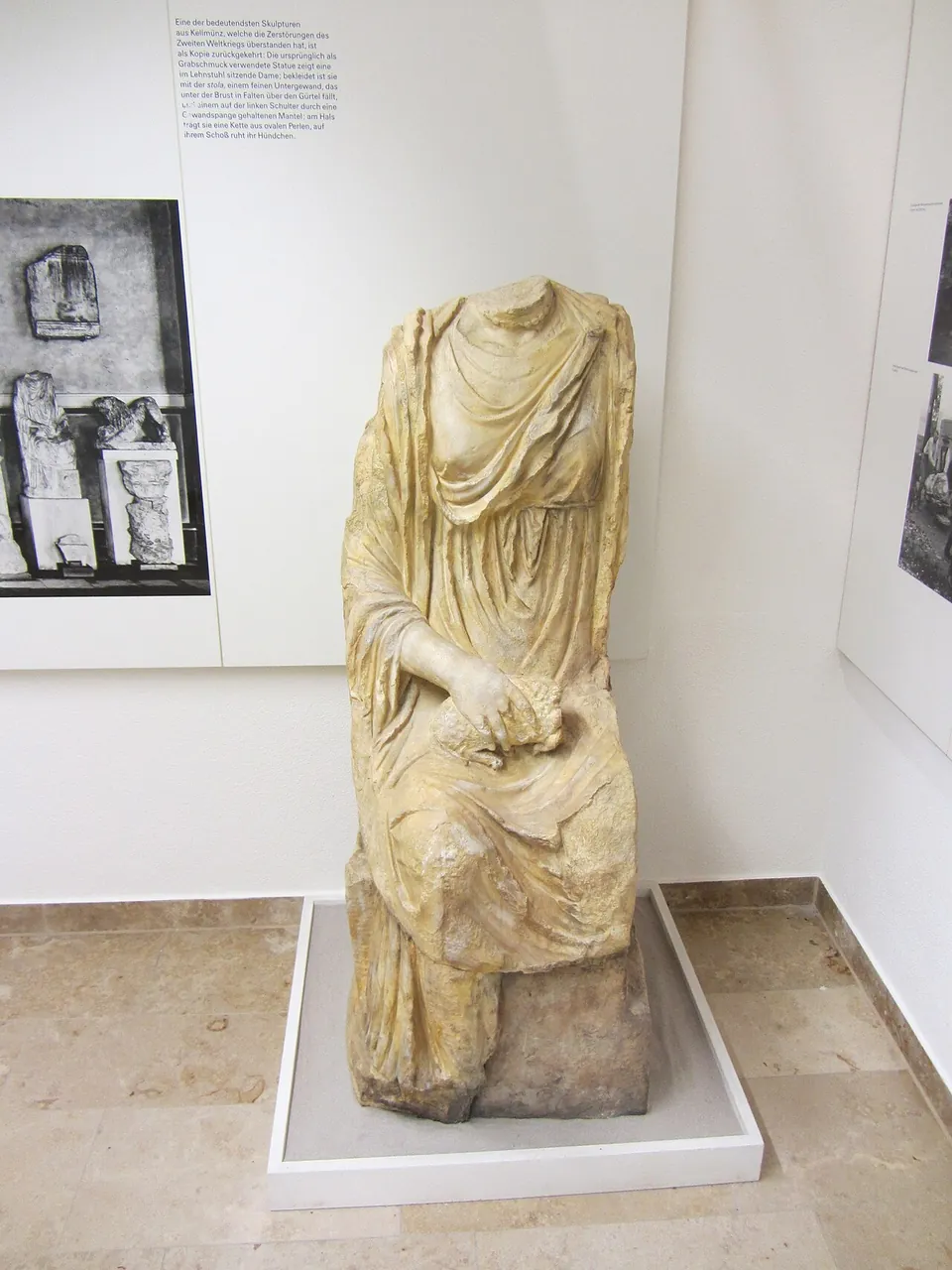
In the museum tower, the ground floor tells the story of the excavations and the upper floor the history of the Roman province of Raetia, with some small finds (de.wikipedia) and a short film (the operator). Carved stones that the Romans reused in the foundations of the east wall, including marble statues cut to fit, are now in Munich’s Archäologische Staatssammlung; casts of them stand in Kellmünz (de.wikipedia). Beyond the park, a signed circuit that starts at the church of St Martin follows the line of the fort walls, and by the church the plan of the fort’s great hall is marked out in coloured paving (de.wikipedia).
Is it worth the trip?
As a stop, yes; as a destination, only for readers with a real interest in the late Roman frontier. This is an hour’s visit at most: the remains are low, there is no gate or standing building, and the museum tower opens only on weekends from April to October. What lifts it above a reconstruction is that the stones at the bottom of the west wall are the Roman ones. It is free, the village has a railway station about eight minutes’ walk away, and it is reached from the A7’s Altenstadt exit, so it is easy to fit into a drive through the Iller valley. Come between April and October on a weekend if you want the museum as well as the park.
Getting there
The park is at Rechbergring 6 in Kellmünz. By car, leave the A7 (Würzburg–Kempten) at the Altenstadt exit and follow the road to Kellmünz. There is no parking at the park: use the small car park opposite St Martin’s church (Kirchstraße 1) or the large public gravel car park at the station. From the station, Kellmünz an der Iller, the walk to the park takes about eight minutes, and the signed path passes the first boards of the archaeological circuit (the operator).
Admission is free. The park is open all year until dusk; the museum tower opens from April to October on Saturdays, Sundays and public holidays, 10.00 to 17.00, and is closed from November to March. Groups and school classes can book guided tours, also outside these hours. Neither the park nor the tower is step-free, and there is no accessible public toilet on site (Landratsamt Neu-Ulm, read 30 October 2026).
Visiting details
- Opening hours
- The park is open all year until dusk. The museum tower opens from April to October on Saturdays, Sundays and public holidays, 10.00–17.00, and is closed from November to March; groups and school classes can book visits outside these hours.
- Tickets
- Free, for the park and the museum tower.
- Parking
- There is no parking at the park itself. The district directs drivers to a small car park opposite St Martin's church (Kirchstraße 1) or the large public gravel car park at the railway station, about 8 minutes' walk away; the signed path from there passes the first boards of the archaeological circuit.
Before you go
- Neither the park nor the museum tower is step-free, and there is no accessible public toilet on site.
- The museum tower is closed from November to March; in winter only the open park can be seen.
Hours and prices checked 30 October 2026 on the operator's own site. Confirm before travelling.
History
The fort belonged to the Danube–Iller–Rhine Limes, the line of frontier forts that grew up along those rivers after the Upper Germanic–Raetian Limes fell, and its garrison guarded and passed messages along the frontier in the lower Iller valley. It was probably built as part of the fortification programme of Diocletian and his co-emperor Maximian: two little-worn coins of 296–297, found under the floor of a timber building of the construction camp that preceded the fort, give the earliest possible date. A fire, dated by coins to around 300–303, destroyed the fort’s buildings, and rebuilding went on until at least 310 (de.wikipedia).
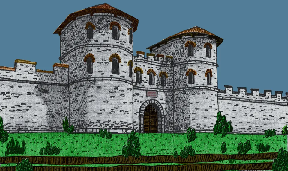
The plan was an irregular polygon fitted to the plateau, enclosing 0.86 hectares, with a wall perhaps seven to eight metres high and fourteen interval towers some 12–15 m high. The east side, the only one easily reached, had a 112 m wall with towers only eight to ten metres apart, a gate between two semicircular towers, and two ditches in front (de.wikipedia). In the rebuilding after the fire, a single-room hall of 26 by 14 m, with heating channels, a columned porch and an apse, went up next to the east wall. The excavator, Michael Mackensen, argued that so costly a building only makes sense if high civil or military officials stayed here at times. Besides ceremony and the hearing of cases, the hall probably also served to receive Alamannic envoys (de.wikipedia).
The Notitia dignitatum, compiled between 420 and 425, records the place as Caelio, a name derived from Caelius, one of the seven hills of Rome, and gives its garrison as the Cohors tertia Herculea Pannoniorum (the third Pannonian cohort “of Hercules”), a frontier cohort under a tribune. The regular army probably left about 430; the inhabitants abandoned the fort at the end of the 6th century, and through the Middle Ages its stone was carried off for building elsewhere (de.wikipedia).
Roman walls were first found when Kellmünz laid its water mains in the mid-19th century. A local merchant, Roman Linder, dug large parts of the wall with his three sons between 1901 and 1913, advised by the archaeologist Paul Reinecke; in the first years the digging was paid for mainly by selling the carved stones to the Bavarian National Museum in Munich. The University of Munich excavated from 1986 to 1993 under Mackensen, and the park was laid out after the excavations ended in 1995 (de.wikipedia).
More photographs


Nearby
Photo: Xocolatl · Public domain · Commons
46 km · city · Bavaria
Cambodunum
The Archäologischer Park Cambodunum shows three parts of the Roman town: the Gallo-Roman temple district, the Small Baths (Kleine Thermen) and the forum with its basilica.

Straight-line distances.
Sources
Every fact on this page comes from the records below, each used under the licence noted.
| Source | Licence |
|---|---|
| Pleiades 118622 | CC BY |
| Wikidata Q1025381 | CC0 |
| Vici.org 8265 | CC BY-SA (text), CC0 (metadata) |
| OpenStreetMap way/1540307366 | ODbL |
| Wikipedia (de) — Caelius Mons | CC BY-SA 4.0 |
| Landratsamt Neu-Ulm — Archäologischer Park Kellmünz (the operator) | licence not recorded |
| Wikidata — Archäologischer Park Kellmünz (Q76628098) | licence not recorded |