Skip to content
Menu

Country · 81 sites · 4 hubs

Roman Germany

Roman Germany is a frontier land. Rome held the provinces of Germania Inferior, Germania Superior and Raetia, and the line that bounded them, the Limes Germanicus, separated the empire from the unsubdued Germanic tribes from about AD 83 to 260. At its height it ran from the North Sea outlet of the Rhine to near Regensburg on the Danube. The two rivers were frontier enough along most of that distance; the exception was a gap of roughly 300 km between Mainz on the Rhine and Regensburg, where the frontier left the water and crossed the hills. There the Upper Germanic-Rhaetian Limes, 550 km long from Rheinbrohl to Eining, used an earth bank and ditch with a wooden palisade and watchtowers, with a system of linked forts behind it. It has been a UNESCO World Heritage Site since 2005. The Lower Germanic Limes along the Rhine was a river border without ramparts, guarded by a chain of auxiliary forts, and was inscribed in 2021. The Saalburg in the Taunus is the most completely reconstructed Roman fort in Germany: a reconstruction, not original walls, which is worth knowing before the trip.

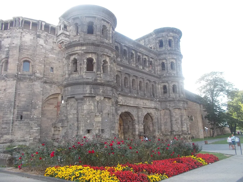
The cities behind the frontier are the other half of the story. Trier was founded in the late 1st century BC as Augusta Treverorum and was one of the four capitals of the empire under the Tetrarchy; its Porta Nigra, a large Roman city gate, is a World Heritage Site, and its medieval name comes from the darkened stone. Cologne, the Colonia Claudia Ara Agrippinensium, was the capital of Germania Inferior and the headquarters of the army of the lower province, and the history of the modern city begins with the Roman colony. Colonia Ulpia Traiana, near Xanten, lasted from about AD 100 to 275 and was the third-largest Roman city in what is now Germany, after Cologne and Trier. The Archaeological Park Xanten, opened in 1977, stands over it and rebuilds parts of the city wall, the harbour temple, an inn and the amphitheatre.

Earlier still, in the Augustan years, Rome tried to hold land east of the Rhine. The camps at Haltern on the Lippe date from that time and were given up after the defeat of Varus. Kalkriese, north of Osnabrück, is considered by archaeologists the likely site of that battle in AD 9, with more than 5,500 Roman objects found since 1988. At Waldgirmes on the Lahn, a planned town that was never finished has the oldest known stone buildings in Magna Germania.

Sources: Wikipedia (en) — Limes Germanicus; Wikipedia (en) — Upper Germanic-Rhaetian Limes; Wikipedia (en) — Lower Germanic Limes; Wikipedia (en) — Saalburg; Wikipedia (en) — Trier; Wikipedia (en) — Porta Nigra; Wikipedia (de) — Colonia Claudia Ara Agrippinensium; Wikipedia (de) — Colonia Ulpia Traiana; Wikipedia (de) — LVR-Archäologischer Park Xanten; Wikipedia (de) — Römerlager Haltern; Wikipedia (en) — Kalkriese; Wikipedia (en) — Waldgirmes Forum

Augusta Treverorum – Trier
Colonia Claudia Ara Agrippinensium – Cologne
Mogontiacum – Mainz
Osterburken
Saalburg Roman Fort
Igel Column
Kriemhildenstuhl
Archaeological Park of Xanten
Roman Villa Borg
Weißenburg Roman Fort
Cambodunum
Castellum of Holzheimer Unterwald
Castrum Sablonetum
Contiomagus
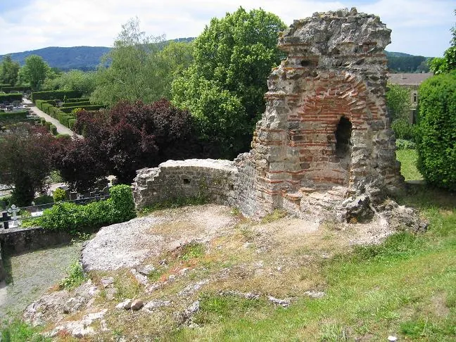
Görresburg
Haselburg Roman villa
Pfünz Roman Fort
Roman temple of Tawern
Schwarzenacker
Tempelbezirk Pesch
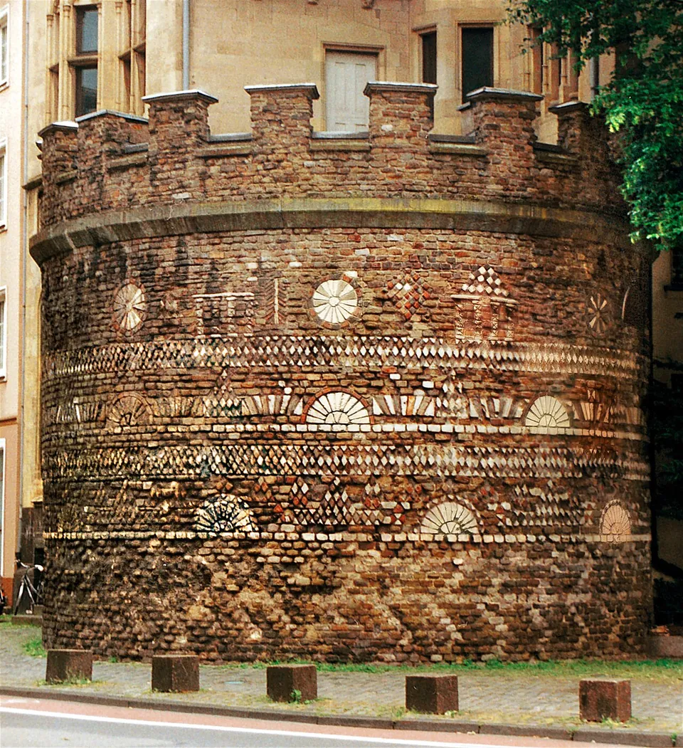
Villa rustica of Büßlingen
Villa rustica of Wachenheim
Villa rustica of Weilberg
Villa urbana of Longuich
Welzheim East Roman Fort
Güglingen Mithraeum
Kleinkastell Haselburg
Kleinkastell Hillscheid
Tempelheiligtum Zingsheim
Castra of Aalen
Castra Regina
Eifel Aqueduct
Aquae Mattiacae
Boiotro
Caelius Mons
Castra Abusina
Castra Brigobannis
Castra of Buch
Castra of Kapersburg
Castra of Walldürn
Castra of Würzberg
European Archaeological Park of Bliesbruck-Reinheim
Kaiservilla Konz
Kastell Alzey
Kastell Boppard
Kastell Großkrotzenburg
Kastell Kleiner Feldberg
Limes gate Dalkingen
Lopodunum
Rigomagus
Roman baths of Badenweiler
Roman settlement Tegelberg
Römergrab Köln-Weiden
Römerkastell Saarbrücken
Römersteine
Römervilla von Bad Neuenahr-Ahrweiler
Römische Thermen Weißenburg
Römische Villa Nennig
Römisches Bad
Varnenum
Villa Otrang
Villa rustica in the Kanzlerwald
Villa rustica of Leutstetten
Castellum of Heidenstock
Castra of Oberscheidental
Juddekirchhof
Open Germany on the interactive map

Select Show on map beside a site or town to see where it is.Scroll the list: each site or town is marked on the map as you reach it. The interactive map shows them all.

Roman towns

Several sites in or around one town, all seen from one base.

Landmarks

Landmark

Worth planning a trip around.

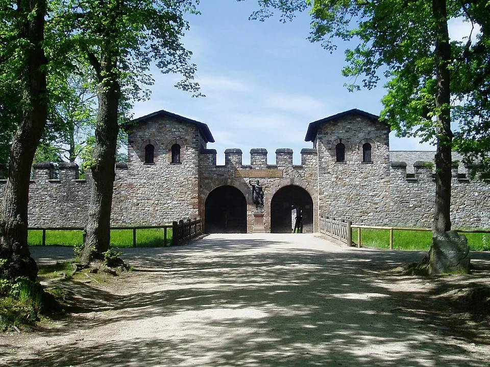
  1. A broad gravel road between trees leading to a gatehouse of grey stone with two arched passages, flanked by two square towers with small windows and tiled roofs, a crenellated wall running off to either side and a statue on a plinth between the arches.

    Photo: en:User:Ekem · Public domain · Commons

    fort · Hesse

    Saalburg Roman Fort

    The fort is a rectangle of 147 by 221 m (de.wikipedia).

    Show on map: Saalburg Roman Fort
    1st – 3rd c. ADTicketed

Hidden gems

Hidden gem

Remains that most visitors to the region never see.

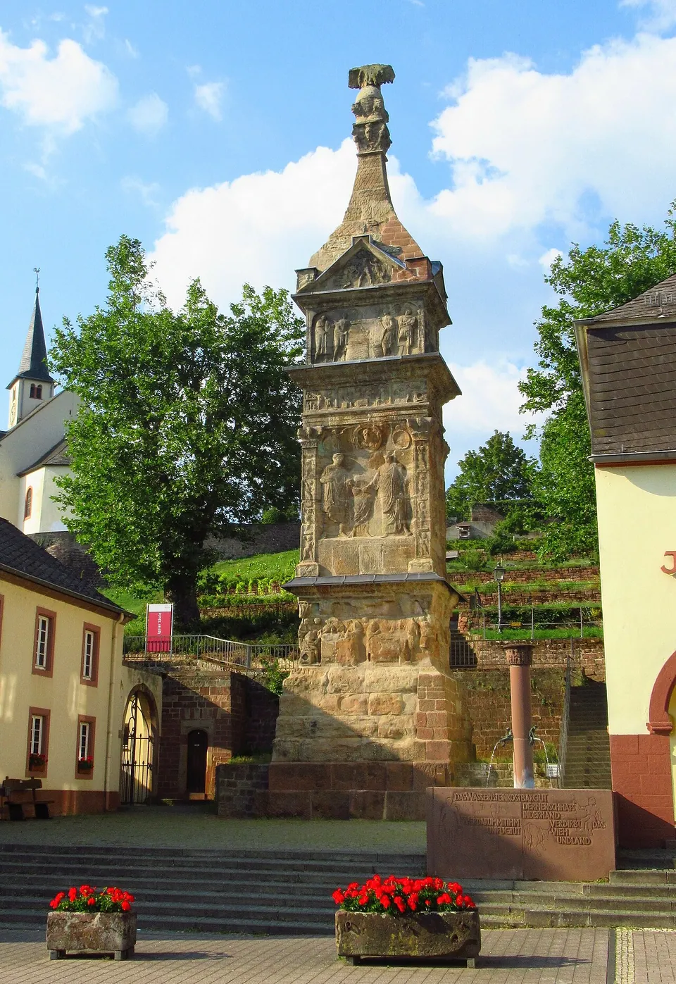
  1. A tall, slender stone monument rising in tiers from a stepped base, its storeys covered in figure reliefs and capped by a steep pointed roof with a weathered sculpture on top, standing at the head of a paved square between houses, with a church spire and green trees behind.

    Photo: Dkvtig · CC BY-SA 4.0 · Commons

    tomb · Rhineland-Palatinate

    Igel Column

    The monument itself, still standing where the Romans built it.

    Show on map: Igel Column
    2nd – 3rd c. ADFree
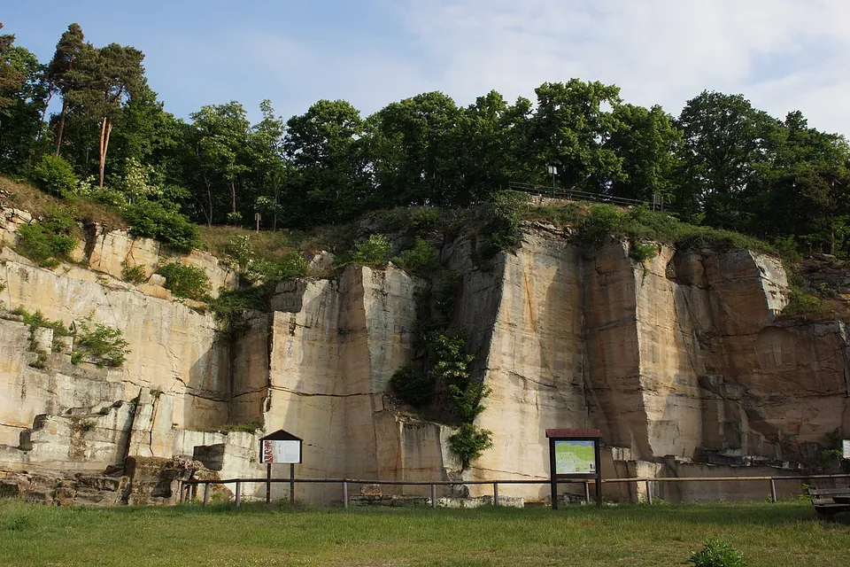
  2. A tall face of pale sandstone, cut into sheer vertical sections with trees growing along its top, rising behind a mown lawn with a low wooden fence and two information boards at its foot.

    Photo: Maik Riede · CC BY-SA 4.0 · Commons

    quarry · Rhineland-Palatinate

    Kriemhildenstuhl

    A half-round quarry cut into the hillside about 150 m above the town, cleared almost entirely of the rubble that once filled it (the owner, the Drachenfels-Club).

    Show on map: Kriemhildenstuhl
    2nd – 3rd c. ADFree
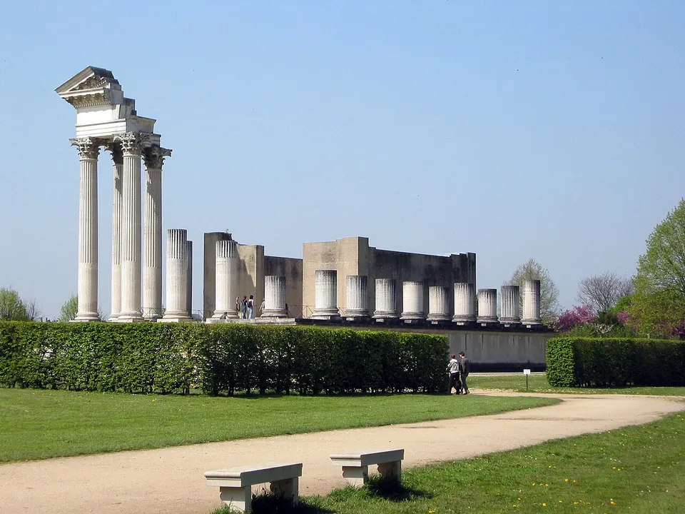
  3. A corner of a temple rebuilt to full height, a few white columns carrying a pediment fragment, standing on a high podium beside a row of column stumps and a bare concrete wall, with lawns, hedges and a gravel path in front.

    Photo: Magnus Manske · CC BY-SA 3.0 · Commons

    city · North Rhine-Westphalia

    Archaeological Park of Xanten

    What stands to any height here is mostly modern reconstruction.

    Show on map: Archaeological Park of Xanten
    1st – 5th c. ADTicketed
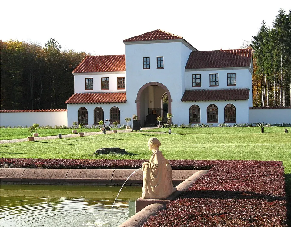
  4. A white two-storey building with red tiled roofs and a tall arched gateway at its centre, seen across a lawn; in the foreground a statue of a draped figure pours water into a basin edged with red-leaved plants.

    Photo: Johnny Chicago at lb.wikipedia · CC BY-SA 3.0 · Commons

    villa · Saarland

    Roman Villa Borg

    The buildings around the inner courtyard stand again: the gatehouse, the manor house, the bath house, the residential and working wing and the Roman kitchen.

    Show on map: Roman Villa Borg
    1st c. BC – 7th c. ADTicketed
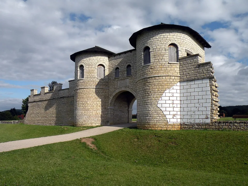
  5. A gateway of pale squared stone seen from outside the fort, its arched passage flanked by two towers rounded at the front with small arched windows and dark caps of roofing, a crenellated wall running off to the left and a patch of the masonry at the right painted white with drawn joints.

    Photo: Vitold Muratov · CC BY-SA 3.0 · Commons

    fort · Bavaria

    Weißenburg Roman Fort
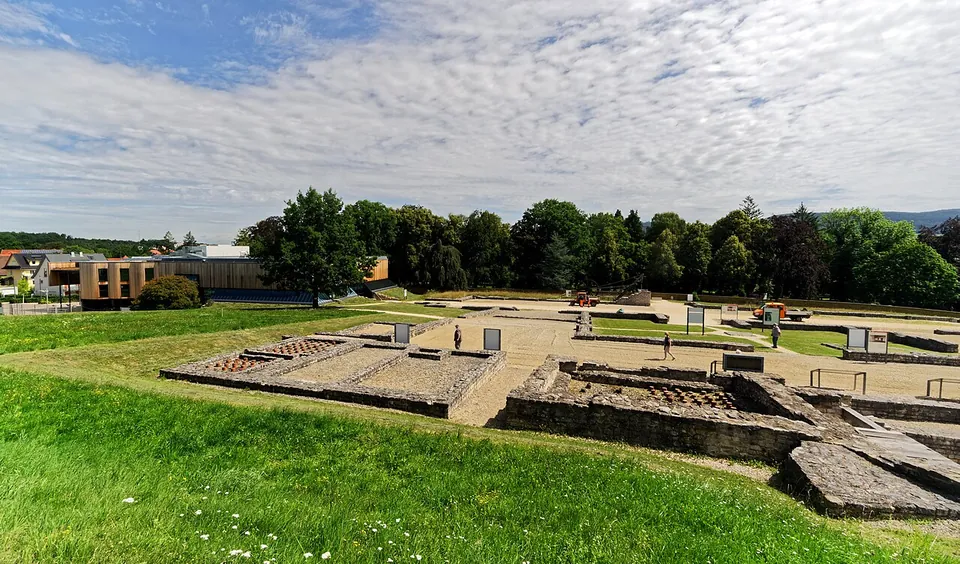
    The fort's whole area, about 3.1 hectares, is kept free of building as a public park (Deutsche Limeskommission).

    Show on map: Weißenburg Roman Fort
    1st – 3rd c. ADFree
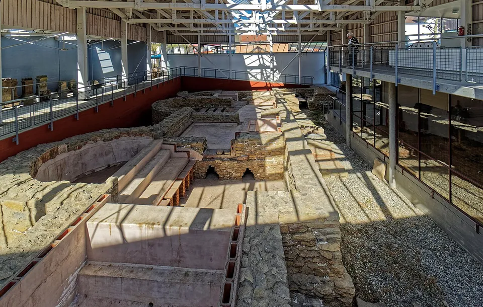
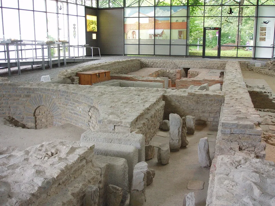
  6. Inside a glass-walled hall, low walls of pale limestone blocks outline excavated rooms, with a narrow channel, scattered stone blocks and a small arched opening in the foreground and display panels on the far wall.

    Photo: Xocolatl · Public domain · Commons

    city · Bavaria

    Cambodunum

    The Archäologischer Park Cambodunum shows three parts of the Roman town: the Gallo-Roman temple district, the Small Baths (Kleine Thermen) and the forum with its basilica.

    Show on map: Cambodunum
    1st – 5th c. ADTicketed
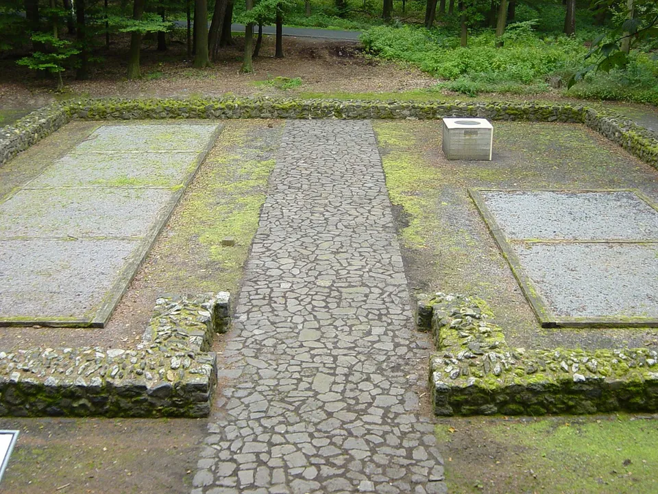
  7. A path of irregular paving stones runs from a gap in a low rubble-stone wall straight across the inside of the enclosure, with a rectangle of grey gravel edged in stone on either side and a small square stone box at the back right.

    Photo: Cherubino · CC BY 3.0 · Commons

    fort · Hesse

    Castellum of Holzheimer Unterwald

    The whole fort is laid out at ground level.

    Show on map: Castellum of Holzheimer Unterwald
    1st – 3rd c. ADFree
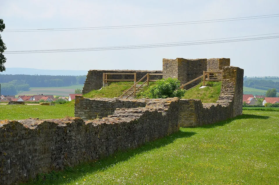
  8. A rebuilt wall of rough, pale grey stone in the foreground, rising at the back to a grassed earth bank with wooden steps and railings leading up to square stone blocks like the stumps of towers, with red-roofed houses and wooded hills behind.

    Photo: Carole Raddato · CC BY-SA 2.0 · Commons

    fort · Bavaria

    Castrum Sablonetum

    What you see is a reconstruction.

    Show on map: Castrum Sablonetum
    2nd – 3rd c. ADFree
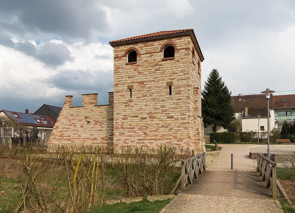
  9. A square tower of pale stone banded with red brick-coloured courses, with arched windows under a tiled roof, beside a crenellated wall section; a wooden footbridge with railings leads past it, and houses stand behind.

    Photo: Amber16 · CC BY-SA 4.0 · Commons

    fort · Saarland

    Contiomagus

    The Römerpark holds a square tower with arched windows and a tiled roof, joined to a short stretch of crenellated wall, set among gravel paths, meadow and a children's playground.

    Show on map: Contiomagus
    1st c. BC – 4th c. ADFree
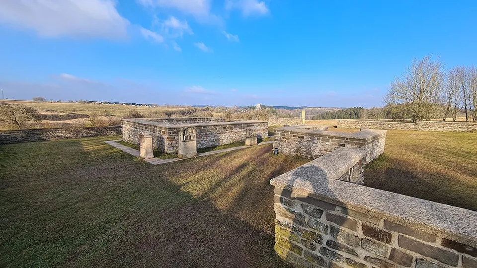
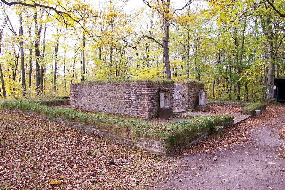
  10. Low walls of grey rubble stone with flat coping stand on winter grass in sunshine; in the middle distance the square main temple, with pale dedication stones set in front of it, and open fields and bare trees beyond.

    Photo: TimeTravelRome · CC BY 2.0 · Commons

    temple · North Rhine-Westphalia

    Görresburg

    A low wall encloses a trapezoid of grass holding three small, almost square buildings, all facing east (KuLaDig, LVR; Eifel Tourismus).

    Show on map: Görresburg
    1st – 4th c. ADFree
  11. Rebuilt sandstone walls about knee to waist high mark out a row of rooms and a gravel-floored courtyard on a sunny lawn, with a line of tall trees and open farmland behind.

    Photo: Haselburg-müller · CC BY-SA 3.0 · Commons

    villa · Hesse

    Haselburg Roman villa

    The excavated buildings have been rebuilt on their own foundations to a low height, so the site reads as a plan you walk through rather than as standing ruins (the operator).

    Show on map: Haselburg Roman villa
    2nd – 3rd c. ADFree
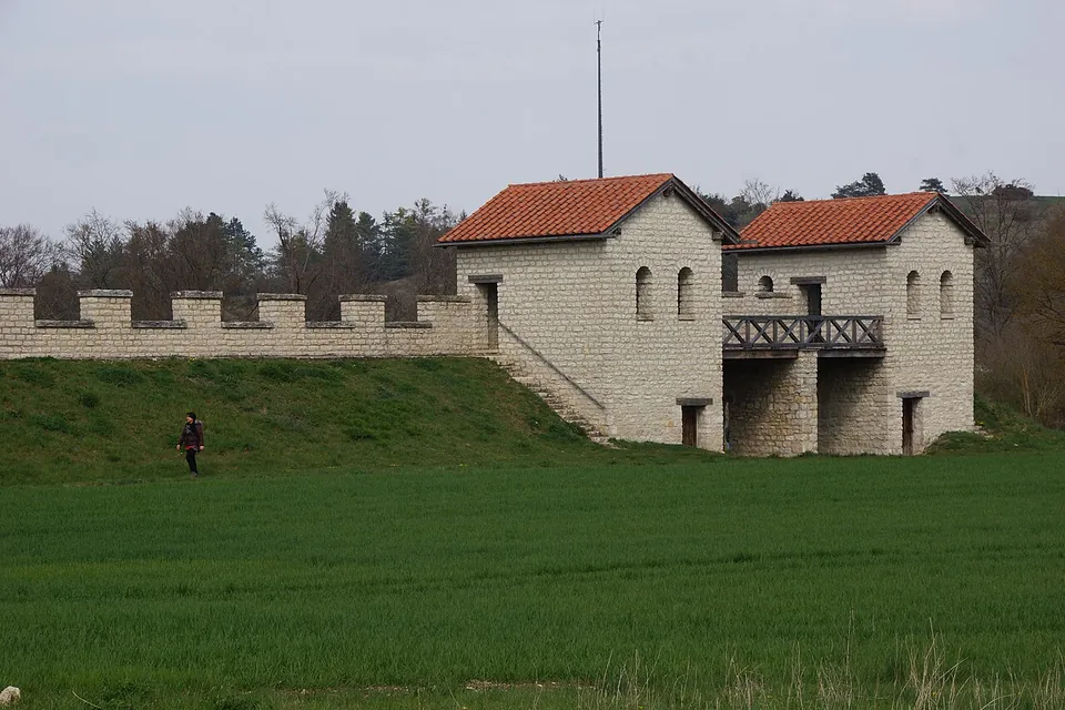
  12. A rebuilt Roman gateway of pale limestone blocks, two towers with red tiled roofs and arched windows joined by a wooden gallery over the passage, with a crenellated wall running off to the left along a grassy bank and a green field in front.

    Photo: DALIBRI · CC BY-SA 4.0 · Commons

    fort · Bavaria

    Pfünz Roman Fort
    The rebuilt north gate, north-west corner tower and stretch of wall are the set piece (de.wikipedia; Naturpark Altmühltal).

    Show on map: Pfünz Roman Fort
    1st – 3rd c. ADFree
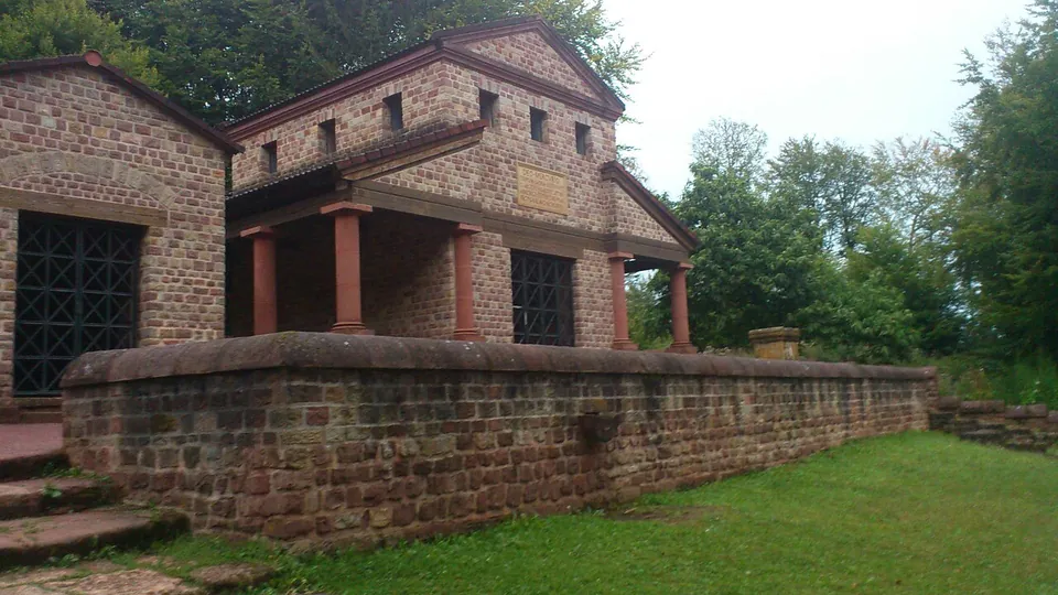
  13. A gabled temple of pale and red stone with a portico of red columns around its lower storey and a tall central block rising above it, standing behind a low stone enclosure wall on mown grass, with a smaller stone building with a grilled doorway at the left and woodland behind.

    Photo: Ecemaml · CC BY-SA 3.0 · Commons

    sanctuary · Rhineland-Palatinate

    Roman temple of Tawern

    Inside a walled precinct of about 46 × 36 m (de.wikipedia), the main temple has been rebuilt: a Gallo-Roman ambulatory temple with a portico on three sides, Tuscan columns, and a central chamber, the cella, rising above the portico roof.

    Show on map: Roman temple of Tawern
    1st c. BC – 4th c. ADFree
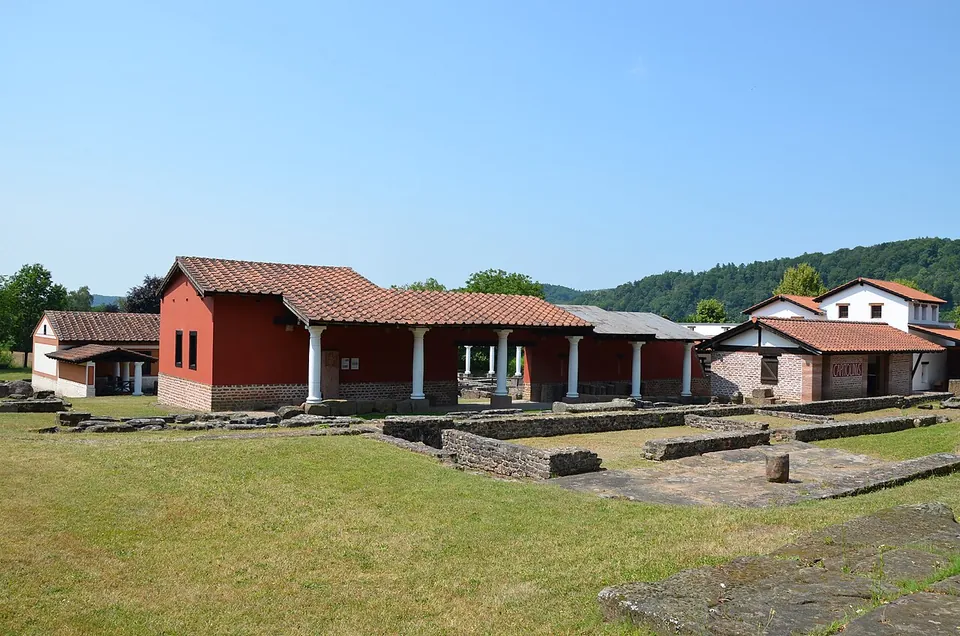
  14. Lawns crossed by the low stone foundation walls of excavated buildings, and beyond them a row of rebuilt Roman houses with red and white rendered walls, tiled roofs and a portico of white columns along the street front.

    Photo: Carole Raddato from FRANKFURT, Germany · CC BY-SA 2.0 · Commons

    city · Saarland

    Schwarzenacker

    The town covered 25 to 30 hectares, and about one hectare of it has been excavated (de.wikipedia).

    Show on map: Schwarzenacker
    1st – 3rd c. ADTicketed
  15. A square of rebuilt rubble-stone walls stands on a broader, lower walled platform carpeted with autumn leaves, with two pale altar stones set against it on either side of an entrance and woodland behind.

    Photo: Klaus Littmann · CC BY-SA 3.0 · Commons

    sanctuary · North Rhine-Westphalia

    Tempelbezirk Pesch

    Be clear about what is original.

    Show on map: Tempelbezirk Pesch
    1st – 5th c. ADFree
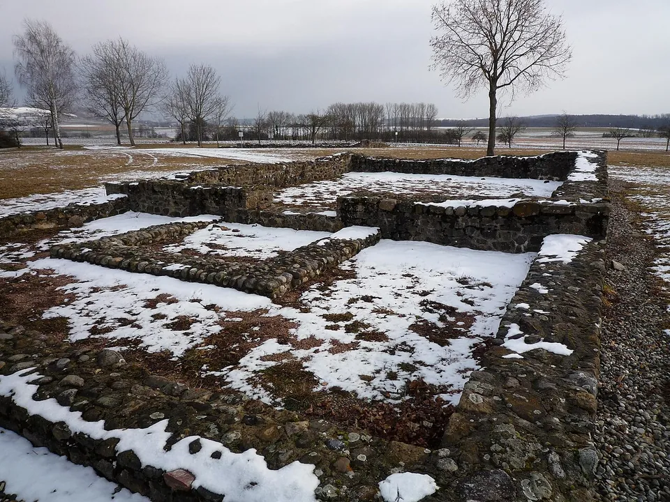
  16. Low walls of rounded stones outline a rectangular building divided into compartments, patched with snow, with a bare tree and open farmland behind.

    Photo: Kauk0r · CC BY-SA 3.0 · Commons

    villa · Baden-Württemberg

    Villa rustica of Büßlingen

    The walls are what you see, and they are low: the town of Tengen describes the farm as almost completely restored in its foundations, and de.wikipedia says the ground plans were rebuilt with modern methods, completing whatever original masonry survived.

    Show on map: Villa rustica of Büßlingen
    1st – 3rd c. ADFree
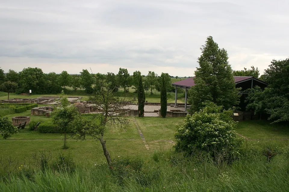
  17. Looking across rough grass and young trees from a low rise to the excavated main building, its low walls laid out on a mown lawn with a dark-roofed shelter over one end, and a belt of trees and open country beyond.

    Photo: Haselburg-müller · CC BY-SA 3.0 · Commons

    villa · Rhineland-Palatinate

    Villa rustica of Wachenheim

    The site covers about 1.5 hectares (de.wikipedia; the operator gives 15,000 m², the same figure).

    Show on map: Villa rustica of Wachenheim
    1st – 5th c. ADUnknown
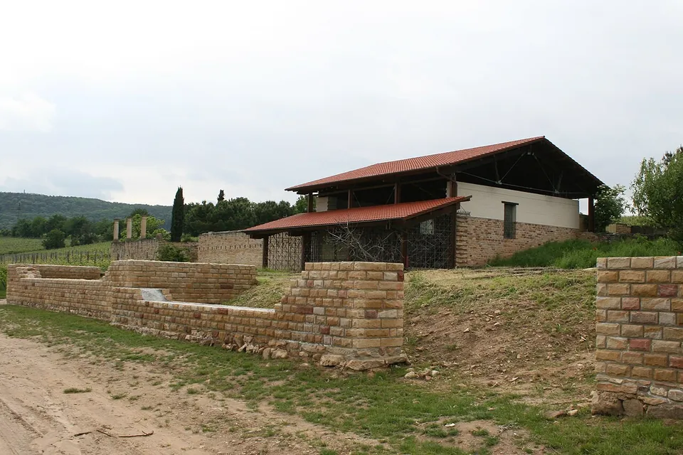
  18. Low walls of pale squared stone with red-brick courses step up a grassy slope towards a long building with red tiled roofs on two levels, its upper storey open-sided, with vineyards and wooded hills to the left.

    Photo: Haselburg-müller · CC BY-SA 3.0 · Commons

    villa · Rhineland-Palatinate

    Villa rustica of Weilberg

    What you walk round is an open-air museum, and much of it is reconstruction on original foundations.

    Show on map: Villa rustica of Weilberg
    1st – 5th c. ADFree
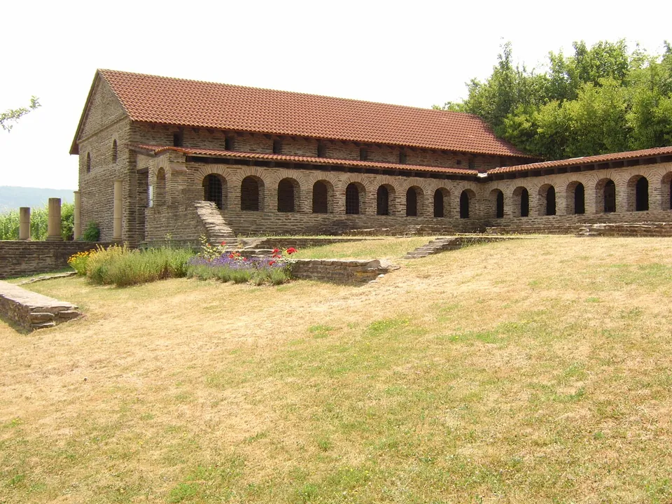
  19. A long single-storey building of grey rubble stone with brick bands and a red tiled roof, fronted by an arcade of round arches, standing behind a mown lawn with low walls, flower beds and a column base in the foreground.

    Photo: Areks · CC BY-SA 3.0 · Commons

    villa · Rhineland-Palatinate

    Villa urbana of Longuich

    What you see first is a long stone building with a tiled roof and an arcade of round arches.

    Show on map: Villa urbana of Longuich
    1st – 4th c. ADFree
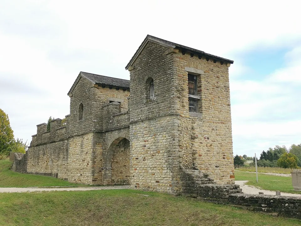
  20. Two tall square towers of yellowish rubble stone with dark pitched roofs flank a round-arched gateway, joined to a crenellated stretch of wall that runs off to the left, with a gravel path and mown grass in front.

    Photo: Z thomas · CC BY-SA 4.0 · Commons

    fort · Baden-Württemberg

    Welzheim East Roman Fort
    The gate is the thing to see: a twin-towered entrance with a passage 3.6 m wide, rebuilt together with a section of the wall (de.wikipedia).

    Show on map: Welzheim East Roman Fort
    2nd – 3rd c. ADFree
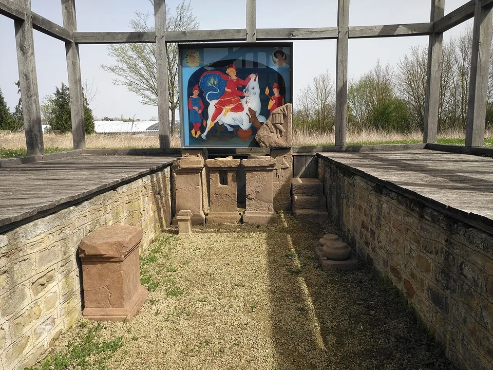
  21. Inside a roofless rectangular building, two long stone-faced benches with plank tops flank a gravel aisle that leads to a stone base and steps at the far end, above which a brightly painted panel shows a figure in a red cloak on a white bull; a bare timber frame stands over it all.

    Photo: RSchreg · CC BY 4.0 · Commons

    temple · Baden-Württemberg

    Güglingen Mithraeum

    The excavated ground that was not built over is now an open-air site, the Archäologische Freilichtanlage, in the Ochsenwiesen/Steinäcker industrial estate south of the river Zaber (the operator).

    Show on map: Güglingen Mithraeum
    2nd – 3rd c. ADFree
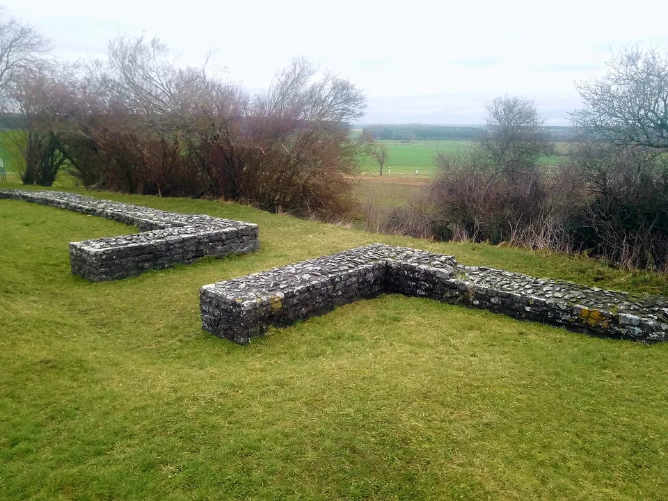
  22. Two low walls of grey stone blocks laid in a meadow, one bending at a right angle, with bare shrubs behind them and flat farmland and a line of woodland on the horizon.

    Photo: Granpar · CC BY-SA 4.0 · Commons

    fort · Baden-Württemberg
    Kleinkastell Haselburg

    Kleinkastell Haselburg is the site of a small Roman fort on the Limes, the frontier of the empire, in open farmland between the villages of Reinhardsachsen and Gerolzahn near Walldürn.
    Show on map: Kleinkastell Haselburg
    2nd – 3rd c. ADFree
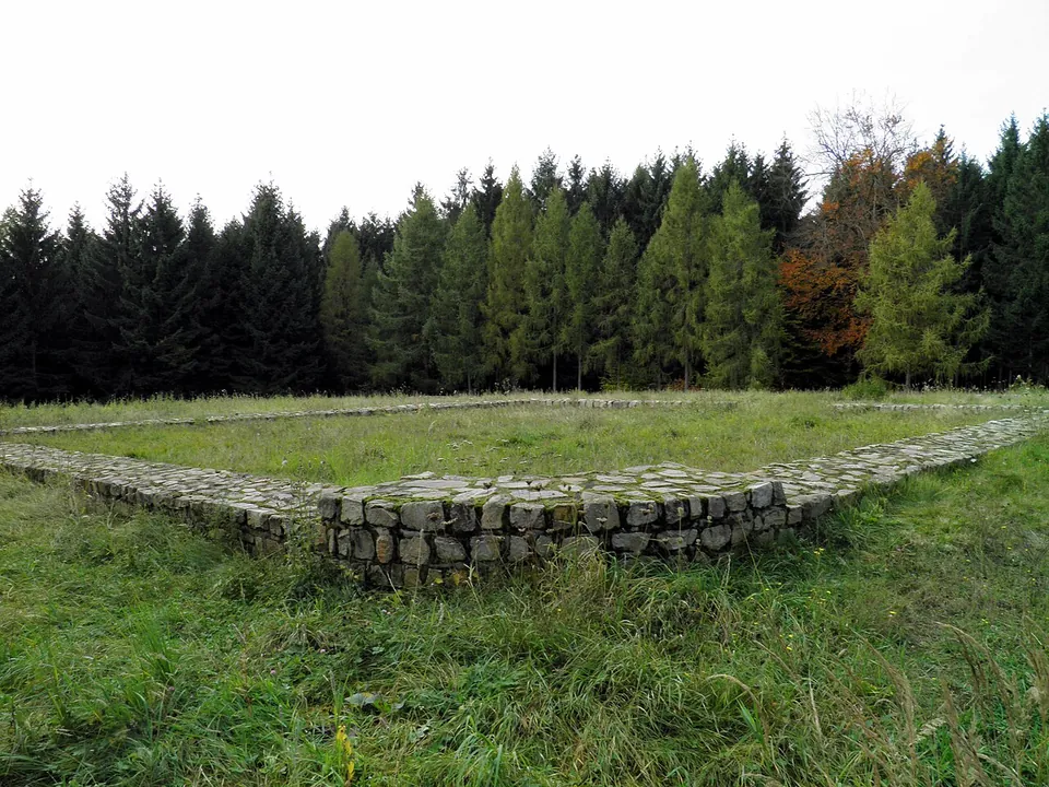
  23. A corner of low stone wall, a few courses high, enclosing a mown grass area, with spruce trees beyond.

    Photo: Carole Raddato from FRANKFURT, Germany · CC BY-SA 2.0 · Commons

    fort · Rhineland-Palatinate
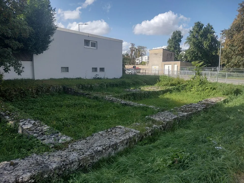
    Kleinkastell Hillscheid

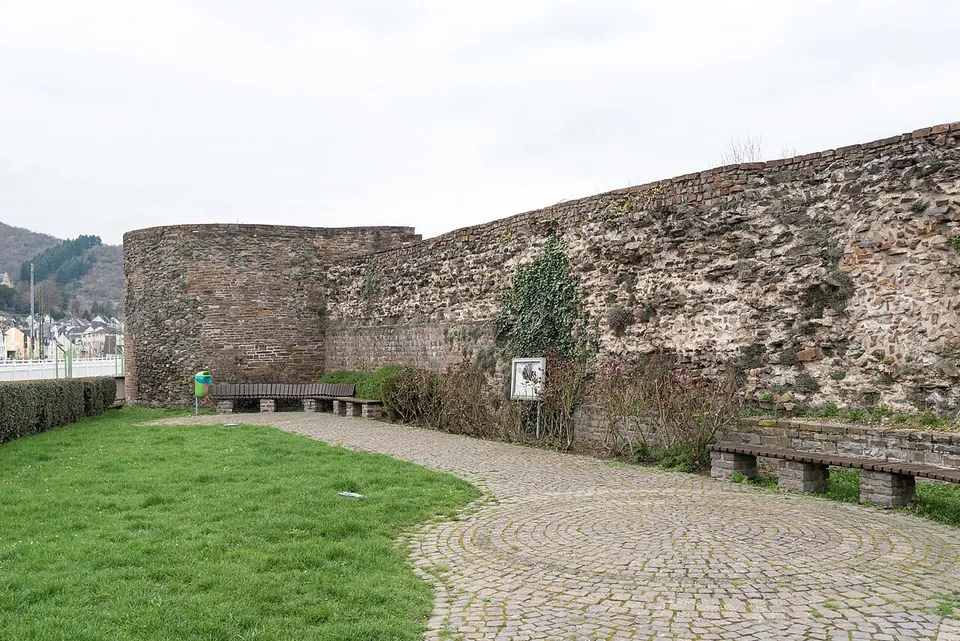
    The fort's outline lies in a clearing in the Hillscheid forest.

    Show on map: Kleinkastell Hillscheid
    2nd – 3rd c. ADFree
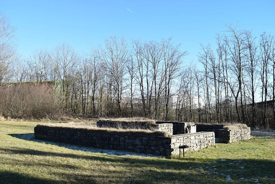
  24. A low rectangular wall of grey rubble stone with a flat top standing in rough grass, enclosing a smaller square of the same walling, with bare trees and the roof of an industrial building behind on a sunny winter day.

    Photo: Marcin-Janek · CC BY-SA 4.0 · Commons

    temple · North Rhine-Westphalia

    Tempelheiligtum Zingsheim

    Two squares of grey rubble wall, one inside the other.

    Show on map: Tempelheiligtum Zingsheim
    2nd – 4th c. ADFree
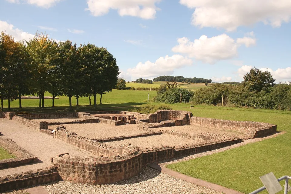
  25. Low conserved stone foundations of a large building laid out in mown grass, with gravel paths, small information panels and a few visitors among them, and trees and houses beyond.

    Photo: Holger Uwe Schmitt · CC BY-SA 4.0 · Commons

    fort · Baden-Württemberg

    Castra of Aalen

    Most of the fort is out of reach.

    Show on map: Castra of Aalen
    2nd – 3rd c. ADTicketed
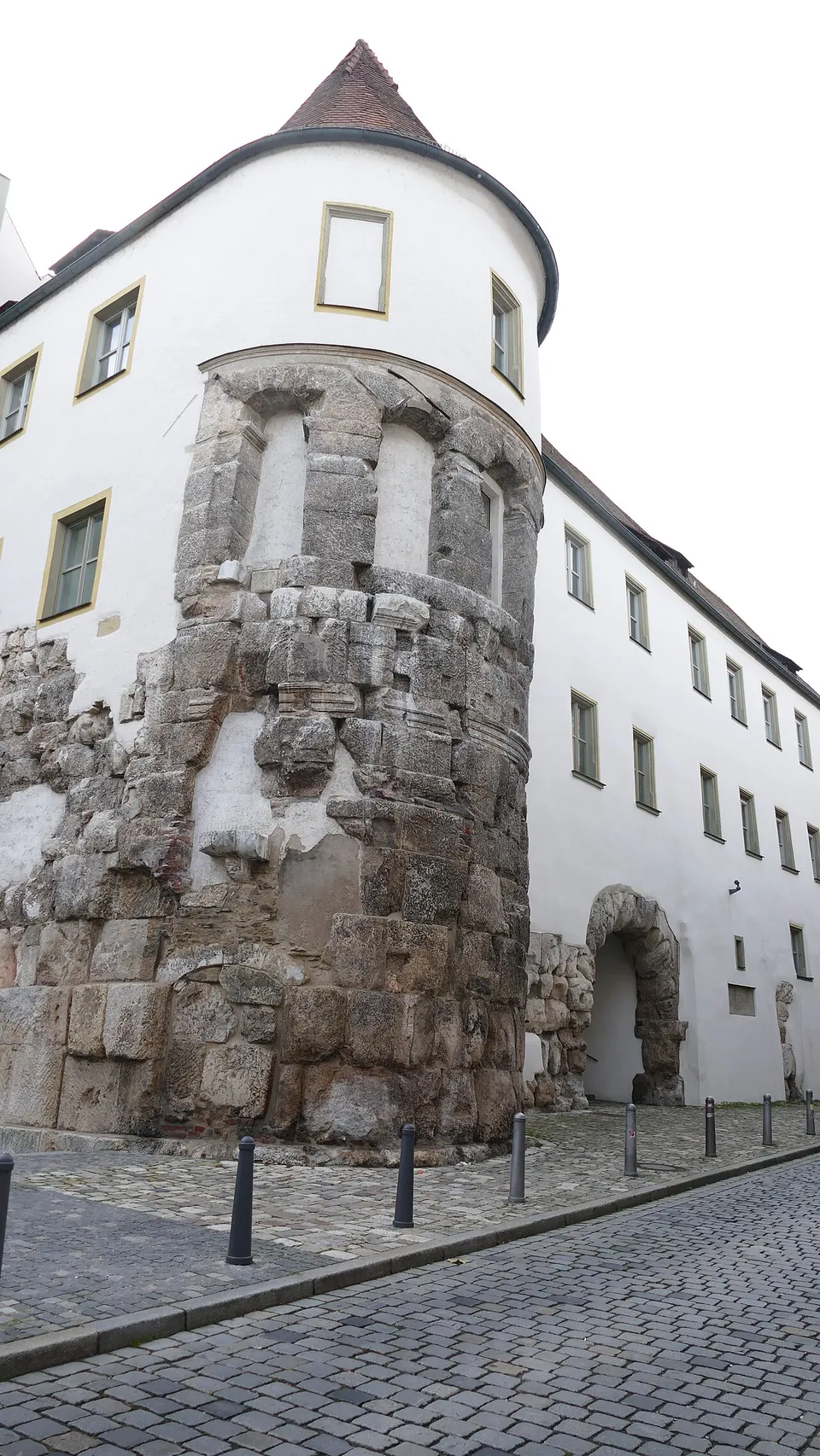
  26. A round tower of rough, weathered limestone blocks rising out of the corner of a white-rendered building with a later conical roof, and beyond it a round-headed stone arch at the foot of the same building, beside a cobbled street.

    Photo: Amrei-Marie · CC BY-SA 4.0 · Commons

    fort · Bavaria

    Castra Regina

    The gate is the thing to see.

    Show on map: Castra Regina
    2nd – 7th c. ADFree
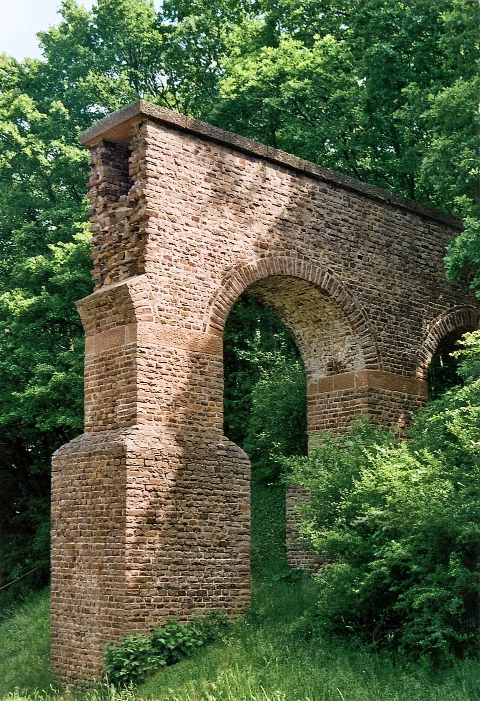
  27. Tall square piers of brownish stone carrying round arches and a flat top, with reddish stone bands where the arches spring, standing in long grass with woodland behind.

    Photo: Mediatus · CC BY-SA 3.0 · Commons

    aqueduct · North Rhine-Westphalia

    Eifel Aqueduct

    Very little of the aqueduct ever stood above ground, and most of what did was quarried away in the Middle Ages (de.wikipedia).

    Show on map: Eifel Aqueduct
    1st – 3rd c. ADFree
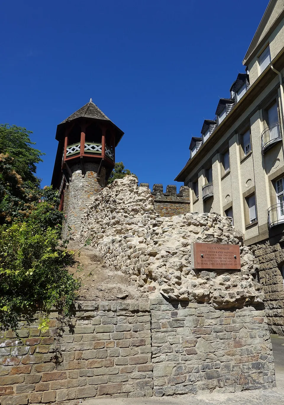
  28. A high stretch of rough wall of irregular stones bedded in mortar, carrying a metal plaque, rises above a lower base of neatly coursed squared stone. Behind it stand a round tower with a red timber gallery and a crenellated wall pierced by an arch.

    Photo: Geolina163 · CC BY-SA 4.0 · Commons

    city · Hesse

    Aquae Mattiacae

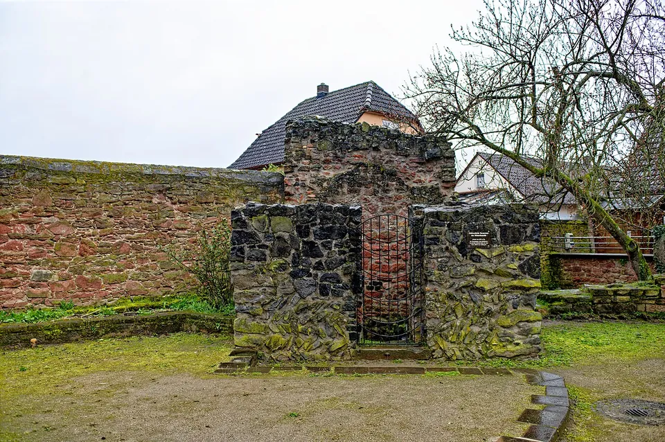
    The wall has been traced for 520 m through the old town, but only two short stretches stand above ground, one on each side of the Römertor (the city's Stadtlexikon), about 80 m in all (de.wikipedia).

    Show on map: Aquae Mattiacae
    1st c. BC – 7th c. ADFree
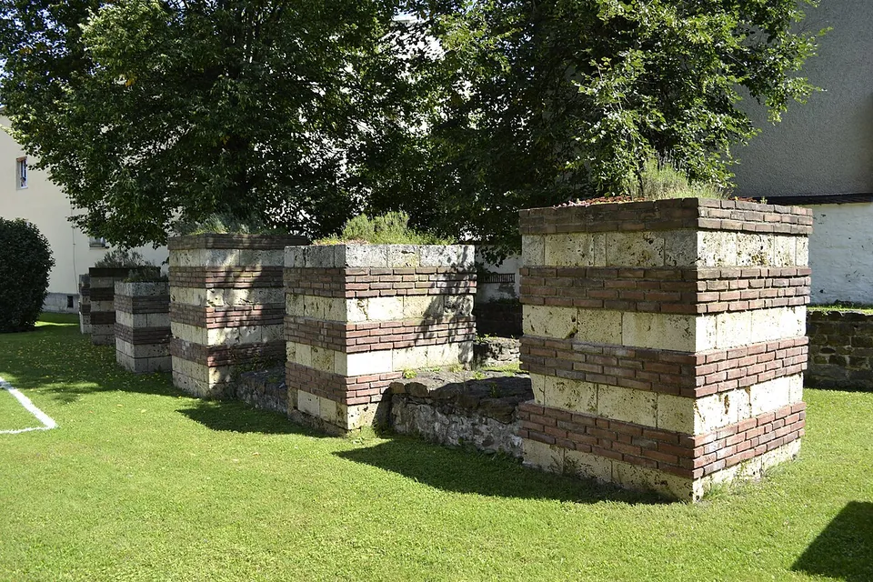
  29. A row of square pillar stumps built of alternating bands of pale tuff blocks and red brick, standing on a lawn beside a low rubble wall, with trees behind.

    Photo: High Contrast · CC BY 3.0 de · Commons

    fort · Bavaria

    Boiotro

    The remains lie in the Römergarten, the museum's garden.

    Show on map: Boiotro
    3rd – 5th c. ADTicketed
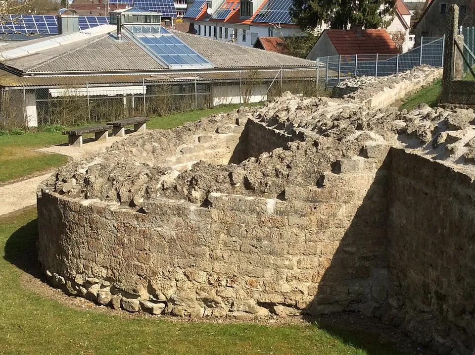
  30. A low semicircular tower base of roughly squared pale stone, its top left rough and uneven, joined to a straight stretch of wall that runs back past a wire fence towards houses with solar panels on their roofs.

    Photo: Werner Doenni · CC BY-SA 3.0 · Commons

    fort · Bavaria

    Caelius Mons

    The fort itself is almost entirely built over by the village (de.wikipedia).

    Show on map: Caelius Mons
    3rd – 5th c. ADFree
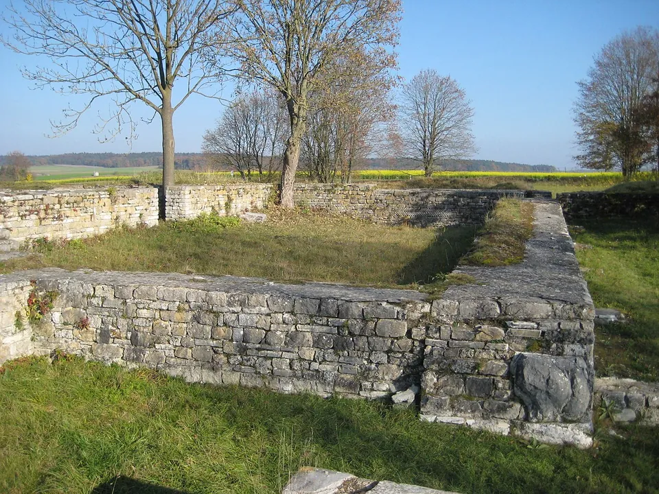
  31. Low walls of squared pale stone blocks enclosing a grassed rectangular room, with leafless trees and open fields beyond under a clear blue sky.

    Photo: WolfgangRieger · Public domain · Commons

    fort · Bavaria

    Castra Abusina

    The fort covered about 1.8 hectares, 147 by 125 metres (de.wikipedia), and its ground is now a small archaeological park in which the main buildings are marked out by low walls.

    Show on map: Castra Abusina
    1st – 5th c. ADUnknown
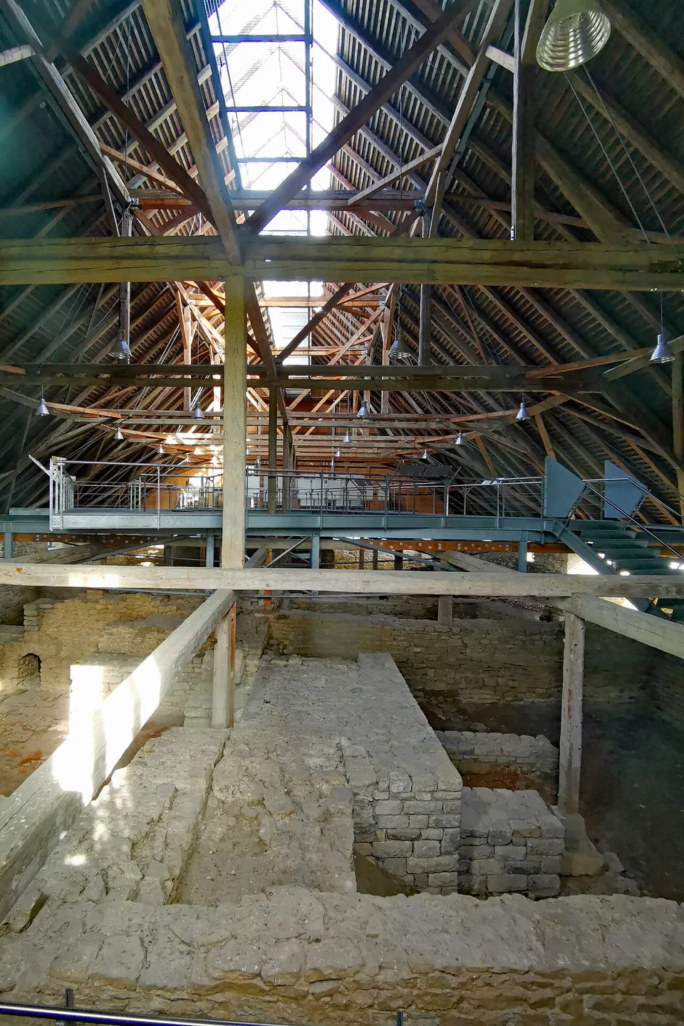
  32. Inside the shelter, low walls of pale rubble stone fill the floor beneath a timber roof structure, with a metal walkway crossing above them and daylight from a roof light.

    Photo: PaulT (Gunther Tschuch) · CC BY-SA 4.0 · Commons

    bath · Baden-Württemberg

    Castra Brigobannis

    One building.

    Show on map: Castra Brigobannis
    1st – 3rd c. ADTicketed
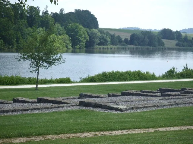
  33. Low foundation walls of grey stone laid out on gravel in a mown lawn, a path beyond them, and the lake with wooded hills behind.

    Photo: Veit Feger · Public domain · Commons

    fort · Baden-Württemberg

    Castra of Buch

    Not much stands, but the site is laid out so that you can read it.

    Show on map: Castra of Buch
    2nd – 3rd c. ADFree
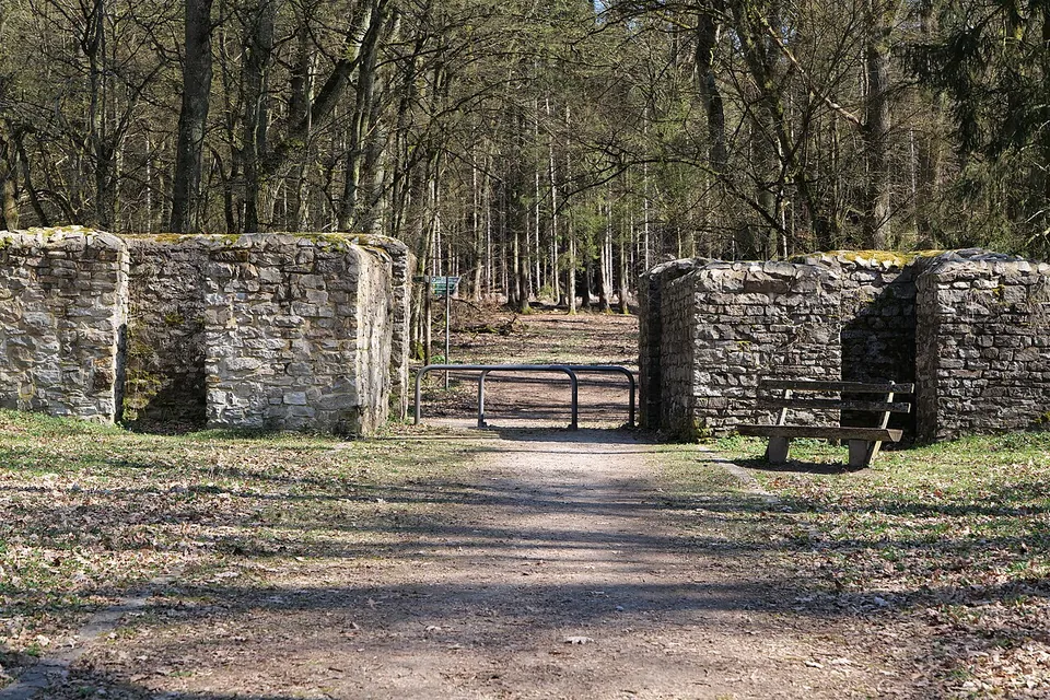
  34. A gravel path running through a gap between two square blocks of stone masonry about head height, with a bench and a metal barrier in the opening and bare beech woodland behind.

    Photo: Leonhard Lenz · CC0 · Commons

    fort · Hesse

    Castra of Kapersburg

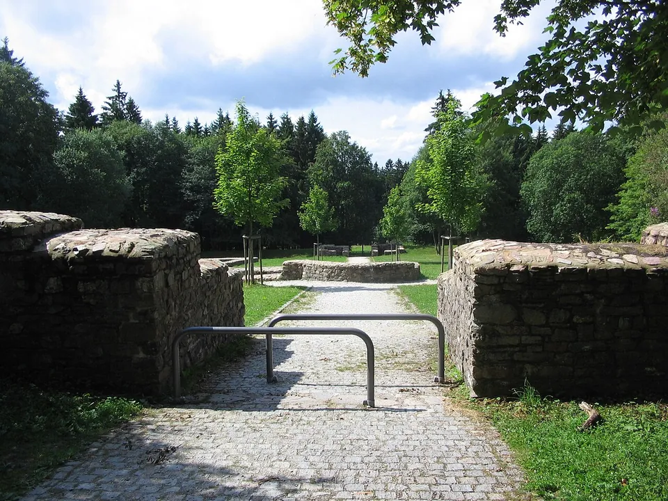
    The fort sits in a forest clearing in front of a hill called the Saukopf and covers 134 by 122 m, about 1.6 hectares (the operator).

    Show on map: Castra of Kapersburg
    1st – 3rd c. ADFree
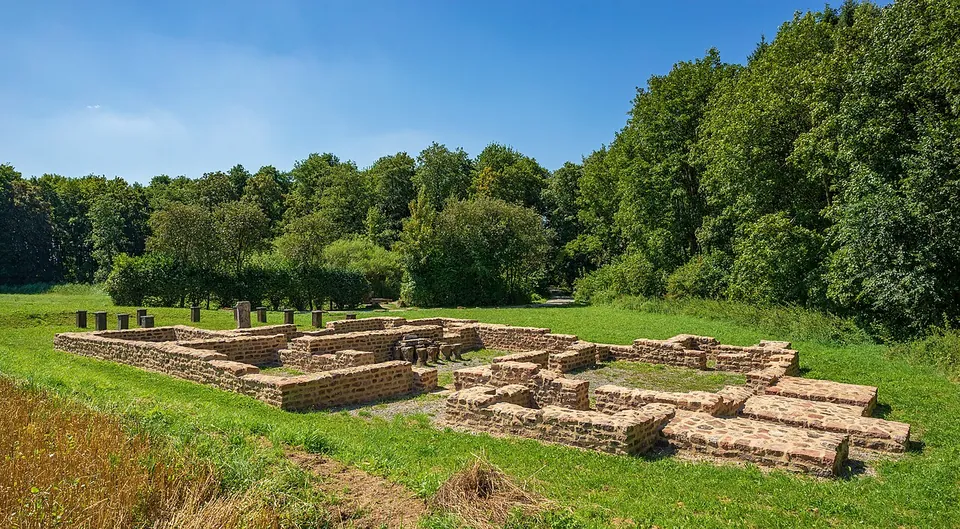
  35. Low walls of reddish sandstone blocks laid out on mown grass in a row of rectangular rooms, a few stone pillars standing in one of them, with woodland behind under a blue sky.

    Photo: Roman Eisele · CC BY-SA 4.0 · Commons

    fort · Baden-Württemberg

    Castra of Walldürn

    Be clear about this before you go: the fort itself has gone.

    Show on map: Castra of Walldürn
    2nd – 3rd c. ADFree
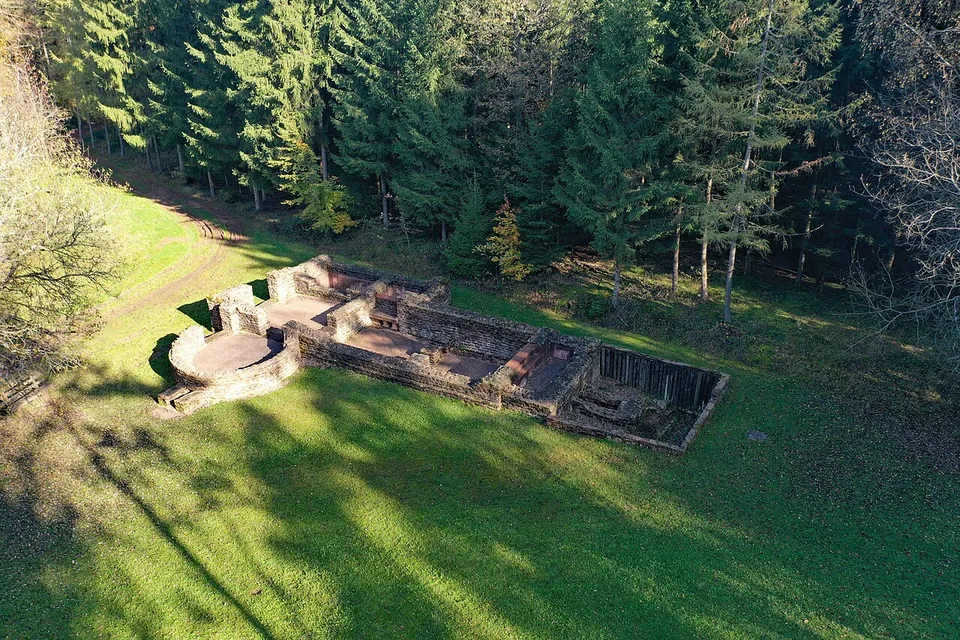
  36. An oblique aerial view of a long, narrow building laid out in low stone walls on grass, divided into a row of rooms, with a round room at its near end and a timber-lined area at the far end, at the edge of a spruce forest.

    Photo: PaulT (Gunther Tschuch) · CC BY-SA 4.0 · Commons

    fort · Hesse

    Castra of Würzberg

    Two things, a short walk apart.

    Show on map: Castra of Würzberg
    1st – 2nd c. ADFree
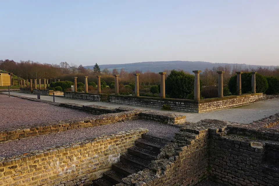
  37. Two rows of stone columns stand on a low wall in front of clipped hedges and small trees; in the foreground, rebuilt stone walls and a short flight of steps lead down into a gravel-filled room of the villa, in evening light.

    Photo: Starkiller3010 · CC BY-SA 4.0 · Commons

    villa · Saarland

    European Archaeological Park of Bliesbruck-Reinheim

    On the German side, the villa is the Roman site.

    Show on map: European Archaeological Park of Bliesbruck-Reinheim
    1st – 5th c. ADFree
  38. A ragged fragment of wall several metres high, built of grey rubble stone laid in courses with bands of red brick and pierced by a round-arched brick opening, with a lower stretch of wall beside it and bare rock and grass in front; clipped hedges and wooded hills behind.

    Photo: Johannes Simon · Public domain · Commons

    villa · Rhineland-Palatinate

    Kaiservilla Konz

    The piece the tourist board points to is part of a cold-water basin, about 4 m high.

    Show on map: Kaiservilla Konz
    3rd – 7th c. ADFree
  39. Low walls of pale rubble stone, about knee high, outline a row of rectangular rooms in long grass, with a plain white building and a street railing behind.

    Photo: Heiko Fischer · CC BY-SA 4.0 · Commons

    fort · Rhineland-Palatinate

    Kastell Alzey

    The fort was large, a slightly skewed square of 163.5 by 159 m covering 2.6 hectares, with walls up to 3 m thick and, probably, fourteen towers around 12 m high (de.wikipedia; regionalgeschichte.net gives the walls as up to 3.5 m thick).

    Show on map: Kastell Alzey
    4th – 5th c. ADFree
  40. A long, tall wall of rough grey and brown rubble stone ending in a massive round tower, with benches and a small information board at its foot, a curving cobbled path and a lawn in front.

    Photo: Tilman2007 · CC BY-SA 4.0 · Commons

    fort · Rhineland-Palatinate

    Kastell Boppard

    The longest exposed stretch is in the park at Kirchgasse and Angertstraße, on the south side of the fort.

    Show on map: Kastell Boppard
    4th – 7th c. ADFree
  41. A short, squat ruin of dark rubble stone standing on a gravel and grass plot, with a barred iron door set into its front; a taller wall of red sandstone runs behind it, with houses beyond.

    Photo: Tilman2007 · CC BY-SA 4.0 · Commons

    fort · Hesse

    Kastell Großkrotzenburg

    The best piece is the south-west corner tower, beside the local museum.

    Show on map: Kastell Großkrotzenburg
    1st – 3rd c. ADFree
  42. A cobbled path running between two thick, low stone walls that form a gateway, with a low curved wall standing in the grass beyond and spruce forest behind.

    Photo: Brühl · Public domain · Commons

    fort · Hesse

    Kastell Kleiner Feldberg

    The fort is a clearing in the forest with its complete ground plan laid out in low stone walls: a rectangle of 78 by 93 m with rounded corners and gateways in its sides, and, at the centre, the headquarters building (principia) with the curved apse of its shrine of the standards (de.wikipedia; the operator).

    Show on map: Kastell Kleiner Feldberg
    2nd – 3rd c. ADFree
  43. The front of the glass shelter seen square on, with a pale printed screen in the shape of a tall gatehouse hanging inside it above low stone walls, and a row of information panels along the glass.

    Photo: Holger Uwe Schmitt · CC BY-SA 4.0 · Commons

    gate · Baden-Württemberg

    Limes gate Dalkingen

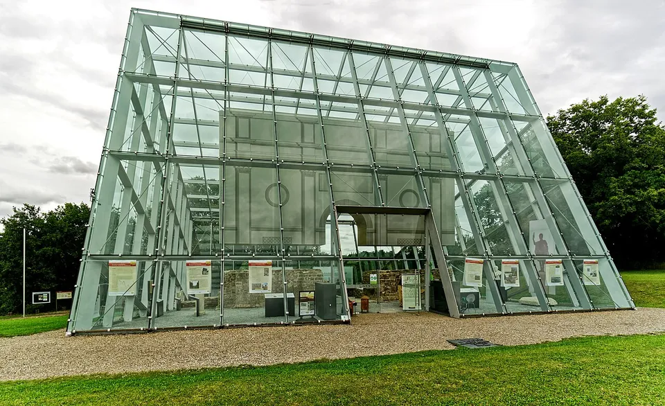
    The stone walls of the gatehouse, excavated in 1973–74 and restored for display, now stand inside a glass-and-steel shelter built in 2010.

    Show on map: Limes gate Dalkingen
    2nd – 3rd c. ADFree
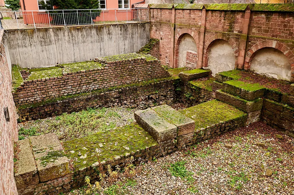
  44. A sunken, walled excavation beside the street, its floor taken up by low, moss-covered masonry walls and steps of red brick and sandstone, with a red sandstone wall of blind arches and a plain concrete retaining wall around it and a railing at street level.

    Photo: Tilman2007 · CC BY-SA 4.0 · Commons

    city · Baden-Württemberg

    Lopodunum

    The Roman town lies under the medieval one, so what you see is a series of conserved fragments.

    Show on map: Lopodunum
    1st – 4th c. ADFree
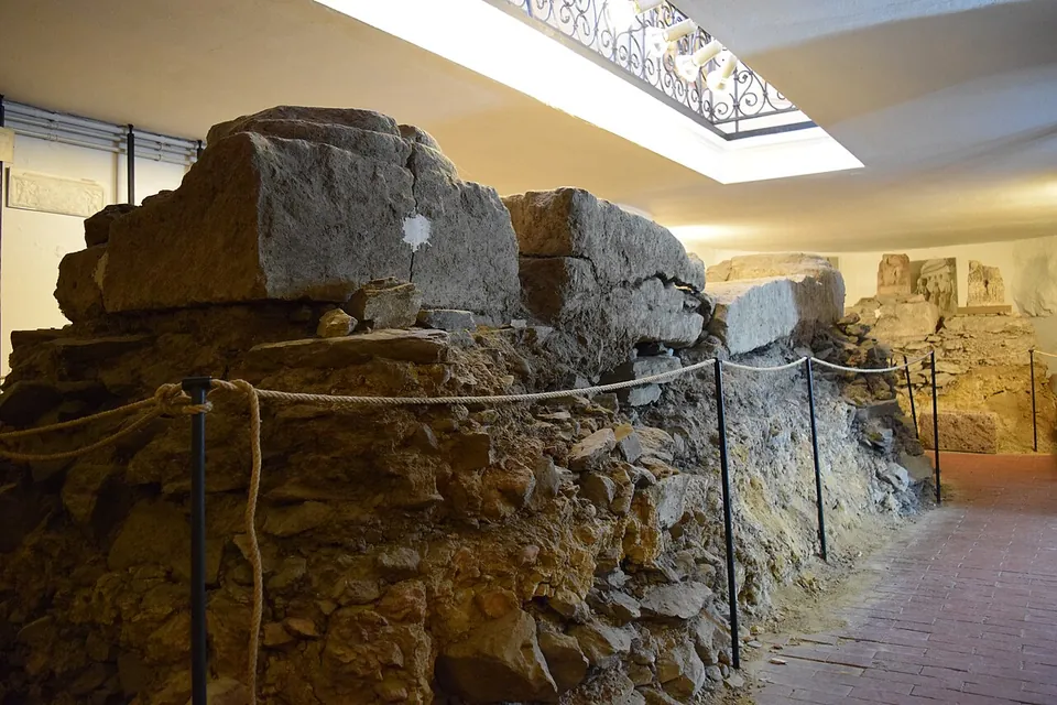
  45. Large squared stone blocks resting on a rough rubble foundation in a basement room, roped off beside a brick-paved floor, with a skylight framed by an ornamental iron railing overhead and carved stones displayed further back.

    Photo: Marcin-Janek · CC BY 3.0 · Commons

    fort · Rhineland-Palatinate

    Rigomagus

    The Römisches Museum occupies a 15th-century chapel on Kirchstraße.

    Show on map: Rigomagus
    1st c. BC – 4th c. ADFree
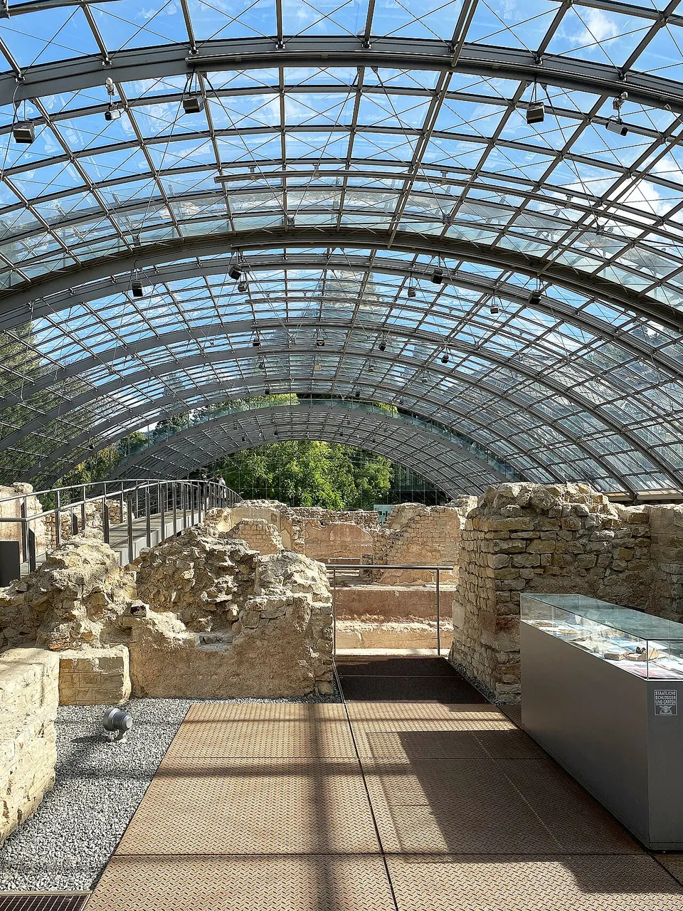
  46. Under a vaulted roof of steel and glass, rough wall stumps and squared stone blocks stand on either side of a walkway, with a glass display case at the right and a raised viewing gallery behind.

    Photo: W. Bulach · CC BY-SA 4.0 · Commons

    bath · Baden-Württemberg

    Roman baths of Badenweiler

    The ruin is the plan of the bath building laid out at ground level: wall stumps and the sunken bathing pools, some lined with limestone slabs (de.wikipedia).

    Show on map: Roman baths of Badenweiler
    1st – 3rd c. ADTicketed
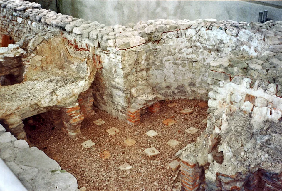
  47. Inside a covered building, low walls of pale rubble stone curve round into an apse; the floor is reddish gravel dotted with small square tiles, and at the left a broken mortar basin stands raised on short stacks of red brick.

    Photo: Libellchen · CC BY-SA 3.0 · Commons

    villa · Bavaria

    Roman settlement Tegelberg

    The bath house is the thing to see.

    Show on map: Roman settlement Tegelberg
    2nd – 3rd c. ADFree
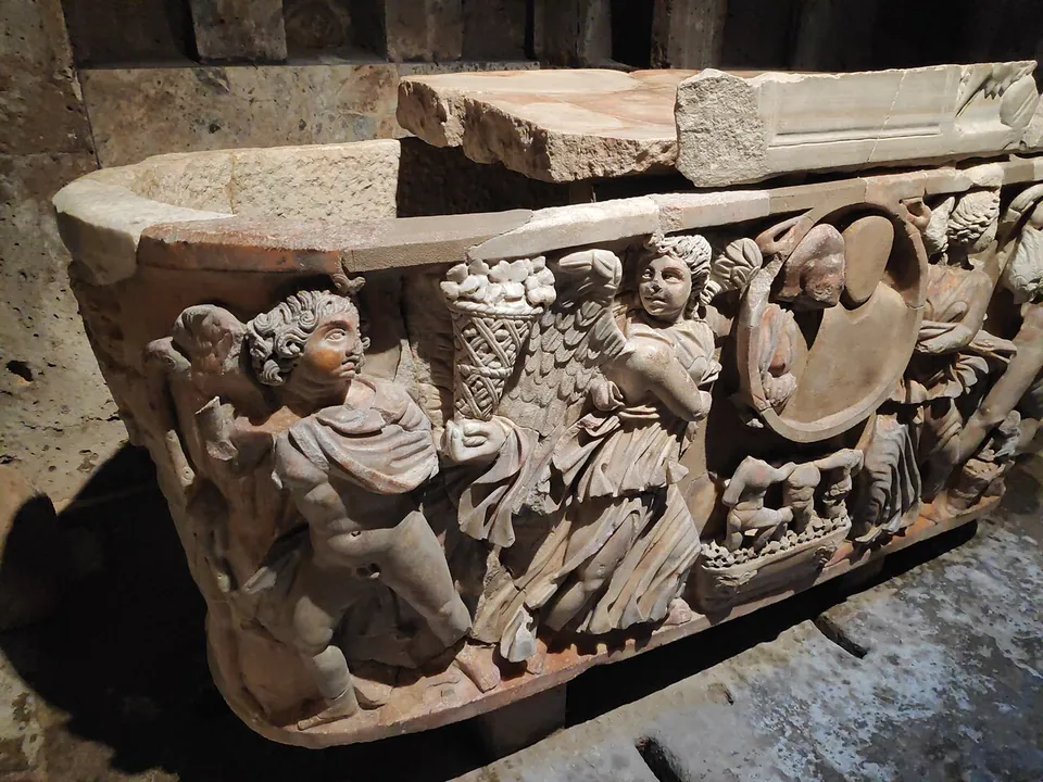
  48. A marble tub-shaped sarcophagus seen at an angle in a dim stone chamber, its front carved in high relief with standing figures, some winged and some in flowing drapery, a basket of fruit and a round medallion; a separate lid lies on top.

    Photo: Konrad Förstner · CC0 · Commons

    tomb · North Rhine-Westphalia

    Römergrab Köln-Weiden

    A flight of stairs takes you down to a doorway about six metres below ground and into a single vaulted room built of tuff stone, roughly 3.6 by 4.4 metres and 4 metres high under the vault.

    Show on map: Römergrab Köln-Weiden
    2nd – 4th c. ADTicketed
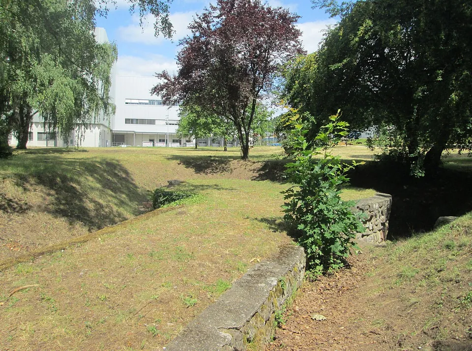
  49. A low wall of rough stone blocks with a flat capping runs along the edge of a grassy hollow in a park, with trees on either side and a large modern white building behind.

    Photo: AnRo0002 · CC0 · Commons

    fort · Saarland

    Römerkastell Saarbrücken

    Low restored foundation walls in a small park on a street called An der Römerbrücke, in the St. Johann district.

    Show on map: Römerkastell Saarbrücken
    1st – 5th c. ADFree
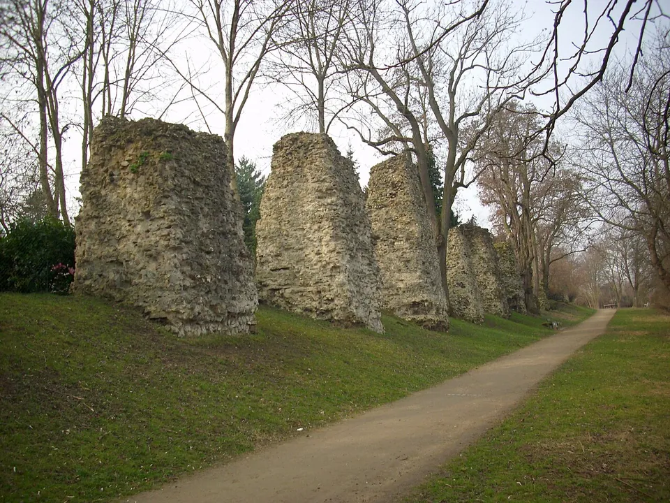
  50. A row of rough, weathered masonry stumps of rubble and mortar standing on a grassy bank beside a gravel path under bare winter trees.

    Photo: Nixnubix · CC BY-SA 4.0 · Commons

    aqueduct · Rhineland-Palatinate

    Römersteine

    Along the path stands a line of rough masonry stumps, the cores of the piers that once carried the water channel across the valley.

    Show on map: Römersteine
    1st – 3rd c. ADFree
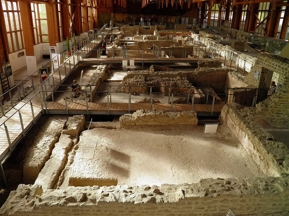
  51. Inside a long timber-framed hall with tall windows, the excavated rooms of the villa's main house spread out below - low walls of rubble stone around pale floors - crossed by raised metal walkways with railings.

    Photo: Carole Raddato from FRANKFURT, Germany · CC BY-SA 2.0 · Commons

    villa · Rhineland-Palatinate

    Römervilla von Bad Neuenahr-Ahrweiler

    The house is 72 m long and 18 to 20 m deep (de.wikipedia), and walkways take you through and over its rooms.

    Show on map: Römervilla von Bad Neuenahr-Ahrweiler
    1st – 4th c. ADTicketed
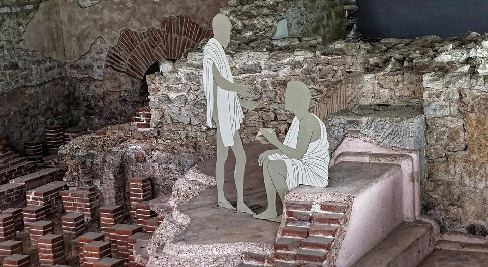
  52. Two flat grey cut-out figures of men in white tunics, one standing and one seated on a ledge of pink plaster, above rows of short brick pillars and a brick arch set in a rubble stone wall.

    Photo: Burkhard Mücke · CC BY-SA 4.0 · Commons

    bath · Bavaria

    Römische Thermen Weißenburg

    The ruins lie under the protective building, and you see them from a fixed circuit of walkways above them (de.wikipedia; the operator): the walls of the bathing rooms, their pools, and the rows of short brick pillars of the underfloor heating (hypocausts).

    Show on map: Römische Thermen Weißenburg
    1st – 3rd c. ADTicketed
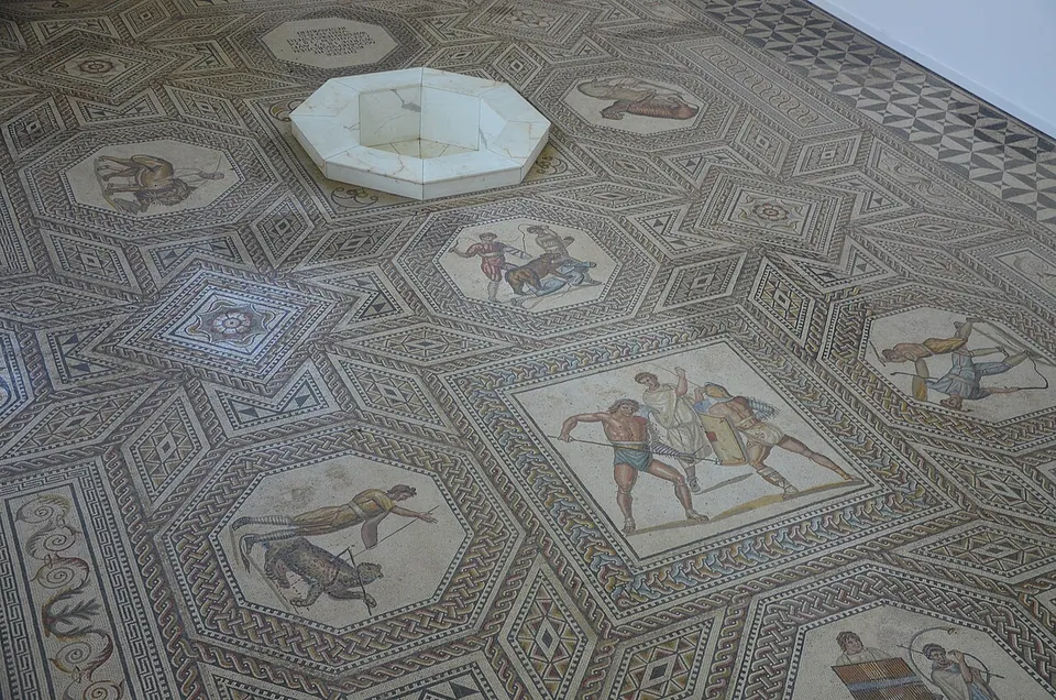
  53. A large floor mosaic seen at an angle, a grid of octagons and lozenges in geometric patterns framing small figured scenes of fighters and animals, with a white octagonal basin set into the floor near the top.

    Photo: Carole Raddato from FRANKFURT, Germany · CC BY-SA 2.0 · Commons

    villa · Saarland

    Römische Villa Nennig

    The mosaic is the site.

    Show on map: Römische Villa Nennig
    1st – 4th c. ADTicketed
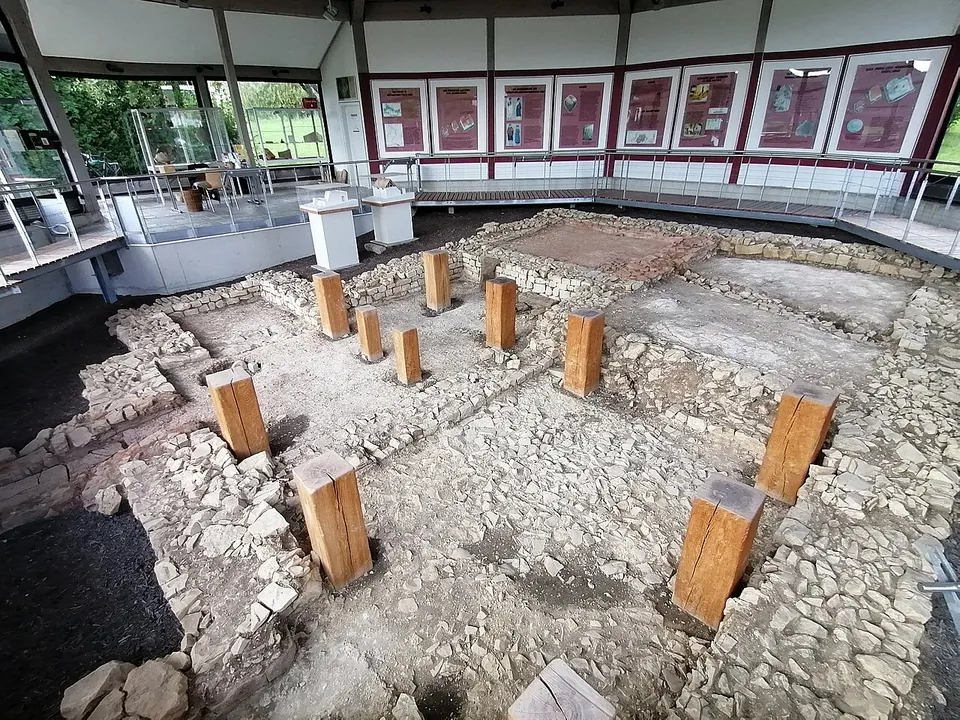
  54. Inside a glazed shelter, the low limestone rubble walls of a small building are laid out on the ground, divided into several rooms, with square timber posts standing upright among them and a patch of reddish floor at the back; a railed walkway and a row of display panels run round the edge.

    Photo: Schwartenmagen · CC BY-SA 4.0 · Commons

    bath · Baden-Württemberg

    Römisches Bad

    What you see are the bath's foundation walls, conserved where they were excavated and roofed over with a shelter that has been open to the public since May 1998, so a visit works in any weather (de.wikipedia; the operator).

    Show on map: Römisches Bad
    1st – 3rd c. ADUnknown
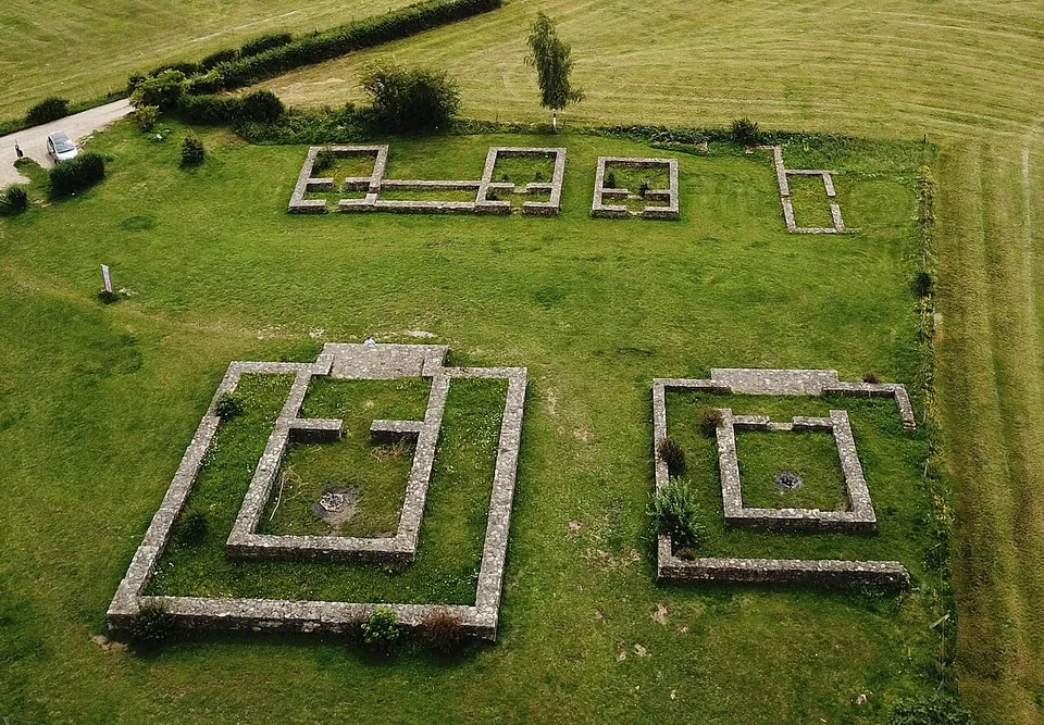
  55. A view from above of a mown meadow in which low stone walls trace the ground plans of several buildings. In the foreground two near-square temple plans each show a smaller room set inside a larger enclosure; behind them lie the plans of smaller rectangular buildings, with a track and fields beyond.

    Photo: Ladislaus Hoffner · CC BY-SA 4.0 · Commons

    temple · North Rhine-Westphalia

    Varnenum

    The foundations of the temples and several outbuildings were restored in 1989 and built back up to about a metre (de.wikipedia), so what you see is a set of ground plans in mown grass rather than standing ruins.

    Show on map: Varnenum
    1st c. BC – 3rd c. ADFree
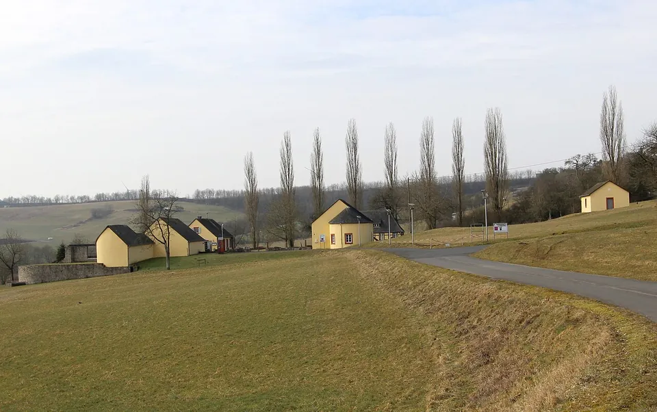
  56. A grassy hillside terrace with a lane running along it, a string of small yellow-rendered buildings with dark slate roofs and a row of tall bare poplars behind them, and rolling farmland on the horizon.

    Photo: Colling-architektur · CC BY-SA 3.0 · Commons

    villa · Rhineland-Palatinate

    Villa Otrang

    The remains of the manor house are protected by small shelter buildings put up by the Prussian state in the 19th century, now listed monuments in their own right (de.wikipedia; the operator).

    Show on map: Villa Otrang
    1st – 4th c. ADFree
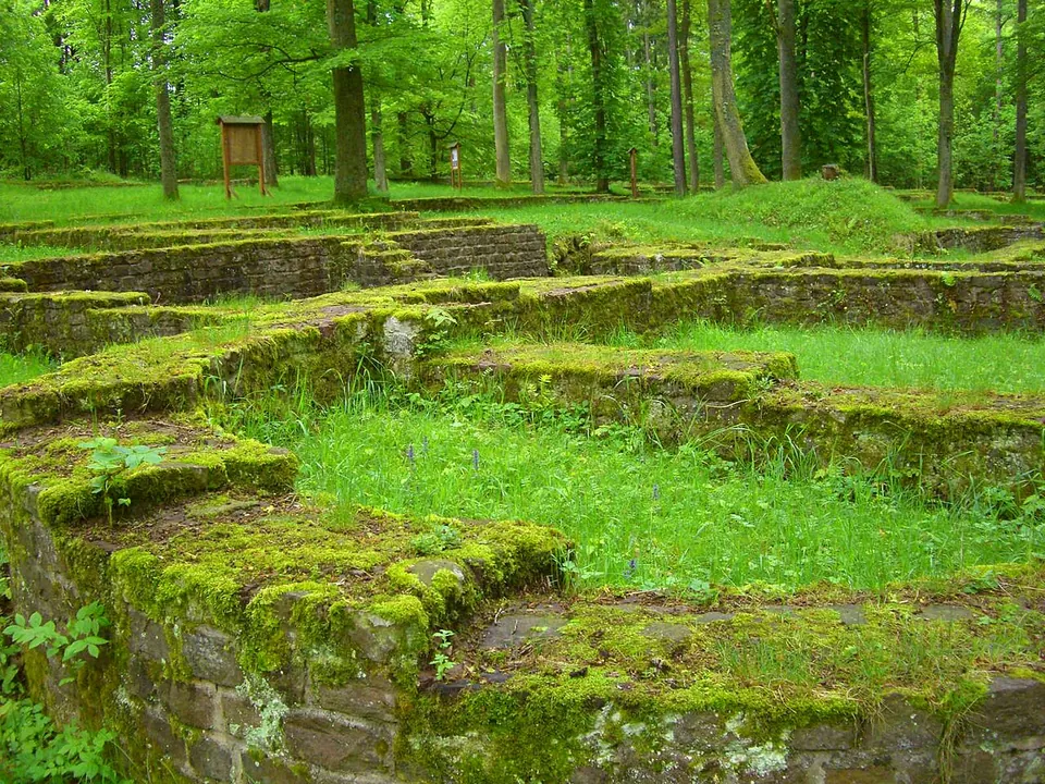
  57. Close view of moss-covered foundation walls of red-brown sandstone dividing a building into grassy rooms, with an information board among the trees behind.

    Photo: Dg-505 · CC BY 3.0 · Commons

    villa · Baden-Württemberg

    Villa rustica in the Kanzlerwald

    The estate survives as ground plans: low, conserved sandstone walls, capped with mortar, laid out on the forest floor among the trees.

    Show on map: Villa rustica in the Kanzlerwald
    1st – 3rd c. ADFree
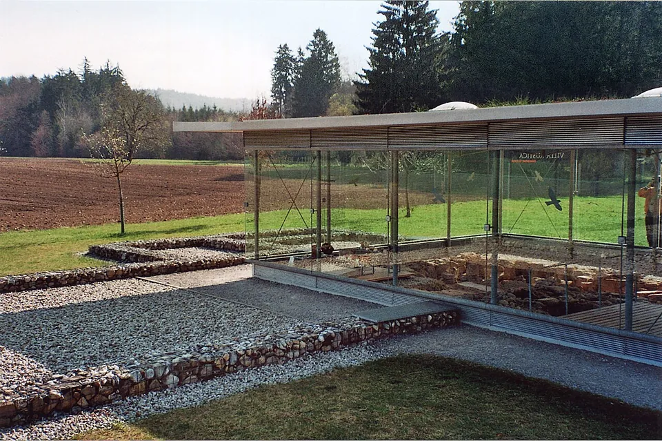
  58. A flat-roofed pavilion with glass walls standing over an excavated room of rough stones and brick pillars, with stone-filled wire baskets marking walls in the gravel in front of it and a ploughed field and trees behind.

    Photo: Mediatus (H.J.)/Wikimedia Commons · CC BY-SA 3.0 · Commons

    villa · Bavaria

    Villa rustica of Leutstetten

    The ground plan of the L-shaped main house, about 25 m long, is marked out with gabions, wire baskets filled with stones, set on the trenches left where the walls were robbed out (de.wikipedia; Gesellschaft für Archäologie und Geschichte – Oberes Würmtal).

    Show on map: Villa rustica of Leutstetten
    2nd c. ADFree
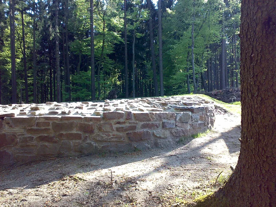
  59. A low dry-stone wall of flat, roughly squared stones running in a gentle curve across the foreground, with a sandy path along it and tall spruce trunks behind.

    Photo: Karsten11 · Public domain · Commons

    fort · Hesse

    Castellum of Heidenstock

    The fort measured 19.4 by 23.4 m, with the rounded corners of Roman forts of its time and a single gate facing the frontier (de.wikipedia).

    Show on map: Castellum of Heidenstock
    2nd – 3rd c. ADFree
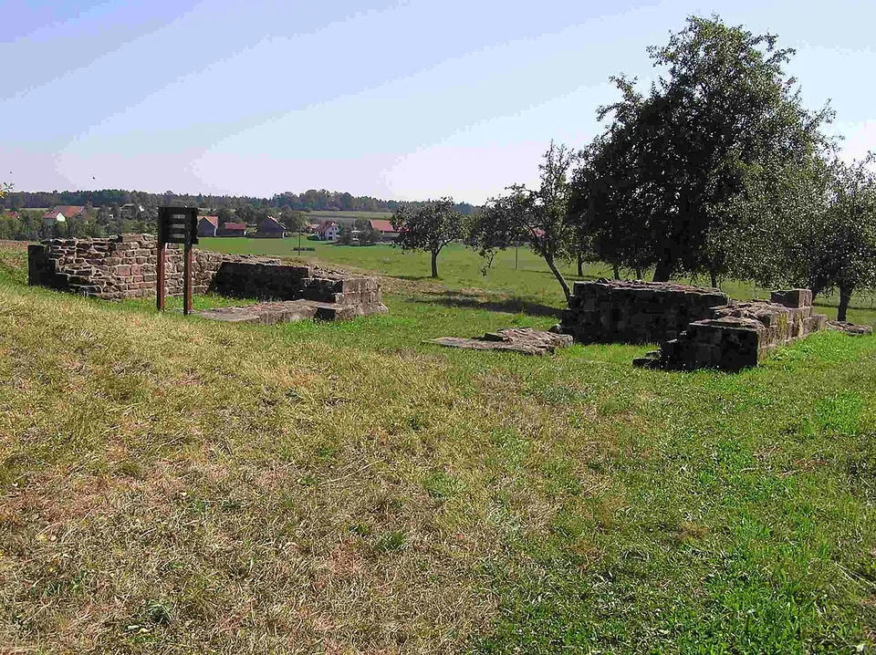
  60. Low blocks of squared red-brown sandstone masonry, about knee to waist high, laid out in the grass of an orchard meadow, with an information board on posts at the left and village houses in the distance.

    Photo: Schwing · Public domain · Commons

    fort · Baden-Württemberg

    Castra of Oberscheidental

    The one built thing to look at is the south gate, the porta principalis dextra.

    Show on map: Castra of Oberscheidental
    1st – 2nd c. ADFree
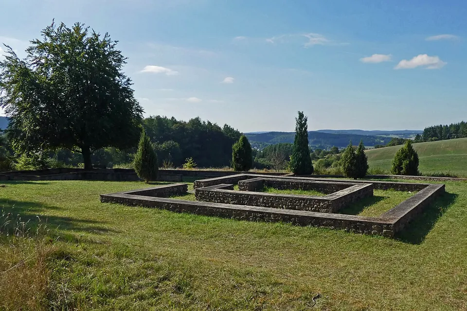
  61. Low walls of mortared stone marking out a square building with a smaller square inside it, on mown grass with a few conifers and a broad tree, and wooded hills and fields stretching away under a blue sky.

    Photo: CatalpaSpirit · CC BY-SA 4.0 · Commons

    sanctuary · Rhineland-Palatinate

    Juddekirchhof

    Only the foundation walls are left, uncovered in excavations in 1927 and 1928 (de.wikipedia, KuLaDig).

    Show on map: Juddekirchhof
    1st c. BC – 7th c. ADFree