

What is there today
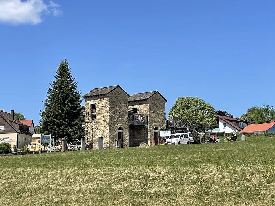
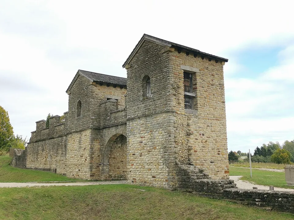
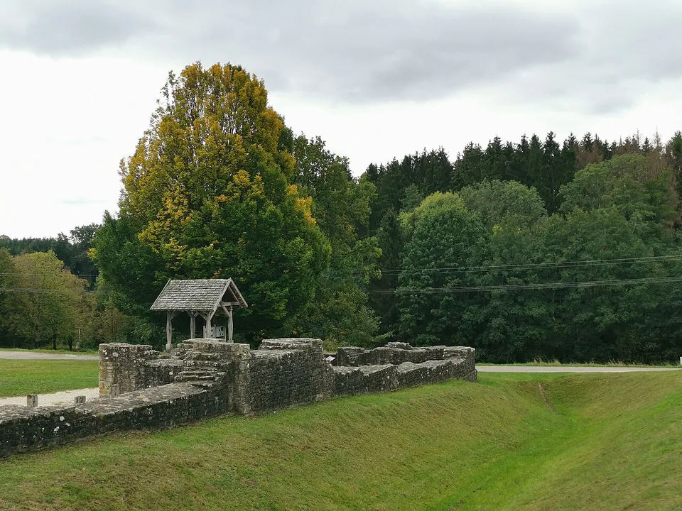
The gate is the thing to see: a twin-towered entrance with a passage 3.6 m wide, rebuilt together with a section of the wall (de.wikipedia). The rest of the fort, about 1.6 hectares, is laid out so that you can take in its size: the line of the wall with its ditch, the outline of a stone building read as a granary and the plan of a small bath building, and, in the south-west corner, one of the wells (de.wikipedia; OpenStreetMap; the operator). Most of the interior was deliberately left unexcavated, as an archaeological reserve for future research; its buildings are thought to have been mostly of timber (de.wikipedia).
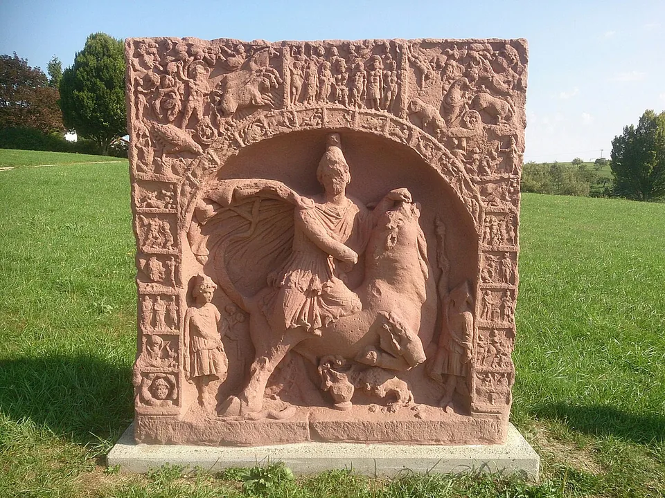
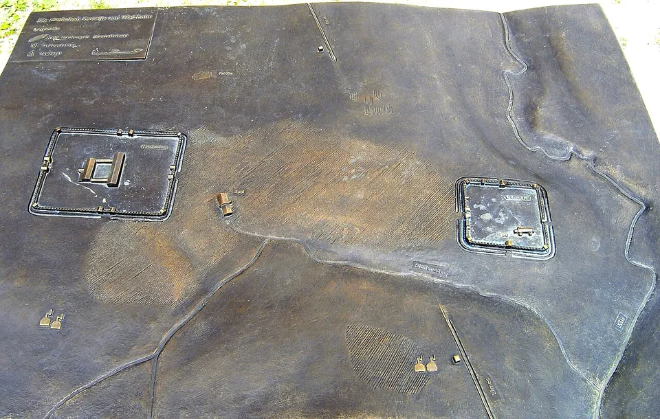
Around the field stand casts of Roman inscriptions and sculpture, from Welzheim and from across Upper Germany, with information boards (de.wikipedia; Deutsche Limes-Straße), among them a copy of the Mithras relief from Osterburken. A bronze model shows both forts in their landscape.
Is it worth the trip?
As a stop on a Limes trip, yes. The gate gives a clear, life-size picture of what a frontier fort looked like, it costs nothing, and the park is open at any hour. Come on a Sunday between May and October and the town’s guides are on hand from 11.00 to 16.00. Be clear about what you are looking at, though: the towers are a modern reconstruction, and beyond them the fort is a mown field with low walls and plans, not a ruin. It is half an hour’s visit, not a day.
Getting there
The park is on Rienharzer Straße, on the edge of Welzheim in the Rems-Murr-Kreis, about 0.7 km from the town centre (the operator; OpenStreetMap). There is a car park about 50 m from the fort and another, mapped as the Ostkastell car park, about 110 m away. No bus stop is mapped beside it.
Entry is free and the park is open all year round, at any time (the operator). From May to October the Limes-Cicerones keep a “fort watch” there every Sunday and public holiday from 11.00 to 16.00, and the town books guided tours for groups (Stadt Welzheim, read 1 November 2026).
The finds are elsewhere: in the town museum in Welzheim, which has a large Roman section, in the Landesmuseum Württemberg in Stuttgart and in the Limesmuseum Aalen (de.wikipedia; Deutsche Limes-Straße). About 1.8 km away, the small fort of Rötelsee has had its wall footings rebuilt to about 0.6 m (OpenStreetMap).
Visiting details
- Opening hours
- Open all year round, at any time. From May to October the Limes-Cicerones, the town's Roman guides, keep a "fort watch" in the park every Sunday and public holiday from 11.00 to 16.00.
- Tickets
- Free. Guided tours for groups are booked through the town of Welzheim; no price is published on its pages.
- Parking
- A car park about 50 m from the fort (OSM way/969725883), and the "Parkplatz beim Ostkastell" about 110 m away (OSM node/277706199).
Before you go
- The west gate and its stretch of wall are a modern reconstruction (presented to the public in 1983). The rest of the fort is shown as a low wall line and ground plans; most of its interior is left unexcavated, as an archaeological reserve.
- No bus stop is mapped beside the park. It is on the edge of Welzheim, about 0.7 km from the town centre.
Hours and prices checked 1 November 2026 on the operator's own site. Confirm before travelling.
History
At Welzheim the Roman frontier ended the long, ruler-straight stretch it followed for some 80 km from the north, and the town is one of the few places on the Upper Germanic-Raetian Limes with two forts (de.wikipedia). The west fort, 4.3 hectares and garrisoned by cavalry, now lies almost entirely under the town. The east fort, 530 m away and linked to it by a road and a civilian settlement, housed a numerus, a unit of 150 to 200 men; unusually, it stood just in front of the Limes, already outside the Empire’s territory (de.wikipedia).
Tile stamps name a Numerus Brittonum, stationed here from 159/161, and an altar of 198–211, found in the rubble of the bath’s heating system, probably reused as building stone, names its commander, Marcus Octavius Severus, a centurion of the Eighth Legion who also led a unit of scouts (exploratores). The soft ground undermined the wall more than once; a layer of burning from around 170/175 is probably linked to the Marcomannic Wars, and the corner and interval towers were added only after it. The fort ended with the fall of the Limes around 260 (de.wikipedia).
The fort’s most important finds came from its wells, where the ground conditions preserved what was thrown into them: some 100 leather shoes from a cobbler’s workshop, from infants’ shoes to boots; a writing tablet; three palisade stakes up to 1.84 m long; parts of an iron face-mask helmet; and seeds and fruit, from imported figs to coriander and wild berries, that give a picture of what the garrison ate and of the forests around it (de.wikipedia).
The fort was investigated by the Reichs-Limeskommission in 1894. When the ground was set to be built over from 1960, the state bought it; excavations from 1976 to 1981 explored mainly the wall, gates and towers, and in 1983 the rebuilt gate was presented to the public, a reconstruction made on strictly scientific lines to the research of the day, with Dietwulf Baatz of the Saalburg Museum. The park took its present name in 1993 (de.wikipedia).
More photographs


Nearby
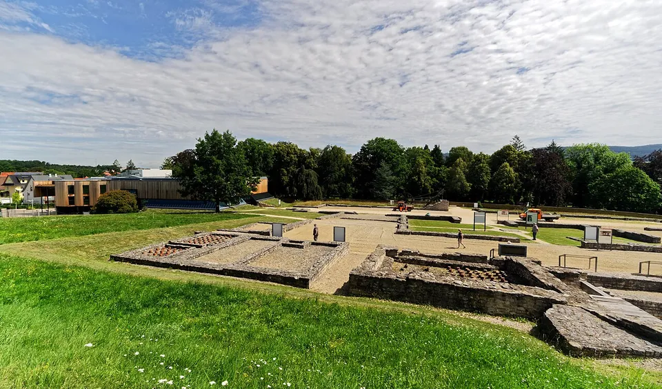
Photo: Holger Uwe Schmitt · CC BY-SA 4.0 · Commons
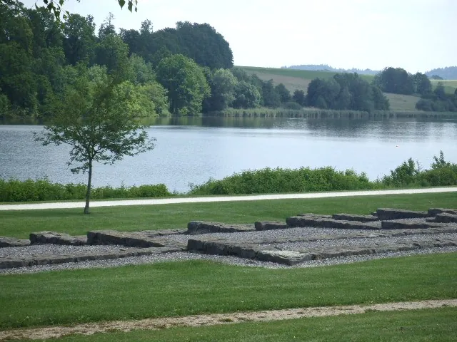
Photo: Veit Feger · Public domain · Commons
37 km · fort · Baden-Württemberg
Castra of Buch
Not much stands, but the site is laid out so that you can read it.
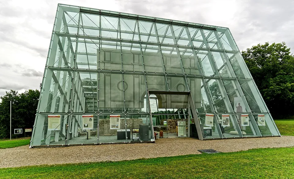
Photo: Holger Uwe Schmitt · CC BY-SA 4.0 · Commons
38 km · gate · Baden-Württemberg
Limes gate Dalkingen
The stone walls of the gatehouse, excavated in 1973–74 and restored for display, now stand inside a glass-and-steel shelter built in 2010.


Straight-line distances.
Sources
Every fact on this page comes from the records below, each used under the licence noted.
| Source | Licence |
|---|---|
| Pleiades 174231907 | CC BY |
| Wikidata Q1735441 | CC0 |
| OpenStreetMap way/28231833 | ODbL |
| Pleiades — Welzheim (the two forts and their settlement) | licence not recorded |
| Wikipedia (de) — Kastelle von Welzheim | CC BY-SA 4.0 |
| Stadt Welzheim — Archäologischer Park Ostkastell (the operator) | licence not recorded |
| Stadt Welzheim — Römische Führungen (Limes-Cicerones) | licence not recorded |
| Ostkastell Welzheim — Service (the operator's former park site, archived 28 May 2022) | licence not recorded |
| Deutsche Limes-Straße — Welzheim | licence not recorded |