

What is there today
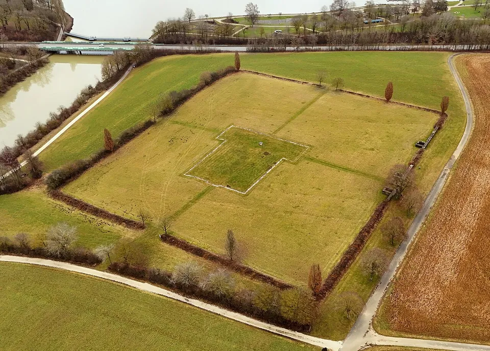
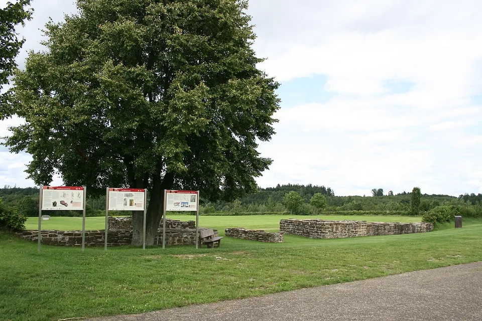
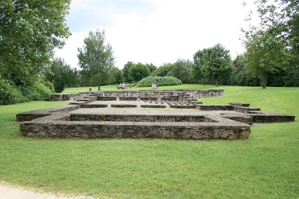
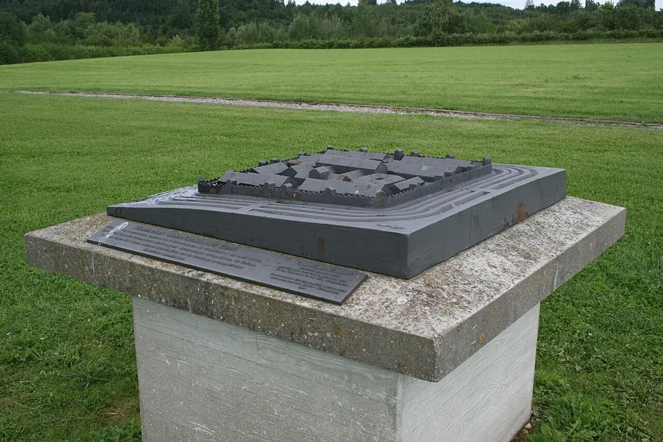
Not much stands, but the site is laid out so that you can read it. On the fort’s ground itself, a hedge and an earth bank trace the wall, and single trees mark where the gate and wall towers stood. The headquarters building is marked out in gravel, with a 1:200 model of the whole fort in the middle of it. In the south, a stretch of the wall and the south gate have been rebuilt to a low height; the walls excavated there in 1972 were conserved (de.wikipedia; the operator).
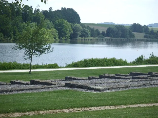
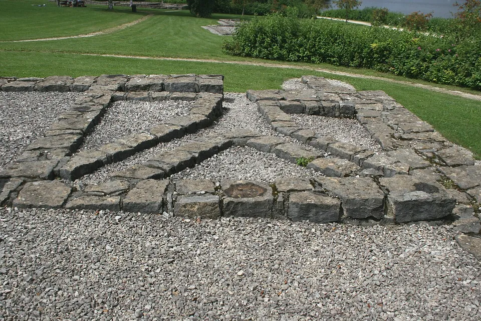
The real masonry is down by the water. The foundations of the fort’s bath and of two buildings of the village outside the fort were conserved after excavation in 1979–80 and can be seen freely on the lake shore (de.wikipedia). The pair is read as a guest house with its own small bath, and one of its rooms shows the stone channels of an underfloor heating system (de.wikipedia). Information boards stand at every station (de.wikipedia). The famous finds from the village wells are not here: they are in the Limesmuseum in Aalen (the operator).
Is it worth the trip?
On its own, it is a short stop: low foundations, a model and a field outlined by a hedge. Its value is as part of the Limes-Park Rainau. The Limes gate at Dalkingen is about 2.25 km to the north-east, and a timber watchtower was reconstructed in 2008 at Mahdholz, north of Buch near Schwabsberg (de.wikipedia). A walking trail links them (the operator). The operator’s own suggestions run from a two-hour visit by car to a five-hour half day, half of it on foot, and the lake-shore park around the remains is also a family recreation area. The operator warns that the dammed lake and the B 290 road, which runs across the old village, have changed the ground so much that it is hard to picture the Roman landscape.
Getting there
Buch lies about 6 km from Ellwangen, the nearest town (OpenStreetMap). The bath and village remains are on the lake shore about 200 m from the middle of the fort (OpenStreetMap). There is no gate and no ticket, and the operator publishes no opening hours for the remains. The municipality’s car park P1 at the lake charges a fee, paid at machines that take coins (no change given) or cards. No bus stop or station is mapped close to the site, so come by car, by bicycle on one of the routes through the park, or on foot along the trail. Guided visits with the certified Limes-Cicerones cost €40–100 per tour, depending on length (Gemeinde Rainau, read 31 October 2026).
Visiting details
- Opening hours
- No gate and no published hours. The fort ground and the bath and village foundations on the lake shore are open-air remains in the park around the Bucher Stausee.
- Tickets
- Free; the operator lists no ticket. Guided visits with the Limes-Cicerones cost €40–100 per tour, depending on length, booked through limestor-dalkingen.de.
- Parking
- The municipality's car park P1 at the Bucher Stausee charges a fee, paid at machines that take coins (no change given) or cards. OpenStreetMap maps only bicycle stands within 250 m of the fort.
Before you go
- No bus stop or railway station is mapped close to the site; plan on a car, a bicycle or the Limes-Park walking trail.
Hours and prices checked 31 October 2026 on the operator's own site. Confirm before travelling.
History
The fort stood on a spur above the valleys of the Jagst and the Ahlbach, about 1.2 km behind the Limes (de.wikipedia; the operator). It covered 2.1 hectares and had a stone wall with rounded corners, four double gates and eight interval towers, with four ditches in front (de.wikipedia). Its garrison was a part-mounted cohort whose name is not recorded; published estimates of its strength range from about 500 to about 760 men (de.wikipedia; the operator).
Published founding dates differ. The excavator Dieter Planck dates the founding to around 130, at the latest 140 (de.wikipedia); the operator gives around 150/160. The village and the timber palisade of the Limes came in the 160s, according to tree-ring dates (de.wikipedia). Wells in the village gave timbers dated 254 or later, and the village burned in the early summer of 254, most probably in a Germanic attack; Roman troops were gone by 260 at the latest (de.wikipedia).
Three of those wells held hoards hidden under the burnt debris. Among the finds were bronze vessels, bronze statuettes of Mars and Cupid, an almost complete mail shirt, a bronze helmet that was never finished, a bronze cauldron and a complete steelyard (de.wikipedia). The Samian Research project also lists Rainau-Buch as a samian ware findspot (Wikidata).
The remains were known by the early 19th century, when walls could still be seen; in 1818 their stones were taken for road building. The Reichs-Limeskommission excavated in 1897. The south gate was dug in 1972, and large parts of the village were excavated in 1976–79 before the B 290 was built across it. The reservoir was filled in 1982 and flooded large parts of the valleys around the fort. The open-air museum grew from 1972 and was renamed Limes-Park Rainau with new information boards after the Limes became a UNESCO World Heritage Site in 2005 (de.wikipedia).
More photographs



Nearby
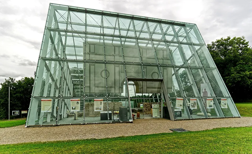
Photo: Holger Uwe Schmitt · CC BY-SA 4.0 · Commons
2 km · gate · Baden-Württemberg
Limes gate Dalkingen
The stone walls of the gatehouse, excavated in 1973–74 and restored for display, now stand inside a glass-and-steel shelter built in 2010.
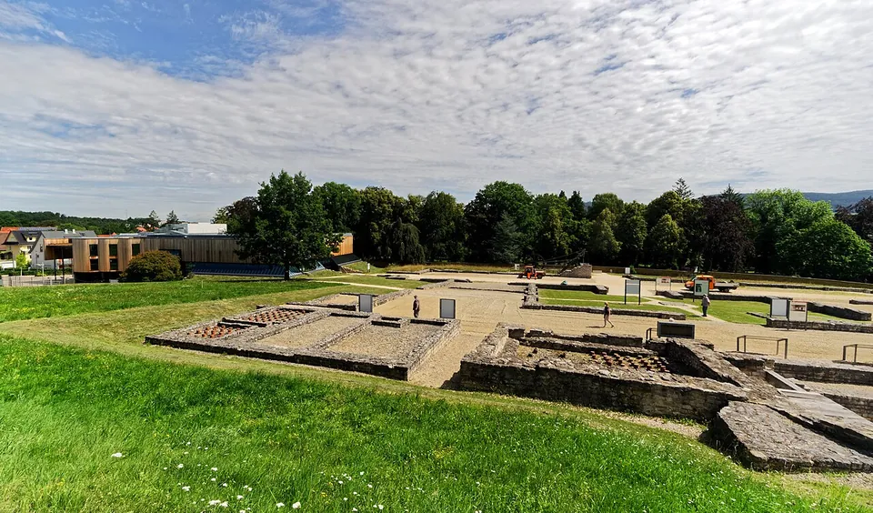
Photo: Holger Uwe Schmitt · CC BY-SA 4.0 · Commons
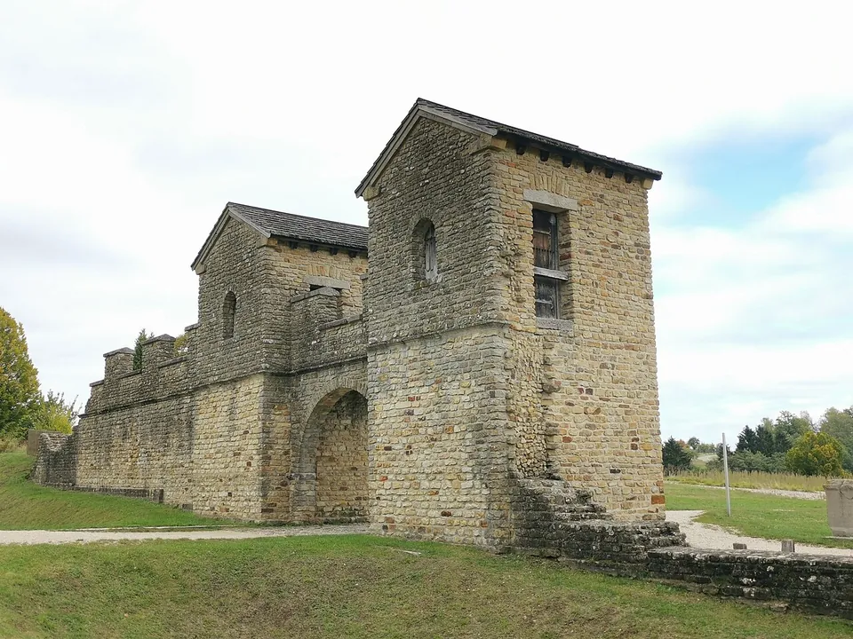
Photo: Z thomas · CC BY-SA 4.0 · Commons
37 km · fort · Baden-Württemberg
Welzheim East Roman Fort
The gate is the thing to see: a twin-towered entrance with a passage 3.6 m wide, rebuilt together with a section of the wall (de.wikipedia).


Straight-line distances.
Sources
Every fact on this page comes from the records below, each used under the licence noted.
| Source | Licence |
|---|---|
| Pleiades 118614 | CC BY |
| Wikidata Q1698469 | CC0 |
| Vici.org 4428 | CC BY-SA (text), CC0 (metadata) |
| OpenStreetMap node/1764338203 | ODbL |
| Wikipedia (de) — Kastell Buch | CC BY-SA 4.0 |
| Gemeinde Rainau — Römisches Kastell (the operator) | licence not recorded |
| Gemeinde Rainau — Römerbad & Zivilsiedlung (the operator) | licence not recorded |
| Gemeinde Rainau — Limes-Park Rainau (the operator) | licence not recorded |
| Gemeinde Rainau — Führungen am Limes (guided tours) | licence not recorded |
| Gemeinde Rainau — Parken am Bucher Stausee | licence not recorded |
| Wikidata — Rainau-Buch (Samian Ware Discovery Site), Q103191054 | licence not recorded |