

What is there today
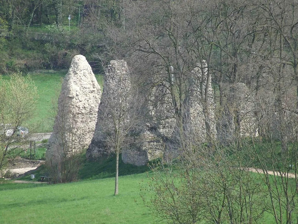
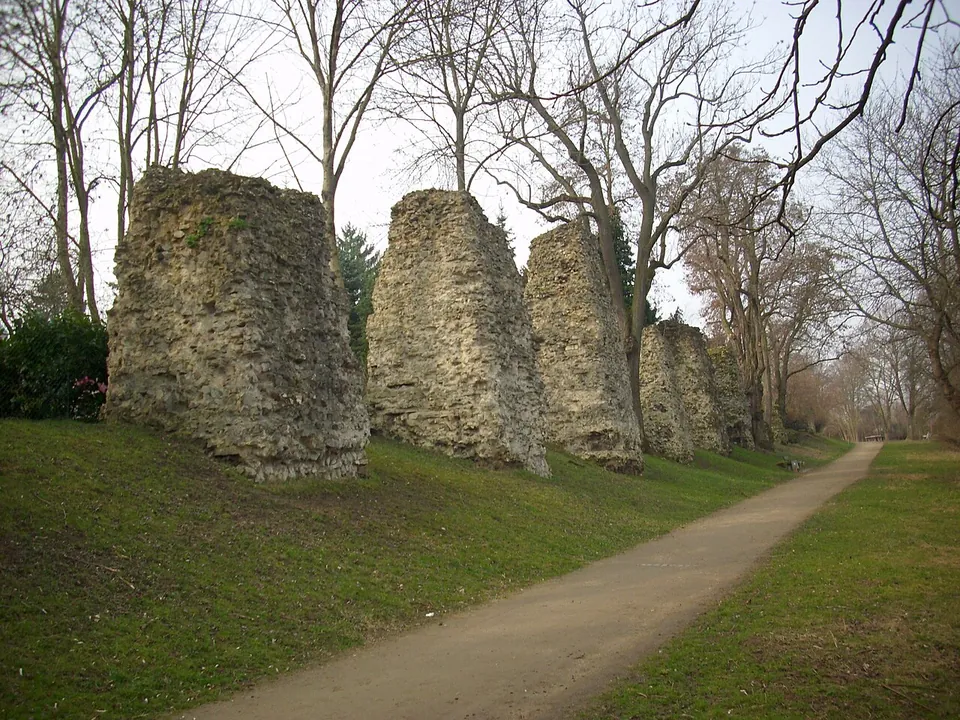
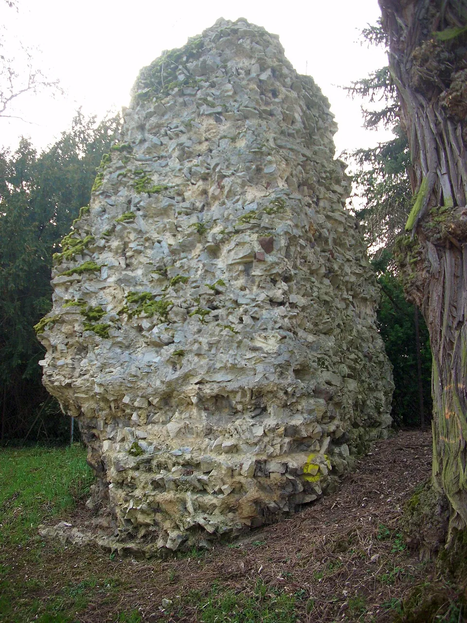
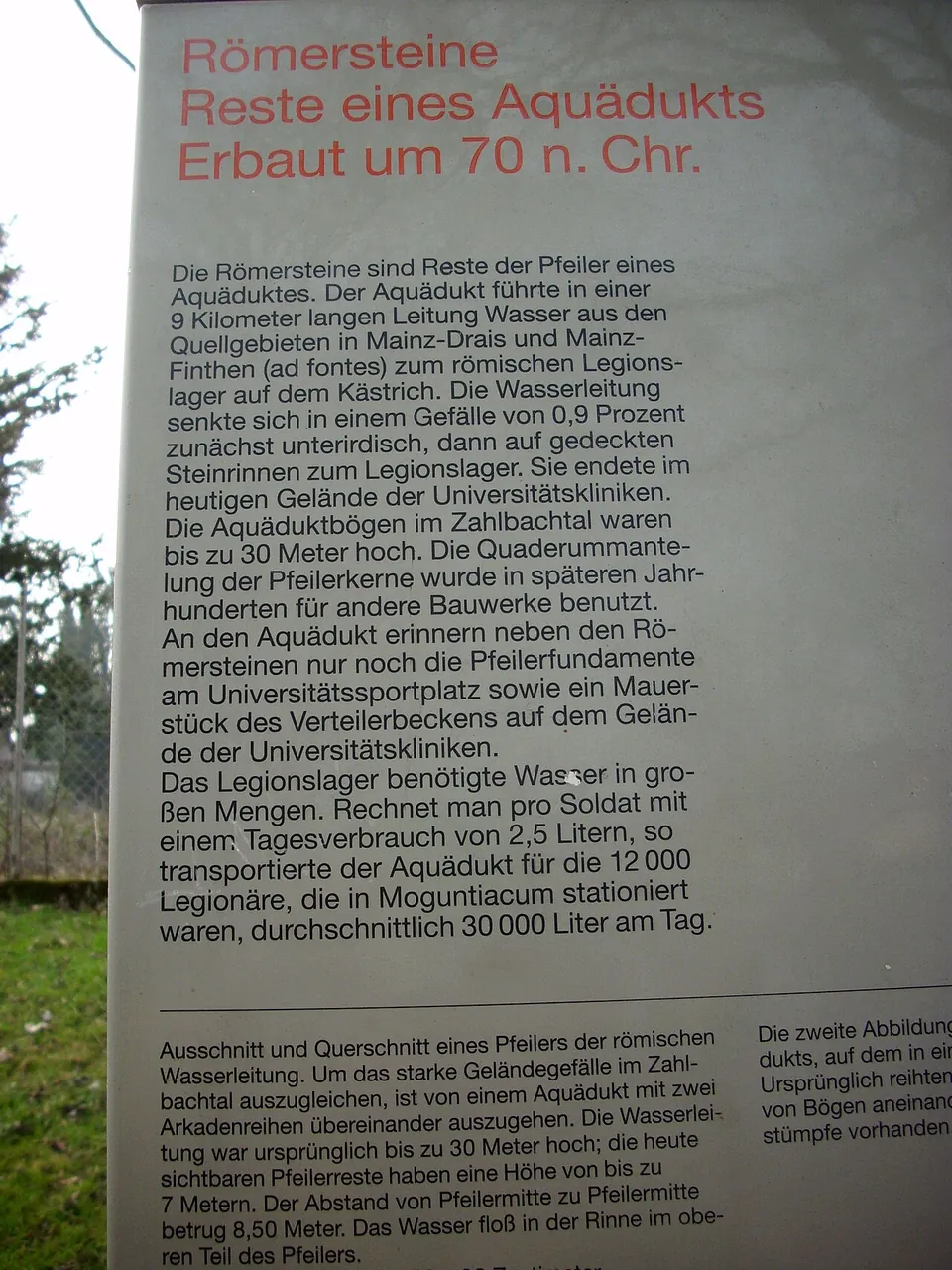
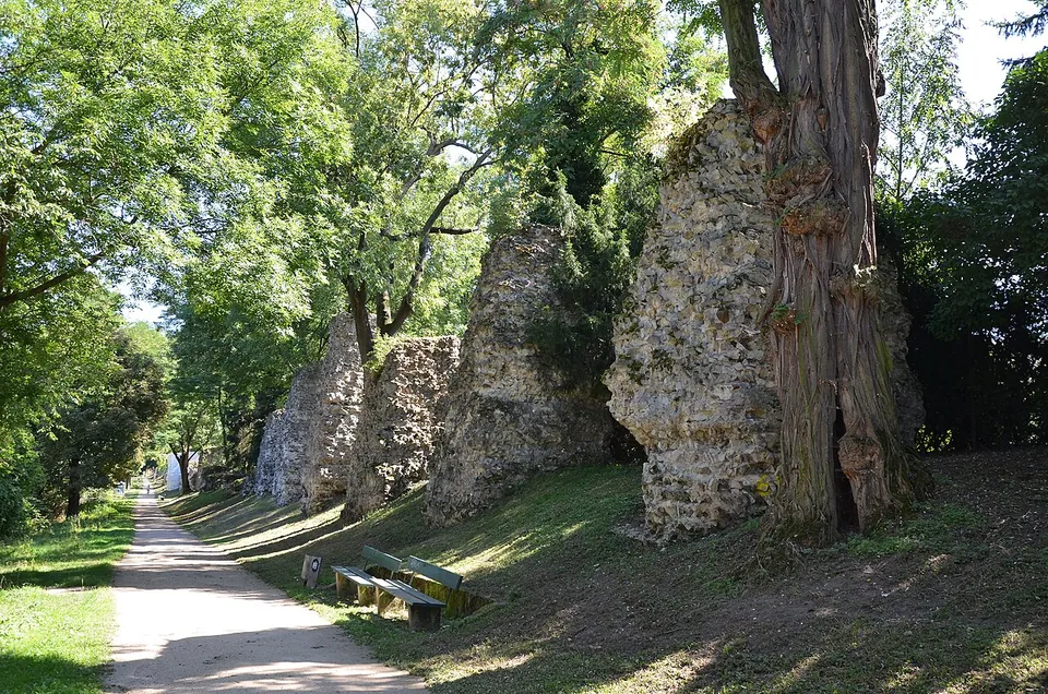
Along the path stands a line of rough masonry stumps, the cores of the piers that once carried the water channel across the valley. Their casing of dressed stone was taken for other buildings in later centuries, so what you see is the fill behind it, stone rubble set in mortar (the city of Mainz; KuLaDig). Published counts run from 58 to 69 piers (KuLaDig; the city; de.wikipedia). The tallest stand up to about 7 m, while others are no more than grassed-over humps, and on a few a piece of the original casing is still in place (KuLaDig; de.wikipedia). The row runs for about 600 m (de.wikipedia, “Mogontiacum”), and an information board stands beside it (OpenStreetMap).
Other pieces survive elsewhere in the city: pier foundations at the university sports ground, found in the 1950s and rebuilt from the original material a few metres from where they were found, and a stretch of wall of the distribution basin on the grounds of the university hospitals (the city of Mainz). de.wikipedia adds pier remains on the Koblenzer Straße, between Bretzenheim and Finthen.
Is it worth the trip?
If you are in Mainz, yes: it is free, open-air and a pleasant walk, and the row of piers marching along the valley is striking even stripped as it is. Set the expectation honestly, though. These are stumps, not arches; nothing of the arcade survives, and it takes some imagination to put back a bridge that stood 25 m or more over the valley. It is not a reason to travel to Mainz on its own. Pair it with the theatre and the city’s other Roman remains, described on the Mogontiacum – Mainz page.
Getting there
The piers line the footpath An den Römersteinen beside the Untere Zahlbacher Straße, in Zahlbach, part of the Mainz-Bretzenheim district (the city of Mainz; OpenStreetMap). The nearest mapped public transport stop, Zahlbach, is about 260 m away, and a free car park lies about 60 m from the piers (OpenStreetMap). The Roman theatre is about 1.8 km away in a straight line.
There is nothing to book and nothing to pay: the city lists the Römersteine as open to visitors and publishes no opening hours or charge for them (the city of Mainz, read 30 October 2026).
Visiting details
- Opening hours
- Open-air. The pier cores stand beside a public footpath in the Zahlbach valley; the city lists them as open to visitors and publishes no opening hours.
- Tickets
- Free. The city publishes no charge, and the piers line a public path.
- Parking
- A free surface car park about 60 m from the piers (OSM way/538756587, fee=no).
Hours and prices checked 30 October 2026 on the operator's own site. Confirm before travelling.
History
The aqueduct was built to supply the legionary fortress on the Kästrich and the camp suburb (canabae) beside it. Work began around AD 70, probably at the same time as the fortress was rebuilt in stone (the city of Mainz; de.wikipedia), although de.wikipedia’s article on Roman Mainz places the stone aqueduct in the reign of Domitian. Tile stamps found along the line name the Fourteenth Legion under a title that dates them to 69–92, the Flavian period; the article on Roman Mainz also names the First Legion Adiutrix among the builders. Whether a timber predecessor existed is unclear, and how long the aqueduct stayed in use is not known (de.wikipedia).
The water most likely came from springs in what is now the Finthen district, although the underground stretch from the springs has not been traced with certainty. The line ran underground at first, then above ground, and ended in a distribution basin on the site of today’s university hospitals (the city of Mainz; de.wikipedia). Its length is usually given as about 9 km, but that figure goes back to the Benedictine Joseph Fuchs, who first described the aqueduct in 1771, and was repeated unchecked; by 2008 only about 3.8 km, the stretch above ground, had been proven (de.wikipedia). In the Zahlbach valley the channel, about 40 by 90 cm, crossed on piers 8.50 m apart, most likely carrying two tiers of arches (the city of Mainz; KuLaDig; de.wikipedia). Published figures put the arches 25 to 30 m high, with one estimate of 35 m, and both de.wikipedia and the city call it the highest aqueduct north of the Alps.
Medieval sources record the field name Ageduch, read as a corruption of “aqueduct”. A family of knights “von Ageduch”, said to have lived nearby and to have carried an aqueduct arch in their arms, turned out to be a 19th-century forgery by the historian Franz Joseph Bodmann (de.wikipedia).
More photographs


Nearby
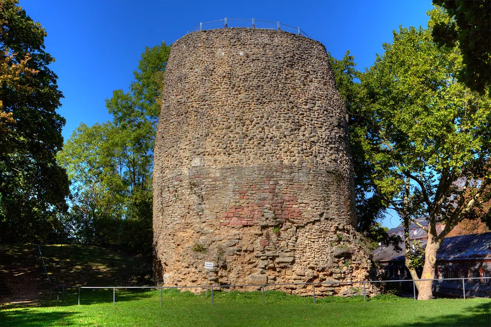
Photo: Martin Bahmann · CC BY-SA 3.0 · Commons
2 km · tomb · Rhineland-Palatinate
Drususstein
What you see is a slightly tapering cylinder of Roman cast masonry, mortar and rubble with larger dressed blocks set into it, standing on a square base of which only part is visible.
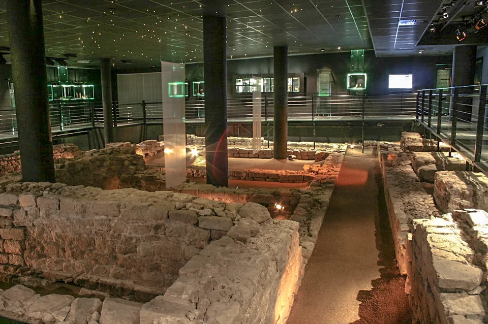
Photo: Martin Bahmann · CC BY-SA 3.0 · Commons
2 km · sanctuary · Rhineland-Palatinate
Sanctuary of Isis and Magna Mater
The remains are the sanctuary as it stood in the 2nd century: low stone footings of buildings whose walls above them were timber-framed and plastered, conserved and set back into the ground five metres down, the depth at which they were found, on their original alignment to the Roman street (de.wikipedia).
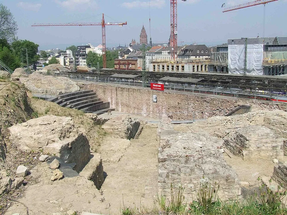
Photo: User:Kandschwar · CC BY-SA 2.0 de · Commons
2 km · theatre · Rhineland-Palatinate
Roman theatre at Mainz
What survives is the theatre's lower structure on the slope below the citadel: piers and foundations of Roman concrete (opus caementicium), faced on the outside with small squared stones, with double layers of brick slabs laid in to stabilise them (the city of Mainz).


Straight-line distances.
Sources
Every fact on this page comes from the records below, each used under the licence noted.
| Source | Licence |
|---|---|
| Pleiades 427637959 | CC BY |
| Wikidata Q896423 | CC0 |
| OpenStreetMap way/100414658 | ODbL |
| Wikipedia (de) — Römersteine | CC BY-SA 4.0 |
| Wikipedia (de) — Mogontiacum (section Aquädukt) | CC BY-SA 4.0 |
| Landeshauptstadt Mainz — Roman stones (the city's own page) | licence not recorded |
| KuLaDig — Römersteine auf dem Kästrich in Zahlbach | licence not recorded |
| OpenStreetMap — Römersteine (aqueduct route, relation/1435170) | licence not recorded |