

What is there today
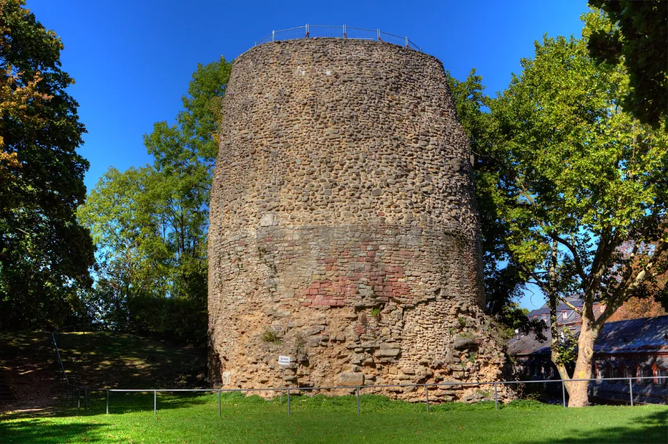
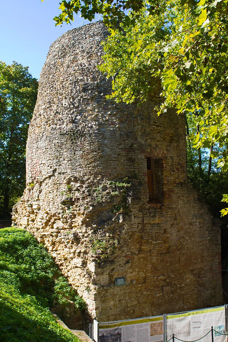
What you see is a slightly tapering cylinder of Roman cast masonry, mortar and rubble with larger dressed blocks set into it, standing on a square base of which only part is visible. It is about 21 m high on its north-east side (de.wikipedia). The facing and any decoration were stripped in the Middle Ages and the rounded top of the core was levelled in the 16th century, so nothing of the monument’s Roman face survives (de.wikipedia); the city of Mainz puts its original height at about 30 m, a square base and a cylindrical storey under a conical top crowned with a pine cone. A doorway about 3 m up on the north-east side dates from its later use as a watchtower, when the core was hollowed out for a spiral staircase of 69 sandstone steps (de.wikipedia). No source says the stair is open to visitors.
The masonry has been conserved: the Roman mortar was analysed in the laboratory and matched in colour and aggregate for the repairs, and a covering now gives the monument better protection from the weather (the city of Mainz). The stone stands in the green grounds of the 17th-century citadel, behind the Stadthistorisches Museum, inside the southern bastion that is named after Drusus (de.wikipedia; the city).
Is it worth the trip?
If you are in Mainz, yes, for a short visit: it is free, it never closes, and it is about 340 m from the Roman theatre, in sight of it (de.wikipedia), so the two make one walk. Set the expectation honestly, though: this is a massive but shapeless block of rubble masonry, not a carved tomb, and ten minutes will show you all of it. Its interest lies in what it is. Together with the Igel Column it is, by de.wikipedia’s account, the only Roman funerary monument north of the Alps still standing above ground where it was built. It is not worth a journey on its own; as part of Roman Mainz it is.
Getting there
The citadel stands on the Jakobsberg above Mainz Römisches Theater station; the address is Zitadelle, near the Stadthistorisches Museum, 55131 Mainz (the city of Mainz). Buses 64 and 65 stop at Zitadellenweg/Südbahnhof and bus 70 at Eisgrubweg. Drivers can park on the citadel or in the “Römisches Theater” or Cinestar multi-storey car parks, but can reach the citadel only from Eisgrubweg or Am 87er Denkmal, since the way in through the main entrance from Zitadellenweg is closed to cars (the city).
The citadel grounds are freely accessible at any time and no ticket is charged (the city of Mainz, read 1 November 2026). The Initiative Zitadelle Mainz runs tours of the citadel grounds from April to October (the city). The Volkshochschule Mainz, the city’s adult education centre, held a guided tour of the Drususstein, the legionary camp and the late Roman city gate on 30 May 2026, for €14 (Rheinhessen-Touristik); no later date is published.
Visiting details
- Opening hours
- Open at all times. The Drususstein stands in the open on the grounds of the citadel, which are freely accessible at any time.
- Tickets
- Free; there is no ticket.
- Parking
- Parking on the citadel grounds, or the "Römisches Theater" and Cinestar multi-storey car parks (the city of Mainz); OpenStreetMap maps a fee-paying car park about 100 m from the stone. By car the citadel is reached only from Eisgrubweg or Am 87er Denkmal, since the way in through the main entrance from Zitadellenweg is closed to cars.
Hours and prices checked 1 November 2026 on the operator's own site. Confirm before travelling.
History
Drusus, a stepson of Augustus, founded the legionary camp at Mainz by 13/12 BC at the latest, as a base for the conquest of Germany. He died in the autumn of 9 BC during his campaigns; his brother Tiberius and the army brought his body back to Mogontiacum, where the soldiers honoured him before it was taken on to Rome (de.wikipedia). They wanted a lasting monument to him there, and Augustus approved it after work had probably already begun; according to Suetonius he wrote the inscription for it himself (de.wikipedia). The monument stood about 800 m from the camp (de.wikipedia).
It became the centre of yearly ceremonies for Drusus: parades by the legions, and sacrifices by delegates of the council of the three Gallic provinces, which Drusus had founded. The theatre, aligned on the monument, was probably drawn into the ceremonies. Later the honours were extended to his son Germanicus and the whole Julio-Claudian house and merged into the imperial cult, and they continued well into the 3rd century (de.wikipedia). A road lined with tombs ran south from the monument towards Weisenau (de.wikipedia). The tumulus of Drusus is named among the Senate’s honours for Germanicus of AD 19 or shortly after, recorded on the Tabula Siarensis, and the historian Eutropius, writing before 378, still places his monument at Mogontiacum (de.wikipedia).
That the Drususstein is this cenotaph is widely accepted but not proven. No inscription, tree-ring date or excavated find dates it exactly; the use of the Roman foot (0.305 m) and the marks of Roman chisels show that it is Roman (de.wikipedia). According to the city of Mainz, new research by the state archaeology service (August 2021) no longer treats the identification as certain: much still points to it, but the building may also have been a victory monument.
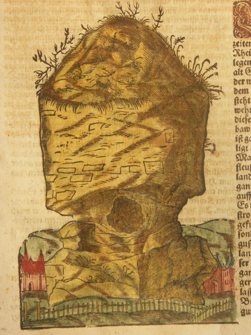
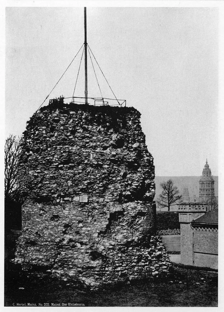
Its casing was stripped at some time in the Middle Ages, perhaps not before the 10th or 11th century; the stone may have gone into the medieval city wall or the churches nearby (de.wikipedia). In the 12th century Otto of Freising compared its shape to a funeral pyre, and from 1268 it was known as the Eichelstein or Eigelstein, a name probably taken from its shape (de.wikipedia). An attempt to demolish it in 1552 failed. It served as a watchtower in the town’s fortifications from the 16th century, according to de.wikipedia’s lead, and was given its door, staircase and a lookout platform by the end of the 17th century (de.wikipedia). For the city’s 2,000th anniversary in 1962 the narrow waist that old pictures show was filled in with masonry, and the monument lost its characteristic outline; excavation and conservation by the state archaeology service since the 1990s have secured it (de.wikipedia).
More photographs

Nearby
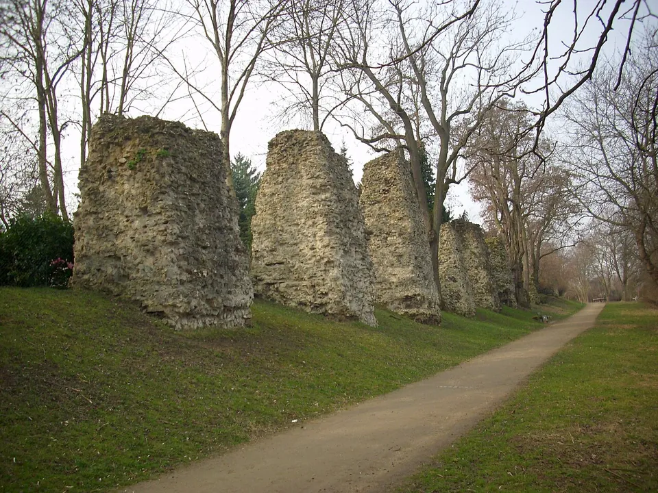
Photo: Nixnubix · CC BY-SA 4.0 · Commons
2 km · aqueduct · Rhineland-Palatinate
Römersteine
Along the path stands a line of rough masonry stumps, the cores of the piers that once carried the water channel across the valley.
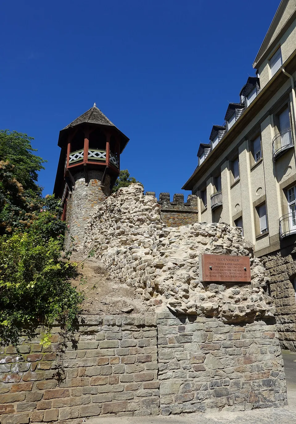
Photo: Geolina163 · CC BY-SA 4.0 · Commons
11 km · city · Hesse
Aquae Mattiacae
The wall has been traced for 520 m through the old town, but only two short stretches stand above ground, one on each side of the Römertor (the city's Stadtlexikon), about 80 m in all (de.wikipedia).
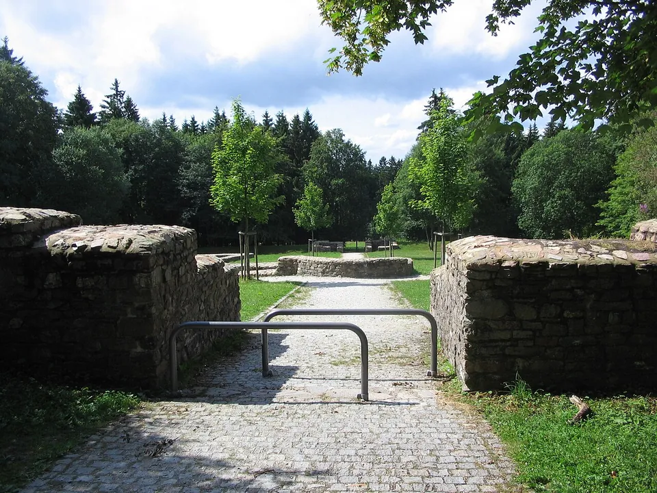
Photo: Brühl · Public domain · Commons
29 km · fort · Hesse
Kastell Kleiner Feldberg
The fort is a clearing in the forest with its complete ground plan laid out in low stone walls: a rectangle of 78 by 93 m with rounded corners and gateways in its sides, and, at the centre, the headquarters building (principia) with the curved apse of its shrine of the standards (de.wikipedia; the operator).


Straight-line distances.
Sources
Every fact on this page comes from the records below, each used under the licence noted.
| Source | Licence |
|---|---|
| Pleiades 590493733 | CC BY |
| Wikidata Q565736 | CC0 |
| OpenStreetMap way/616611851 | ODbL |
| Wikipedia (de) — Drususstein | CC BY-SA 4.0 |
| Wikipedia (en) — Drususstein | CC BY-SA 4.0 |
| Landeshauptstadt Mainz — Drususstein (the city's own page) | licence not recorded |
| Landeshauptstadt Mainz — Zitadelle, green space (the city's own page; access, hours, directions) | licence not recorded |
| Landeshauptstadt Mainz — Zitadelle, the fortress (the city's own page) | licence not recorded |
| Rheinhessen-Touristik — Drususstein | licence not recorded |