What is there today
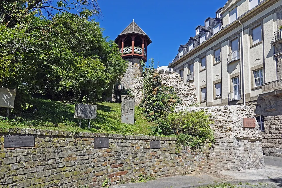
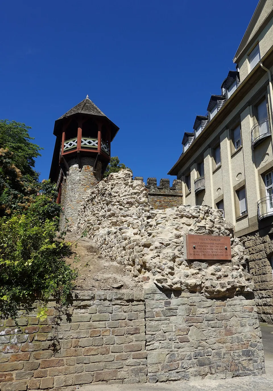
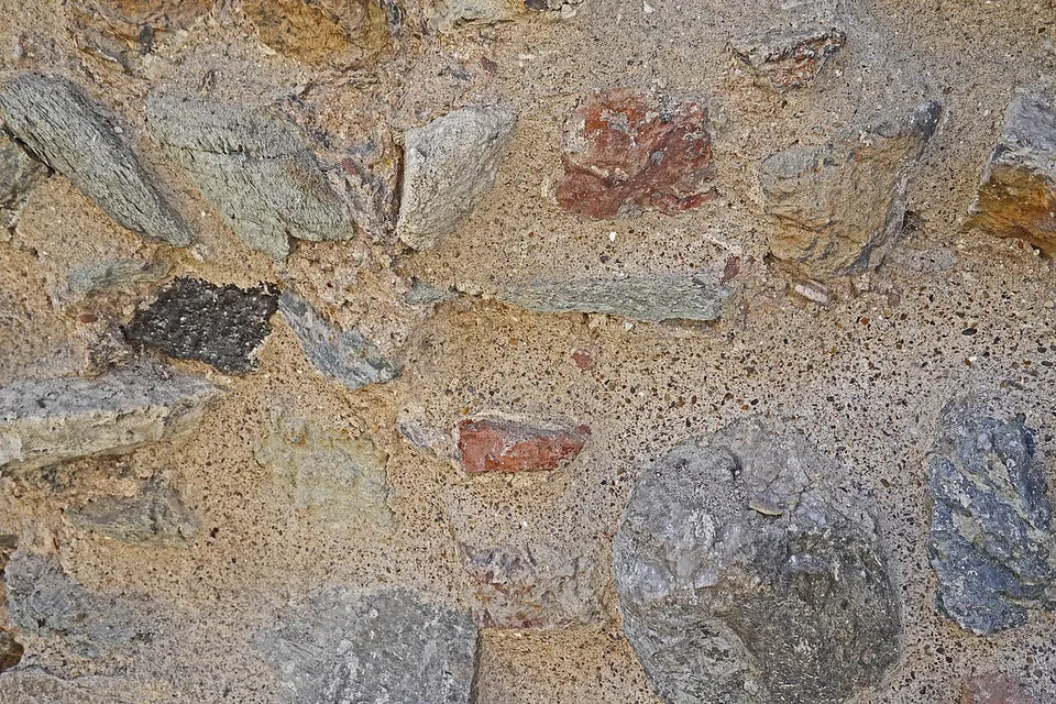
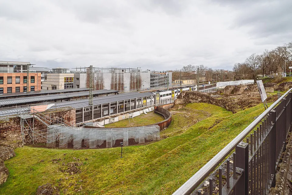
The wall has been traced for 520 m through the old town, but only two short stretches stand above ground, one on each side of the Römertor (the city’s Stadtlexikon), about 80 m in all (de.wikipedia). It was built as a mortared core faced with small squared blocks, from very mixed stone that includes reused pieces of earlier Roman monuments, and is given as 2.3 m thick at the base and up to 10 m high (de.wikipedia). Of its towers only one survives, the Heidenturm on the Schulberg above the Römertor (de.wikipedia).
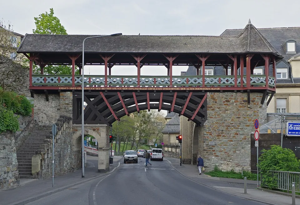
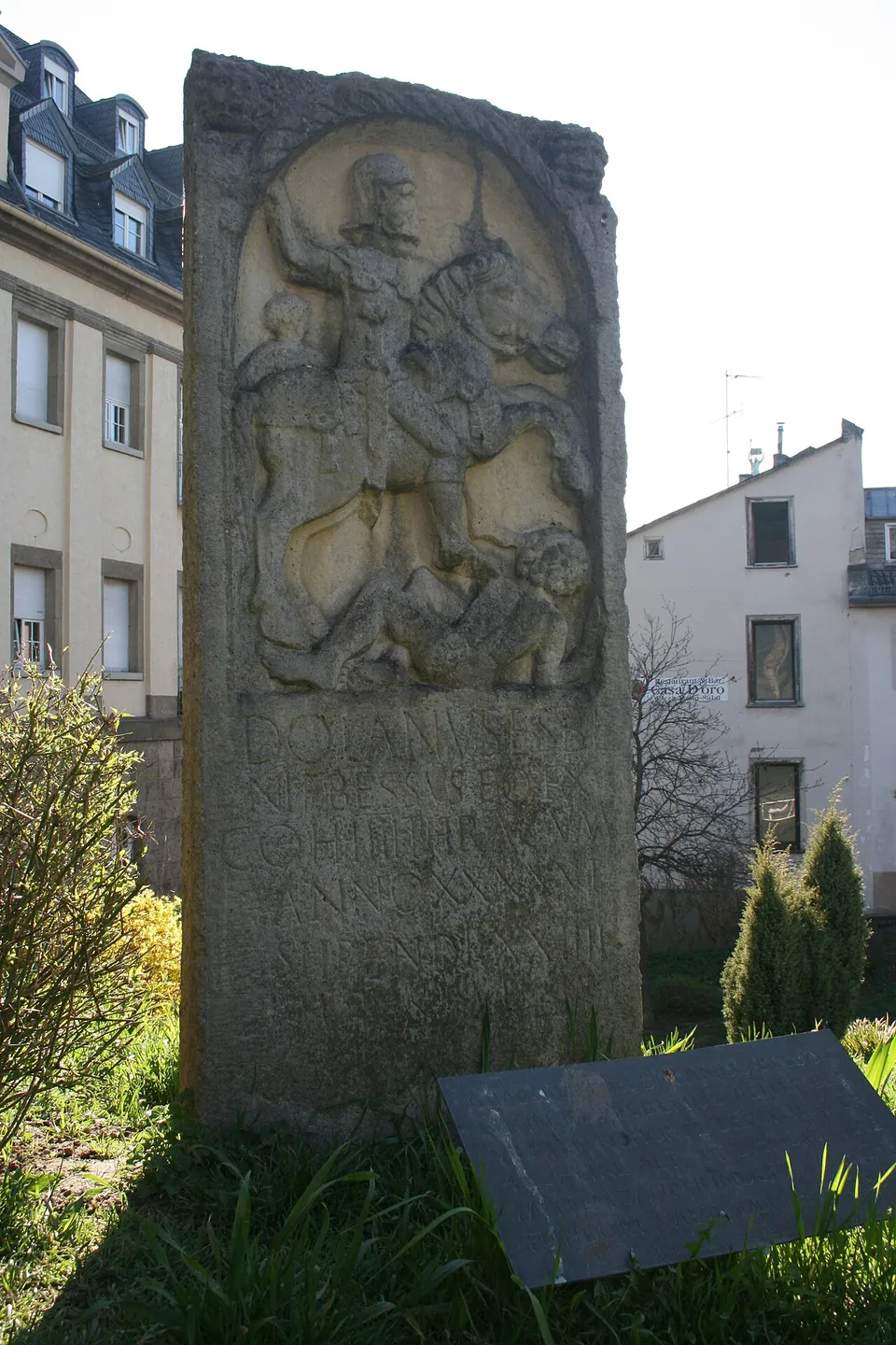
The Römertor itself is not Roman. When the city cut Coulinstraße through the wall in 1902, the city architect Felix Genzmer bridged the gap with a gate, towers and a covered timber walkway meant to recall Roman fortifications, built in 1903 (de.wikipedia). Below it, copies of Roman stones found in Wiesbaden stand in the open as a small open-air museum: soldiers’ tombstones, an inscription recording the restoration of a sanctuary of Jupiter Dolichenus, and the building inscription of a meeting house of local merchants. A mithraeum came to light during the works for the gate, and a cast of a Mithras relief from Nida-Heddernheim now stands there (de.wikipedia).
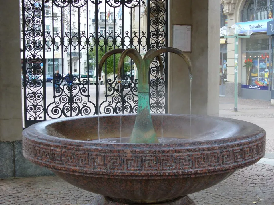
Nothing else Roman is on show where it was found. Three Roman bath complexes are known, the best studied at the Kranzplatz just south of the Kochbrunnen (de.wikipedia), and the city’s Roman town walk notes that few original remains are left in place anywhere in town (Visit Wiesbaden). The Kochbrunnen spring, about 300 m north-east of the wall, still runs at over 66 °C and seems to have been known in Roman times (de.wikipedia).
Is it worth the trip?
Not on its own. This is a short stretch of wall in a city street, a gate of 1903 and copies of stones, which makes a stop of half an hour or so. If you are already in Wiesbaden it is easy and free, and it combines well with the Kochbrunnen and the city museum, the sam – Stadtmuseum am Markt, about 400 m away. The museum’s free permanent exhibition on the city’s history includes the Roman period (the operator).
Getting there
The wall stands where Am Römertor meets Coulinstraße in the town centre. The Webergasse bus stops are about 170 m away and Michelsberg about 230 m; the multi-storey Parkhaus Coulinstraße is about 120 m from the wall (OpenStreetMap). The wall can be seen at any time and costs nothing. The covered walkway over the street is open only on guided tours (de.wikipedia).
The sam on the Marktplatz opens Tuesday to Sunday from 11.00 to 17.00 and until 20.00 on Thursdays, and is closed on Mondays. In 2026 it also closes from 17 to 24 November for an exhibition change and on 24, 25 and 31 December. The permanent exhibition is free; only special exhibitions are charged (sam – Stadtmuseum am Markt, read 2 November 2026).
Visiting details
- Opening hours
- The Heidenmauer stands in the street at Am Römertor / Coulinstraße and has no opening hours. The city museum, sam – Stadtmuseum am Markt, opens Tuesday to Sunday 11.00–17.00 and on Thursdays until 20.00; it is closed on Mondays, and in 2026 also from 17 to 24 November (exhibition change) and on 24, 25 and 31 December.
- Tickets
- Free. The sam's permanent exhibition on the city's history is free for everyone; only its special exhibitions are charged.
- Parking
- The multi-storey Parkhaus Coulinstraße (fee, open 24 hours) is about 120 m from the wall, and a small paid car park about 55 m (OSM way/66952971, way/31047081). The nearest bus stops, Webergasse, are about 170 m away, and Michelsberg about 230 m (OpenStreetMap).
Before you go
- The Römertor is a gate of 1903, not a Roman one, and its covered timber walkway is open only on guided tours; the Roman wall is seen from the street and from the slope below it.
- The stones set up below the Römertor are copies; the originals belong to the Sammlung Nassauischer Altertümer.
Hours and prices checked 2 November 2026 on the operator's own site. Confirm before travelling.
History
The oldest Roman finds in Wiesbaden go back to the reign of Augustus. Several early defensive ditches have been found on the Heidenberg, and in the 80s AD, after Domitian’s war against the Chatti, a stone fort of 2.2 hectares was built there. Its garrison was moved forward to the Limes by AD 122 at the latest (de.wikipedia).
The civilian settlement beside the forts then became the administrative centre of the Civitas Mattiacorum, named after the Germanic Mattiaci. The name Aquae Mattiacorum first appears on a milestone of AD 122 found in Kastel. The hot springs were the town’s fortune: Pliny the Elder mentions them, and Martial names their mineral deposit as a hair dye (de.wikipedia). An inscription of AD 194 calls the inhabitants vicani Aquenses (de.wikipedia).
The town’s importance fell sharply with the loss of the Limes around AD 260, although coin finds suggest that settlement went on in its southern part into the 4th century (de.wikipedia). The Heidenmauer has traditionally been dated to about AD 370, under Valentinian I. A radiocarbon date from its mortar gave AD 214–344, but the sample may come from a repair, so its date remains open. Its purpose is open too, because the wall breaks off at both ends: it has been read as a barrier wall in front of the legionary fortress at Mainz, and as a defence that was never finished (de.wikipedia). The city’s tourist office presents an architect’s proposal that it was part of an aqueduct (Visit Wiesbaden), which the archaeologist Margot Klee rejected in 2013 (de.wikipedia). The city’s own Stadtlexikon concludes that none of the readings is archaeologically proven.
Tiles stamped by late Roman units of the Mainz command were found in and around the wall. On both sides of it, burials of the early 5th century, the men’s with swords, lances and axes, point to mercenaries in Roman service (de.wikipedia). In the Middle Ages the wall was taken into the town’s fortifications, and it is the only part of them still standing (de.wikipedia).
More photographs
Nearby
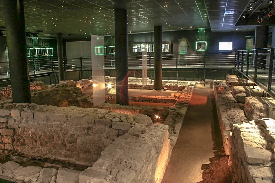
Photo: Martin Bahmann · CC BY-SA 3.0 · Commons
9 km · sanctuary · Rhineland-Palatinate
Sanctuary of Isis and Magna Mater
The remains are the sanctuary as it stood in the 2nd century: low stone footings of buildings whose walls above them were timber-framed and plastered, conserved and set back into the ground five metres down, the depth at which they were found, on their original alignment to the Roman street (de.wikipedia).
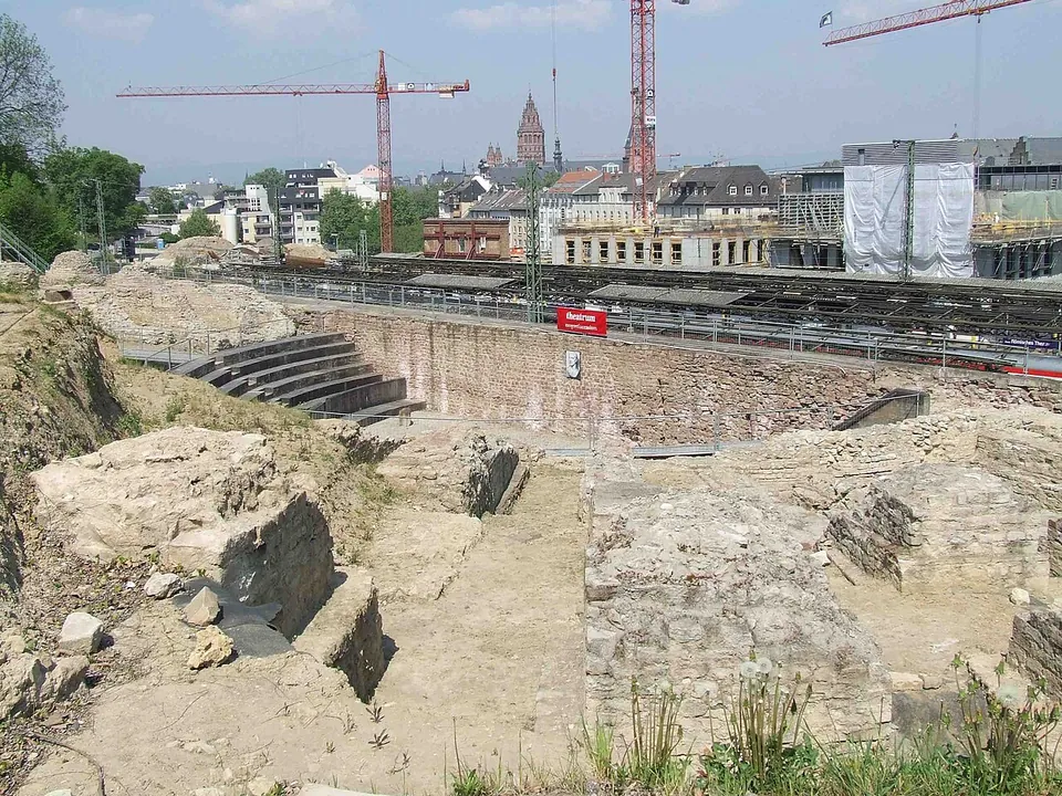
Photo: User:Kandschwar · CC BY-SA 2.0 de · Commons
11 km · theatre · Rhineland-Palatinate
Roman theatre at Mainz
What survives is the theatre's lower structure on the slope below the citadel: piers and foundations of Roman concrete (opus caementicium), faced on the outside with small squared stones, with double layers of brick slabs laid in to stabilise them (the city of Mainz).


Straight-line distances.
Sources
Every fact on this page comes from the records below, each used under the licence noted.
| Source | Licence |
|---|---|
| Pleiades 108750 | CC BY |
| Wikidata Q622981 | CC0 |
| OpenStreetMap way/111266193 | ODbL |
| Wikipedia (de) — Aquae Mattiacorum | CC BY-SA 4.0 |
| Wikipedia (de) — Heidenmauer (Wiesbaden) | CC BY-SA 4.0 |
| Wikipedia (de) — Kochbrunnen | CC BY-SA 4.0 |
| Wikipedia (de) — Sammlung Nassauischer Altertümer | CC BY-SA 4.0 |
| Landeshauptstadt Wiesbaden, Stadtlexikon — Heidenmauer | licence not recorded |
| Visit Wiesbaden (Wiesbaden Congress & Marketing) — Heidenmauer mit Römertor | licence not recorded |
| Visit Wiesbaden — Römischer Stadtspaziergang | licence not recorded |
| Freunde der Wiesbaden Stiftung — Der römische Stadtspaziergang | licence not recorded |
| sam – Stadtmuseum am Markt — opening hours and prices (the operator) | licence not recorded |
| sam – Stadtmuseum am Markt — permanent exhibition | licence not recorded |