What is there today
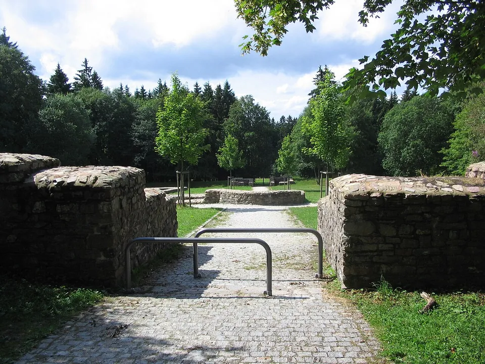
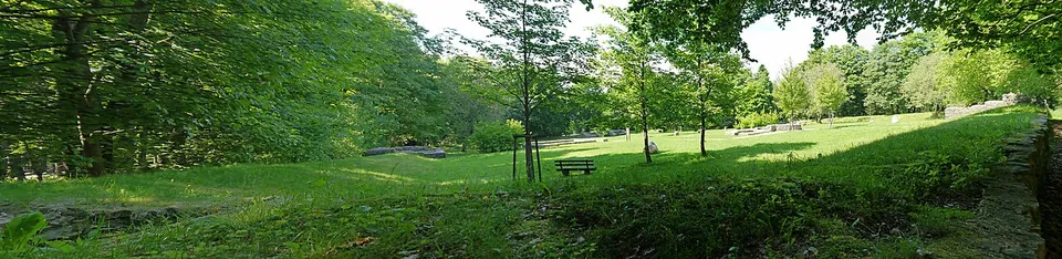
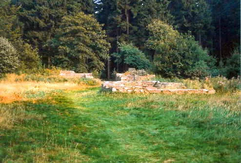
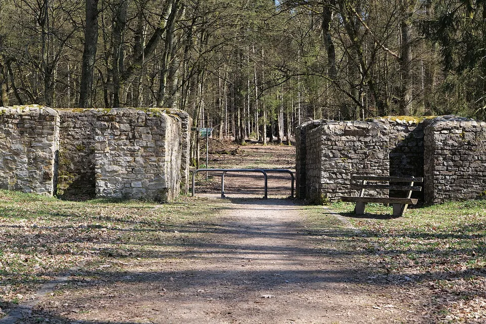
The fort is a clearing in the forest with its complete ground plan laid out in low stone walls: a rectangle of 78 by 93 m with rounded corners and gateways in its sides, and, at the centre, the headquarters building (principia) with the curved apse of its shrine of the standards (de.wikipedia; the operator). Wall sections of what may have been the commander’s house and of the granary survive too, and outside the fort, towards the Limes, lie the exposed foundations of the bath house, which had cold, warm and hot baths (the operator). Be clear about what you are looking at: the enclosure walls were rebuilt in the 19th century on top of the Roman remains, and the fort and bath were restored again in 2003-05 (the operator’s 2025 press release). Most of the buildings inside were of timber and have left nothing visible, and nothing is left to see of the civilian settlement that stood outside the gates (de.wikipedia).
Is it worth the trip?
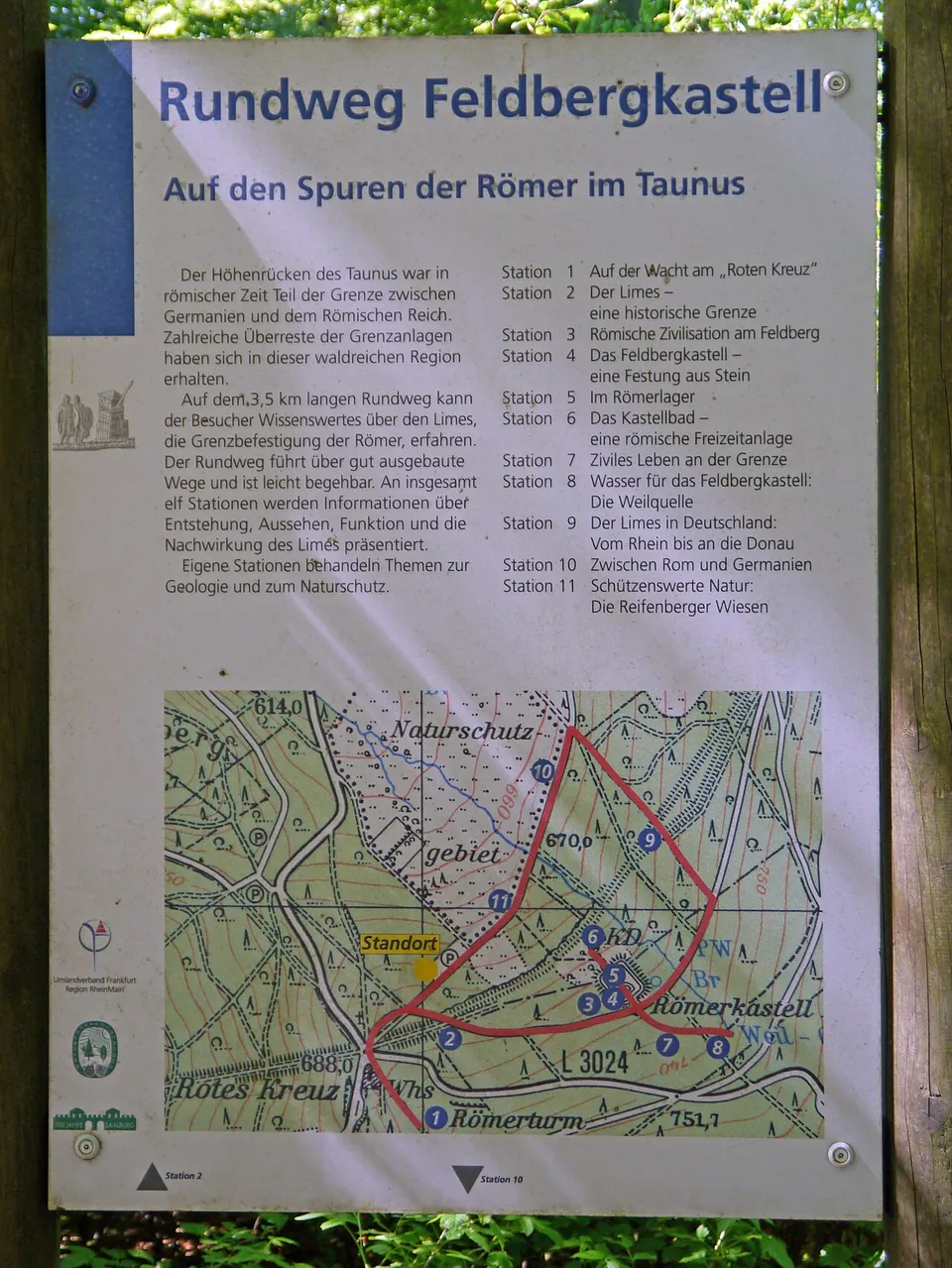
As part of a walk, yes. The operator counts it among the especially well-preserved military sites on the Limes in Hesse, it is free and open, and it lies in the Taunus, on what the operator calls the best-preserved stretch of the frontier in the state: from here east to the Saalburg the Limes bank and ditch can be followed through the woods for many kilometres (de.wikipedia). A 3.5 km circular trail with eleven information stations takes in the fort, the bath, the Limes and the spring that supplied the garrison (the trail’s own board, photographed in 2013; OpenStreetMap still maps its stations at the fort).
On its own it is a short visit - low walls in a meadow, no building standing to any height, and no museum: the finds are elsewhere. The operator itself says an outing is not complete without the reconstructed Saalburg fort, whose museum holds many of them, so plan the two together.
Getting there
The fort lies on the north slope of the Kleiner Feldberg, close to the Feldberg pass at Rotes Kreuz (de.wikipedia). The nearest car park is the free hikers’ car park “Heidenkirche”, about 380 m away; a larger free car park at Windeck is about 600 m away. RMV bus stops at Windeck and Rotes Kreuz are about 600 m away in a straight line (all OpenStreetMap; the timetables were not checked).
The site is freely accessible and free of charge, no opening hours are published, and the operator, Staatliche Schlösser und Gärten Hessen, offers a free audio tour in its Kulturschätze app (schloesser-hessen.de, read 1 November 2026).
Visiting details
- Opening hours
- Open grounds in the forest, freely accessible; no opening hours are published.
- Tickets
- Free. A free audio tour of the fort is available in the operator's Kulturschätze app.
- Parking
- Free hikers' car park "Heidenkirche" about 380 m away (OSM way/964938763), and a larger free car park at Windeck, about 600 m away (183 spaces, OSM way/195393783).
Before you go
- The nearest mapped bus stops (RMV), Windeck and Rotes Kreuz, are about 600 m away in a straight line; their timetables were not checked.
- OpenStreetMap maps no visitor facilities at the fort, and there is no museum on site; many of its finds are in the Saalburg museum.
Hours and prices checked 1 November 2026 on the operator's own site. Confirm before travelling.
History
The fort was built around AD 150, a date given by the small finds and by tree-ring dating of a spring housing in the settlement (de.wikipedia). It was placed to guard the old road over the Taunus at the Feldberg pass, but near the source of the river Weil rather than on the pass itself, for the sake of its water; a road running along the Limes passed straight through it, and the frontier itself ran about 100 m to the north-west (de.wikipedia).
Its garrison was a small, partly mounted scouting unit of some 150 to 200 men (the operator; de.wikipedia gives about 160), recorded as the exploratio Halic[…] Alexandriana. Readings of the name differ: de.wikipedia has the unit probably raised at Halicanum in Pannonia, in today’s Hungary, while the operator says recent research takes “Halic” instead as a shortened name of the unit’s own station. The fort was held until the crisis of the mid-3rd century, when the Limes was given up (de.wikipedia; Pleiades dates its occupation to about 150-260).
Local people knew the ruined bath as the “Heidenkirche”, the heathens’ church, before scholarly research began; its Roman origin was recognised by the end of the 18th century at the latest. Excavation began shortly after the middle of the 19th century and systematic work followed from 1892, first by the Reichs-Limeskommission and later by the Saalburg museum (de.wikipedia). The fort has been part of the UNESCO World Heritage Site of the Upper German-Raetian Limes since 2005, and Staatliche Schlösser und Gärten Hessen looks after it (de.wikipedia).
More photographs
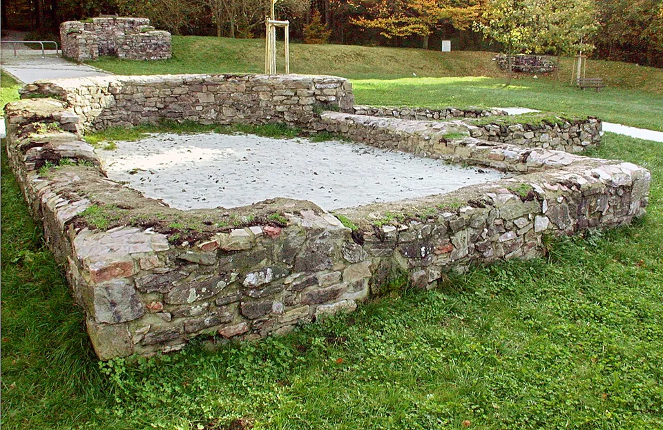
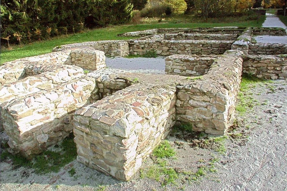
Nearby
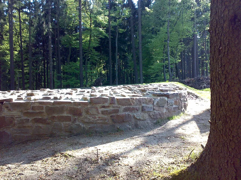
Photo: Karsten11 · Public domain · Commons
6 km · fort · Hesse
Castellum of Heidenstock
The fort measured 19.4 by 23.4 m, with the rounded corners of Roman forts of its time and a single gate facing the frontier (de.wikipedia).
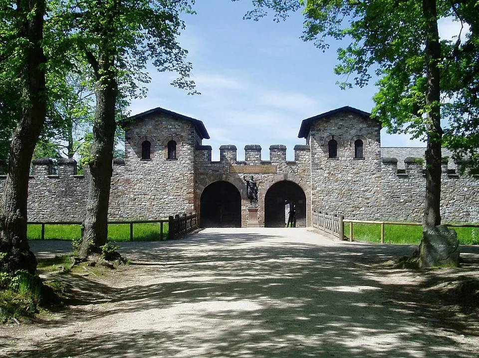
Photo: en:User:Ekem · Public domain · Commons
17 km · fort · Hesse
Castra of Kapersburg
The fort sits in a forest clearing in front of a hill called the Saukopf and covers 134 by 122 m, about 1.6 hectares (the operator).


Straight-line distances.
Sources
Every fact on this page comes from the records below, each used under the licence noted.
| Source | Licence |
|---|---|
| Pleiades 108979 | CC BY |
| Wikidata Q1735383 | CC0 |
| Vici.org 4411 | CC BY-SA (text), CC0 (metadata) |
| OpenStreetMap way/707059619 | ODbL |
| Wikipedia (de) — Kastell Kleiner Feldberg | CC BY-SA 4.0 |
| Staatliche Schlösser und Gärten Hessen — Roman Fort Kleiner Feldberg (the operator) | licence not recorded |
| Staatliche Schlösser und Gärten Hessen — press release, 15 July 2025 (20 years of World Heritage) | licence not recorded |