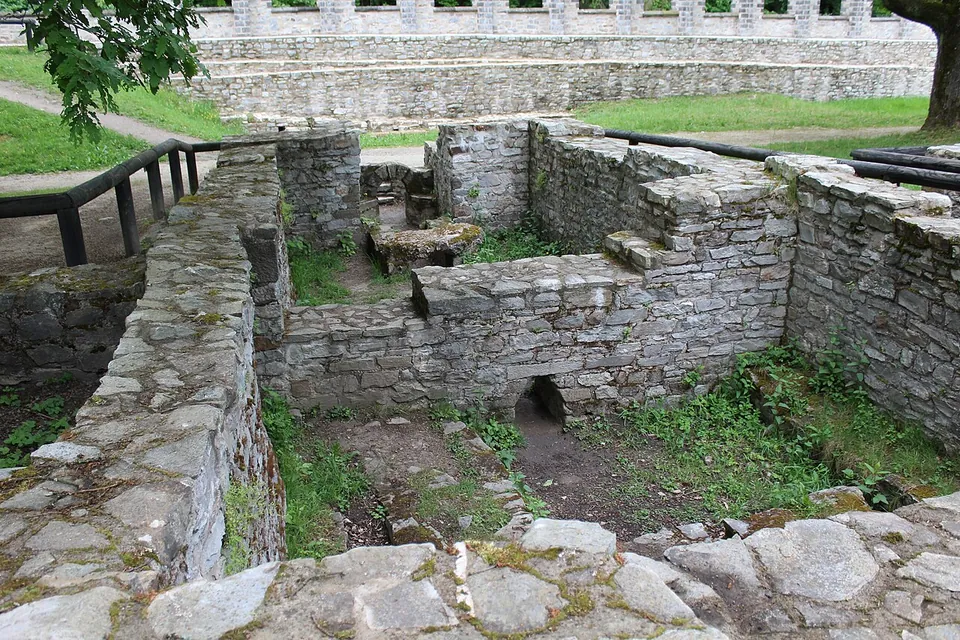
The Saalburg is a Roman auxiliary fort on the ridge of the Taunus north-west of Bad Homburg, rebuilt in full around 1900 on the plan its excavators found, and it is the most completely reconstructed fort on the Upper Germanic–Raetian Limes (de.wikipedia). Come for a complete picture of how a frontier fort looked; know that almost everything standing is the reconstruction, and that the Roman masonry is low: foundations, cellars and wall footings.
What is there today
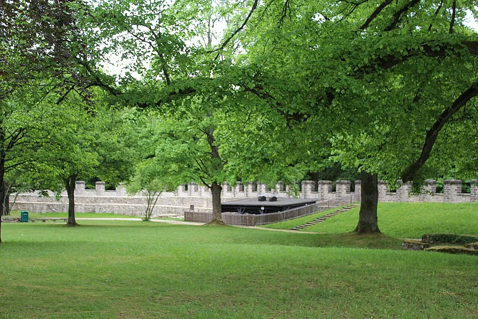
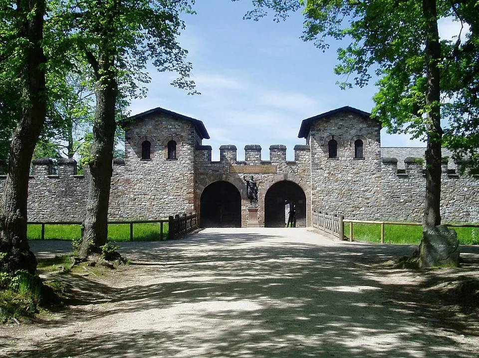
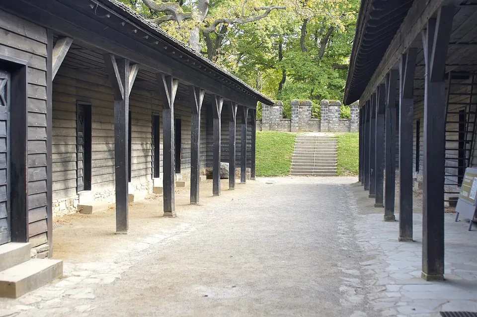
The fort is a rectangle of 147 by 221 m (de.wikipedia). Rebuilt between 1897 and about 1907 on the order of Kaiser Wilhelm II, it has its full circuit wall again, with battlements and four gates flanked by pairs of towers, and inside it the headquarters building (principia) with its shrine for the standards and its tall cross-hall, the granary (horreum), two barrack blocks divided into soldiers’ rooms, part of the commander’s house, and a workshop (fabrica) rebuilt in 2008 (de.wikipedia). The museum displays are in the granary, the headquarters and the workshop. The rest of the interior, which in Roman times was packed with stables, stores and barracks, is now lawn and trees (en.wikipedia).
The reconstruction follows the last Roman building phase but is not exact. The battlements are spaced more closely than the excavation showed, because Wilhelm II asked for it, and the courtyard of the headquarters was probably roofed rather than open (de.wikipedia). When it was excavated, the Roman wall still stood about 2.4 m high at most; the original is reckoned to have been about 4.8 m (de.wikipedia).
What is genuinely Roman:
- Inside the fort, fragments of the older dry-stone wall can be seen in the rear part of the fort, and a section of an earlier fort’s ditch has been left open or restored (de.wikipedia).
- Outside the main gate are the excavated walls of the soldiers’ bath house (mapped as ruins in OpenStreetMap). Beside it the excavators found a large building read as an official guesthouse (mansio) for travellers on state business (de.wikipedia).
- The civilian settlement (vicus) south of the fort, along the old road to the Roman town of Nida (modern Frankfurt-Heddernheim), survives as conserved foundations and cellars of houses, some partly rebuilt. The Saalburg is the only Limes fort whose settlement has been partly excavated and conserved in this way (de.wikipedia).
- The finds in the museum: military and domestic equipment from the Saalburg and other sites nearby, with architectural and landscape models (en.wikipedia).
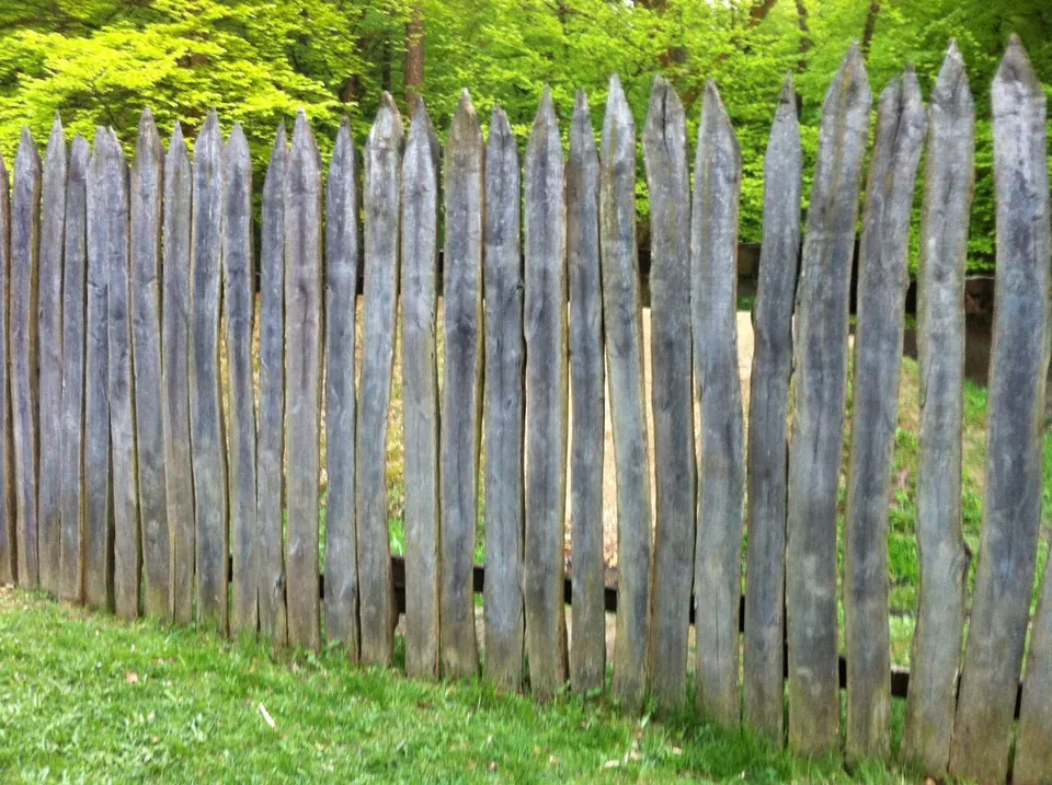
The Limes itself runs about 200 m north of the rear gate. A stretch of ditch, bank and palisade has been reconstructed there, and near the Saalburg the ditch and bank of the frontier are clearly visible for long stretches (en.wikipedia). South of the fort stands a copy, about 12 m high and finished in 1912, of a Jupiter column found in Mainz in 1904–05 (de.wikipedia). There is a restaurant, the Taberna, on site (the operator) and toilets for visitors (OpenStreetMap).
The “Mithraeum”
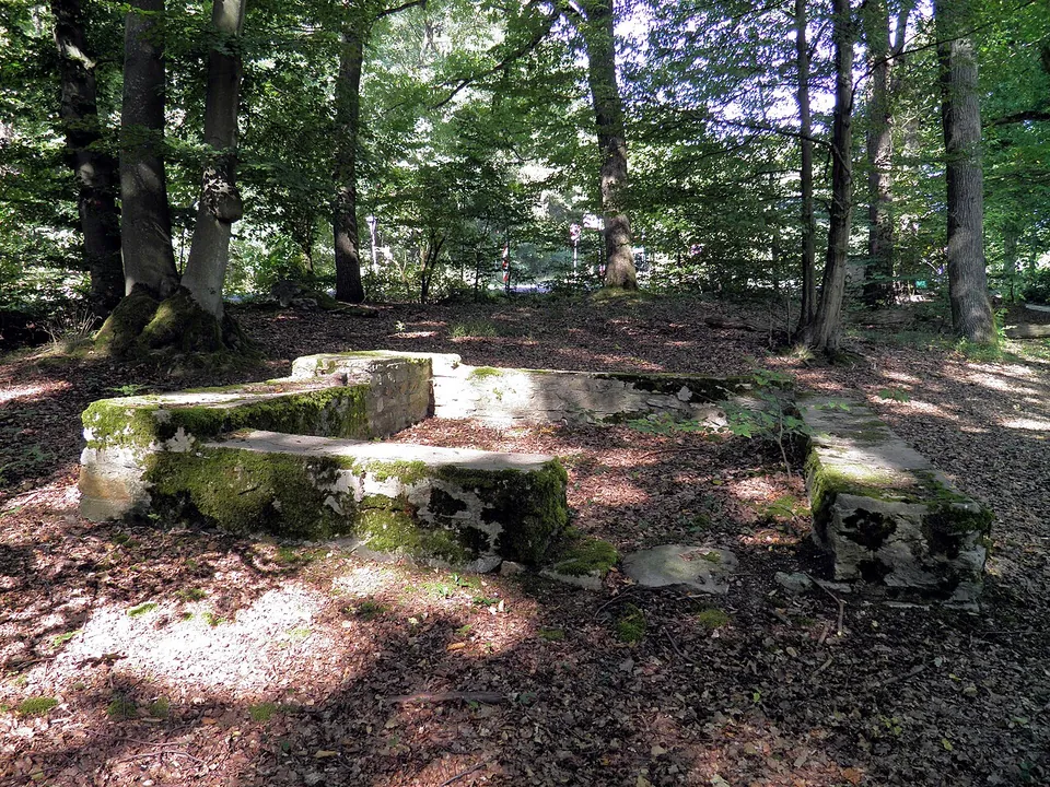
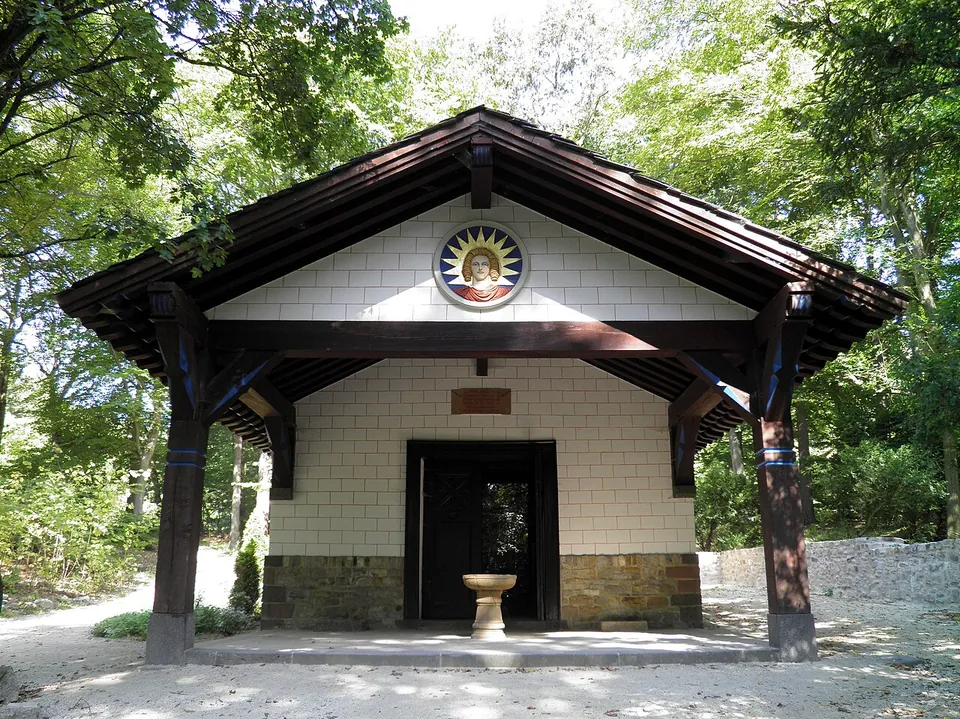
At the southern edge of the settlement, beside a spring, Heinrich Jacobi built a temple of Mithras, a god popular with Roman soldiers. Nothing found there supports it: the excavated remains were two parallel walls between which 33 cremation burials had been recovered in 1872, and scholars now agree that they belonged to the enclosure of a group of graves, still in use in the first half of the 3rd century (de.wikipedia). The building belongs to the reconstruction, not to Rome. A sanctuary of Mithras near a fort of this size is likely, but its site is unknown (de.wikipedia).
Is it worth the trip?
Yes, with the right expectation. No other fort on this frontier has been rebuilt so completely, so here you can walk through the gate of a full-size Roman fort, along its wall and into its headquarters hall; for a family, or anyone who finds ruins hard to read, that is the Saalburg’s great strength. It is also a monument of 1900s archaeology in its own right, built for an emperor and partly to his taste.
If what you want is Roman stone, the honest answer is that it is here, but low: foundations, cellars and wall footings, which take a walk outside the walls to find. The Limes path north of the fort adds a real stretch of the frontier, which since 2005 has been a UNESCO World Heritage site (de.wikipedia).
Getting there
The fort lies in woodland just west of the B 456, about halfway between Bad Homburg (about 6 km) and Wehrheim (de.wikipedia). The address is Am Römerkastell 1, 61350 Bad Homburg (the operator). There is a free car park about 160 m from the fort (OpenStreetMap).
Without a car it takes planning. From Frankfurt the S5 runs to Bad Homburg, but city bus 5 from the station forecourt goes on to the Saalburg only four times a day on weekdays. The other way is the Taunusbahn (line 15) to Saalburg/Lochmühle station and then a footpath along the Limes, about 45 minutes on foot (the operator).
It is open Tuesday to Sunday, 10.00 to 18.00 from March to October and 10.00 to 16.00 from November to February, and closed on Mondays and on 24 and 31 December; last entry is half an hour before closing. A ticket is €8 (reduced €6); children from 6 to 17 pay €3 and under-sixes go free, and a family ticket for two adults and their children is €16. A combined ticket with the Celtic museum at the Glauberg is €11 (saalburgmuseum.de, read 30 October 2026 — check before travelling, since prices move).
Visiting details
- Opening hours
- Tuesday to Sunday, 10.00–18.00 from March to October and 10.00–16.00 from November to February. Closed on Mondays and on 24 and 31 December. Last entry half an hour before closing.
- Tickets
- €8, reduced €6 (pensioners, students, people with disabilities and some others, on proof); children 6–17 €3, under 6 free; family ticket €16 (two adults with children up to 17), small family ticket €8 (one adult with children); dogs on a leash €1. A combined ticket with the Keltenwelt am Glauberg is €11 (reduced €9). Cards accepted.
- Parking
- Surface car park about 160 m from the fort, mapped as free (OSM way/49163844).
Before you go
- Closed on Mondays all year.
- City bus 5 from Bad Homburg station runs to the Saalburg only four times a day on weekdays; the alternative is the Taunusbahn to Saalburg/Lochmühle and a walk of about 45 minutes along the Limes.
Hours and prices checked 30 October 2026 on the operator's own site. Confirm before travelling.
History
The pass over the Taunus ridge here carried a route from the Rhine–Main plain into the Usingen basin long before the Romans, and the first Roman works on it were probably two small earthwork camps from Domitian’s war against the Chatti in 83–85 (de.wikipedia). In 1913 two army pioneer battalions rebuilt both camps a little way north-west of the fort, one of the earliest exercises in experimental archaeology, and their traces can still be made out on the ground (de.wikipedia).
Around AD 90 a fort of timber and earth was built for a numerus, a unit of about 160 men. About 135, late in Hadrian’s reign, it was replaced by a fort of about 3.2 hectares for a cohort of nearly 500 infantry, now facing south towards Nida, first with a dry-stone and timber wall and from the second half of the 2nd century with the mortared stone wall that the reconstruction shows (de.wikipedia). Its garrison was the Cohors II Raetorum civium Romanorum, which had served at Wiesbaden and Butzbach before (de.wikipedia). At times the fort and its settlement housed up to 2,000 people, about 500 of them soldiers (de.wikipedia). A large fire swept the settlement in the first half of the 3rd century, perhaps in a Germanic raid of 233, and it mattered little afterwards; the fort was evacuated, apparently without fighting, when the frontier east of the Rhine was given up around 260 (de.wikipedia).
The ruins then served as a quarry, for the church of Thron Abbey near Wehrheim among other buildings, until the Landgrave of Hesse-Homburg stopped the stone-robbing in 1818 (de.wikipedia). Excavation began in the 19th century, and from 1897 the architect Louis Jacobi rebuilt the fort for Wilhelm II; the foundation stone was laid on 11 October 1900 (de.wikipedia). The Saalburg is now one of Hesse’s two state archaeological museums and a research centre for the Roman provinces (de.wikipedia).
More photographs
Nearby
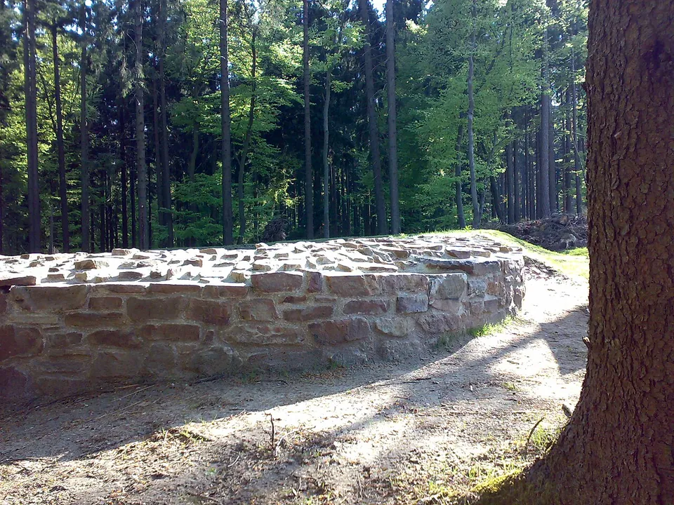
Photo: Karsten11 · Public domain · Commons
4 km · fort · Hesse
Castellum of Heidenstock
The fort measured 19.4 by 23.4 m, with the rounded corners of Roman forts of its time and a single gate facing the frontier (de.wikipedia).
7 km · fort · Hesse
Castra of Kapersburg
The fort sits in a forest clearing in front of a hill called the Saukopf and covers 134 by 122 m, about 1.6 hectares (the operator).
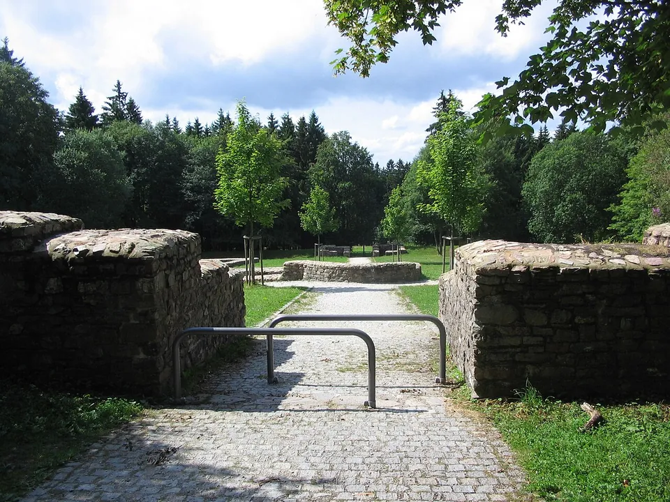
Photo: Brühl · Public domain · Commons
10 km · fort · Hesse
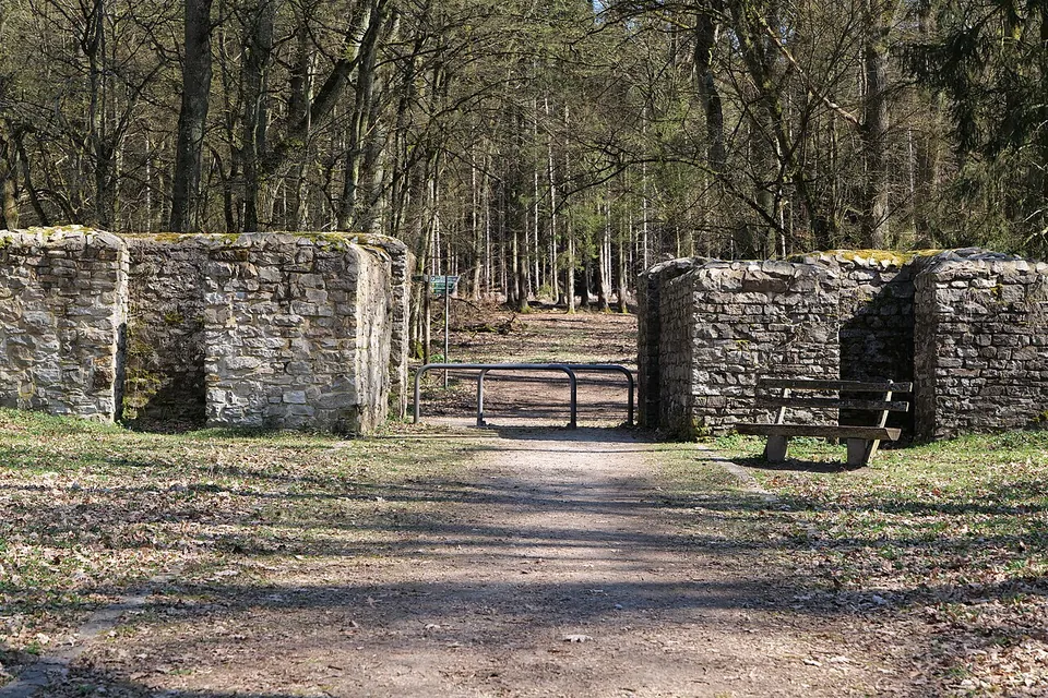
Kastell Kleiner Feldberg
The fort is a clearing in the forest with its complete ground plan laid out in low stone walls: a rectangle of 78 by 93 m with rounded corners and gateways in its sides, and, at the centre, the headquarters building (principia) with the curved apse of its shrine of the standards (de.wikipedia; the operator).


Straight-line distances.
Sources
Every fact on this page comes from the records below, each used under the licence noted.
| Source | Licence |
|---|---|
| Pleiades 109297 | CC BY |
| Wikidata Q542329 | CC0 |
| Vici.org 4412 | CC BY-SA (text), CC0 (metadata) |
| OpenStreetMap way/8655395 | ODbL |
| Wikipedia (de) — Kastell Saalburg | CC BY-SA 4.0 |
| Wikipedia (en) — Saalburg | CC BY-SA 4.0 |
| Wikidata — Saalburg Mithraeum (Q26706730) | licence not recorded |
| Wikidata — Mithraeum de Saalburg (Q130044590) | licence not recorded |
| Römerkastell Saalburg — opening times, arrival, prices (the operator) | licence not recorded |