

What is there today
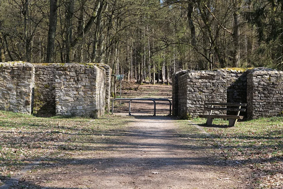
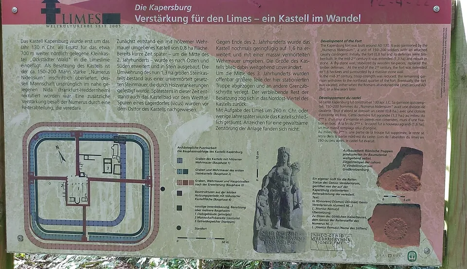
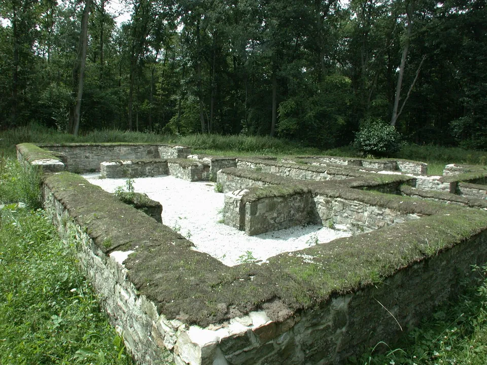
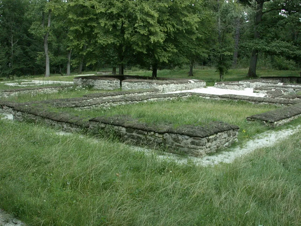
The fort sits in a forest clearing in front of a hill called the Saukopf and covers 134 by 122 m, about 1.6 hectares (the operator). Its ditches are still visible all the way round, the enclosing wall and gates remain on the west and east sides, and inside you can follow the foundations of rooms of the headquarters building, the granary, wells and a soldiers’ barrack (the operator). The walls you see belong to the last stone fort, built late in the 2nd century; they were first secured in the late 19th century, and in 2005 the fort was restored and turned into an archaeological park (de.wikipedia; the operator), so the walls on show have been consolidated and made up in modern times.
The highlight is the bath house between the fort and the Limes line, whose foundations are very well preserved: the cold room, two warm rooms, the hot room and a sweat room are all conserved, so the sequence of a Roman bath reads clearly on the ground (de.wikipedia). The village that grew up around the fort lies mostly to the east, but its remains are only recognisable to a trained eye (de.wikipedia). Information boards stand on site (OpenStreetMap), and the operator offers an audio tour through its smartphone app.
Is it worth the trip?
For a walker interested in the Limes, yes: it counts among the best-preserved Roman military sites on the Upper German-Raetian frontier (de.wikipedia), and where farming has erased such works elsewhere, here the plan of a fort survived in the woods (the operator), free to enter. It pairs well with a hike along the frontier, which is well preserved in this stretch, with the small forts of Ockstädter Wald and Kaisergrube and the watchtower on the Gaulskopf, rebuilt in 1926, to the north (de.wikipedia).
Set your expectations accordingly: these are low conserved walls, with the gate towers built up to about head height, not standing buildings, and the operator lists no museum or facilities at the fort itself. For finds and context, the Saalburg Roman fort, home of the Saalburg state museum, lies about 7 km away (the operator; hessenschau.de).
Getting there
The fort lies in the forest about 2.5 km from Pfaffenwiesbach (a district of Wehrheim) and 3.5 km from Ober-Rosbach (de.wikipedia), and the operator notes that it can only be reached on foot. The nearest mapped car park is a free hikers’ car park on the Pfaffenwiesbach side, about 2.1 km north-north-west of the fort in a straight line; the nearest bus stops are in Pfaffenwiesbach, about 2.5 km away (OpenStreetMap). The Köppern munitions depot lies directly beside the fort (de.wikipedia).
The site is open ground and freely accessible; the operator publishes no opening hours and no admission charge (Staatliche Schlösser und Gärten Hessen, read 31 October 2026).
Visiting details
- Opening hours
- Open site in the forest, freely accessible; the operator publishes no opening hours.
- Tickets
- Free.
- Parking
- No car park is mapped at the fort. The nearest mapped one is a free hikers' car park on the Pfaffenwiesbach side, about 2.1 km north-north-west in a straight line (OSM way/428992698); the last stretch is on forest paths.
Before you go
- The fort can only be reached on foot (the operator).
- The nearest mapped bus stops are in Pfaffenwiesbach, about 2.5 km away in a straight line.
Hours and prices checked 31 October 2026 on the operator's own site. Confirm before travelling.
History
The fort was founded at the earliest under Trajan, from 98, and perhaps only around 130; the coins found here point to a start around the middle of the 2nd century (de.wikipedia). Excavation has shown three phases: a timber-and-earth fort of about 0.8 hectares, a drystone-walled fort of about 1.3 hectares around the middle of the 2nd century, and a fort with mortared walls of just over 1.6 hectares near the end of that century (de.wikipedia). Its main gate faced north towards the small fort of Ockstädter Wald, 700 m away, which may have been its predecessor, rather than towards the Limes, which passes about 60 m to the west (de.wikipedia; the operator). The granary whose foundations you see was built in 208 or 209 over the demolished commander’s house (de.wikipedia).
The garrison was a numerus, a unit of about 150 men strengthened by a small mounted detachment (de.wikipedia; the operator gives 150–200). Only the first letter of its name, N, is certain; the old reading “Numerus Nidensium”, tying it to the town of Nida at today’s Frankfurt-Heddernheim, has been challenged and the question is open (de.wikipedia). A relief of the horse goddess Epona found here is in the Wetterau Museum in Friedberg, which holds the finds from the excavations (de.wikipedia).
Around the middle of the 3rd century part of the garrison seems to have been withdrawn: the remaining soldiers pulled back into the north-east quarter around the granary, a small heated stone building, probably the centurion’s quarters, replaced the hall of the headquarters, and the outer rampart decayed (de.wikipedia). The fort was probably abandoned without a fight shortly after the middle of the century, in the crisis that ended the Limes; no trace of violent destruction has been found (de.wikipedia). It is first recorded by name in 1482, as “Karpesserburgk”; after first digs in 1879–1881 the Reich Limes Commission excavated it in 1896–97, 1901 and 1905 (de.wikipedia).
Recent excavation has turned to the fort’s village. Archaeologists found its buildings a few years ago in an area where a storm had cut through the forest, and in 2026 reported the foundations of a temple there, with fragments of statues of gods including a nearly complete torso of Victoria (hessenschau.de, 27 September 2026). No source says these new finds can be seen on site.
More photographs

Nearby
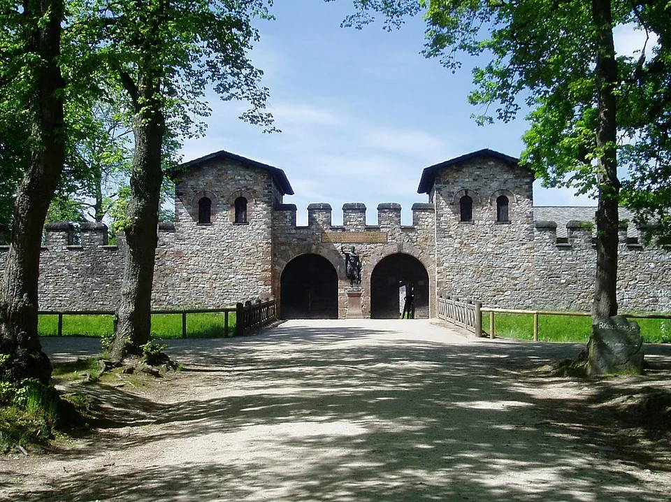
Photo: en:User:Ekem · Public domain · Commons
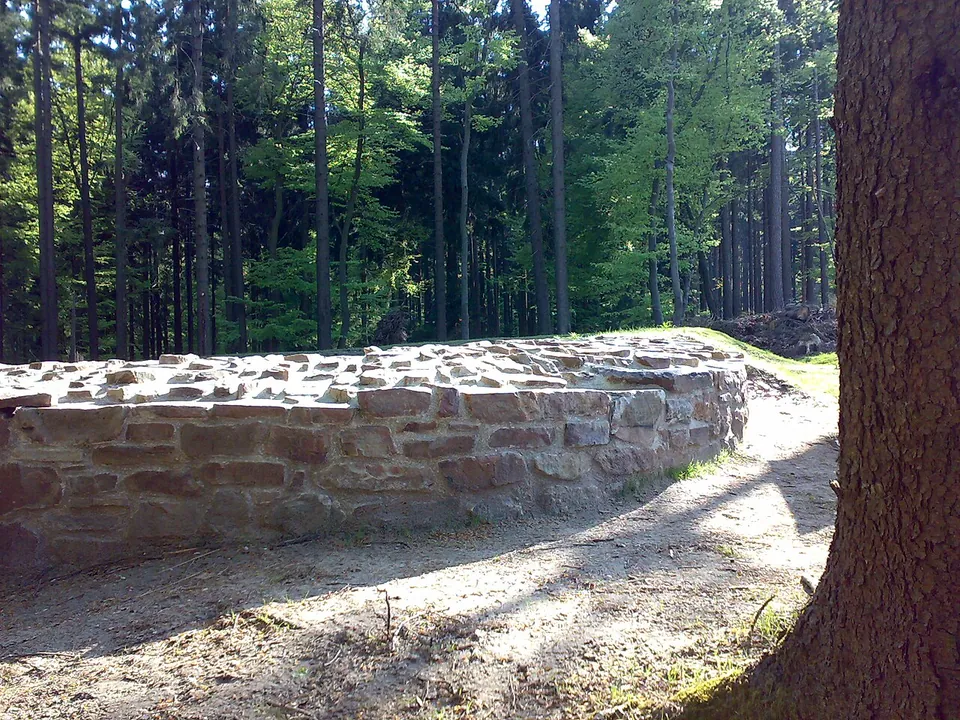
Photo: Karsten11 · Public domain · Commons
11 km · fort · Hesse
Castellum of Heidenstock
The fort measured 19.4 by 23.4 m, with the rounded corners of Roman forts of its time and a single gate facing the frontier (de.wikipedia).
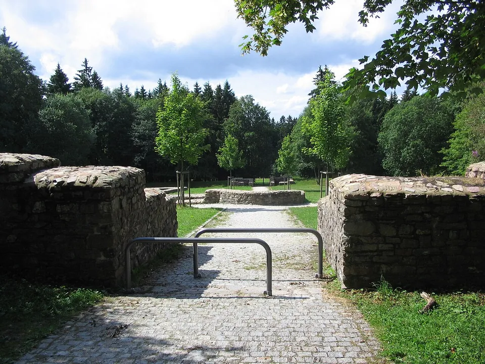
Photo: Brühl · Public domain · Commons
17 km · fort · Hesse
Kastell Kleiner Feldberg
The fort is a clearing in the forest with its complete ground plan laid out in low stone walls: a rectangle of 78 by 93 m with rounded corners and gateways in its sides, and, at the centre, the headquarters building (principia) with the curved apse of its shrine of the standards (de.wikipedia; the operator).


Straight-line distances.
Sources
Every fact on this page comes from the records below, each used under the licence noted.
| Source | Licence |
|---|---|
| Pleiades 109074 | CC BY |
| Wikidata Q1735382 | CC0 |
| OpenStreetMap way/8040963 | ODbL |
| Staatliche Schlösser und Gärten Hessen — Roman Fort Kapersburg (the operator) | licence not recorded |
| Wikipedia (de) — Kastell Kapersburg | CC BY-SA 4.0 |
| hessenschau.de — Archäologen stoßen im Taunus auf römischen Tempel (27 September 2026) | licence not recorded |