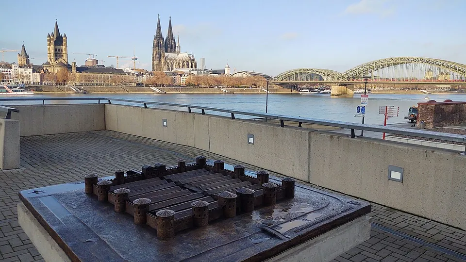
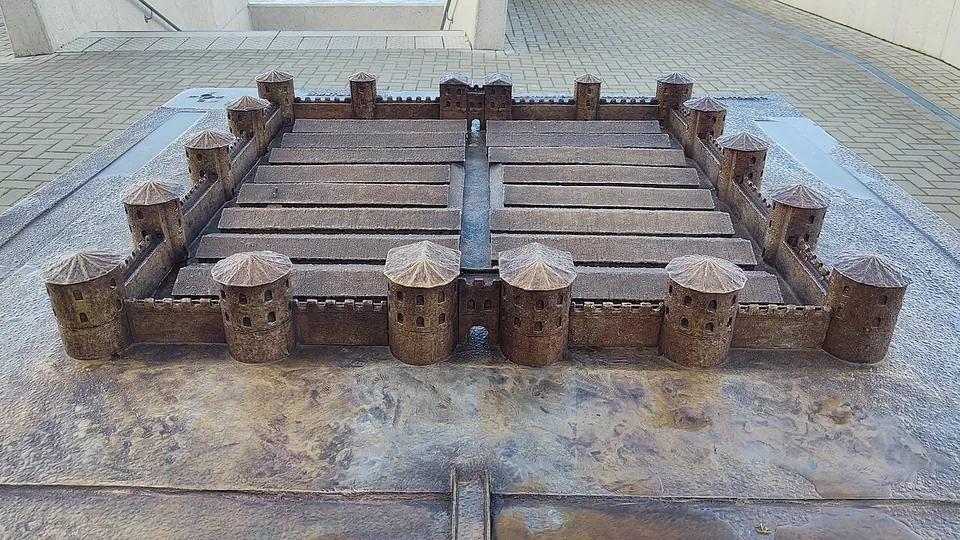
Divitia was a late Roman fort that Constantine had built on the right bank of the Rhine, in today’s Deutz, as the bridgehead of the first bridge across the Rhine at Roman Cologne (de.wikipedia). What a visitor sees now is modest: the foundations of its east gate in a small green space, the line of its north wall and main street set into the paving, and a bronze model of the fort on the riverside promenade, with Cologne’s old town across the water.
What is there today
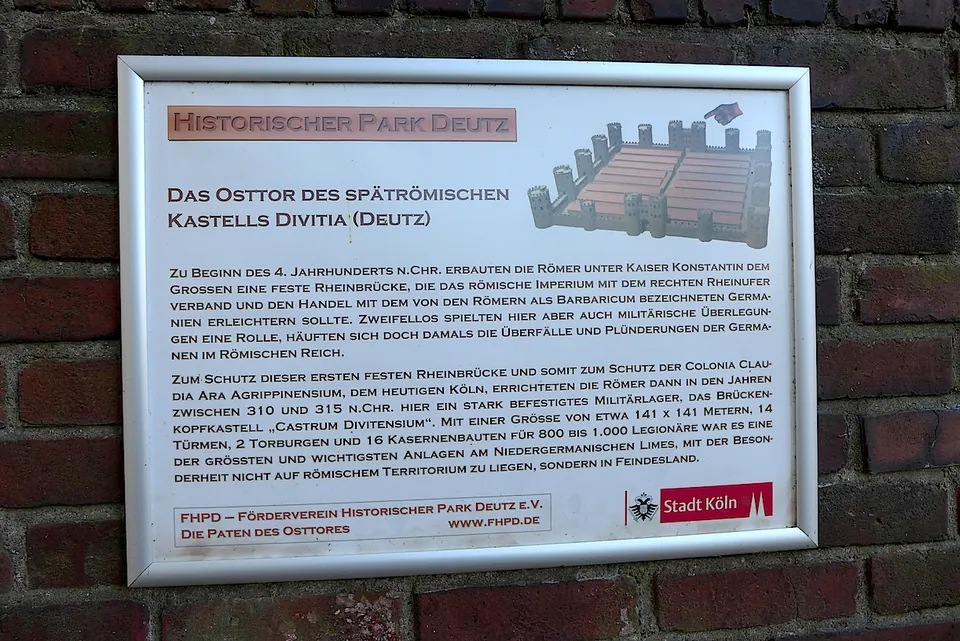
The east gate is the main thing to see. It was investigated in the 1920s and 30s and left in its original position; the side walls of its semicircular towers have been rebuilt (Römisch-Germanisches Museum). It lies in the green space Am Deutzer Kastell, uncovered again in 2013 when the former Lufthansa building next to it had been converted into the Lanxess tower, and the Förderverein Historischer Park Deutz has sponsored it since (FHPD). West of it, paving marks the course of the fort’s main street and its interior buildings, though the association itself says this is hardly recognisable today; on Urbanstraße paving marks the line of the north wall, much of which survives in the ground beneath (FHPD).
On the river side, the remains of the north tower of the west gate can be seen under a modern protective structure; further walls of the fort’s Rhine front lie under the concrete slabs of the Rheinboulevard (FHPD). Built into the boulevard’s steps is the Schinkenkessel, a 19th-century Prussian tower whose core is the fort’s north-west corner tower, now a viewing platform (FHPD; Römisch-Germanisches Museum). The bronze model of the fort, unveiled in 2020, stands on the archaeological balcony of the Rheinboulevard (FHPD). Since 2025 sixteen information boards point out the individual remains, and on the so-called historical balcony an overview map and a viewer that lays the fort over the present-day scene explain what is in sight (city of Cologne).
The most substantial remains are out of sight. Parts of the fort wall stand, seen from the inside and in very good condition, in the vaulted cellars of the former Deutz abbey (de.wikipedia), which was built over the fort’s north-east corner (Römisch-Germanisches Museum). The cellars were shown on the association’s tours, and it offers none until further notice (FHPD). Remains under the Lanxess tower lie in its underground car park and are not open to the public (de.wikipedia).
Is it worth the trip?
As a short walk from the old town, yes; as a destination of its own, no. Little remains of the fort (Römisch-Germanisches Museum), and with the cellars closed what is on show is a gate foundation, markings in the pavement and a model. The pleasure of it is the setting: you stand near where Constantine’s bridge reached the right bank, with the cathedral in view across the river, and the model and the boards help with a plan that is otherwise hard to make out on the ground. Allow half an hour and combine it with the other stops on the Cologne page.
Getting there
The fort lies on the right bank of the Rhine, in Deutz, opposite the old town. The tram stop Deutzer Freiheit is about 130 m from the site (OpenStreetMap). No public car park is mapped beside it: the car parks next to the fort are private, the rest is bicycle parking (OpenStreetMap).
The east gate and the riverside remains are in public open space, and no opening hours or entry fee are published for them. The Förderverein Historischer Park Deutz arranges guided walks of about an hour, above ground only, on request; it lists no public dates at present (fhpd.de, read 1 November 2026).
Visiting details
- Opening hours
- The east gate stands in a public green space, Am Deutzer Kastell, and the other remains along the Rheinboulevard; no opening hours are published for either. The vaulted cellars of the former abbey, where significant parts of the Roman wall survive, are not open at present.
- Tickets
- No entry fee is published for the green space or the riverside promenade. Guided tours of the area (about 60 minutes, above ground only) are arranged on request by the Förderverein Historischer Park Deutz; it publishes no price and has no public tour dates listed.
- Parking
- No public car park is mapped beside the fort; the car parks OpenStreetMap shows next to it are private, and the rest is bicycle parking.
Before you go
- The Förderverein Historischer Park Deutz, which ran the tours of the abbey cellars, offers none "until further notice", so the Roman walls preserved there cannot be seen for now.
- The paving that marks the fort's main street between the Lanxess tower and the old abbey is often covered by illegally parked cars, according to the Förderverein Historischer Park Deutz.
Hours and prices checked 1 November 2026 on the operator's own site. Confirm before travelling.
The Roman bridge
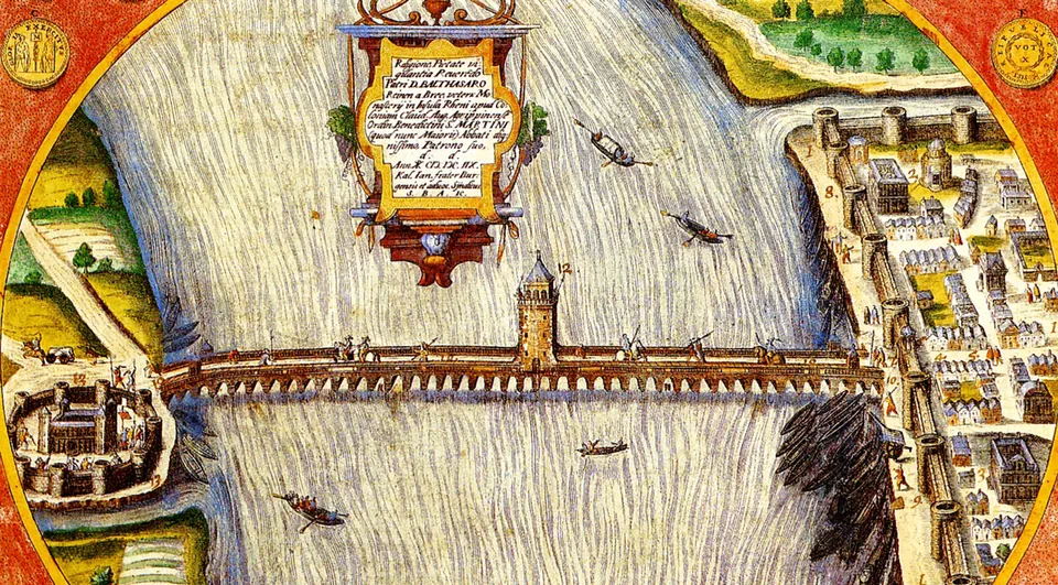
The fort was the bridgehead of a bridge across the Rhine, begun in 310 according to a speech in praise of Constantine delivered in Trier, a date that the outer tree rings of oak piles have provisionally confirmed. It stood on 19 stone piers, 15 of them proven by excavated pile remains, and carried a timber deck a good 400 m long and about 11 m wide. The Deutzer Brücke crosses the river on its site today. When it was taken down is not known: some put its decay from about 400, others its demolition around 960 (de.wikipedia). In Deutz it is remembered by one of the information boards (FHPD). Excavated piles and a reconstruction are exhibited by the Römisch-Germanisches Museum (de.wikipedia), whose building on Roncalliplatz is closed for renovation (the operator); the Cologne page has the details.
History
Franks first crossed the Rhine frontier near Cologne around 261, and raids followed. Around 310, under Constantine the Great, the Romans built the bridge so that troops could cross quickly, and the fort to protect it (de.wikipedia). Building began around 308 and was finished after 312, probably in 315 (de.wikipedia); the museum gives 310 to 315. It was named after its first unit, the Divitenses, a late Roman unit descended from the Legio XXII (de.wikipedia).
The fort was nearly square, about 142 m a side, covering 2.25 hectares, with walls some 3.3 m thick. Two gates, each flanked by two towers, lay exactly on the axis of the bridge, and ten intermediate and four corner towers projected about 6 m from the wall. Along the main street, five metres wide, stood sixteen barrack blocks, eight on each side, enough for some 900 soldiers (de.wikipedia); the association’s boards put the garrison at 800 to 1,000 (FHPD).
How long the army stayed is not certain. De.wikipedia says the Romans left around 401 and the Franks set up a royal court inside the walls after 430; the museum says Frankish troops in Roman service were still stationed there until about the middle of the 5th century. Saxons plundered the fort in 555–557. When its walls came down is not certain: most accounts put the demolition under Archbishop Bruno I, between 957 and 965, who is said to have wanted the stone for St Pantaleon. In 1003 Archbishop Heribert turned the old fort into a Benedictine abbey, and a last surviving piece was lost when the castle of Deutz was pulled down in 1243 (de.wikipedia). The west part was demolished in the 19th century when the river bank was remodelled (Römisch-Germanisches Museum). Excavations for the Rheinboulevard from 2010 brought the west front to light again, and in 2021 the fort became part of the Lower German Limes World Heritage Site (de.wikipedia; FHPD).
More photographs
Nearby
10 km · tomb · North Rhine-Westphalia
Römergrab Köln-Weiden
A flight of stairs takes you down to a doorway about six metres below ground and into a single vaulted room built of tuff stone, roughly 3.6 by 4.4 metres and 4 metres high under the vault.
44 km · fort · Rhineland-Palatinate
Rigomagus
The Römisches Museum occupies a 15th-century chapel on Kirchstraße.
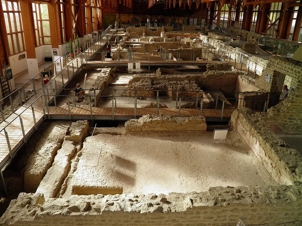
Photo: Carole Raddato from FRANKFURT, Germany · CC BY-SA 2.0 · Commons
45 km · villa · Rhineland-Palatinate
Römervilla von Bad Neuenahr-Ahrweiler
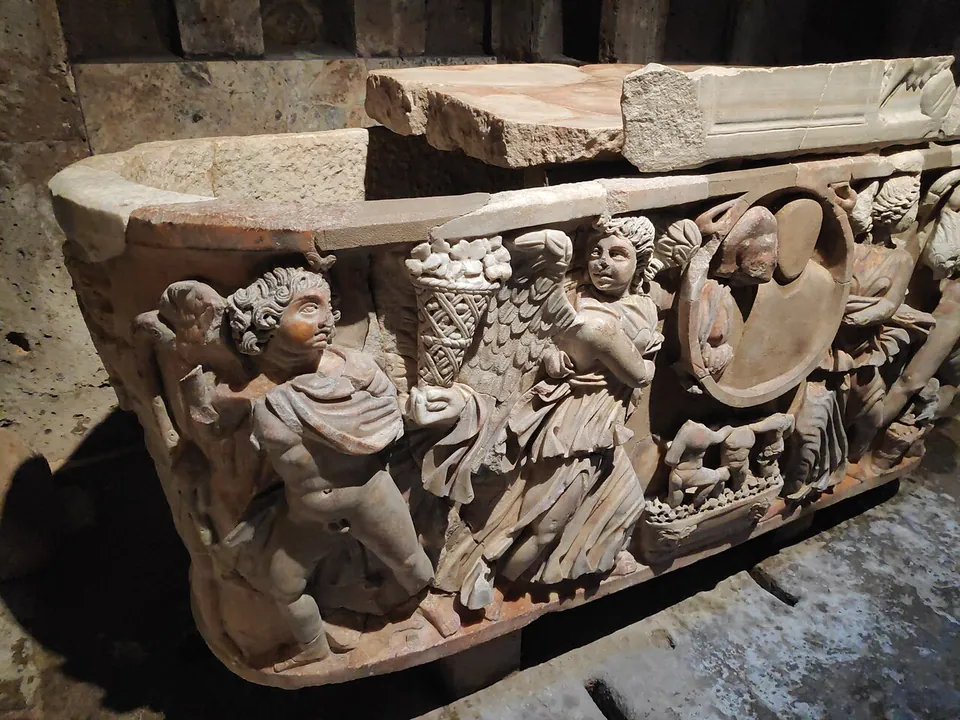
The house is 72 m long and 18 to 20 m deep (de.wikipedia), and walkways take you through and over its rooms.


Straight-line distances.
Sources
Every fact on this page comes from the records below, each used under the licence noted.
| Source | Licence |
|---|---|
| Pleiades 108863 | CC BY |
| Wikidata Q1735350 | CC0 |
| Vici.org 355 | CC BY-SA (text), CC0 (metadata) |
| OpenStreetMap relation/19428405 | ODbL |
| Wikipedia (de) — Kastell Deutz | CC BY-SA 4.0 |
| Wikipedia (it) — Divitia | CC BY-SA 4.0 |
| Wikipedia (de) — Römerbrücke (Köln) | CC BY-SA 4.0 |
| Römisch-Germanisches Museum Köln — Divitia-Deutz | licence not recorded |
| Römisch-Germanisches Museum Köln — Tower of the Roman Fort Divitia | licence not recorded |
| Stadt Köln — Historischer Park Deutz, information system (press release, 28 May 2025) | licence not recorded |
| Förderverein Historischer Park Deutz — tours | licence not recorded |
| Förderverein Historischer Park Deutz — stations in the Historischer Park Deutz | licence not recorded |
| Förderverein Historischer Park Deutz — the bronze model of the fort | licence not recorded |