

Rigomagus was a Roman fort on the Rhine, the southernmost on the Lower German frontier, and the old town of Remagen now stands on top of it. What you can see is modest: a small free museum built over the foundations of the fort’s headquarters, and pieces of the fort wall in a churchyard wall a few steps away.
What is there today
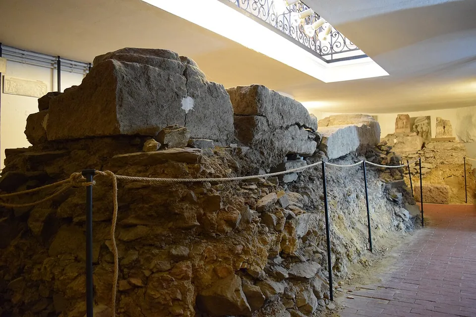
The Römisches Museum occupies a 15th-century chapel on Kirchstraße. When it was converted in 1903, the builders found large column bases just below the floor; they belonged to the entrance of the principia, the fort’s headquarters building, and were kept in place with their foundations in a basement that visitors can reach (Stadt Remagen). Everything on display was found in Remagen and its surroundings: eight Roman graves in the basement, inscriptions on the soldiers’ daily life on the ground floor, and pottery, glass, terracottas, coins and metalwork on the gallery (the operator).
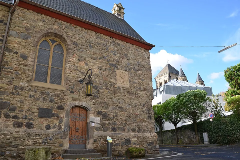
Outside, parts of the late Roman fortress wall can still be seen (de.wikipedia). The town puts them in the wall round the parish churchyard, in the arches of the church’s retaining wall on Deichweg (Stadt Remagen). The rest of the fort, about 1.6 ha, lies under the streets around the town hall. The neighbouring house at Kirchstraße 5 keeps the underfloor heating of the commander’s house in its cellar, but it is not yet open to visitors; the town plans to make it accessible (the operator).
Is it worth the trip?
As a stop, yes; as a destination on its own, no. The museum is small enough to see in a short visit, it costs nothing, and the column bases are the real thing in the place where they stood. But there is no fort to walk round: what survives above ground is a stretch of masonry in a churchyard wall, and the 200 m stretch of wall along Milchgasse is the 14th-century town wall, not the Roman one (Stadt Remagen).
It suits someone following the Rhine or the Lower German frontier (UNESCO World Heritage since 2021), and it is easy without a car, since Remagen’s railway station is about 300 m away (OpenStreetMap). Check the day before you go: from November to February the museum opens only at weekends, and on weekdays from March to October only in the afternoon.
Getting there
The museum is at Kirchstraße 9 in the old town of Remagen, in the district of Ahrweiler. Remagen station is about 300 m from the museum, and the nearest bus stop, Remagen Kölner Str., about 130 m (OpenStreetMap). For drivers there is a small free car park with four spaces about 40 m away and paid parking along the street about 90 m away; public toilets are mapped about 100 m from the museum (OpenStreetMap).
From March to October the museum opens Tuesday to Friday 14.00–17.00 and on Saturdays, Sundays and public holidays 11.00–17.00; from November to February only on Saturdays, Sundays and public holidays, 11.00–17.00. The holiday opening excludes 1 January, Good Friday, 1 November and 25–26 December. Admission is free (Stadt Remagen, read 31 October 2026).
The town runs a 90-minute guided walk round the fort, “Römisches Remagen”, on set Sundays at 14.00 between March and October, starting at the tourist information office at Josefstraße 1. It costs €6, €3 for children aged 6 to 14, and nothing for children up to 6; in 2026 the last date was 11 October (Stadt Remagen).
Visiting details
- Opening hours
- Römisches Museum: March to October, Tuesday to Friday 14.00–17.00 and Saturday, Sunday and public holidays 11.00–17.00; November to February, Saturday, Sunday and public holidays 11.00–17.00. Public holidays exclude 1 January, Good Friday, 1 November and 25–26 December. Groups by arrangement. The wall remains are in the street and can be seen at any time.
- Tickets
- Free (Eintritt frei). The town's 90-minute guided walk "Römisches Remagen" costs €6, €3 for ages 6 to 14, free for children up to 6; it runs on set Sundays at 14.00 from March to October, starting at the tourist information office, Josefstraße 1.
- Parking
- A small free car park with four spaces about 40 m from the museum (OSM way/277110256), and 20 paid spaces along the street about 90 m away (OSM way/128083276).
Before you go
- The Roman hypocaust heating in the cellar of the neighbouring house at Kirchstraße 5 is not yet open to the public; the town says it is to be made accessible.
- Remagen also has a long stretch of 14th-century town wall along Milchgasse. That is medieval; the Roman wall remains are in the retaining wall of the parish church on Deichweg.
Hours and prices checked 31 October 2026 on the operator's own site. Confirm before travelling.
History
The fort guarded the Roman road along the left bank of the Rhine between Bonn and Andernach, on a narrow strip between the river and the hills, which suggests it watched the valley road rather than routes inland (de.wikipedia). The name is Celtic, but no settlement older than the Romans has been found (de.wikipedia; Stadt Remagen).
The army was here early. Oak posts from a palisade found in 1900, when the parish church was rebuilt, have been dated by their tree rings to the turn of the era, and a pilum murale, a piece of Roman soldiers’ equipment known only from military sites, was found with them (de.wikipedia; Stadt Remagen). Under Tiberius or Claudius a fort of earth and timber, about 100 m wide, followed; a burnt layer shows it was destroyed in the Batavian revolt of 69–70. Under Vespasian it was rebuilt in stone and enlarged, to about 110 by 140–150 m, with corner and interval towers, and inscriptions name the cohorts of auxiliary soldiers stationed there (de.wikipedia). A hoard of 8,500 coins struck between 270 and 280 was found near the fort’s front gate, the porta praetoria (de.wikipedia).
In the late Roman period the fort was refortified on much the same ground: a new face of greywacke rubble thickened the old wall to 3 m, and a bath house replaced the workshop (de.wikipedia). Writing of the year 356, the historian Ammianus Marcellinus names Rigomagus as the only place north of Brocomagus (Brumath), apart from one tower at Cologne, that the Germanic invasion of 355 had left undestroyed (de.wikipedia; Stadt Remagen). Brick stamps of two army units attest the place in 368–370; how the fortress ended is less clear, but a destruction layer lies between the Roman and early medieval levels, and the operator says the fort lasted certainly to the end of the 4th century and probably into the 5th (de.wikipedia; the operator). The late wall probably stayed in use until the medieval town wall was built (Stadt Remagen).
Nearby
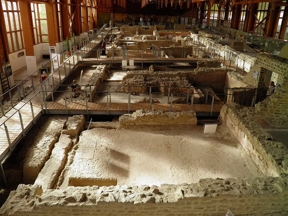
Photo: Carole Raddato from FRANKFURT, Germany · CC BY-SA 2.0 · Commons
11 km · villa · Rhineland-Palatinate
Römervilla von Bad Neuenahr-Ahrweiler
The house is 72 m long and 18 to 20 m deep (de.wikipedia), and walkways take you through and over its rooms.
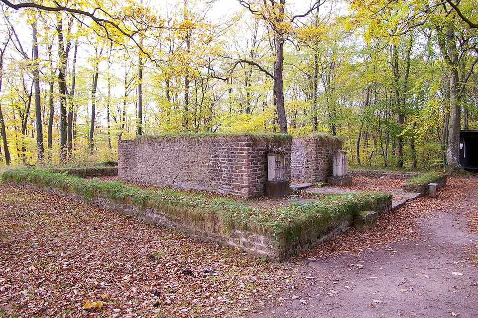
Photo: Klaus Littmann · CC BY-SA 3.0 · Commons
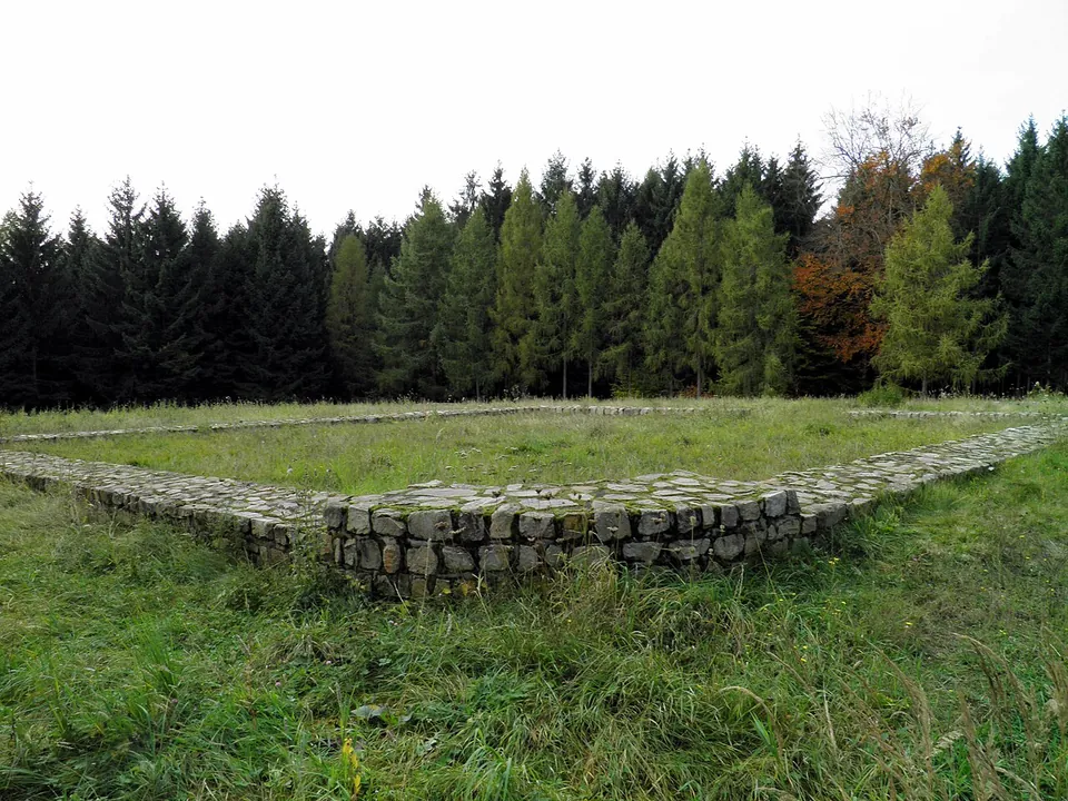
Photo: Carole Raddato from FRANKFURT, Germany · CC BY-SA 2.0 · Commons
39 km · fort · Rhineland-Palatinate
Kleinkastell Hillscheid
The fort's outline lies in a clearing in the Hillscheid forest.


Straight-line distances.
Sources
Every fact on this page comes from the records below, each used under the licence noted.
| Source | Licence |
|---|---|
| Pleiades 109281 | CC BY |
| Wikidata Q3431966 | CC0 |
| Vici.org 8555 | CC BY-SA (text), CC0 (metadata) |
| OpenStreetMap way/837305098 | ODbL |
| Wikipedia (de) — Rigomagus | CC BY-SA 4.0 |
| Stadt Remagen — Römisches Museum (the operator; hours) | licence not recorded |
| Stadt Remagen — Römisches Museum flyer, 2025 (the operator; admission) | licence not recorded |
| Stadt Remagen — UNESCO Welterbe Niedergermanischer Limes | licence not recorded |
| Stadt Remagen — Stadtrundgang Remagen Stadt (town walk) | licence not recorded |
| Stadt Remagen — Stadt- und Themenführungen 2026 (guided walks) | licence not recorded |